
Before the estate, 1900–1928
Farms, lanes, cottages and the old village — the countryside the Corporation built across.
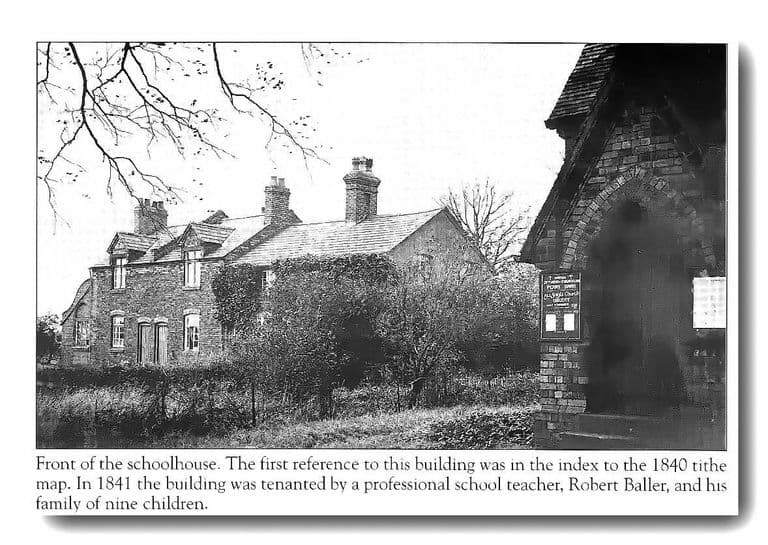
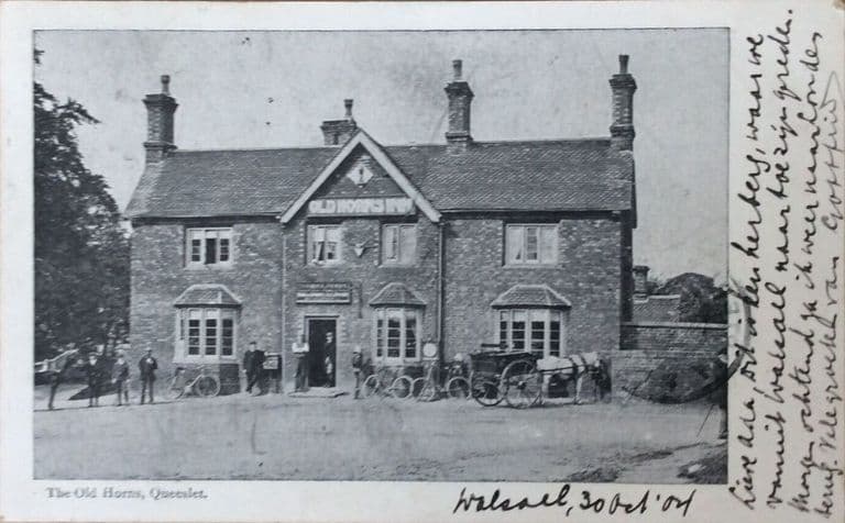
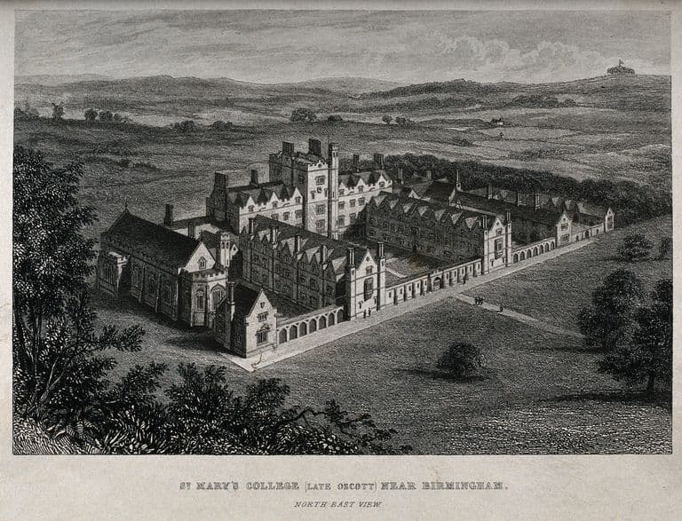
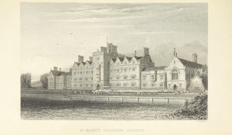
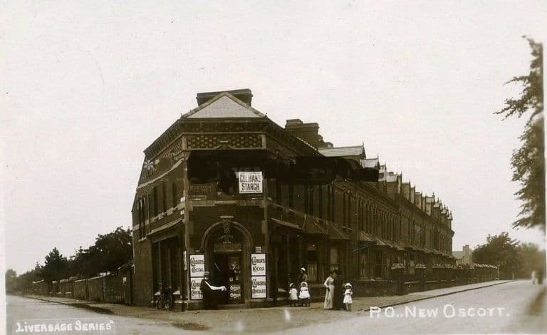
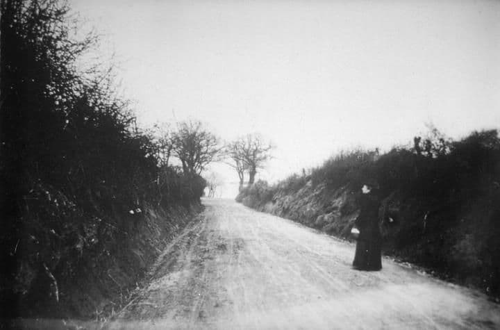
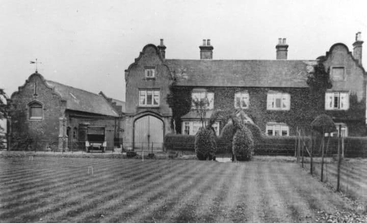
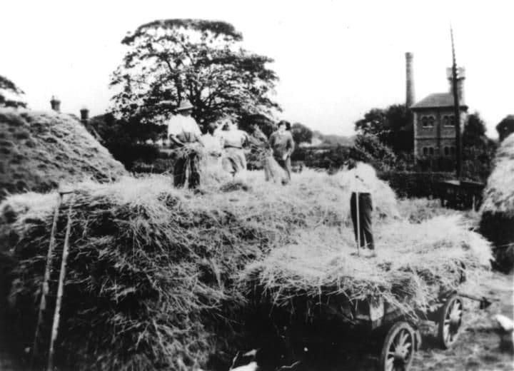
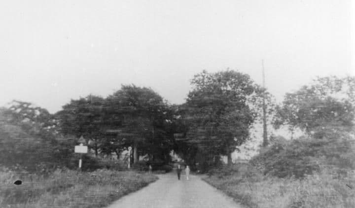
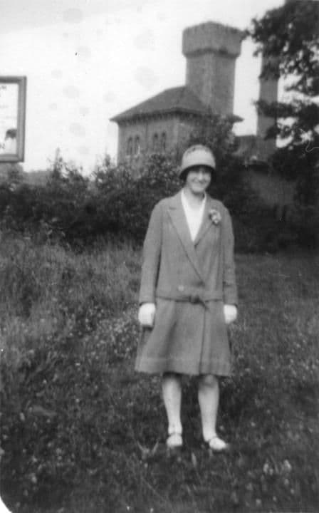
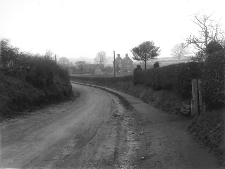
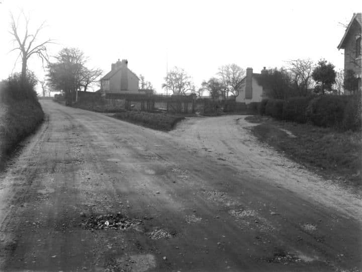
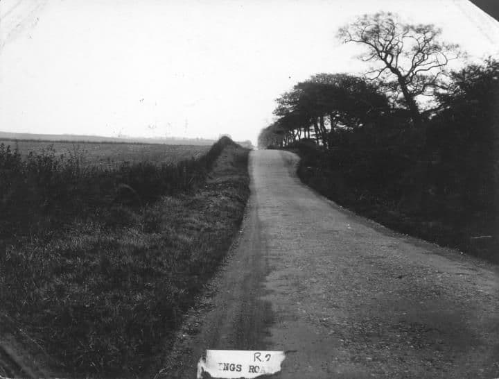
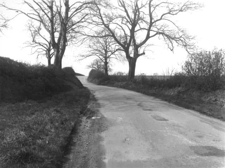
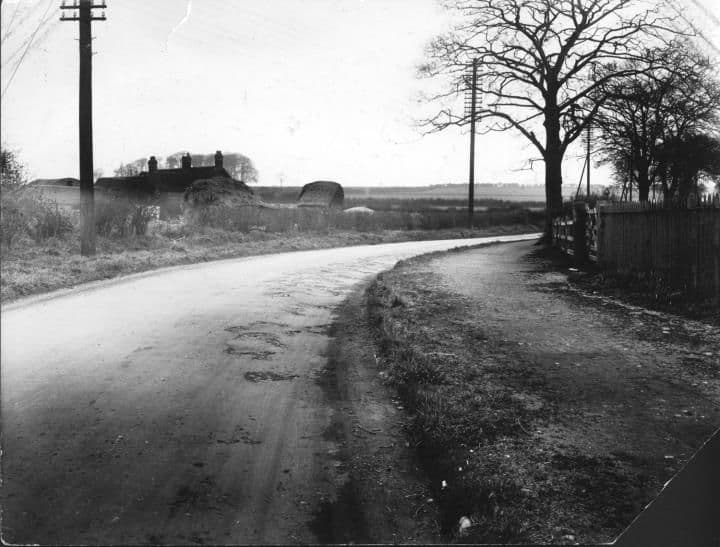
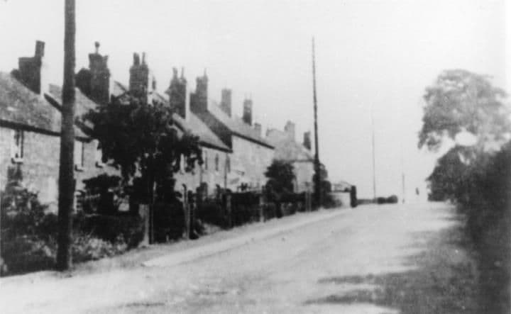
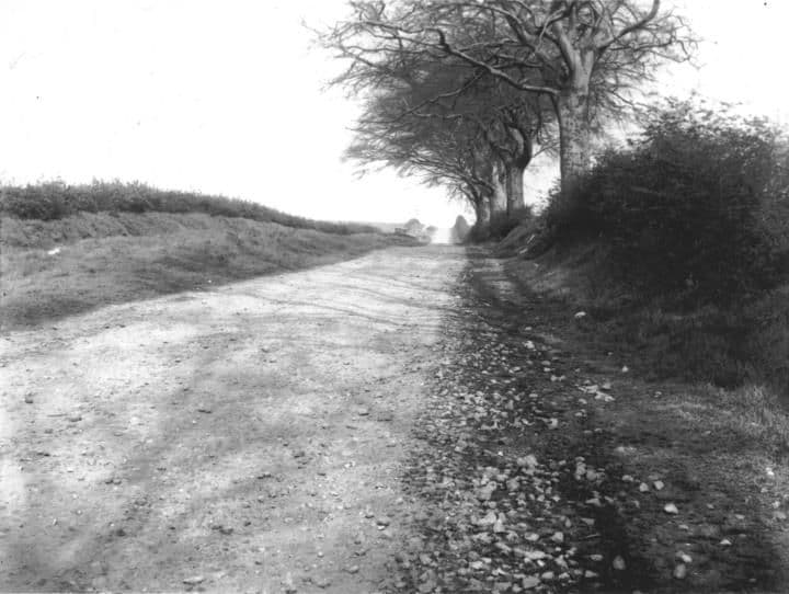
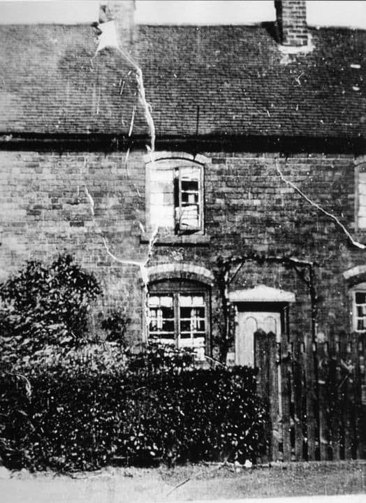
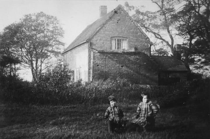
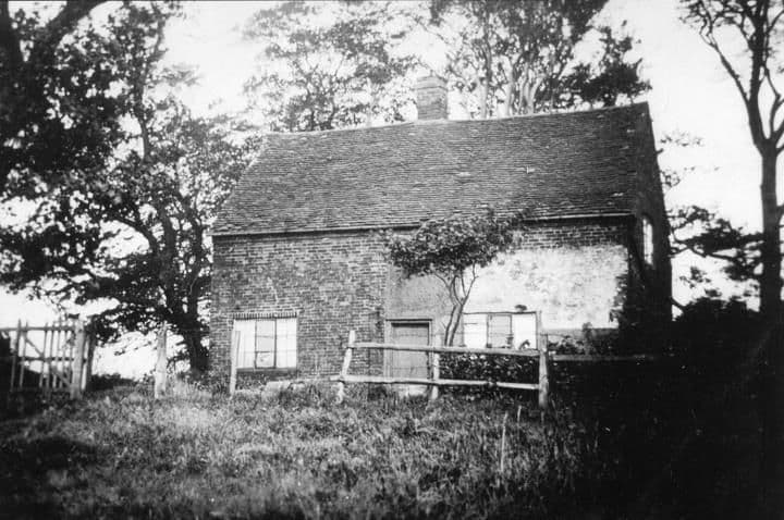
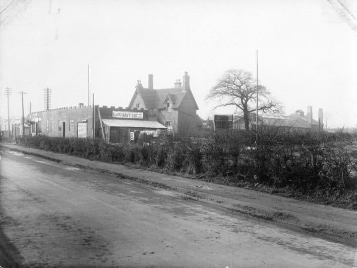
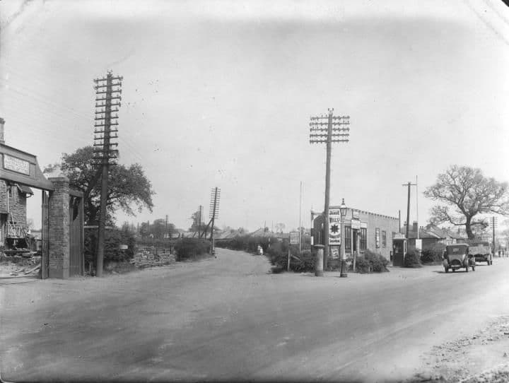
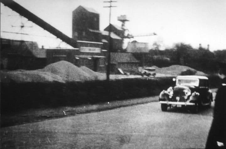
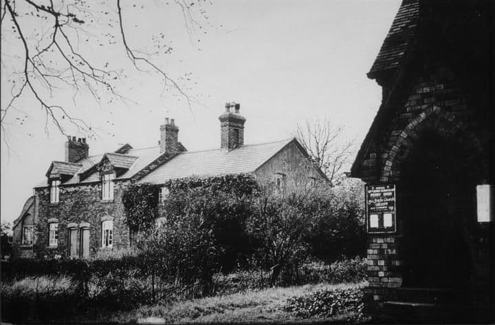
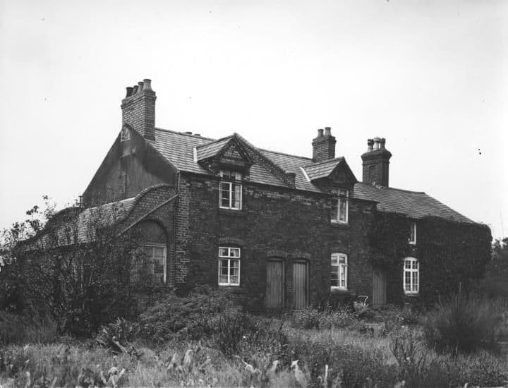
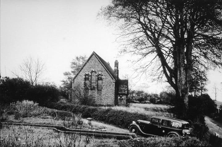
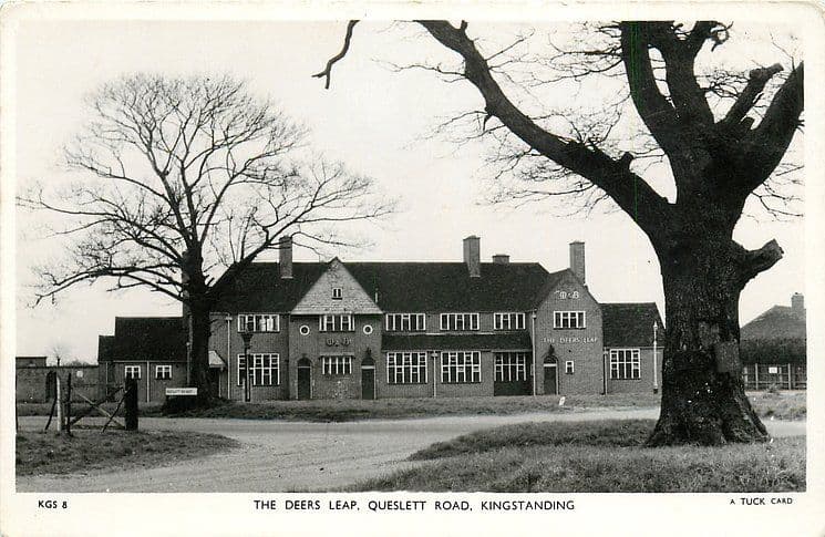
The old schoolhouse by the church, OscottPhotograph undated; building recorded 1840 · Shady LaneSubmitted by a resident of Oscott The Old Horns, Queslett, 1904 (postcard)Posted 30 October 1904 · Queslett RoadPhotographer unknown, via Wikimedia Commons. Public domain St Mary’s College, Oscott, from the air (19th-century engraving)19th century · St Mary’s College, New OscottWellcome Collection (CC BY 4.0), via Wikimedia Commons St Mary’s College, Oscott, 1839 (engraving)1839 · St Mary’s College, New OscottEngraving in Thomas Roscoe, The Book of the Grand Junction Railway (1839), via Wikimedia Commons. Public domain The post office at New Oscott, 1903 (postcard)1903 · Kings RoadLiversage Series (photographer unknown), via Wikimedia Commons. Public domain Kingstanding Road1900 · Kingstanding RoadLibrary of Birmingham, Local Studies and History Department, LSH Warks Photo Survey WK-K10-0083 (3/1306) Halfway Farm1920Library of Birmingham, Local Studies and History Department, LSH WK K10 0086 (3/1309) Hare & Hounds1920Library of Birmingham, Local Studies and History Department, LSH WK K10 0087 (3/1310) Warren Farm1921Library of Birmingham, Local Studies and History Department, Local Studies/ Warks Photo Survey WK/K10/70 (3/1296) Kettlehouse Farmc. 1920–1925Library of Birmingham, Local Studies and History Department, LSH Warks Photo Survey WK-K10-0069 (3/1295) The Circle1923Library of Birmingham, Local Studies and History Department, LSH WPS WK-K10-0068 (3/1294) Kettlehouse Farmc. 1920–1929Library of Birmingham, Local Studies and History Department, LSH Warks Photo Survey WK-K10-0050 (3/1276) Aldridge Road1928 · Aldridge RoadLibrary of Birmingham, Local Studies and History Department, LSH WK K10 0120 (3/1339) Aldridge Road at Shady Lane1928 · Aldridge RoadLibrary of Birmingham, Local Studies and History Department, LSH WK K10 0121 (3/1340) Kings Road1928 · Kings RoadLibrary of Birmingham, Local Studies and History Department, LSH Warks Photo Survey WK-K10-0128 (3/1347) Kings RoadApril 1928 · Kings RoadLibrary of Birmingham, Local Studies and History Department, LSH/ Warks Photo Survey WK-K10-0129 (3/1348) Kingstanding RoadApril 1928 · Kingstanding RoadLibrary of Birmingham, Local Studies and History Department, LSH Warks Photo Survey WK-K10-0065 (3/1291) Kingstanding Village1928Library of Birmingham, Local Studies and History Department, LSH Warks Photo Survey WK-K10-0082 (3/1305) Rough Road1928 · Rough RoadLibrary of Birmingham, Local Studies and History Department, LSH WPS WK-K10-0130 (3/1349) Beech Tree Cottages1929Library of Birmingham, Local Studies and History Department, LSH WK K10 0085 (3/1308) Bandywood Cottages1930Library of Birmingham, Local Studies and History Department, LSH WK K10 0095 (3/1315) Ironmonger’s shop1932 (from the catalogue description)Library of Birmingham, Local Studies and History Department, Warks Photo Survey/ Kingstanding/ WK-K10-0089 (3/1311) Bandy Wood CottagesDate not recordedLibrary of Birmingham, Local Studies and History Department, Local Studies/ Warks Photo Survey WK/K10/96 (3/1316) Kettlehouse FarmDate not recordedLibrary of Birmingham, Local Studies and History Department, (3/1314)

Building the estate, 1919–1938
From the government type plans of 1919 to the new streets of the early 1930s and the aerial views of 1938.
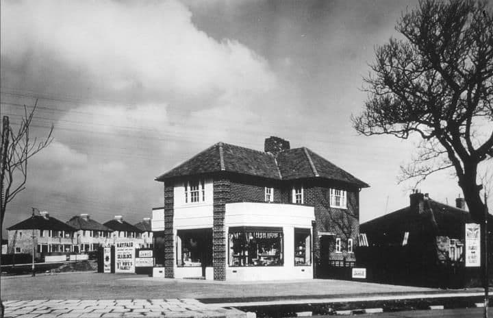
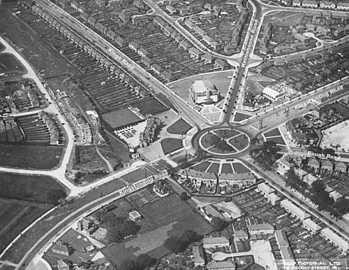
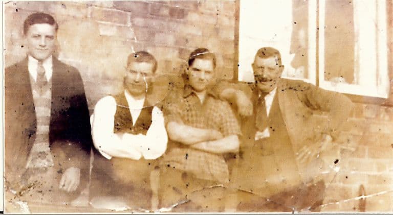
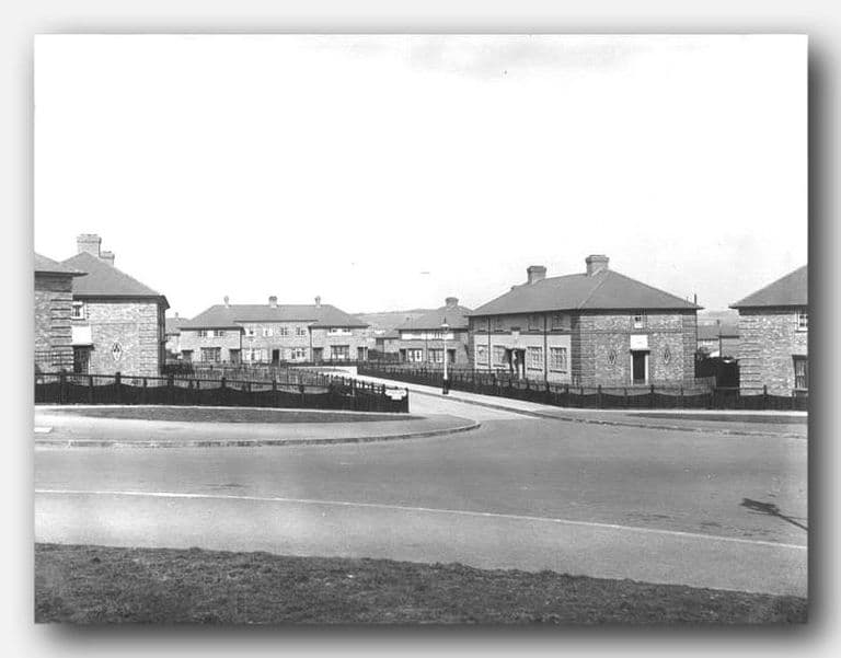
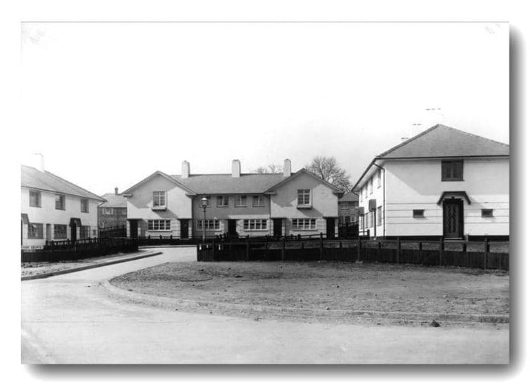
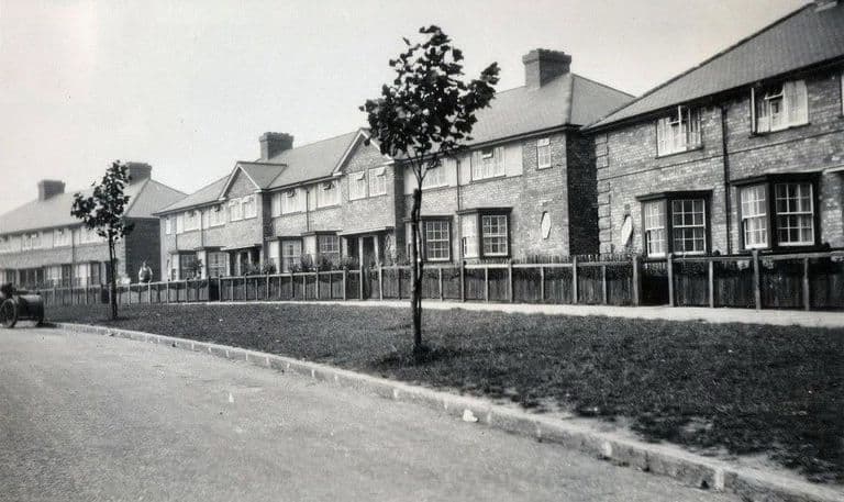
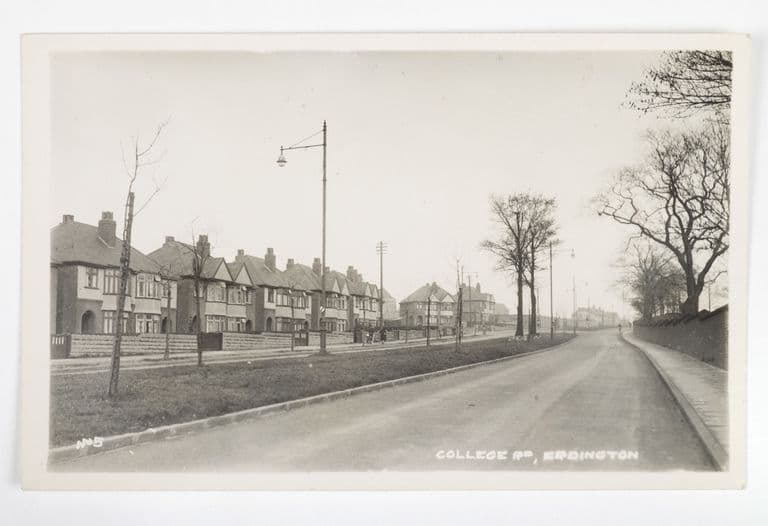
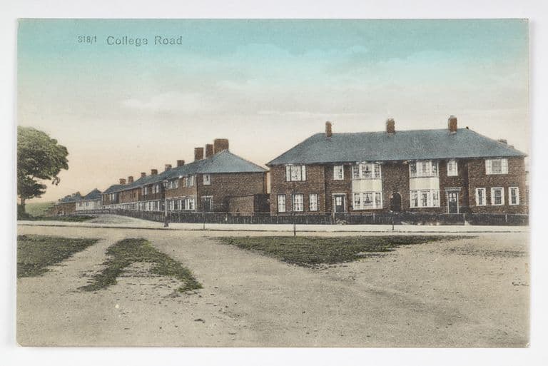
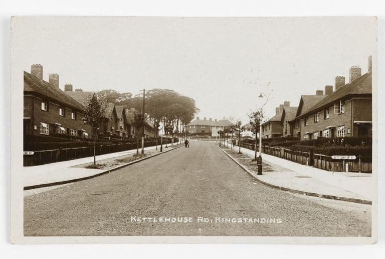
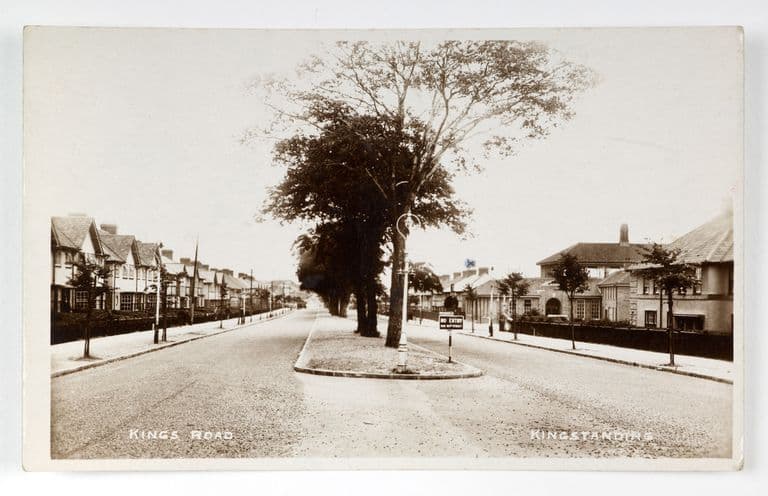
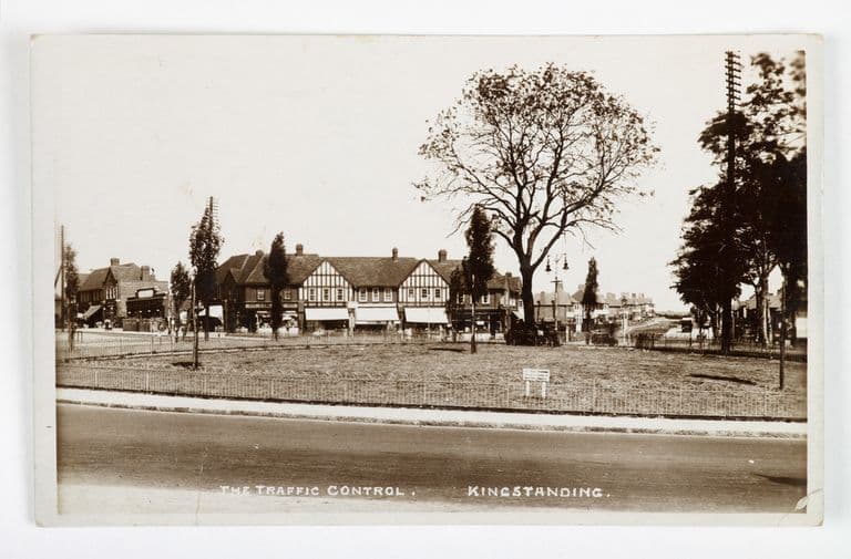
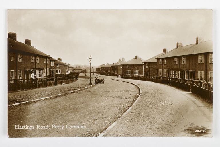
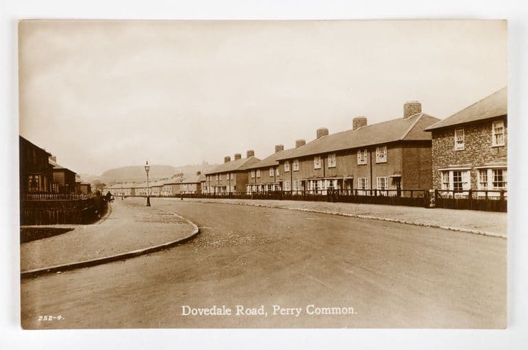
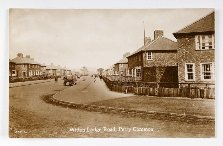
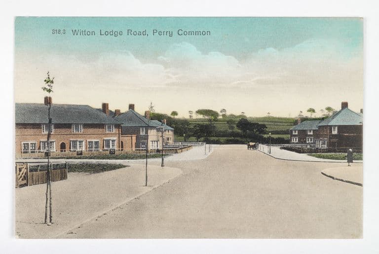
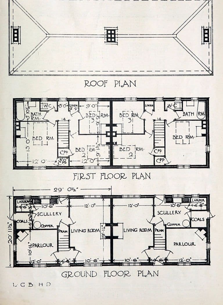
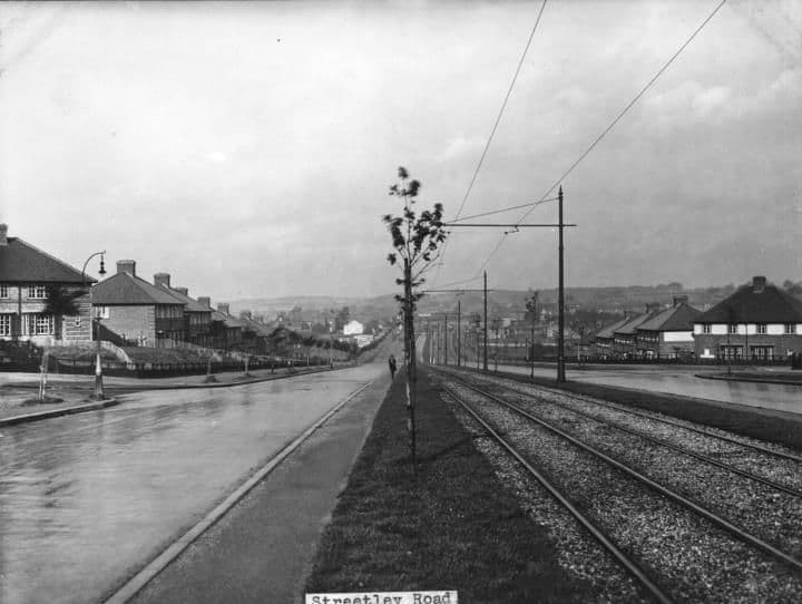
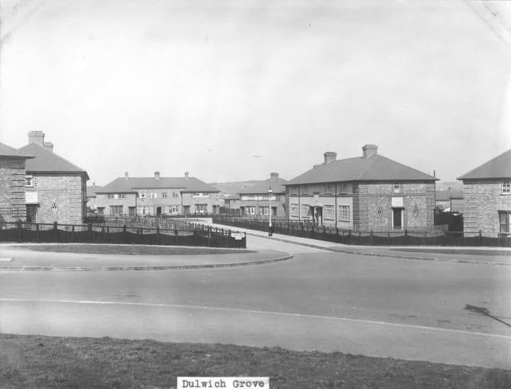
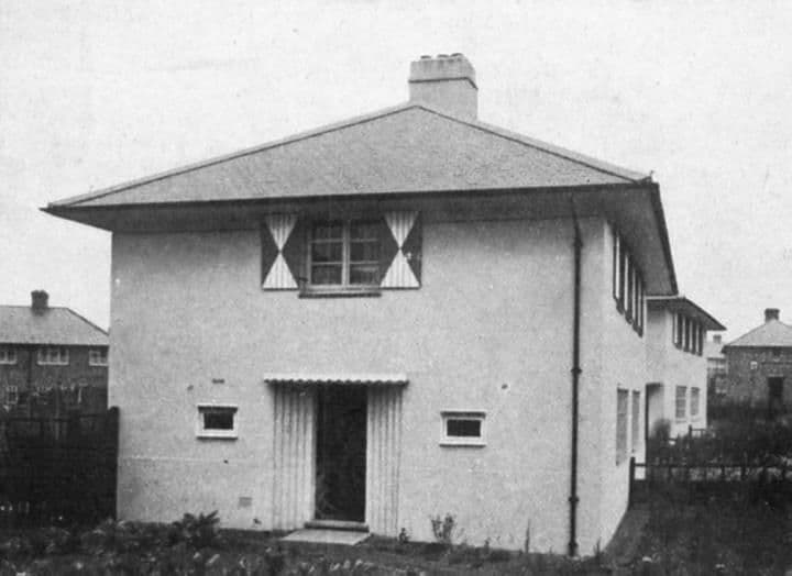
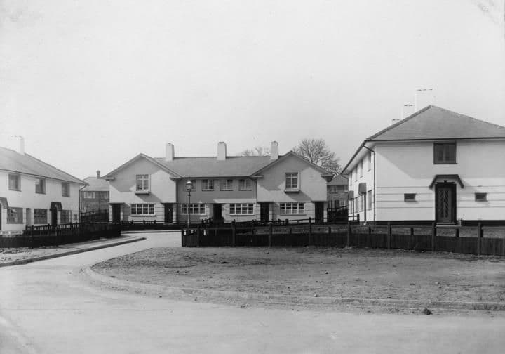
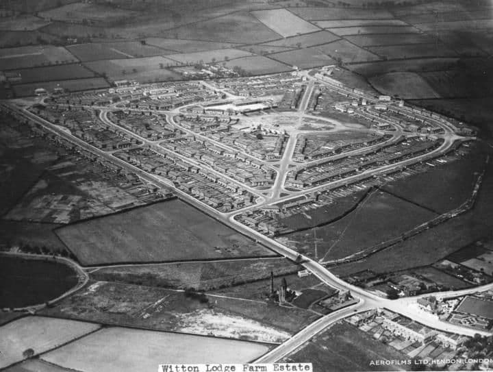
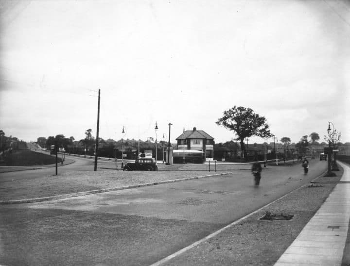
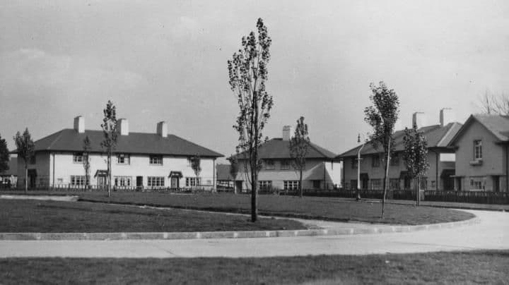
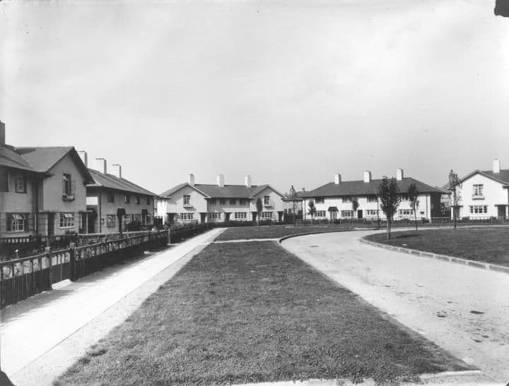
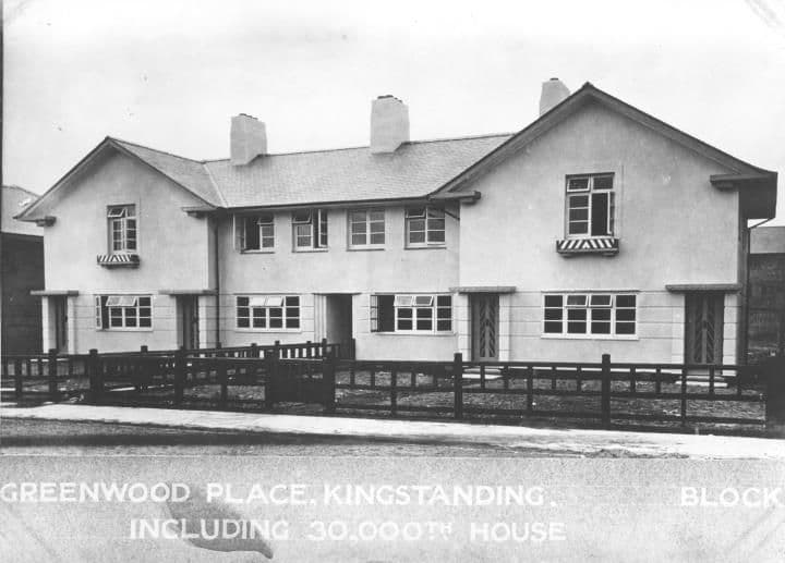
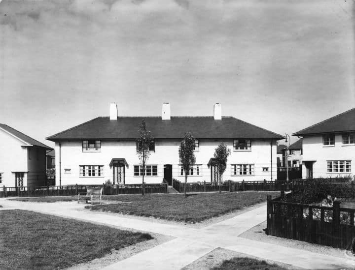
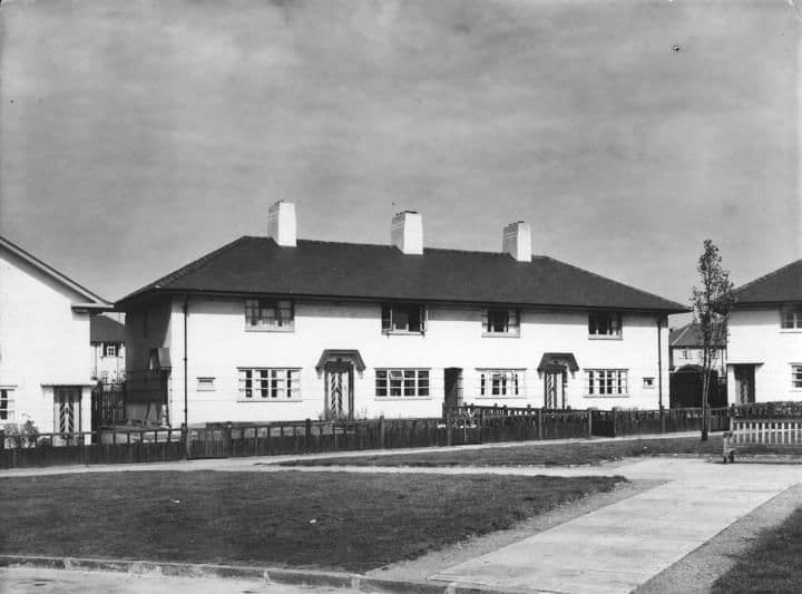
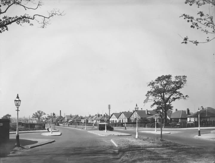
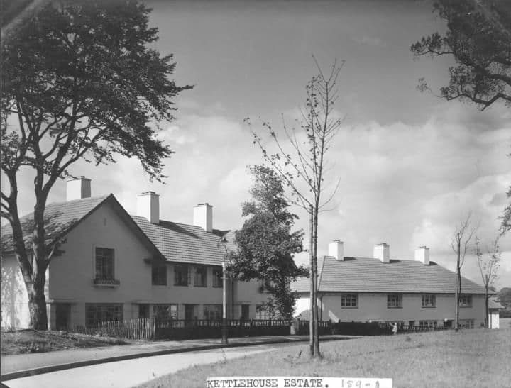
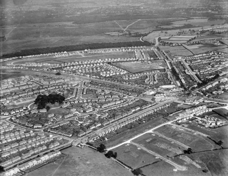
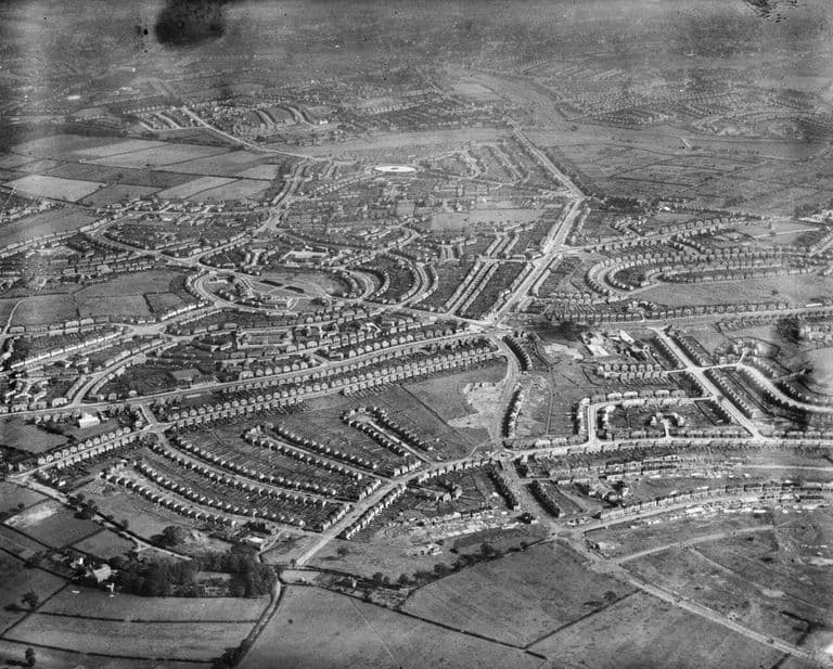
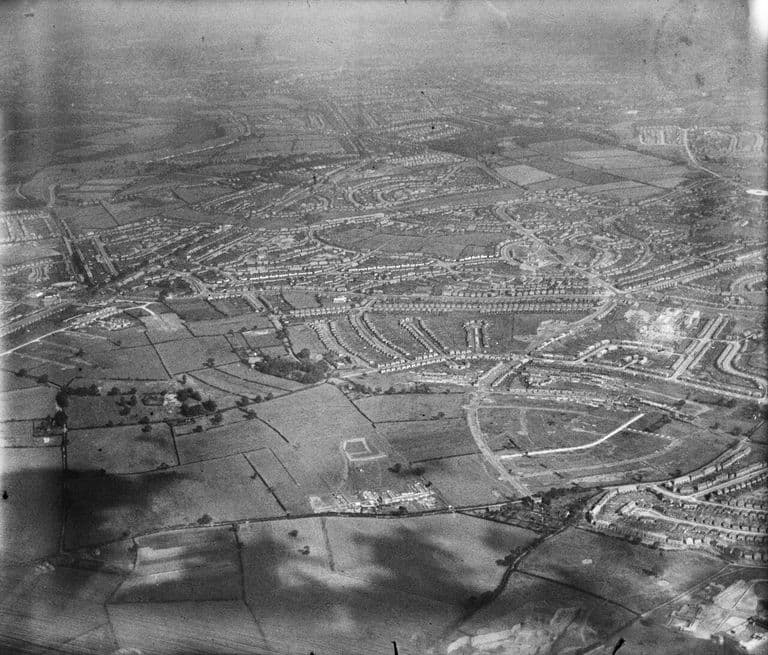
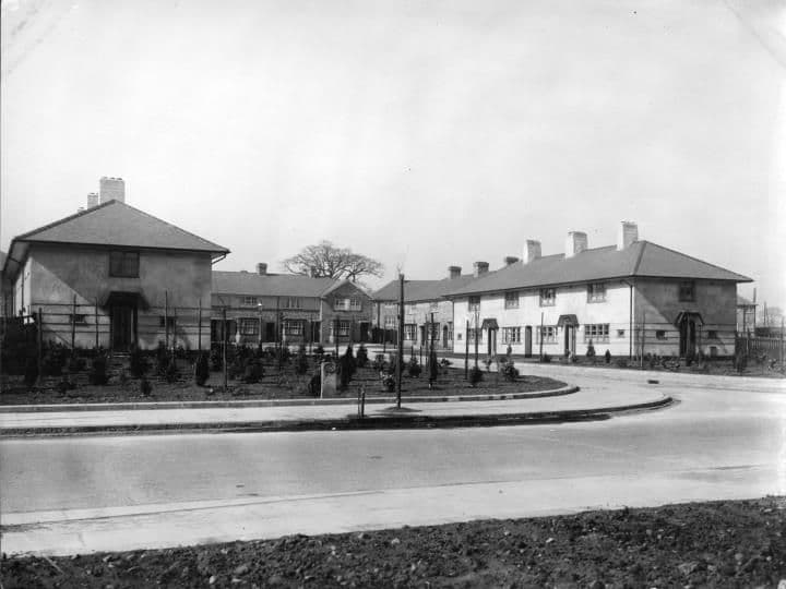
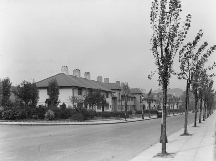
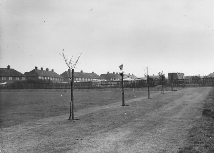
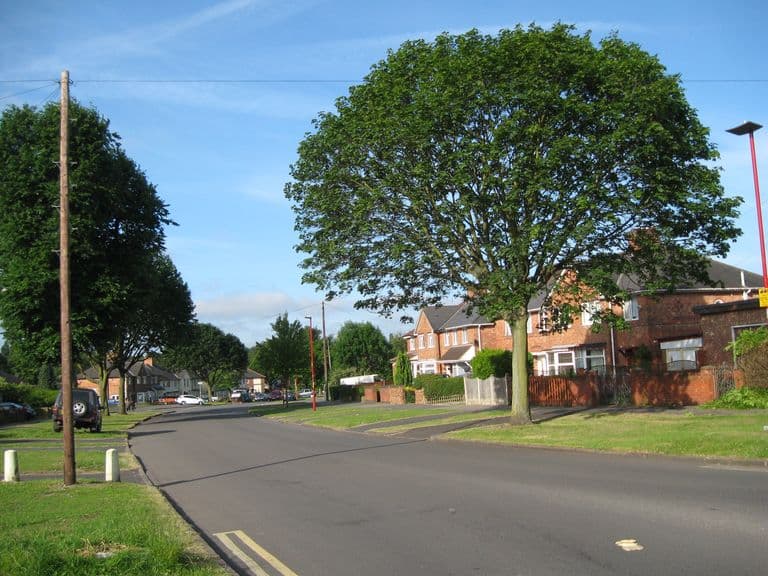
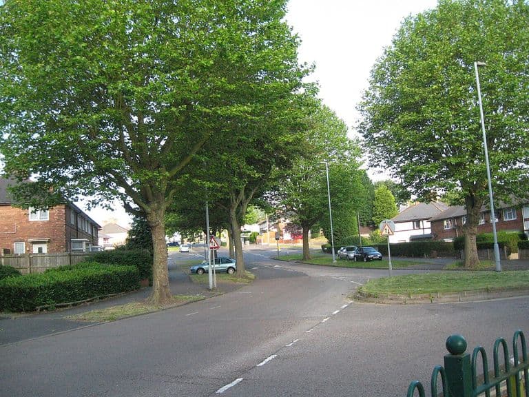
The Crossways pub and College Road, 19381938 · College RoadSource unknown (as shown on Voices of Kingstanding). Reproduced via Chris Hillcox, Voices of Kingstanding. The Circle from the air, 1930s1930s · Kingstanding RoadPhoto: Aero Pictorial Ltd (as printed on the photograph; shared on Voices of Kingstanding by Paul Ariss). Reproduced via Chris Hillcox, Voices of Kingstanding. Rough Road, 19321932 · Rough RoadPhoto: Paul (as credited on Voices of Kingstanding). Reproduced with permission via Chris Hillcox, Voices of Kingstanding. William Henry Wilson and his plasterers, Warren Farm estateDate unknown · Warren Farm estate, KingstandingPhoto: David Smith. Reproduced with permission via Chris Hillcox, Voices of Kingstanding. A junction on the new estate, 1930sc. 1930s · Kingstanding estate (street not identified)Submitted by a resident of Oscott White-rendered houses round a green, 1930sc. 1930s · Kingstanding estate (street not identified)Submitted by a resident of Oscott New council houses and young street trees, 1930sc. 1930s · Kingstanding estate (street not identified)Submitted by a resident of Oscott College Road, 'Erdington' (real-photo postcard No. 5)1930–40 (catalogue) · College RoadPhoto by Birmingham Museums Trust, licensed under CC0 New council houses on College Road (coloured postcard)Catalogued as 1930–40; the scene looks like the late 1920s · College RoadPhoto by Birmingham Museums Trust, licensed under CC0 The Witton Lodge Road estate, May 192711 May 1927 · Witton Lodge RoadAerofilms Ltd, 11 May 1927. Historic England Archive, Aerofilms Collection EPW017949 Perry Common’s central circle from the air, October 19266 October 1926 · Perry CommonAerofilms Ltd, 6 October 1926. Historic England Archive, Aerofilms Collection EPW017044 Perry Common estate being built, October 19266 October 1926 · Perry CommonAerofilms Ltd, 6 October 1926. Historic England Archive, Aerofilms Collection EPW017043 Perry Common from the air, October 19266 October 1926 · Perry Common and Witton Lodge RoadAerofilms Ltd, 6 October 1926. Historic England Archive, Aerofilms Collection EPW017042 Kettlehouse Road, Kingstanding (postcard)c. 1930s · Kettlehouse RoadPhoto by Birmingham Museums Trust, licensed under CC0 Kings Road, Kingstanding (postcard)c. 1930s · Kings RoadPhoto by Birmingham Museums Trust, licensed under CC0 “The Traffic Control”: the Circle, Kingstanding (postcard)c. 1930s · Kingstanding CirclePhoto by Birmingham Museums Trust, licensed under CC0 Hastings Road, Perry Common (postcard)c. 1930s · Hastings RoadPhoto by Birmingham Museums Trust, licensed under CC0 Dovedale Road, Perry Common (postcard)c. 1930s · Dovedale RoadPhoto by Birmingham Museums Trust, licensed under CC0 Witton Lodge Road, Perry Common (postcard)c. 1930s · Witton Lodge RoadPhoto by Birmingham Museums Trust, licensed under CC0 Witton Lodge Road, Perry Common (coloured postcard)c. 1930s · Witton Lodge RoadPhoto by Birmingham Museums Trust, licensed under CC0 Type plan: Class B parlour house, 19191919 · General type plan (not a specific site)Local Government Board, 1919. Wellcome Collection, Public Domain Mark College Road near Holly Lane1927 · College RoadLibrary of Birmingham, Local Studies and History Department, LSH WK K10 0044 (3/1270) College Road towards the canal1927 · College RoadLibrary of Birmingham, Local Studies and History Department, LSH WK K10 0080 (3/1303) Harringay Road1929 · Harringay RoadLibrary of Birmingham, Local Studies and History Department, LSH WK K10 0060 (3/1286) Warren Farm Estate under construction, 1929September 1929 · Warren Farm Estate, KingstandingUnknown photographer, September 1929. Public domain, via Wikimedia Commons Streetly Road1930 · Streetly RoadLibrary of Birmingham, Local Studies and History Department, LSH Warks Photo Survey WK-K10-0076 (3/1300) College Road1931 · College RoadLibrary of Birmingham, Local Studies and History Department, LSH WK K10 0125 (3/1344) Dulwich Grove1931 · Dulwich GroveLibrary of Birmingham, Local Studies and History Department, LSH WK K10 0024 (3/1255) House on the Kingstanding Estate1931 (from the catalogue description)Library of Birmingham, Local Studies and History Department, Local Studies/ Warks Photo Survey WK-K10-55 (3/1283) Leyton Grove1931 · Leyton GroveLibrary of Birmingham, Local Studies and History Department, LSH Warks Photo Survey WK-K10-0002 (3/1237) Witton Lodge Farm Estate1931Library of Birmingham, Local Studies and History Department, LSH WK K10 0075 (3/1298) College Road looking onto Kingstanding Road1932 (from the catalogue description) · College RoadLibrary of Birmingham, Local Studies and History Department, Local Studies/ Warks Photo Survey Wk-K10-0045 (3/1271) Greenwood Place1932 · Greenwood PlaceLibrary of Birmingham, Local Studies and History Department, LSH WK K10 0001 (3/1234) Greenwood Place, off Finchley Road1932 · Greenwood PlaceLibrary of Birmingham, Local Studies and History Department, LSH WK K10 0025 (3/1256) Greenwood Place: the 30,000th council house1932 · Greenwood PlaceLibrary of Birmingham, Local Studies and History Department, LSHWK K10 0026 (3/1257) Greenwood Place, August 19321932 · Greenwood PlaceLibrary of Birmingham, Local Studies and History Department, LSH WK K10 0058 (3/1284) Greenwood Place, July 19321932 (from the catalogue description) · Greenwood PlaceLibrary of Birmingham, Local Studies and History Department, LSH WK K10 0058a (3/1285) College Road1933 · College RoadLibrary of Birmingham, Local Studies and History Department, LSH WK K10 0009 (3/1241) Bandywood Road1934 · Bandywood RoadLibrary of Birmingham, Local Studies and History Department, LSH WK K10 0036 (3/1265) Queslett Roadc. 1930–1939 · Queslett RoadLibrary of Birmingham, Local Studies and History Department, LSH WPS Wk-K10-0100 (3/1320) Shady Lane1938 · Shady LaneLibrary of Birmingham, Local Studies and History Department, LSH/ Warks Photo Survey WK-K10-0111 (3/1331) Shady Lane13 October 1938 · Shady LaneLibrary of Birmingham, Local Studies and History Department, LSH WPS WK-K10-0123 (3/1342) Bandywood Crescent from the air, 19388 September 1938 · Bandywood CrescentAerofilms Ltd, 1938 (Historic England Archive EPW059305). Public domain, via Wikimedia Commons Kingstanding Road and Warren Farm Road from the air, 19388 September 1938 · Kingstanding Road and Warren Farm RoadAerofilms Ltd, 1938 (Historic England Archive EPW059310). Public domain, via Wikimedia Commons The estate from the north-west, 19388 September 1938 · Across the estate from the north-westAerofilms Ltd, 1938 (Historic England Archive EPW059311). Public domain, via Wikimedia Commons The Circle and the Odeon from the north-west, 19388 September 1938 · The CircleAerofilms Ltd, 1938 (Historic England Archive EPW059312). Public domain, via Wikimedia Commons Perry Beeches and the estate from the south-west, 19388 September 1938 · Perry Beeches and Aldridge RoadAerofilms Ltd, 1938 (Historic England Archive EPW059313). Public domain, via Wikimedia Commons The estate from the south-west, 19388 September 1938 · Across the estate from the south-westAerofilms Ltd, 1938 (Historic England Archive EPW059314). Public domain, via Wikimedia Commons The estate from the south-west, 1938 (another view)8 September 1938 · Across the estate from the south-westAerofilms Ltd, 1938 (Historic England Archive EPW059315). Public domain, via Wikimedia Commons Witton Lodge Farm Estatec. 1930–1969Library of Birmingham, Local Studies and History Department, LSH/ Warks Photo Survey Wk-K10-0071 (3/1297)
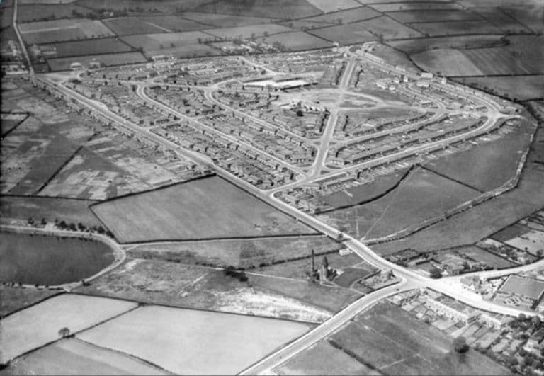
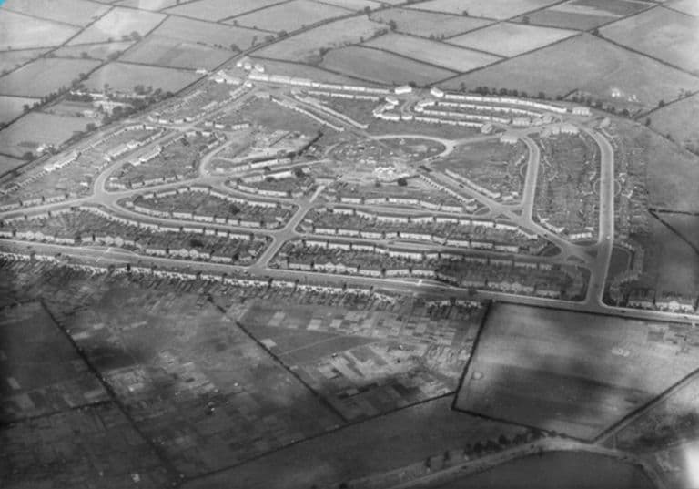
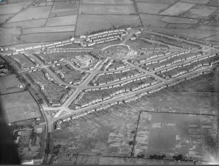
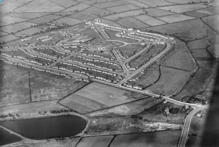
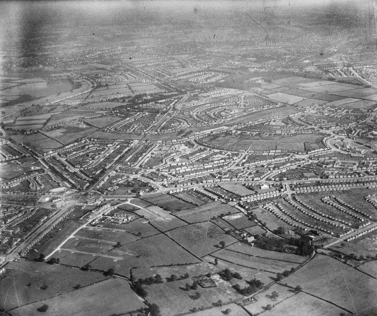
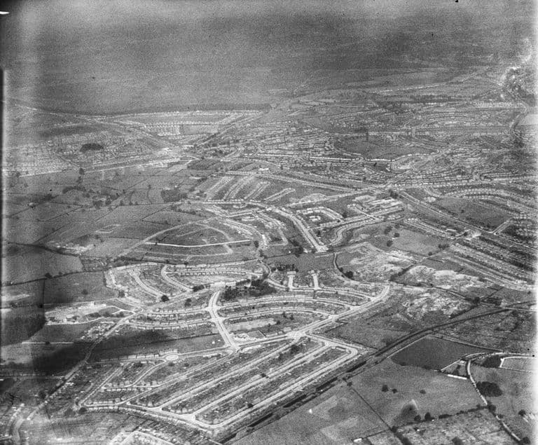
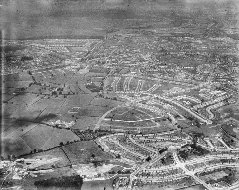
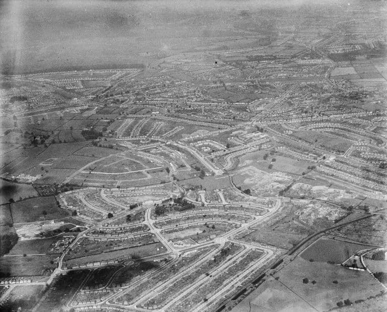
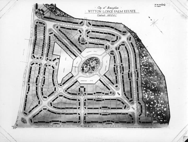
Hurlingham Road
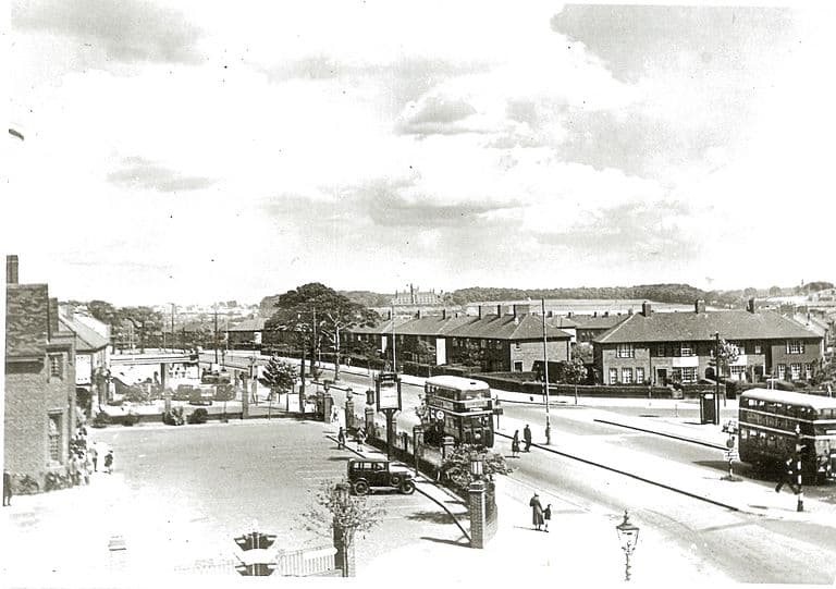
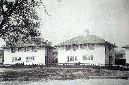
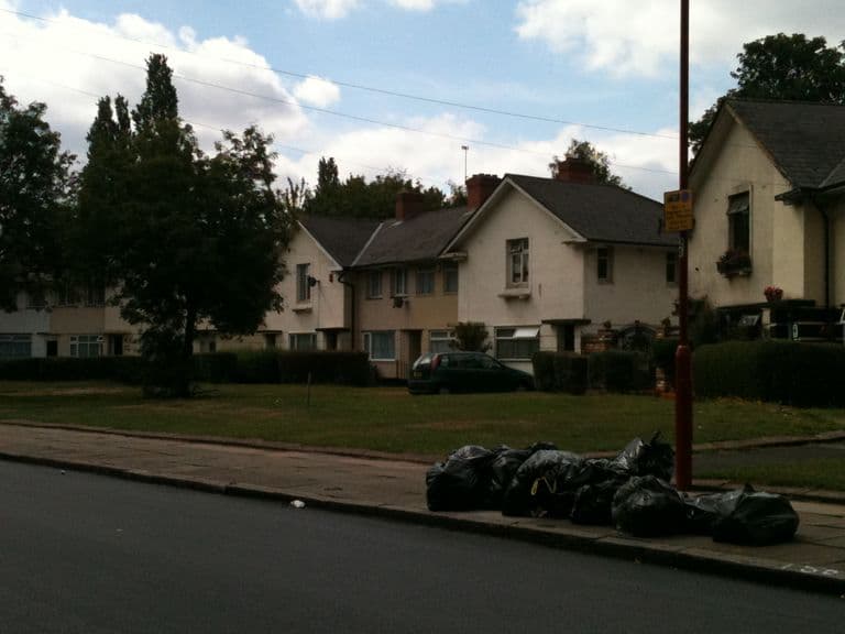
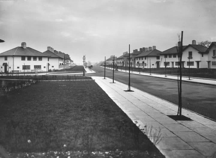
The estate’s straight, tree-lined axis, from its completion in the early 1930s to today.
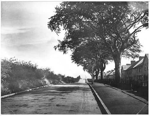
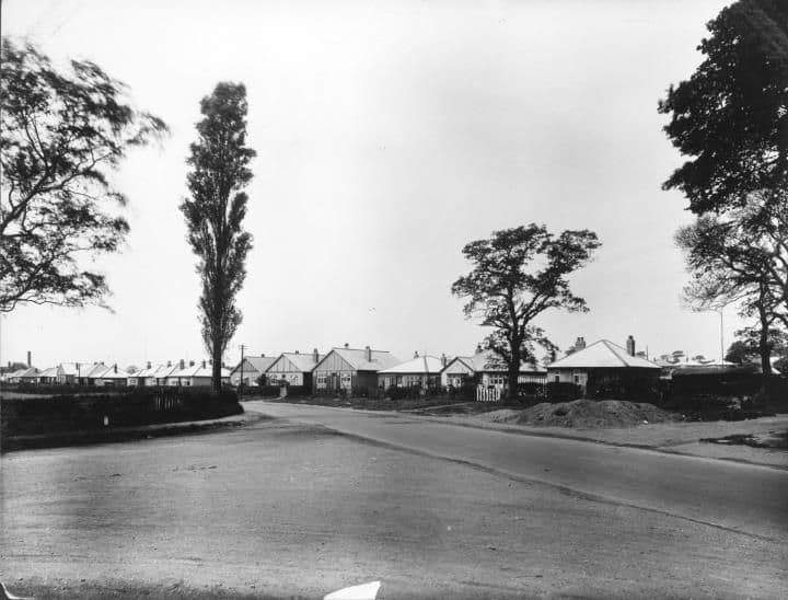
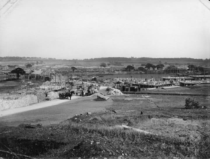
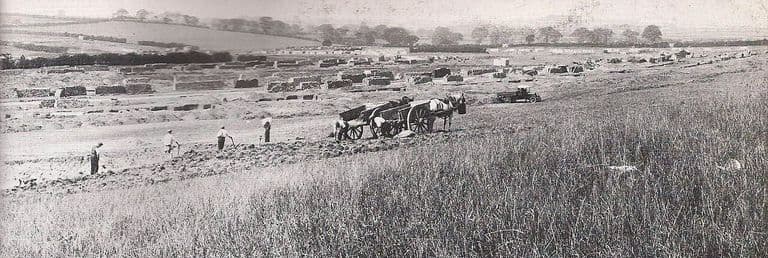
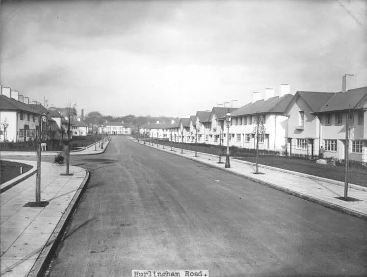
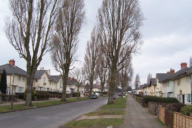
New houses on Hurlingham Road, 19311931 · Hurlingham RoadSource unknown (as shown on Voices of Kingstanding). Reproduced via Chris Hillcox, Voices of Kingstanding. Rebuilt houses on Hurlingham Road, 20112011 · Hurlingham RoadImage reproduced with permission of Chris Hillcox, Voices of Kingstanding. Hurlingham Road1930 (from the catalogue description) · Hurlingham RoadLibrary of Birmingham, Local Studies and History Department, Local Studies/ Warks Photo Survey WK-K10-13 (3/1245) Grove off Hurlingham Road1931 (from the catalogue title)Library of Birmingham, Local Studies and History Department, Local Studies/ Warks Photo Survey WK-K10-47 (3/1273) Hurlingham RoadJanuary 1932 · Hurlingham RoadLibrary of Birmingham, Local Studies and History Department, LSH Warks Photo Survey WK-K10-0022 (3/1253) Hurlingham Roadc. 1950–1970 · Hurlingham RoadLibrary of Birmingham, Local Studies and History Department, LSH/ Warks Photo Survey WK-K10-0015 (3/1247) Hurlingham Road, 200515 March 2005 · Hurlingham RoadPhoto: Adrian Bailey, CC BY-SA 2.0, via Geograph / Wikimedia Commons
Danesbury Crescent and the oval
The crescent that closes the Hurlingham Road axis.
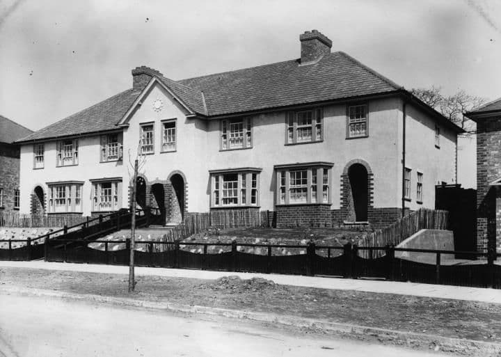
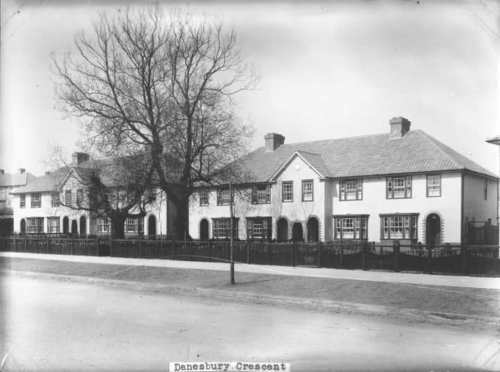
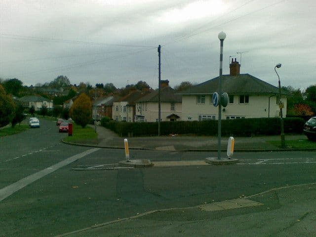
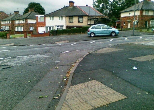
Danesbury Crescent1931 · Danesbury CrescentLibrary of Birmingham, Local Studies and History Department, LSH WK K10 0003 (3/1236) Danesbury Crescent1932 · Danesbury CrescentLibrary of Birmingham, Local Studies and History Department, LSH WK K10 0027 (3/1258) Danesbury Crescent and Hurlingham Road junction, 20105 November 2010 · Danesbury CrescentPhoto: Alex McGregor, CC BY-SA 2.0, via Geograph / Wikimedia Commons Danesbury Crescent, 201113 June 2011 · Danesbury CrescentPhoto: Alex McGregor, CC BY-SA 2.0, via Geograph / Wikimedia Commons
Schools, churches and public buildings
The schools, churches, clinics, cinema and open spaces the estate grew around it.
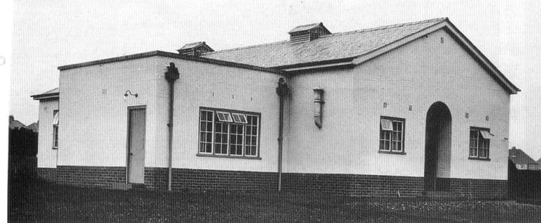
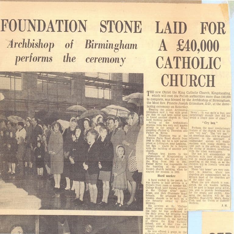
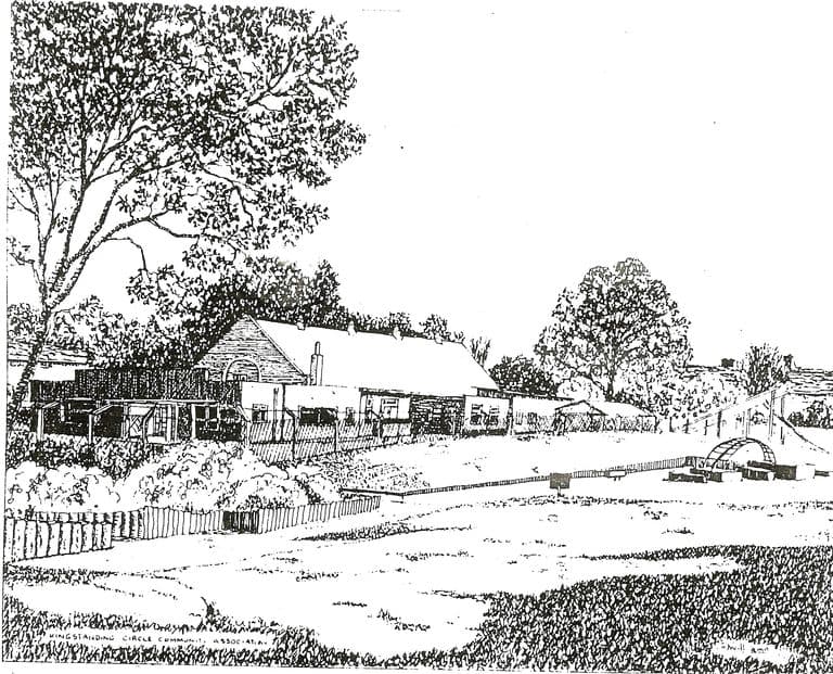
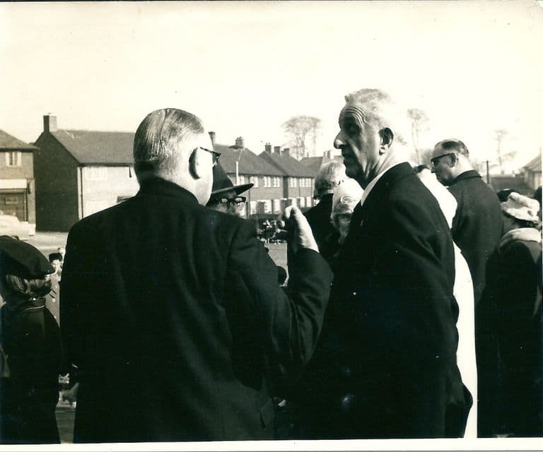
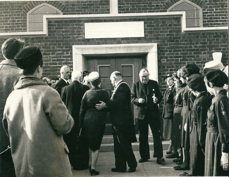
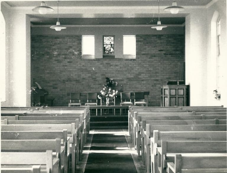
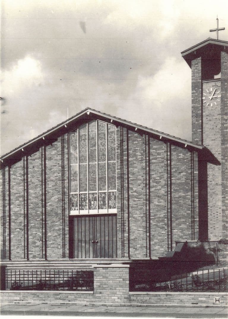
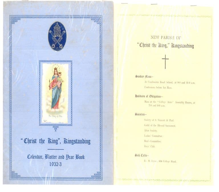
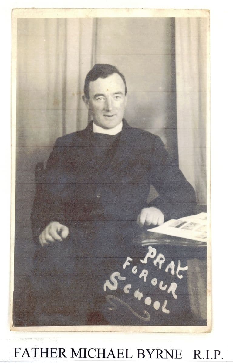
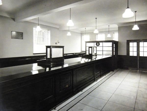
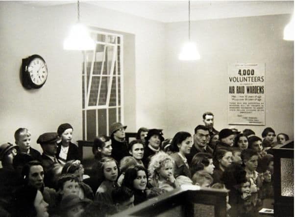
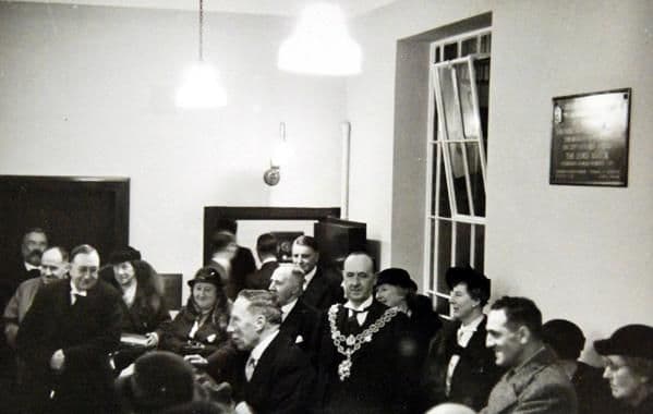
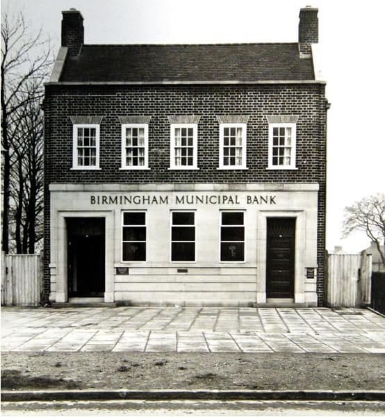
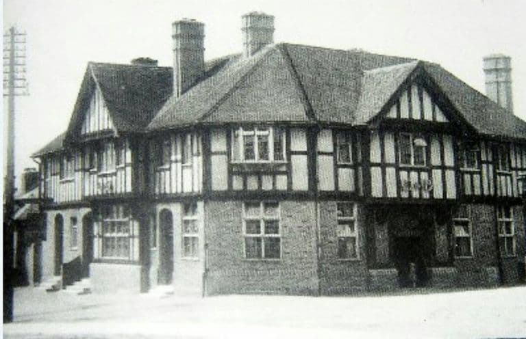
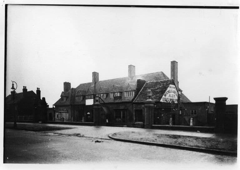
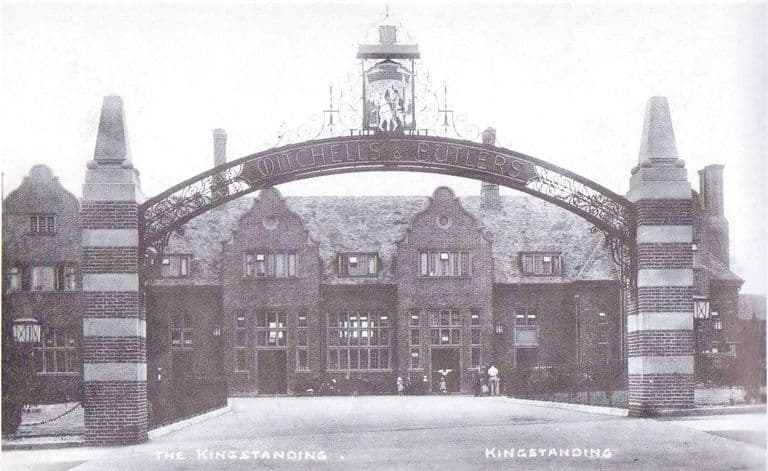
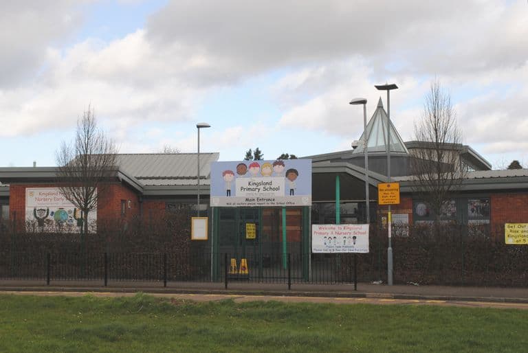
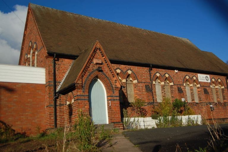
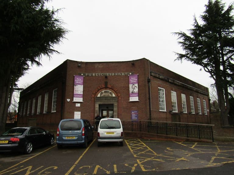
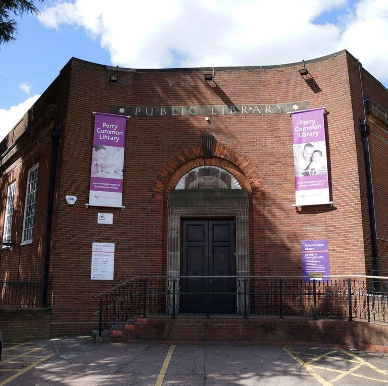
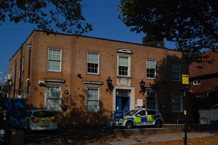
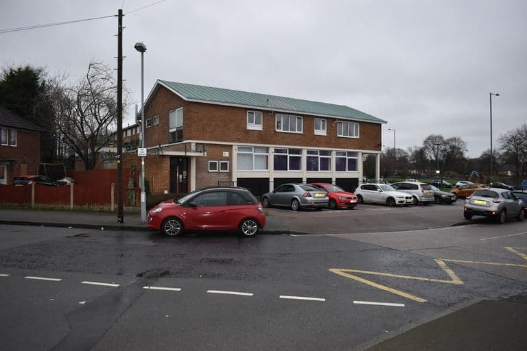
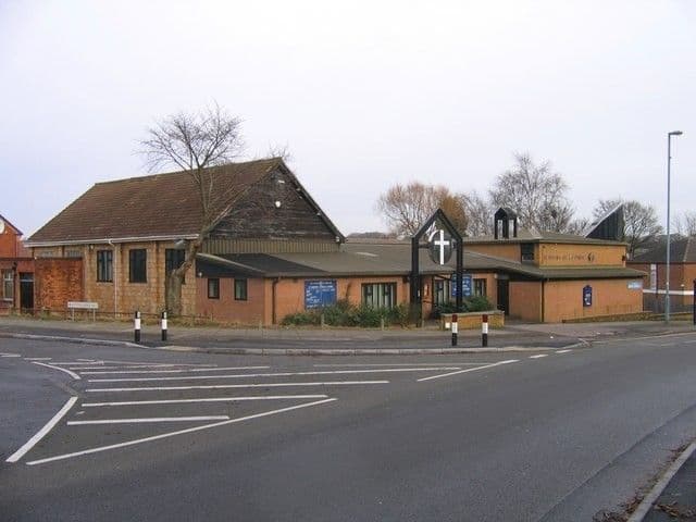
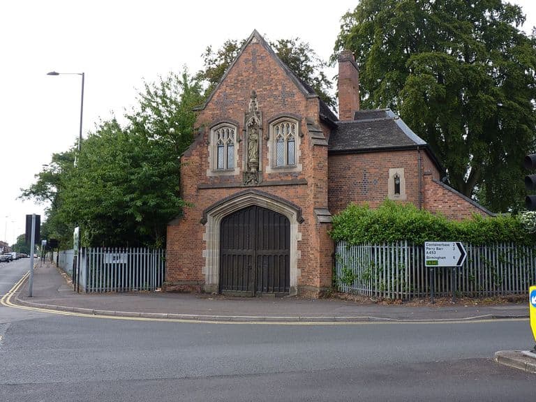
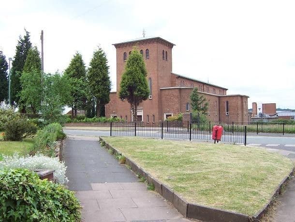
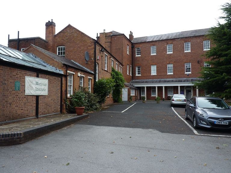
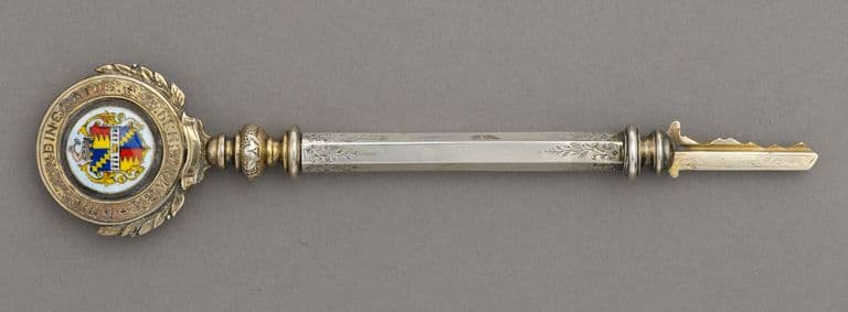
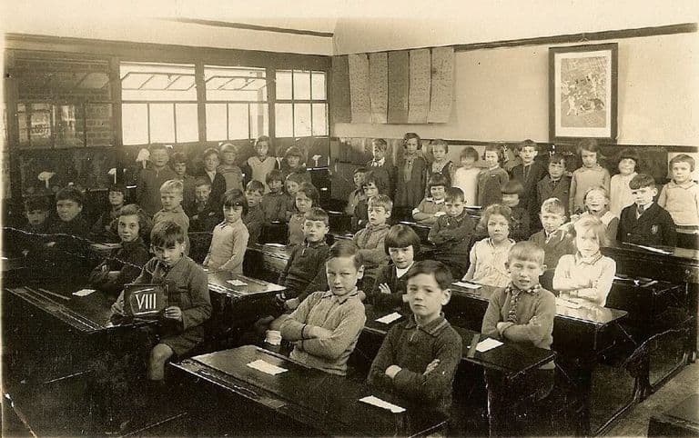
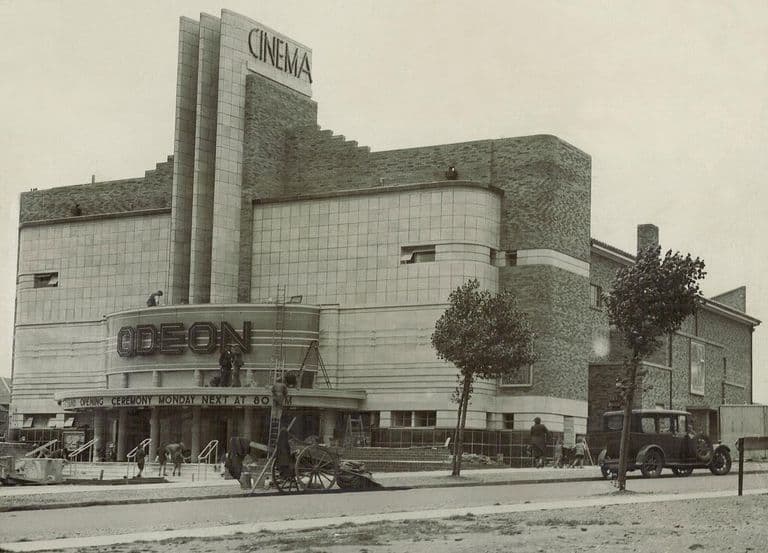
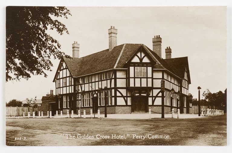
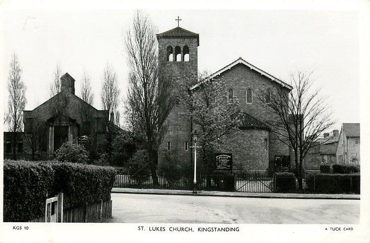
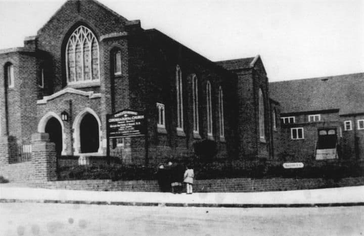
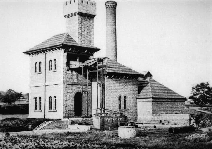
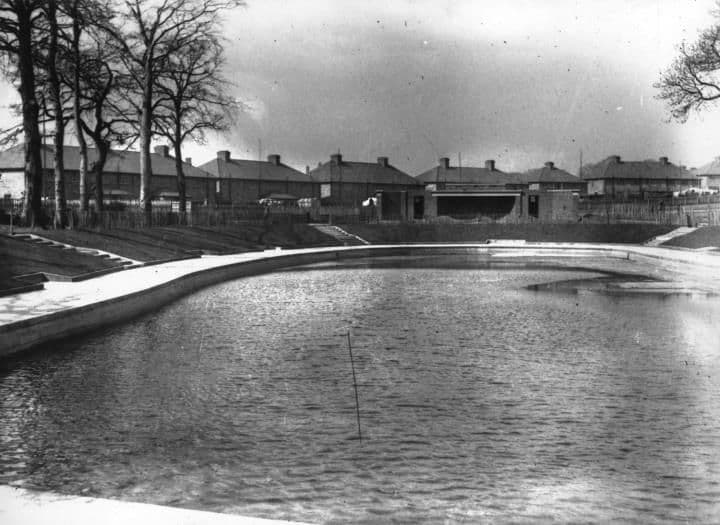
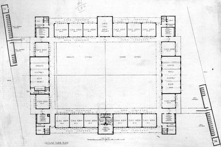
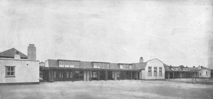
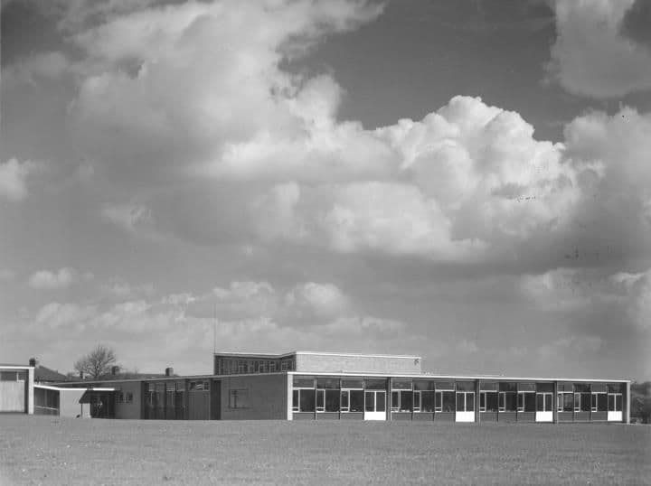
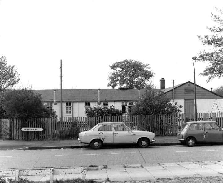
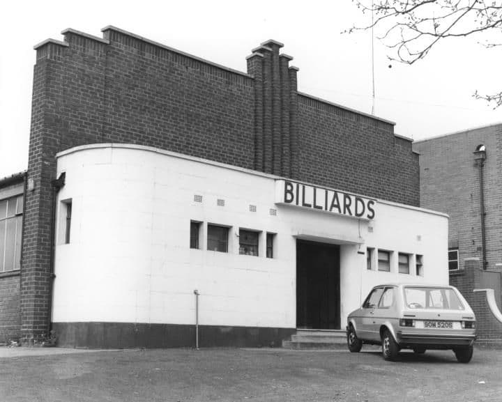
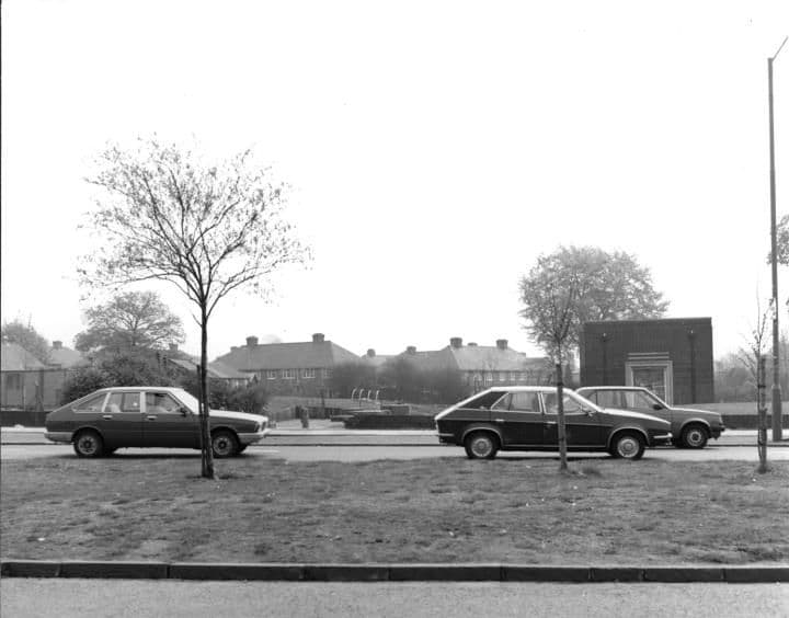
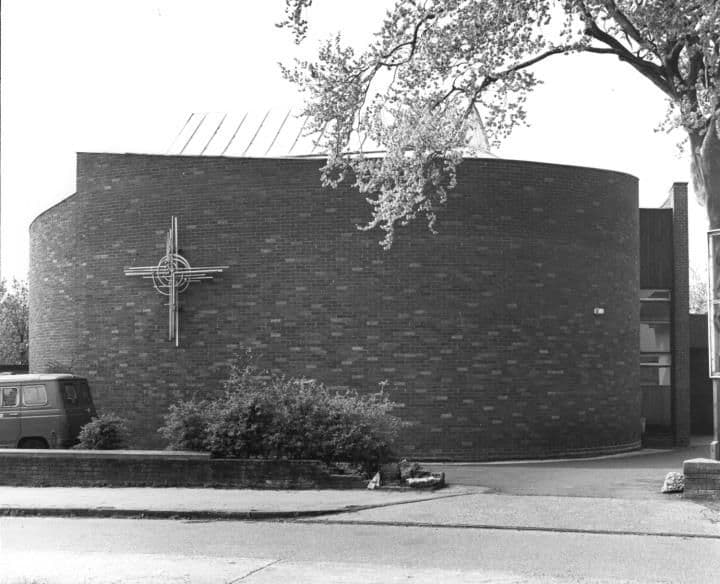
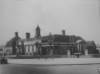
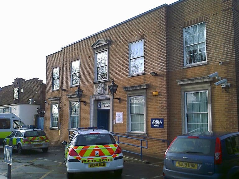
The Kingstanding Settlement buildingDate unknown · Kingstanding Settlement, KingstandingPhoto: Kingstanding Library (as credited on Voices of Kingstanding). Reproduced via Chris Hillcox, Voices of Kingstanding. “Foundation stone laid for a £40,000 Catholic church”, c. 1961c. 1961 · Christ the King Catholic Church, KingstandingFrom a newspaper cutting, c. 1961 (publication not named; from the Christ the King church archive, as reproduced on Voices of Kingstanding). Reproduced via Chris Hillcox, Voices of Kingstanding. Kingstanding Circle Community Association: the planned extension, 19791979 · Kings RoadPhoto: Kingstanding Library (as credited on Voices of Kingstanding). Reproduced via Chris Hillcox, Voices of Kingstanding. Guests at the John Bunyan Baptist Chapel opening, 19631963 · John Bunyan Baptist Chapel, KingstandingPhoto: Rob Clarke. Reproduced with permission via Chris Hillcox, Voices of Kingstanding. Civic leaders at the opening of John Bunyan Baptist Chapel, 19631963 · John Bunyan Baptist Chapel, KingstandingPhoto: Rob Clarke. Reproduced with permission via Chris Hillcox, Voices of Kingstanding. Inside the new John Bunyan Baptist Church, 19631963 · John Bunyan Baptist Chapel, KingstandingPhoto: Rob Clarke. Reproduced with permission via Chris Hillcox, Voices of Kingstanding. The new Christ the King church, completed 19621962 · Christ the King Catholic Church, KingstandingImage reproduced with permission of Chris Hillcox, Voices of Kingstanding. Christ the King year book, 1932–331932–33 · Christ the King parish, KingstandingImage reproduced with permission of Chris Hillcox, Voices of Kingstanding. Father Michael Byrne, first priest of Christ the KingDate unknown (1930s–40s) · Christ the King parish, KingstandingImage reproduced with permission of Chris Hillcox, Voices of Kingstanding. Inside the Municipal Bank, Kingstanding, 19371937 · Kingstanding RoadPhoto: David Parkes. Reproduced with permission via Chris Hillcox, Voices of Kingstanding. Depositors at the opening of the Municipal Bank, Kingstanding, 193723 October 1937 · Kingstanding RoadPhoto: David Parkes. Reproduced with permission via Chris Hillcox, Voices of Kingstanding. The Lord Mayor opens the Municipal Bank, Kingstanding, 193723 October 1937 · Kingstanding RoadPhoto: David Parkes. Reproduced with permission via Chris Hillcox, Voices of Kingstanding. Birmingham Municipal Bank, Kingstanding Road, 19371937 · Kingstanding RoadPhoto: David Parkes. Reproduced with permission via Chris Hillcox, Voices of Kingstanding. A half-timbered inn (not yet identified)Undated (probably inter-war) · Not yet identifiedSubmitted by a resident of Oscott A new Mitchells & Butlers pub, inter-war yearsc. 1930s · Kingstanding area (to be confirmed)Submitted by a resident of Oscott. Photo courtesy of Lee Lewis (as credited on Voices of Kingstanding). The Kingstanding pub and its great arch, 1936 (postcard)Postmarked 10 August 1936 · Kingstanding RoadPostcard, 1936; publisher and photographer unknown Kingsland Primary School, 20201 March 2020 · Kingsland Road© Andy Mabbett, CC BY-SA 4.0 The old All Saints' church, Shady Lane, 201322 November 2013 · Shady Lane© Andy Mabbett, CC BY-SA 3.0 Perry Common Library, 201518 December 2015 · College Road© Brianboru100, CC BY-SA 4.0 'Lamp of Knowledge': William Bloye's relief on Perry Common LibraryCarving c.1934; photographed 26 April 2016 · College Road© Oosoom (English Wikipedia user), CC BY-SA 3.0 Kingstanding Police Station, 201421 September 2014 · Near Kingstanding Circle (Commons coordinates of the 2025 view: 52.5541, −1.8841)© Andy Mabbett, CC BY-SA 4.0 Kingstanding Library, 20207 January 2020 · Kingstanding Library, Kingstanding Circle© Martin Richard Phelan, CC BY-SA 2.0 (Geograph) St Martin's Church Centre on 'the Ring', Perry Common, 200924 January 2009 · Witton Lodge Road© Roy Hughes, CC BY-SA 2.0 (Geograph) The Oscott College gatehouse, 20189 August 2018 · College Road© Richard Law, CC BY-SA 2.0 (Geograph) Our Lady of the Assumption (Maryvale church), 200517 June 2005 · Old Oscott Hill© Adrian Bailey, CC BY-SA 2.0 (Geograph) Maryvale House, Old Oscott, 20189 August 2018 · Old Oscott Hill© Richard Law, CC BY-SA 2.0 (Geograph) Ceremonial key to Kingstanding Swimming BathsObject c.1938; photographed 2012 · Warren Farm RoadBirmingham Museums Trust (accession 2007.0843), CC BY-NC-SA 2.0 A class at Peckham Road School, 19321932 · Peckham RoadPhotographer unknown, 1932; via Wikimedia Commons (Great Barr Observer). Also published on Voices of Kingstanding as “Copyright Margaret Crompton”. The Odeon the week before it opened, July 1935July 1935 · The Odeon, Kingstanding CirclePhotographer unknown, via Wikimedia Commons. Public domain The Golden Cross Hotel, Perry Common (postcard)c. 1930s · The Golden Cross, Perry CommonPhoto by Birmingham Museums Trust, licensed under CC0 St Luke’s Church, c. 1950 (postcard)c. 1950 · St Luke’s Church, KingstandingRaphael Tuck & Sons postcard, c. 1950 (TuckDB Postcards). Public domain Ebenezer Memorial Congregational Church1925Library of Birmingham, Local Studies and History Department, LSH WK K10 0132 (3/1350) Kingsvale Pumping Stationc. 1900–1959Library of Birmingham, Local Studies and History Department, LSH/ Warks Photo Survey WK-K10-0098 (3/1318) Kingstanding Recreation Ground1930 (from the catalogue description)Library of Birmingham, Local Studies and History Department, Local Studies/ Warks Photo Survey/ Wk-K10-0127 (3/1346) Cranbourne Road School: the architects’ plan1931 · Cranbourne Road Junior & Infant School, KingstandingLibrary of Birmingham, Local Studies and History Department, LSH WK K10 0054a (3/1280) Cranbourne Road Junior & Infant School1931Library of Birmingham, Local Studies and History Department, 0780-WK K10 0054b (3/1281) Kingstanding Odeon1935Library of Birmingham, Local Studies and History Department, Handsworth Historical Society (3/1338) All Saints Church1938Library of Birmingham, Local Studies and History Department, LSH WK K10 0112 (3/1332) Health Clinics, Warren Farm Road1940 · Warren Farm RoadLibrary of Birmingham, Local Studies and History Department, LSH WK K10 0134 (3/1352) Kingstanding Recreation Ground11 April 1957Library of Birmingham, Local Studies and History Department, LSH/ Warks Photo Survey WK-K10-0126 (3/1345) Wilson Stuart School1957Library of Birmingham, Local Studies and History Department, LSH/ Warks Photo Survey WK-K10-0079 (3/1302) City Day Nursery, Dunedin Road1975 · Dunedin RoadLibrary of Birmingham, Local Studies and History Department, LSH WK K10 0040 (3/1268) Billiard Hall1984Library of Birmingham, Local Studies and History Department, WK K10 0010 (3/1242) Old waterworks building1984Library of Birmingham, Local Studies and History Department, LSH Warks Photo Survey WK-K10-0046 (3/1272) St Mark's Church1984Library of Birmingham, Local Studies and History Department, LSH Warks Photo Survey WK-K10-0035 (3/1264)
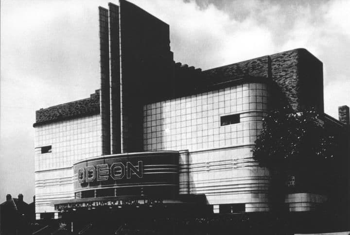
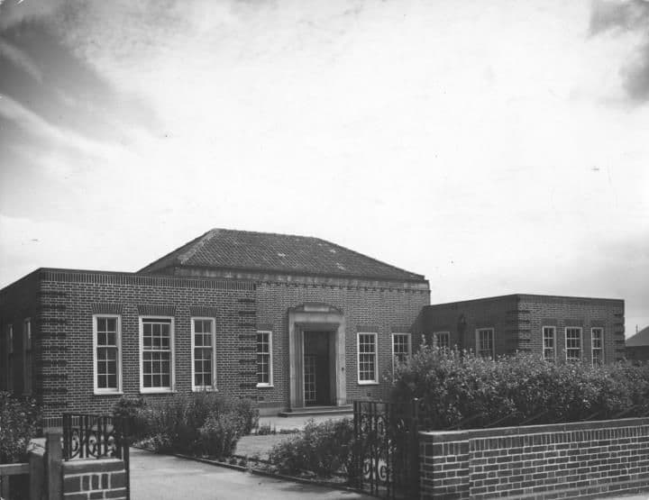
Community life
Classes, festivals, outings and street gatherings.
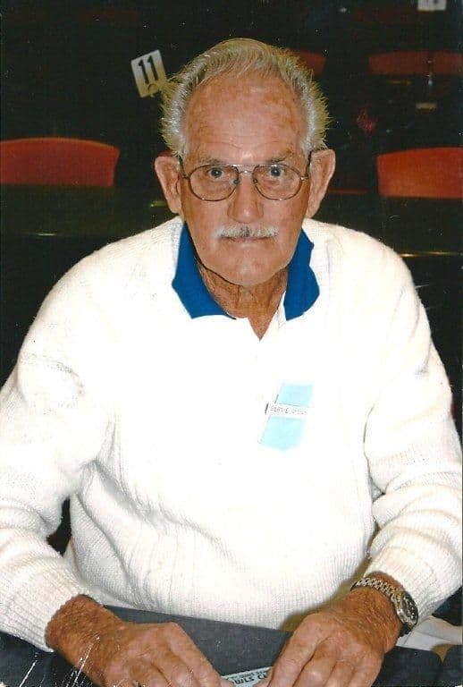
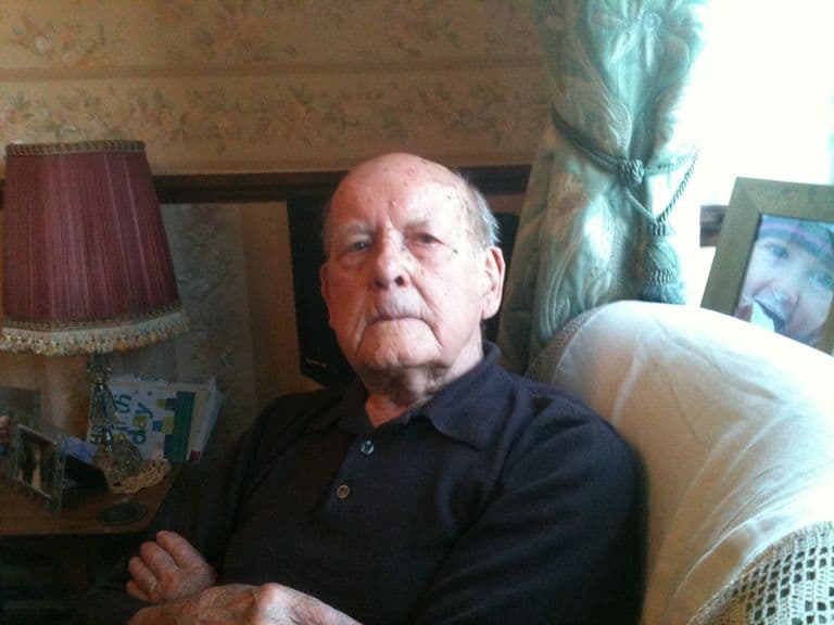
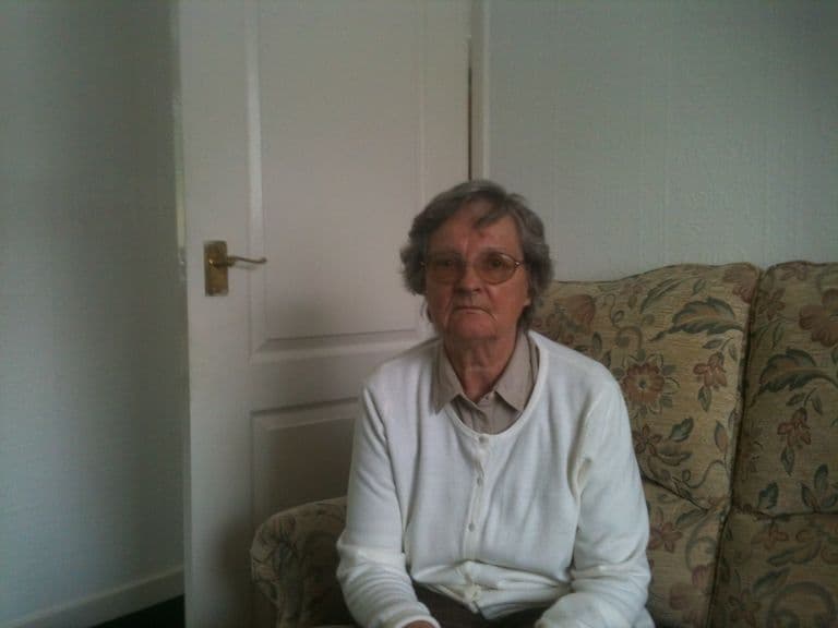
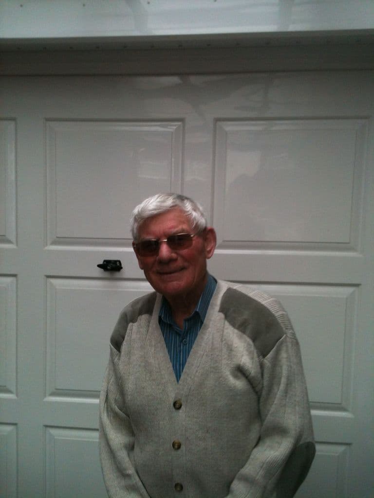
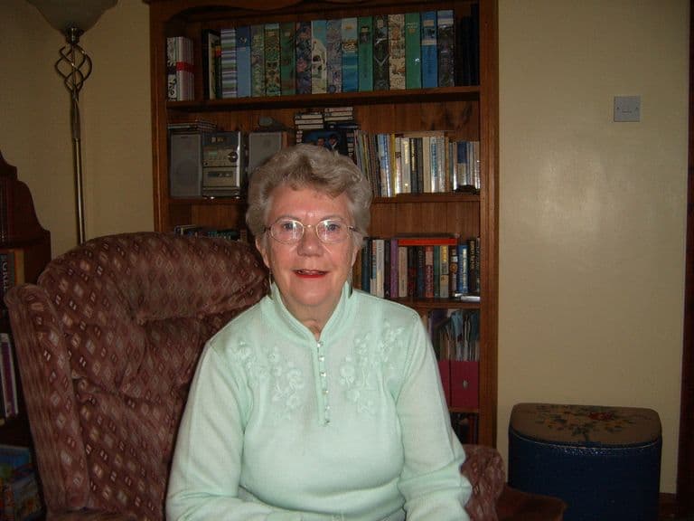
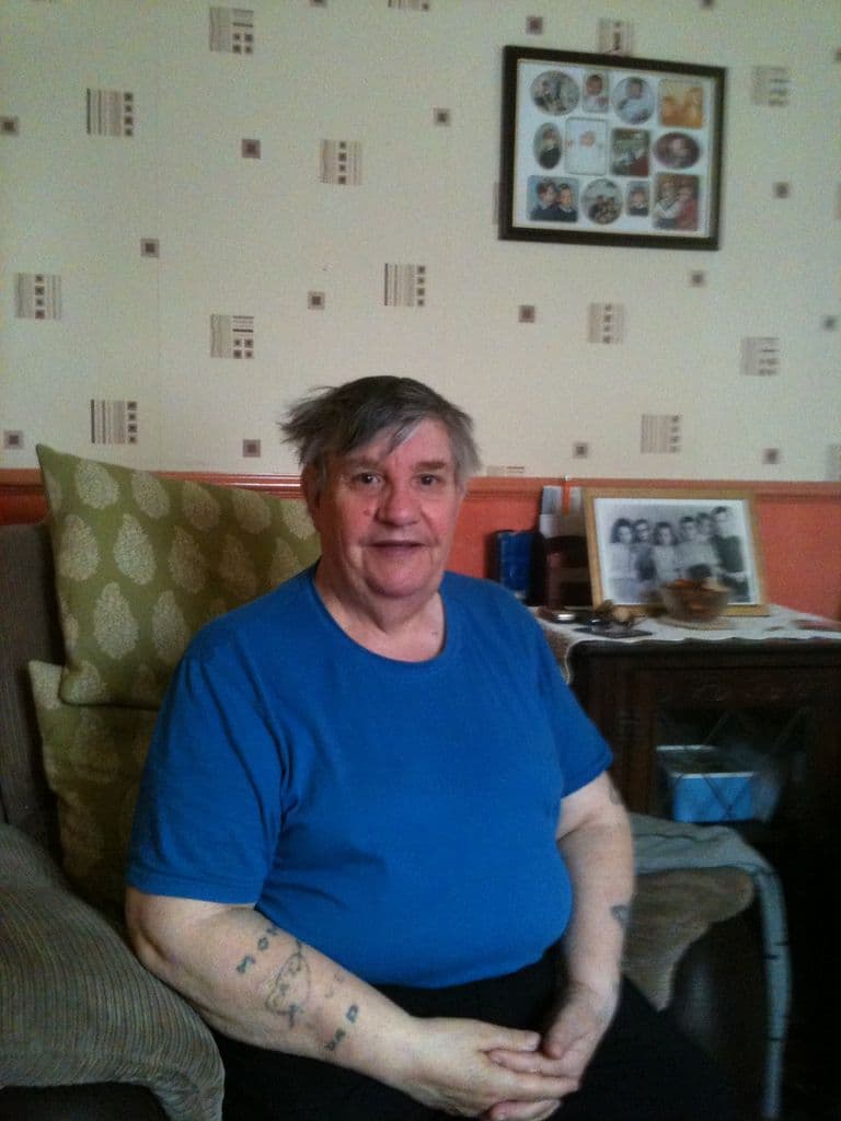
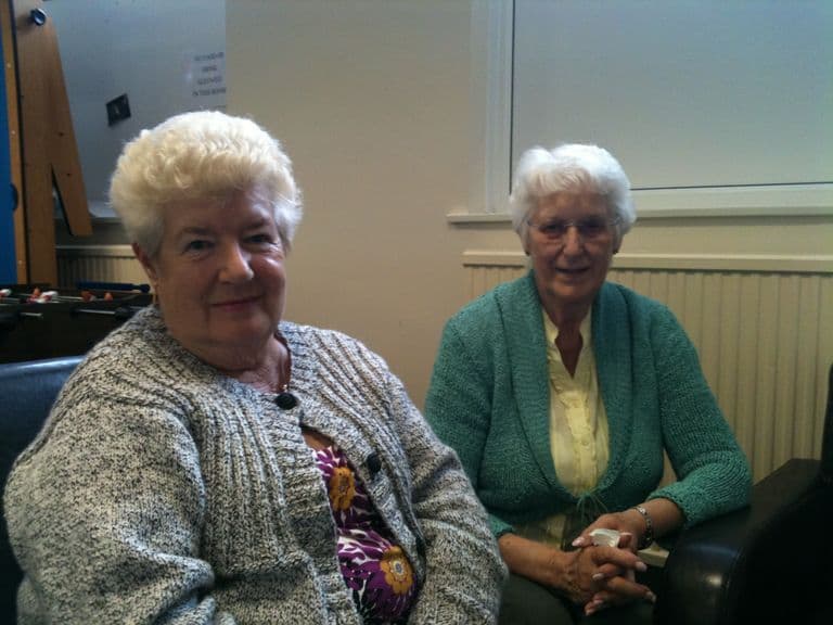
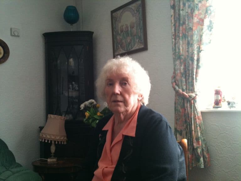
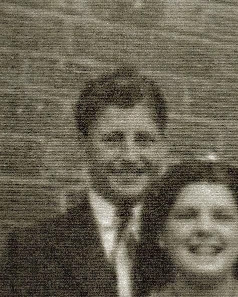
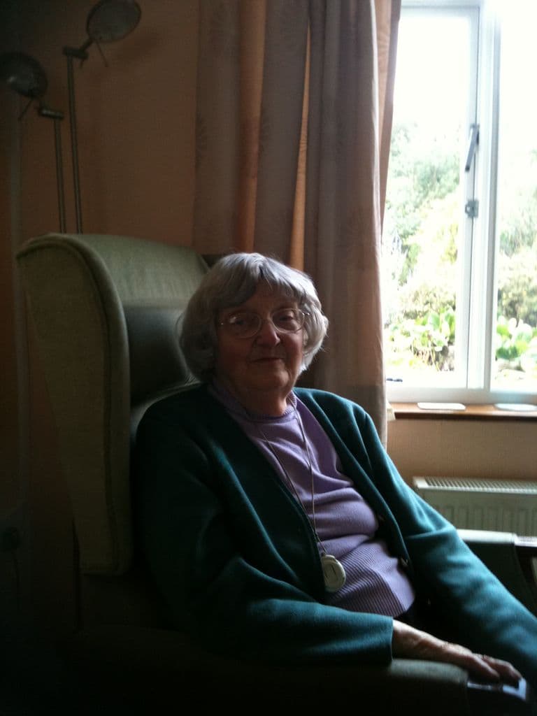
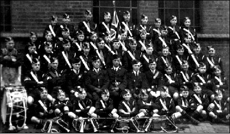
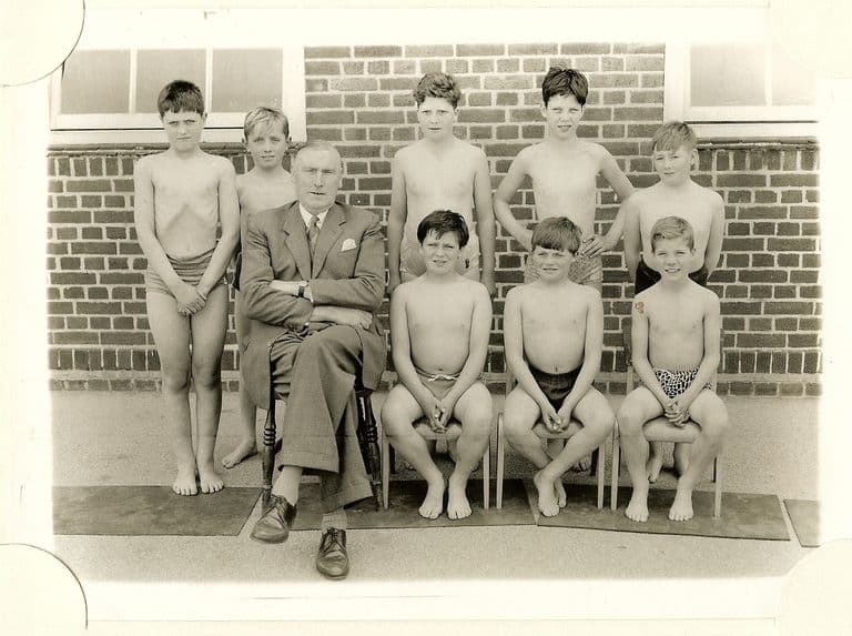
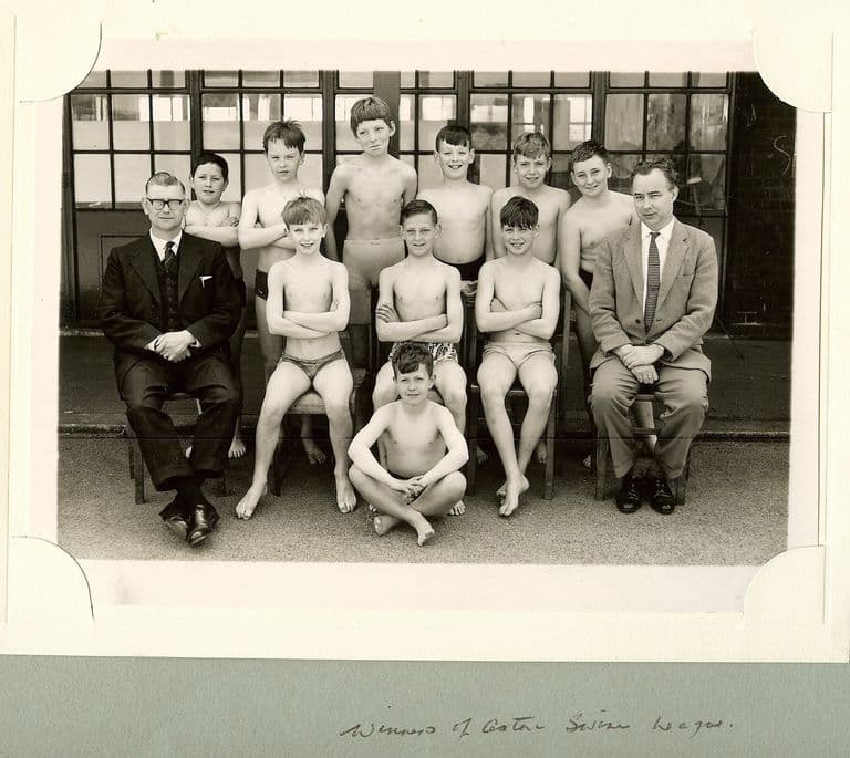
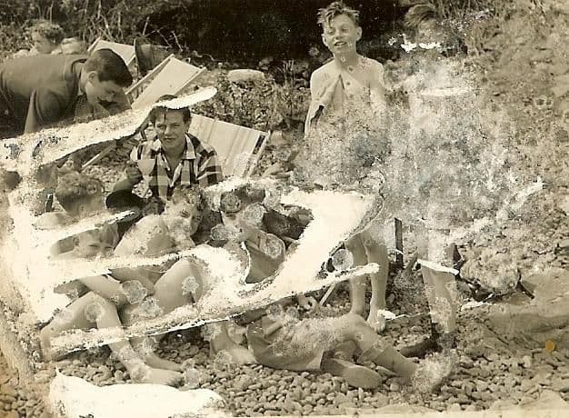
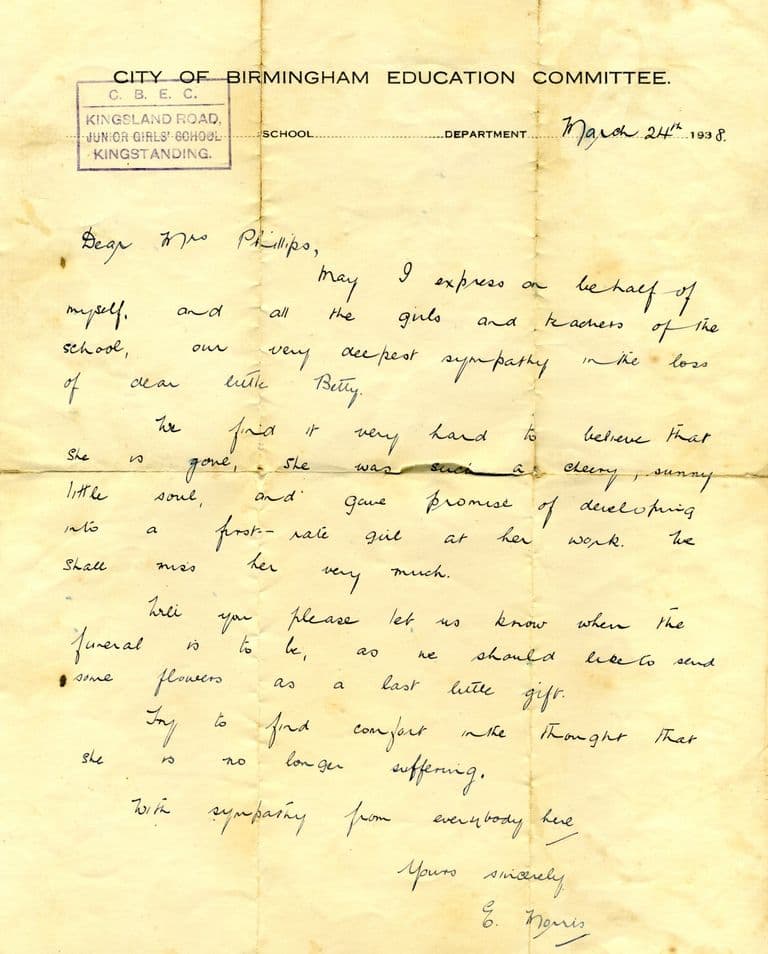
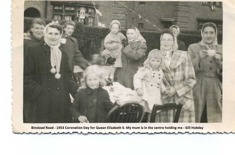
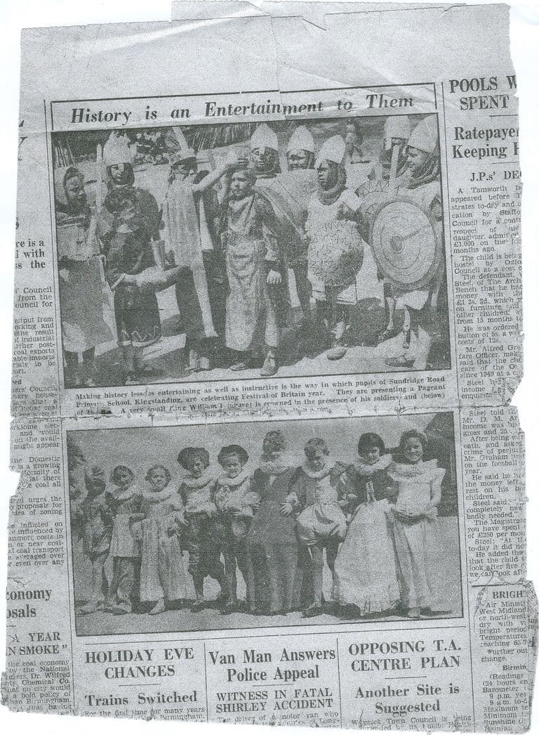
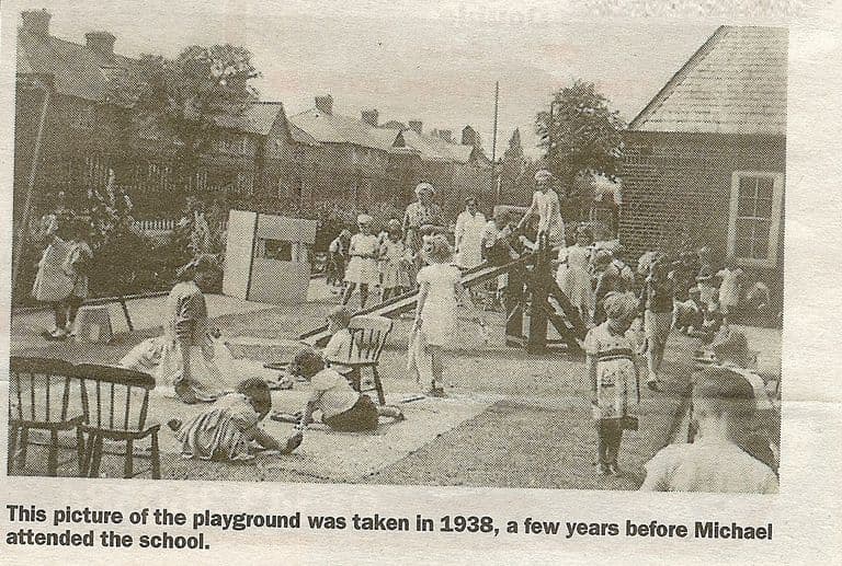
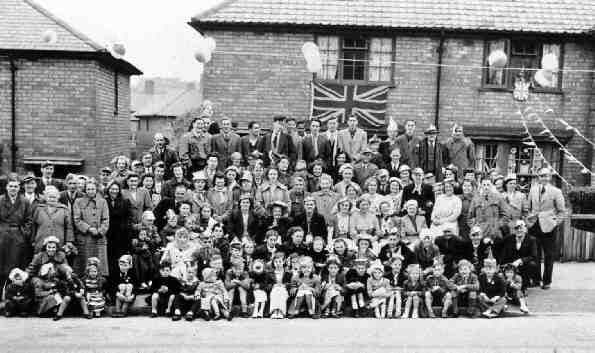
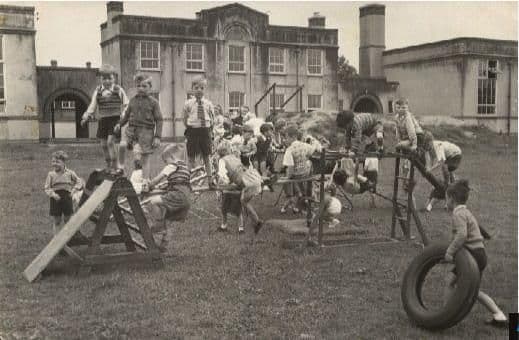
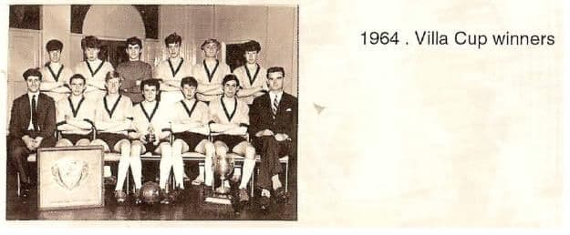
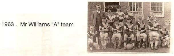
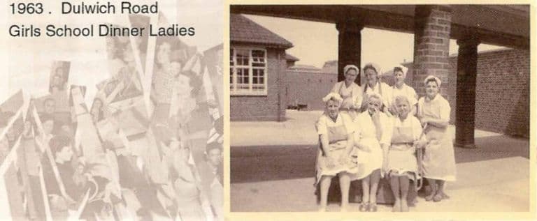
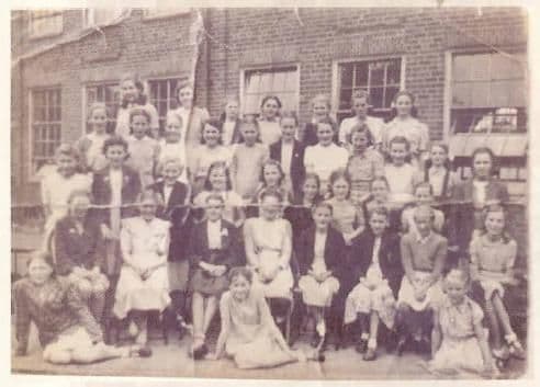
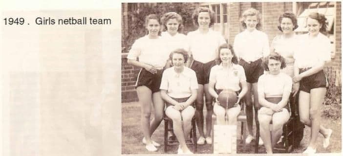
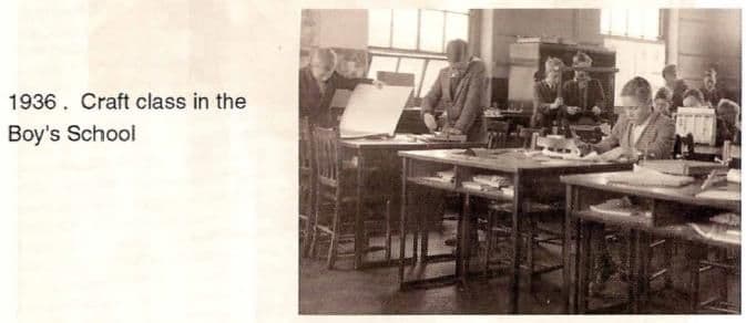
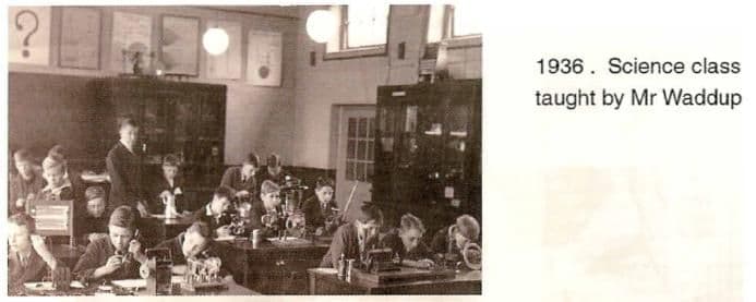
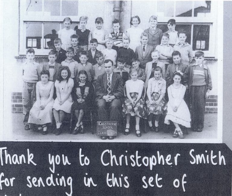
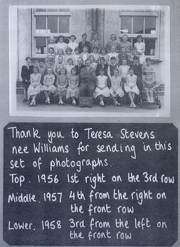
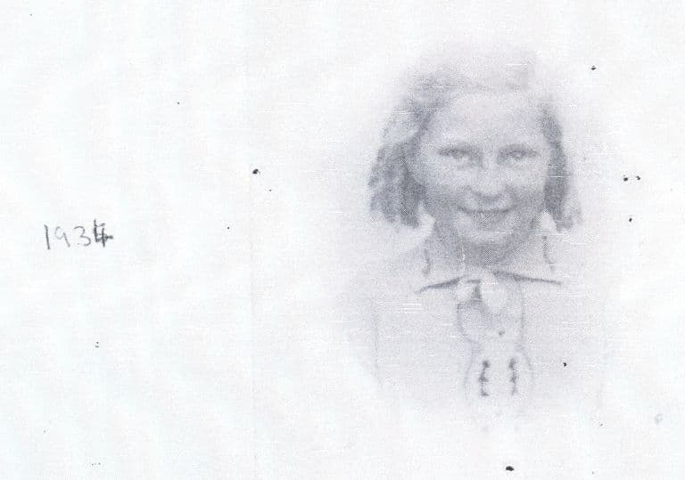
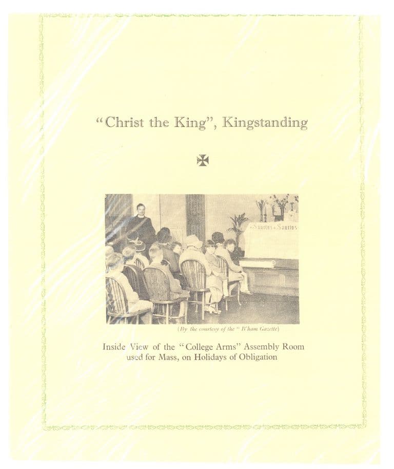
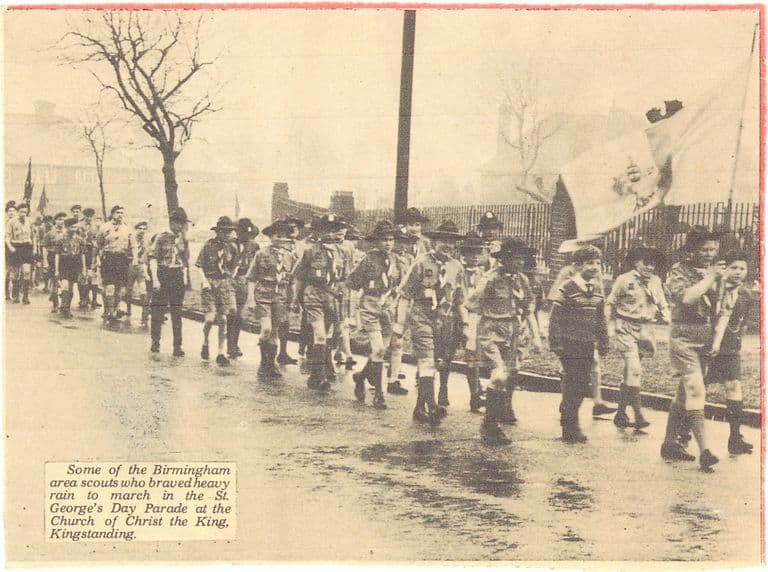
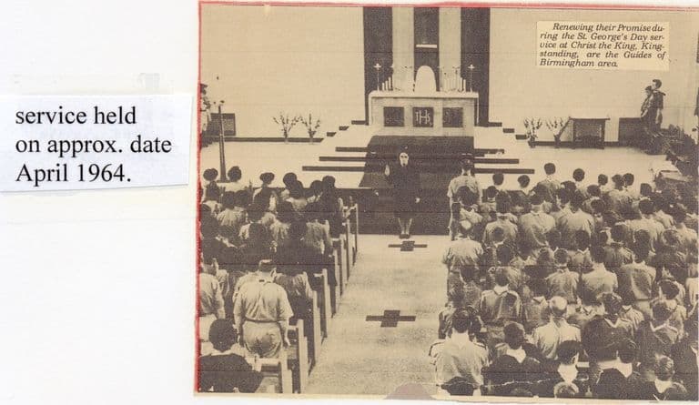
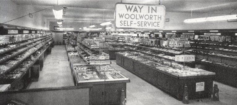
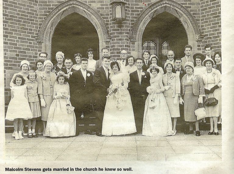
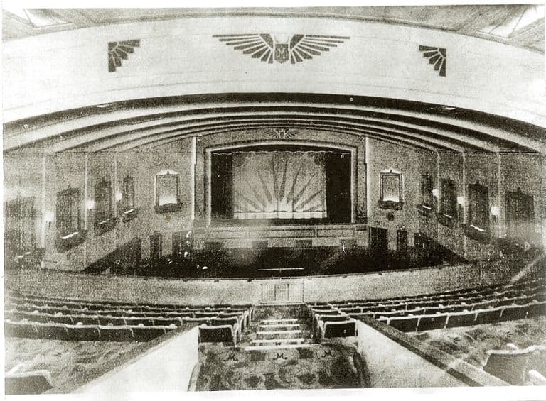
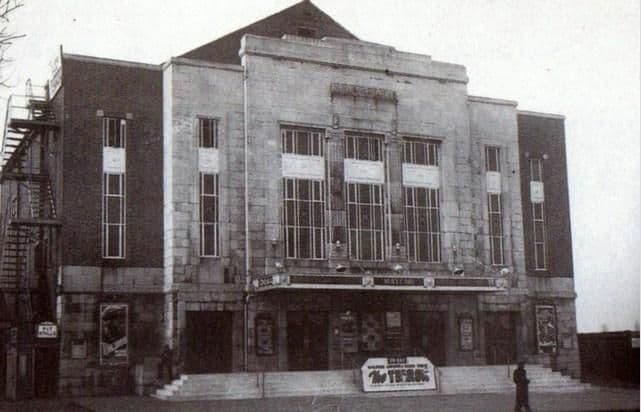
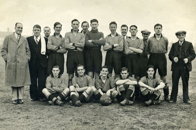
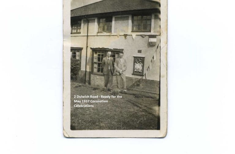
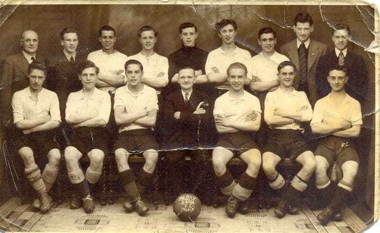
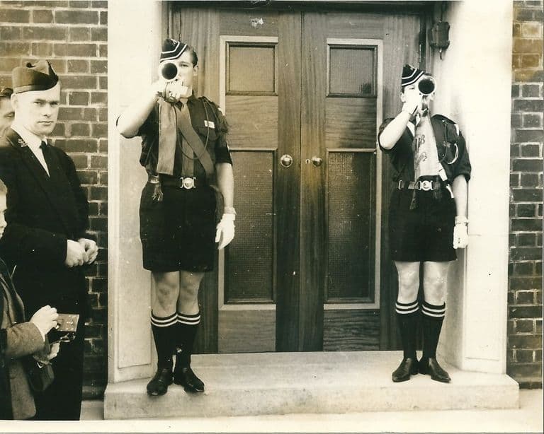
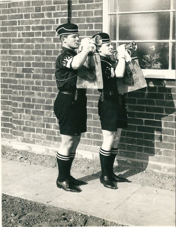
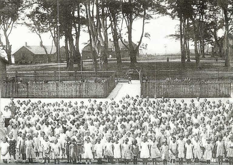
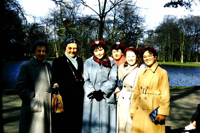
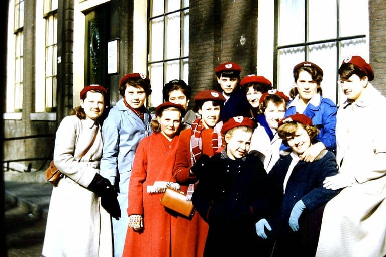
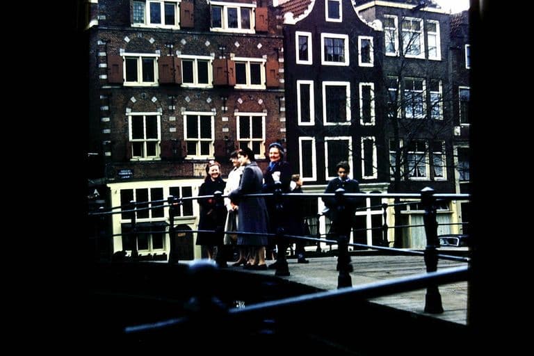
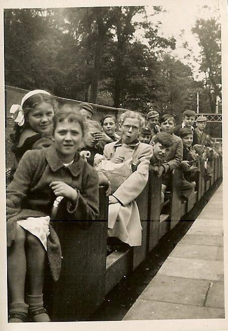
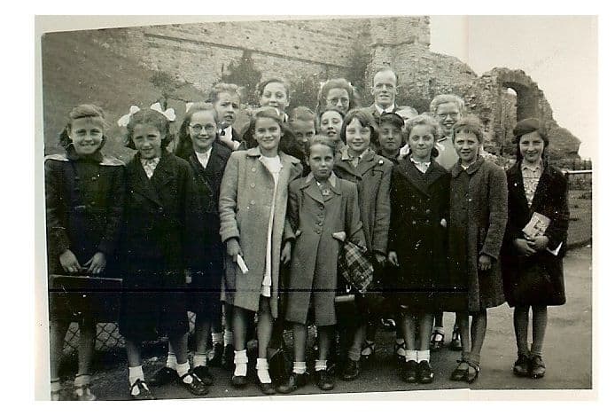
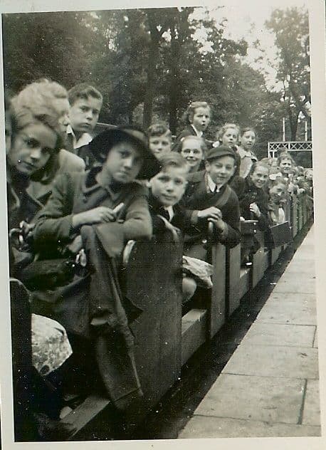
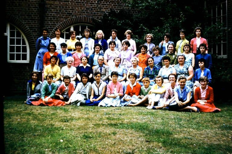
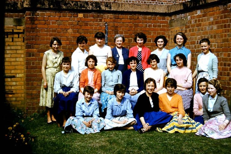
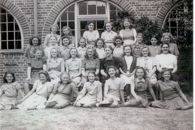
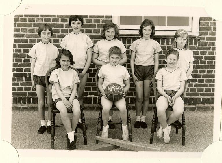
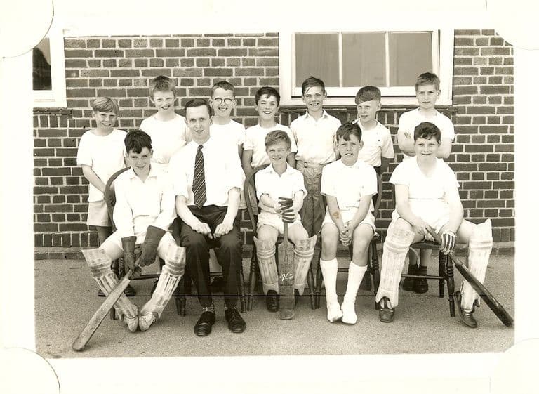
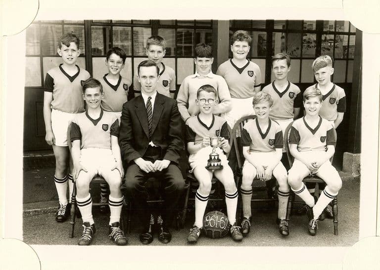
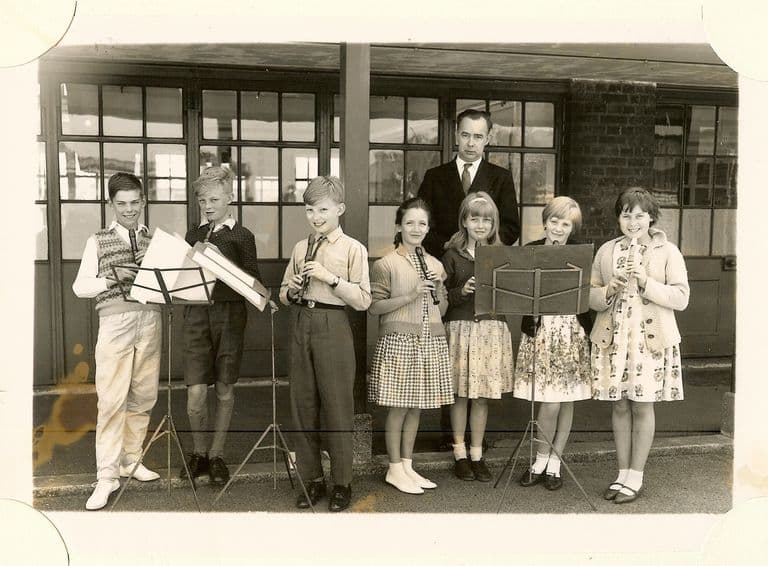
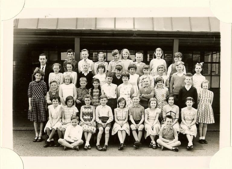
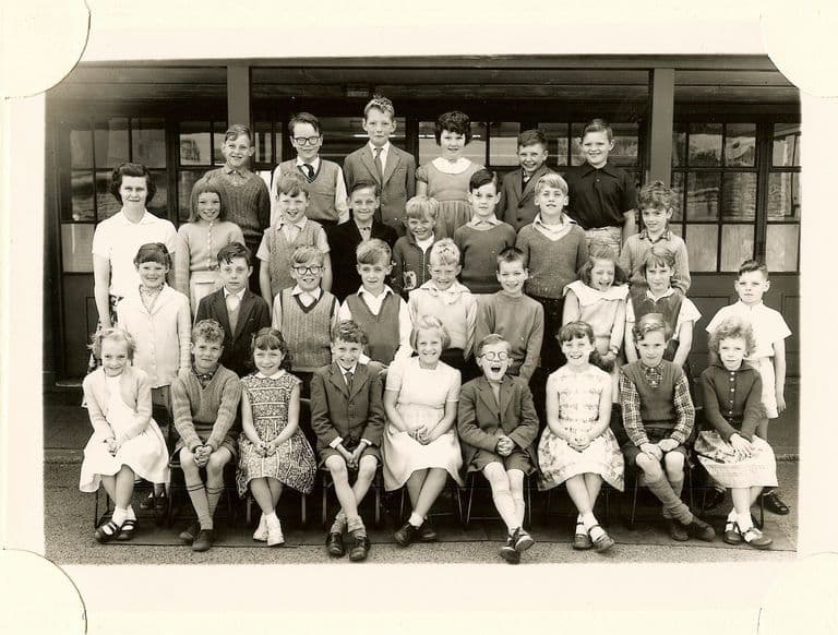
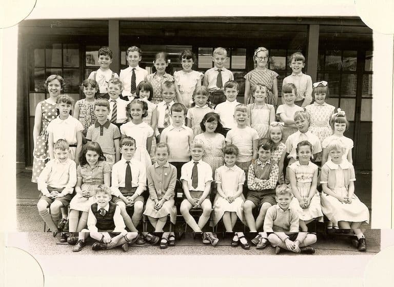
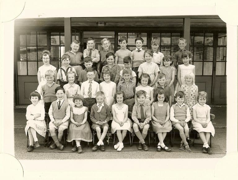
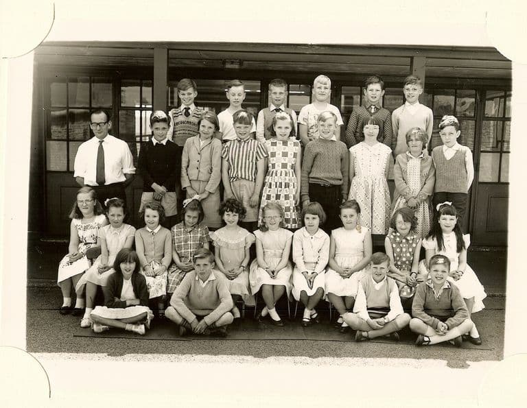
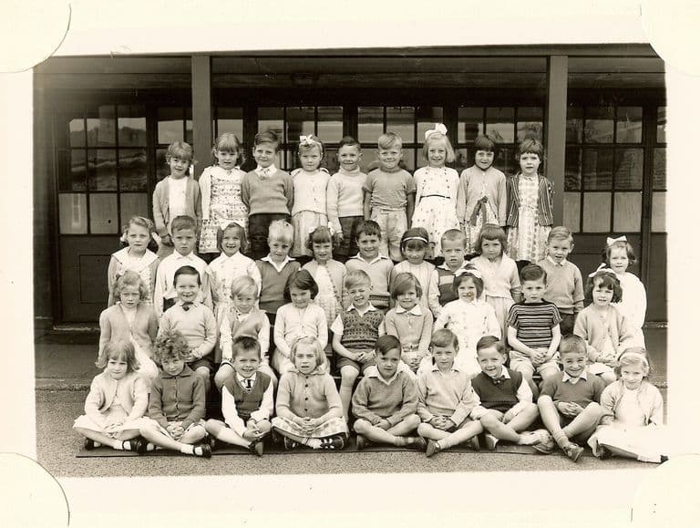
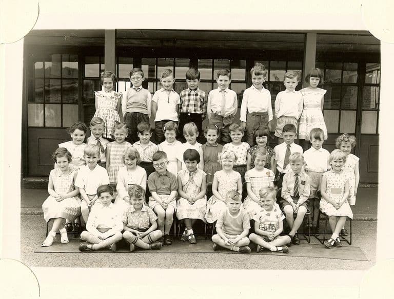
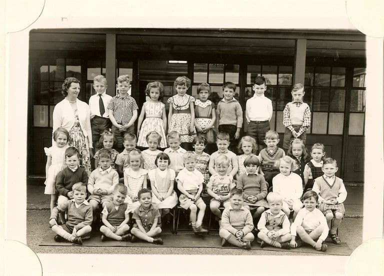
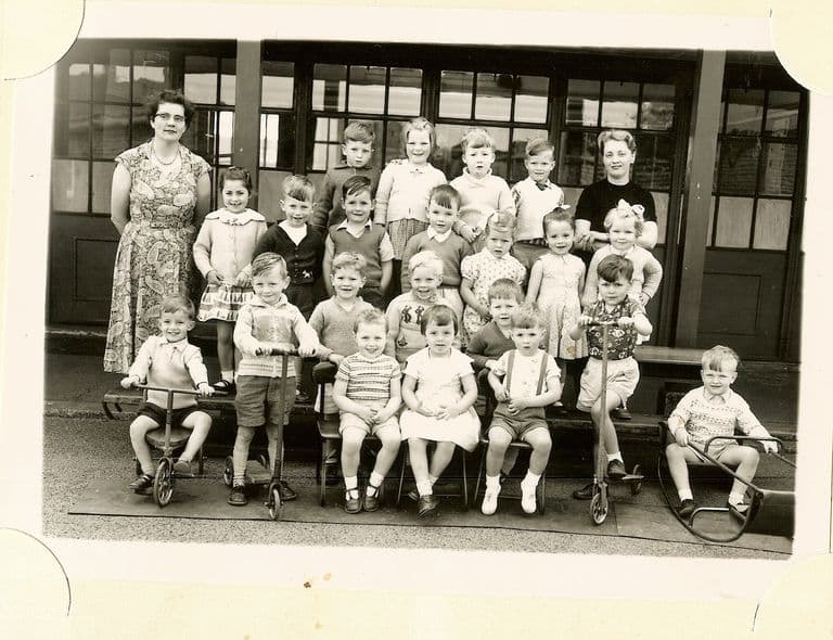
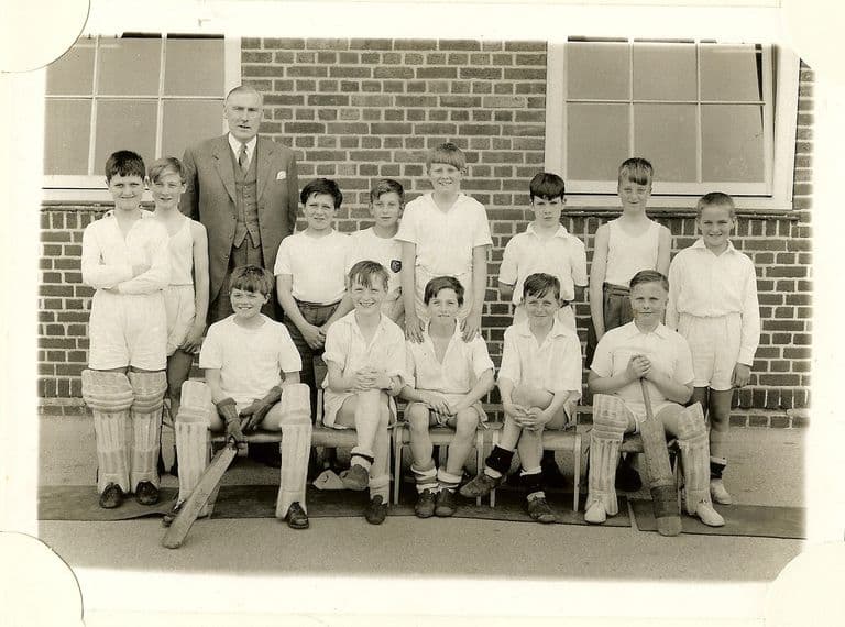
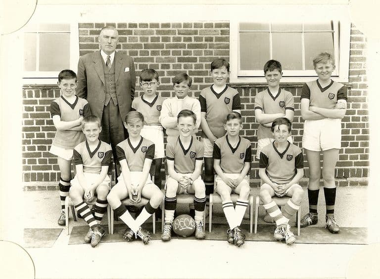
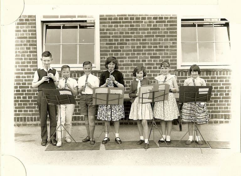
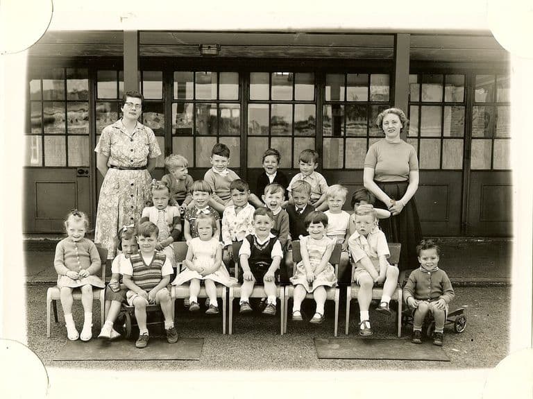
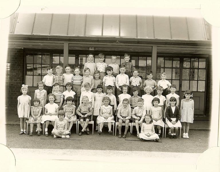
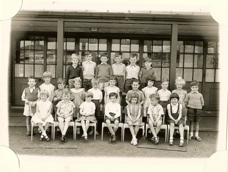
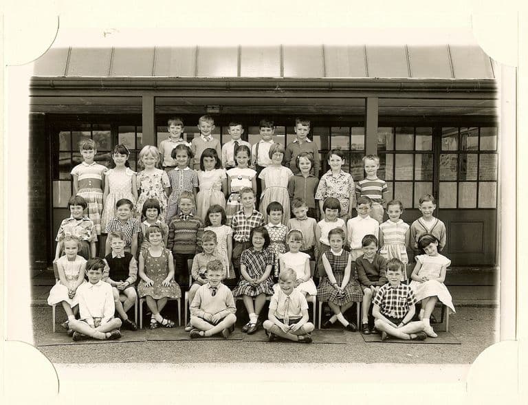
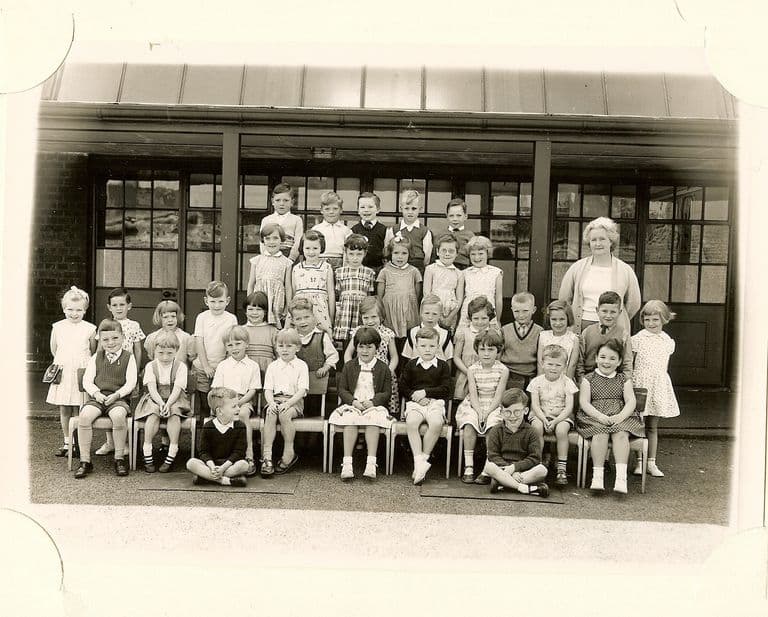
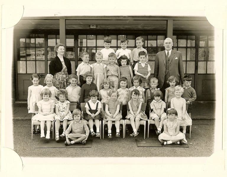
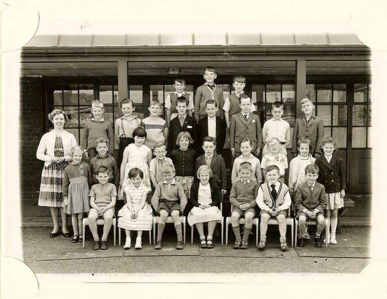
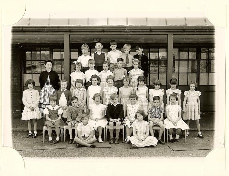
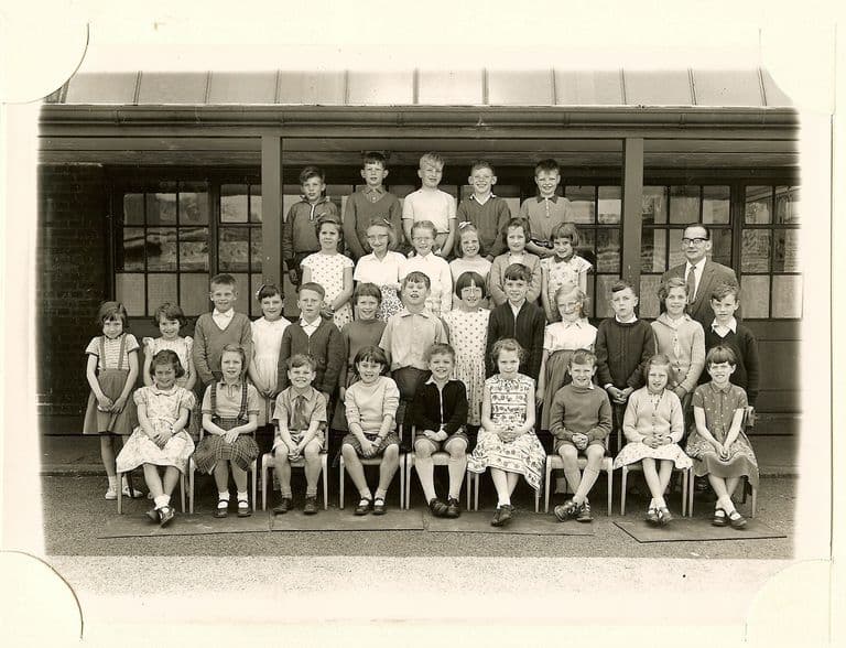
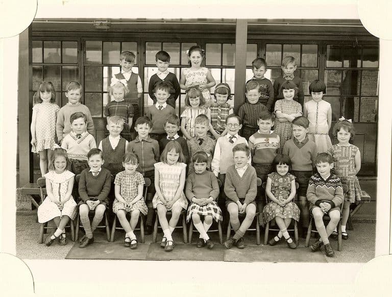
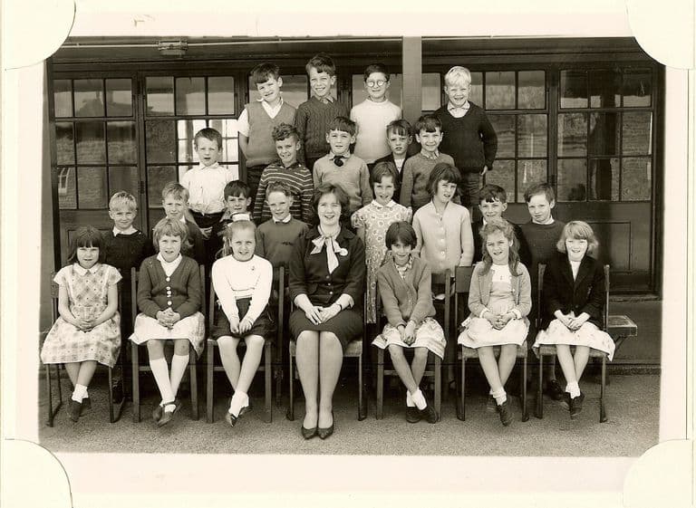
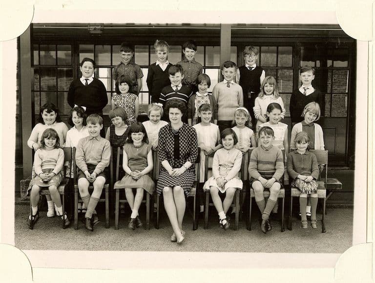
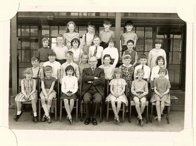
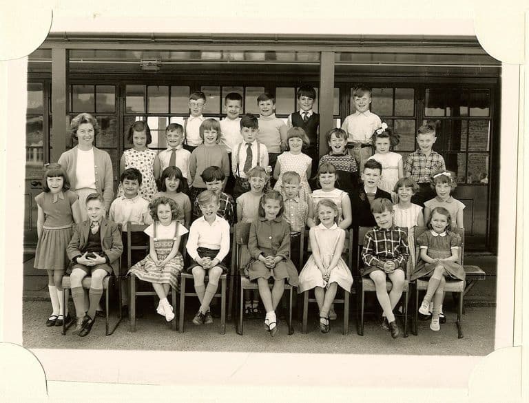
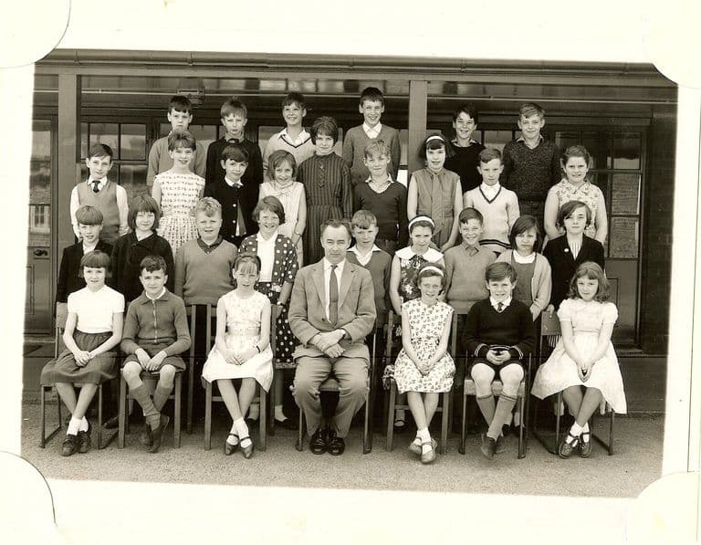
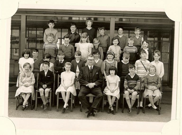
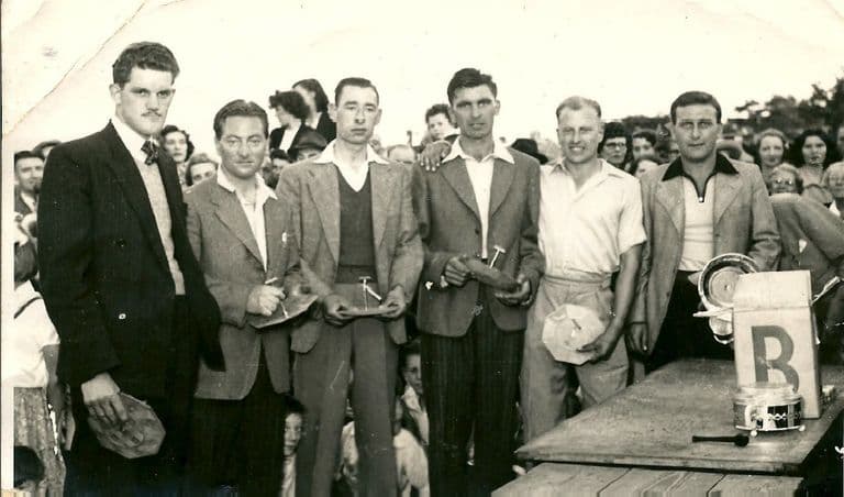
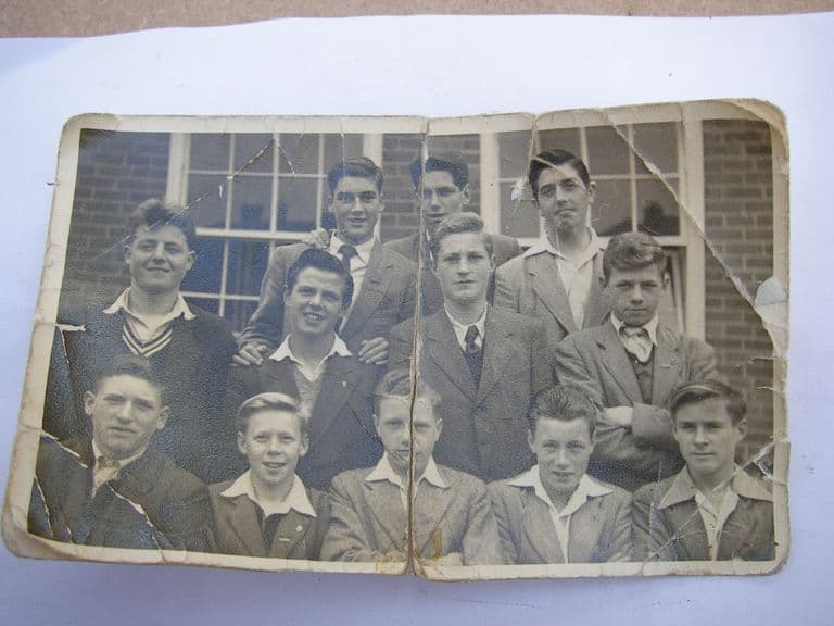
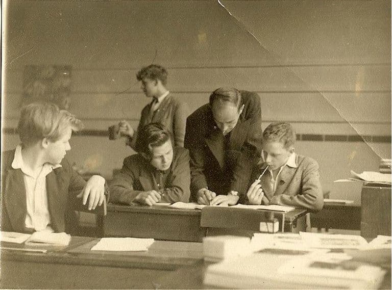
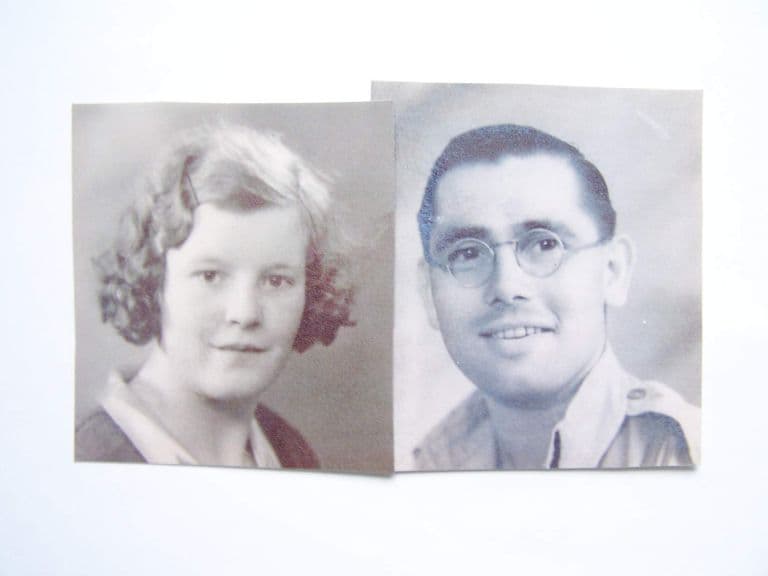
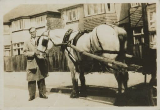
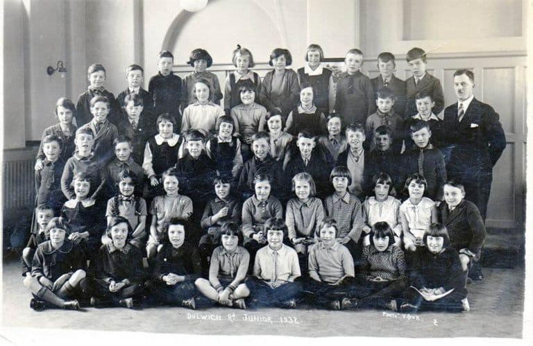
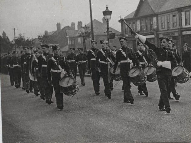
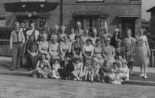
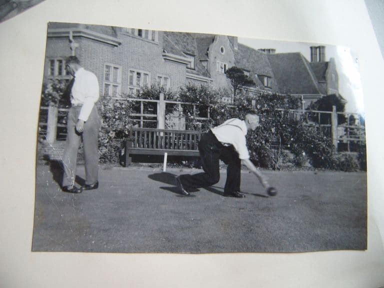
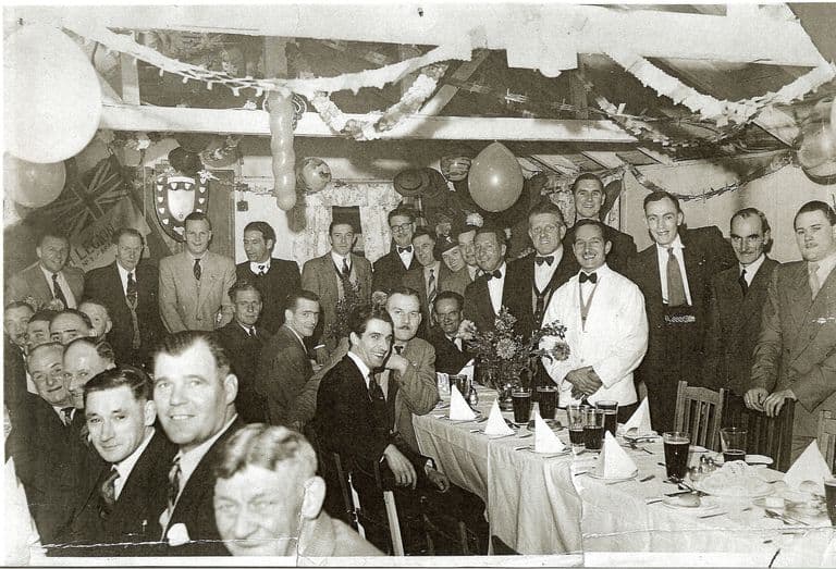
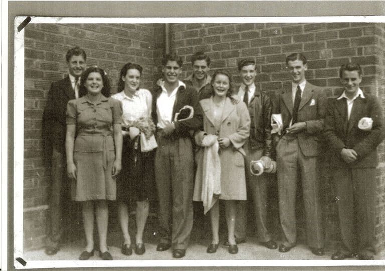
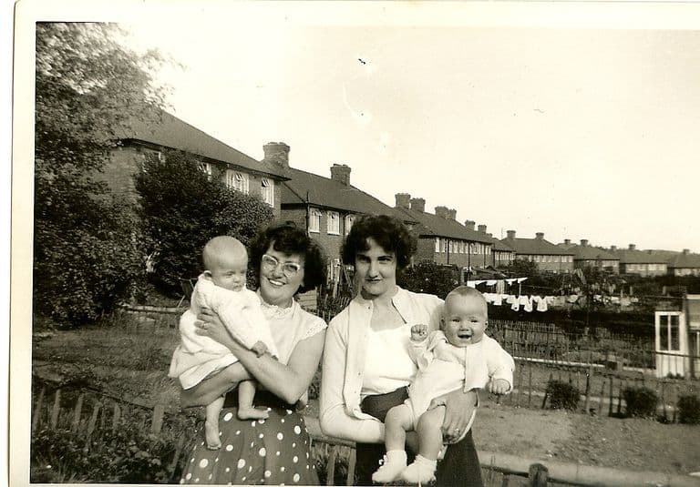
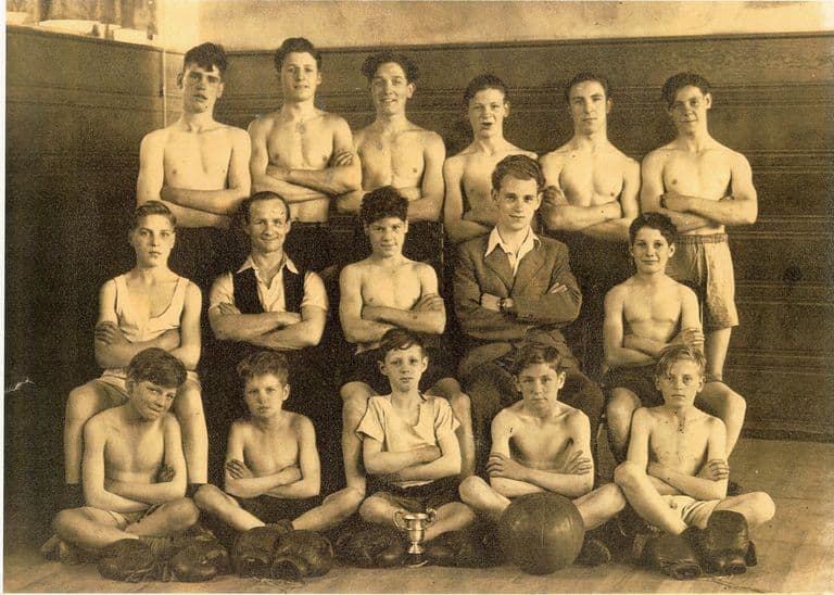
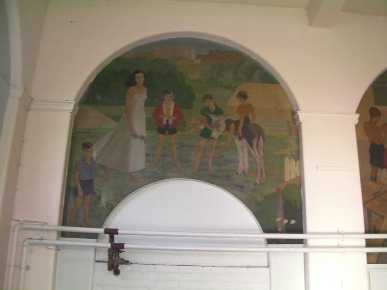
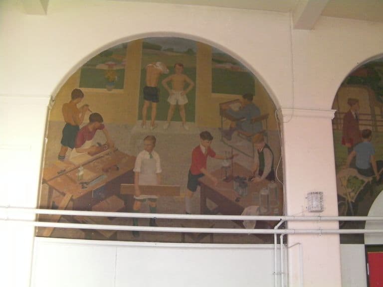
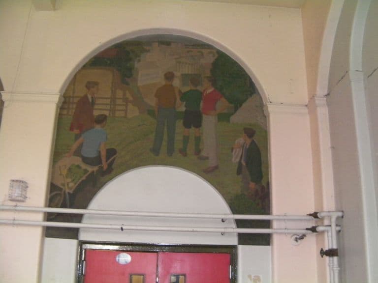
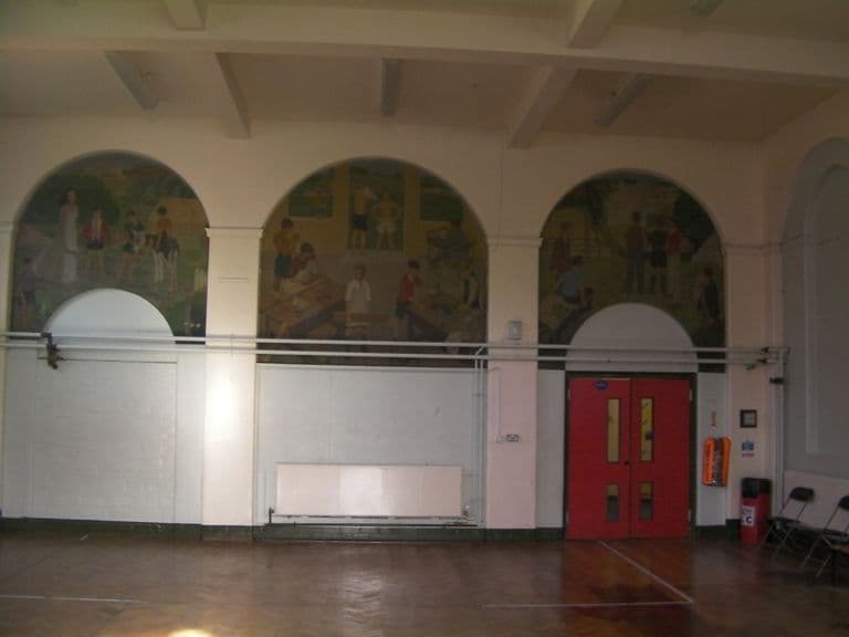
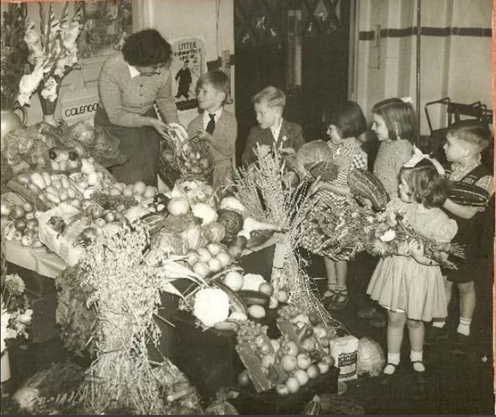
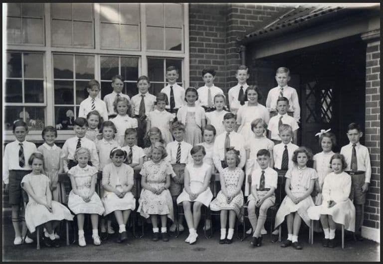
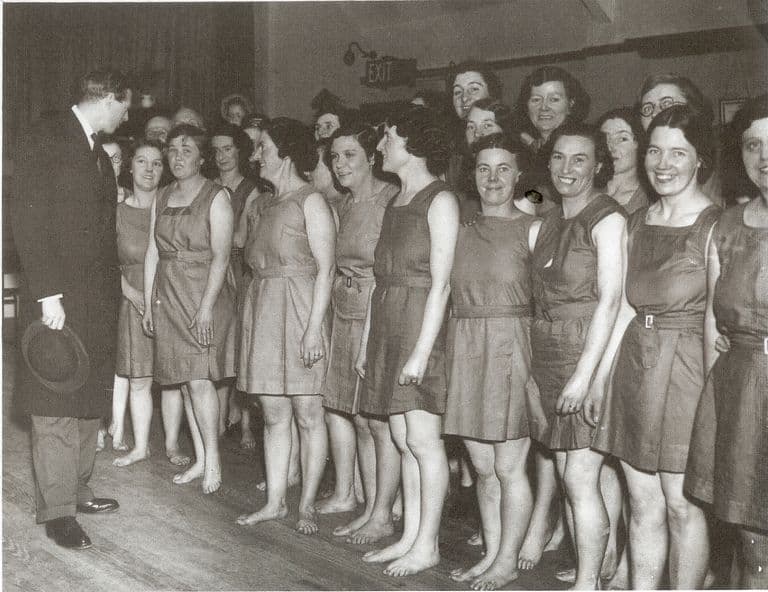
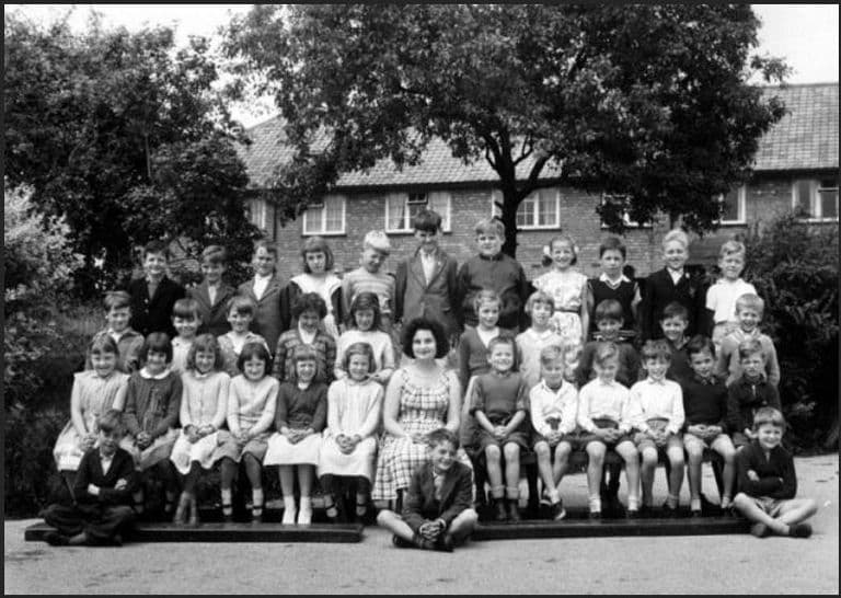
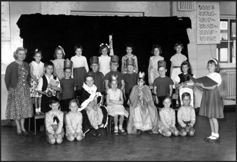
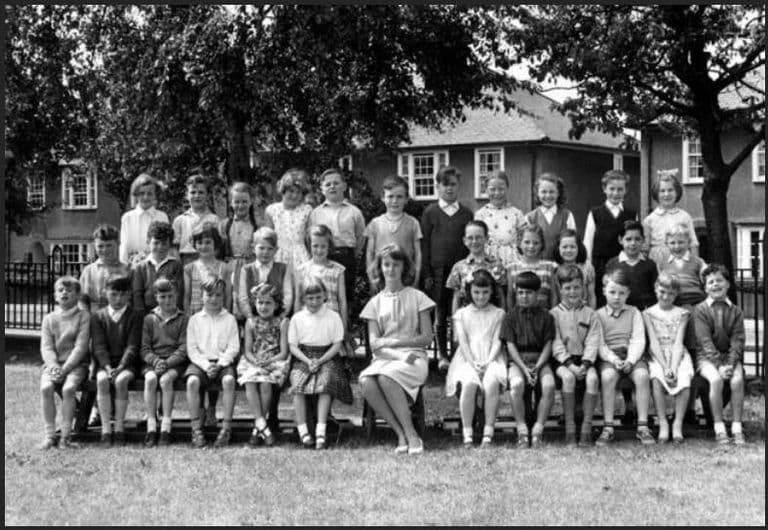
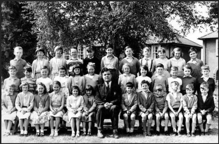
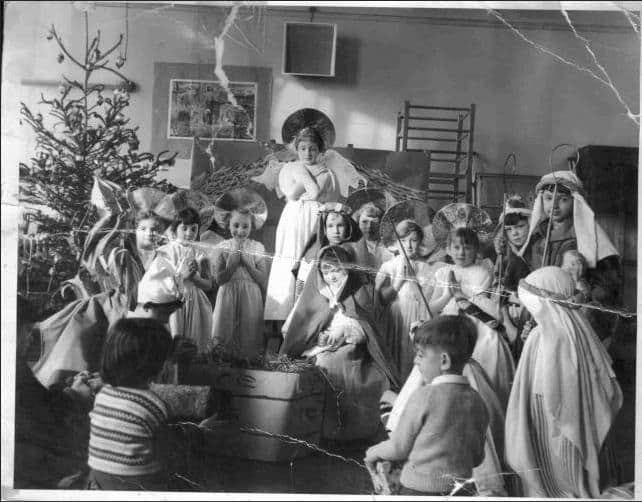
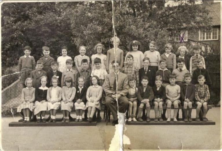
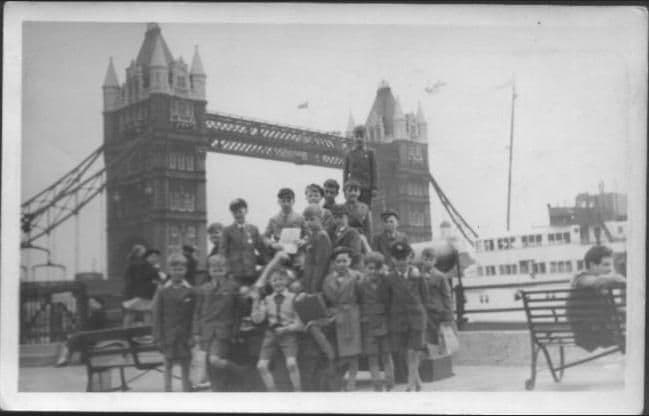
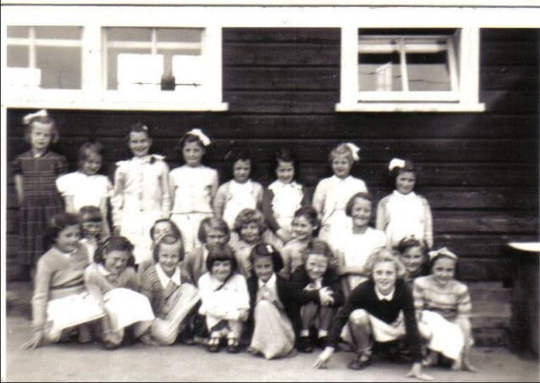
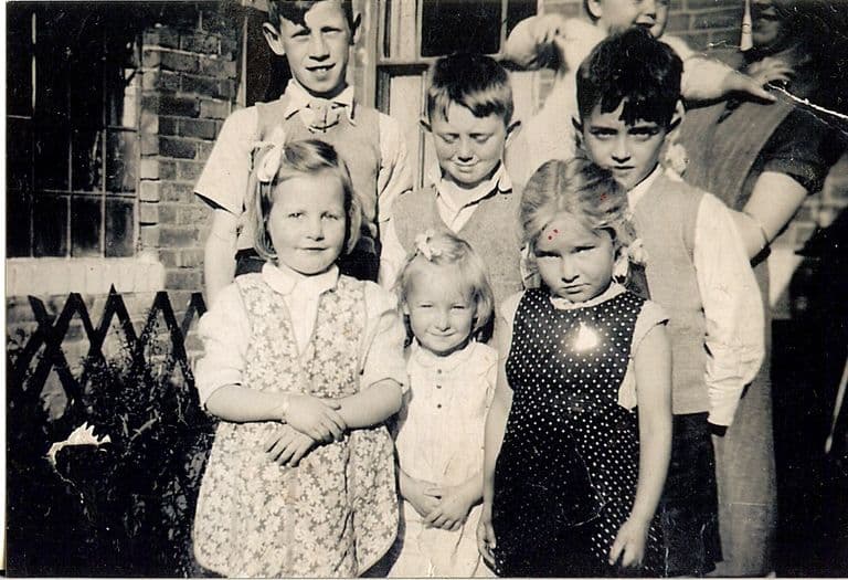
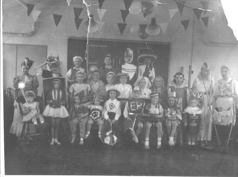
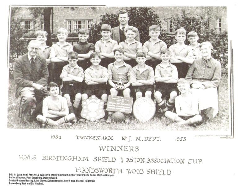
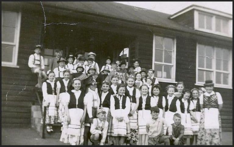
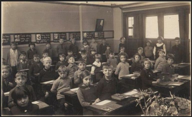
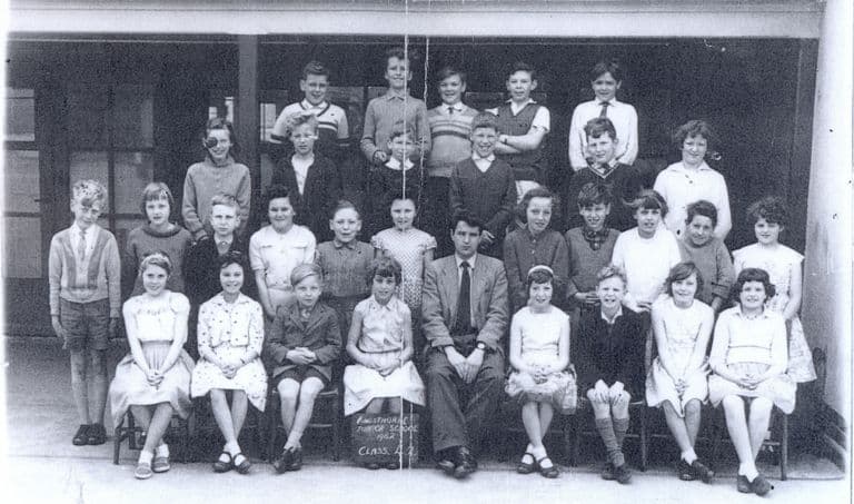
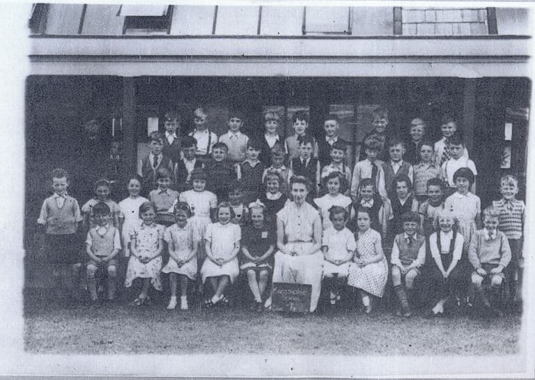
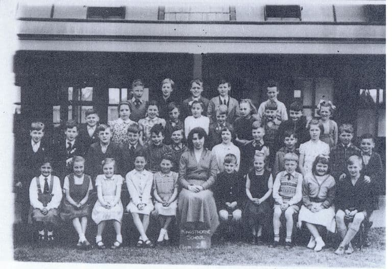
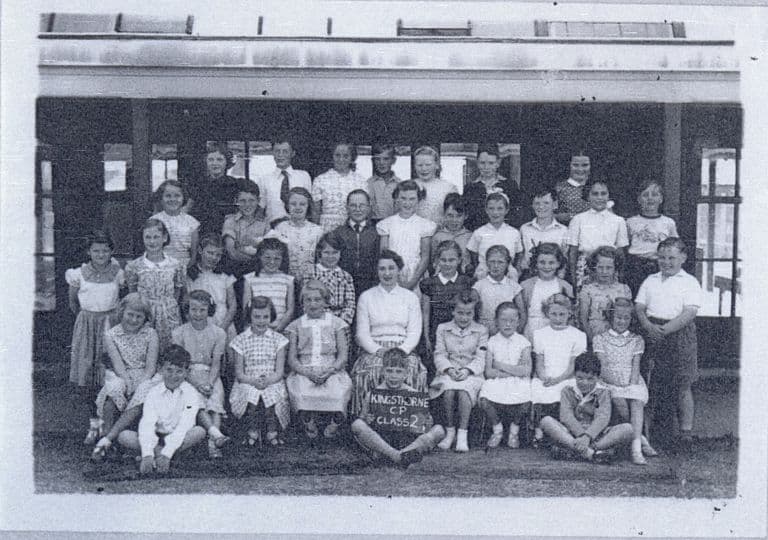
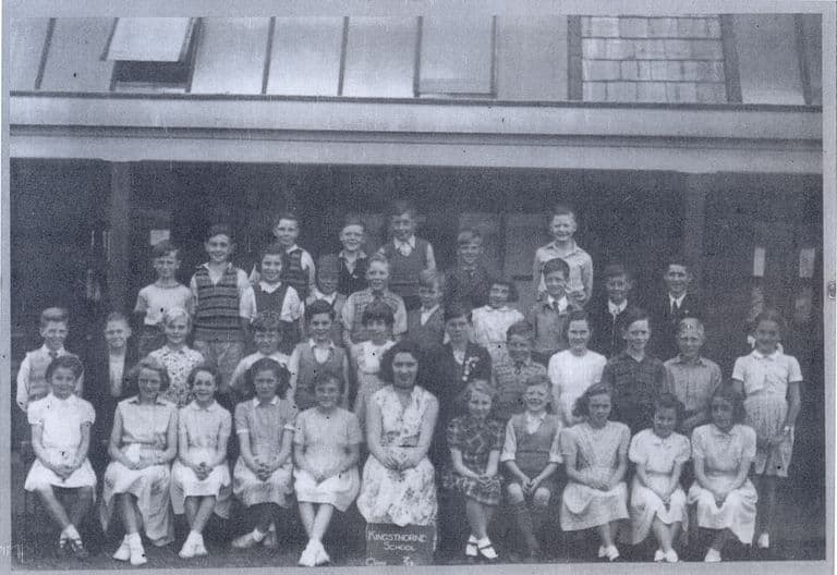
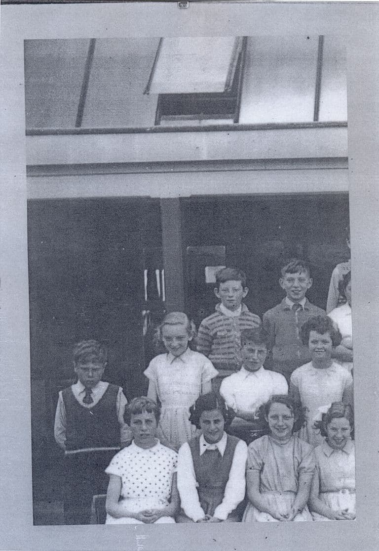
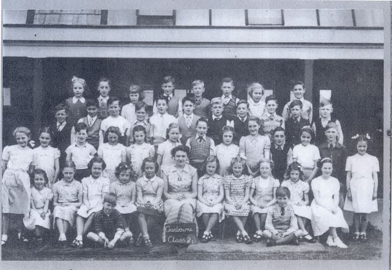
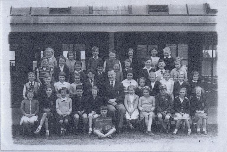
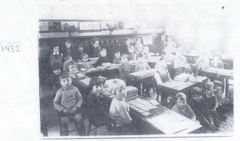
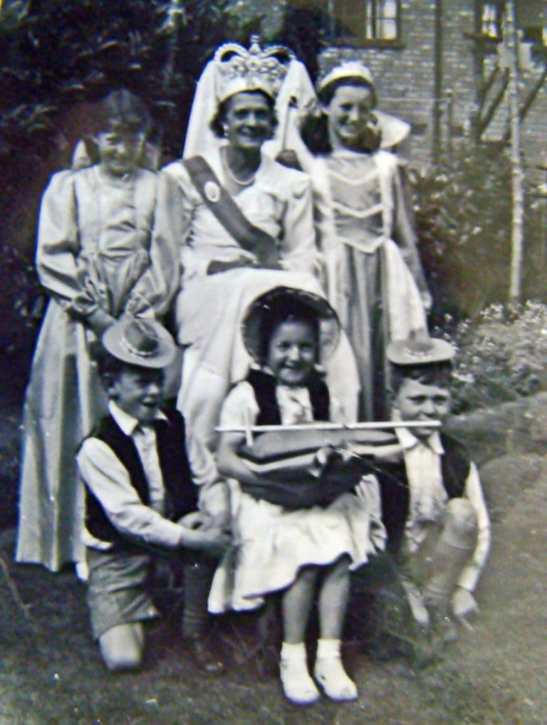
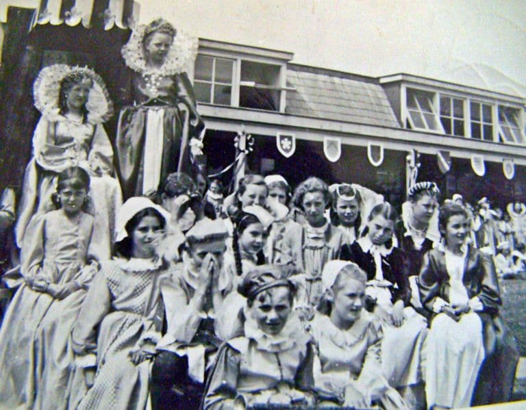
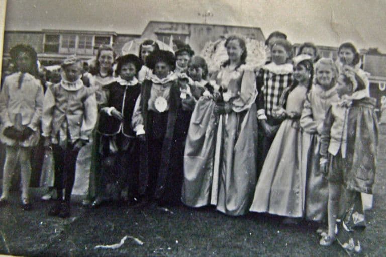
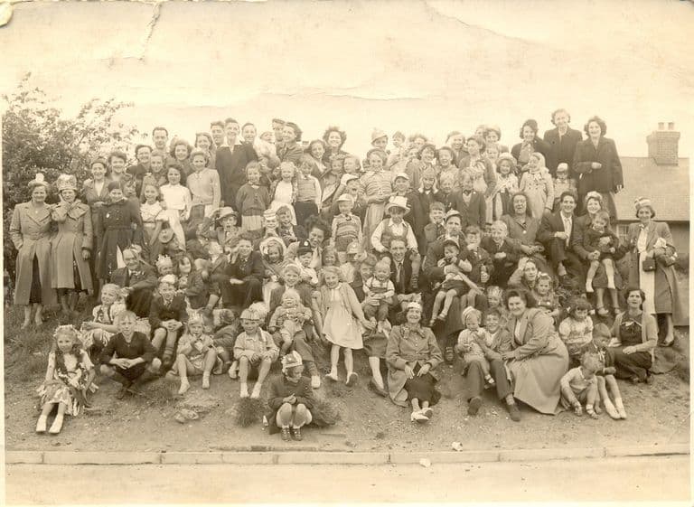
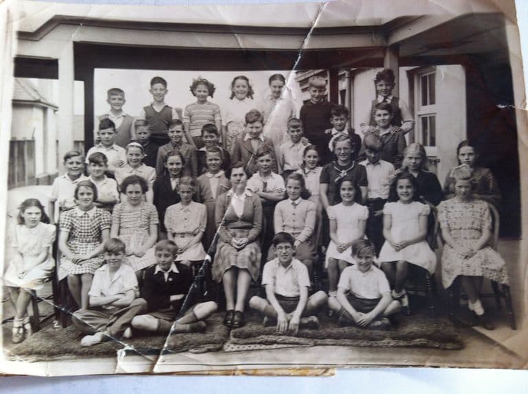
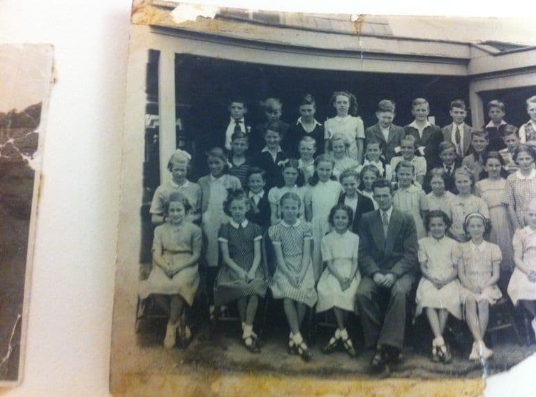
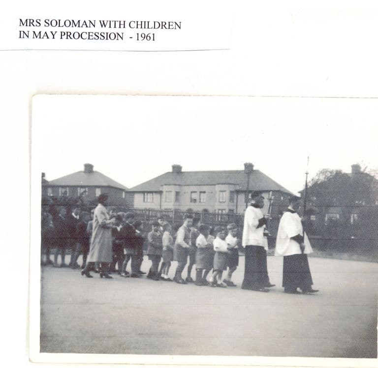
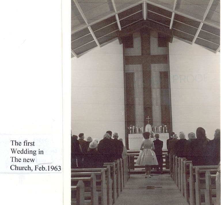
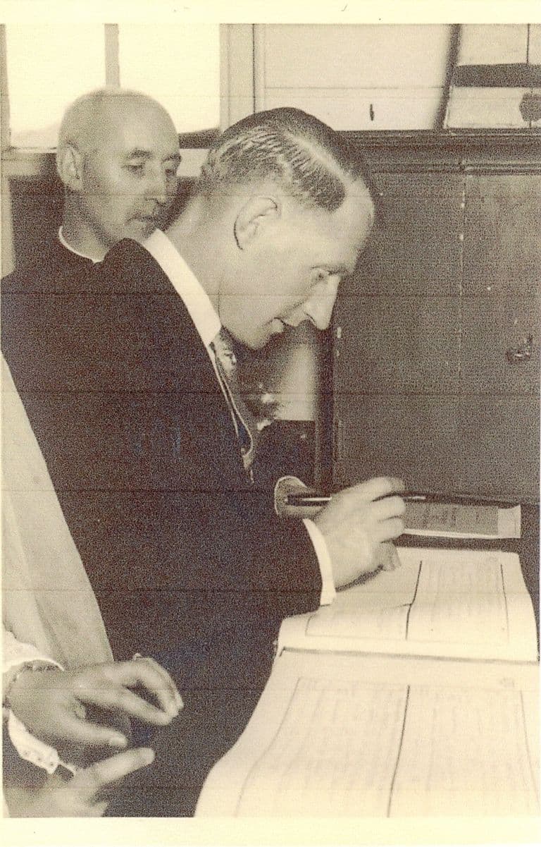
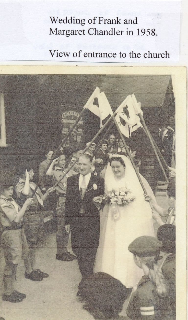
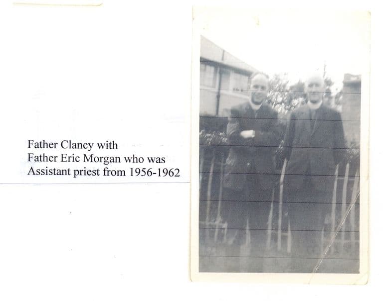
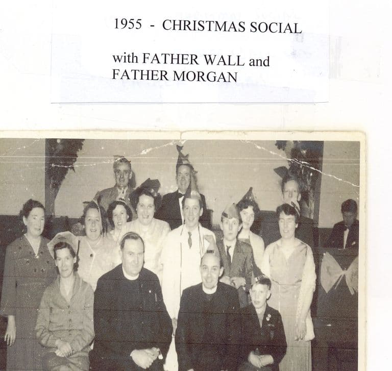
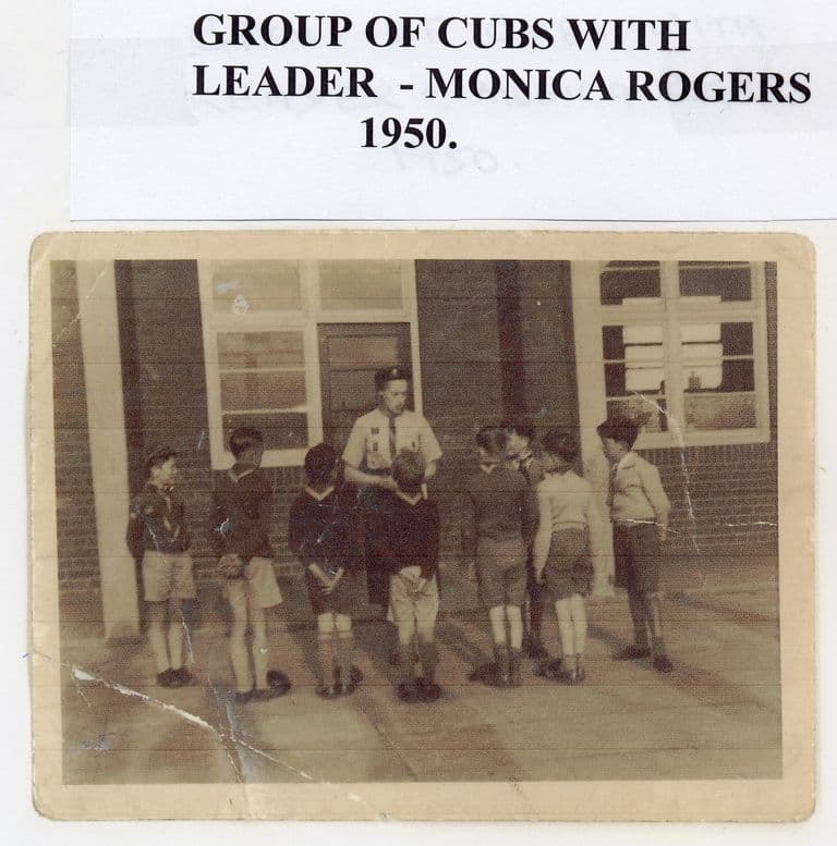
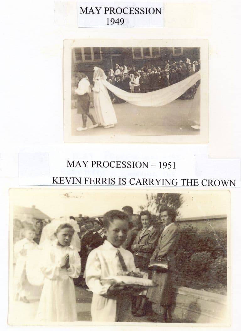
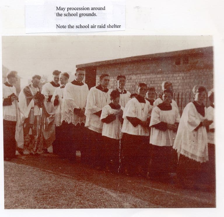
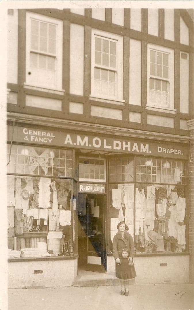
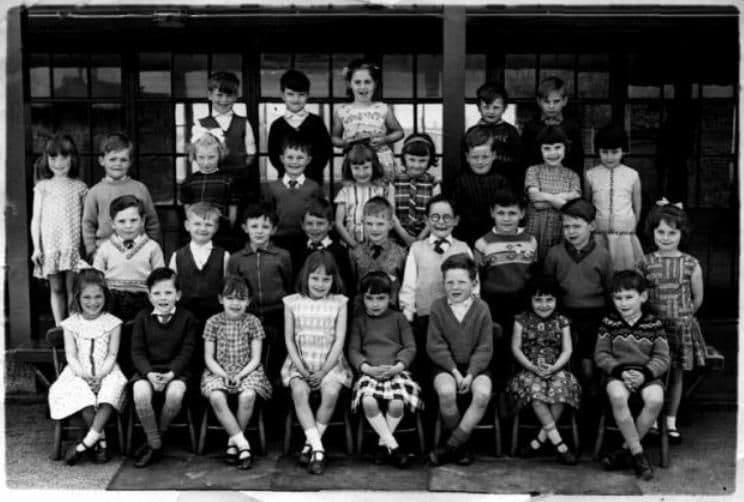
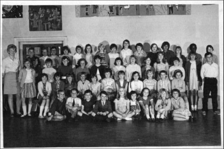
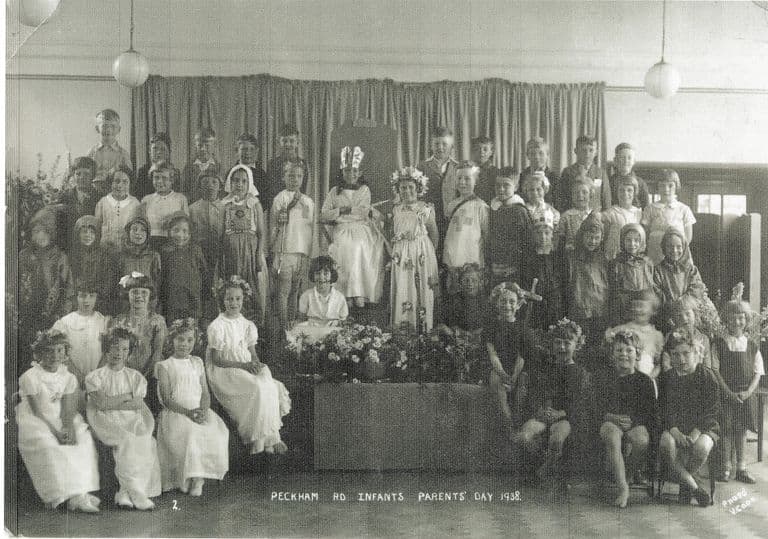
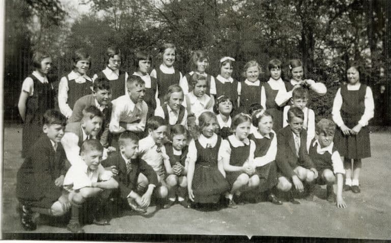
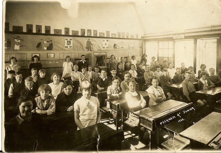
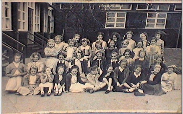
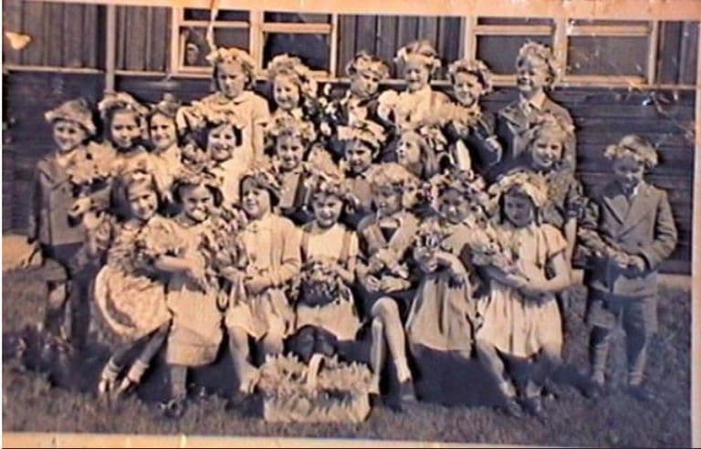
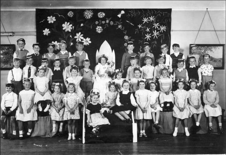
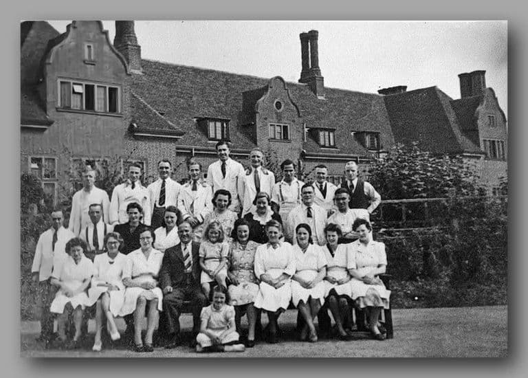
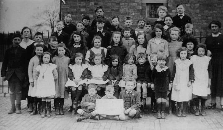
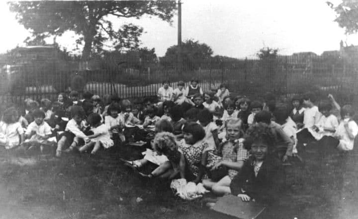
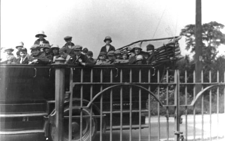
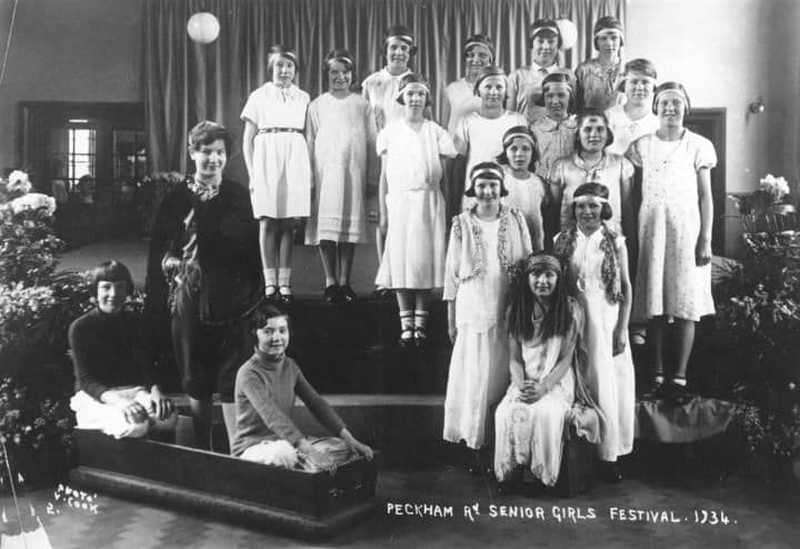
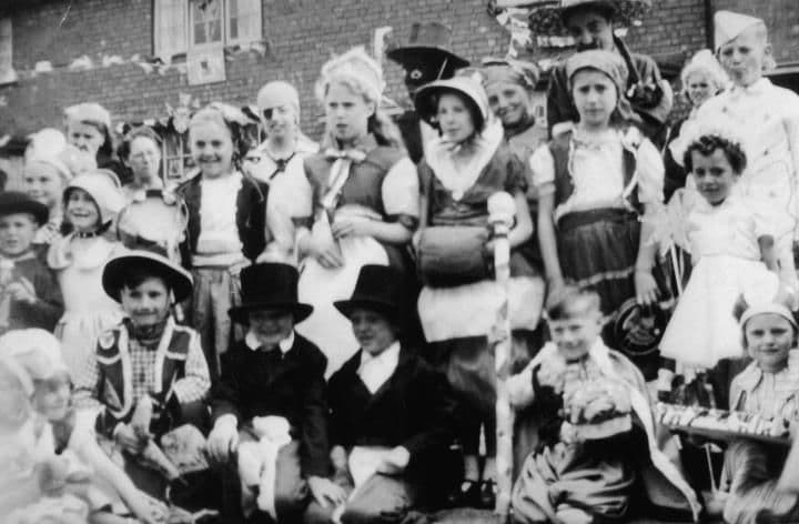
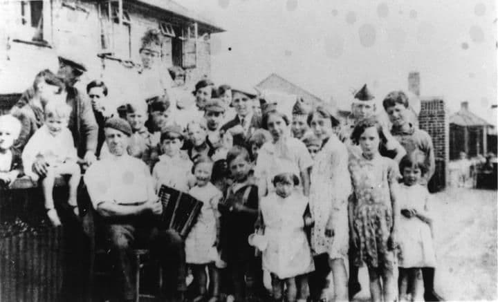
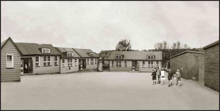
Sheila Birch2011–12 · KingstandingImage reproduced with permission of Chris Hillcox, Voices of Kingstanding. Bernie Ryman2011–12 · KingstandingImage reproduced with permission of Chris Hillcox, Voices of Kingstanding. John Payne, 20122012 · KingstandingImage reproduced with permission of Chris Hillcox, Voices of Kingstanding. Shirley Hammond2011–12 · KingstandingImage reproduced with permission of Chris Hillcox, Voices of Kingstanding. Ken Shelley, 20122012 · KingstandingImage reproduced with permission of Chris Hillcox, Voices of Kingstanding. David Mitchell, 20122012 · KingstandingImage reproduced with permission of Chris Hillcox, Voices of Kingstanding. Veronica Marshall, 20122012 · KingstandingImage reproduced with permission of Chris Hillcox, Voices of Kingstanding. John Rowley, 20122012 · KingstandingImage reproduced with permission of Chris Hillcox, Voices of Kingstanding. Charles Southam, 20122012 · KingstandingImage reproduced with permission of Chris Hillcox, Voices of Kingstanding. Clement Watts, 20122012 · KingstandingImage reproduced with permission of Chris Hillcox, Voices of Kingstanding. Mrs Wright and Beryl, 20112011 · KingstandingImage reproduced with permission of Chris Hillcox, Voices of Kingstanding. Mrs Lutwich, 20112011 · KingstandingImage reproduced with permission of Chris Hillcox, Voices of Kingstanding. Brian Scott1930s · KingstandingImage reproduced with permission of Chris Hillcox, Voices of Kingstanding. Dennis ElwellDate unknown · KingstandingImage reproduced with permission of Chris Hillcox, Voices of Kingstanding. Margaret Crompton, 20112011 · KingstandingImage reproduced with permission of Chris Hillcox, Voices of Kingstanding. Ron Jameson, 20112011 · KingstandingImage reproduced with permission of Chris Hillcox, Voices of Kingstanding. A 1st A Birmingham Boys’ Brigade company photographDate unknown · Place not confirmedImage reproduced with permission of Chris Hillcox, Voices of Kingstanding. King’s Rise swimming team with Mr Thompson, 1960–611960–61 · Peckham RoadImage reproduced with permission of Chris Hillcox, Voices of Kingstanding. King’s Rise swimming team, Aston Swim League winners, 1962–631962–63 · Peckham RoadImage reproduced with permission of Chris Hillcox, Voices of Kingstanding. A Boys’ Association trip out, 1950s1950s · Away from Kingstanding (beach not named)Image reproduced with permission of Chris Hillcox, Voices of Kingstanding. A letter from Kingsland Road Junior Girls’ School, 193824 March 1938 · Kingsland RoadCourtesy of Lee Lewis (as credited on Voices of Kingstanding). Reproduced via Chris Hillcox, Voices of Kingstanding. Coronation Day on Binstead Road, 19531953 · Binstead RoadPhoto: Gill Hobday / Lee Lewis (as credited on Voices of Kingstanding). Reproduced via Chris Hillcox, Voices of Kingstanding. “History is an Entertainment to Them”: Sundridge Road School pageant, 19511951 · Sundridge RoadFrom a newspaper cutting, 1951 (publication not named; donated by Diane Stringer, as reproduced on Voices of Kingstanding). Reproduced via Chris Hillcox, Voices of Kingstanding. Peckham Road Infant School playground, 19381938 · Peckham RoadFrom a newspaper cutting (publication and date not stated; as reproduced on Voices of Kingstanding). Reproduced via Chris Hillcox, Voices of Kingstanding. Sidcup Road coronation party, 19531953 · Sidcup RoadSource unknown (as shown on Voices of Kingstanding). Reproduced via Chris Hillcox, Voices of Kingstanding. PE apparatus at Twickenham Road School, 1950s1950s · Twickenham RoadSource unknown (as shown on Voices of Kingstanding). Reproduced via Chris Hillcox, Voices of Kingstanding. The College Arms, College Road, 1930sc. 1930s · College RoadPhoto: Birmingham History Forum (“out of copyright”, as credited on Voices of Kingstanding). Reproduced via Chris Hillcox, Voices of Kingstanding. Villa Cup winners, Dulwich Road School, 19641964 · Dulwich RoadPhoto: Kingstanding Leisure Centre (as credited on Voices of Kingstanding). Reproduced via Chris Hillcox, Voices of Kingstanding. Mr Williams’s “A” team, Dulwich Road School, 19631963 · Dulwich RoadPhoto: Kingstanding Leisure Centre (as credited on Voices of Kingstanding). Reproduced via Chris Hillcox, Voices of Kingstanding. Dinner ladies at Dulwich Road Girls’ School, 19631963 · Dulwich RoadPhoto: Kingstanding Leisure Centre (as credited on Voices of Kingstanding). Reproduced via Chris Hillcox, Voices of Kingstanding. A girls’ class at Dulwich Road School, 19491949 · Dulwich RoadPhoto: Kingstanding Leisure Centre (as credited on Voices of Kingstanding). Reproduced via Chris Hillcox, Voices of Kingstanding. Dulwich Road girls’ netball team, 19491949 · Dulwich RoadPhoto: Kingstanding Leisure Centre (as credited on Voices of Kingstanding). Reproduced via Chris Hillcox, Voices of Kingstanding. Craft class in the boys’ school, Dulwich Road, 19361936 · Dulwich RoadPhoto: Kingstanding Leisure Centre (as credited on Voices of Kingstanding). Reproduced via Chris Hillcox, Voices of Kingstanding. Science class with Mr Waddup, Dulwich Road School, 19361936 · Dulwich RoadPhoto: Kingstanding Leisure Centre (as credited on Voices of Kingstanding). Reproduced via Chris Hillcox, Voices of Kingstanding. A Kingsthorne School class, 1950s (Christopher Smith’s set)1950s · Cranbourne RoadPhoto: Kingsthorne School archive, sent in by Christopher Smith (as shown on Voices of Kingstanding). Reproduced via Chris Hillcox, Voices of Kingstanding. A Kingsthorne School class, 1950s (Teresa Stevens’s set)1956–58 · Cranbourne RoadPhoto: Kingsthorne School archive, sent in by Teresa Stevens (née Williams) (as shown on Voices of Kingstanding). Reproduced via Chris Hillcox, Voices of Kingstanding. A child’s portrait from the Kingsthorne School archive, 19341934 · Cranbourne RoadPhoto: Kingsthorne School archive (as shown on Voices of Kingstanding). Reproduced via Chris Hillcox, Voices of Kingstanding. Mass in the College Arms assembly room, early 1930sc. 1932–33 · College RoadPhoto: Birmingham Gazette (as credited in the Christ the King parish year book, 1932–33, reproduced on Voices of Kingstanding). Reproduced via Chris Hillcox, Voices of Kingstanding. Scouts’ St George’s Day parade at Christ the King, c. 1964c. 1964 · Christ the King Catholic Church, KingstandingFrom a newspaper cutting, c. 1964 (publication not named; from the Christ the King church archive, as reproduced on Voices of Kingstanding). Reproduced via Chris Hillcox, Voices of Kingstanding. Guides’ St George’s Day service at Christ the King, c. 1964c. April 1964 · Warren Farm RoadFrom a newspaper cutting, c. April 1964 (publication not named; from the Christ the King church archive, as reproduced on Voices of Kingstanding). Reproduced via Chris Hillcox, Voices of Kingstanding. Woolworth’s self-service store, Hawthorn Road, 19551955 · Hawthorn RoadPhoto: Woolworths Virtual Museum (source Paul Seaton; as credited on Voices of Kingstanding). Reproduced via Chris Hillcox, Voices of Kingstanding. A wedding at Ebenezer Memorial Church, Brackenbury Road, 1962September 1962 · Brackenbury RoadFrom a newspaper cutting, 1962 (publication not named; courtesy of Malcolm Stevens, as reproduced on Voices of Kingstanding). Reproduced via Chris Hillcox, Voices of Kingstanding. Inside the Mayfair cinema, 19311931 · College RoadPhoto: Kingstanding Library (as credited on Voices of Kingstanding). Reproduced via Chris Hillcox, Voices of Kingstanding. The Mayfair cinema, College RoadDate unknown · College RoadPhoto: Cinema Treasures (cinematreasures.org) (as credited on Voices of Kingstanding). Reproduced via Chris Hillcox, Voices of Kingstanding. The Kingstanding Royals football team1930s · KingstandingPhoto: Lee Lewis. Reproduced with permission via Chris Hillcox, Voices of Kingstanding. Dulwich Road ready for the 1937 CoronationMay 1937 · Dulwich RoadImage reproduced with permission of Chris Hillcox, Voices of Kingstanding. Perry Star football team, 1946–471946–47 · Perry Star F.C.Photo: Mr Gannon. Reproduced with permission via Chris Hillcox, Voices of Kingstanding. Buglers at the church door, John Bunyan church opening, 19631963 · Lambeth RoadImage reproduced with permission of Chris Hillcox, Voices of Kingstanding. Boys’ Brigade buglers at the John Bunyan church opening, 19631963 · Lambeth RoadImage reproduced with permission of Chris Hillcox, Voices of Kingstanding. Kingsland Junior Girls, 19391939 · Kingsland RoadImage reproduced with permission of Chris Hillcox, Voices of Kingstanding. Phyllis Eastgate, Miss Woody and girls at Keukenhof, 19541954 · Keukenhof, Lisse, NetherlandsImage reproduced with permission of Chris Hillcox, Voices of Kingstanding. Peckham Road girls outside their hotel in Amsterdam, 19541954 · Amsterdam, NetherlandsImage reproduced with permission of Chris Hillcox, Voices of Kingstanding. Peckham Road school trip to Amsterdam, 1954: by a canal1954 · Amsterdam, NetherlandsImage reproduced with permission of Chris Hillcox, Voices of Kingstanding. School trip to Dudley Zoo, 1951: the miniature railway1951 · Dudley Zoo, DudleyImage reproduced with permission of Chris Hillcox, Voices of Kingstanding. School trip to Dudley Zoo, 1951: at the castle1951 · Dudley Castle, Dudley Zoo, DudleyImage reproduced with permission of Chris Hillcox, Voices of Kingstanding. School trip to Dudley Zoo, 1951: on the train1951 · Dudley Zoo, DudleyImage reproduced with permission of Chris Hillcox, Voices of Kingstanding. Peckham Road leavers and staff, 19591959 · Peckham RoadImage reproduced with permission of Chris Hillcox, Voices of Kingstanding. Phyllis Eastgate’s last class, Peckham Road, 19581958 · Peckham RoadImage reproduced with permission of Chris Hillcox, Voices of Kingstanding. Peckham Road senior girlsDate unknown · Peckham RoadImage reproduced with permission of Chris Hillcox, Voices of Kingstanding. Peckham Road school girls’ team, 1961–621961–62 · Peckham RoadImage reproduced with permission of Chris Hillcox, Voices of Kingstanding. Peckham Road school cricket team, 1961–621961–62 · Peckham RoadImage reproduced with permission of Chris Hillcox, Voices of Kingstanding. Peckham Road school football team, 1961–621961–62 · Peckham RoadImage reproduced with permission of Chris Hillcox, Voices of Kingstanding. Peckham Road school recorder group, 1961–621961–62 · Peckham RoadImage reproduced with permission of Chris Hillcox, Voices of Kingstanding. Peckham Road school class photo, 1961–62 (16)1961–62 · Peckham RoadImage reproduced with permission of Chris Hillcox, Voices of Kingstanding. Peckham Road school class photo, 1961–62 (14)1961–62 · Peckham RoadImage reproduced with permission of Chris Hillcox, Voices of Kingstanding. Peckham Road school class photo, 1961–62 (12)1961–62 · Peckham RoadImage reproduced with permission of Chris Hillcox, Voices of Kingstanding. Peckham Road school class photo, 1961–62 (10)1961–62 · Peckham RoadImage reproduced with permission of Chris Hillcox, Voices of Kingstanding. Peckham Road school class photo, 1961–62 (8)1961–62 · Peckham RoadImage reproduced with permission of Chris Hillcox, Voices of Kingstanding. Peckham Road school class photo, 1961–62 (6)1961–62 · Peckham RoadImage reproduced with permission of Chris Hillcox, Voices of Kingstanding. Peckham Road school class photo, 1961–62 (4)1961–62 · Peckham RoadImage reproduced with permission of Chris Hillcox, Voices of Kingstanding. Peckham Road school class photo, 1961–62 (2)1961–62 · Peckham RoadImage reproduced with permission of Chris Hillcox, Voices of Kingstanding. Peckham Road school class photo, 1961–62 (1)1961–62 · Peckham RoadImage reproduced with permission of Chris Hillcox, Voices of Kingstanding. King’s Rise school cricket team, 1960–611960–61 · Peckham RoadImage reproduced with permission of Chris Hillcox, Voices of Kingstanding. King’s Rise school football team, 1960–611960–61 · Peckham RoadImage reproduced with permission of Chris Hillcox, Voices of Kingstanding. King’s Rise school recorder group, 1960–611960–61 · Peckham RoadImage reproduced with permission of Chris Hillcox, Voices of Kingstanding. King’s Rise school class photo, 1960–61 (13)1960–61 · Peckham RoadImage reproduced with permission of Chris Hillcox, Voices of Kingstanding. King’s Rise school class photo, 1960–61 (12)1960–61 · Peckham RoadImage reproduced with permission of Chris Hillcox, Voices of Kingstanding. King’s Rise school class photo, 1960–61 (10)1960–61 · Peckham RoadImage reproduced with permission of Chris Hillcox, Voices of Kingstanding. King’s Rise school class photo, 1960–61 (9)1960–61 · Peckham RoadImage reproduced with permission of Chris Hillcox, Voices of Kingstanding. King’s Rise school class photo, 1960–61 (8)1960–61 · Peckham RoadImage reproduced with permission of Chris Hillcox, Voices of Kingstanding. King’s Rise school class photo, 1960–61 (7)1960–61 · Peckham RoadImage reproduced with permission of Chris Hillcox, Voices of Kingstanding. King’s Rise school class photo, 1960–61 (6)1960–61 · Peckham RoadImage reproduced with permission of Chris Hillcox, Voices of Kingstanding. King’s Rise school class photo, 1960–61 (5)1960–61 · Peckham RoadImage reproduced with permission of Chris Hillcox, Voices of Kingstanding. King’s Rise school class photo, 1960–61 (4)1960–61 · Peckham RoadImage reproduced with permission of Chris Hillcox, Voices of Kingstanding. King’s Rise school class photo, 1960–61 (2)1960–61 · Peckham RoadImage reproduced with permission of Chris Hillcox, Voices of Kingstanding. King’s Rise school class photo, 1960–61 (1)1960–61 · Peckham RoadImage reproduced with permission of Chris Hillcox, Voices of Kingstanding. King’s Rise school class photo, 1962–63 (10)1962–63 · Peckham RoadImage reproduced with permission of Chris Hillcox, Voices of Kingstanding. King’s Rise school class photo, 1962–63 (9)1962–63 · Peckham RoadImage reproduced with permission of Chris Hillcox, Voices of Kingstanding. King’s Rise school class photo, 1962–63 (8)1962–63 · Peckham RoadImage reproduced with permission of Chris Hillcox, Voices of Kingstanding. King’s Rise school class photo, 1962–63 (7)1962–63 · Peckham RoadImage reproduced with permission of Chris Hillcox, Voices of Kingstanding. King’s Rise school class photo, 1962–63 (6)1962–63 · Peckham RoadImage reproduced with permission of Chris Hillcox, Voices of Kingstanding. King’s Rise school class photo, 1962–63 (5)1962–63 · Peckham RoadImage reproduced with permission of Chris Hillcox, Voices of Kingstanding. King’s Rise school class photo, 1962–63 (3)1962–63 · Peckham RoadImage reproduced with permission of Chris Hillcox, Voices of Kingstanding. King’s Rise school class photo, 1962–63 (2)1962–63 · Peckham RoadImage reproduced with permission of Chris Hillcox, Voices of Kingstanding. King’s Rise school class photo, 1962–63 (1)1962–63 · Peckham RoadImage reproduced with permission of Chris Hillcox, Voices of Kingstanding. Co-op Dairy tug-of-war winners, c. 1950c. 1950 · Co-op Dairy sports day (probably the former Kynoch/ICI sports field)Photo: Bernie Ryman. Reproduced with permission via Chris Hillcox, Voices of Kingstanding. Dulwich Road Boys’ School prefects, 19551955 · Dulwich RoadPhoto: John Hall. Reproduced with permission via Chris Hillcox, Voices of Kingstanding. Mr Porter’s maths lesson, Dulwich Road School, c. 1955c. 1955 · Dulwich RoadImage reproduced with permission of Chris Hillcox, Voices of Kingstanding. Henry and Marie Gill, comedy performersDate unknown · Cranbourne RoadImage reproduced with permission of Chris Hillcox, Voices of Kingstanding. Milkman with his horse and milk cartDate unknown · KingstandingImage reproduced with permission of Chris Hillcox, Voices of Kingstanding. Dulwich Road Junior School class, 19321932 · Dulwich RoadImage reproduced with permission of Chris Hillcox, Voices of Kingstanding. Kingstanding and Perry Barr ATC band on paradeDate unknown · Kingstanding / Perry Barr (exact road uncertain)Image reproduced with permission of Chris Hillcox, Voices of Kingstanding. Neighbours in fancy dress, Hatcham RoadDate unknown · Hatcham RoadImage reproduced with permission of Chris Hillcox, Voices of Kingstanding. Harry Marshall bowling on the Kingstanding pub greenDate unknown · Kingstanding RoadImage reproduced with permission of Chris Hillcox, Voices of Kingstanding. A dinner at the British Legion “Warriors” club, Lambeth Road, 1940s1940s · Lambeth RoadImage reproduced with permission of Chris Hillcox, Voices of Kingstanding. Young people with their towels at Kingstanding Baths, 19461946 · Warren Farm RoadPhoto: Dennis Elwell. Reproduced with permission via Chris Hillcox, Voices of Kingstanding. Two mothers and their babies in Hartley Road, 19591959 · Hartley RoadPhoto: Margaret Crompton. Reproduced with permission via Chris Hillcox, Voices of Kingstanding. The Kingstanding Settlement boxing team, 1940s1946 or 1947 · Kingstanding Settlement, KingstandingImage reproduced with permission of Chris Hillcox, Voices of Kingstanding. Dulwich Road School mural, left-hand panel (1936)c. 2011 (murals 1936) · Dulwich RoadImage reproduced with permission of Chris Hillcox, Voices of Kingstanding. Dulwich Road School mural, central panel (1936)c. 2011 (murals 1936) · Dulwich RoadImage reproduced with permission of Chris Hillcox, Voices of Kingstanding. Dulwich Road School mural, right-hand panel (1936)c. 2011 (murals 1936) · Dulwich RoadImage reproduced with permission of Chris Hillcox, Voices of Kingstanding. The 1936 murals in the Dulwich Road School hallc. 2011 (murals 1936) · Dulwich RoadImage reproduced with permission of Chris Hillcox, Voices of Kingstanding. Harvest festival at Dulwich Road School, 1950s1950s · Dulwich RoadPhoto: Andrew Guck. Reproduced with permission via Chris Hillcox, Voices of Kingstanding. A class at Dulwich Road School, c. 1956c. 1956 · Dulwich RoadPhoto: Andrew Guck. Reproduced with permission via Chris Hillcox, Voices of Kingstanding. Ladies’ fitness class and the Duke of Kent, Kingstanding Community Hall, late 1930sLate 1930s · Kings RoadPhoto: Brian Scott. Reproduced with permission via Chris Hillcox, Voices of Kingstanding. A class in the school yard, Twickenham Road School, 1960s1960s · Twickenham RoadPhoto: Roy Dillon. Reproduced with permission via Chris Hillcox, Voices of Kingstanding. A class play at Twickenham Road School, 1960s1960s · Twickenham RoadPhoto: Roy Dillon. Reproduced with permission via Chris Hillcox, Voices of Kingstanding. A class and their teacher in front of houses, Twickenham Road School, 1960s1960s · Twickenham RoadPhoto: Roy Dillon. Reproduced with permission via Chris Hillcox, Voices of Kingstanding. A class and their master under the trees, Twickenham Road School, 1960s1960s · Twickenham RoadPhoto: Roy Dillon. Reproduced with permission via Chris Hillcox, Voices of Kingstanding. Nativity play at Twickenham Road School, 1960s1960s · Twickenham RoadPhoto: Kay Beail. Reproduced with permission via Chris Hillcox, Voices of Kingstanding. Mr Edwards and his class, Twickenham Road School, 1956–571956–57 · Twickenham RoadPhoto: Frances Fletcher. Reproduced with permission via Chris Hillcox, Voices of Kingstanding. Sundridge Road School trip to London, 19531953 · Tower Bridge, LondonPhoto: John Griffiths. Reproduced with permission via Chris Hillcox, Voices of Kingstanding. A class of girls at Sundridge Road School, 19531953 · Sundridge RoadPhoto: Ann Parker. Reproduced with permission via Chris Hillcox, Voices of Kingstanding. Children in Western Terrace, Crabtree Road, 19461946–47 · Crabtree RoadPhoto: Sheila Birch. Reproduced with permission via Chris Hillcox, Voices of Kingstanding. Halsbury Grove children’s Coronation fancy dress, 19532 June 1953 · Warren Farm RoadPhoto: A. W. Cotterell, courtesy of Frank Burton. Reproduced with permission via Chris Hillcox, Voices of Kingstanding. Twickenham Road School football team, 1952–531952–53 · Twickenham RoadPhoto: Jennifer Connor. Reproduced with permission via Chris Hillcox, Voices of Kingstanding. Twickenham Junior School children dressed to dance, June 195314 June 1953 · Twickenham RoadPhoto: Valerie Roberts. Reproduced with permission via Chris Hillcox, Voices of Kingstanding. A classroom at Twickenham Road School, c. 1933c. 1933 · Twickenham RoadPhoto: John Jarrett. Reproduced with permission via Chris Hillcox, Voices of Kingstanding. Kingsthorne Junior School, class 4.2, 19621962 · Cranbourne RoadImage reproduced with permission of Chris Hillcox, Voices of Kingstanding. A Kingsthorne School class (school archive 10)Date unknown · Cranbourne RoadImage reproduced with permission of Chris Hillcox, Voices of Kingstanding. A Kingsthorne School class (school archive 9)Date unknown · Cranbourne RoadImage reproduced with permission of Chris Hillcox, Voices of Kingstanding. A Kingsthorne School class (school archive 8)Date unknown · Cranbourne RoadImage reproduced with permission of Chris Hillcox, Voices of Kingstanding. A Kingsthorne School class (school archive 6)Date unknown · Cranbourne RoadImage reproduced with permission of Chris Hillcox, Voices of Kingstanding. Part of a Kingsthorne School class photograph (school archive 5)Date unknown · Cranbourne RoadImage reproduced with permission of Chris Hillcox, Voices of Kingstanding. A Cranbourne Road School class (school archive 4)Date unknown · Cranbourne RoadImage reproduced with permission of Chris Hillcox, Voices of Kingstanding. A Kingsthorne School class (school archive 3)Date unknown · Cranbourne RoadImage reproduced with permission of Chris Hillcox, Voices of Kingstanding. A classroom at Cranbourne Road School, 19321932 · Cranbourne RoadImage reproduced with permission of Chris Hillcox, Voices of Kingstanding. Coronation Day in Wanstead Grove, 19531953 · Wanstead GroveImage reproduced with permission of Chris Hillcox, Voices of Kingstanding. Coronation Day celebrations, Cranbourne Road School, 19531953 · Cranbourne RoadImage reproduced with permission of Chris Hillcox, Voices of Kingstanding. Coronation Day pageant, Cranbourne Road School, 19531953 · Cranbourne RoadImage reproduced with permission of Chris Hillcox, Voices of Kingstanding. Coronation party, Cranbourne Road, 19531953 · Cranbourne RoadPhoto: Mr Gannon. Reproduced with permission via Chris Hillcox, Voices of Kingstanding. Mrs Warwick’s class, Cranbourne Road School, 1951c. 1951 · Cranbourne RoadImage reproduced with permission of Chris Hillcox, Voices of Kingstanding. Mr Hill’s class, Cranbourne Road School, 1949c. 1949 · Cranbourne RoadImage reproduced with permission of Chris Hillcox, Voices of Kingstanding. May procession at Christ the King, 19611961 · Christ the King school grounds, KingstandingImage reproduced with permission of Chris Hillcox, Voices of Kingstanding. The first wedding in the new Christ the King church, 1963February 1963 · Christ the King Catholic Church, KingstandingImage reproduced with permission of Chris Hillcox, Voices of Kingstanding. Signing the register at the final wedding in the old church, 19581958 · The old wooden church of Christ the King, KingstandingImage reproduced with permission of Chris Hillcox, Voices of Kingstanding. The last wedding in the old Christ the King church, 19581958 · The old wooden church of Christ the King, KingstandingImage reproduced with permission of Chris Hillcox, Voices of Kingstanding. Father Clancy and Father Morgan, Christ the King1958–1962 · Christ the King parish, KingstandingImage reproduced with permission of Chris Hillcox, Voices of Kingstanding. Christmas social at Christ the King, 19551955 · Christ the King parish, KingstandingImage reproduced with permission of Chris Hillcox, Voices of Kingstanding. Christ the King cubs with Monica Rogers, 19501950 · Christ the King parish, KingstandingImage reproduced with permission of Chris Hillcox, Voices of Kingstanding. Christ the King May processions, 1949 and 19511949 and 1951 · Christ the King church, KingstandingImage reproduced with permission of Chris Hillcox, Voices of Kingstanding. A May procession past the school air-raid shelter, Christ the KingDate unknown (1940s–50s) · Christ the King school grounds, KingstandingImage reproduced with permission of Chris Hillcox, Voices of Kingstanding. A. M. Oldham, draper, at the Circle, 1930s1930s · Kingstanding RoadPhoto: Bernie Ryman. Reproduced with permission via Chris Hillcox, Voices of Kingstanding. A King’s Rise Primary class, 1960s1960s · Peckham RoadImage reproduced with permission of Chris Hillcox, Voices of Kingstanding. A King’s Rise year photograph, 1960s1960s · Peckham RoadPhoto: Janet Crowe. Reproduced with permission via Chris Hillcox, Voices of Kingstanding. Peckham Road Infants’ Parents’ Day play, 19381938 · Peckham RoadPhoto: V. Cook, from the collection of Brian Scott. Reproduced with permission via Chris Hillcox, Voices of Kingstanding. A Peckham Road School class outdoors, 1940s1940s · Peckham RoadPhoto: Brian Scott. Reproduced with permission via Chris Hillcox, Voices of Kingstanding. A Peckham Road junior class, 19351935 · Peckham RoadPhoto: Margaret Crompton. Reproduced with permission via Chris Hillcox, Voices of Kingstanding. A Kingsland School class, 19551955 · Kingsland RoadPhoto: Gwen Clifford. Reproduced with permission via Chris Hillcox, Voices of Kingstanding. May Day at Kingsland School, 19521952 · Kingsland RoadPhoto: Gwen Clifford. Reproduced with permission via Chris Hillcox, Voices of Kingstanding. May Day at Kingsland School, 19571957 · Kingsland RoadPhoto: Hazel Sherrard. Reproduced with permission via Chris Hillcox, Voices of Kingstanding. A staff group in front of the Kingstanding pub, 1940s1940s (from clothing) · Probably The Kingstanding pub, the CircleSubmitted by a resident of Oscott Kingsvale School1922Library of Birmingham, Local Studies and History Department, LSH/ Warks Photo Survey WK-K10-0099 (3/1319) Kingsvale School outingc. 1920–1929 · Kingsvale School, KingstandingLibrary of Birmingham, Local Studies and History Department, LSH WPS WK-K10-0039 (3/1267) Kingsvale School children in a charabancc. 1920–1929 · Kingsvale School, KingstandingLibrary of Birmingham, Local Studies and History Department, LSH Warks Photo Survey WK-K10-0064 (3/1289) Peckham Road School1934Library of Birmingham, Local Studies and History Department, Warks Photographic Survey (3/1262) Bendall Road1953 · Bendall RoadLibrary of Birmingham, Local Studies and History Department, LSH WK K10 0091 (3/1313) Peckham Road1953 · Peckham RoadLibrary of Birmingham, Local Studies and History Department, LSHWK K10 0066 (3/1292) Peckham Road School1955Library of Birmingham, Local Studies and History Department, LSH/ Warks Photo Survey WK-K10-0118 (3/1337)





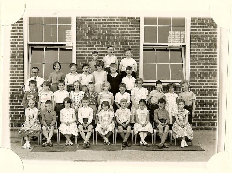
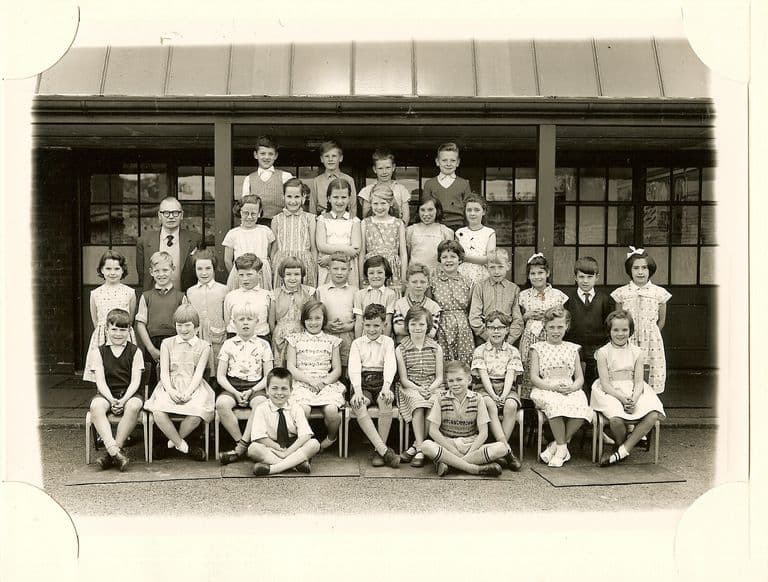
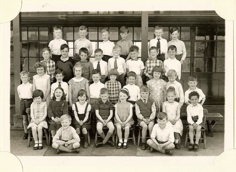
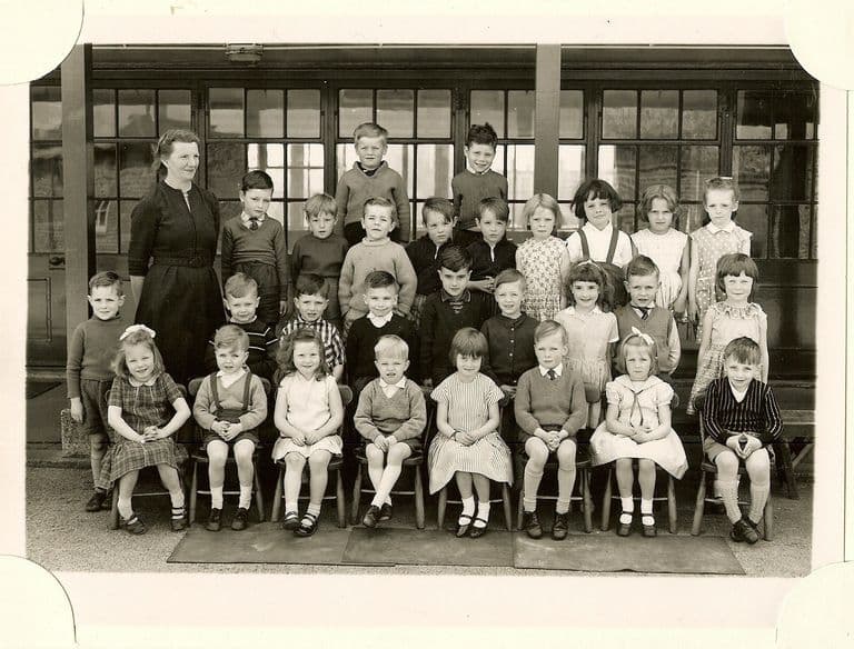
Wartime
Kingstanding during the Second World War.
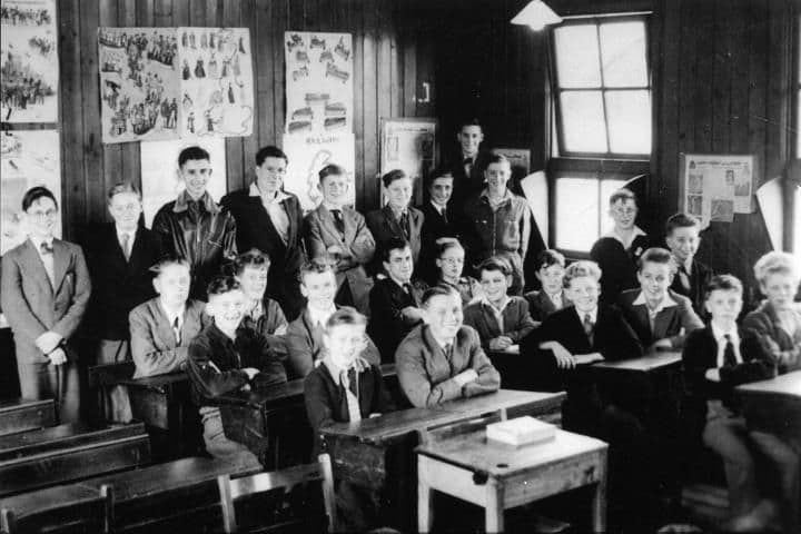
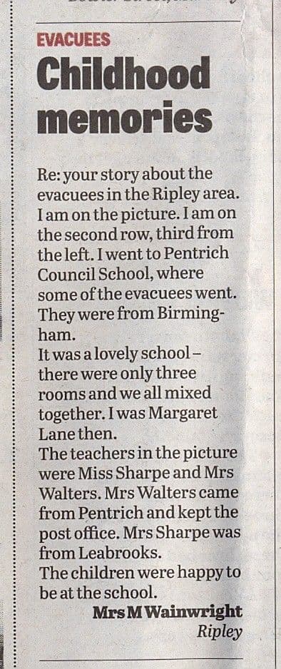
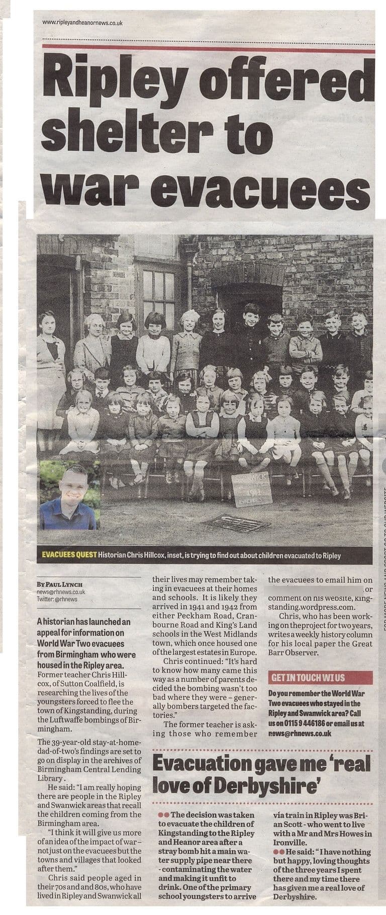
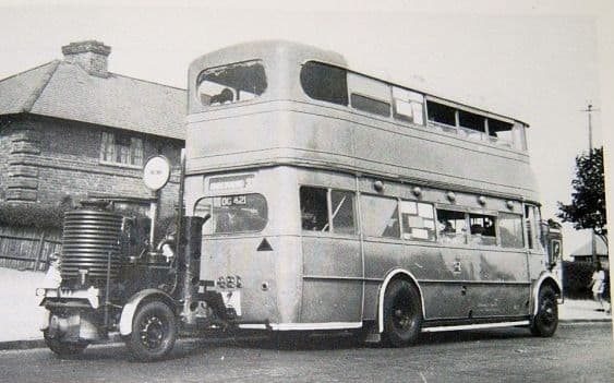
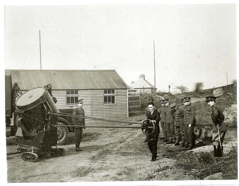
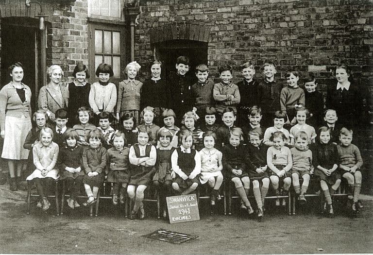
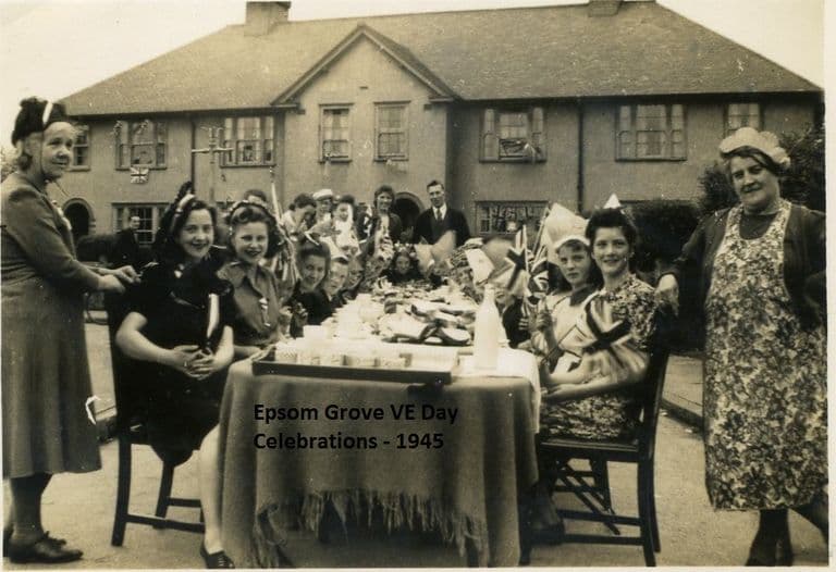
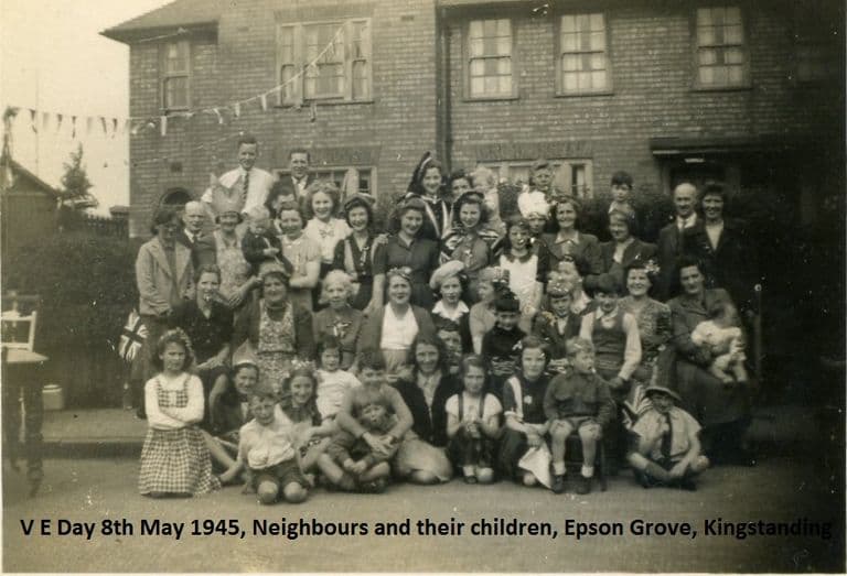
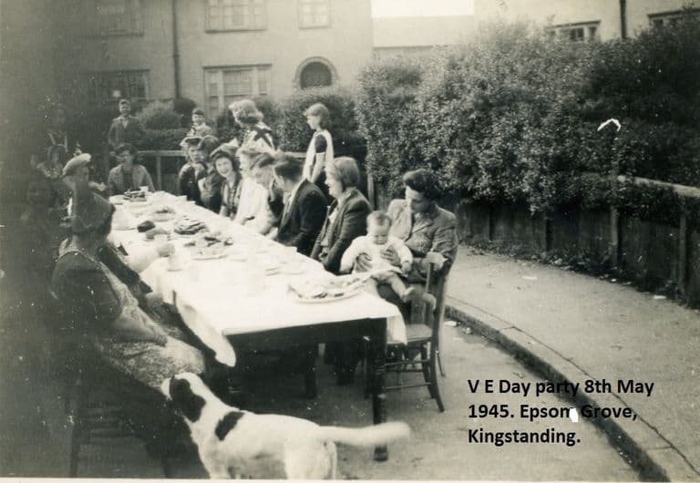
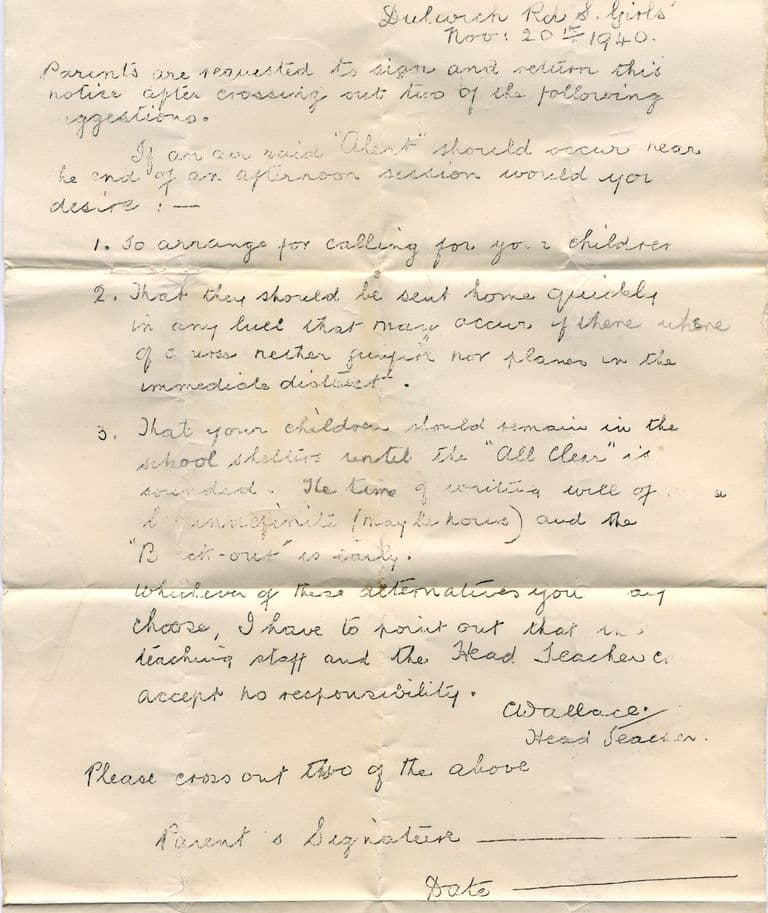
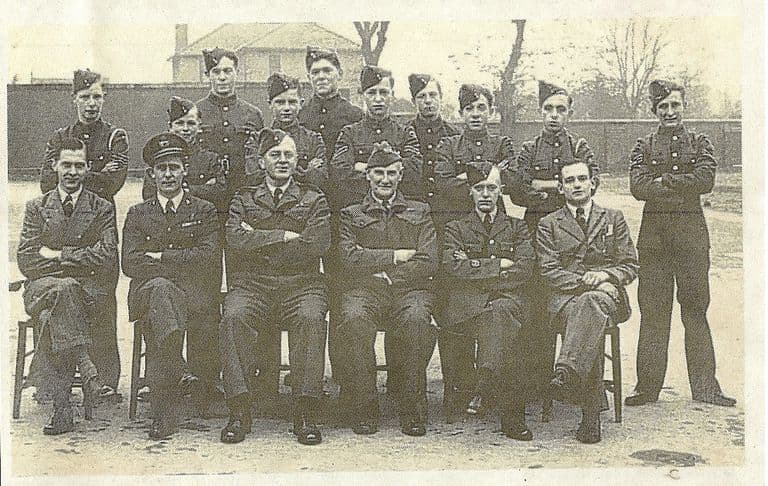
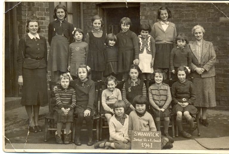
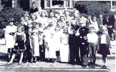
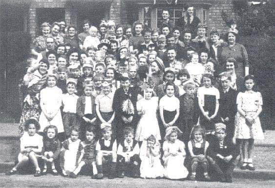
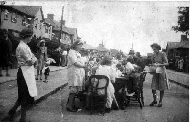
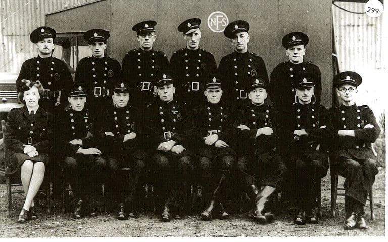
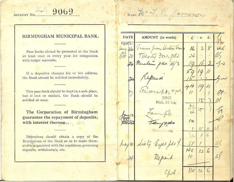
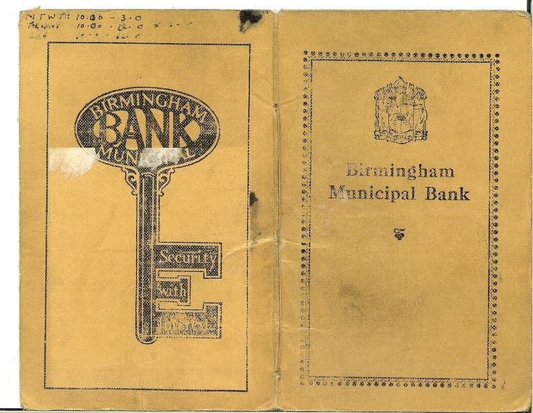
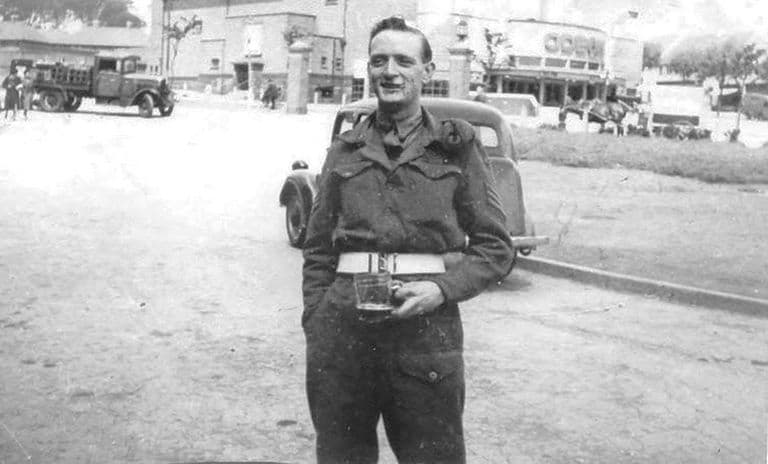
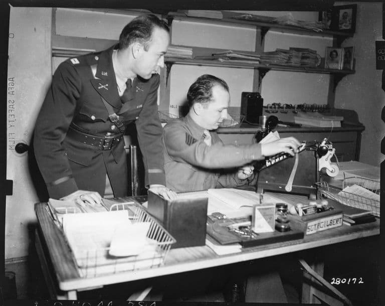
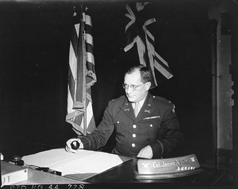
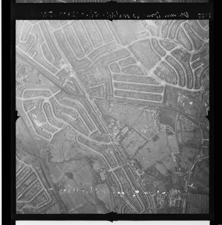
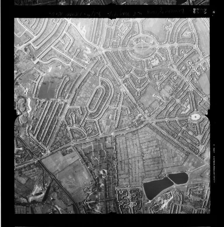
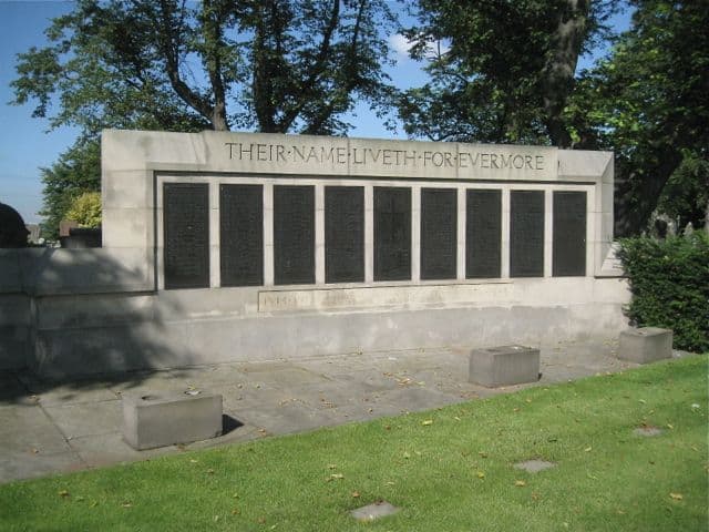
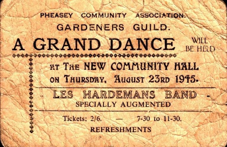
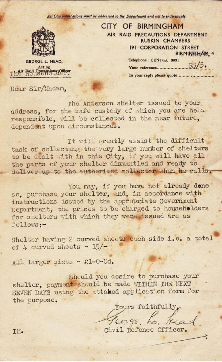
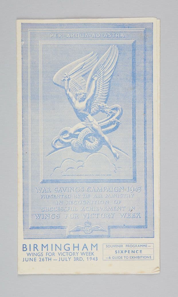
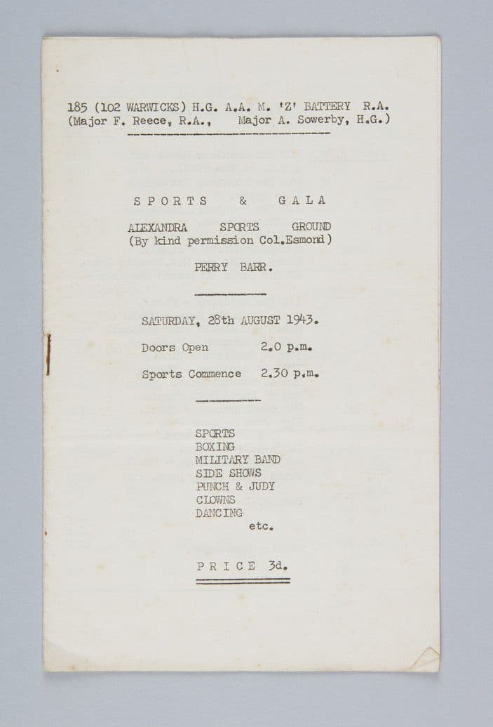
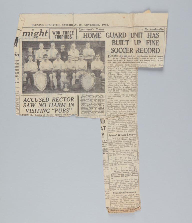
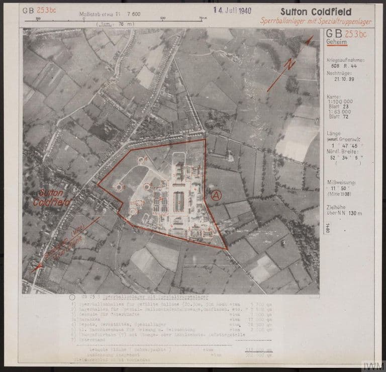
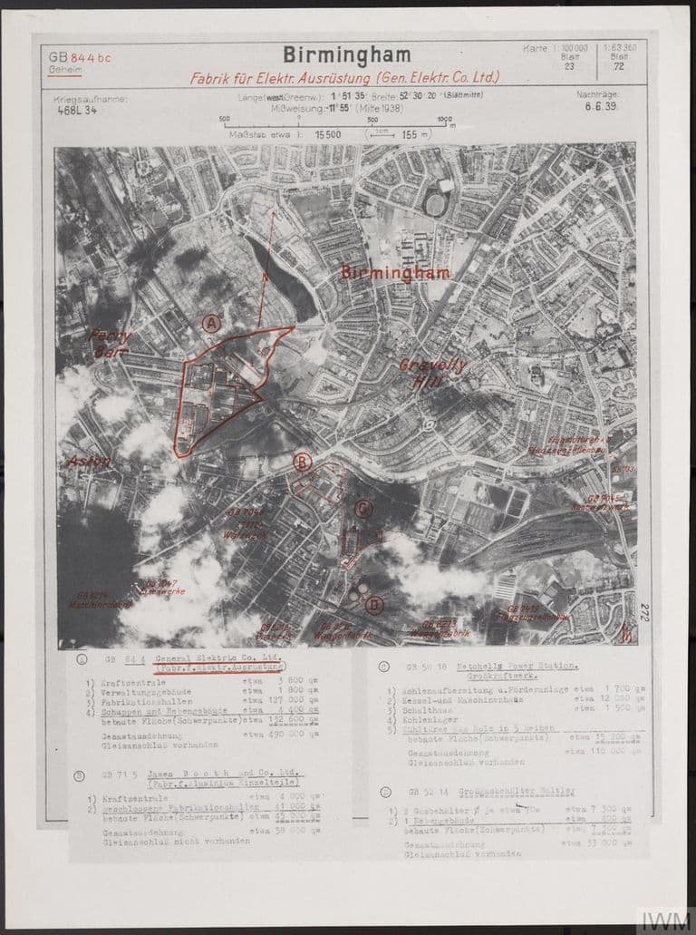
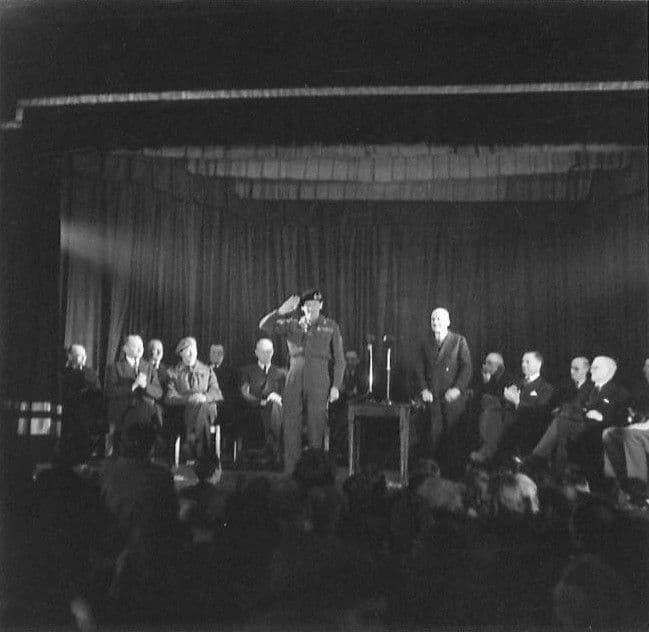
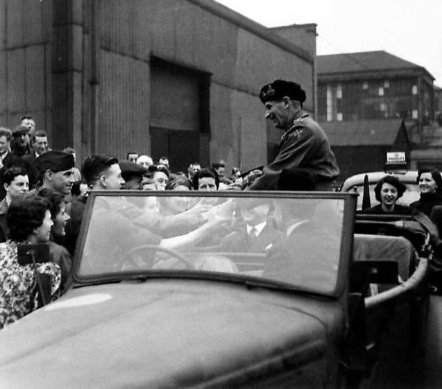
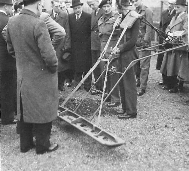
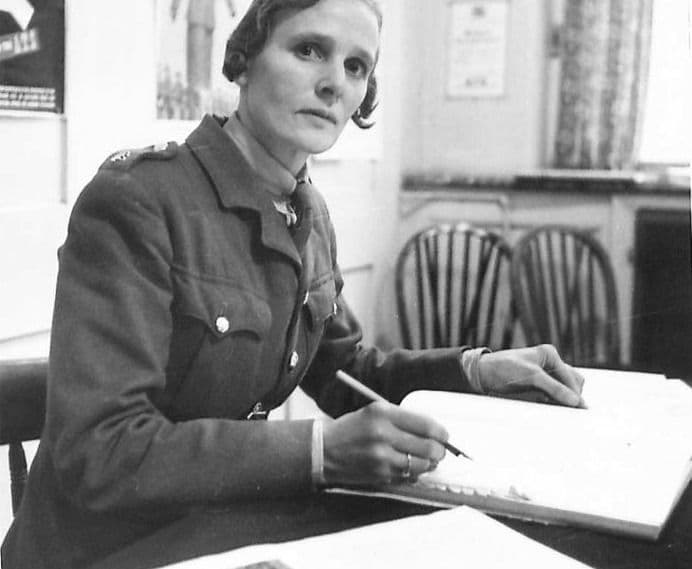
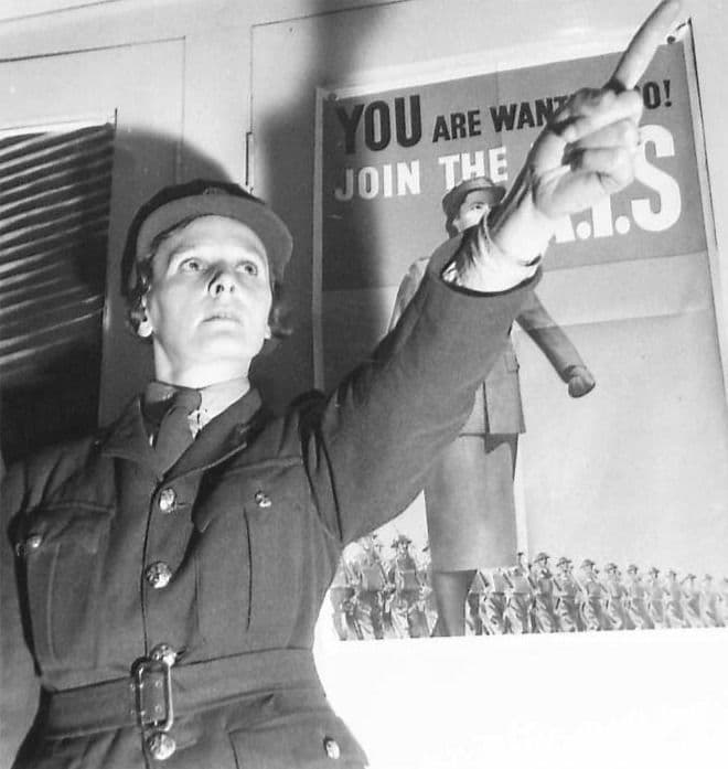
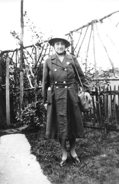
“Childhood memories”: a reader’s letter, Ripley & Heanor News, 201218 October 2012 · Ripley, DerbyshireFrom the Ripley & Heanor News, 18 October 2012 (as reproduced on Voices of Kingstanding). Reproduced via Chris Hillcox, Voices of Kingstanding. “Ripley offered shelter to war evacuees”, Ripley & Heanor News, 201211 October 2012 · Ripley, DerbyshireFrom the Ripley & Heanor News, 11 October 2012 (as reproduced on Voices of Kingstanding). Reproduced via Chris Hillcox, Voices of Kingstanding. A wartime bus towing a producer-gas trailer, 19431943 · Kingstanding (street not stated)Source unknown (as shown on Voices of Kingstanding). Reproduced via Chris Hillcox, Voices of Kingstanding. A US military policeman at the entrance to Pheasey, Romney Wayc. 1942–45 · Romney WayPhoto: 10th Replacement Depot Archives (courtesy of Fran and Martin Collins; as credited on Voices of Kingstanding). Reproduced via Chris Hillcox, Voices of Kingstanding. The Pheasey estate control point, Second World Warc. 1942–45 · Pheasey estatePhoto: 10th Replacement Depot Archives (courtesy of Fran and Martin Collins; as credited on Voices of Kingstanding). Reproduced via Chris Hillcox, Voices of Kingstanding. 322nd Company orderly room and billets, Pheasey, Second World Warc. 1942–45 · Pheasey estatePhoto: 10th Replacement Depot Archives (courtesy of Fran and Martin Collins; as credited on Voices of Kingstanding). Reproduced via Chris Hillcox, Voices of Kingstanding. Cranbourne Road School evacuees at Ripley stationc. 1941 · Ripley railway station, DerbyshirePhoto: Kingsthorne School (as credited on Voices of Kingstanding). Reproduced via Chris Hillcox, Voices of Kingstanding. Searchlight training at the Kingstanding drill hall, 19381938 · Kingstanding RoadPhoto: Kingstanding Library (as credited on Voices of Kingstanding). Reproduced via Chris Hillcox, Voices of Kingstanding. Peckham Road School evacuees at Swanwick, 19411941 · Swanwick, Derbyshire (evacuation)Photo: Kingstanding Library (as credited on Voices of Kingstanding). Reproduced via Chris Hillcox, Voices of Kingstanding. Epsom Grove VE Day celebrations, 19451945 · Epsom GrovePhoto: Lee Lewis. Reproduced with permission via Chris Hillcox, Voices of Kingstanding. VE Day neighbours and their children, Epsom Grove, 19458 May 1945 · Epsom GrovePhoto: Lee Lewis. Reproduced with permission via Chris Hillcox, Voices of Kingstanding. VE Day party, Epsom Grove, 8 May 19458 May 1945 · Epsom GrovePhoto: Lee Lewis. Reproduced with permission via Chris Hillcox, Voices of Kingstanding. Dulwich Road Girls’ School air-raid letter, 194020 November 1940 · Dulwich RoadCourtesy of Lee Lewis. Reproduced with permission via Chris Hillcox, Voices of Kingstanding. 487 Squadron Air Training Corps, c. 1944c. 1944 · Kingstanding and Perry Barr Air Training Corps, 487 SquadronPhoto: Graham Bailey. Reproduced with permission via Chris Hillcox, Voices of Kingstanding. Swanwick school children and evacuees, 19411941 · Swanwick, DerbyshirePhoto: Joan Sterland. Reproduced with permission via Chris Hillcox, Voices of Kingstanding. VJ Day party group, Twickenham Road, 19451945 · Twickenham RoadPhoto: John Prime. Reproduced with permission via Chris Hillcox, Voices of Kingstanding. VE Day party group, Twickenham Road, 19451945 · Twickenham RoadPhoto: John Prime. Reproduced with permission via Chris Hillcox, Voices of Kingstanding. VE Day street party in Twickenham Road, 19451945 · Twickenham RoadPhoto: Frances Fletcher. Reproduced with permission via Chris Hillcox, Voices of Kingstanding. Sundridge Road School playground, 19441944 · Sundridge RoadImage reproduced with permission of Chris Hillcox, Voices of Kingstanding. The National Fire Service at Kingstanding, Second World War1939–1945 · Kings RoadImage reproduced with permission of Chris Hillcox, Voices of Kingstanding. Inside a Municipal Bank book, 1942–441942–1944 · Kingstanding RoadPhoto: Ron Jameson. Reproduced with permission via Chris Hillcox, Voices of Kingstanding. A Birmingham Municipal Bank account book, 1940s1940s · Kingstanding RoadPhoto: Ron Jameson. Reproduced with permission via Chris Hillcox, Voices of Kingstanding. A soldier with a pint outside the Odeon, 1940s1940s (from the uniform) · Probably the Circle, KingstandingSubmitted by a resident of Oscott Checking pay accounts at the 10th Replacement Depot, Lichfield, January 194428 January 1944 · Whittington Barracks, Lichfield, StaffordshireUS Army Signal Corps photograph, 1944. US National Archives (111-SC-280172). Colonel James A. Kilian at the 10th Replacement Depot, Lichfield, January 194428 January 1944 · Whittington Barracks, Lichfield, Staffordshire (10th Replacement Depot headquarters)US Army Signal Corps photograph, 1944. US National Archives (111-SC-280171). Perry Barr and Perry Beeches from an American reconnaissance aircraft, May 194427 or 28 May 1944 · Perry Barr, Perry Beeches and Perry Reservoir, Birmingham (south-west edge of the Kingstanding area)US Army Air Forces photograph, 1944. US National Archives (NAID 286942700), digitised with NCAP. Kingstanding and Perry Common photographed by an American reconnaissance aircraft, May 194427 or 28 May 1944 · Kingstanding (south: Kingstanding Circle, Warren Farm Road, Danesbury Crescent), Perry Common, Witton Lakes and Witton Cemetery, BirminghamUS Army Air Forces photograph, 1944. US National Archives (NAID 286942898), digitised with NCAP. The war graves memorial wall, Witton Cemetery (2012)Photographed 10 August 2012 · Witton Cemetery, The Ridgeway, Witton, Birmingham© Robin Stott (Geograph 3374267), CC BY-SA 2.0 Dancing after VJ Day: Pheasey, 23 August 194523 August 1945 · New Community Hall, Pheasey (Great Barr), next to KingstandingPheasey Community Association dance ticket, 1945, via Wikimedia Commons (public domain) 'Your Anderson shelter will be collected': Birmingham's letter to householders1940s (probably 1945–46) · Birmingham (city-wide circular)City of Birmingham ARP Department circular, 1940s, via Wikimedia Commons (public domain) Birmingham Wings for Victory Week, 194326 June – 3 July 1943 · Birmingham (city-wide campaign)Photo by Birmingham Museums Trust, licensed under CC0 (2004.0589) The rocket battery's sports gala, Perry Barr, 194328 August 1943 · Alexandra (Alexander) Sports Ground, Perry Barr, BirminghamPhoto by Birmingham Museums Trust, licensed under CC0 (1989F152) Perry Barr's Home Guard footballers, 194425 November 1944 · Alexander Sports Ground, Perry Barr, BirminghamPhoto by Birmingham Museums Trust, licensed under CC0 (1989F529) German target photo of the Sutton Coldfield balloon centre, 1940Photograph annotated 21 October 1939; sheet stamped 14 July 1940 · No. 5 Balloon Centre, Whitehouse Common, Sutton Coldfield (about 6 km north-east of Kingstanding)Image: IWM (LBY LUFT 526). Luftwaffe target folder, 1940 The enemy's view: German target photo of GEC Witton, 1939Annotated 8 June 1939; folder dated December 1939 · GEC works, Witton, Birmingham (south of Perry Common)Image: IWM (LBY LUFT 518). Luftwaffe target folder, 1939 Montgomery addresses the GEC workforce, 19449 March 1944 · General Electric Company works, Birmingham, probably WittonImage: IWM (H 36453). War Office official photograph, 9 March 1944 GEC workers crowd round Montgomery's car, 19449 March 1944 · General Electric Company works, Birmingham, probably WittonImage: IWM (H 36452). War Office official photograph, 9 March 1944 Montgomery watches a GEC mine detector, 9 March 19449 March 1944 · General Electric Company works, Birmingham, probably WittonImage: IWM (H 36451). War Office official photograph by Sgt J. D. L. Morris, 9 March 1944 Gertrude Roberts at the recruiting desk, 1942November 1942 · Birmingham (ATS recruiting office); sitter from KingstandingImage: IWM (H 25756). War Office official photograph by Lt E. A. Taylor, November 1942 Private Gertrude Roberts of Kingstanding, ATS recruiter, 1942November 1942 · Birmingham (ATS recruiting office); sitter from KingstandingImage: IWM (H 25755). War Office official photograph by Lt E. A. Taylor, November 1942 ARP Warden in Longford Road1943 · Longford RoadLibrary of Birmingham, Local Studies and History Department, LSH WK K10 0034 (3/1263)
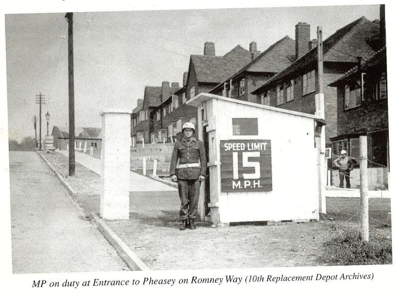
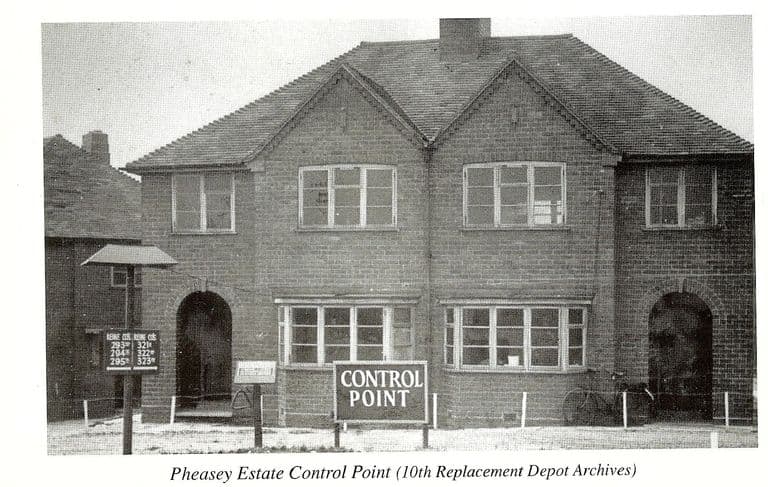
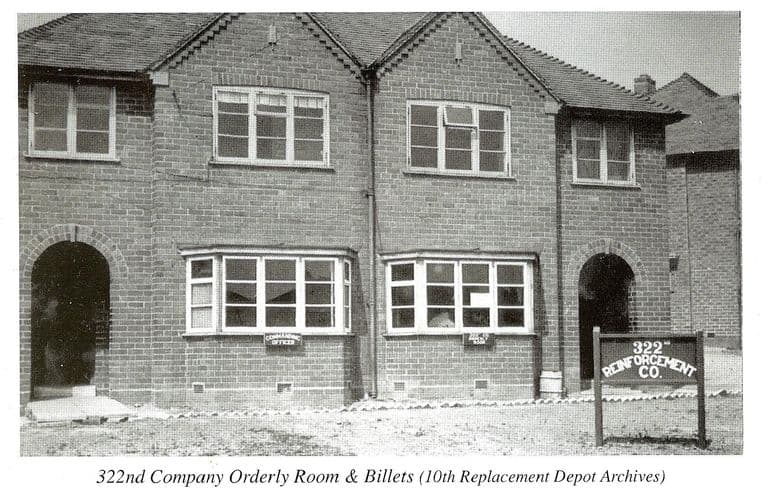
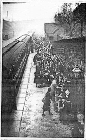
Later years, 1950s–1980s
The Circle, the shops and the streets as the estate matured.
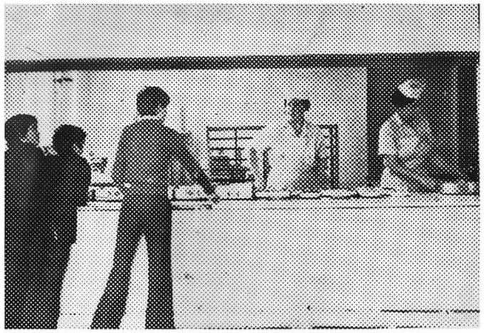
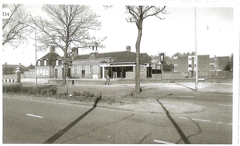
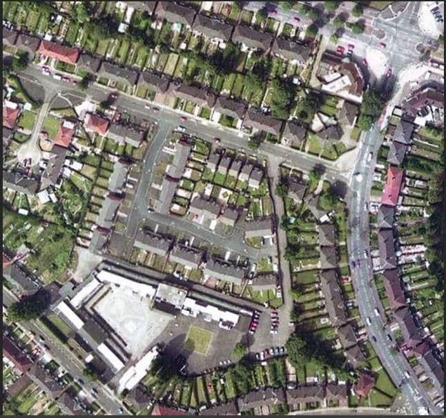
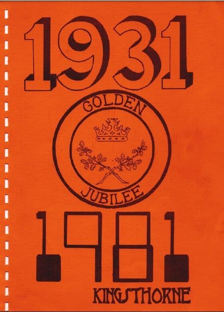
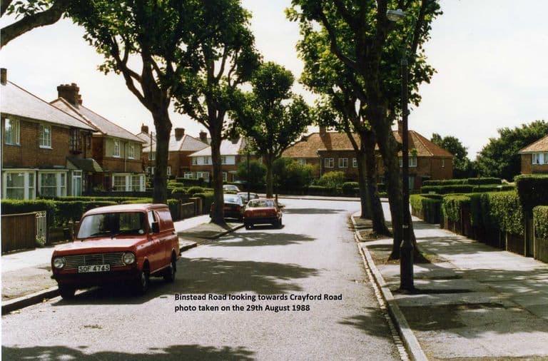
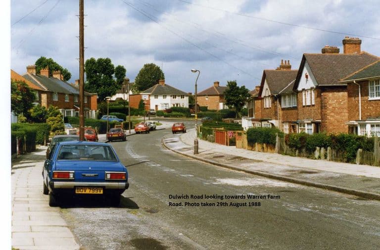
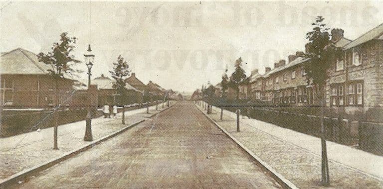
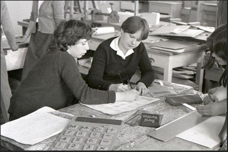
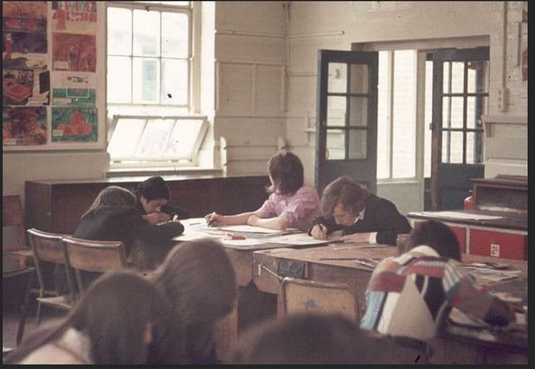
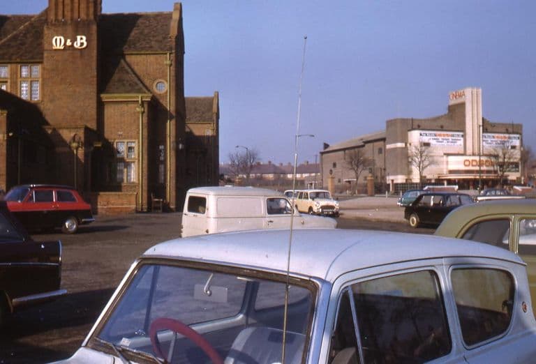
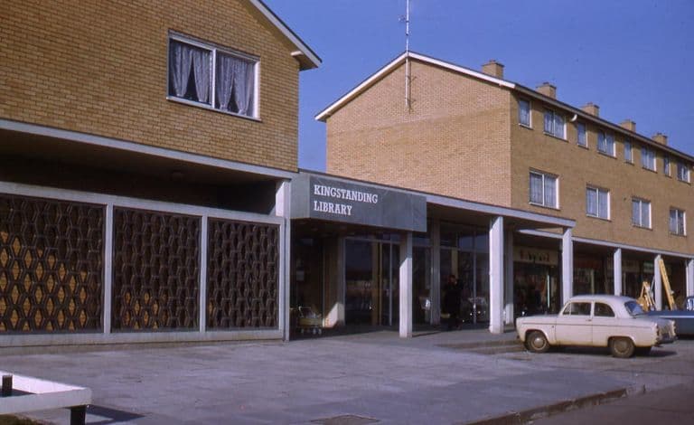
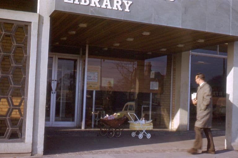
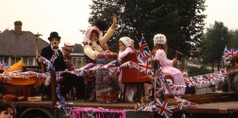
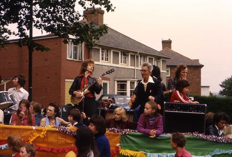
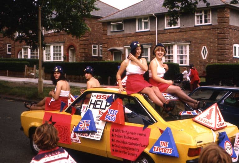
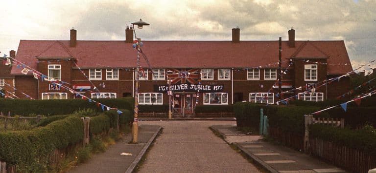
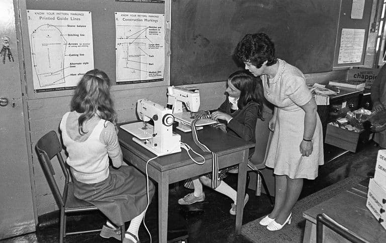
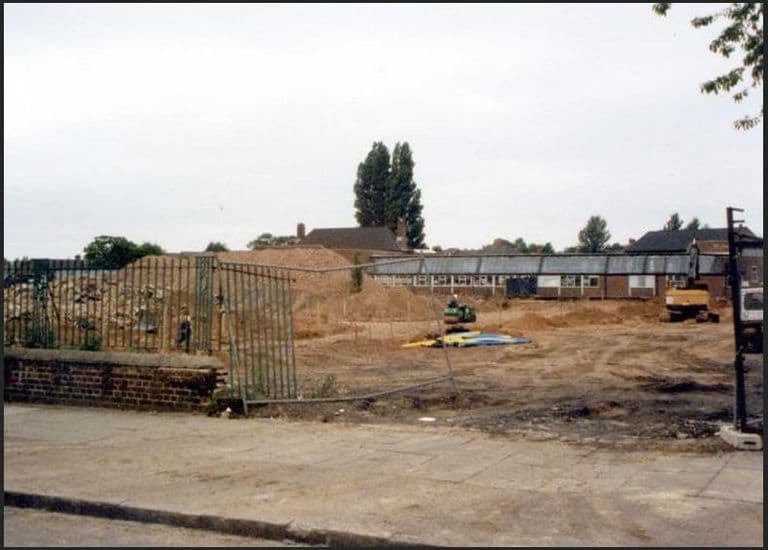
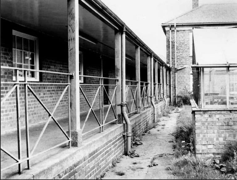
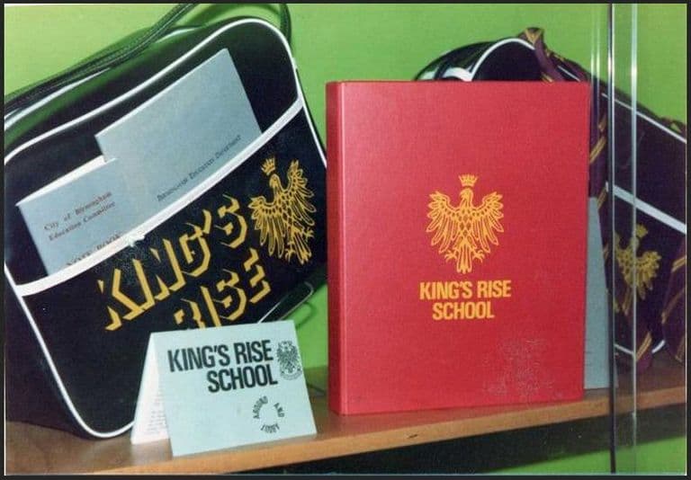
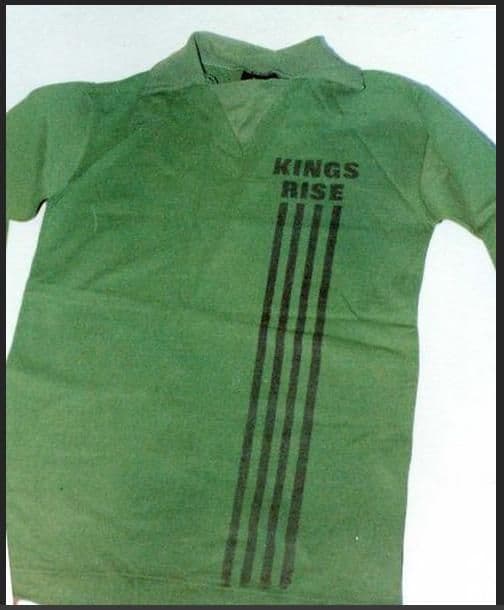
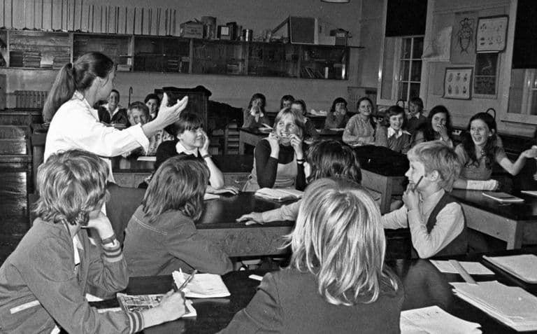
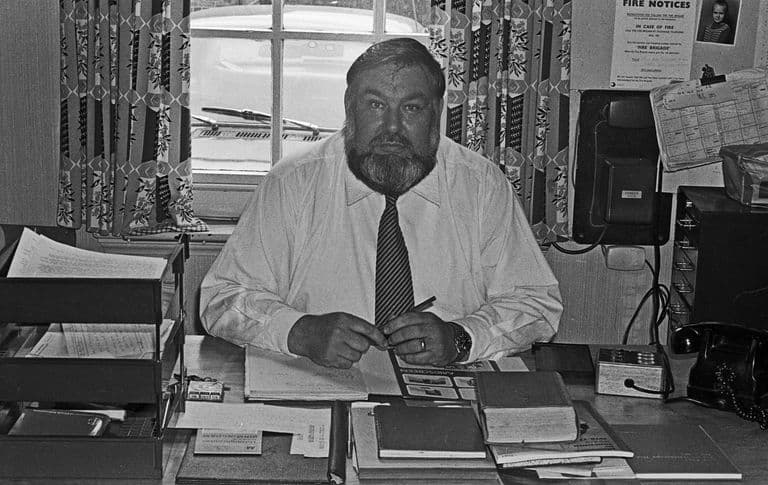
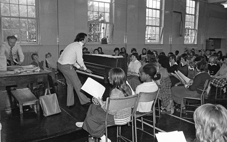
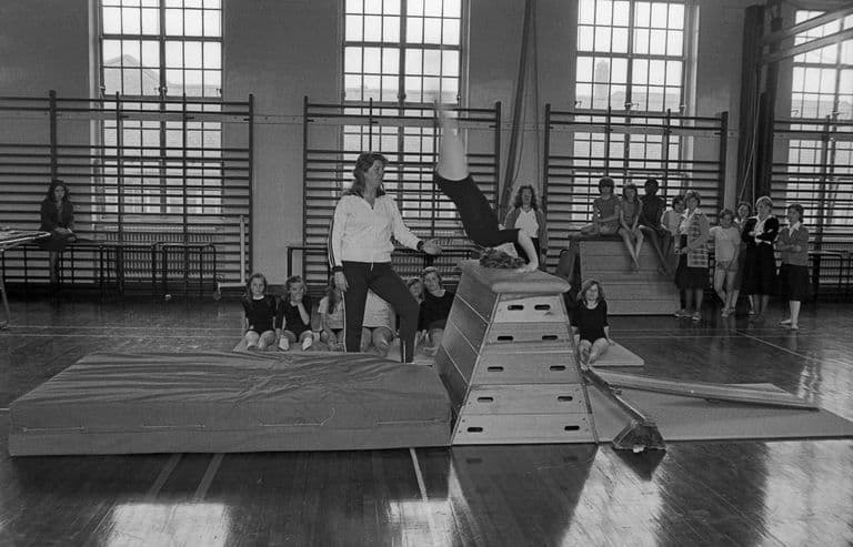
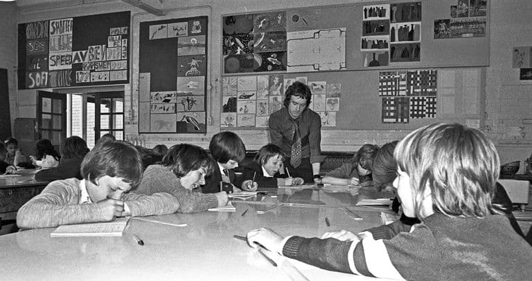
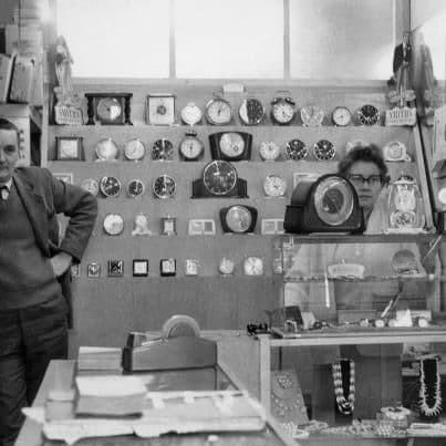
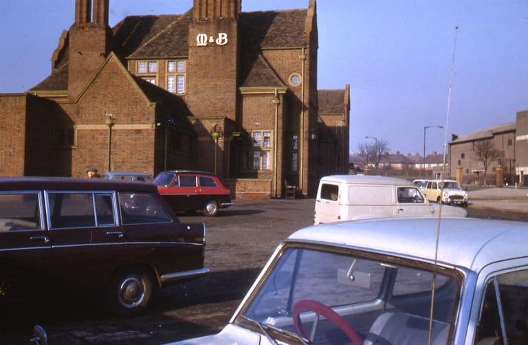
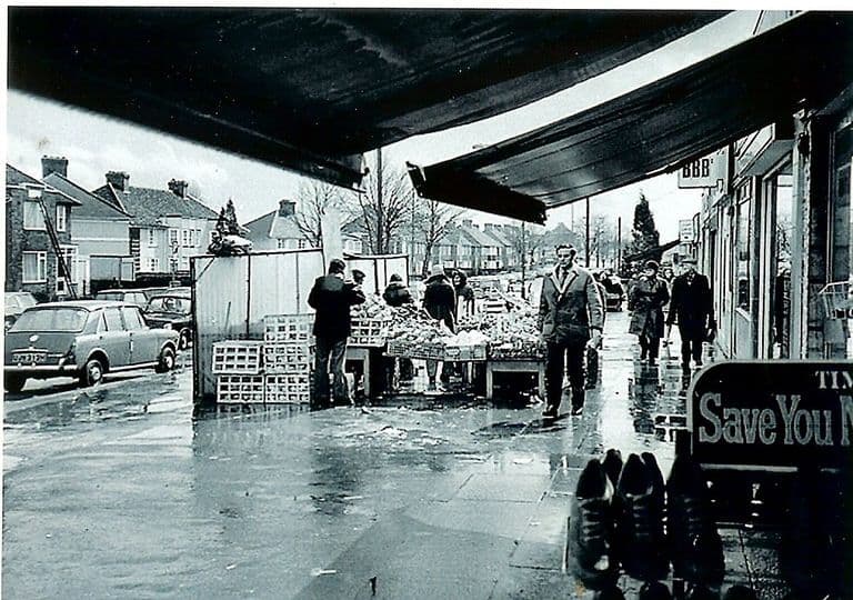
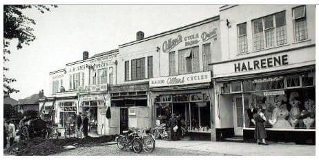
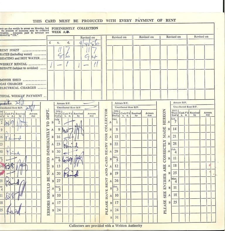
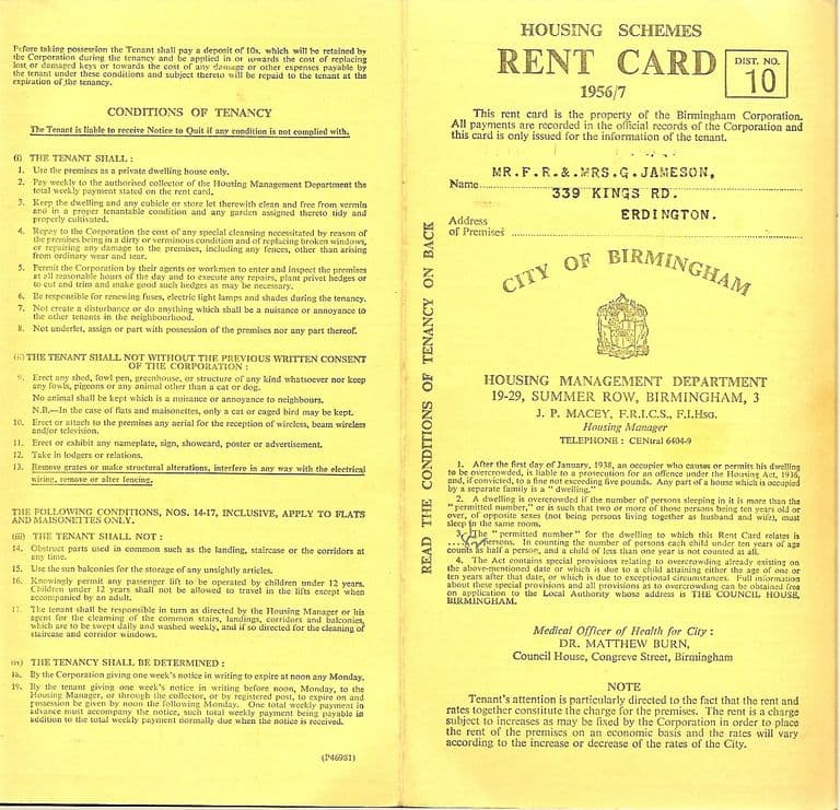
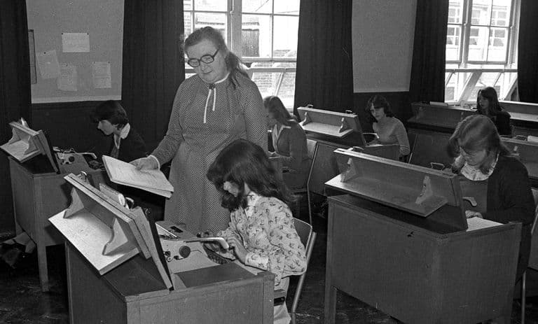
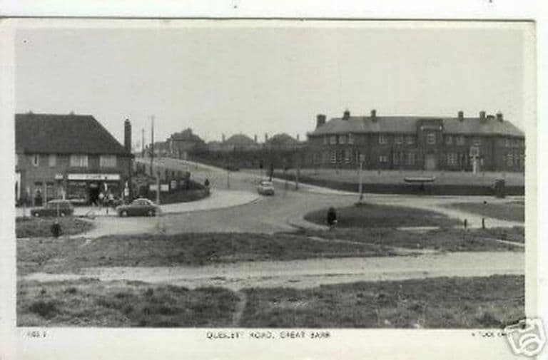
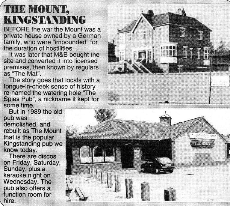
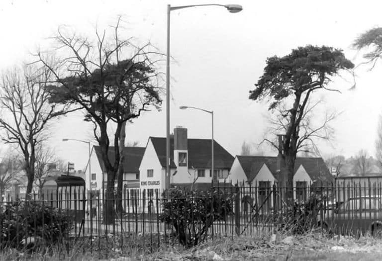
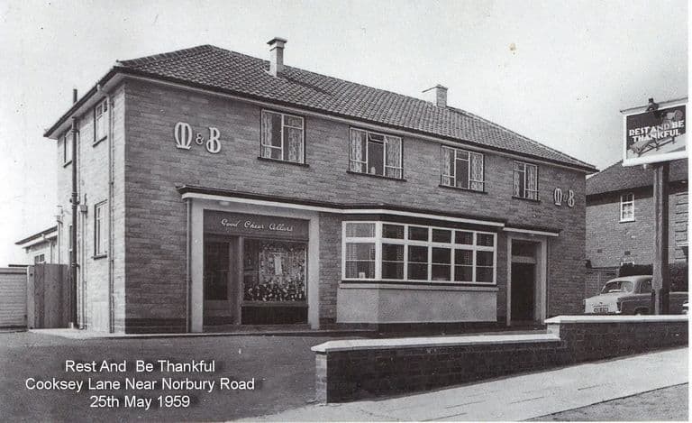
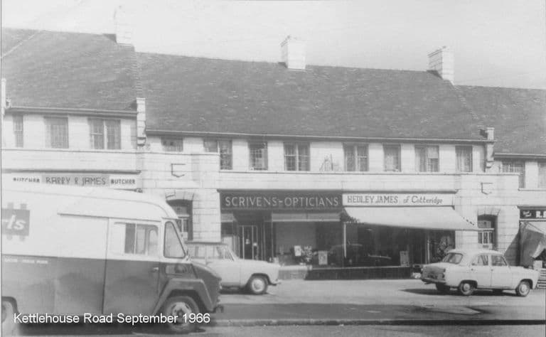
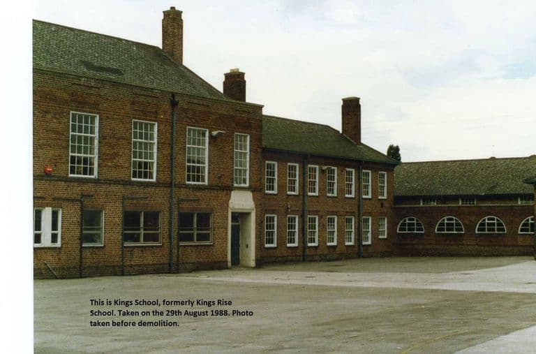
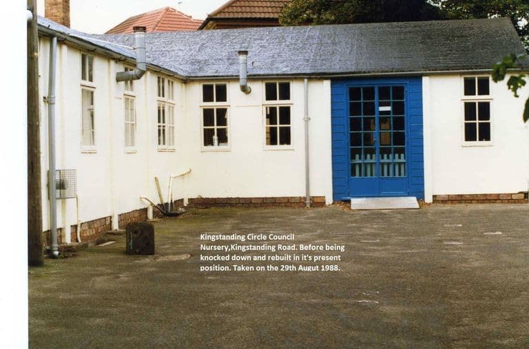
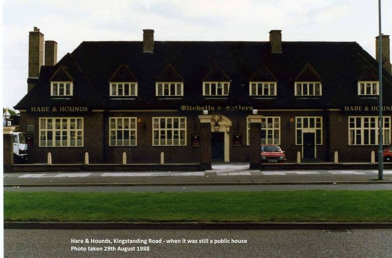
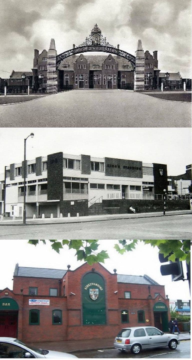
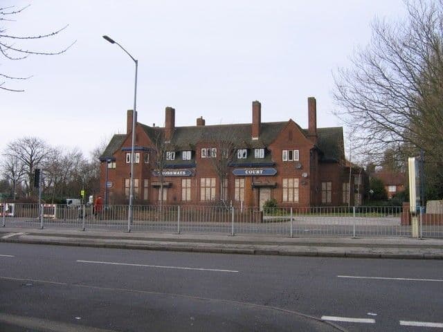
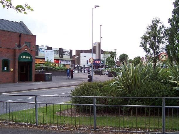
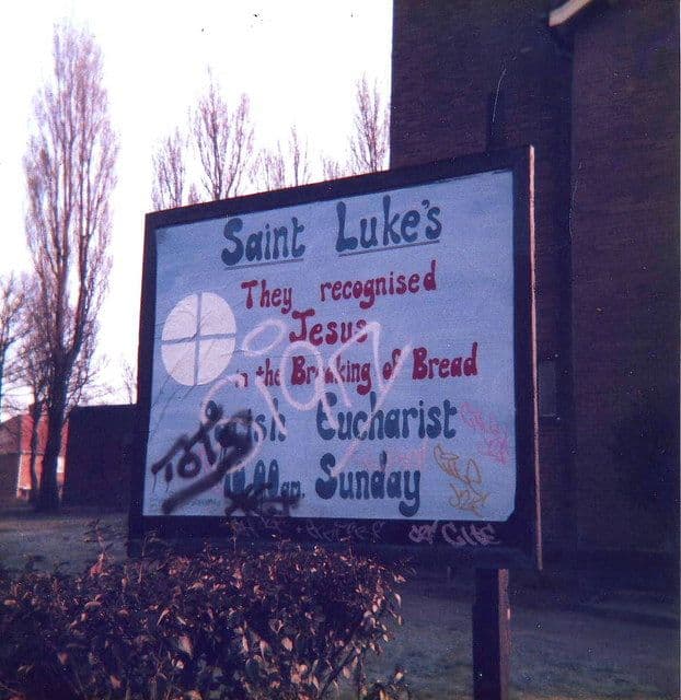
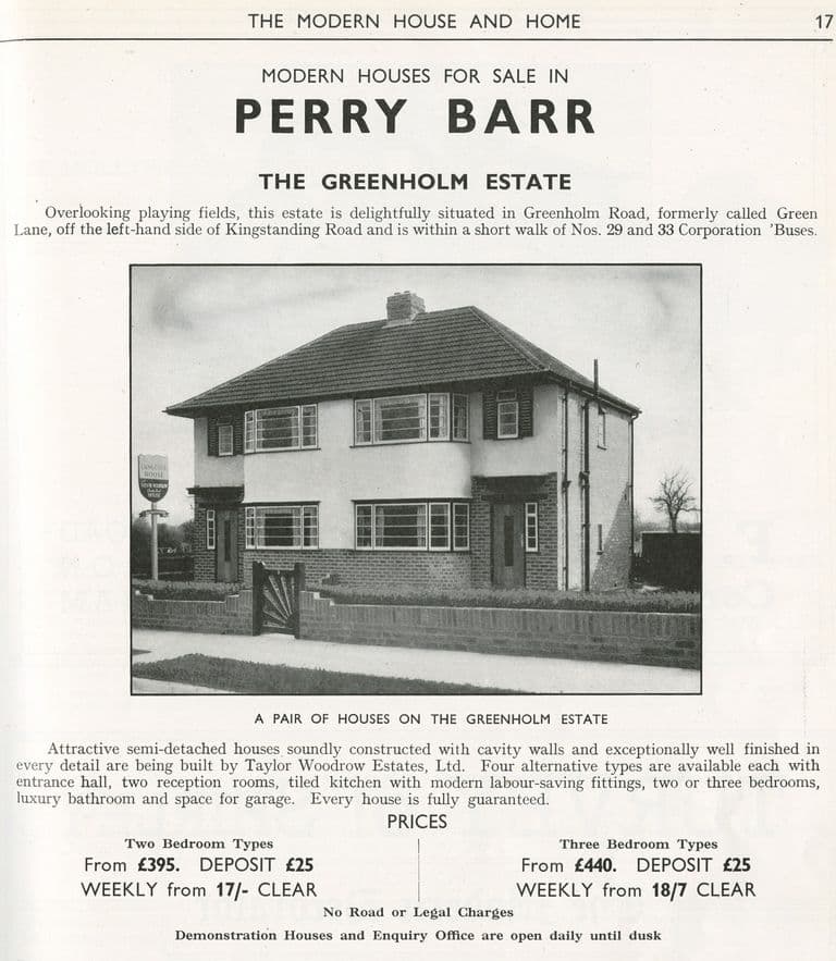
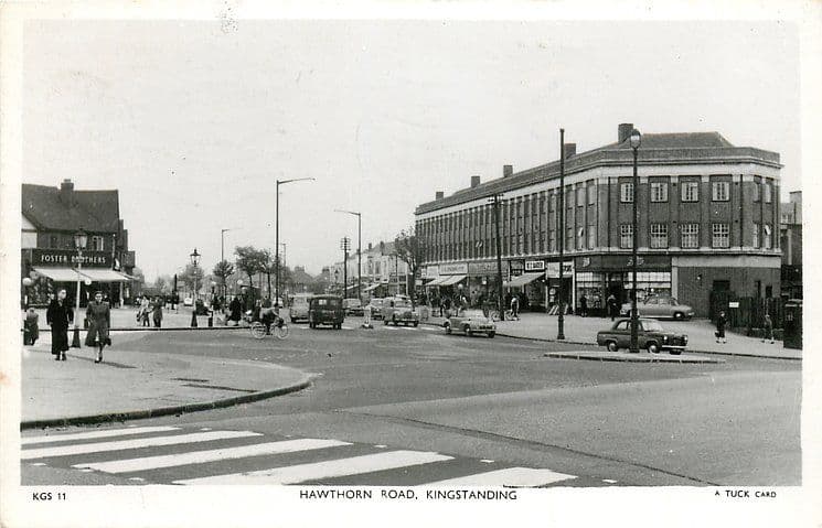
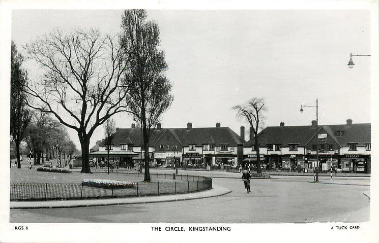
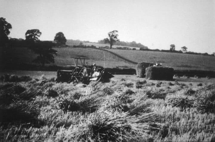
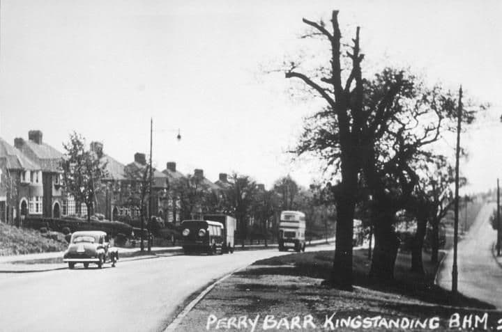
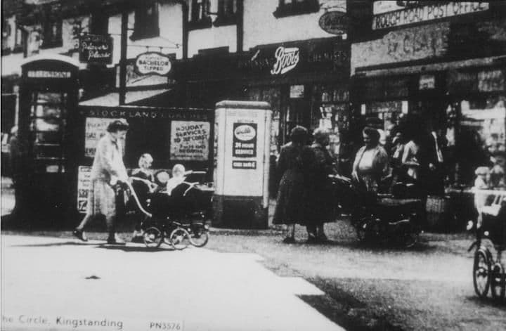
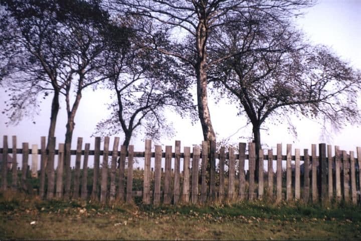
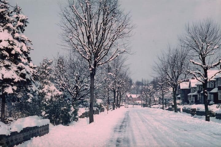
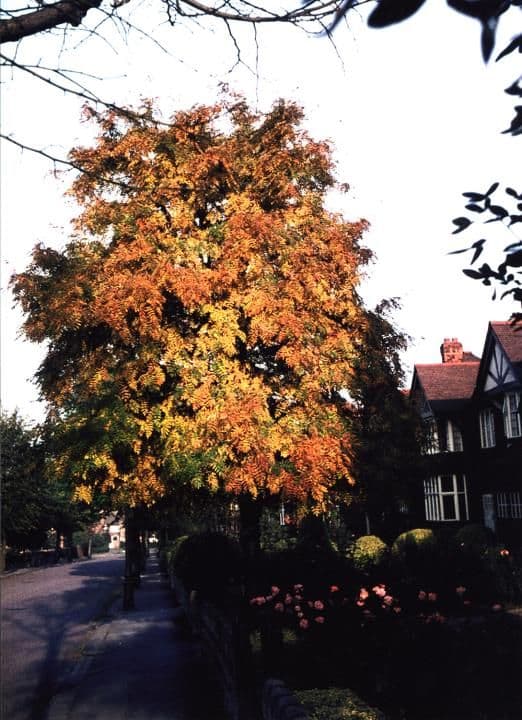
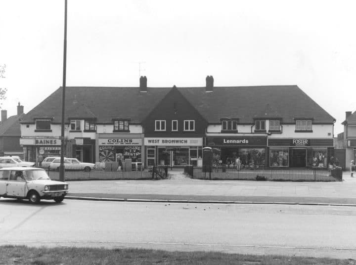
The dinner counter, King’s Rise Secondary Schoolc. 1976 · King’s Rise Secondary SchoolSource unknown (as shown on Voices of Kingstanding). Reproduced via Chris Hillcox, Voices of Kingstanding. The College Arms, College Road, 19891989 · College RoadSource unknown (as shown on Voices of Kingstanding). Reproduced via Chris Hillcox, Voices of Kingstanding. King’s Rise School from aboveDate unknown · King’s Rise School and surrounding streetsPhoto: Keith Wright (as credited on Voices of Kingstanding). Reproduced via Chris Hillcox, Voices of Kingstanding. Kingsthorne School Golden Jubilee booklet, 1931–19811981 · Cranbourne RoadKingsthorne School Golden Jubilee booklet, 1981 (shared by Richard Colin; as shown on Voices of Kingstanding). Reproduced via Chris Hillcox, Voices of Kingstanding. Binstead Road looking towards Crayford Road, 198829 August 1988 · Binstead RoadPhoto: Lee Lewis. Reproduced with permission via Chris Hillcox, Voices of Kingstanding. Dulwich Road looking towards Warren Farm Road, 198829 August 1988 · Dulwich RoadImage reproduced with permission of Chris Hillcox, Voices of Kingstanding. Hornsey Road, 19481948 · Hornsey RoadImage reproduced with permission of Chris Hillcox, Voices of Kingstanding. Pupils drawing at a workbench, King’s Rise Secondary SchoolDate unknown · Peckham RoadPhoto: Keith Wright. Reproduced with permission via Chris Hillcox, Voices of Kingstanding. Pupils in the art room, King’s Rise Secondary SchoolDate unknown · Peckham RoadPhoto: Keith Wright. Reproduced with permission via Chris Hillcox, Voices of Kingstanding. The Kingstanding pub and the Odeon, 1960s1960s · Kingstanding RoadPhoto: Ron Jameson. Reproduced with permission via Chris Hillcox, Voices of Kingstanding. Kingstanding Library and the neighbouring shops, 1960s1960s · Kingstanding LibraryPhoto: Ron Jameson. Reproduced with permission via Chris Hillcox, Voices of Kingstanding. The entrance of Kingstanding Library, 1960s1960s · Kingstanding LibraryPhoto: Ron Jameson. Reproduced with permission via Chris Hillcox, Voices of Kingstanding. A fancy-dress float at the Silver Jubilee, Kingstanding, 19771977 · Kingstanding (street not stated)Image reproduced with permission of Chris Hillcox, Voices of Kingstanding. A band on a carnival float at the Silver Jubilee, Kingstanding, 19771977 · Kingstanding (street not stated)Image reproduced with permission of Chris Hillcox, Voices of Kingstanding. A driving-school carnival car at the Silver Jubilee, Kingstanding, 19771977 · Kingstanding (street not stated)Image reproduced with permission of Chris Hillcox, Voices of Kingstanding. Houses dressed for the Silver Jubilee, Kingstanding, 19771977 · Kingstanding (street not stated)Image reproduced with permission of Chris Hillcox, Voices of Kingstanding. Sewing class, King’s Rise School, 19761976 · Peckham RoadImage reproduced with permission of Chris Hillcox, Voices of Kingstanding. King’s Rise senior school site being clearedDate unknown · Peckham RoadPhoto: Keith Wright. Reproduced with permission via Chris Hillcox, Voices of Kingstanding. Veranda and greenhouse, King’s Rise Secondary SchoolDate unknown · Peckham RoadPhoto: Keith Wright. Reproduced with permission via Chris Hillcox, Voices of Kingstanding. King’s Rise School bag, folder and badgeDate unknown · Peckham RoadPhoto: Keith Wright. Reproduced with permission via Chris Hillcox, Voices of Kingstanding. A King’s Rise School sports shirtDate unknown · Peckham RoadPhoto: Keith Wright. Reproduced with permission via Chris Hillcox, Voices of Kingstanding. Science lesson with Mrs Pocknell, King’s Rise School, 19761976 · Peckham RoadImage reproduced with permission of Chris Hillcox, Voices of Kingstanding. Mr Lane, Deputy Head of King’s Rise School, 19761976 · Peckham RoadImage reproduced with permission of Chris Hillcox, Voices of Kingstanding. Singing in the main hall, King’s Rise School, 19761976 · Peckham RoadImage reproduced with permission of Chris Hillcox, Voices of Kingstanding. Girls’ gym class, King’s Rise School, 19761976 · Peckham RoadImage reproduced with permission of Chris Hillcox, Voices of Kingstanding. Art class with Mr Wright, King’s Rise School, 19761976 · Peckham RoadImage reproduced with permission of Chris Hillcox, Voices of Kingstanding. Inside Tranters the jewellers, Hawthorn Road, 1960sc. 1960s · Hawthorn RoadImage reproduced with permission of Chris Hillcox, Voices of Kingstanding. The Kingstanding pub and its car park, 19651965 · Kingstanding RoadPhoto: Ron Jameson. Reproduced with permission via Chris Hillcox, Voices of Kingstanding. Hawthorn Road shops on a wet day, 1960s1960s · Hawthorn RoadImage reproduced with permission of Chris Hillcox, Voices of Kingstanding. Hawthorn Road shops, 19571957 · Hawthorn RoadPhoto: Paul (surname not given). Reproduced with permission via Chris Hillcox, Voices of Kingstanding. Rent payments on a Kings Road rent card, 19561956 · Kings RoadPhoto: Ron Jameson. Reproduced with permission via Chris Hillcox, Voices of Kingstanding. A council rent card for Kings Road, 1956–571956–57 · Kings RoadPhoto: Ron Jameson. Reproduced with permission via Chris Hillcox, Voices of Kingstanding. Typing with Mrs Taylor, King’s Rise Secondary School, 19761976 · King’s Rise Secondary School, KingstandingImage reproduced with permission of Chris Hillcox, Voices of Kingstanding. Queslett Road, Great Barr (postcard)c. late 1950s–1960s · Queslett RoadSubmitted by a resident of Oscott “The Spies Pub”: The Mount, Kingstanding (news cutting)Cutting c. 1990s; story covers 1930s–1989 · KingstandingSubmitted by a resident of Oscott The King Charles pub, seen through the railingsUndated (probably 1960s–70s) · Kings RoadSubmitted by a resident of Oscott. Photo copyright Keith Wright (as credited on Voices of Kingstanding). The Rest and Be Thankful, Cooksey Lane, 195925 May 1959 · Cooksey LaneSubmitted by a resident of Oscott Shops on Kettlehouse Road, September 1966September 1966 · Kettlehouse RoadSubmitted by a resident of Oscott Kings School (formerly Kings Rise School), 198829 August 1988 · KingstandingSubmitted by a resident of Oscott Kingstanding Circle Council Nursery, 198829 August 1988 · Kingstanding RoadSubmitted by a resident of Oscott The Hare & Hounds, Kingstanding Road, 198829 August 1988 · Kingstanding RoadSubmitted by a resident of Oscott. Photo courtesy of Lee Lewis (as credited on Voices of Kingstanding). Three Kingstanding pubs on one site1930s to c. 2000s · The Circle, KingstandingSubmitted by a resident of Oscott The former Crossways pub, derelict, 200924 January 2009 · College Road© Roy Hughes, CC BY-SA 2.0 (Geograph) The Circle in 2005: pub, precinct and bingo hall3 June 2005 · Kingstanding Circle© Adrian Bailey, CC BY-SA 2.0 (Geograph) St Luke’s noticeboard, 198712 January 1987 · St Luke’s Church, Kingstandingnick macneill, CC BY-SA 2.0, via Wikimedia Commons “Modern houses for sale”: the Greenholm Estate, 1939 (advert)February 1939 · Greenholm RoadTaylor Woodrow Estates advert in The Modern House and Home, via Wikimedia Commons. Public domain The Deers Leap, Queslett Road, c. 1950 (postcard)c. 1950 · Queslett RoadRaphael Tuck & Sons postcard, c. 1950 (TuckDB Postcards). Public domain Hawthorn Road, c. 1950 (postcard)c. 1950 · Hawthorn RoadRaphael Tuck & Sons postcard, c. 1950 (TuckDB Postcards). Public domain The Circle, c. 1950 (postcard)c. 1950 · Kingstanding CircleRaphael Tuck & Sons postcard, c. 1950 (TuckDB Postcards). Public domain Farming near Queslett Road1942 · Queslett RoadLibrary of Birmingham, Local Studies and History Department, LSH WK K10 0101 (3/1321) Kingstanding Roadc. 1950–1959 · Kingstanding RoadLibrary of Birmingham, Local Studies and History Department, lSH/ Warks Photo Survey WK-K10-0084 (3/1307) The Circlec. 1950–1959Library of Birmingham, Local Studies and History Department, LSH Warks Photo Survey WK-K10-0103 (3/1323) The Tumulus1966Library of Birmingham, Local Studies and History Department, LSH/ Warks Photo Survey WK-K10-0116 (3/1335) Beacon Road1970 · Beacon RoadLibrary of Birmingham, Local Studies and History Department, LSH WK K10 0114 (3/1333) Beacon Road1980 · Beacon RoadLibrary of Birmingham, Local Studies and History Department, LSH WK K10 0115 (3/1334) The Circle1984Library of Birmingham, Local Studies and History Department, LSH/ Warks Photo Survey WK-K10-0003 (3/1238)
Kingstanding today
Recent photographs of the estate’s streets and buildings.
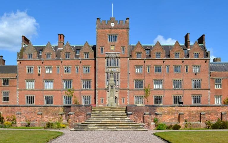
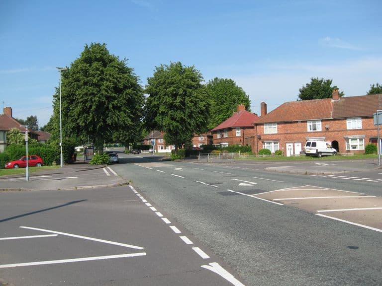
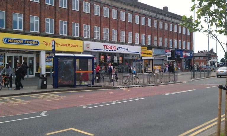
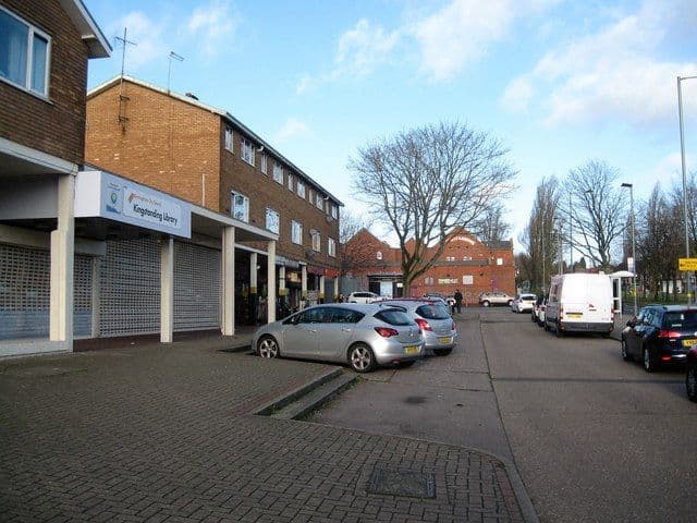
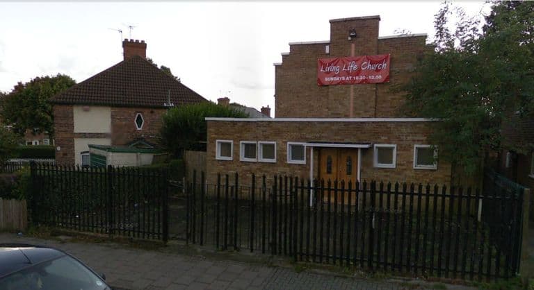
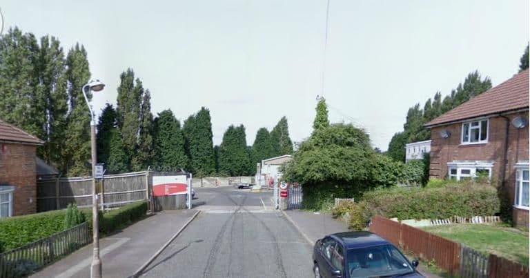
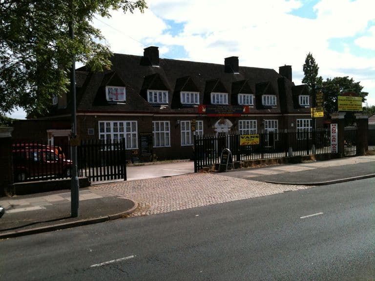
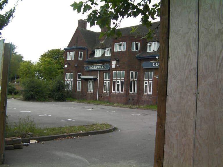
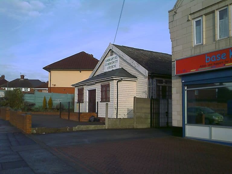
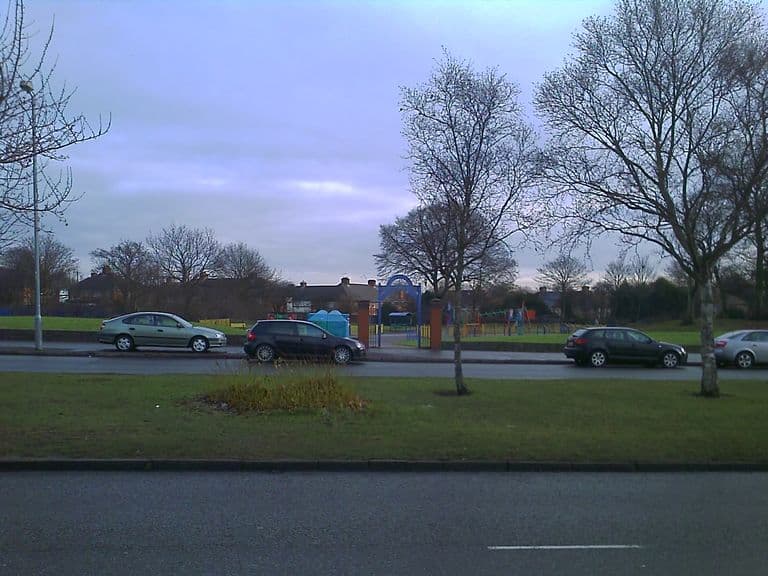
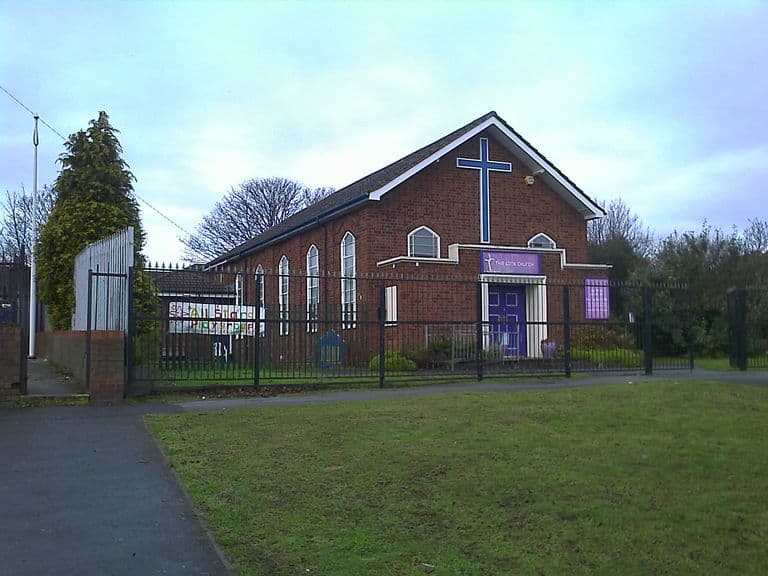
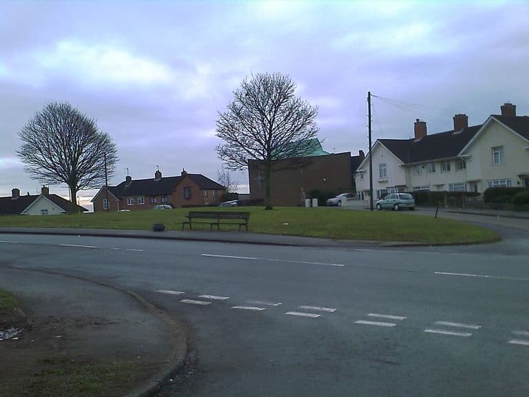
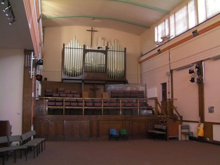
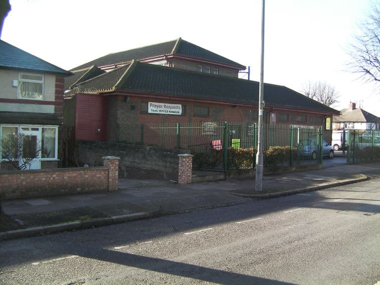
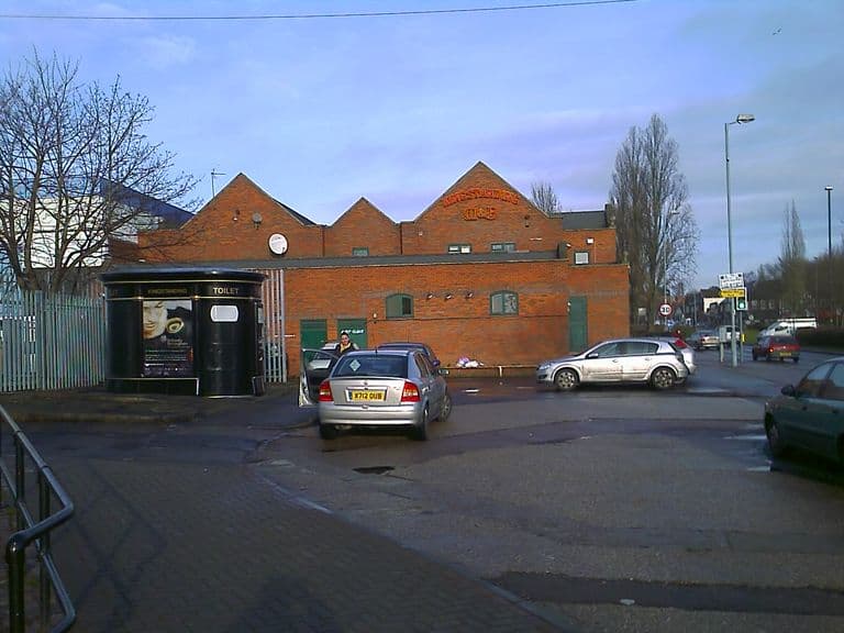
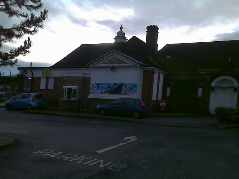
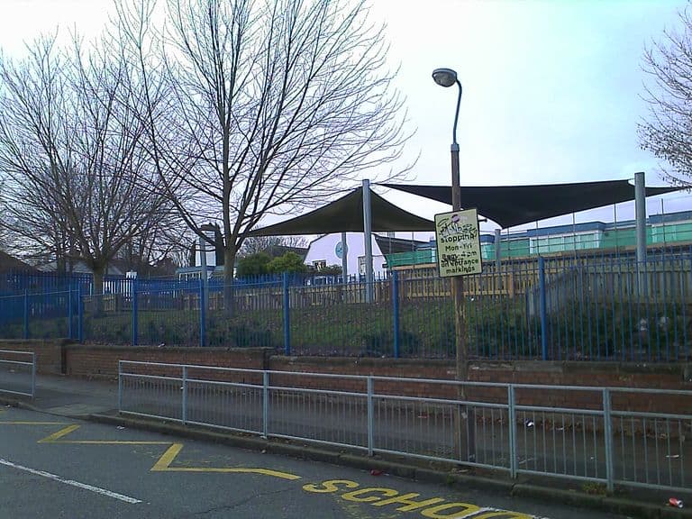
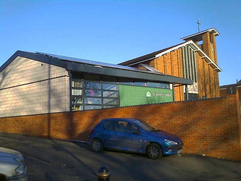
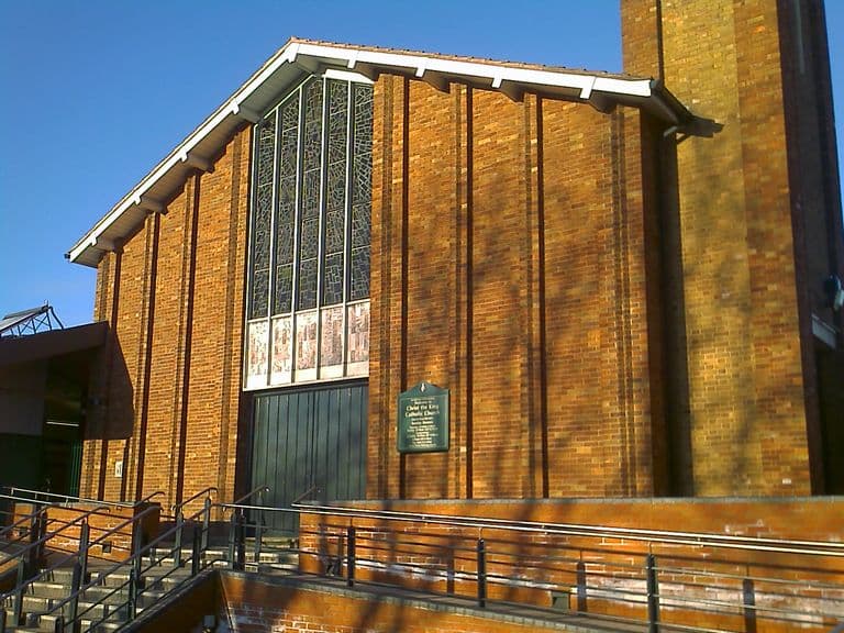
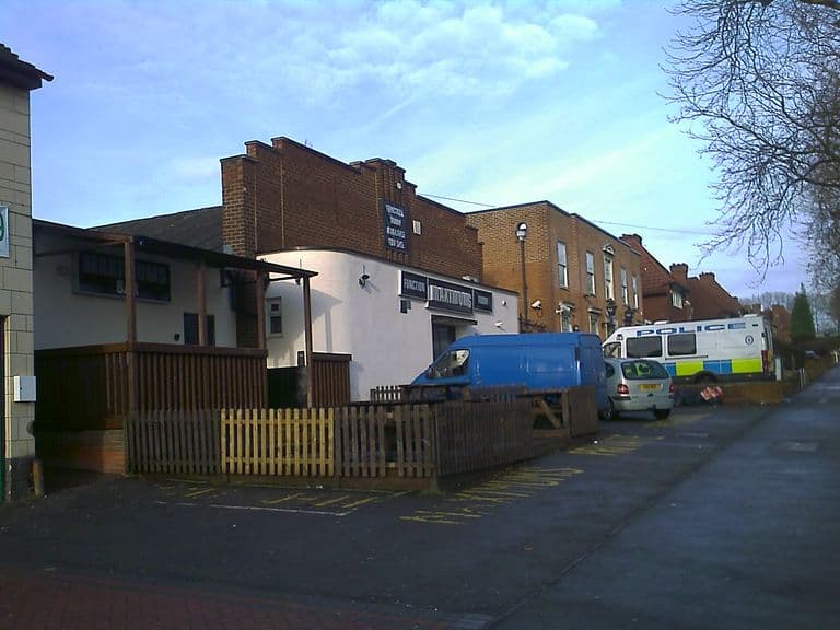
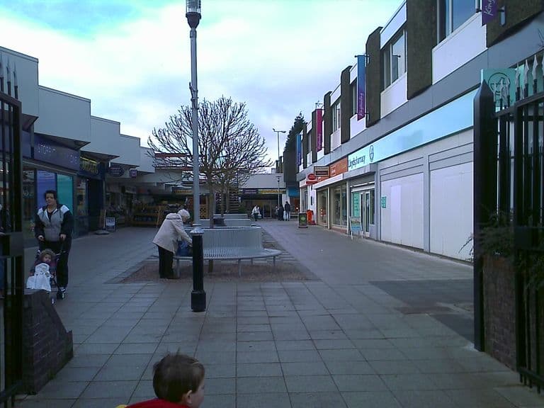
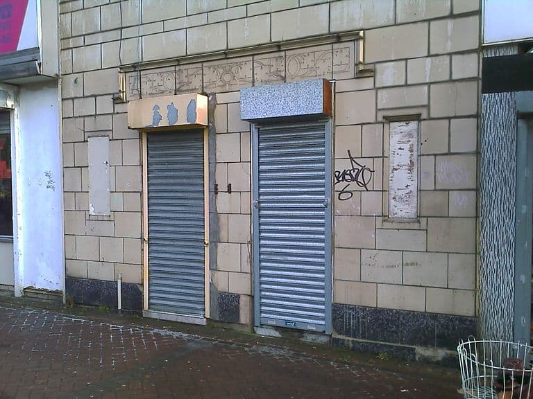
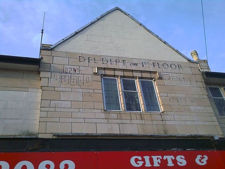
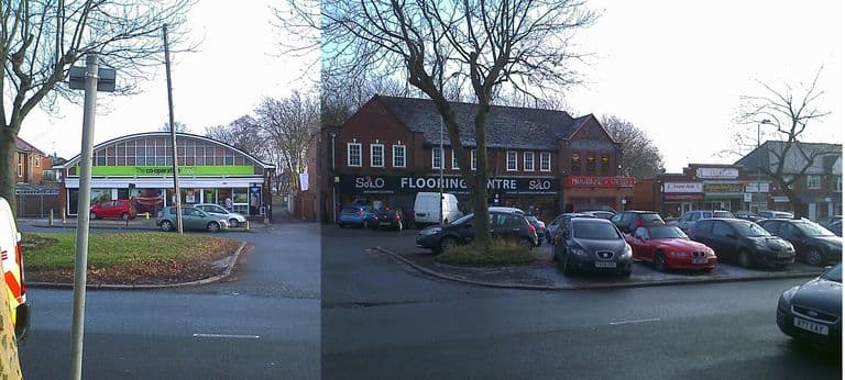
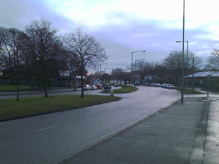
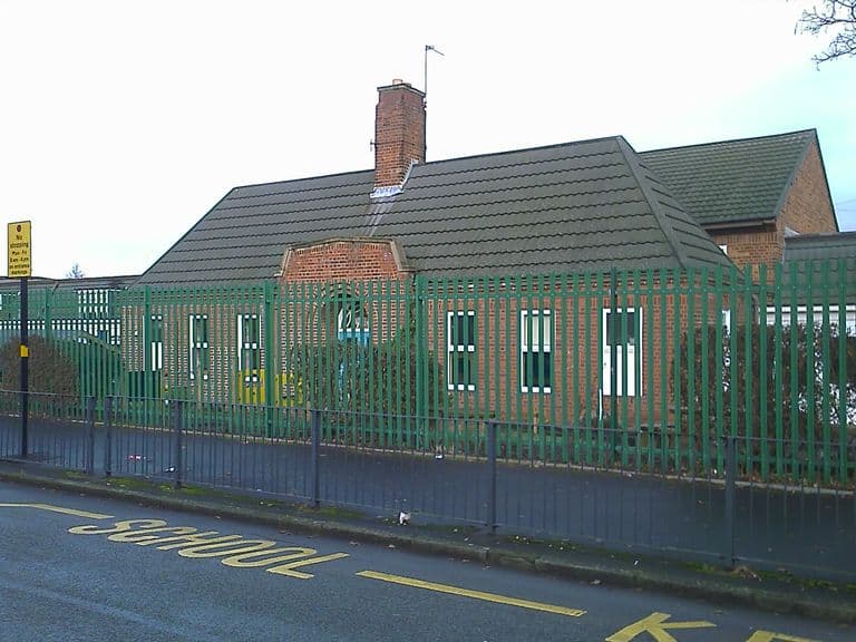
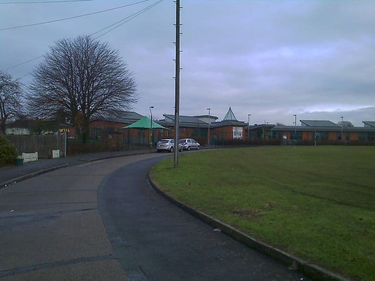
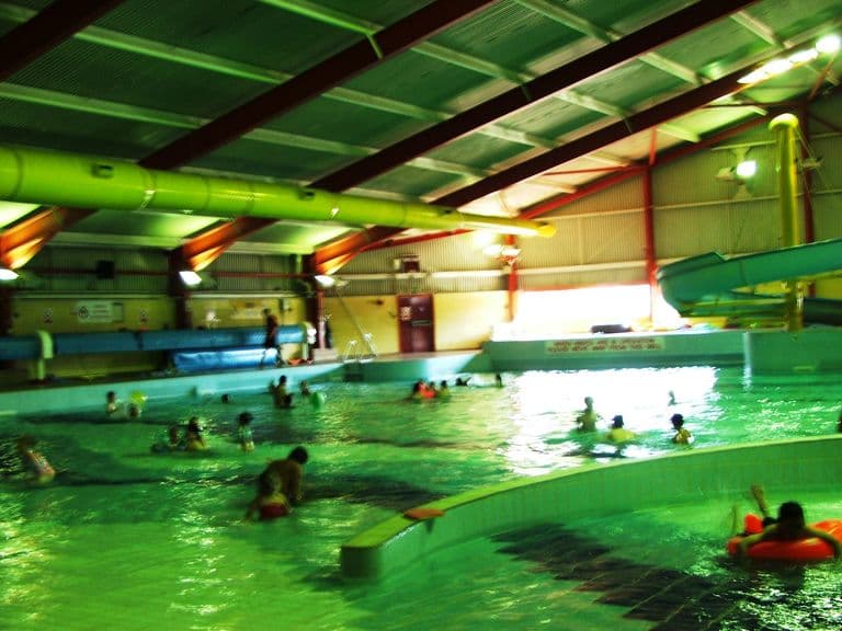
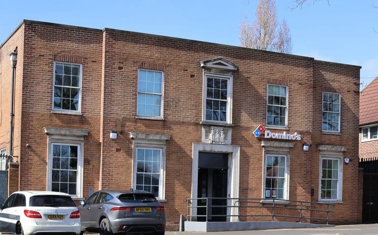
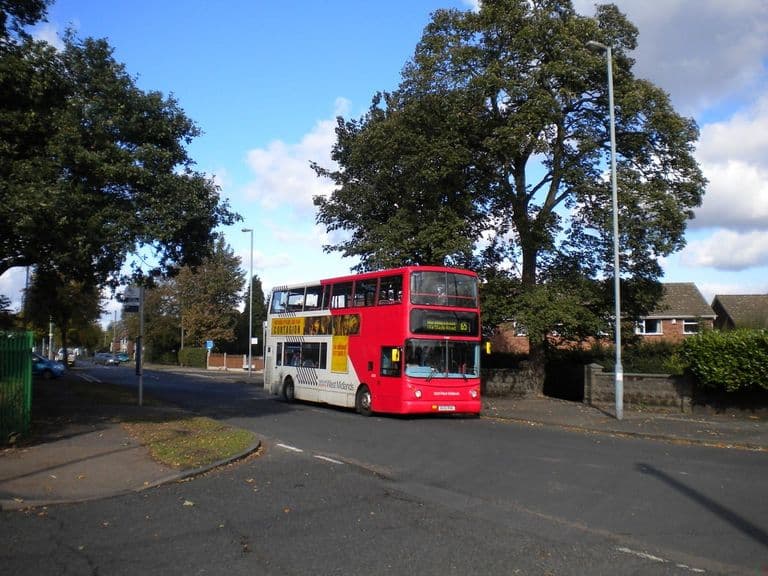
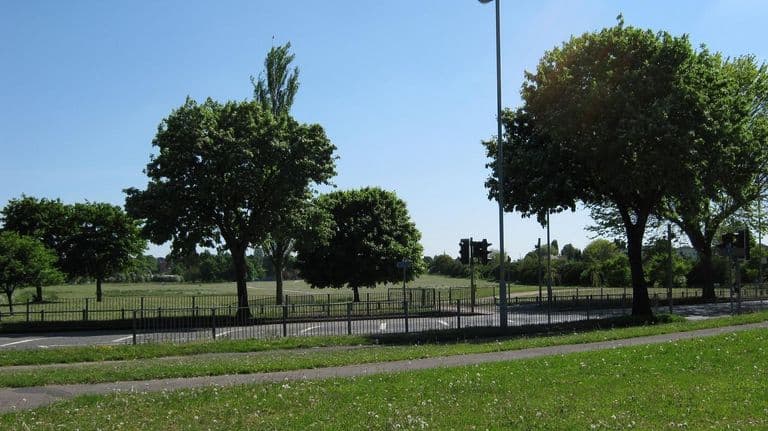
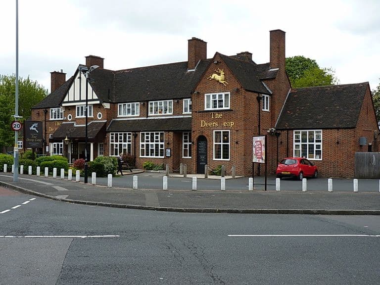
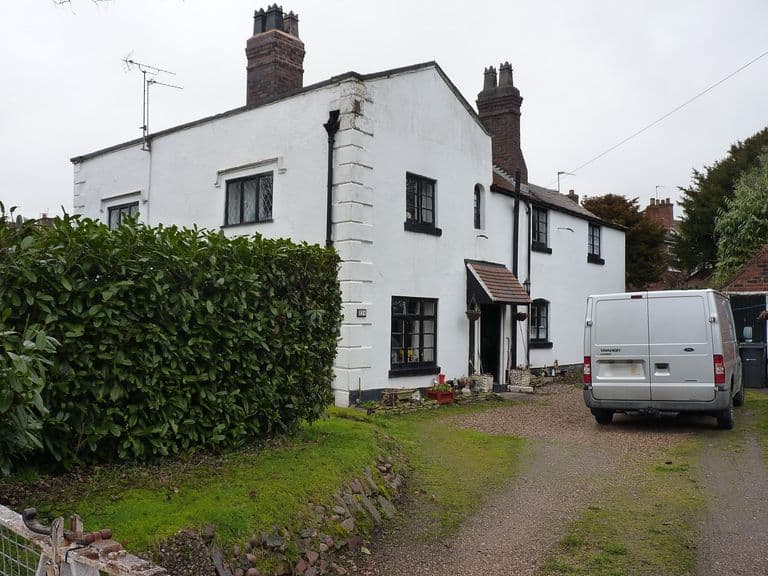
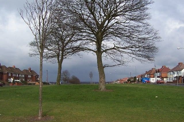
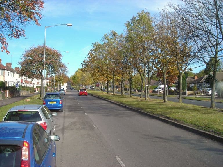
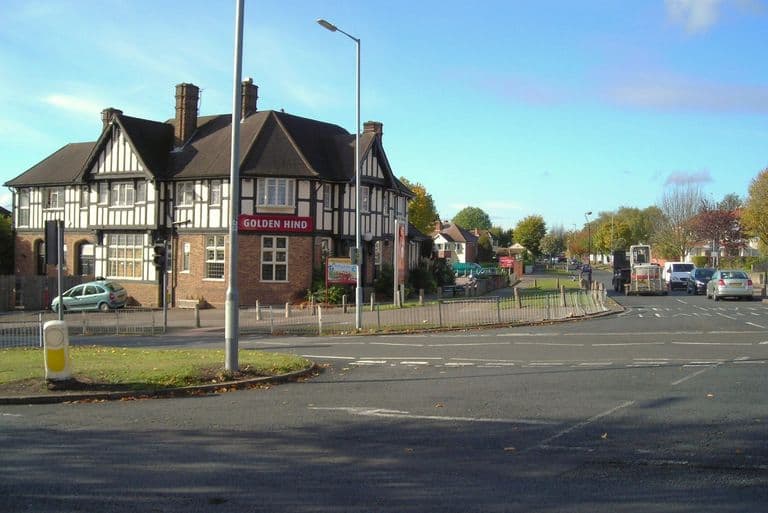
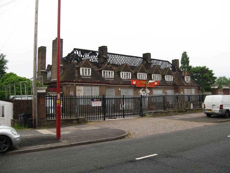
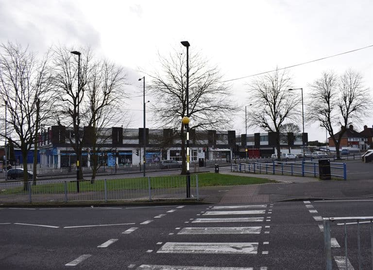
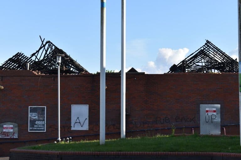
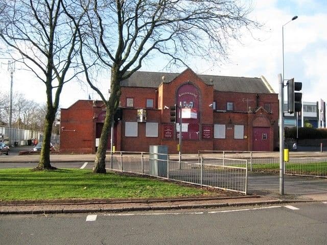
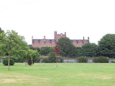
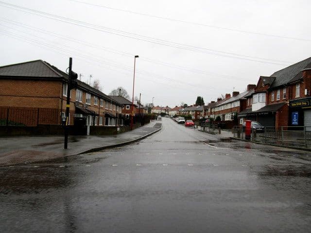
Oscott.jpg2013 · Chester RoadPhoto: BoldmereBoy, 2013 · CC BY-SA 3.0 Witton Lodge Road - Perry Common, Birmingham2014 · Witton Lodge RoadPhoto: Martin Richard Phelan, 2014 · CC BY-SA 2.0 Hawthorn Road, Kingstanding, Birmingham - Andy Mabbett - 2012-07-20 - 022012 · Hawthorn RoadPhoto: Andy Mabbett, 2012 · CC BY-SA 4.0 Library, shops, pub - Kingstanding, North Birmingham2018 · Kingstanding RoadPhoto: Martin Richard Phelan, 2018 · CC BY-SA 2.0 The church hall, Kingstanding Road, 20092009 · Kingstanding RoadImage: Google Street View, 2009 (watermark on the image; as shown on Voices of Kingstanding). Reproduced via Chris Hillcox, Voices of Kingstanding. The council depot, Ealing Grove, c. 2011c. 2011 · Ealing GroveSource unknown (as shown on Voices of Kingstanding). Reproduced via Chris Hillcox, Voices of Kingstanding. The Hare and Hounds as a hand car wash, 20112011 · Kingstanding RoadImage reproduced with permission of Chris Hillcox, Voices of Kingstanding. The Crossways pub, 20112011 · The Crossways pub, KingstandingImage reproduced with permission of Chris Hillcox, Voices of Kingstanding. Emmanuel Community Church (Victory Gospel Hall), Kettlehouse Road, 2011c. 2011 · Kettlehouse RoadImage reproduced with permission of Chris Hillcox, Voices of Kingstanding. Wheeldon recreation ground, 2010c. 2010 · Wheeldon recreation ground, KingstandingImage reproduced with permission of Chris Hillcox, Voices of Kingstanding. Warren Farm School, Dulwich Road, 2010c. 2010 · Dulwich RoadImage reproduced with permission of Chris Hillcox, Voices of Kingstanding. Twickenham Road Primary School, 2010c. 2010 · Twickenham RoadImage reproduced with permission of Chris Hillcox, Voices of Kingstanding. Sundridge Primary School, 2010c. 2010 · Sundridge RoadImage reproduced with permission of Chris Hillcox, Voices of Kingstanding. St Luke’s Church, Caversham Road, 2010c. 2010 · Caversham RoadImage reproduced with permission of Chris Hillcox, Voices of Kingstanding. The Link Church, Brookwell Road, 2010c. 2010 · Brookwell RoadImage reproduced with permission of Chris Hillcox, Voices of Kingstanding. St Mark’s Church, Bandywood Crescent, 2010c. 2010 · Bandywood CrescentImage reproduced with permission of Chris Hillcox, Voices of Kingstanding. Inside the Kings Road Methodist church hall, 2010c. 2010 · Kings RoadImage reproduced with permission of Chris Hillcox, Voices of Kingstanding. Kingstanding Methodist Church, Kings Road, 2010c. 2010 · Kings RoadImage reproduced with permission of Chris Hillcox, Voices of Kingstanding. Kingstanding Police Station, 2010c. 2010 · Kingstanding Police Station, KingstandingImage reproduced with permission of Chris Hillcox, Voices of Kingstanding. The Kingstanding pub, 20112011 · The Kingstanding pub, the Circle, KingstandingImage reproduced with permission of Chris Hillcox, Voices of Kingstanding. McDonald’s in the former College Arms, College Road, c. 2010c. 2010–11 · College RoadImage reproduced with permission of Chris Hillcox, Voices of Kingstanding. Kingsthorne School, 2010c. 2010 · Cranbourne RoadImage reproduced with permission of Chris Hillcox, Voices of Kingstanding. St John’s Centre beside Christ the King church, 2010c. 2010 · St John’s Centre, beside Christ the King church, KingstandingImage reproduced with permission of Chris Hillcox, Voices of Kingstanding. Christ the King Catholic Church, 2010c. 2010 · Christ the King Catholic Church, KingstandingImage reproduced with permission of Chris Hillcox, Voices of Kingstanding. The former billiard hall by the police station, c. 2011c. 2010–11 · Kingstanding RoadImage reproduced with permission of Chris Hillcox, Voices of Kingstanding. Kingstanding shopping centre, 2010c. 2010 · Kingstanding shopping centre, the Circle, KingstandingImage reproduced with permission of Chris Hillcox, Voices of Kingstanding. Shuttered doorways under a tiled frieze, the Circle, c. 2011c. 2010–11 · The Circle, KingstandingImage reproduced with permission of Chris Hillcox, Voices of Kingstanding. Faded toy-shop lettering above a shop at the Circle, c. 2011c. 2010–11 · The Circle, KingstandingImage reproduced with permission of Chris Hillcox, Voices of Kingstanding. The old and new Co-op near the Circle, c. 2011c. 2010–11 · Kingstanding RoadImage reproduced with permission of Chris Hillcox, Voices of Kingstanding. Kingstanding Road, 2010c. 2010 · Kingstanding RoadImage reproduced with permission of Chris Hillcox, Voices of Kingstanding. Kings Road, 2010c. 2010 · Kings RoadImage reproduced with permission of Chris Hillcox, Voices of Kingstanding. The way up to “the Pimple” (Kingstanding Beacon), 2010c. 2010 · Hever AvenueImage reproduced with permission of Chris Hillcox, Voices of Kingstanding. Finchley Road recreation ground, 2010c. 2010 · Finchley RoadImage reproduced with permission of Chris Hillcox, Voices of Kingstanding. Conker Island in the snow, 2010c. 2010 · Conker Island, KingstandingImage reproduced with permission of Chris Hillcox, Voices of Kingstanding. Bandywood Road spinney, 2010c. 2010 · Bandywood RoadImage reproduced with permission of Chris Hillcox, Voices of Kingstanding. King’s Rise Primary School, 2010c. 2010 · Peckham RoadImage reproduced with permission of Chris Hillcox, Voices of Kingstanding. Kingsland Primary School, 2010c. 2010 · Kingsland RoadImage reproduced with permission of Chris Hillcox, Voices of Kingstanding. The leisure pool at Kingstanding Leisure CentreBefore February 2013 · Warren Farm RoadBirmingham City Council (BCC Leisure Centres), CC BY 2.0 The former police station as a pizza shop, 202526 March 2025 · Near Kingstanding Circle (52.5541, −1.8841)© Tony Hisgett, CC BY 2.0 The bus terminus at Perry Common, 20117 October 2011 · Court Lane© Richard Vince, CC BY-SA 2.0 (Geograph) Witton Lodge Road, Perry Common, 201022 May 2010 · Witton Lodge Road© Michael Westley, CC BY-SA 2.0 (Geograph) The Deers Leap, Queslett Road, 201312 June 2013 · Queslett Road© Richard Law, CC BY-SA 2.0 (Geograph) Yew Tree Cottages, Oscott: a 17th-century survivor8 March 2018 · Yew Tree Cottages, Oscott (west of Old Oscott)© Richard Law, CC BY-SA 2.0 (Geograph) The King's Standing mound, 200522 February 2005 · Kingstanding Road© Adrian Bailey, CC BY-SA 2.0 (Geograph) Kingstanding Road from the College Road end, 201126 October 2011 · Kingstanding Road© Antony Dixon, CC BY-SA 2.0 (Geograph) The Golden Hind, Kingstanding Road, 201126 October 2011 · Kingstanding Road© Antony Dixon, CC BY-SA 2.0 (Geograph) The Hare and Hounds after the fire, 201630 May 2016 · Kingstanding Road© Martin Richard Phelan, CC BY-SA 2.0 (Geograph) The Kingstanding Precinct just before demolition, 20202 February 2020 · Kettlehouse Road© Martin Richard Phelan, CC BY-SA 2.0 (Geograph) The Kingstanding pub roofless after the fire, 201911 May 2019 · Kingstanding Road© Martin Richard Phelan, CC BY-SA 2.0 (Geograph) The Kingstanding pub, closed and for sale, 20183 January 2018 · Kingstanding Road© Martin Richard Phelan, CC BY-SA 2.0 (Geograph) St Mary’s College, Oscott, from the south, 200517 June 2005 · St Mary’s College, Oscott (viewed from the south)Photo: Adrian Bailey, CC BY-SA 2.0, via Geograph / Wikimedia Commons Harringay Road, 201424 June 2014 · Harringay RoadPhoto: Martin Richard Phelan, CC BY-SA 2.0, via Geograph / Wikimedia Commons Westwards along Warren Farm Road, 201424 June 2014 · Warren Farm RoadPhoto: Martin Richard Phelan, CC BY-SA 2.0, via Geograph / Wikimedia Commons A wet Hartley Road, 201815 January 2018 · Hartley RoadPhoto: Roy Hughes, CC BY-SA 2.0, via Geograph / Wikimedia Commons Across Kingstanding Road, 20193 January 2019 · Kingstanding RoadPhoto: Martin Richard Phelan, CC BY-SA 2.0, via Geograph / Wikimedia Commons Over to Warren Farm Road, 20191 January 2019 · Warren Farm RoadPhoto: Martin Richard Phelan, CC BY-SA 2.0, via Geograph / Wikimedia Commons Army Reserve Centre, Kingstanding Road, 2023 (1)18 September 2023 · Kingstanding RoadPhoto: Andy Mabbett, CC BY-SA 4.0, via Wikimedia Commons Army Reserve Centre, Kingstanding Road, 2023 (2)18 September 2023 · Kingstanding RoadPhoto: Andy Mabbett, CC BY-SA 4.0, via Wikimedia Commons Army Reserve Centre, Kingstanding Road, 2023 (3)18 September 2023 · Kingstanding RoadPhoto: Andy Mabbett, CC BY-SA 4.0, via Wikimedia Commons
Maps, plans and analysis
Maps and diagrams from the 2026 study of Hurlingham Road, and historic plans.
Queslett to Old Oscott and the Circle: OS 1:2500, 1962Revised 1961, published 1962 · Kingstanding Circle (west side), Kingstanding Road and Old OscottReproduced with the permission of the National Library of Scotland (CC BY) Kingstanding east to New Oscott, house by house: OS 1:2500, 1963Revised 1961–1962, published 1963 · Kingstanding Circle (east side) and Kettlehouse estateReproduced with the permission of the National Library of Scotland (CC BY) Kingstanding and Perry Common in the 1960s: OS six-inch, 1966Revised 1951–1965, published 1966 · Kingstanding, Perry Common, Perry Barr and WittonReproduced with the permission of the National Library of Scotland (CC BY) North Kingstanding around 1970: OS six-inch, 1971Revised 1961–1970, published 1971 · North Kingstanding, Queslett, Pheasey and Banners GateReproduced with the permission of the National Library of Scotland (CC BY) North of the Circle in the 1950s: OS six-inch, 1955Revised pre-1930 to 1955, published 1955 · North Kingstanding, Queslett, Pheasey and Banners GateReproduced with the permission of the National Library of Scotland (CC BY) Kingstanding and Perry Common in the 1950s: OS six-inch, 1956Revised 1930–1955, published 1956 · Kingstanding, Perry Common, Perry Barr and WittonReproduced with the permission of the National Library of Scotland (CC BY) Queslett, Pheasey and the northern estate: OS six-inch, 1938 revisionRevised 1938, published c.1945 · Queslett, Pheasey and north KingstandingReproduced with the permission of the National Library of Scotland (CC BY) College Road and Perry Common west: OS 25-inch, 1937 revisionRevised 1937, published 1945 · College Road and western Perry CommonReproduced with the permission of the National Library of Scotland (CC BY) Perry Common and 'the Ring': OS 25-inch, 1937 revisionRevised 1937, published 1945 · Perry Common, Witton Lodge and Witton LakesReproduced with the permission of the National Library of Scotland (CC BY) North Kingstanding built up: OS 25-inch, 1938 revisionRevised 1938, published 1947 · North Kingstanding, Queslett and Pheasey edgeReproduced with the permission of the National Library of Scotland (CC BY) North Kingstanding and Queslett before the estate: OS 25-inch, 1914Revised 1912, published 1914 · North Kingstanding, Queslett and Pheasey edgeReproduced with the permission of the National Library of Scotland (CC BY) The eastern estate complete: OS 25-inch, 1937 revisionRevised 1937, published 1940 · Eastern Kingstanding estateReproduced with the permission of the National Library of Scotland (CC BY) Kettlehouse and Warren Farm before the estate: OS 25-inch, 1914Revised 1913, published 1914 · Eastern Kingstanding: Warren Farm, Kettlehouse and New OscottReproduced with the permission of the National Library of Scotland (CC BY) The last map before the estate: OS six-inch, 1921Revised 1913, published 1921 · Kingstanding, Perry Common, Old Oscott and New OscottReproduced with the permission of the National Library of Scotland (CC BY) Farms and lanes: OS six-inch map, 1904Revised 1901, published 1904 · Kingstanding, Perry Common, Old Oscott and New OscottReproduced with the permission of the National Library of Scotland (CC BY) Witton Lodge and Perry Common Road, 1880sSurveyed 1880s; published 1884–1891 (first edition) · Witton Lodge, Perry Common, Short Heath and New OscottOrdnance Survey, 1880s; via Wikimedia Commons The fields of Kingstanding: OS 25-inch map, 1880sSurveyed 1882–83; published 1884–1891 (first edition) · Kingstanding, Queslett, Old Oscott and KettlehouseOrdnance Survey, 1880s; via Wikimedia Commons King's Standing on the first Ordnance Survey map, 1834Surveyed 1814–17, revised 1831–32, published 1834 (this copy printed 1863) · Perry Barr Common (later Kingstanding), Old Oscott, Banners Gate and Sutton Park edgeReproduced with the permission of the National Library of Scotland (CC BY) Kynoch's and GEC marked as targets: German map detail, 1941Information to 31 December 1941; published 1941–42 · Witton and Perry Barr, BirminghamDavid Rumsey Map Collection, David Rumsey Map Center, Stanford Libraries (CC BY-NC-SA 3.0) German invasion map of Perry Barr and Witton, 1941Information to 31 December 1941 (Ausgabe Nr. 2, Stand 1941); published 1941–42 · Perry Barr, Witton, Aston and Gravelly Hill, Birmingham (south of Kingstanding)David Rumsey Map Collection, David Rumsey Map Center, Stanford Libraries (CC BY-NC-SA 3.0) German target map of Witton, with Kingstanding's edge, 1939December 1939 · North-east Birmingham: Witton, Erdington and Castle Bromwich, with New Oscott and Kings Vale at the top-left edgeImage: IWM (LBY LUFT 518). Luftwaffe target map, December 1939 The War Office map of Kingstanding: 'Second War Revision', 1940Second War Revision 1940; this copy printed 1943 · Kingstanding, Queslett, Pheasey, Old and New Oscott (north Birmingham)Reproduced with the permission of the National Library of Scotland (War Office GSGS 3907, Sheet 72, 1940 war revision) Street atlas of Birmingham, 1939: the Kingstanding Road area1939 · Kingstanding and OscottStreet Atlas of Birmingham, 1939, via Wikimedia Commons. Public domain Kings Road, Carshalton Road and St Luke’s: OS 1:1,250 plan, 1962Surveyed January 1962 · Kings RoadOrdnance Survey, 1962. Reproduced with the permission of the National Library of Scotland (CC BY 4.0) The finished estate: OS six-inch map, 1938 additionsRevision of 1913 with additions in 1938, published c. 1945 · Kingstanding, Great Barr and Perry Barr (Staffordshire sheet LXIX.NW)Ordnance Survey, c. 1945. Reproduced with the permission of the National Library of Scotland (CC BY 4.0) The first detailed survey: OS six-inch map, 1884Surveyed 1882–83, published 1884 · Kingstanding, Great Barr and Perry Barr (Staffordshire sheet LXIX.NW)Ordnance Survey, 1884. Reproduced with the permission of the National Library of Scotland (CC BY 4.0) The new estate: OS 25-inch map, revised 1937Revised 1937, published 1941 · Kingstanding Circle and Old Oscott (Staffordshire sheet LXIX.1)Ordnance Survey, 1941. Reproduced with the permission of the National Library of Scotland (CC BY 4.0) Before the estate: OS 25-inch map, revised 1913Revised 1913, published 1914 · Kingstanding and Old Oscott (Staffordshire sheet LXIX.1)Ordnance Survey, 1914. Reproduced with the permission of the National Library of Scotland (CC BY 4.0) Location of Hurlingham Road2026 · Hurlingham RoadContains data © OpenStreetMap contributors (ODbL) Map regression: 1888, 1955 and today2026 · Hurlingham Road1888 and 1955 Ordnance Survey via MapTiler / National Library of Scotland (CC BY); modern imagery © MapTiler, © OpenStreetMap contributors The composition today, from the air2026 · Hurlingham RoadImagery © MapTiler, © OpenStreetMap contributors Figure-ground plan of Hurlingham Road and Danesbury Crescent2026 · Hurlingham RoadContains data © OpenStreetMap contributors (ODbL) How straight is Hurlingham Road?2026 · Hurlingham RoadContains data © OpenStreetMap contributors (ODbL) Every estate street over 400 metres, ranked by straightness2026 · Hurlingham RoadContains data © OpenStreetMap contributors (ODbL) The axis, the oval and the fall of the ground2026 · Hurlingham RoadContains data © OpenStreetMap contributors (ODbL); elevation Copernicus EU-DEM v1.1 Cross-section: Hurlingham Road and a typical estate street2026 · Hurlingham RoadContains data © OpenStreetMap contributors (ODbL) Building setbacks by street2026 · Hurlingham RoadContains data © OpenStreetMap contributors (ODbL) Three Birmingham estates compared2026 · Hurlingham RoadContains data © OpenStreetMap contributors (ODbL) Street trees on Hurlingham Road and Danesbury Crescent2026 · Hurlingham RoadContains data © OpenStreetMap contributors (ODbL); underlying tree data Birmingham City Council, December 2016 Map of street trees by age class2026 · Hurlingham RoadContains data © OpenStreetMap contributors (ODbL); underlying tree data Birmingham City Council, December 2016 Five key viewpoints2026 · Hurlingham RoadContains data © OpenStreetMap contributors (ODbL) Architectural details: interpretive drawings2026 · Hurlingham RoadDrawn for the Hurlingham Road study from Library of Birmingham record photographs Details from the 1930s record photographs1930–32 (original photographs) · Hurlingham RoadEnlargements from Library of Birmingham, Local Studies and History Department record photographs, 1930–32 Entrance surround, 1930s (detail)1930–32 (original photographs) · Hurlingham RoadEnlargement from a Library of Birmingham, Local Studies and History Department record photograph Oscott on the skyline, 1929 (detail)1930–32 (original photographs) · Hurlingham RoadDetail from Library of Birmingham, Local Studies and History Department, 3/1286 Indicative boundary options A to C2026 · Hurlingham RoadContains data © OpenStreetMap contributors (ODbL) The four boundary options tested2026 · Hurlingham RoadContains data © OpenStreetMap contributors (ODbL) Proposed conservation area boundary (Option D)2026 · Hurlingham RoadContains data © OpenStreetMap contributors (ODbL)
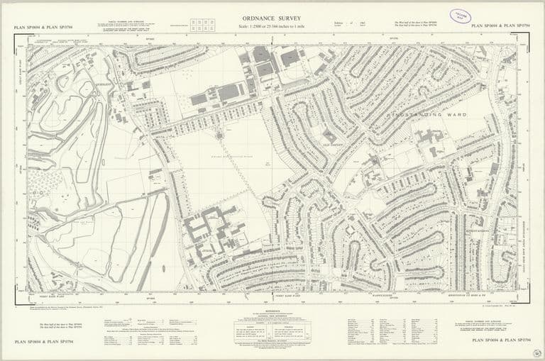
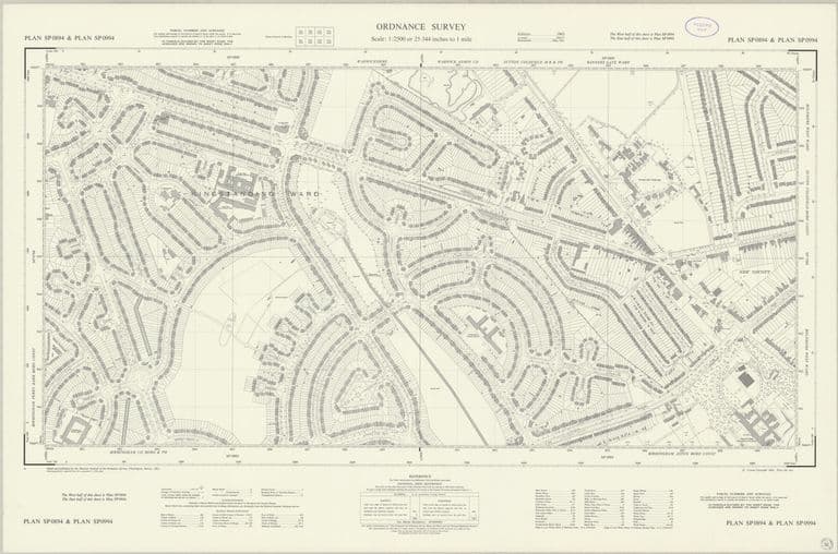
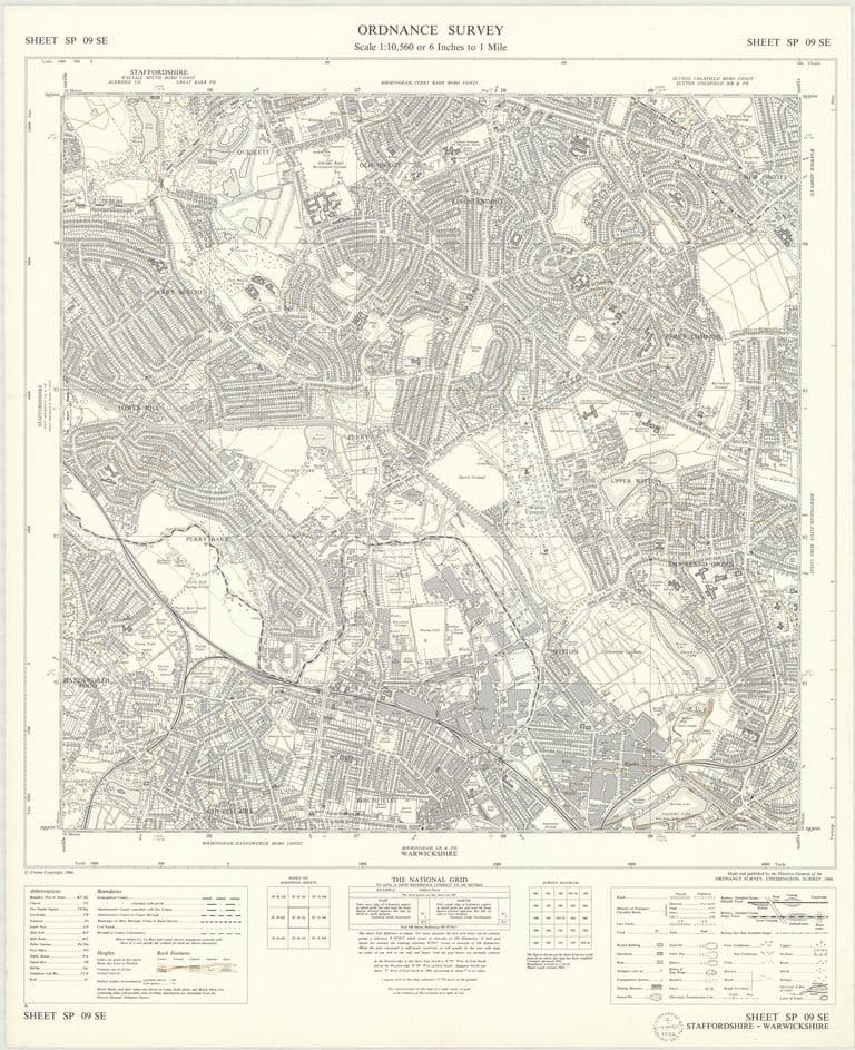
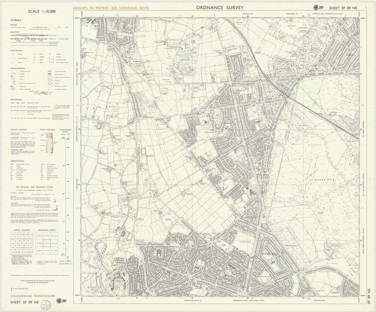
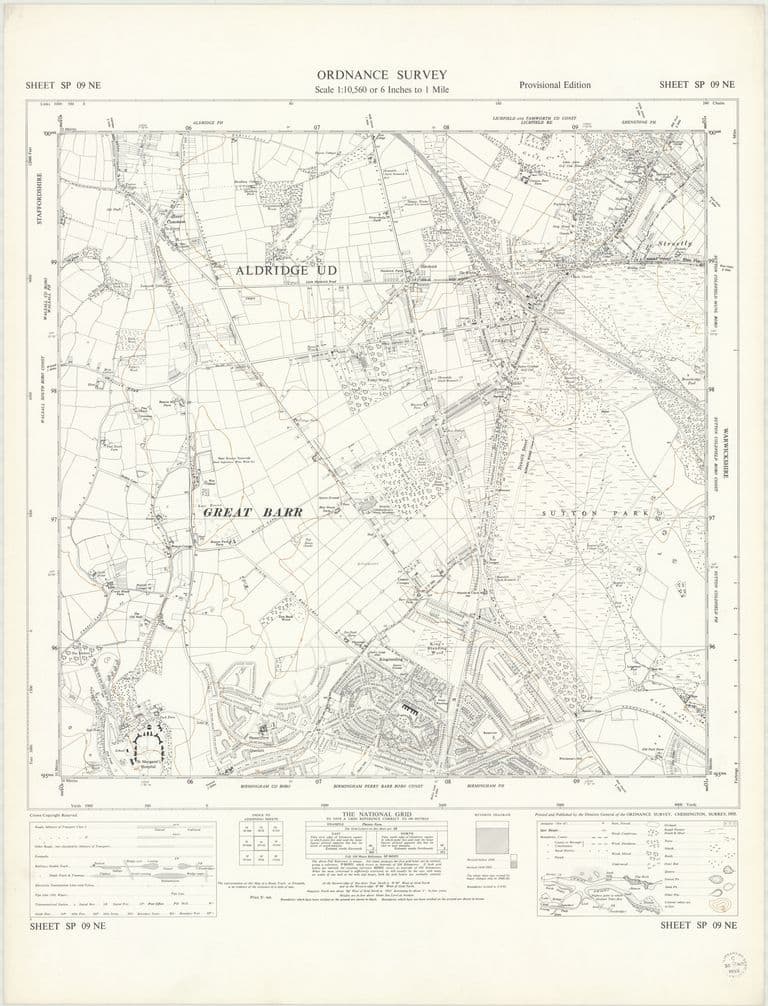
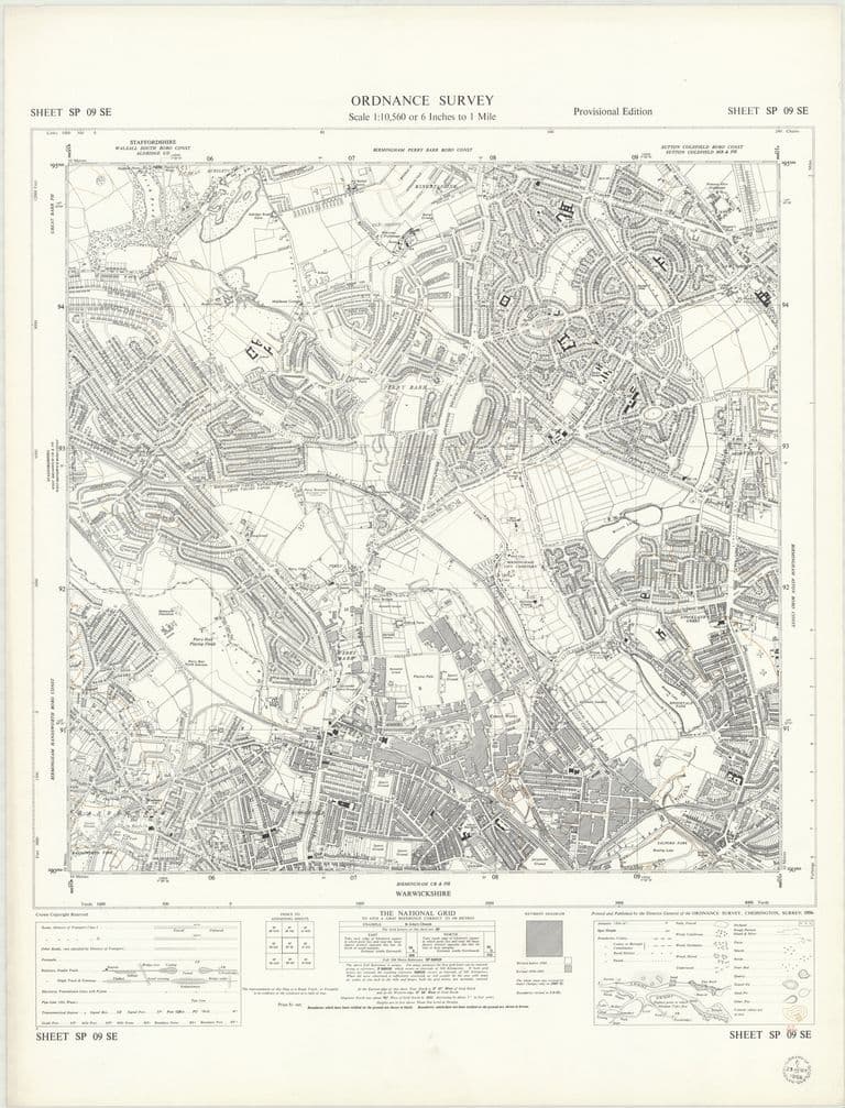
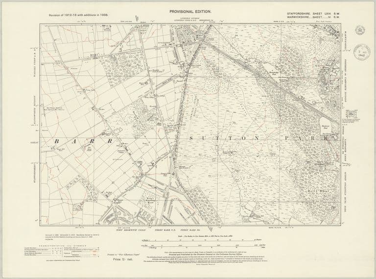
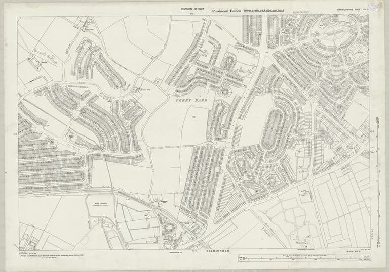
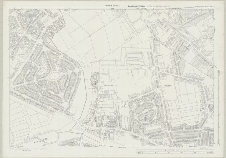
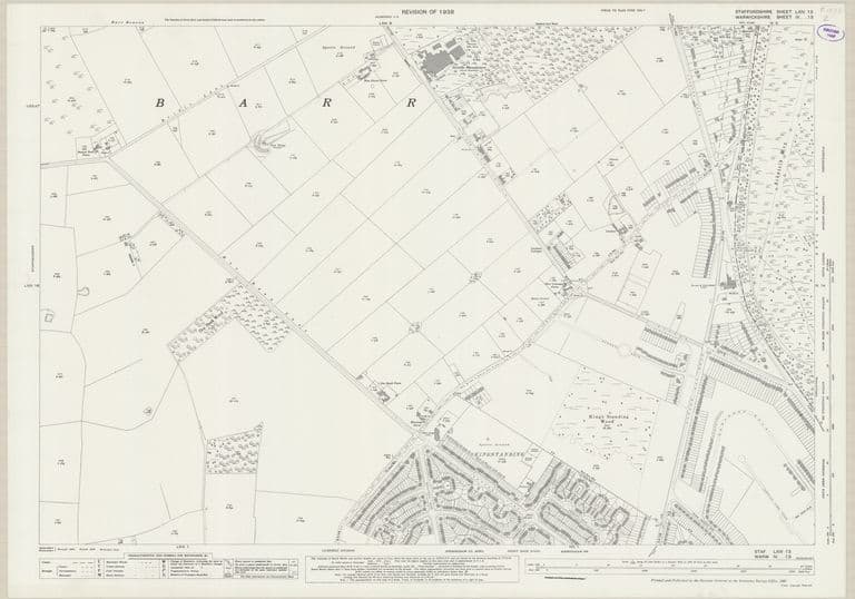
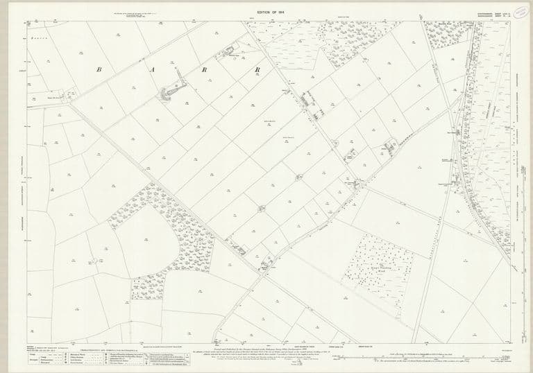
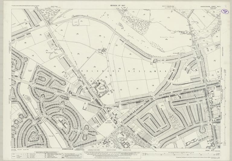
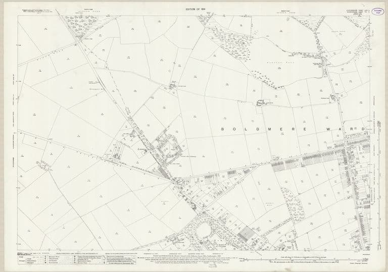
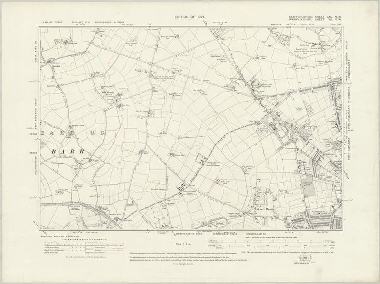
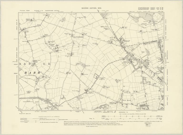
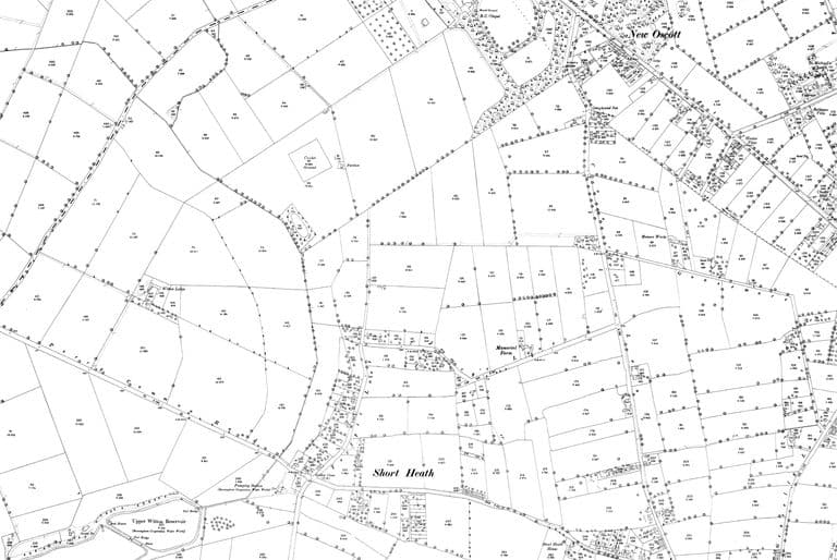
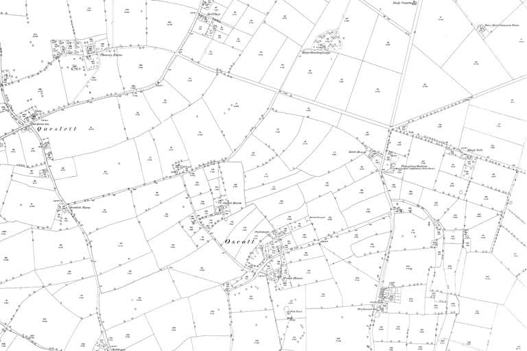
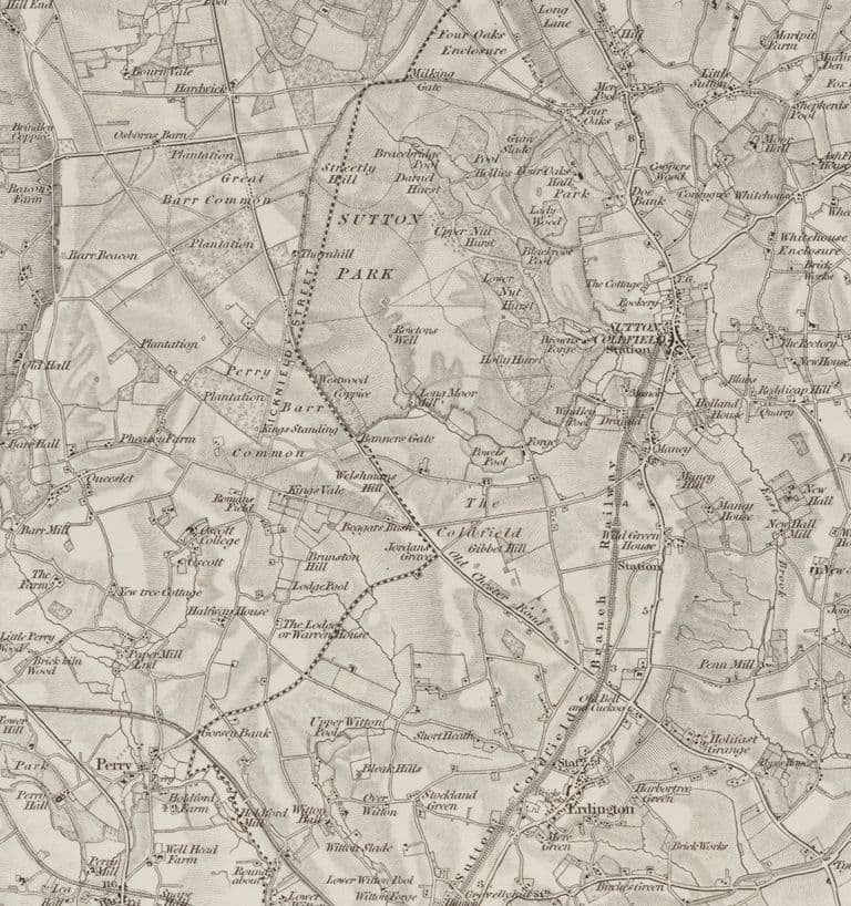
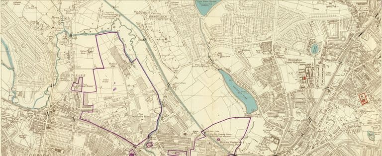
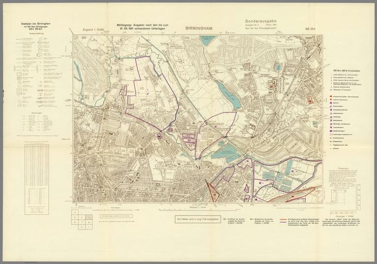
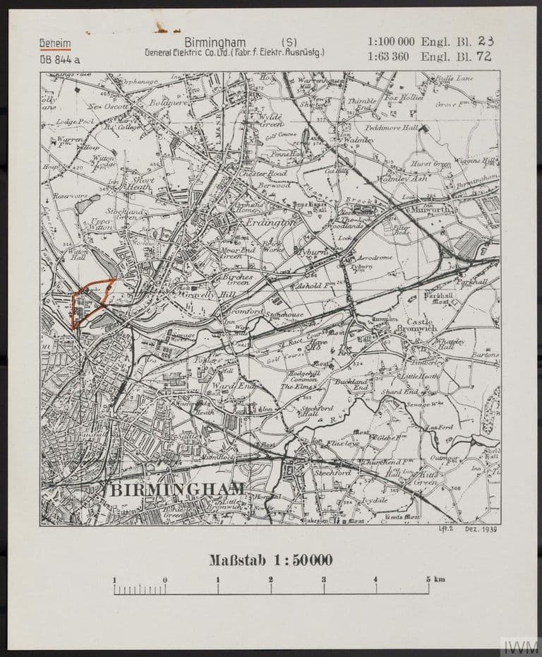
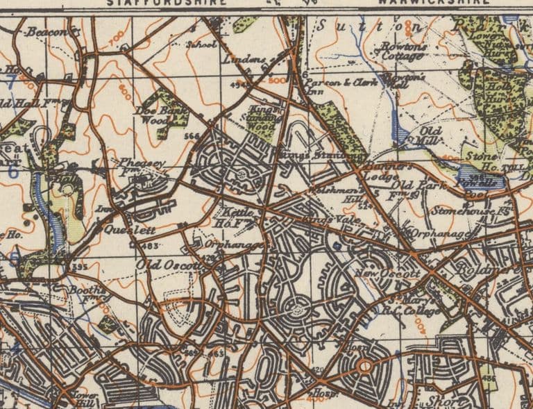
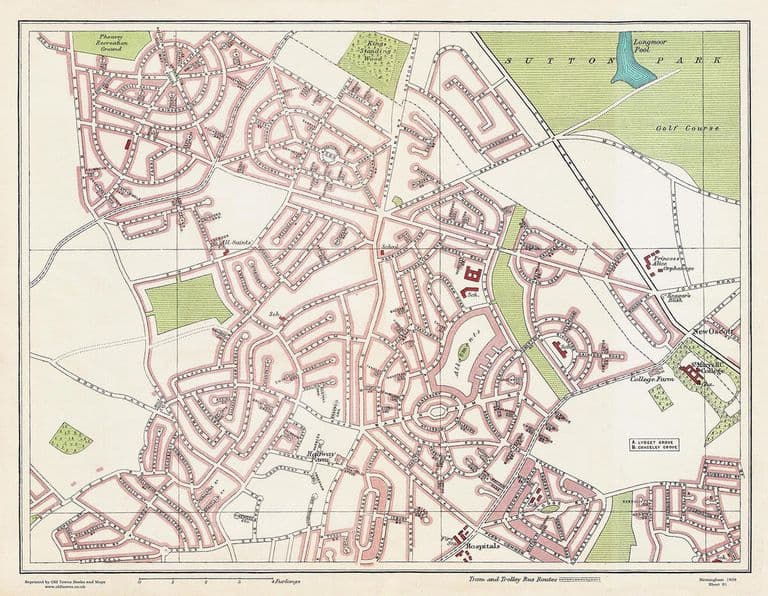
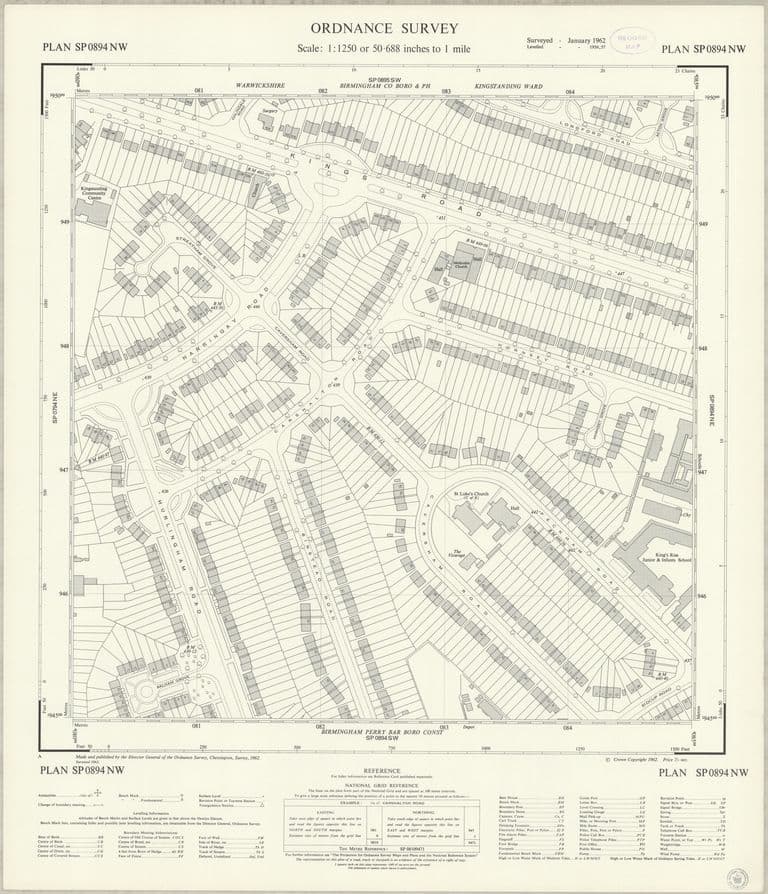
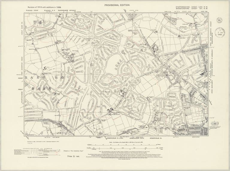
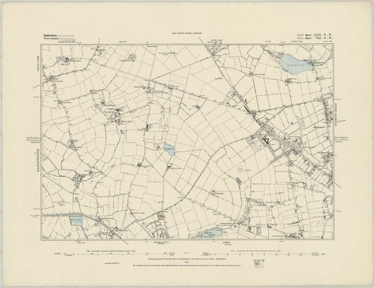
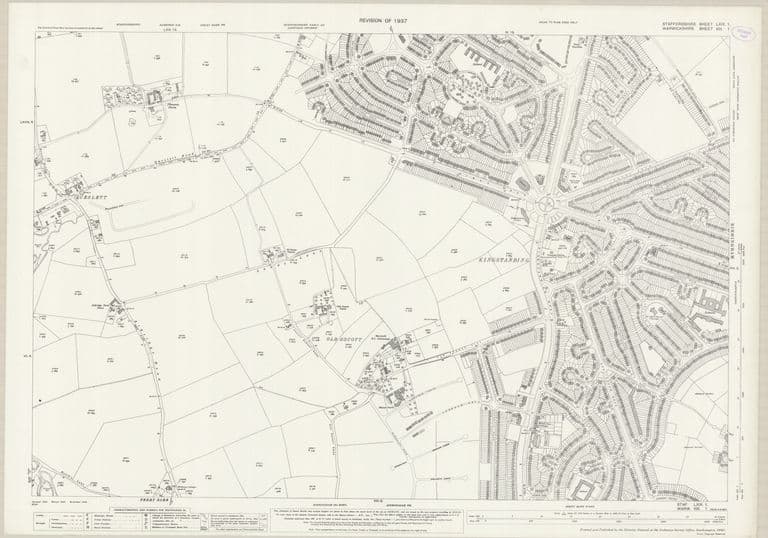
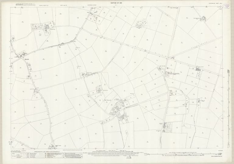
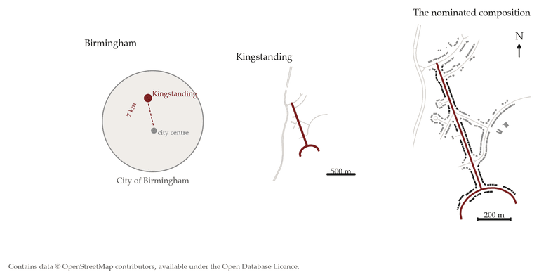
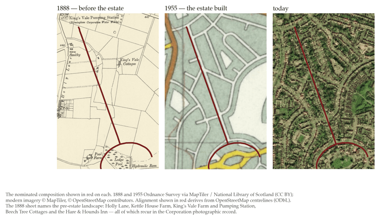
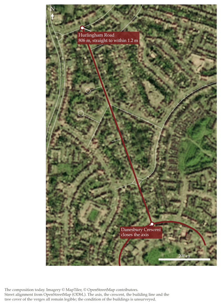
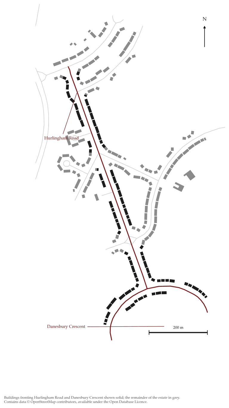
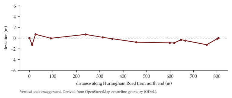
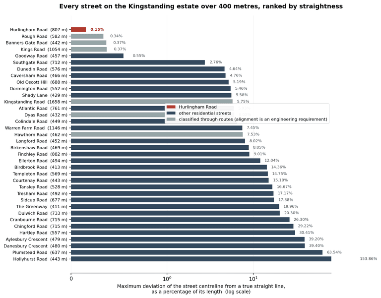
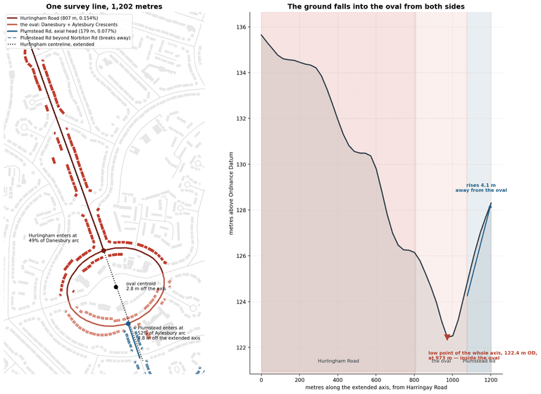
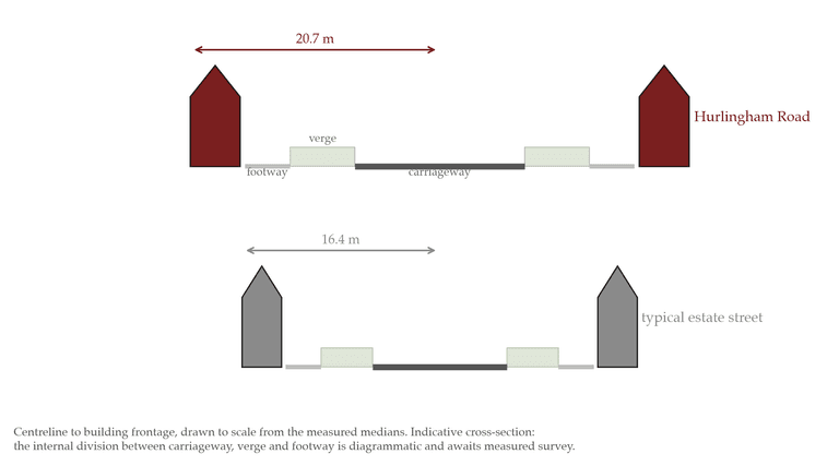
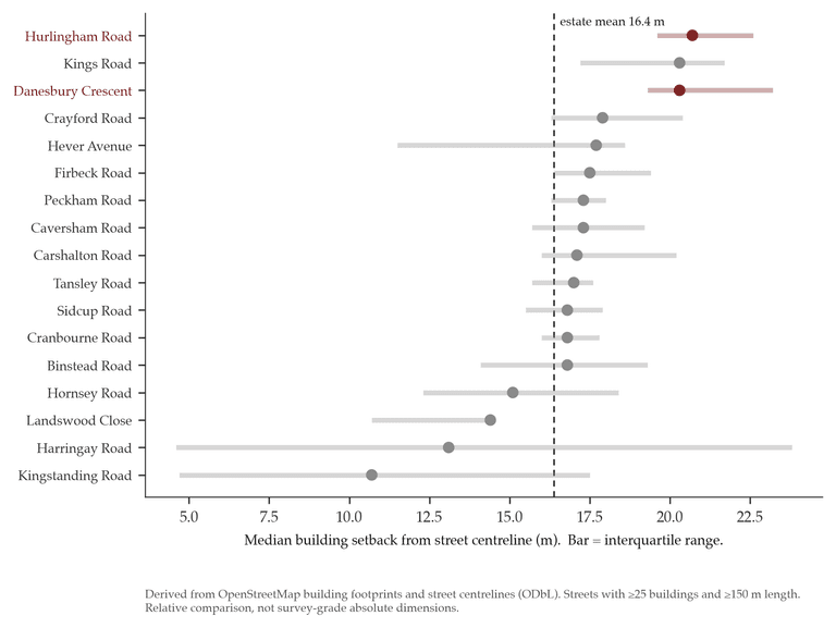
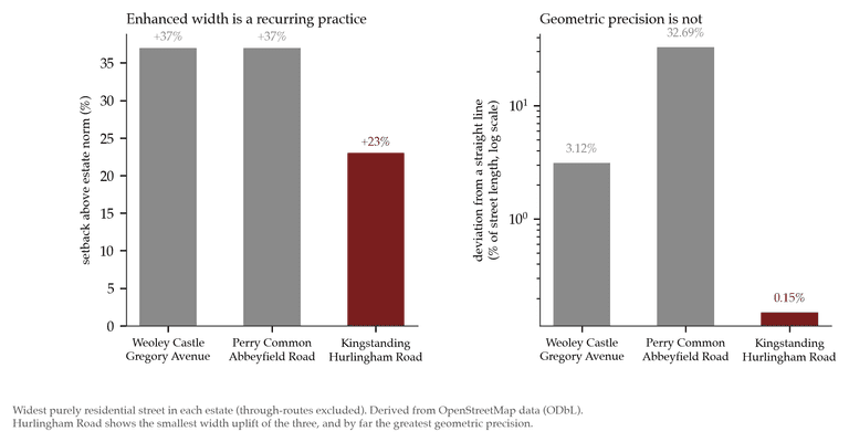
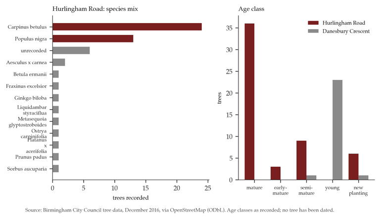
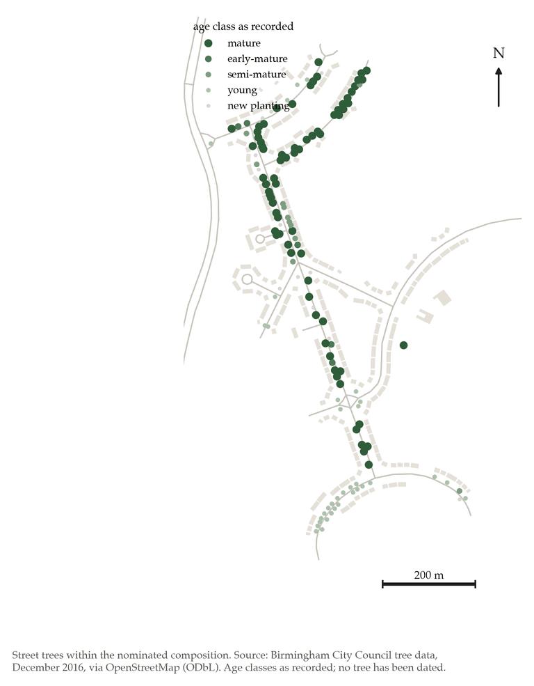
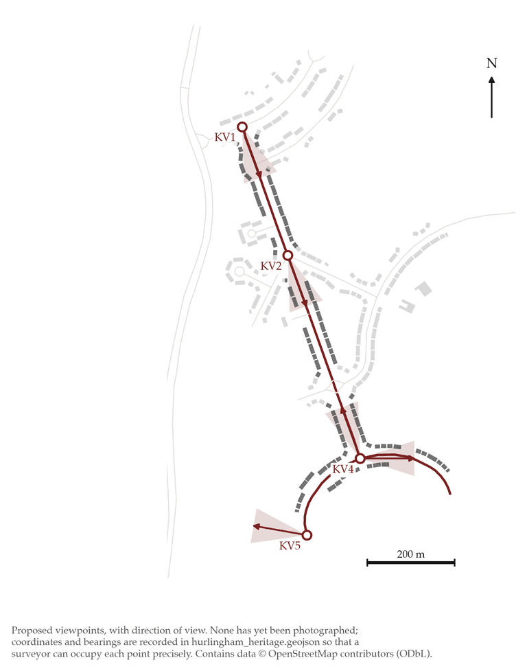
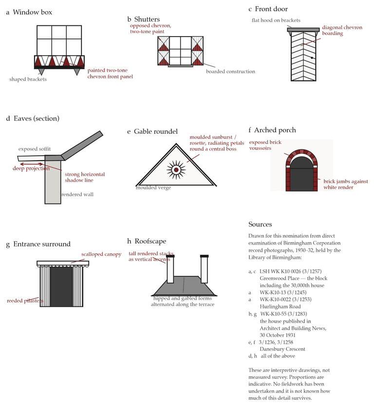
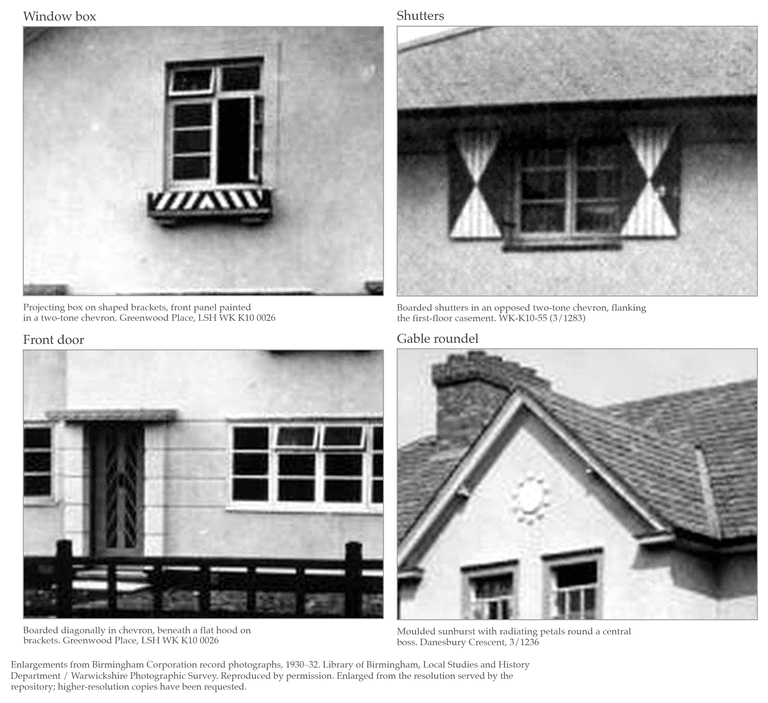
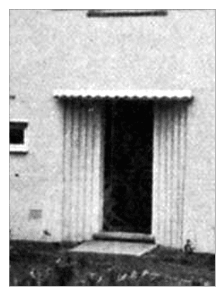

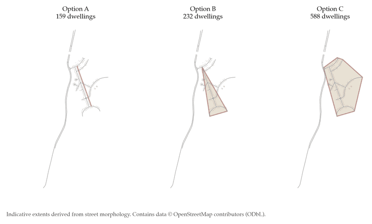
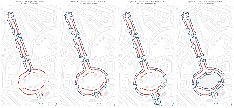
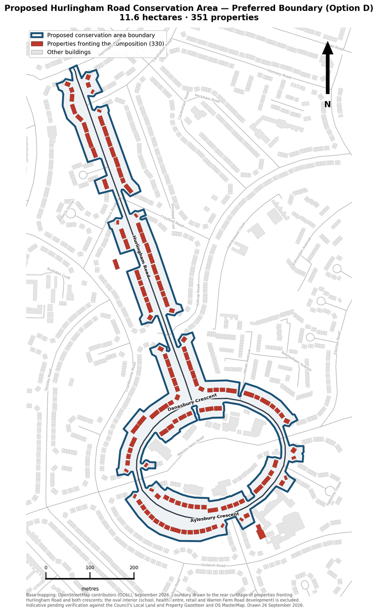
Latest from the community
What neighbours are saying and sharing — join in on any photo, street, place or history page.
Loading…
Historic photographs are reproduced by permission of the Library of Birmingham, Local Studies and History Department, reproduced with permission from Chris Hillcox’s Voices of Kingstanding, or are in the public domain; recent photographs are used under Creative Commons licences, and some have been shared by local people. Each picture’s own page gives its full source, reference and licence. See also our gallery and Voices of Kingstanding.