Birmingham survived the Blitz. Then it rebuilt itself, clearing whole districts and looping a road of concrete round its centre, something the bombers had never done. Behind it stood an engineer who had drawn up the plans before the first bomb fell. Half a century on, he still divides the city: to some he dragged Birmingham out of the slums, to others he tore out its heart.
How did one council engineer gain such power over Birmingham’s streets, what did he think he was fixing, and why has the city spent half a century arguing over, and undoing, so much of what he built?
A long read · 23 places on the map · sources for every claim
Air photograph of central Birmingham in May 1950: a dense mesh of streets and rooftops.⇆19501974
The same square mile in 1950 (air survey) and 1974 (Ordnance Survey). Drag, or use the arrow keys. Reproduced with the permission of the National Library of Scotland (CC BY 4.0).
Manzoni in 90 seconds
1917
A councillor proposed a ‘loop’ of widened streets round the centre, almost the line the Inner Ring Road would follow forty years later.
1935
Herbert Manzoni, who had joined the council’s drains section in 1923, became City Engineer and Surveyor and at once began planning to rebuild whole districts.
1941
With the city still clearing up after the raids, he told the Birmingham Mail that the bombing had not changed his plans: he only wanted the chance to carry them out.
1947
The council completed the purchase of about 1,400 acres in five inner districts, which were cleared and rebuilt over the next quarter-century.
1971
The Inner Ring Road was finished and opened by the Queen, eight years after Manzoni retired.
1988
The Highbury Initiative recommended, in the council’s words, that the ring road’s ‘concrete collar’ be broken, and the city began taking it apart.
Chapter 1 · Birmingham before
A dirty muddle
Autumn, 1933
In the autumn of 1933 the writer J. B. Priestley came into Birmingham on the bus from Coventry. He had never been there before. Watching the outskirts go by, he asked himself whether this really looked like the entrance to the second city in England. His answer, printed in English Journey the following year, was blunt: “It did. It looked a dirty muddle.”
Then he reached Colmore Row, and the city won him round. “Here in Colmore Row,” he wrote, “you could imagine yourself in the second city of England.” Where the Council House turns into Victoria Square, with Hill Street falling away beneath the bridge the Post Office had thrown across the road, he found the finest view in town: “If there is any better view in Birmingham than this, I never saw it.”
A very narrow limit
That was the Victorian centre, and Priestley was precise about how small it was. “So long as you keep within a very narrow limit in the centre, Colmore Row, New Street, Corporation Street,” he wrote, “Birmingham has quite a metropolitan air.” He noticed that the city had “a passion for arcades” and “a passion for bridging streets”.
Downhill lay an older Birmingham. The Market Hall had stood above the Bull Ring since 1835, the wholesale fish market in Bell Street since 1869. The Victoria County History records that the open-air Bull Ring market was still selling poultry, eggs, rabbits, flowers and shrubs in 1950. Trams still ground through the streets. The council had begun replacing them with buses in 1930, but the last routes would not go until 1953.
Mean dinginess
Priestley took a tram out of the centre, and the spell broke.
“In two minutes, its civic dignity, its metropolitan airs, had vanished; and all it offered me, mile after mile, was a parade of mean dinginess.”
J. B. Priestley, novelist and broadcaster — English Journey (Heinemann, 1934), chapter ‘To Coventry, Birmingham and the Black Country’ — Autumn 1933 (published 1934)Priestley’s first visit to Birmingham. Having admired Colmore Row, he took a tram out of the centre.Contemporary claim · Published travel book; transcribed from a 1934 Heinemann scan (page numbers unverified against a first edition)
He was careful about what he was describing: “It was not, you understand, a slum.” It was the ordinary fabric of an industrial city, “so many miles of ugliness, squalor, and the wrong kind of vulgarity”. From the edge he looked back at “the vast smoky hollow of the city, with innumerable tall chimneys thrusting out of the murk”. At night his hotel room was “vibrating with the roar of changing gears and accelerated engines”.
The figures behind his gloom were stark. In 1931 the central ward of St Martin’s and Deritend held 95.9 people to the acre, the densest in the borough. In 1936, after more than 73,000 new houses had been completed, Birmingham still had over 38,000 back-to-back houses, 13,000 houses without their own water supply and 51,000 without their own lavatory.
A city that worked
Yet the muddle made money. Through the slump, the VCH says, the motor and electrical industries “hardly hesitated in their expansion”. Unemployment in Birmingham fell from 17.7 per cent in 1931 to 8.1 per cent in 1934. That year the Austin works at Longbridge employed 14,000 people and turned out 1,500 cars a week. In 1931 the city counted 5,856 factories and 2,545 workshops, many of them wedged in among the houses.
The new edge
On the rim of the city, a different Birmingham was going up. Between the wars the council built 50,268 houses, homes for about 200,000 people, most of them at twelve to the acre with gardens. The VCH names Kingstanding as the largest of these “vast new suburbs”. All of that was under way before Herbert Manzoni became City Engineer in 1935, and long before his great post-war schemes.
View up Spiceal Street, May 1959May 1959. John Ball (jlb2011.co.uk) via Wikimedia Commons · CC BY-SA 4.0
On another trip Priestley rode out to Bournville, travelling, he wrote, “through dignified Birmingham, messy Birmingham, to planned Birmingham”. After the war the city’s engineers set out to turn the whole of it into the third kind.
Chapter 2 · Who was Manzoni?
The engineer who started with the drains
Herbert Manzoni never stood for election. He did not own the land he cleared or sit on the council that paid for it. Yet for twenty-eight years few people did more to decide what Birmingham would look like.
From Birkenhead to the sewers
He was born in Birkenhead in 1899, the son, according to the Moseley Society, of an Italian potter and sculptor who worked in the Arts and Crafts style. He studied at Liverpool University and served three years as a pupil of Birkenhead’s Borough Engineer. In 1923 he came to Birmingham as an engineering assistant in the Sewers and Rivers Section of the Public Works Department. He began, in other words, with the drains.
He rose quickly. In 1927 he became chief engineer of the section, in 1929 Deputy City Engineer, and on 17 July 1935, in his mid-thirties, he succeeded Herbert Humphries as City Engineer and Surveyor. The council’s own history of planning, published in 1989, called it “the beginning of a remarkable era”.
One office, every job
The title hid how much the job covered. The City Engineer and Surveyor’s office combined engineering, surveying, town planning and architecture. Not until 1952 did the council create a separate City Architect, and even then its report went out of its way to say this was no criticism of Manzoni. It was “a very high tribute to Mr. Manzoni”, the report said, that he had so far been able “so successfully to command so large an undertaking”. People qualified in both fields, it added, were “now very rare”.
That concentration of work had a cost. In 1959 the planner Leslie Ginsburg complained that planning in Birmingham was spread across “a dozen departments”, and that the redevelopment section had “less than six qualified town planners and not a single architect”.
How an official gets power
The planning historian Peter Larkham calls Manzoni “a powerful and influential personality”. He was, Larkham writes, “professionally very well connected, tended to work well with his committee chairmen, and had a personal air of authority and confidence”. When the West Midland Group on Post-War Reconstruction and Planning was set up in January 1941, he was one of only two representatives of Birmingham’s local government in it.
The honours followed. The New Year Honours of 1941 made him a CBE “for services in connection with Civil Defence”. He was knighted in 1954, dubbed at Buckingham Palace on 16 February by the Queen Mother, acting for the Queen. In 1960 his fellow engineers made him President of the Institution of Civil Engineers.
The councillor who pushed
He did not do it alone, and Larkham is wary of casting him as a dictator. Especially towards the end of Manzoni’s time, Larkham argues, the committee chairmen were more influential, above all Frank Price. Price stood for the council in 1949 aged 27, chaired the Public Works Committee from 1954 and was Lord Mayor in 1964–65. He was conscious of growing up in the city’s inner slums, and Larkham describes him as “abrasive and outspoken”. Price’s lobbying of the Minister was, by his own later account, “bullying”. Councillors pushed; Manzoni planned.
Late in life, interviewed by the historian Anthony Sutcliffe, Manzoni weighed his own part carefully.
“the influence of officialdom in town-planning in Birmingham has been very considerable, but from time to time there have been individuals who have played a very big part in initiating important ideas”
Herbert Manzoni — Interviews with the historian Anthony Sutcliffe — 1967–69Manzoni reflecting, after retirement, on who really shaped the city.Contemporary claim · Oral-history interview, quoted in Larkham (2016)
He also made a bolder claim. Birmingham had been ready for the new planning powers of the 1940s, he said, “because we’d shaped the legislation for it, or at least we had been there while it was being shaped”. Larkham’s dry gloss: by “we”, Manzoni meant himself.
Retirement
He retired in 1963 and was succeeded by Neville Borg, eight years before the ring road was finished. He died on 18 November 1972. Two years later Sutcliffe and Roger Smith dedicated their history of modern Birmingham to his memory, calling him “the creator of modern Birmingham”.
Chapter 3 · The plan came before the bombs
Ready before the raids
A loop drawn in 1917
The idea of the Inner Ring Road is older than Manzoni’s career in Birmingham. In October 1917, with the First World War still being fought, the council debated a report on the widths of the city’s main roads. In an appendix, the chairman of the Public Works Committee, Councillor Talbot, proposed widening the radial roads “until we arrive at certain streets near the centre, forming a kind of loop round the centre”. Widening lines were approved in January 1918. The council’s 1989 history notes that Talbot’s streets “were almost identical to the line eventually adopted for the Inner Ring Road”. No detailed scheme followed, though; only piecemeal widenings.
Rebuilding a district
Manzoni’s first great scheme came as soon as he took charge. The Housing Act of 1935 gave councils new powers to redevelop whole areas, and he drew up a plan for part of Duddeston and Nechells that separated homes from industry. It grew to 267 acres, at an estimated cost of £6 million, and the council approved it in November 1937: the city’s first comprehensive redevelopment area plan. By 1941, the historian Carl Chinn writes, his department was drawing up plans for three more areas, at Gooch Street, Summer Lane and Ladywood. In September 1939 he wrote a paper on city planning for a British–American engineering congress in New York.
The bombs
Then came the raids. On 27 February 1941, with the city still clearing up after the winter bombing, the Birmingham Mail asked its City Engineer whether the damage meant Birmingham would have to be replanned. His answer, as quoted by Larkham, was this.
“we have not got to start replanning Birmingham. All we want is the opportunity to carry out the plans we have already”
Herbert Manzoni, City Engineer and Surveyor — Interview with the Birmingham Mail — 27 February 1941His answer when the paper asked, during the Blitz, whether the city would now have to be replanned.Contemporary claim · Newspaper interview, quoted in Larkham (2016); the newspaper page itself was not seen
Asked whether the bombing had altered his plans, he gave a one-word reply: “no”. The damage was far from a clean sweep, he said, and “any dream that a completely new city can emerge, Phoenix-like […] is quite erroneous”.
Larkham’s verdict is that Manzoni “had already identified five slum clearance areas, which became the main focus for rebuilding, together with the inner ring road: ideas which predated the bombing”. Sutcliffe and Smith add that even after the raids, his slum-clearance task was “still almost as great as it had been in 1939”.
Birmingham Corporation Inner Ring Road Key Plan, 1946Birmingham Corporation, City Engineer and Surveyor’s Department (plan signed by Herbert J. Manzoni), 1946. Library of Birmingham copy, via Wikimedia Commons · Public domain (tagged PD-UK-unknown on Wikimedia Commons)
Turning plans into powers
What the war changed was the law, and Manzoni moved fast. On 16 October 1941 he gave the Public Works Committee a confidential preliminary report on planning the centre. Four advisory panels followed, on traffic, the limits of the city, redevelopment areas and housing. In June 1942 he published a paper on post-war planning and reconstruction for his fellow engineers. On 29 April 1943 the committee approved his ring road in principle.
When the Town and Country Planning Act of 1944 gave councils powers to buy land on a large scale, Birmingham moved before anyone else, or so Manzoni later claimed. “We in Birmingham were ready,” Manzoni recalled in 1968, “because our plans had already been drawn up in detail, and we took advantage of these powers.” Other cities, he added, “had not been so well prepared as we were”.
The council then went to Parliament. The local historian Keith Jordan dates the council’s approval of the scheme to July 1944; Larkham, working from the minutes, has the full council authorising a Parliamentary Bill in July 1945. The Birmingham Corporation Act 1946 gave powers to build the road and to buy the land compulsorily. Larkham calls it “the largest such local authority scheme to have come before Parliament”. Not every clause survived: after the Chamber of Commerce petitioned, a Commons committee struck out several, including one that would have made parking provision a condition of planning permission.
In 1947 the council completed the purchase of about 1,400 acres in five districts lying in a horseshoe round the centre: Duddeston and Nechells, Summer Lane, Ladywood, Bath Row and Gooch Street. Manzoni set a twenty-five-year timetable for the rebuilding.
Would it have happened anyway?
Larkham thinks so. “It is highly likely that a ring road would have been designed even without the impetus of bomb damage,” he writes. But the bombs did help to decide where it ran. Manzoni explained in 1961 that the route had been chosen “as far as possible to avoid the most valuable property, and advantage was taken of sites where the buildings had been destroyed or damaged”. The Luftwaffe did not draw the plan. It did, here and there, clear the way for it.
Chapter 4 · Why did this seem like progress?
The future arriving at last
The houses
Start with the houses, because everyone at the time did. A survey in 1946 found 29,000 back-to-back houses still standing in Birmingham, 6,500 homes without their own water supply, nearly 40,000 without their own lavatory and more than 142,000 without a bathroom. In December 1949 the minister responsible, Aneurin Bevan, told the Commons that of the 29,182 back-to-backs counted in September 1946, just 807 had since been closed or demolished.
The closer people looked, the worse it got. A survey in 1954 found more than 50,000 houses, one in five in the city, unfit to live in. When the housing minister Henry Brooke listed fifty councils facing a substantial long-term slum problem in 1960, only Liverpool and Manchester had more unfit houses than Birmingham’s 50,250.
Manzoni did not believe in patching. Writing for the Town Planning Institute in 1955, he set out why.
“to bring back an obsolete district to a high standard... can only be achieved if the whole layout is changed with the proper zoning, and all the amenities of a new and up-to-date development; to rebuild a few groups of houses in an already dingy setting will never do this – the whole area must be new and it must look completely different”
Herbert Manzoni — ‘Redevelopment of Blighted Areas in Birmingham’, Journal of the Town Planning Institute — March 1955His case for comprehensive redevelopment rather than piecemeal slum repair.Contemporary claim · Professional journal article, quoted by Carl Chinn (Birmingham Mail, 2013)
Back-to-back house interior, 21 November 2008Rod Allday, 21 November 2008. Geograph via Wikimedia Commons · CC BY-SA 2.0
Nowhere to put people
Building alone could not keep up. About 37,500 houses went up in the city between 1945 and 1956, most of them council houses. In 1955 the council reckoned it needed 50,000 more homes and had land for only 8,000. In 1956 it hoped to move 220,000 people out to “overspill” towns over twenty years. The housing historian John Boughton notes that by 1957 the neighbouring councils had allocated just 38 houses to Birmingham families.
The traffic
Then there was the traffic. The Victoria County History, written as the ring road went up, says through traffic “had grown too heavy to be adequately served by the existing system of one-way streets”. And the cars were coming. Government figures show that in 1951 only 14 per cent of British households had a car; by 1961 it was 31 per cent, and by 1971 more than half.
For the city’s factories, a jam was a bill. In November 1956 a council deputation told the Minister of Transport that Joseph Lucas’s twelve factories ran 300 vehicles inside the city, and that a five-mile crossing took half an hour. Lifting average speeds from 10 to 12 miles an hour across the city’s 28,000 goods vehicles, it argued, would save “of the order of £2 million a year”.
The spirit of the age
Keeping people and traffic apart was the advanced thinking of the time. In 1946 the Ministry of War Transport advised that main roads be separated from pedestrian routes and not lined with “shops of types which attract crowds”. The planning historian David Adams links Birmingham’s flyovers and underpasses to the multi-level crossings imagined by Le Corbusier, the architect who wrote that “we must pull things down and throw the corpses onto the garbage heap”.
Westminster supplied the tools. Introducing the 1947 planning bill, the minister Lewis Silkin listed what the nation’s land was needed for, including “the clearance of slums and the rebuilding of blitzed areas, the redevelopment of obsolete and badly laid out areas”. Under the 1944 Act, he noted, “Grants were provided for blitzed areas, but not for areas of blight”. Now councils would be able to buy land compulsorily for all planning purposes and pay “merely the value of the land for its existing use”. After 1951, Larkham adds, building materials came off the ration, a 100 per cent levy on land values was scrapped and private developers forced the pace.
Ahead of the textbook
It is often assumed that Britain’s urban motorways followed Colin Buchanan’s famous report, Traffic in Towns. In Birmingham the order ran the other way. The ring road was approved in principle in 1943 and its first section opened in 1960. Buchanan’s report came out in November 1963. Presenting it, the transport minister Ernest Marples said: “Cars are a boon. But they have now started to choke movement and, indeed, to threaten the quality of urban life.”
By then outsiders were dazzled. In 1959 the Architect & Building News called Birmingham’s programme “probably the biggest and boldest scheme of comprehensive redevelopment ever undertaken in this country”. To families with no lavatory of their own, stuck in jams in narrow old streets, the bulldozer did not look like vandalism. It looked like the future arriving at last.
Chapter 5 · The map
Four Birminghams
The map below lets you move between four versions of the same square mile, lined up exactly: the Victorian city of the 1890s; the city as the war left it in 1950, before any ring-road work began; the city as the planners had finished it by 1974; and the streets as they are today. The ring road is drawn section by section and marked by what has happened to it since: survives, altered or gone.
The shaded areas show roughly where the five redevelopment areas lay. They are redrawn from a simplified published sketch map, so treat them as a guide to where the great clearances happened, not as a record of whether a particular street was inside them. Historic maps and aerial photographs are reproduced with the permission of the National Library of Scotland.
SurvivesAlteredRemoved
Tap a numbered place to see what stood there, what removed it and what is there now. Switch years to watch the streets change underneath.
On 8 March 1957 the Minister of Transport, Harold Watkinson, set off an explosive charge to bring down a wall in central Birmingham. It was the ceremonial start of the Inner Ring Road, fourteen years after the Public Works Committee had approved it in principle and forty years after Councillor Talbot first sketched his loop. Watkinson had agreed the government money in January.
The design was Manzoni’s. A dual carriageway 110 feet wide, with an extra lane for stationary vehicles, would cross every main road into the centre. It was drawn so that no point inside it lay more than 300 yards away, the distance, Larkham explains, that people could reasonably be expected to walk from the car parks and bus stops that would line it. The aim, Manzoni later insisted, was to keep cars out of the core, not to invite them in.
“The intention was that people should not bring their cars into the city centre”
Herbert Manzoni — ‘The Development of Town Planning in Birmingham’, History of Birmingham Seminar paper, p. 3 — 1968Explaining the rule that no point in the centre should be more than 300 yards from the ring road, where car parks and bus stops would be.Contemporary claim · His own retrospective account, quoted in Larkham (2016)
He was just as insistent about what kind of road it was. In 1961 he told the Institution of Civil Engineers that it was “a city street of novel character—it is not an urban motorway, nor principally a traffic street or a shopping street”, and that its design was “a consciously chosen compromise between the needs of traffic, cost and amenity”. The historian Simon Gunn, writing in 2018, calls it “Britain’s first complete urban motorway”. Keith Jordan is blunter still: it was “an ‘engineer’s plan’ and not a ‘planner’s plan’”.
Section by section
Work began in the south-west, from Horse Fair towards New Street station. Smallbrook Ringway was raised above the ground with car parks underneath. On 8 April 1959 a subway opened beneath it at Hill Street and Hurst Street; Jordan claims it was the first in the country to be the only way pedestrians could cross a road. On 11 March 1960 the Minister of Transport, Ernest Marples, opened the first section, from Horse Fair to Queen’s Drive. By 1961 the road had reached Carrs Lane. At the Bull Ring, the photographer John Ball recorded Phillips Street widened into one carriageway and Bell Street into the other, slicing the old market quarter off from the streets above it.
Looking east along Smallbrook Ringway from Holloway Circus, 19631963. John Ball, via Wikimedia Commons · CC BY-SA 4.0
Through the 1960s the road swung north and west: Moor Street Queensway; the elevated Masshouse Circus; Lancaster Circus; St Chad’s, where Pugin’s Bishop’s House had been demolished in 1959 to make way for it; and the tunnels under Great Charles Street and Paradise Circus. Jordan counts three and a half miles of roadwork in all, of which the ring itself was two and a quarter, with eight large underpasses or circuses and 52 pedestrian subways. The bill climbed with it: land from £12 million to £21 million, construction from £2.5 million to £13.25 million.
Manzoni retired in 1963, so most of the road was built under his successor, Neville Borg, on the lines Manzoni had laid down. The full circuit was first used by traffic on 4 January 1971, and the Queen formally opened it on 7 April 1971 (one historian gives 8 April). One part never came. The widening of Colmore Row, which would have taken a large part of the cathedral churchyard, was dropped that same year.
Cracks
The road aged fast. In May 1977 cracks closed the Masshouse Circus underpass. The Sunday Times reported rainwater pouring down supporting beams, “rusting the reinforcement”, and predicted that Masshouse and Smallbrook could collapse within a decade. A West Midlands County Council inquiry found the road structurally sound but noted poor workmanship, including at Masshouse.
There was worse. The Masshouse contract had gone in 1963 to the firm of Bryant. In June 1977, Gunn records, the Birmingham Post was calling the affair around the firm a “Birmingham Watergate”, and in April 1978 three Bryant directors were convicted of corruption, having secured contracts worth £112 million from the Corporation since 1963. The road that was meant to show Birmingham at its most modern had become, for a while, a symbol of something else.
The road, section by section
Holloway Circus – SurvivesDates: Opened in 1960, with the first section.Today: The roundabout survives above the A38 underpass.
Smallbrook Queensway (Smallbrook Ringway) – AlteredDates: Work began on 8 March 1957; opened by Ernest Marples on 11 March 1960.Today: Lowered to street level at Hill Street and Hurst Street; now a surface street.
St Martin’s Circus – RemovedDates: Opened c.1961–62.Today: Swept away for the Bullring, 2000–03.
Moor Street Queensway – AlteredDates: Opened in June 1965 (unconfirmed).Today: Lowered and rebuilt in 2002–03 as a bus and taxi street; later carries the Metro.
Masshouse Circus – RemovedDates: Contract let in October 1963; open by 1965 (unconfirmed).Today: The elevated roundabout was demolished from March 2002.
James Watt Queensway – AlteredDates: Opened in June 1965 (unconfirmed).Today: Survives as a surface road; its Masshouse end remodelled in 2002–03.
Lancaster Circus – AlteredDates: Built in the 1960s; the Aston Expressway flyover followed in 1972.Today: Roundabout and flyover survive; subways and landscaping altered.
St Chad’s Queensway and Circus – AlteredDates: Underpass opened 1968–69 (unconfirmed).Today: The tunnel survives; the circus’s subways and sunken gardens were brought to street level c.2007–08. Pugin’s Bishop’s House was demolished for this line.
Great Charles Street Queensway – SurvivesDates: Built in the 1960s; the whole ring was in use from 4 January 1971.Today: Survives as the A38 between the two tunnels.
Paradise Circus and the Queensway tunnel – RemovedDates: Open to traffic from 4 January 1971.Today: The circus was dismantled from 2015 and closed to general traffic in September 2018; the tunnel beneath survives.
Suffolk Street Queensway – SurvivesDates: Built in the 1960s.Today: Survives as the A38, with the underpass beneath Holloway Circus.
Priory Queensway, Old Square and Colmore Circus – AlteredDates: Built by 1964.Today: The Old Square and Colmore Circus underpasses were filled in and brought to street level by 2005.
Two years on Spiceal Street
Colour photograph of shoppers crowding a street of tall Victorian shops beside a grassy churchyard, looking up a slope.⇆May 1959May 1961
The same viewpoint, two years apart: the ringway’s carriageways arrive. Photos: John Ball · CC BY-SA 4.0 · 1959 · 1961
The new ringway beside the Market Hall, May 1961John Ball, May 1961. Wikimedia Commons · CC BY-SA 4.0
Looking east along Smallbrook Ringway from Holloway Circus, 19631963. John Ball, via Wikimedia Commons · CC BY-SA 4.0
The partly built Queensway tunnel, 19691969. John Ball (jlb2011.co.uk) via Wikimedia Commons · CC BY-SA 4.0
St Chad’s Circus, January 1977David Stowell, January 1977. Geograph via Wikimedia Commons · CC BY-SA 2.0
Chapter 7 · The city that disappeared
What went, and why
What follows is a roll-call of what went: streets, a market, a college, a library, a bishop’s house, whole neighbourhoods. Each card says, as precisely as the evidence allows, why it went and who decided.
That matters, because not everything lost in post-war Birmingham was lost to Manzoni. Some places stood in the path of the ring road. Some lay inside the redevelopment areas the council bought in 1947. Some were wrecked by bombs first and cleared later. Some went years after he retired, in schemes that grew out of his road. And some had nothing to do with him: British Railways pulled down the Victorian New Street station in 1964, and the Georgian Old Square had been swept away in 1882 for Corporation Street. Birmingham was tearing itself down and starting again long before Manzoni was born.
Set the cards against the words the council’s own 1989 history dates to 1957.
“As to Birmingham’s buildings, there is little of real worth in our architecture. Its replacement should be an improvement, provided we keep a few monuments as museum pieces to past ages. Such buildings as the Town Hall, the Law Courts and a few churches will undoubtedly be retained….. As for future generations, I think they will be better occupied in applying their thoughts and energies to forging ahead, rather than looking backward.”
Herbert Manzoni — Original occasion not traced; quoted in the council’s own 1989 history, Developing Birmingham — 1957, as dated by Birmingham City Council’s Developing Birmingham (1989)Continues the ‘tangible links’ passage. Often misquoted as ‘architectural heritage’; the phrase is ‘little of real worth in our architecture’.Contemporary claim · Dated 1957 by the council’s own 1989 history, Developing Birmingham; original speech or article not identified
Inner Ring Road / direct redevelopmentBroader Manzoni-era redevelopmentWar damaged, then redevelopedPost-war, later demolitionUnrelated historical loss
Inner Ring Road / direct redevelopment (7)
1 Smallbrook Street · c. 1707–1957
Inner Ring Road / direct redevelopment
ThenMalt Shovel Inn, Smallbrook Street, 1869 Anonymous, 1869. The Buildings of Birmingham, Past and Present (Second Series), 1869, via Wikimedia Commons · Public domain
What was here
An old street running south-west from the Bull Ring, named after the Smallbrook family. From 1957 its buildings were cleared for Smallbrook Ringway, the very first stretch of the Inner Ring Road, opened in 1960.
What happened, and why
The Inner Ring Road scheme. Funding was approved by the Minister of Transport on 18 January 1957 and work began on the first section between Horse Fair and New Street station (Jordan; Larkham). The street’s buildings were cleared from 1957 (Jordan’s photograph caption) and Smallbrook Ringway opened in 1960 (VCH).
What replaced it
Smallbrook Ringway, the first section of the Inner Ring Road, opened in 1960 and later renamed Smallbrook Queensway, with the Ringway Centre (James A. Roberts) along its south side and the Albany Hotel (also Roberts, 1960–62) opposite.
Now
Smallbrook Queensway, the A4400 dual carriageway running from Holloway Circus towards the Bullring and Moor Street.
The evidence
Jordan’s 1957 photograph is captioned “clearing the way for Smallbrook Queensway”, and the VCH and Larkham both identify Smallbrook Ringway as the first section of the Inner Ring Road, begun in 1957 and opened in 1960.
NowSmallbrook Queensway, Birmingham, 14 September 2012 Roy Hughes, 14 September 2012. Geograph (geograph.org.uk/photo/3132146) via Wikimedia Commons · CC BY-SA 2.0
ThenBishop’s House, Birmingham, published 1843 A. W. N. Pugin, published 1843. Wikimedia Commons, from Pugin’s The Present State of Ecclesiastical Architecture in England · Public domain
What was here
A. W. N. Pugin’s Gothic house for the Catholic bishop, built in 1840–41 on Bath Street opposite St Chad’s. It was demolished around 1959 for the Inner Ring Road. A carved chimneypiece and two chairs survive at the V&A.
What happened, and why
The house was demolished to make way for the City Council’s Inner Ring Road, according to Taking Stock (1959). The V&A describes the cause as “a road-widening scheme”. The St Chad’s Queensway section of the ring road now runs between the cathedral and the former house site.
What replaced it
St Chad’s Queensway, part of the A4400 Inner Ring Road, which runs between St Chad’s Cathedral and the former site of the house.
Now
The site lies beside St Chad’s Queensway, across the road from St Chad’s Cathedral.
The evidence
Taking Stock records that it was demolished in 1959 “to make way for the City Council’s inner ring road”; St Chad’s Queensway now runs past the site.
3 The old Bull Ring and Spiceal Street · c. 1166–c. 1961
Inner Ring Road / direct redevelopment
ThenView up Spiceal Street, May 1959 May 1959. John Ball (jlb2011.co.uk) via Wikimedia Commons · CC BY-SA 4.0
What was here
For eight centuries Birmingham traded on the open slope below St Martin’s. Between 1959 and 1964 the old market place, its streets and its Market Hall were swept away, and the Inner Ring Road and the Bull Ring Centre were built across them.
What happened, and why
The Inner Ring Road scheme. The road was authorised by the Birmingham Corporation Act 1946; in 1959 the Public Works Committee agreed to demolish the bombed Market Hall (Larkham, citing PWC minutes of 6 January 1959).
What replaced it
First, the Inner Ring Road (with St Martin’s Circus and its subways) and the Bull Ring Centre, built by Laing and opened on 29 May 1964, with Manzoni Gardens on the Market Hall island. Then, after demolition from 2000, the present Bullring shopping centre (opened 2003), with a rebuilt Spiceal Street and the Selfridges store.
Now
The Bullring shopping centre covers the old market place. Spiceal Street runs down past St Martin’s Church, and the Nelson statue stands near the church.
The evidence
Larkham’s reading of the Public Works Committee minutes shows the committee agreed in January 1959 to demolish the Market Hall so the ring road and a new shopping centre could be laid out, and 1961 photographs show Phillips Street and Bell Street turned into the road’s carriageways.
NowSpiceal Street, Birmingham, 9 July 2022 Mutney, 9 July 2022. Wikimedia Commons · CC BY-SA 4.0
4 Mason Science College, Edmund Street · 1880–1964
Inner Ring Road / direct redevelopment
ThenMason Science College, 1880 1880. Illustrated London News via Wikimedia Commons · Public domain
What was here
Josiah Mason’s Gothic science college on Edmund Street, opened in 1880, was the seed of the University of Birmingham. It was demolished in 1964 to clear the site for the new Central Library, built over the Paradise Circus section of the Inner Ring Road.
What happened, and why
Birmingham Corporation demolished it in 1964 to make way for the new Central Library (University of Birmingham plaque). The library site was chosen in 1959, cleared from 1963 and vacant in 1964 (Larkham and Adams); the library was built over the Paradise Circus tunnels of the Inner Ring Road and its details were approved “so the Inner Ring Road could be built” (Larkham and Adams).
What replaced it
John Madin’s Central Library, begun in 1969 and opened in January 1974, built above the Paradise Circus ring-road tunnels. After its demolition in 2015–16 the site became part of the Paradise development, beginning with One Chamberlain Square.
Now
The site is within the Paradise development on the north side of Chamberlain Square, around One Chamberlain Square.
The evidence
Cleared in 1963–64 (demolition photographed by the City Engineer’s department) for the library that Larkham and Adams show was designed over, and approved together with, the Paradise Circus ring-road tunnels.
NowOne Chamberlain Square, 6 August 2022 BlueandWhiteStripes, 6 August 2022. Wikimedia Commons · CC BY-SA 4.0
5 Birmingham and Midland Institute, Paradise Street · 1858–c. 1965
Inner Ring Road / direct redevelopment
ThenThe Birmingham and Midland Institute, c.1894 Whitlock (photographer), published by Robert K. Dent, 1894. British Library scan via Wikimedia Commons · Public domain
What was here
The Birmingham and Midland Institute’s Renaissance building by E. M. Barry stood beside the Town Hall from 1858. It was compulsorily purchased in 1965 and demolished so that Paradise Street could be widened for traffic re-routed by the ring-road works.
What happened, and why
Compulsory purchase by Birmingham Corporation in 1965 (BMI) so that Paradise Street could be widened “for rerouted traffic” (Victorian Society West Midlands group), as the Paradise Circus section of the Inner Ring Road was built.
What replaced it
A widened Paradise Street and the remodelled road system around Paradise Circus; later the Paradise Circus civic buildings and, since 2015, the Paradise development.
Now
The corner beside the Town Hall now lies within the Paradise development, between the Town Hall and the rebuilt Chamberlain Square.
The evidence
The Victorian Society records it was scheduled for demolition “to widen Paradise Street for rerouted traffic” after compulsory purchase in 1965, during the Paradise Circus ring-road works; the ring-road link is inferred from timing and place.
NowChamberlain Square, 2 May 2021 Mat Fascione, 2 May 2021. Geograph (geograph.org.uk/photo/6830257) via Wikimedia Commons · CC BY-SA 2.0
The streets north of Steelhouse Lane where, by 1829, two-thirds of Birmingham’s gun trade worked in small houses and backyard workshops. It armed Britain’s soldiers and supplied the African trade. Most of it was cleared in the 1950s and 1960s.
What happened, and why
The trade declined after government and BSA moved to machine production from the 1850s and 1860s, while foreign competition grew. Street improvements in the 1870s, the General Hospital (opened 1897), the Dental Hospital and the Inner Ring Road of the 1950s and 1960s destroyed most of the old buildings (Birmingham City Council, Jewellery Quarter appraisal, 2002).
What replaced it
The Children’s and General Hospital buildings on Steelhouse Lane, the Dental Hospital, St Chad’s Queensway and the Inner Ring Road, and later offices, works and flats.
Now
Walk north from Steelhouse Lane across St Chad’s Queensway. The surviving part of the quarter lies mainly north of the ring road, around Price Street, Loveday Street and Shadwell Street: a mix of small works, offices and newer buildings, with a handful of older houses and pubs. The Proof House, which tested the quarter’s guns, is about a kilometre to the south-east in Banbury Street, Digbeth.
The evidence
The council’s 2002 Jewellery Quarter appraisal, as cited in the record, says the Dental Hospital and the Inner Ring Road of the 1950s–60s destroyed most of the old buildings.
NowShadwell Street, Gun Quarter, 19 November 2010 John M, 19 November 2010. Geograph Britain and Ireland via Wikimedia Commons · CC BY-SA 2.0
7 The Victorian Central Library, Ratcliff Place · 1865–1974
Inner Ring Road / direct redevelopment
ThenThe Central Library after the fire of January 1879 Unknown, January 1879. Wikimedia Commons · Public domain
What was here
Birmingham’s first Central Library opened in Ratcliff Place in 1865, burnt in 1879 and was rebuilt by Martin and Chamberlain in 1882. It served for ninety years, until Madin’s new library opened over the Paradise Circus ring road. It was demolished in October 1974.
What happened, and why
Birmingham Corporation replaced it with John Madin’s new Central Library, part of the Paradise Circus civic scheme built over the Inner Ring Road tunnels (Larkham and Adams: “the project required the demolition of the familiar late-Victorian library”). The old building was demolished in October 1974 (D. J. Norton).
What replaced it
John Madin’s Central Library (opened January 1974) and the remodelled civic layout around Paradise Circus; Edmund Street’s western end disappeared in the early 1970s. Madin’s library was demolished in 2015–16 for the Paradise development.
Now
The site lies within the Paradise development, beside the Town Hall and the rebuilt Chamberlain Square.
The evidence
Larkham and Adams show its replacement was designed over the Paradise Circus ring-road tunnels and approved “so the Inner Ring Road could be built”, and that the project “required the demolition” of the Victorian library; demolition itself came in 1974, after Manzoni’s tenure.
NowChamberlain Square, 2 May 2021 Mat Fascione, 2 May 2021. Geograph (geograph.org.uk/photo/6830257) via Wikimedia Commons · CC BY-SA 2.0
ThenNewtown tower blocks, 1987 Miles Glendinning, 1987. Tower Block UK, University of Edinburgh, via Wikimedia Commons · CC BY 4.0
What was here
Summer Lane gave its name to one of the five redevelopment areas that Birmingham bought in 1947. Its courts, back-to-backs and workshops were cleared almost completely between the late 1950s and the 1970s and rebuilt as Newtown.
What happened, and why
Birmingham Corporation’s redevelopment-area programme: the Summer Lane area was one of five areas bought compulsorily in 1947 (VCH) under the Town and Country Planning Act 1944, identified by the City Engineer’s department by 1941 (Jones; Larkham), and cleared almost totally from the late 1950s to the late 1970s (Dargue).
What replaced it
Newtown, a planned council estate with tower blocks (including Wiggin, Hodgeson and Brooks Towers, three 20-storey blocks with 354 dwellings), low-rise housing, a new shopping centre replacing the shops of Newtown Row, schools and open space.
Now
Summer Lane runs north from the Jewellery Quarter edge through Newtown, lined with later housing, flats and commercial buildings.
The evidence
One of the five redevelopment areas identified by Manzoni’s department by 1941 and bought by the council in 1947 (VCH; Jones), then cleared from the late 1950s.
NowSummer Lane, Birmingham, 18 March 2022 A J Paxton, 18 March 2022. Geograph (geograph.org.uk/photo/7122236) via Wikimedia Commons · CC BY-SA 2.0
ThenBirmingham Market Hall – artist’s impression, c.1833 By or after Charles Edge, c.1833. Wikimedia Commons · Public domain
What was here
Charles Edge’s great covered market opened beside the Bull Ring in 1835. Bombing reduced it to a shell in 1940, yet traders carried on inside the walls until the ruin was cleared in the early 1960s for the Bull Ring Centre.
What happened, and why
Bombing in 1940 gutted the hall and left only its walls (Victoria County History). Covered stalls were put up inside the shell, which was still standing in 1962. It was demolished in the early 1960s for the Bull Ring Centre (Dargue).
What replaced it
The Bull Ring Centre of the 1960s, with Manzoni Gardens, an open space, on part of the site. The 1960s centre was itself replaced by the present Bullring shopping centre, opened in 2003. The land now lies within the Bullring and its approaches between St Martin’s Church and New Street.
Now
The site is part of the Bullring shopping centre and its approaches, north-west of St Martin’s Church and below New Street.
The evidence
Gutted by bombing in August 1940, it traded as a shell until the Public Works Committee agreed in January 1959 to demolish it for the ring road and Bull Ring Centre (Larkham).
10 Prince of Wales Theatre, Broad Street · 1856–1941
War damaged, then redeveloped
ThenDorothy Ward as Robin Hood at the Prince of Wales Theatre, 1909 Unknown photographer, 1909. Postcard, via Wikimedia Commons · Public domain
What was here
Opened on Broad Street in 1856 as the Music Hall, the Prince of Wales was one of Birmingham’s best-loved theatres. A direct hit on 9 April 1941 destroyed its auditorium. It never reopened, and its site became Symphony Hall.
What happened, and why
Bomb damage: a direct hit on 9 April 1941 destroyed the auditorium and interior (Iron Room; Arthur Lloyd). It never reopened, and the remains were demolished in 1987 for Symphony Hall (Arthur Lloyd).
What replaced it
Symphony Hall, opened in 1991 as part of the International Convention Centre (ICC) on Broad Street.
Now
Symphony Hall and the ICC occupy the site, facing Centenary Square on Broad Street.
The evidence
A direct hit on 9 April 1941 destroyed the auditorium; the ruin was not cleared by any Manzoni-era scheme but demolished in 1987 for Symphony Hall.
NowCentenary Square and Symphony Hall, 10 August 2019 Chris Allen, 10 August 2019. Geograph (geograph.org.uk/photo/6236634) via Wikimedia Commons · CC BY-SA 2.0
These places were lost too, but the evidence ties them to other causes or later decisions. They are on the map, labelled, so the picture stays fair.
Post-war, later demolition
11 Theatre Royal, New Street · 1774–1956Closed by its owners in December 1956 and replaced by an office building; no source links the demolition to the ring road or any City Engineer’s scheme.
12 Elkington’s electroplating works, Newhall Street · 1838–c. 1960Largely demolished in the 1960s (NHLE 1392797); no source read links this to the ring road or the City Engineer’s schemes, so it is classed as an unrelated post-war loss pending better evidence.
13 The Grove, Harborne · c. 1877–1963Demolished by the city council in 1963; the Victorian Society’s founder recalls a failed campaign to save it, but no source read links it to the City Engineer’s road or redevelopment schemes.
14 The Victorian New Street Station · 1854–1964Network Rail attributes the 1964 demolition to British Railways’ West Coast Main Line modernisation and electrification, not to any council or City Engineer’s scheme.
15 Cornwall Works (Tangyes) · 1864–c. 1969Vacated by Tangyes in 1969 after a takeover and later demolished; in Smethwick and unrelated to Birmingham’s ring road.
16 BSA works, Armoury Road, Small Heath · 1863–c. 1977Bombed on 19 November 1940 but not cleared then; demolished in the 1970s after the collapse of BSA’s motorcycle business.
17 Snow Hill Station · 1852–c. 1977Closed by British Rail in 1972 after main-line services moved to New Street, and demolished 1976–77; a railway decision, not a City Engineer’s scheme.
18 Gaumont Palace, Colmore Circus · 1931–1986Still open in 1963 while Colmore Circus was being built (John Ball); closed by its operators in 1983 and demolished in 1986 for the Wesleyan headquarters.
20 Kynoch’s Lion Works, Witton · 1861–c. 2003Redeveloped from 1983 and largely demolished after 2003 as IMI left; industrial decline, not a Manzoni-era scheme.
22 Birmingham Central Library (John Madin) · 1974–c. 2016Built 1969–74 as part of the Paradise Circus scheme, it was demolished in 2015–16 by Birmingham City Council for the Paradise redevelopment, half a century after Manzoni retired.
25 Curzon Street Station (1838) · 1838Its train shed and buildings were lost after the goods depot closed in 1966, and the hotel wing went during the council’s repairs of 1979–82, after Manzoni’s tenure.
Unrelated historical loss
26 Upper Priory Cotton Mill · c. 1741–c. 1743The mill failed in the 1740s; the street later disappeared under Priory Queensway, but the mill’s loss long predates Manzoni.
27 Fair Hill · lost 1791Burnt in the Priestley Riots of July 1791; the rebuilt house went about 1871.
28 Easy Hill · c. 1745–1791Burnt in the Priestley Riots of July 1791.
33 Old Square · c. 1713–1882The VCH dates the square’s destruction to 1882, for Chamberlain’s Corporation Street; the Inner Ring Road only reshaped the space that was left, eighty years later.
37 Heathfield Hall · c. 1790–c. 1927Demolished in 1927–28 when the Watt estate was redeveloped for housing.
38 Perry Hall, Perry Barr · lost c. 1929Demolished in the late 1920s after the estate was sold for housing and open space.
39 Corporation Street · 1878A Victorian creation of Chamberlain’s Improvement Scheme (first section opened 1879), which itself destroyed Old Square; included as the precedent for later clearance, not as a Manzoni loss.
What changed Birmingham more — the Luftwaffe or Birmingham itself?
It is the comparison everyone reaches for. A newspaper of the time, quoted by the local historian Keith Jordan, put it like this.
“Bulldozers were determined to succeed where the Luftwaffe had failed.”
An unnamed newspaper of the time — Quoted by Keith Jordan, The Inner Ring Road, Underpasses & Murals of Birmingham (2006) — 1960s (undated)A journalistic quip about clearance, not a measured comparison. No historian has published figures comparing bomb damage with post-war demolition.Contemporary claim · Undated newspaper statement quoted without title by a local historian
In 2013 a Birmingham journalist repeated the quip that Manzoni had brought more damage to the city “than the Luftwaffe could only ever dream of”. These are quips, not findings. What does the evidence say?
What the bombs did
Start with what cannot be compared. Between August 1940 and April 1943 German air raids killed 2,241 people in Birmingham. Nothing done in peacetime belongs on the same scale as that. The only comparison worth making is about buildings and streets.
The damage to buildings was heavy but scattered. In June 1945 the Ministry of Works told Parliament that about 90,000 houses had been affected and 5,000 destroyed. The Victoria County History, written around 1961, puts the number destroyed beyond repair at about 12,000; the two figures probably count different things. Almost all of them, the VCH says, were in the central area, and three-quarters were slum or near-slum property.
In the centre, Larkham finds, damage was “extensive, but widely scattered across the city rather than consisting of large areas of completely-demolished property”. A council report of 1944 counted 76 sites of over half an acre “devastated”. The worst in the heart of town were the Bull Ring and Market Hall, and the corner of New Street and High Street known as the Big Top site. The damage was not even serious enough to win special government approval for rebuilding the shops and offices.
The Market Hall in wartime, 1942Ministry of Information Photo Division, 1942. Imperial War Museums via Wikimedia Commons · Public domain (Crown copyright expired)
Clearing up was itself a kind of demolition. By December 1946 the Public Works Committee had pulled down 1,450 bombed properties and made 600 more safe; by March 1948 the total had reached 6,985.
What the planners did
The peacetime programme was different in kind. In 1947 the council completed the purchase of about 1,400 acres in five inner districts and, over the next quarter-century, cleared and rebuilt them. By the early 1970s, the geographer Phil Jones writes, “almost none of the original buildings” survived. On top of that came the ring road through the centre. No historian has published a count of the buildings it took; its land alone cost £21 million.
The same streets
So which changed Birmingham more? No historian has set the two side by side in figures, and the numbers that exist — houses “affected”, “destroyed”, “beyond repair”, acres bought — measure different things. Larkham warns that different definitions of damage “cause problems for comparison”.
What the evidence does show is that the bombs and the bulldozers often fell on the same streets: the inner belt of slum housing that took most of the bomb damage was the belt the redevelopment areas later cleared. It also shows that the plans came first. Manzoni said so himself in February 1941.
The difference lies in intent. The bombers left a city full of holes. The planners set out to replace the street pattern of whole districts and lay a new road round the centre: on purpose, over twenty-five years, with the approval of the city’s elected council.
The air raids, 1940–42
2,241
people killed in air raids on Birmingham, August 1940 to April 1943
Birmingham Air Raids Remembrance Association; BCC, Architecture and Austerity (1995)
6,692
people injured in the raids
BCC, Architecture and Austerity (1995)
5,000
houses destroyed, of about 90,000 affected (official count, 1945)
Ministry of Works written answer, HC Deb 6 June 1945
c.12,000
houses destroyed beyond repair, almost all central and mostly slum or near-slum property
Victoria County History, Warwickshire vol. 7
76
sites of over half an acre recorded as ‘devastated’
Public Works Committee report, 1944, via Larkham (2016)
6,985
bombed properties demolished by March 1948
Public Works Committee minutes, via Larkham (2016)
Planned clearance and the ring road
c.1,400 acres
bought in five inner redevelopment areas by 1947, then cleared and rebuilt
Victoria County History, Warwickshire vol. 7
50,250
Birmingham houses estimated unfit in 1955, the target of clearance
Housing minister’s written answer, HC Deb 22 November 1960
£21m
land cost of the Inner Ring Road; no count of buildings demolished for it has been published
Borg (1973), via Larkham (2016)
These figures measure different things and are not set against each other. No historian has published a like-for-like comparison of war damage and planned demolition in central Birmingham, so we have not made one.
Chapter 9 · Gained and lost
Was it worth it?
People who lived through it still disagree, and so do historians. Below, each gain is set beside a loss on the same theme.
Larkham’s summary of the whole post-war effort is hard to improve on.
“a technocentrism which prioritised vehicle movement; and a willingness to ignore any value in what had been damaged or destroyed”
Peter J. Larkham, planning historian — ‘Replanning post-war Birmingham’, architectura 46 — 2016Two of the key themes Larkham identifies in Birmingham’s reconstruction, alongside a top-down planning approach.Historian’s interpretation · Peer-reviewed historian’s judgement
But Birmingham’s rebuilding also reached further than any of its rivals’. In the words of the architectural historian Elain Harwood, quoted by Larkham, “Far more of the city was rebuilt than in other big provincial centres like Manchester, Liverpool and Leeds.” Read across each pair and decide for yourself.
Gained
Baths, lavatories and an end to the back-to-backs
In 1946 more than 142,000 Birmingham homes had no bathroom, nearly 40,000 had no lavatory of their own and 29,182 were back-to-backs. In December 1949 the minister reported that just 807 of those back-to-backs had been closed or demolished. By the 1960s, the National Trust records, nearly all of them had gone, and the new homes came with a bath and an indoor lavatory as standard. For hundreds of thousands of people, that was the most important thing the planners did.
Documented · W. B. Stephens (ed.) (1964)
Lost
Neighbourhoods broken up
Clearance moved whole communities. In Ladywood the vicar Norman Power watched better houses come down while some of the worst stayed standing, and called the cleared ground “the waste land” in his book The Forgotten People (1965). Families went to new estates and to overspill towns such as Tamworth and Redditch. Carl Chinn writes that the ring roads “smashed through vibrant working-class neighbourhoods”.
Historian’s interpretation · Jon Neale (2025)
Gained
New homes on a vast scale
About 37,500 houses went up in the city between 1945 and 1956, most of them council houses, and 25,000 more in the redevelopment areas had been renovated by 1956. By the early 1970s, Phil Jones writes, the five inner redevelopment areas had been completely rebuilt. By 1971, according to the housing historian John Boughton, the council owned 464 tower blocks.
Documented · W. B. Stephens (ed.) (1964)
Lost
Homes that did not last
Larkham concludes that “longevity was not a major consideration, some of the technologies were experimental, and short building life was anticipated”. Of the 464 tower blocks the council owned in 1971, 305 remained in 2001. In 1967 the critic Nicholas Taylor wrote that at Lee Bank “there is no threshold to connect the private world with the public, except the anonymous lift shaft”. Jones adds, fairly, that allocation policy and tight government budgets were as much to blame.
Historian’s interpretation · Peter J. Larkham (2016)
Gained
A modern city centre
The Bull Ring Centre, opened by the Duke of Edinburgh on 29 May 1964, was, Historic England says, “the first indoor city-centre shopping centre in the UK”, with 140 shop units and air conditioning said to give “an atmosphere of late spring all year round”. People used it. Steven, born in 1949, remembered summer lunchtimes in Manzoni Gardens and winter ones inside the Bull Ring, out of the weather.
Documented · Historic England
Lost
The old Bull Ring
Before the road, David Adams writes, “the Bull Ring was part of the city centre; pedestrians walked down the hill from New Street and High Street into the market area.” Phillips Street and Bell Street became the road’s carriageways, and in January 1959 the Public Works Committee agreed to demolish the bombed Market Hall. The centre that replaced them was “professionally and publicly derided from the mid-1980s” and pulled down from June 2000.
Documented · David Adams (2013)
Gained
Traffic kept moving
The ring road did what its engineers designed it to do: two and a quarter miles of dual carriageway, finished in 1971, carried through traffic round the centre instead of through its narrow streets. Its western tunnels are still the main link between the south of the city and the M6. In 1971 even Colin Buchanan called it “an example to other towns” for its drive and energy.
Documented · Keith M. Jordan (2006)
Lost
Pedestrians sent underground
The road was built with 52 pedestrian subways. The planners John Tetlow and Anthony Goss protested that the “pedestrian is treated like a second-class citizen, driven down steps and ramps into subterranean passages”. A letter to the Birmingham Mail in October 1969 said “the railings round the roads I deplore; they make one feel herded.” Thomas, born in 1942, remembered: “it was either under or over. It seemed to take much longer.”
Contemporary claim · Keith M. Jordan (2006)
Gained
Bomb sites put back to use
The raids left 76 sites of over half an acre “devastated”, with the burnt-out Market Hall and the Big Top site at the corner of New Street and High Street the worst in the heart of town. Redevelopment brought those holes back into use, along with districts the VCH describes as “largely of slum property and obsolete industrial and shop premises”.
Documented · Peter J. Larkham (2016)
Lost
Buildings that had survived the war
Pugin’s Bishop’s House was demolished in 1959 for the ring road. The shell of the 1835 Market Hall, where traders had carried on since the 1940 bombing, went in the early 1960s. Mason College went in 1964 and the Victorian Central Library in 1974, after Manzoni had retired, for the library and tunnel scheme at Paradise. The Rotunda’s architect, James Roberts, said of the library: “it’s escaped the war, he knocked it down because he put the ring road underneath it”.
Documented · Taking Stock (Catholic Church heritage survey with Historic England)
Gained
Homes apart from the factories
Inner Birmingham had grown up with workshops and houses jammed together. The plans aimed to pull them apart: the redevelopment areas were to become self-contained neighbourhoods of 6,500 to 15,000 people, with their own shops, open spaces, churches and schools. How far that worked has never been measured, but the aim was cleaner, quieter streets for families who had had neither.
Documented · W. B. Stephens (ed.) (1964)
Lost
Workshops and mixed streets
The redevelopment areas were not only houses: comprehensive redevelopment cleared shops and small workshops too, and by the early 1970s “almost none of the original buildings” survived. The Jewellery Quarter, with its “multiplicity of small workshops”, was itself a redevelopment area until 1980. A wartime Bournville Village Trust book had even proposed, in Larkham’s words, “the wholesale redevelopment of the Jewellery Quarter”.
Documented · W. B. Stephens (ed.) (1964)
Gained
A defined centre
Larkham explains that the ring road was meant to provide for the coming rise of the private car, divert through traffic, provide car parks and bus stations, and “delimit the city core”. For the first time Birmingham’s centre had a clear edge, and in 1959 the Architect & Building News hailed “probably the biggest and boldest scheme of comprehensive redevelopment ever undertaken in this country”.
Historian’s interpretation · Peter J. Larkham (2016)
Lost
A centre cut off
Larkham calls the ring road a frame round the core, “constricting its growth”. In 2001 the council itself told Parliament that it had “created a pedestrian barrier around the Central Core presenting a depressing and unfriendly environment”. Digbeth, the Gun Quarter and Eastside were left on the far side of the concrete until the elevated sections came down.
Contemporary claim · Peter J. Larkham (2016)
Chapter 10 · In his own words
Manzoni in his own words
Manzoni left a long paper trail: papers for engineers and planners, interviews with historians, and a newspaper interview given in the middle of the Blitz. The quotations gathered here are only those we could trace to a reliable source, in their exact wording. Each one says who recorded it, when and where.
His most famous words, about “tangible links with the past”, need a warning. They are dated 1957 by the council’s own 1989 history, Developing Birmingham, and every later version we found descends from that book. Nobody has yet traced the speech or article in which he first said them.
“I have never been very certain as to the value of tangible links with the past. They are often more sentimental than valuable. In fact, I sometimes deplore the modern tendency to pay exaggerated respect to everything old.”
Herbert Manzoni — Original occasion not traced; quoted in the council’s own 1989 history, Developing Birmingham — 1957, as dated by Birmingham City Council’s Developing Birmingham (1989)His best-known statement on rebuilding. Every later version found derives from the council’s 1989 text.Contemporary claim · Dated 1957 by the council’s own 1989 history, Developing Birmingham; original speech or article not identified
Some lines that circulate under his name are not here at all. The claim that he wanted buildings to last only fifteen or twenty years has no traceable source, and neither does his supposed creed that cities go out of date like kitchen utensils. Read what he can be shown to have said, and judge him on that.
“any dream that a completely new city can emerge, Phoenix-like […] is quite erroneous”
Herbert Manzoni — Interview with the Birmingham Mail — 27 February 1941Part of the same wartime interview: the damage was far from a clean sweep.Contemporary claim · Newspaper interview, quoted in Larkham (2016)
“we in Birmingham were ready, because our plans had already been drawn up in detail, and we took advantage of these powers”
Herbert Manzoni — ‘The Development of Town Planning in Birmingham’, History of Birmingham Seminar paper, p. 2 — 1968Looking back on the Town and Country Planning Act of 1944 and the large areas Birmingham was able to acquire.Contemporary claim · His own retrospective account, quoted in Larkham (2016)
“because we’d shaped the legislation for it, or at least we had been there while it was being shaped”
Herbert Manzoni — Interviews with the historian Anthony Sutcliffe — 1967–69Explaining why Birmingham was ready for the 1940s planning powers. Larkham comments that by “we” Manzoni meant himself.Contemporary claim · Oral-history interview, quoted in Larkham (2016)
“The Ring Road is a city street of novel character—it is not an urban motorway, nor principally a traffic street or a shopping street.”
Herbert Manzoni — ‘The Inner Ring Road, Birmingham’, Proceedings of the Institution of Civil Engineers, p. 267 — March 1961His technical account of the road to fellow engineers, while it was being built.Contemporary claim · Professional paper, quoted by Sutcliffe & Smith (1974) and Larkham (2016)
“It should be quite clear that this basis of design was a consciously chosen compromise between the needs of traffic, cost and amenity.”
Herbert Manzoni — ‘The Inner Ring Road, Birmingham’, Proceedings of the Institution of Civil Engineers — March 1961Defending the road’s design standards.Contemporary claim · Professional paper, quoted by Sutcliffe & Smith (1974)
“as far as possible to avoid the most valuable property, and advantage was taken of sites where the buildings had been destroyed or damaged”
Herbert Manzoni — ‘The Inner Ring Road, Birmingham’, Proceedings of the Institution of Civil Engineers, p. 268 — 1961On how the line of the road was chosen.Contemporary claim · Professional paper, quoted in Larkham (2016)
“Make no little plans. They have no magic to stir men’s blood, and probably themselves will not be realized. Make big plans, aim high in hope and work […]”
Daniel Burnham, Chicago planner, quoted by Herbert Manzoni — Manzoni’s paper in the Journal of the Town Planning Institute, p. 92 — 1955Not Manzoni’s own words: a planner’s motto he chose to quote to his profession.Contemporary claim · Quotation used in a professional paper, cited by Larkham (2016)
Chapter 11 · Contemporary critics
“The greatest traffic and town design tragedy”
Doubts from the start
Manzoni’s critics did not need hindsight. In August 1959 a Birmingham Post editorial was headed “Wanted: a Plan for the City Centre”. In October, in the Architects’ Journal, the planner Leslie Ginsburg wrote that the ring road looked “like being the greatest traffic and town design tragedy yet to afflict an English city”. There did not appear, he said, “to have been any real traffic survey”. The city, he argued, should instead “be setting a positive example by replanning the properties under its leasehold control”.
In 1960 the critic Ian Nairn, in the Architectural Review, found the proposed rebuilding of the centre “imposing at a quick look” but “disastrously ham-handed as it appears in the concrete”. In 1964 the architect Owen Luder judged the new Bull Ring unduly dominated by a complex road plan; the lesson, he said, was “that when roads and buildings are integrated in a three-dimensional layout they must be designed at the same time”. The newspapers joined in. One, quoted by Keith Jordan, decided that “Man must have created in central Birmingham one of the most hostile localities on earth.” The planners John Tetlow and Anthony Goss complained that the “pedestrian is treated like a second-class citizen, driven down steps and ramps into subterranean passages”. The architect John Madin, interviewed in the late 1960s, put it most simply.
“basically Manzoni was a road engineer […] this was his limitation”
John Madin, architect — Interviews with the historian Anthony Sutcliffe — 1967–69Madin, who designed the 1974 Central Library, on Manzoni’s approach to the city.Contemporary claim · Oral-history interview, quoted in Larkham (2016)
James Roberts, the architect of the Rotunda, who worked with Manzoni, said decades later that he “had no interest in architecture at all, old, new, nothing at all”.
Pedestrian walkway over Smallbrook Ringway, 19641964. John Ball via Wikimedia Commons · CC BY-SA 4.0
The admirers
Others were dazzled. Geoffrey Winter of the Yorkshire Post saw Birmingham as “A giant, shedding tattered clothes and struggling into a new suit.” In 1966 Nikolaus Pevsner and Alexandra Wedgwood judged Birmingham under Manzoni and its City Architect “at least as bold” as Coventry, on three times the scale: “The courage in fact of devising a completely new set of roads and open spaces in the very centre of the city is wholly admirable.” In 1971 Colin Buchanan, the prophet of traffic restraint, called the ring road “an example to other towns” for its drive and energy. And in 1974 Sutcliffe and Smith argued that the critics “often failed to understand that the whole project had been planned as a multipurpose venture”.
The argument has never quite ended.
Two views
Hero or vandal?
The case for
Birmingham had a slum problem on a scale few cities matched. In 1946 it still had 29,182 back-to-backs and 142,000 homes without a bathroom. By the 1960s nearly all the back-to-backs had gone, and the families who had lived in them had homes with a bath, an indoor lavatory and hot water. The ring road, begun in 1957, kept traffic moving round a city that made cars, and its tunnels still carry the A38 today.
People who knew the old city were impressed. In 1966 Nikolaus Pevsner and Alexandra Wedgwood called the courage of the new road layout “wholly admirable”, and in 1971 Colin Buchanan called the ring road “an example to other towns”. Far more of Birmingham was rebuilt than in Manchester, Liverpool or Leeds. To his defenders, Manzoni did what the city asked of him, with the powers Parliament gave it, more thoroughly than anyone else.
The case against
The plans counted houses and cars, not the life of the streets. Whole neighbourhoods were cleared and their people scattered to new estates and overspill towns. Many of the new homes did not last: of the 464 tower blocks the council owned in 1971, 305 remained in 2001. People on foot were sent into 52 subways under a road that, the council itself told Parliament in 2001, had “created a pedestrian barrier around the Central Core”.
Buildings that had come through the war went too, from Pugin’s Bishop’s House to the shell of the Market Hall, where traders had carried on since 1940. Critics said so at the time: in 1959 Leslie Ginsburg called the ring road “the greatest traffic and town design tragedy yet to afflict an English city”. And Birmingham has spent the decades since taking much of it apart.
Both cases rest on the evidence in this feature. Which matters more is for you to decide.
Chapter 12 · The city that changed its mind
Breaking the concrete collar
The first retreats
The turn began with the conservationists. The Victorian Society was founded in February 1958 by John Betjeman, Nikolaus Pevsner and others, to defend exactly the kind of buildings Birmingham was pulling down. On 27 July 1967 the Civic Amenities Act let councils protect whole “areas of special architectural or historic interest”: conservation areas.
In 1971, the year the ring road was finished, the council dropped its plan to widen Colmore Row. Larkham links that retreat, and the public campaign against demolishing the Victorian Post Office on Victoria Square, to the moment the city’s direction changed.
Then came the Jewellery Quarter. Its streets of small workshops had been designated a redevelopment area. In January 1980 the council abandoned that and made the Quarter a conservation area instead. The public meeting, the council’s report records, “ended in spontaneous applause”.
Breaking the collar
By the 1980s the city needed a new way to earn its living. In 1987 the council’s City Centre Strategy welcomed housing back into the centre and promised “good pedestrian access”. In March 1988 it invited planners and architects to the Highbury Initiative. In the council’s own later summary, they “recommended that the concrete collar of the Inner Ring Road be broken”.
It was. Centenary Way was lowered. Smallbrook Queensway was brought down to street level at Hill Street and Hurst Street. Subways at Paradise Circus and Newhall Street were filled in. New Street was fully pedestrianised, and the council reported in 2001 that footfall had risen “by over 50 per cent”. Freed from its collar, the council calculated, the city centre had grown in fifteen years “from 80 ha to 800 ha”.
Tearing down the 1960s
Demolition of the 1964 Bull Ring Centre began on 20 June 2000, and on 4 September 2003 a new Bullring opened, restoring, Larkham notes, the direct walk between High Street and Digbeth. In 2002 the elevated Masshouse Circus came down. By 2005 Phil Jones could write that all the elevated sections of the inner ring had gone, and that the post-war legacy was being removed “with very little protest and frequently a good deal of celebration”.
From 2015 the Paradise Circus gyratory was taken apart, and in September 2018 it closed to general traffic. John Madin’s Central Library, opened in 1974 as part of the same scheme, was demolished in 2015–16. The developer behind Paradise now speaks of “recreating lost street patterns”.
Not every reversal was a simple gain. Jones points out that the old 1960s Bull Ring had been conceived as a socially inclusive space, and that the new Bullring moved the market to the edge.
Moor Street Queensway, 21 October 2022Robin Stott, 21 October 2022. Geograph via Wikimedia Commons · CC BY-SA 2.0
Jones saw the irony.
“It is perhaps something of an historical irony that modernist infrastructure, built in a style associated with the destruction of outdated urban forms, is now itself quietly under attack.”
Phil Jones, geographer — ‘The city as artwork: the dismemberment of modern Birmingham’ — 2005Written as the elevated sections of the ring road were being removed.Historian’s interpretation · Academic book chapter (final draft)
People and trams come back
The deepest reversal was about who the centre was for. Manzoni’s generation moved people out of the inner districts. The council’s Big City Plan of 2011 aimed to grow the city core by a quarter, with more than 5,000 new homes in its areas of transformation, partly to attract families to live in the centre. Its maps label the Inner Ring Road “the concrete collar”. Across England and Wales, the Centre for Cities found, the populations of large-city centres, Birmingham’s among them, more than doubled between 2001 and 2011.
Birmingham scrapped its last trams in 1953. Light rail returned from Wolverhampton in 1999. Trams reached Centenary Square in December 2019 and ran along Broad Street to Edgbaston from 17 July 2022. Manzoni had planned for cars to stop at the edge of the centre, leaving people to walk the last 300 yards. Now the trams run straight through it.
And on the edge of Eastside, beside the surviving 1838 building of Curzon Street station, HS2 is building a terminus under a 70-metre-wide arched roof that, its builders say, takes its inspiration from “the arched roofs built by the Victorian railway pioneers”.
Chapter 13 · Manzoni’s legacy
Forging ahead, looking back
Drive into Birmingham from the south today and you still use Manzoni’s road. The A38 dives through the tunnels under Suffolk Street, Paradise and Great Charles Street, still the main link, as Phil Jones put it, between the south of the city and the M6. Holloway Circus and Lancaster Circus still turn. Much of the rest has been lowered, filled in or dug up, and the gardens in the Bull Ring that once bore his name have gone too.
Manzoni Gardens and Smallbrook Ringway, 1966John Ball, 1966. Wikimedia Commons · CC BY-SA 4.0
His other legacy is harder to see, because it is in people’s homes. Tens of thousands of families left houses without a bath or a lavatory of their own for homes that had both. The back-to-backs that reformers had fought for a century were nearly all gone by the 1960s. Those were real gains, and they should not be forgotten in the rush to condemn the concrete.
But the price was paid in things the plans did not count: neighbourhoods, short cuts, old streets, the feeling of a city that belonged to the people walking through it. The historian Carl Chinn puts the failing precisely, and fairly.
“As a powerful and inspirational leader, Manzoni cared deeply for the city – but like so many professionals, he did not understand nor seek to understand either working-class culture or the need for proper consultation with the citizens of Birmingham.”
Carl Chinn, historian — ‘Change came fast with Herbert Manzoni’, Birmingham Mail — 18 May 2013A Birmingham historian’s balance sheet of the man.Historian’s interpretation · Historian writing in a newspaper column
He was not a cartoon villain. He inherited the loop from 1917 and the slums from the nineteenth century. He planned for a car-owning future that duly arrived and a housing crisis that was real, with powers Parliament gave him and councillors who backed him. Whether he was right is still argued over in Birmingham, in pubs, letters pages and planning departments. What is certain is that it took the city half a century to undo much of what he built.
In 1957, by the council’s own later account, Manzoni said there was “little of real worth” in Birmingham’s architecture, and that future generations would be “better occupied in applying their thoughts and energies to forging ahead, rather than looking backward”. Birmingham took him at his word and forged ahead. Then those future generations looked back — at the workshops of the Jewellery Quarter, the last court of back-to-backs, the old street lines under Paradise — and found a great deal there of real worth.
Timeline
Plan, build, undo
Plan before 1957Build 1957–1975Undo after 1975
Plan: October 1917 — A ‘loop’ of streets round the centre is proposedA Public Works Committee report on road widths includes Councillor Talbot’s plan to widen ‘certain streets near the centre, forming a kind of loop round the centre’. The council’s 1989 history says the streets were almost identical to the line of the later Inner Ring Road. Widening lines were approved in January 1918.
Plan: 1923 — Manzoni joins Birmingham’s Public Works DepartmentManzoni comes to Birmingham as an engineering assistant in the Sewers and Rivers Section of the Public Works Department. Four years later he is chief engineer of the section, and in 1929 deputy City Engineer.
Plan: October 1933 — Chamberlain opens the 40,000th council houseNeville Chamberlain opens Birmingham’s 40,000th council home, calling it “an achievement on the part of Birmingham which has no parallel in this or any other country”.
Plan: 17 July 1935 — Manzoni becomes City Engineer and SurveyorIn his mid-thirties, Manzoni succeeds Herbert Humphries as City Engineer and Surveyor, in charge of roads, sewers, planning and building. He will hold the post for 28 years.
Plan: 1936 — Still 38,000 back-to-backsAfter more than 73,000 council and private houses have been built since the First World War, Birmingham still has over 38,000 back-to-back houses, 13,000 houses without their own water supply and 51,000 without their own lavatory.
Plan: November 1937 — Duddeston and Nechells redevelopment plan approvedThe council approves Manzoni’s plan to redevelop 267 acres of Duddeston and Nechells as a whole, separating homes from industry. It is the city’s first comprehensive redevelopment area plan, drawn up before the war.
Plan: September 1939 — Manzoni’s planning paper for a New York congressManzoni writes a paper on city planning and the Restriction of Ribbon Development Act 1935 for the British–American Engineering Congress in New York; the Institution of Civil Engineers publishes it in November 1939.
Plan: 1 January 1941 — Manzoni appointed CBE for civil defence workIn the New Year Honours Manzoni, as City Engineer and Surveyor of Birmingham, is made a CBE ‘for services in connection with Civil Defence’.
Plan: 27 February 1941 — ‘We have not got to start replanning Birmingham’Asked by the Birmingham Mail whether the bombing has changed his plans, Manzoni says no: ‘we have not got to start replanning Birmingham. All we want is the opportunity to carry out the plans we have already.’
Plan: 16 October 1941 — Manzoni reports on central city planningCity Engineer Herbert Manzoni sends a confidential report on central city planning, built round a ring road, to the Public Works Committee. Four advisory panels follow, on traffic, housing, redevelopment areas and the city’s limits.
Plan: June 1942 — Manzoni’s paper on post-war planningThe Journal of the Institution of Civil Engineers publishes Manzoni’s paper ‘Post-war planning and reconstruction’, covering housing, slums, traffic and roads.
Plan: 29 April 1943 — Ring road approved in principleThe Public Works Committee approves Manzoni’s ring-road proposals in principle. The line follows the inner loop first suggested in 1917 and uses bombed sites where it can.
Plan: 6 June 1945 — Minister counts Birmingham’s bombed homesAnswering a written question, the Ministry of Works tells Parliament that about 90,000 Birmingham houses were affected by bombing, 5,000 of them destroyed, and about 2,000 other properties put out of use.
Plan: July 1945 — Council backs a Bill for the ring roadThe full City Council authorises a Parliamentary Bill for the Inner Ring Road. Keith Jordan dates the council’s approval of the scheme to July 1944; Larkham, working from the archives, gives July 1945 for the Bill.
Plan: 7–23 May 1946 — Commons committee examines the Birmingham Corporation BillA House of Commons committee examines the city’s Bill for the ring road. Some clauses are removed, including one letting the council make parking spaces a condition of planning permission, after the Chamber of Commerce objects.
Plan: 1946 — A housing survey counts the slumsA city housing survey finds 29,000 back-to-back houses, 6,500 homes without their own water supply, nearly 40,000 without their own lavatory and more than 142,000 without a bathroom.
Plan: 1946 — Birmingham Corporation Act passedParliament gives the council powers to build the Inner Ring Road and buy the land compulsorily. Peter Larkham calls it the largest such council scheme to have come before Parliament.
Plan: 29 January 1947 — Parliament debates the 1947 Planning BillLewis Silkin calls the Town and Country Planning Bill “the most comprehensive and far-reaching planning Measure” ever put before the Commons. It gives councils wide compulsory purchase powers, paying the existing-use value of land.
Plan: 1947 — Council buys the five redevelopment areasThe council completes the purchase of about 1,400 acres of slum housing and old industry in five areas round the centre: Duddeston and Nechells, Summer Lane, Ladywood, Bath Row and Gooch Street.
Plan: 1953 — Birmingham’s last trams runThe last tram routes, to Erdington, Pype Hayes and Short Heath, are replaced by buses. The transport department now runs nearly 1,800 buses carrying 500 million passengers a year.
Plan: 1 January 1954 — Manzoni knightedManzoni is knighted in the New Year Honours. On 16 February 1954 Queen Elizabeth the Queen Mother, acting for the Queen, confers the knighthood at Buckingham Palace.
Plan: 1955 — Over 50,000 Birmingham houses unfitA survey of 1954 finds over 50,000 houses, a fifth of the city’s homes, unfit to live in; in the national count of 1955 Birmingham estimates 50,250. The council reckons it needs 50,000 new homes and has land for 8,000.
Plan: 21 November 1956 — A council deputation puts a price on trafficBirmingham’s deputation to the Minister of Transport argues that Lucas’s 300 vehicles average 10 mph across the city, and that faster roads would save the city’s 28,000 goods vehicles about £2 million a year.
Build: 18 January 1957 — Ring road funding approvedThe Minister of Transport, Harold Watkinson, approves funding for the Inner Ring Road, eleven years after the Act. Work starts on the stretch from Horse Fair towards New Street station.
Build: 8 March 1957 — Work on the ring road starts with a bangThe Minister of Transport, Harold Watkinson, inaugurates the Inner Ring Road by exploding a charge to bring down a wall, as recorded in the council’s own film of the first stage.
Build: 1957 — Smallbrook Street cleared for the ring roadDemolition clears Smallbrook Street for Smallbrook Ringway, the first section of the Inner Ring Road, after the Minister of Transport approves funding in January 1957.
Build: 1957 — ‘Little of real worth in our architecture’Manzoni says he has ‘never been very certain as to the value of tangible links with the past’ and that ‘there is little of real worth in our architecture’. The council’s 1989 history dates the words to 1957; where he said them has not been traced.
Build: February 1958 — The Victorian Society is foundedJohn Betjeman, Nikolaus Pevsner and others found the Victorian Society to protect Victorian and Edwardian architecture, just as Birmingham’s rebuilding gathers pace.
Build: January 1959 — Public Works Committee agrees to demolish the Market HallA Public Works Committee conference on the Bull Ring agrees to demolish the bombed Market Hall, opening the way for the ring road and the Bull Ring Centre.
Build: 8 April 1959 — First ring-road subway opensThe subway from Hill Street to Hurst Street opens beneath the new road, reportedly the first in the country to be pedestrians’ only way across.
Build: 1 October 1959 — Ginsburg calls the ring road a ‘tragedy’In the Architects’ Journal, Leslie Ginsburg of the Birmingham School of Planning warns that the ring road ‘looks like being the greatest traffic and town design tragedy yet to afflict an English city’.
Build: 30 June 1960 — Only 6,219 unfit houses clearedOf the 50,250 Birmingham houses estimated unfit in 1955, the housing minister Henry Brooke later reports, 6,219 have been cleared by the end of June 1960.
Build: 1960 — Manzoni becomes President of the Institution of Civil EngineersManzoni becomes President of the Institution of Civil Engineers for 1960–61. He chairs his last meeting as retiring President on 7 November 1961.
Build: 1960 — Smallbrook Ringway opensThe first section of the Inner Ring Road, Smallbrook Ringway, opens. By 1961 the road has reached Carrs Lane.
Build: March 1961 — Manzoni describes the Inner Ring Road to engineersIn the Proceedings of the Institution of Civil Engineers Manzoni calls the ring road ‘a city street of novel character – it is not an urban motorway, nor principally a traffic street or a shopping street’.
Build: May 1961 — The ringway splits Spiceal StreetJohn Ball’s photographs show the new Inner Ringway running between Spiceal Street and the Market Hall, with Phillips Street widened into one of its carriageways.
Build: 13 August 1963 — Demolition begins for the new libraryThe City Engineer and Surveyor’s Department photographs demolition beginning in Great Charles Street for the new Central Library at Paradise Circus.
Build: October 1963 — Masshouse Circus contract awardedThe construction contract for Masshouse Circus goes to Bryant Civil Engineering. In 1977 the Sunday Times alleged that Bryant had been preferred to a lower tender.
Build: 27 November 1963 — Traffic in Towns is publishedColin Buchanan’s report reaches MPs. The Minister of Transport, Ernest Marples, says: “Cars are a boon. But they have now started to choke movement.” Birmingham’s ring road has been under construction since 1957.
Build: 1963 — Manzoni retiresManzoni retires as City Engineer and Surveyor after 28 years in the post. Neville Borg succeeds him.
Build: 29 May 1964 — Bull Ring Centre opensThe Duke of Edinburgh opens the Bull Ring Centre, built by Laing in under three years. Historic England calls it the first indoor city-centre shopping centre in the UK.
Build: 1964 — Priory Ringway built from Old SquareThe new Priory Ringway dual carriageway runs from Old Square down to Masshouse Circus, photographed newly completed in 1964.
Build: 1964 — British Railways demolishes the Victorian New Street stationThe 19th-century New Street station and the Queen’s Hotel are demolished as British Railways rebuilds for West Coast Main Line electrification. The new station opens in 1967.
Build: 1964 — Mason College demolishedThe Edmund Street building of Mason College, opened in 1880 and the forerunner of the University of Birmingham, is demolished for the new Central Library. Fragments still stood in 1969.
Build: 1965 — Midland Institute compulsorily purchasedThe Birmingham and Midland Institute’s Paradise Street building is compulsorily purchased so that Paradise Street can be widened for re-routed traffic. The Institute moves to Margaret Street in 1966.
Build: 1966 — Pevsner praises Birmingham’s ‘courage’Nikolaus Pevsner and Alexandra Wedgwood’s Warwickshire calls the courage of devising a completely new set of roads and open spaces in the centre of Birmingham ‘wholly admirable’, though they find the city’s high housing disappointing.
Build: 21 April 1967 — Old Square mural unveiledA cast brass and iron mural of Old Square’s history by Kenneth Budd & Associates, commissioned by the Public Works Department for the new sunken precinct, is unveiled.
Build: 27 July 1967 — Conservation areas become lawThe Civic Amenities Act lets councils protect whole areas “of special architectural or historic interest”. The Jewellery Quarter will become one of Birmingham’s in 1980.
Build: 4 January 1971 — Traffic uses the whole ring for the first timeThe complete Inner Ring Road is opened to traffic, three months before the Queen’s ceremonial opening.
Build: 7 April 1971 — The Queen opens the Inner Ring RoadQueen Elizabeth II officially opens the completed Inner Ring Road, in use by traffic since January. The loop is two and a quarter miles long with 52 pedestrian subways.
Build: 1971 — Colmore Row widening droppedThe council abandons its plan to widen Colmore Row as part of the ring road scheme. The historian Peter Larkham sees this as a turning point in the city’s planning culture.
Build: 18 November 1972 — Death of Sir Herbert ManzoniManzoni dies in Birmingham, the year after the Queen opened his Inner Ring Road. In 1974 Sutcliffe and Smith dedicate their history of Birmingham 1939–1970 to his memory.
Build: 1972 — Aston Expressway reaches Lancaster CircusThe Aston Expressway opens, linking the ring road to the M6. Its elevated section sweeps over Lancaster Circus on concrete supports.
Build: 1974 — Victorian Central Library demolishedAfter Madin’s new library opens, the Victorian library of 1882 in Ratcliff Place is demolished. Its Shakespeare Memorial Room is dismantled and saved.
Undo: 29 May 1977 — “City’s ringroad falling apart”After cracks close the Masshouse Circus underpass in mid-May, the Sunday Times publishes an engineer’s report predicting that Masshouse Circus and Smallbrook Ringway could collapse within a decade. An official interim report calls the road structurally sound.
Undo: April 1978 — Ring-road contractors convictedThree directors of Bryant’s, the ring road’s main contractor, are convicted of corruption over council contracts worth £112 million since 1963.
Undo: 7 June 1978 — Parliament asks who pays to mend the ring roadIn the Commons the West Midlands County Council’s estimate of about £440,000 for maintenance of the ring road in 1977–81 is given. Jeff Rooker MP says the Ministry of Transport paid three-quarters of its original cost.
Undo: January 1980 — Jewellery Quarter becomes a conservation areaThe council abandons the Jewellery Quarter’s status as a redevelopment area and designates it a conservation area. Its report records that the public meeting “ended in spontaneous applause”. The area was enlarged in 1996 and 2000.
Undo: 1987 — A City Centre StrategyThe council publishes a City Centre Strategy welcoming housing back into the centre and promising good pedestrian access, especially across the Queensway.
Undo: 25–27 March 1988 — The Highbury InitiativeA symposium on the future of the city centre recommends that “the concrete collar of the Inner Ring Road be broken”. The council begins lowering and removing the road.
Undo: 1991 — The International Convention Centre opensThe ICC opens on Broad Street as a flagship for a new service economy; a new pedestrian route is run from it across the lowered ring road into the city centre.
Undo: 1999 — Light rail returns to BirminghamThe Midland Metro opens between Birmingham and Wolverhampton, the first light rail service in the city since the last trams ran in 1953.
Undo: 20 June 2000 — Demolition of the Bull Ring Centre beginsDemolition of the 1964 Bull Ring Centre, 65,000 tonnes of concrete, begins. It is finished by March 2001.
Undo: c. By 2001 — New Street is pedestrianisedThe council reports that the full pedestrianisation of New Street has removed vehicles and increased footfall by over 50 per cent.
Undo: 2002 — Masshouse Circus demolishedThe raised Masshouse Circus section of the ring road is demolished, the first big break in the “concrete collar”. Birmingham Friends of the Earth sell chunks at 50p each.
Undo: 4 September 2003 — The new Bullring opensThe Birmingham Alliance’s Bullring opens on the site of the 1964 centre, with Future Systems’ Selfridges store clad in 15,000 aluminium discs.
Undo: November 2009 — Minister refuses to list the Central LibraryMargaret Hodge rejects English Heritage’s advice to list Madin’s Central Library at Grade II, calling the decision “finely balanced”. A certificate of immunity from listing follows in 2011.
Undo: July 2011 — The Big City PlanBirmingham’s city centre masterplan aims to grow the city core by a quarter, beyond the old ‘concrete collar’ of the Inner Ring Road, with over 5,000 new homes in its areas of transformation.
Undo: 20 July 2013 — Ring road tunnels shut for repairsThe A38 St Chad’s and Queensway tunnels, the main surviving parts of the ring road, close for six weeks of essential repairs.
Undo: December 2015 — Work begins on ParadiseArgent starts work on the Paradise redevelopment. Madin’s library, Paradise Forum, the Conservatoire and the Adrian Boult Hall are demolished over the following year.
Undo: September 2018 — Paradise Circus closes to general trafficParadise Circus, renamed Lyon Queensway, closes for the Metro and the Paradise redevelopment. Through traffic keeps using the A38 tunnel underneath.
Undo: December 2019 — Trams reach Centenary SquareThe Metro extension from Grand Central to Library opens, bringing trams to Centenary Square.
Undo: 1 July 2020 — Attwood returns to Chamberlain SquareAfter nearly five years in store during the Paradise redevelopment, the bronze Thomas Attwood is returned to the steps of Chamberlain Square.
Undo: 29 March 2021 — Chamberlain Square reopensChamberlain Square reopens after five years of rebuilding, with the 1880 Chamberlain Memorial fully restored and its fountain working again.
Undo: 17 July 2022 — Trams run along Broad StreetThe Metro opens along Broad Street to Edgbaston, with stops at Brindleyplace, Five Ways and Edgbaston Village, in time for the Commonwealth Games.
Undo: July 2026 — Watt and Priestley return to Ratcliff PassageAfter about ten years in store during the Paradise redevelopment, the statues of James Watt and Joseph Priestley are reinstated at either end of Ratcliff Passage, beside the Town Hall.
Chapter 14 · From Industrial Pioneers to the motor city
The city the car built
The industrial pioneers built a city of workshops, where guns and jewellery were made a short walk from the houses of the people who made them. A century on, their trades had been overtaken by something bigger.
By 1951, the Victoria County History calculated, 94,400 people in Birmingham worked in the motor trade, 15.1 per cent of everyone in work, with 46,500 more in electrical engineering. “The motor trade dominated Birmingham’s industry in 1951,” it concluded, “far more than did the small arms or jewellery trades in the eighties of the 19th century.” Lucas employed 17,400 people by 1948, a growth “made possible by the expansion of the demand for cars”. Austin at Longbridge, which made 1,500 cars a week in 1934, was making 6,758 a week by 1960. Car makers’ demand, the VCH says, even “created the machine-tool industry in Birmingham”.
So when the council argued for its ring road, it spoke the language of the production line: Lucas’s 300 vehicles crawling across the city at ten miles an hour, small firms in the centre making parts for factories on the edge. The historian David Adams draws the conclusion.
“In a city where the motor-car had been so pivotal in creating pre-war economic prosperity, it was unsurprising that Manzoni’s plans for the reconstruction of Birmingham included a network of new, car-friendly boulevards and ring roads.”
David Adams, planning historian — ‘Walking in the Modern City’, CESR Working Paper 23, Birmingham City University — 2013Linking the city’s motor economy to the shape of its post-war roads.Historian’s interpretation · Academic working paper
By the late 1960s, Phil Jones writes, the road’s underground dual carriageways had crystallised Birmingham’s “self-image as a ‘car city’”. Yet the VCH was already worried, in 1964, about “too great reliance on the motor industry for employment”.
Workshops in Vittoria Street, Jewellery Quarter, 2 May 2013John M, 2 May 2013. Geograph via Wikimedia Commons · CC BY-SA 2.0
The worry was justified. Manufacturing employed over 250,000 people in Birmingham at its peak in the mid-1960s; by 2006, the council found, fewer than 56,000 such jobs were left. The car city lost its factories, and then began taking apart its car-city roads.
The pioneers built industrial Birmingham. A century later Manzoni tried to rebuild the city their industries had created, for the age of the motor car those industries had made. In the end Birmingham kept the pioneers’ workshops and took apart much of the engineer’s concrete.
Quotations carry their evidence level: documented (the record itself), contemporary claim (what someone said or wrote at the time) or historian’s interpretation. Pictures are credited where they appear; each links to its full record and licence.
Where the evidence is uncertain
The Queen’s opening of the ring road: 7 April 1971 (Larkham, Jordan, BFI); Gunn gives 8 April.
Council approval of the ring-road scheme: July 1944 (Jordan) or the Bill authorised in July 1945 (Larkham, from the minutes); probably both.
The ‘tangible links’ and ‘little of real worth’ remarks: dated 1957 by the council’s 1989 history Developing Birmingham; original speech or article not traced.
The Birmingham Mail interview of 27 February 1941 is known only through Larkham (2016); the newspaper page was not seen.
Houses destroyed by bombing: 5,000 (Hansard 1945), about 12,000 beyond repair (VCH), 12,391 (BARRA); differences of definition.
No acreage of land taken or count of buildings demolished for the ring road has been found.
The redevelopment-area shading on the map is approximate (from a sketch map; about 15 per cent under-sized, ±100–200 m).
Manzoni’s age at appointment (35 or 36) depends on an unverified birth day; the text says ‘in his mid-thirties’. Birthplace Birkenhead in three sources, Wallasey in one forum post.
Retirement month in 1963 not established.
Ring-road section opening dates after 1961 rest partly on newspaper reports cited by Wikipedia and not read.
Highbury (1988): whether the proceedings themselves used the words ‘concrete collar’, or only the council’s later summary, is not confirmed. Who coined the phrase is unknown.
Mason College (1964) and the Victorian Central Library (1974) were demolished after Manzoni retired; their link to the ring road rests on the library-and-tunnel scheme being one project.
The 1946 Inner Ring Road key plan image: tagged public domain on Commons, but it bears Manzoni’s signature; the Library of Birmingham should confirm rights before prominent use.
Priestley page numbers come from a 1934 Heinemann scan and have not been checked against a first edition.
Big City Plan: the document read is dated July 2011; 2010 may be its launch year.
Larkham links the dropping of the Colmore Row widening and the Post Office campaign to the change of direction; no date for the Post Office campaign is given.
H. J. B. Manzoni, Post-war planning and reconstruction, Journal of the Institution of Civil Engineers 18(7), pp. 233–253 (1942), doi:10.1680/ijoti.1942.13809
Sir H. J. B. Manzoni, The Inner Ring Road, Birmingham, Proceedings of the Institution of Civil Engineers 18(3), pp. 265–282 (1961), doi:10.1680/iicep.1961.11539

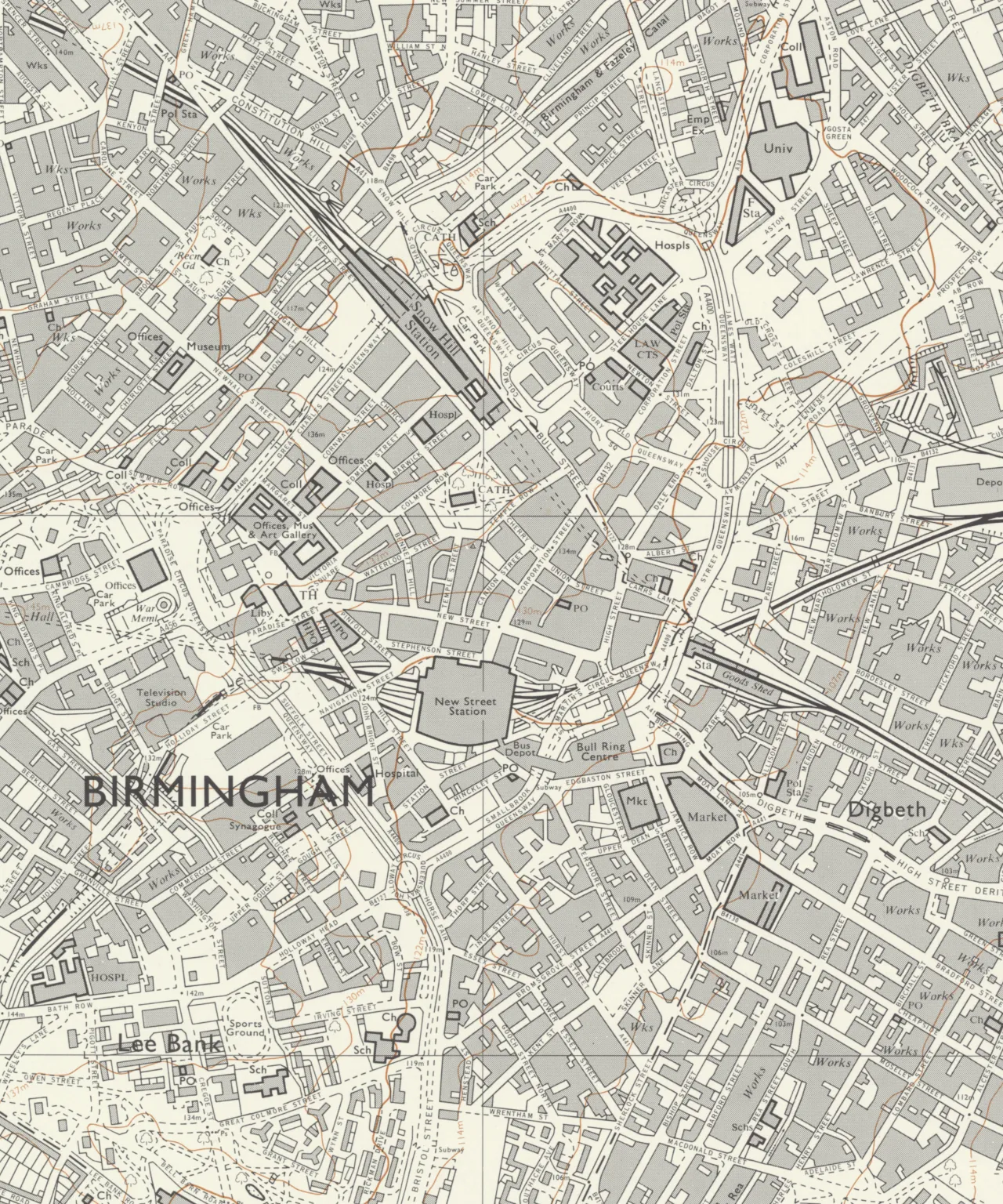
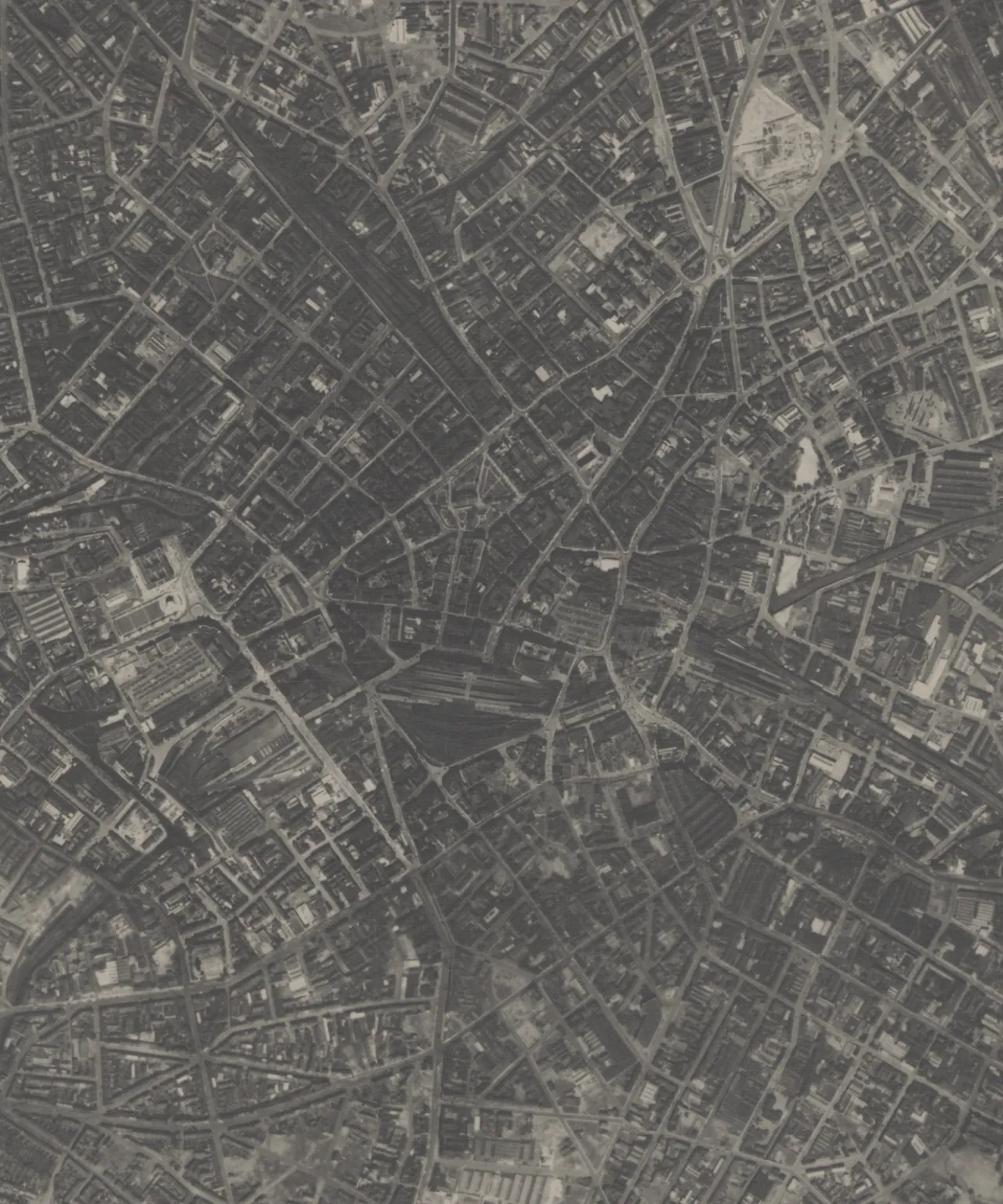
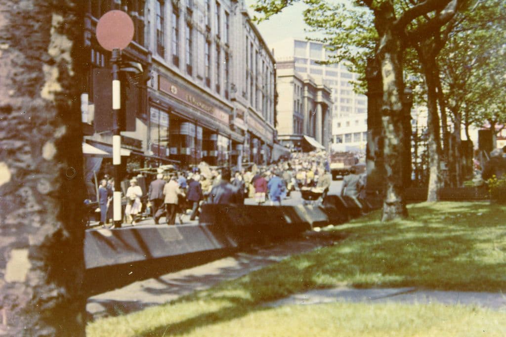
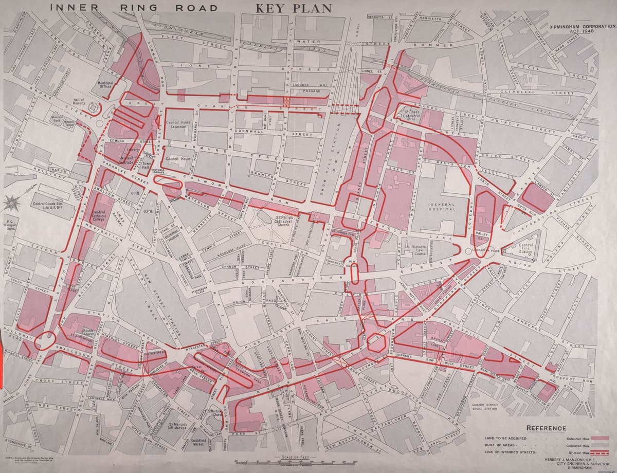

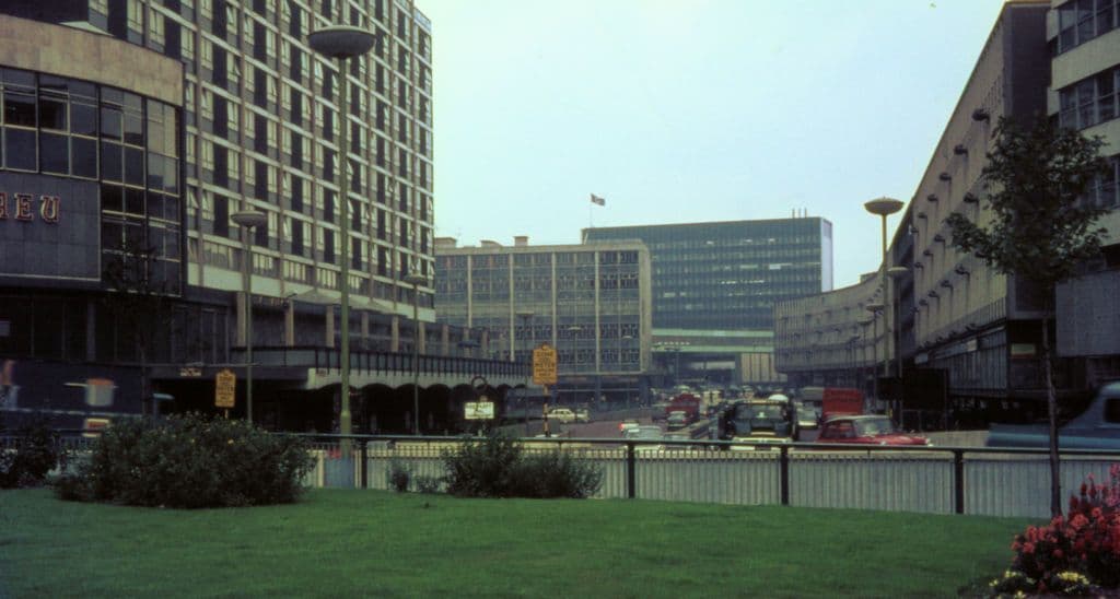
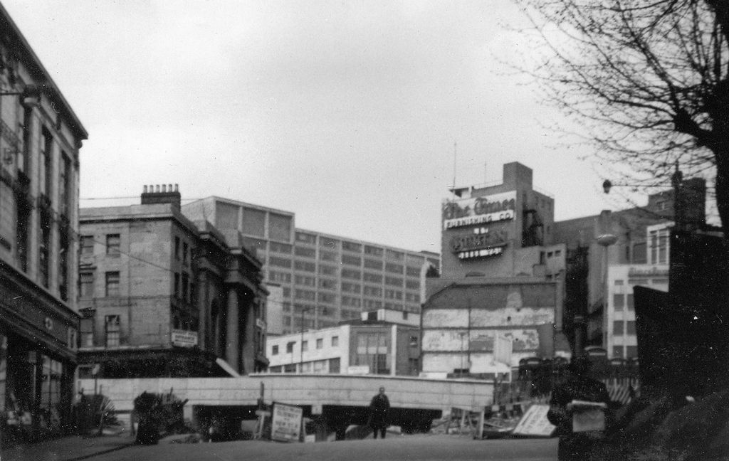
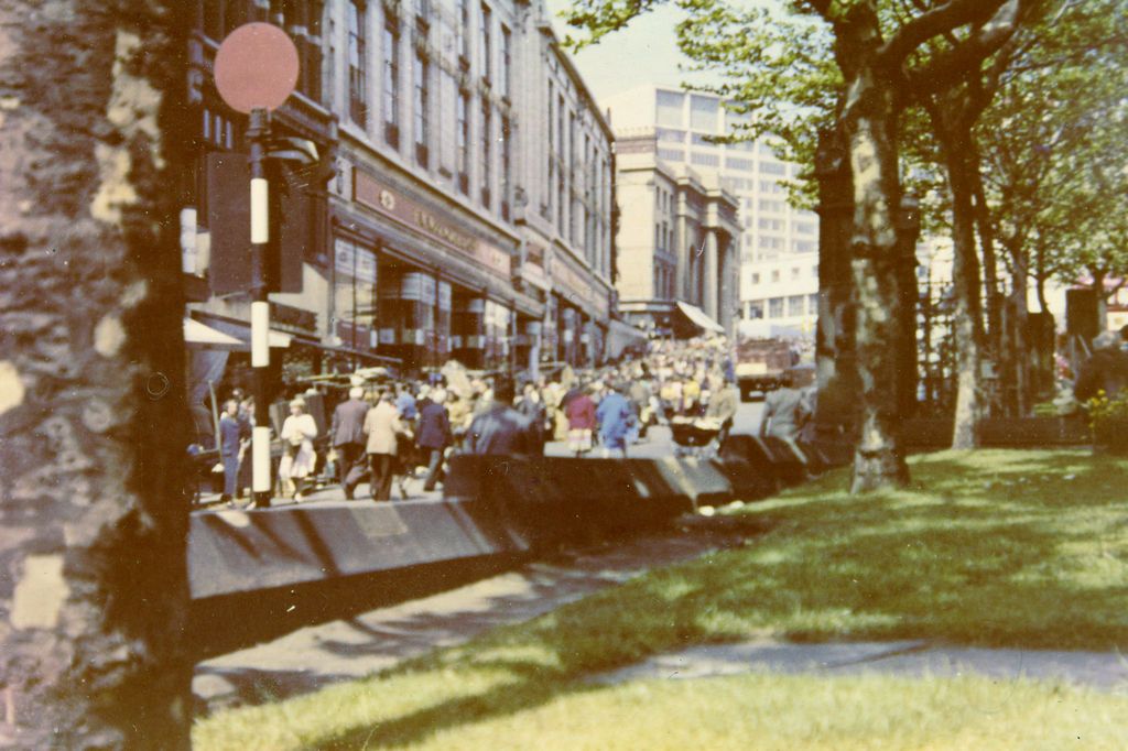
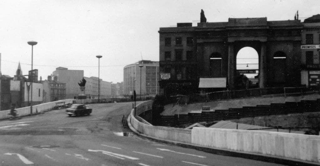
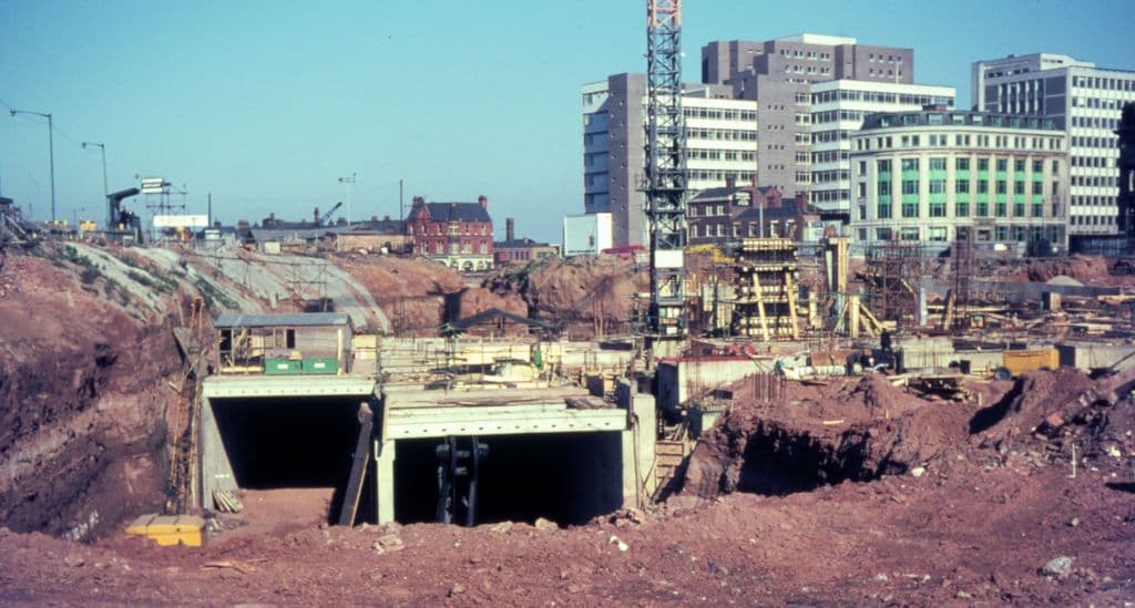
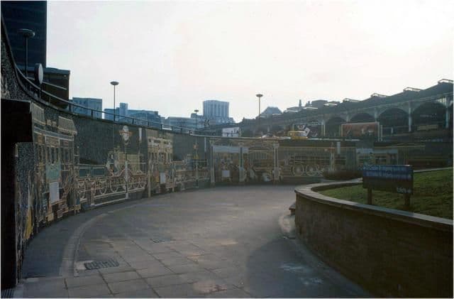
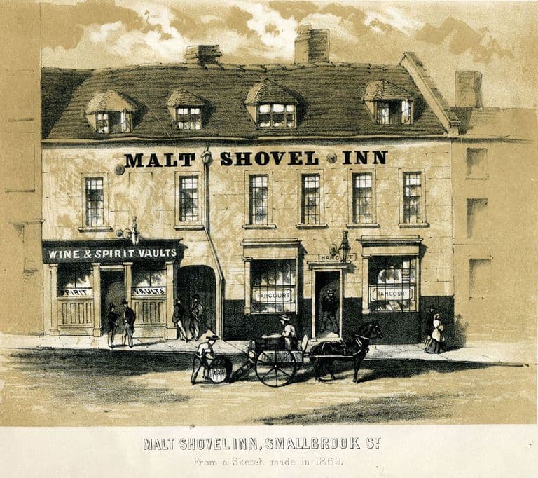
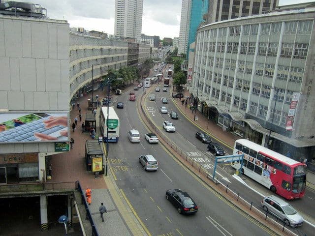
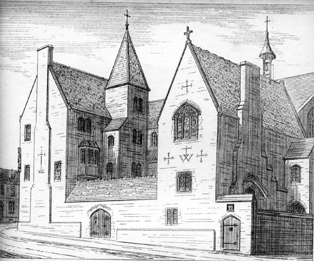
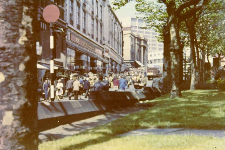
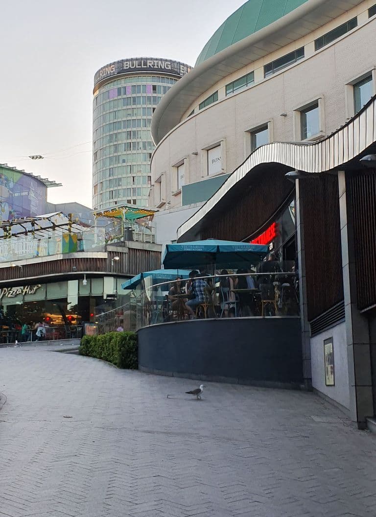
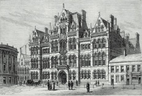
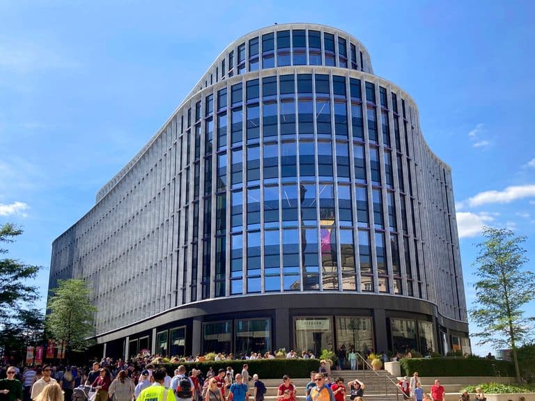
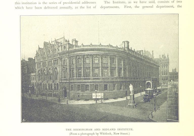
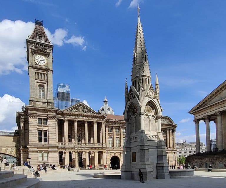
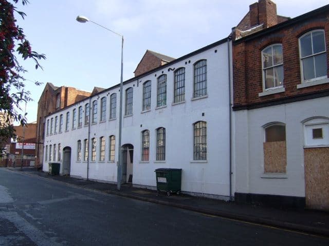
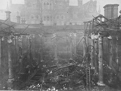
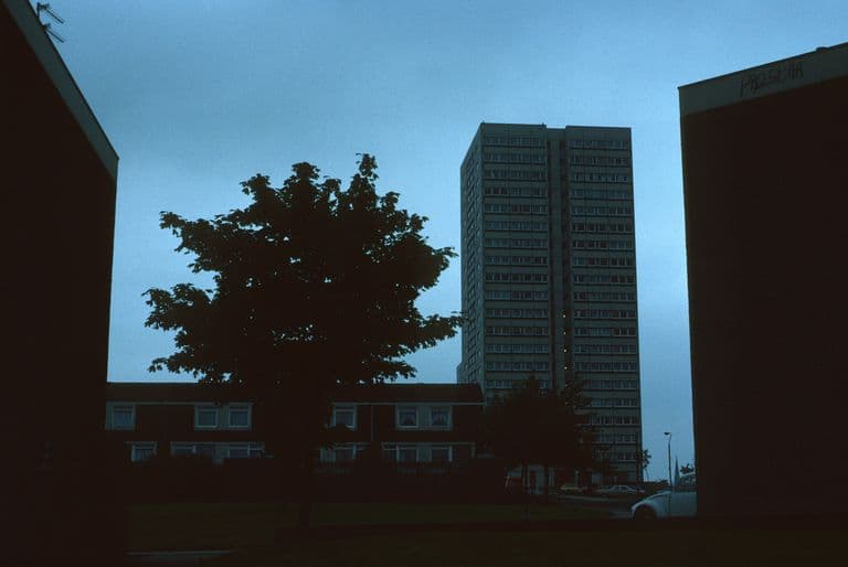
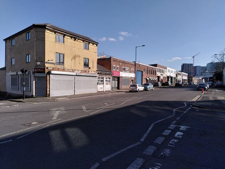
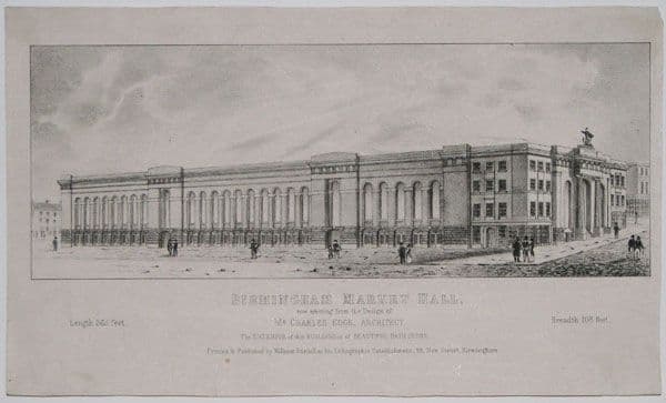
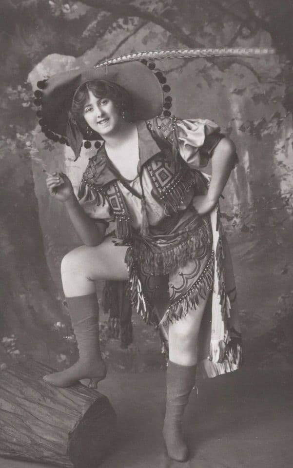
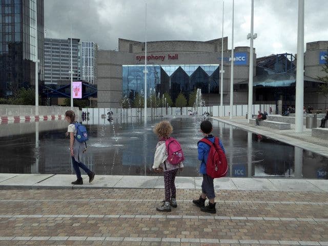
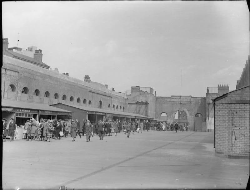
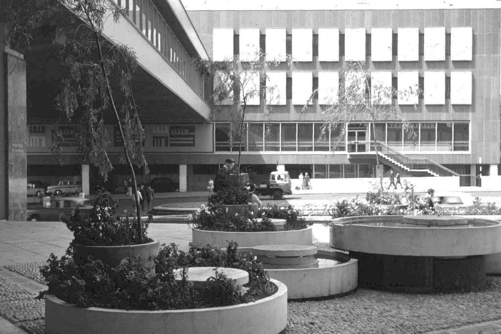
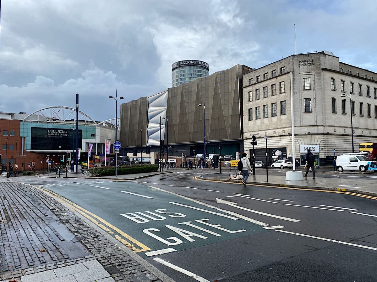
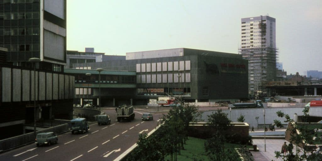
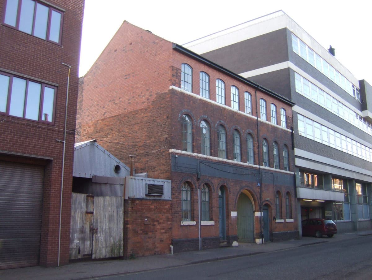
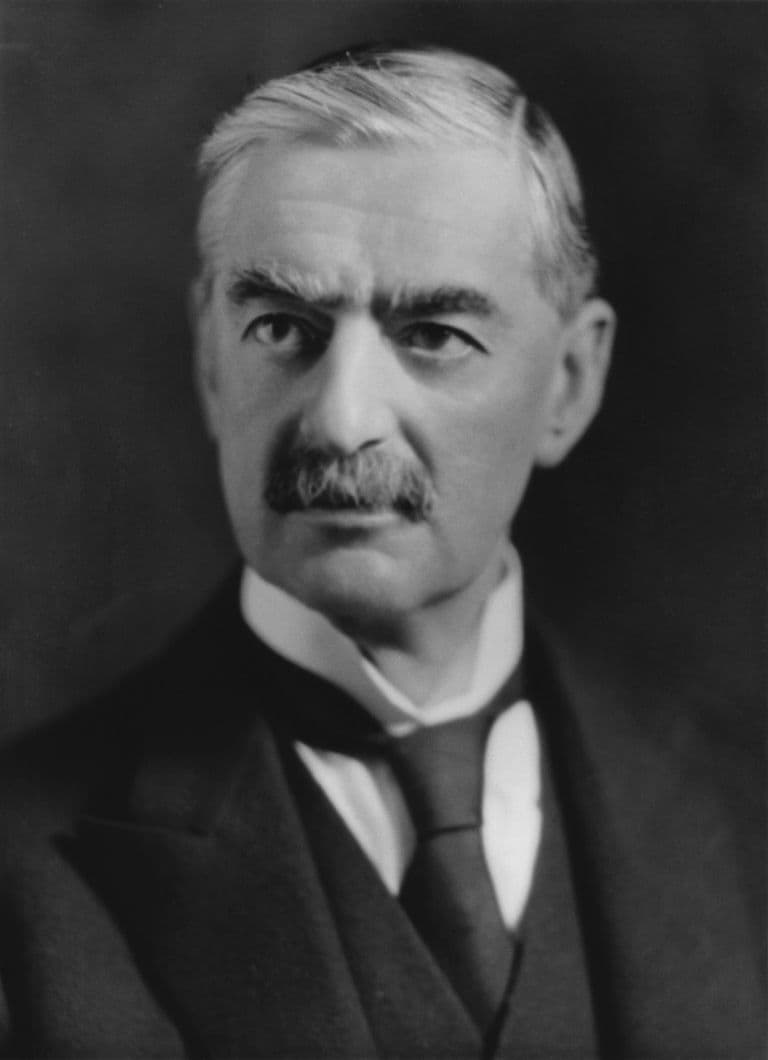
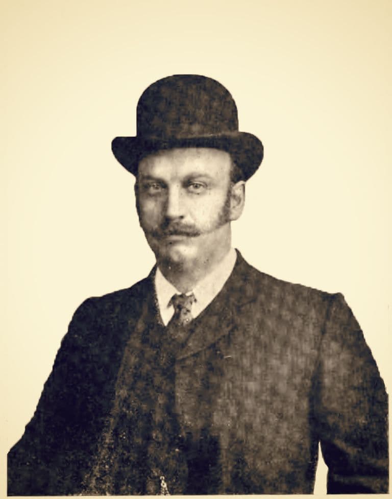
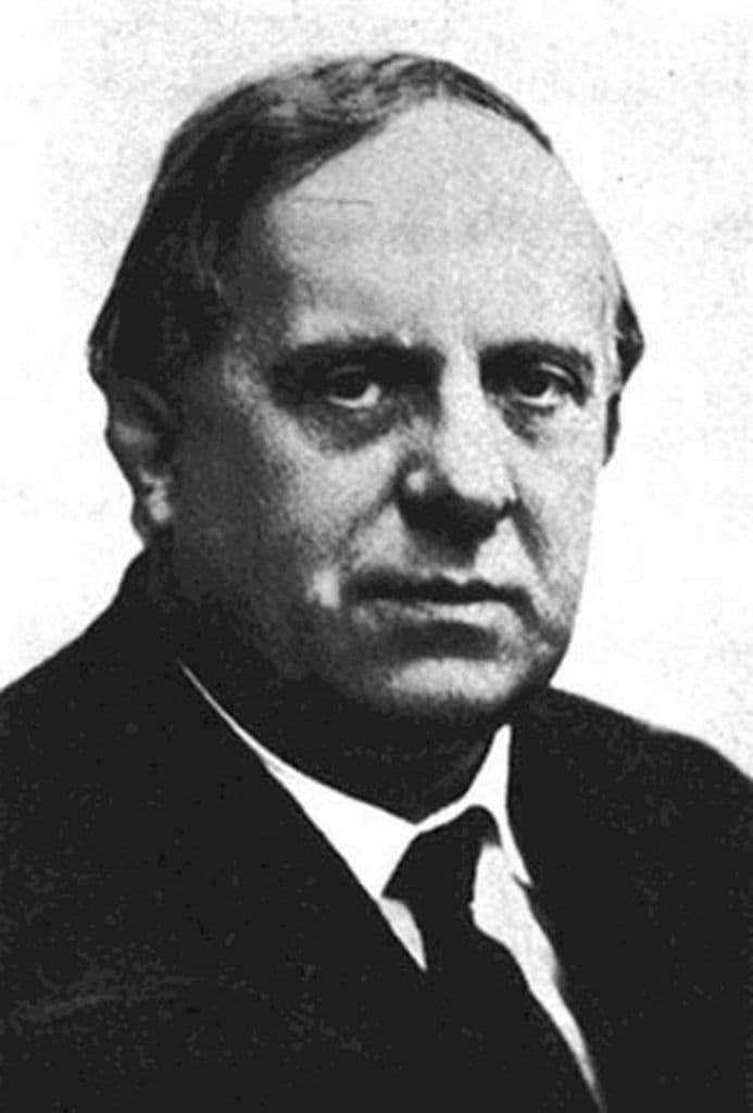

Comments
Comments will load here.