
What was here?
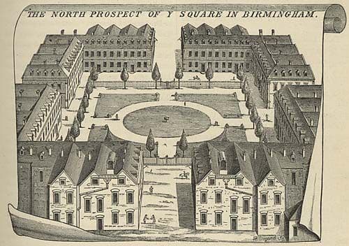
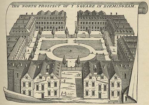
Before Corporation Street, Old Square was an enclosed Georgian square of sixteen near-identical two-storey houses with pedimented doorways and dormers, entered by a street in the middle of each side, home to some of the town’s leading families.
History
In the Middle Ages the Hospital of St Thomas, the priory that gave the area its name, stood here. After it was dissolved its land passed through several hands. About 1700 John Pemberton bought the block between Bull Street, Steelhouse Lane, Dale End and Stafford Street, and, the Victoria County History says, “enforced covenants to ensure that it remained a select residential district”.
A square for the rich
The Square itself followed, around 1713. The VCH describes it as “16 more or less uniform two-storied houses, their five-bayed fronts having angle pilasters, pedimented doorways, and dormer windows”, entered “by a street in the middle of each side”. William Westley engraved it in 1732: a neat, ordered space in a town better known for workshops.
Its residents were Birmingham’s elite. Edmund Hector, the surgeon, lived at No. 1, where Samuel Johnson came to visit; panelling from that house is preserved at Aston Hall. Keith Jordan’s account of the 1967 mural in the square lists other residents, among them Samuel Lloyd the banker and William Scholefield, the town’s first mayor in 1838.
Swept away by a boulevard
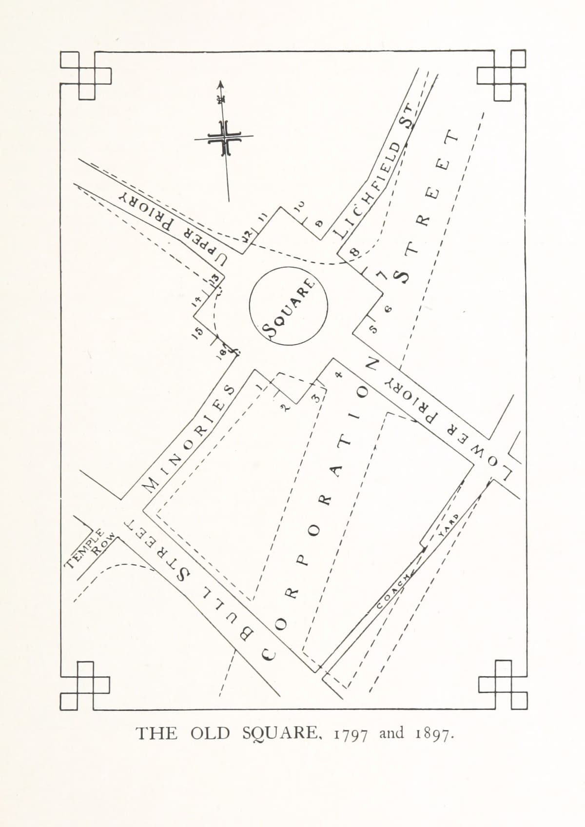
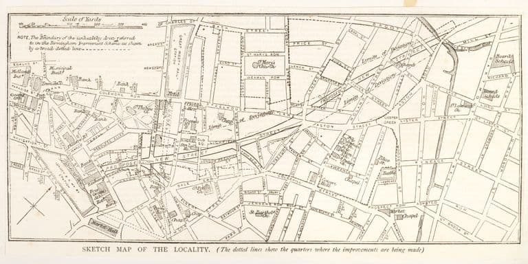
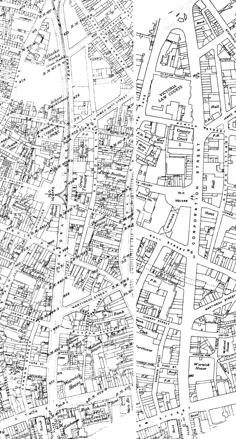
The square was not destroyed by the twentieth century. It was the nineteenth that did it. Joseph Chamberlain’s Improvement Scheme drove Corporation Street through the old town, its first stretch opening in 1879, and the historian Chris Upton notes that along with the slums it removed “the grand if decaying houses of Old Square”. The VCH is exact: Old Square was “the first important group to go … largely destroyed in 1882 for the construction of Corporation Street”. By 1897, when Hill and Dent published their Memorials of the Old Square, they could print a plan setting the square of 1797 against the streets of 1897, with Corporation Street slicing straight across it. The mural key reproduced by Jordan says the last of the houses came down in 1895.
The name that would not die
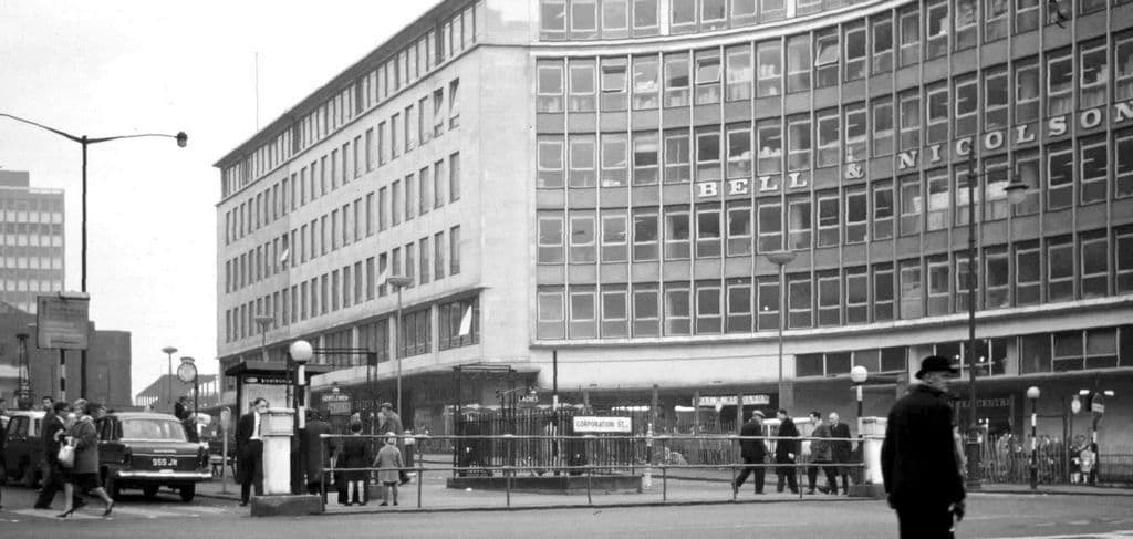
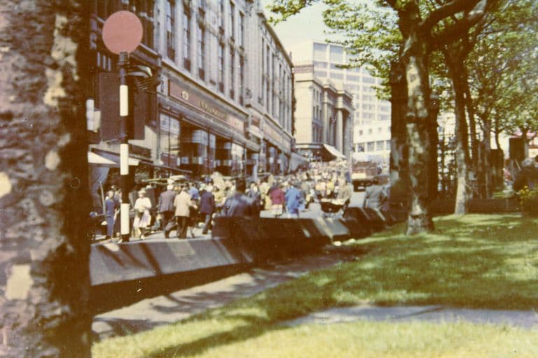
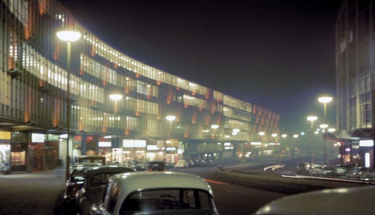
The space lived on as a busy road junction lined with shops and offices, including Lewis’s department store. Then, in the 1960s, the Inner Ring Road arrived. John Ball photographed the newly built Priory Ringway in 1964, running from Old Square down to Masshouse Circus. Old Square became a sunken shopping precinct and subway junction. In 1967 the Public Works Department commissioned Kenneth Budd’s firm to make a mural of the square’s history for it, in cast brass and iron.
The same spot, then and now
1888–1913
Today
Old map: Ordnance Survey six-inch, reproduced with the permission of the National Library of Scotland (CC BY 4.0). Today: © OpenStreetMap contributors.
That precinct has gone too. The hole has been filled in and the square raised back to street level, with Budd’s mural put back in its place. The Georgian houses are long gone, but their square still has a name, and a monument to what it once was.
What happened here?
Then A Georgian residential square of sixteen houses (c.1713), on the land of the medieval priory, home to the town’s leading families.
What happened Largely destroyed in 1882 for Corporation Street; the last houses were demolished by 1895.
Why Joseph Chamberlain’s Birmingham Improvement Scheme (1875–76), which cleared slums and old property to lay out Corporation Street.
What replaced it Victorian and Edwardian commercial buildings round a road junction; from the 1960s, Priory Queensway and a sunken precinct with Kenneth Budd’s 1967 mural.
Now A paved, tree-planted square at street level on Priory Queensway, with Budd’s mural reinstated.
Why it mattered
Old Square was Georgian Birmingham at its most polished, and its loss proves that the city’s habit of rebuilding itself is older than Manzoni. The Victorian Improvement Scheme destroyed it eighty years before the ring road, and in the name of public health and civic pride rather than traffic.
Why it disappeared
Slum clearance · Redevelopment
Joseph Chamberlain’s Birmingham Improvement Scheme. The VCH records the square was “largely destroyed in 1882 for the construction of Corporation Street”; Upton lists its “grand if decaying houses” among the buildings the scheme removed.
More pictures
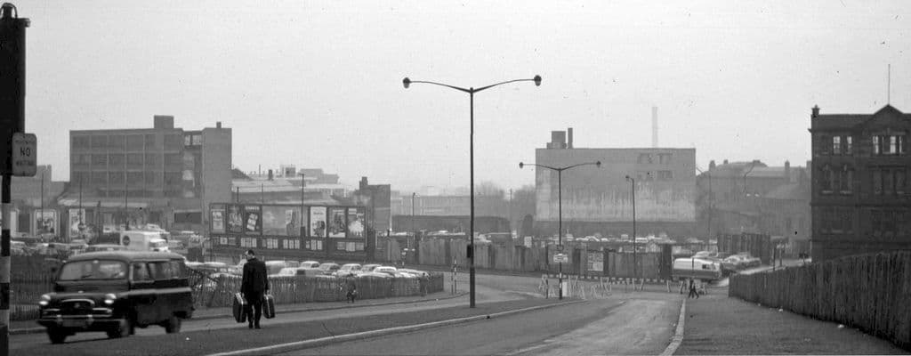
The new Priory Ringway, 19641964. John Ball (jlb2011.co.uk) via Wikimedia Commons · CC BY-SA 4.0
What’s there now
What replaced it
Corporation Street and its commercial buildings, including Lewis’s department store; then, from the 1960s, the Priory Queensway section of the Inner Ring Road with a sunken shopping precinct and subways. The precinct has since been filled in and the square rebuilt at street level.
What survives
Panelling from No. 1 Old Square at Aston Hall (VCH). Kenneth Budd’s 1967 cast brass and iron mural of the square’s history, re-erected in the rebuilt square.
Today
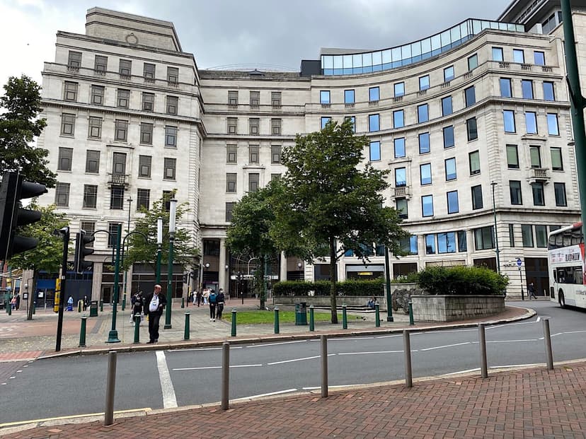
Old Square is a small paved square on Priory Queensway at its junction with Corporation Street, with Budd’s mural and trees.
Then and now
Then · 1732
Now · 10 July 2021
Today
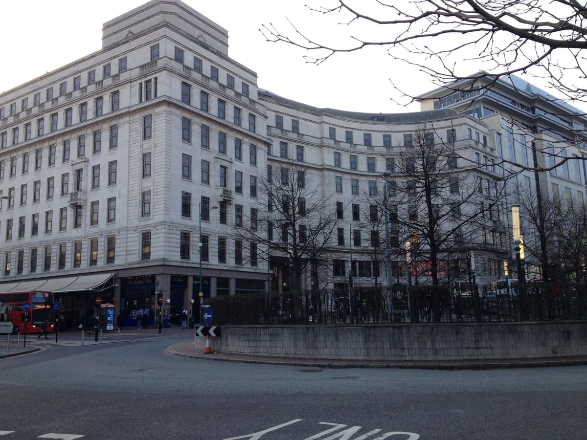
Old Square, Birmingham, 12 March 2014Richard Cooke, 12 March 2014. Geograph Britain and Ireland via Wikimedia Commons · CC BY-SA 2.0
Key dates
- 1964 — Priory Ringway built from Old SquareThe new Priory Ringway dual carriageway runs from Old Square down to Masshouse Circus, photographed newly completed in 1964.
- 21 April 1967 — Old Square mural unveiledA cast brass and iron mural of Old Square’s history by Kenneth Budd & Associates, commissioned by the Public Works Department for the new sunken precinct, is unveiled.
Sources and further reading
Completion of the loss: the VCH gives 1882 for the main destruction; the mural key published by Jordan (2006) says the last house went in 1895. Both are given.
The 1713 date and William Westley’s role come from the VCH and from Jordan’s mural key; Jordan names Thomas Kenney as builder, which has not been checked against Hill and Dent (1897).
Jordan’s mural key also names a “Samuel Grafton” at No. 13; this may be a garbled reference to Samuel Galton, but that is not confirmed, so the name is not used.
The 1960s ring-road changes are described only from Jordan and John Ball’s dated photographs.
- A History of the County of Warwick, vol. 7: The City of Birmingham — Secular Architecture, pp. 43–57 — W. B. Stephens (ed.), Victoria County History, 1964. pp. 43–57
- A History of the County of Warwick, vol. 7: The City of Birmingham — The Growth of the City, pp. 4–25 — W. B. Stephens (ed.), Victoria County History, 1964. pp. 4–25
- Slum Clearance and the Building of Corporation Street — Chris Upton, History West Midlands
- The Inner Ring Road, Underpasses & Murals of Birmingham — Keith M. Jordan, Sutton Coldfield Local History Research Group, 2006. pp. 24–28
- Photographs by John Ball (Birmingham, 1959–1969) — John Ball, Wikimedia Commons (from jlb2011.co.uk)
Comments
Comments will load here.