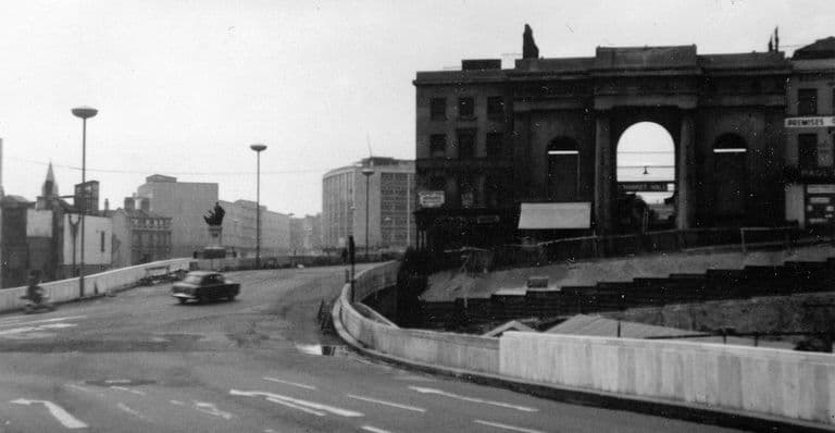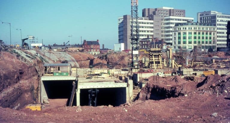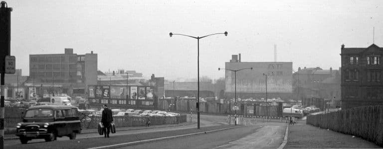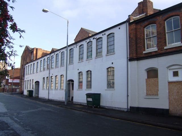
On 7 April 1971 the Queen came to Birmingham and opened a road. It was two and a quarter miles long, ran in a loop round the city centre, and had taken fourteen years to build. The local historian Keith Jordan counted 52 pedestrian subways. For a generation it would be the thing visitors remembered about Birmingham.
An old idea
The notion of an inner loop road had been sketched as early as 1917–18. It came back in the Second World War, when the City Engineer, Herbert Manzoni, put a ring road at the heart of his 1941 report on central planning. The council’s Public Works Committee approved it in principle on 29 April 1943, and the Birmingham Corporation Act 1946 gave the powers to build it and to buy the land compulsorily.
The Victoria County History, written while it was going up, explains the thinking. It was to be a dual carriageway 110 feet wide, crossing every main road out of the city, so through traffic would no longer squeeze along the old one-way streets. Larkham records Manzoni’s rule that no point in the centre should be more than 300 yards from the ring road, where the bus stops and car parks would be.
Building it
For eleven years nothing could start. Then, on 18 January 1957, the Minister of Transport, Harold Watkinson, approved the money. Work began on the stretch from Horse Fair towards New Street station. On 8 April 1959 a subway from Hill Street to Hurst Street opened beneath it, which Jordan describes as the first in the country to be the only way pedestrians could cross a road.
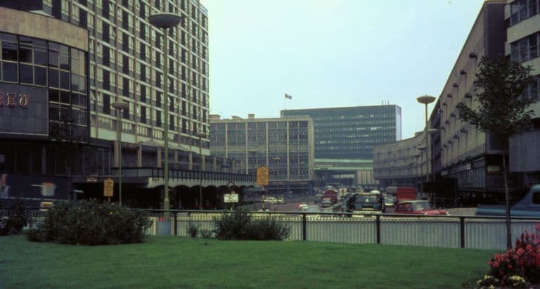
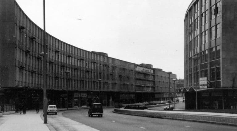
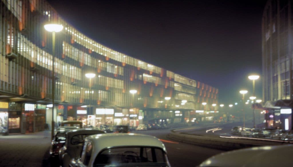
The first section, Smallbrook Ringway, opened in 1960, lined on its south side by James A. Roberts’s long curving block of shops and offices. Then the road crept round the centre: Holloway Circus, St Martin’s Circus beside the new Bull Ring, Masshouse Circus, Old Square, Colmore Circus, St Chad’s Circus, Paradise Circus. Traffic first used the full circuit on 4 January 1971. The Queen’s visit made it official, and the road became known as Queensway.
It was expensive. Larkham, using the council’s own figures, found that the land cost rose from £12 million to £21 million and the construction from £2.5 million to £13.25 million.
What stood in the way
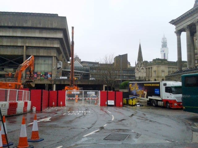
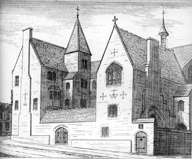
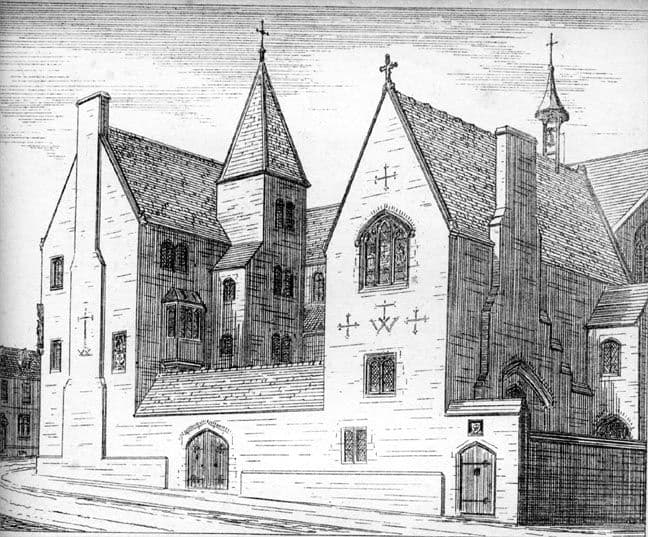
The road needed land, and the land had buildings on it. The best known loss was Bishop’s House in Bath Street, designed by A. W. N. Pugin and built in 1840–41 opposite St Chad’s Cathedral. Taking Stock, the Catholic Church’s heritage survey, records that in 1959 it was “demolished to make way for the City Council’s inner ring road”; some accounts give 1960. A chimneypiece and two chairs went to the V&A. St Chad’s Queensway now runs past the cathedral where the house stood.
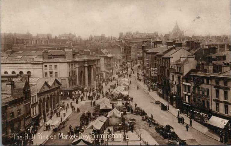
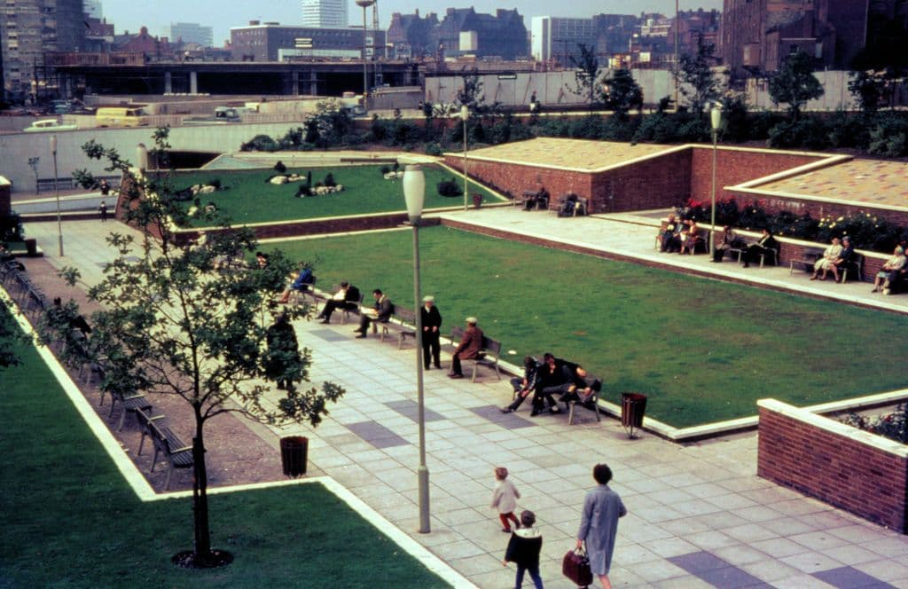
At the Bull Ring the story was stranger. The 1946 plan showed the bombed Market Hall demolished, but Larkham found that the line was soon changed, probably because of opposition from market traders. The council’s own 1995 history says that as late as 1956 there were plans to re-roof the hall, and then, “in one of the more curious episodes of post-war planning”, the decision was taken “both to route the Inner Ring Road around it and to demolish it as well”. The shell came down in the early 1960s. Manzoni Gardens took its place.
Not everything went. A plan to widen Colmore Row, which would have taken part of St Philip’s churchyard, was dropped in 1971, as the new conservation movement grew in strength.
Life underneath
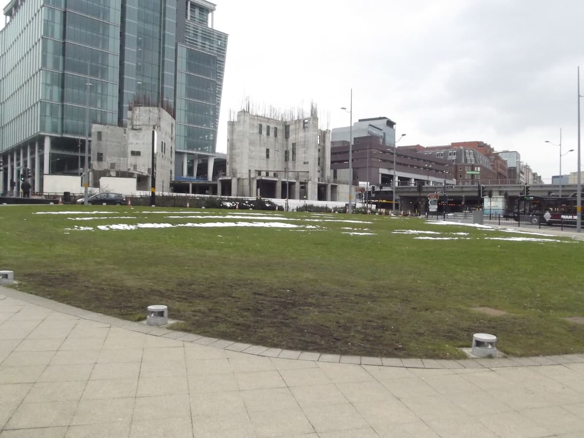
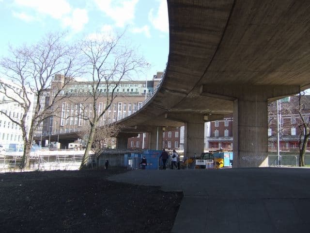
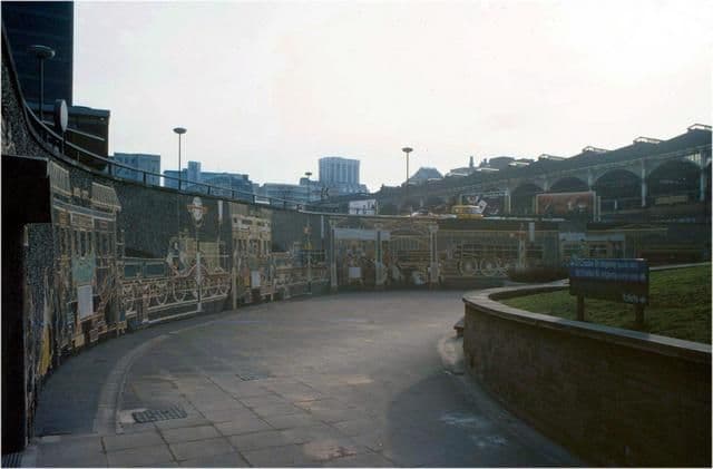
The ring road put cars on top and people underneath. Pedestrians used ramps, subways and murals; Kenneth Budd’s mosaic of the old Horse Fair was unveiled at Holloway Circus in 1966. The critics were quick. Leslie Ginsburg, head of the Birmingham School of Planning, wrote in 1959 that it looked like “the greatest traffic and town design tragedy yet to afflict an English city”. By about 2000 the council itself described the road as having “created a pedestrian barrier around the Central Core presenting a depressing and unfriendly environment”.
Breaking the collar
The turning point was the Highbury Initiative, a symposium held on 25–27 March 1988. Its experts recommended, in the council’s words, “that the concrete collar of the Inner Ring Road be broken”. The geographer Phil Jones describes it as a conscious decision to remove the post-war infrastructure of the centre, with the ring road as “the particular target”.
The work went on for thirty years. Centenary Way was lowered. Smallbrook Queensway was brought down to street level at Hill Street. In 2002 Masshouse Circus was demolished; Birmingham Friends of the Earth sold chunks of it for 50p each. By about 2005, Jones notes, all the elevated sections had gone. Paradise Circus was dismantled in stages from 2015 and closed to general traffic in 2018 for the Metro and the Paradise scheme. In 2023–24 the council approved the demolition of the Ringway Centre on Smallbrook Queensway, and the High Court rejected a challenge in September 2024.
What remains
The tunnels under the west of the centre still carry traffic, and the name Queensway survives on the signs. Little else of the loop is left as it was built. The road was finished in 1971 and, within seventeen years, the city had resolved to take it apart. Its builders and its demolishers shared one belief: that a city should not be afraid to remake itself.
A long read
Herbert Manzoni: the man who remade Birmingham
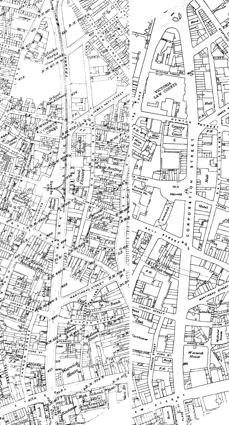
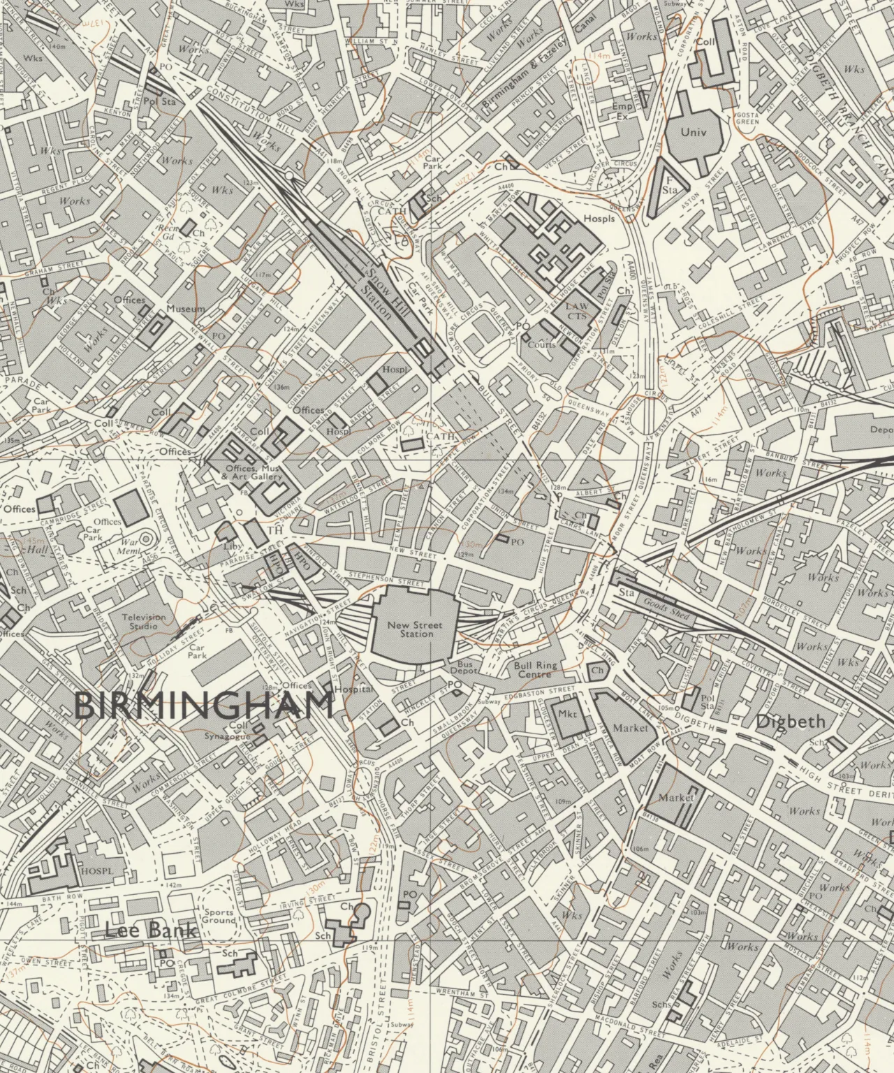
Birmingham survived the Blitz, then rebuilt itself on purpose. Compare the city before and after on four lined-up maps, see what the Inner Ring Road took, and judge for yourself.
On the map
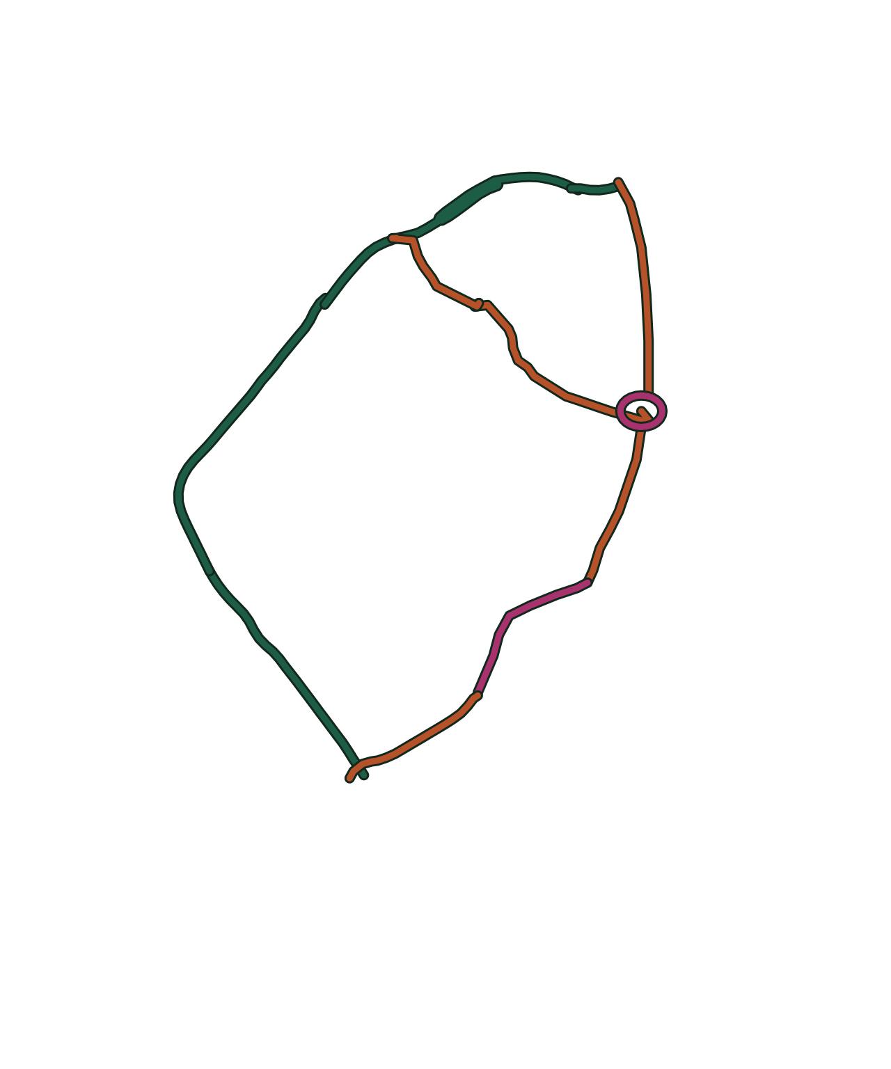
17 places connected with The Inner Ring Road. Tap a number for directions — some sites are private homes or gardens, so each place’s page says what you can see from the street.

- Grand Theatre, Corporation Street — Lost, Site redeveloped · Directions to Grand Theatre, Corporation Street (opens Google Maps)
- Fish Market, Bell Street — Lost, Site redeveloped · Directions to Fish Market, Bell Street (opens Google Maps)
- Old Square — Lost, Site redeveloped · Directions to Old Square (opens Google Maps)
- The Victorian Central Library, Ratcliff Place — Lost, Site redeveloped · Directions to The Victorian Central Library, Ratcliff Place (opens Google Maps)
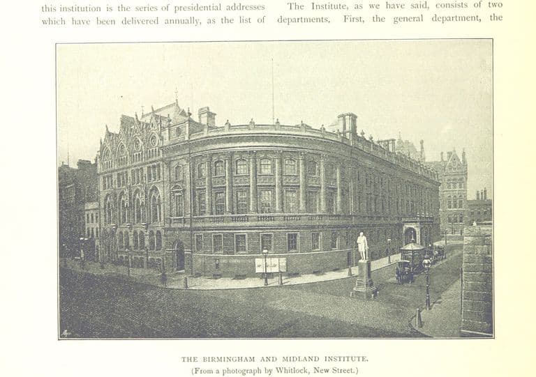
- Birmingham and Midland Institute, Paradise Street — Lost, Site redeveloped · Directions to Birmingham and Midland Institute, Paradise Street (opens Google Maps)
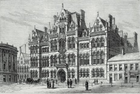
- Mason Science College, Edmund Street — Lost, Site redeveloped · Directions to Mason Science College, Edmund Street (opens Google Maps)
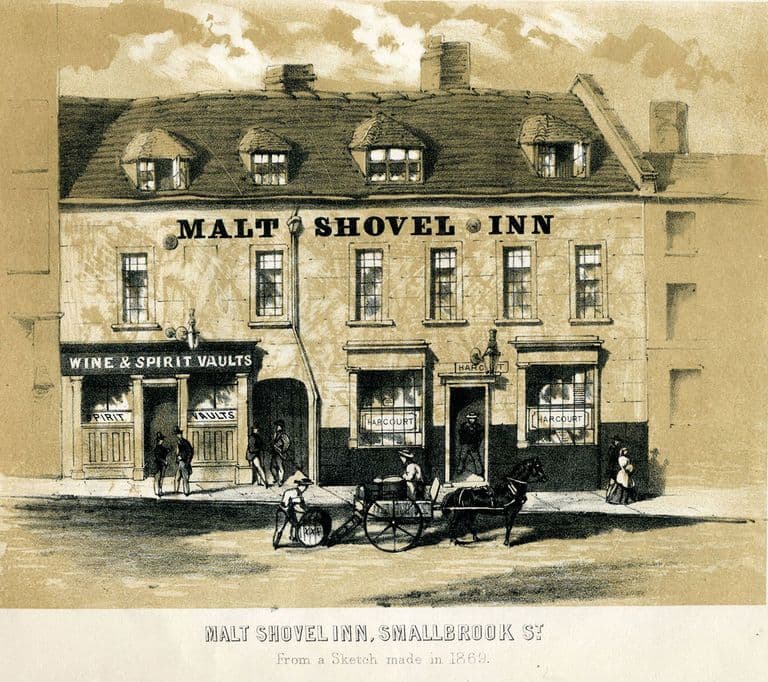
- Smallbrook Street — Lost, Site redeveloped
- The old Bull Ring and Spiceal Street — Lost, Site redeveloped · Directions to The old Bull Ring and Spiceal Street (opens Google Maps)
- Holloway Circus — Surviving, Surviving but altered · Directions to Holloway Circus (opens Google Maps)
- Lancaster Circus — Surviving, Surviving but altered · Directions to Lancaster Circus (opens Google Maps)
- St Chad’s Circus — Surviving but altered · Directions to St Chad’s Circus (opens Google Maps)
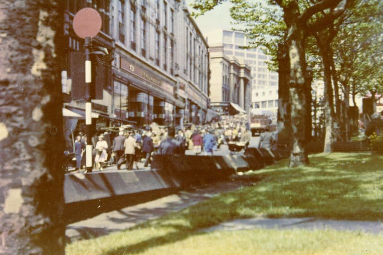
- Smallbrook Queensway — Surviving but altered · Directions to Smallbrook Queensway (opens Google Maps)
- St Martin’s Circus — Lost, Site redeveloped · Directions to St Martin’s Circus (opens Google Maps)
- Paradise Circus — Lost, Site redeveloped · Directions to Paradise Circus (opens Google Maps)
- Masshouse Circus — Lost, Site redeveloped · Directions to Masshouse Circus (opens Google Maps)
- The Gun Quarter — Partly surviving, Site redeveloped
- Bishop’s House, Bath Street — Lost · Directions to Bishop’s House, Bath Street (opens Google Maps)
Key dates
- October 1917 — A ‘loop’ of streets round the centre is proposedA Public Works Committee report on road widths includes Councillor Talbot’s plan to widen ‘certain streets near the centre, forming a kind of loop round the centre’. The council’s 1989 history says the streets were almost identical to the line of the later Inner Ring Road. Widening lines were approved in January 1918.
- 16 October 1941 — Manzoni reports on central city planningCity Engineer Herbert Manzoni sends a confidential report on central city planning, built round a ring road, to the Public Works Committee. Four advisory panels follow, on traffic, housing, redevelopment areas and the city’s limits.
- 29 April 1943 — Ring road approved in principleThe Public Works Committee approves Manzoni’s ring-road proposals in principle. The line follows the inner loop first suggested in 1917 and uses bombed sites where it can.
- July 1945 — Council backs a Bill for the ring roadThe full City Council authorises a Parliamentary Bill for the Inner Ring Road. Keith Jordan dates the council’s approval of the scheme to July 1944; Larkham, working from the archives, gives July 1945 for the Bill.
- 7–23 May 1946 — Commons committee examines the Birmingham Corporation BillA House of Commons committee examines the city’s Bill for the ring road. Some clauses are removed, including one letting the council make parking spaces a condition of planning permission, after the Chamber of Commerce objects.
- 1946 — Birmingham Corporation Act passedParliament gives the council powers to build the Inner Ring Road and buy the land compulsorily. Peter Larkham calls it the largest such council scheme to have come before Parliament.
- 21 November 1956 — A council deputation puts a price on trafficBirmingham’s deputation to the Minister of Transport argues that Lucas’s 300 vehicles average 10 mph across the city, and that faster roads would save the city’s 28,000 goods vehicles about £2 million a year.
- 1957 — Smallbrook Street cleared for the ring roadDemolition clears Smallbrook Street for Smallbrook Ringway, the first section of the Inner Ring Road, after the Minister of Transport approves funding in January 1957.
- 8 March 1957 — Work on the ring road starts with a bangThe Minister of Transport, Harold Watkinson, inaugurates the Inner Ring Road by exploding a charge to bring down a wall, as recorded in the council’s own film of the first stage.
- 18 January 1957 — Ring road funding approvedThe Minister of Transport, Harold Watkinson, approves funding for the Inner Ring Road, eleven years after the Act. Work starts on the stretch from Horse Fair towards New Street station.
- 8 April 1959 — First ring-road subway opensThe subway from Hill Street to Hurst Street opens beneath the new road, reportedly the first in the country to be pedestrians’ only way across.
- January 1959 — Public Works Committee agrees to demolish the Market HallA Public Works Committee conference on the Bull Ring agrees to demolish the bombed Market Hall, opening the way for the ring road and the Bull Ring Centre.
- 1 October 1959 — Ginsburg calls the ring road a ‘tragedy’In the Architects’ Journal, Leslie Ginsburg of the Birmingham School of Planning warns that the ring road ‘looks like being the greatest traffic and town design tragedy yet to afflict an English city’.
- 1960 — Smallbrook Ringway opensThe first section of the Inner Ring Road, Smallbrook Ringway, opens. By 1961 the road has reached Carrs Lane.
- May 1961 — The ringway splits Spiceal StreetJohn Ball’s photographs show the new Inner Ringway running between Spiceal Street and the Market Hall, with Phillips Street widened into one of its carriageways.
- March 1961 — Manzoni describes the Inner Ring Road to engineersIn the Proceedings of the Institution of Civil Engineers Manzoni calls the ring road ‘a city street of novel character – it is not an urban motorway, nor principally a traffic street or a shopping street’.
- 27 November 1963 — Traffic in Towns is publishedColin Buchanan’s report reaches MPs. The Minister of Transport, Ernest Marples, says: “Cars are a boon. But they have now started to choke movement.” Birmingham’s ring road has been under construction since 1957.
- 13 August 1963 — Demolition begins for the new libraryThe City Engineer and Surveyor’s Department photographs demolition beginning in Great Charles Street for the new Central Library at Paradise Circus.
- October 1963 — Masshouse Circus contract awardedThe construction contract for Masshouse Circus goes to Bryant Civil Engineering. In 1977 the Sunday Times alleged that Bryant had been preferred to a lower tender.
- 1964 — Priory Ringway built from Old SquareThe new Priory Ringway dual carriageway runs from Old Square down to Masshouse Circus, photographed newly completed in 1964.
- 1965 — Midland Institute compulsorily purchasedThe Birmingham and Midland Institute’s Paradise Street building is compulsorily purchased so that Paradise Street can be widened for re-routed traffic. The Institute moves to Margaret Street in 1966.
- 1966 — Pevsner praises Birmingham’s ‘courage’Nikolaus Pevsner and Alexandra Wedgwood’s Warwickshire calls the courage of devising a completely new set of roads and open spaces in the centre of Birmingham ‘wholly admirable’, though they find the city’s high housing disappointing.
- 21 April 1967 — Old Square mural unveiledA cast brass and iron mural of Old Square’s history by Kenneth Budd & Associates, commissioned by the Public Works Department for the new sunken precinct, is unveiled.
- 1971 — Colmore Row widening droppedThe council abandons its plan to widen Colmore Row as part of the ring road scheme. The historian Peter Larkham sees this as a turning point in the city’s planning culture.
- 4 January 1971 — Traffic uses the whole ring for the first timeThe complete Inner Ring Road is opened to traffic, three months before the Queen’s ceremonial opening.
- 7 April 1971 — The Queen opens the Inner Ring RoadQueen Elizabeth II officially opens the completed Inner Ring Road, in use by traffic since January. The loop is two and a quarter miles long with 52 pedestrian subways.
- 1972 — Aston Expressway reaches Lancaster CircusThe Aston Expressway opens, linking the ring road to the M6. Its elevated section sweeps over Lancaster Circus on concrete supports.
- 29 May 1977 — “City’s ringroad falling apart”After cracks close the Masshouse Circus underpass in mid-May, the Sunday Times publishes an engineer’s report predicting that Masshouse Circus and Smallbrook Ringway could collapse within a decade. An official interim report calls the road structurally sound.
- 7 June 1978 — Parliament asks who pays to mend the ring roadIn the Commons the West Midlands County Council’s estimate of about £440,000 for maintenance of the ring road in 1977–81 is given. Jeff Rooker MP says the Ministry of Transport paid three-quarters of its original cost.
- April 1978 — Ring-road contractors convictedThree directors of Bryant’s, the ring road’s main contractor, are convicted of corruption over council contracts worth £112 million since 1963.
- 1987 — A City Centre StrategyThe council publishes a City Centre Strategy welcoming housing back into the centre and promising good pedestrian access, especially across the Queensway.
- 25–27 March 1988 — The Highbury InitiativeA symposium on the future of the city centre recommends that “the concrete collar of the Inner Ring Road be broken”. The council begins lowering and removing the road.
- 1991 — The International Convention Centre opensThe ICC opens on Broad Street as a flagship for a new service economy; a new pedestrian route is run from it across the lowered ring road into the city centre.
- 1999 — Light rail returns to BirminghamThe Midland Metro opens between Birmingham and Wolverhampton, the first light rail service in the city since the last trams ran in 1953.
- c. By 2001 — New Street is pedestrianisedThe council reports that the full pedestrianisation of New Street has removed vehicles and increased footfall by over 50 per cent.
- 2002 — Masshouse Circus demolishedThe raised Masshouse Circus section of the ring road is demolished, the first big break in the “concrete collar”. Birmingham Friends of the Earth sell chunks at 50p each.
- July 2011 — The Big City PlanBirmingham’s city centre masterplan aims to grow the city core by a quarter, beyond the old ‘concrete collar’ of the Inner Ring Road, with over 5,000 new homes in its areas of transformation.
- 20 July 2013 — Ring road tunnels shut for repairsThe A38 St Chad’s and Queensway tunnels, the main surviving parts of the ring road, close for six weeks of essential repairs.
- September 2018 — Paradise Circus closes to general trafficParadise Circus, renamed Lyon Queensway, closes for the Metro and the Paradise redevelopment. Through traffic keeps using the A38 tunnel underneath.
Sources and further reading
- Replanning post-war Birmingham: process, product and longevity — Peter J. Larkham, architectura 46, 2016
- The Inner Ring Road, Underpasses & Murals of Birmingham — Keith M. Jordan, Sutton Coldfield Local History Research Group, 2006
- A History of the County of Warwick, vol. 7: The City of Birmingham — The Growth of the City, pp. 4–25 — W. B. Stephens (ed.), Victoria County History, 1964
- Birmingham — Metropolitan Cathedral of St Chad — Taking Stock (Catholic Church heritage survey with Historic England)
- Chimneypiece from the Bishop’s House, Bath Street, Birmingham (CIRC.351PART/1-1961) — Victoria and Albert Museum. Ref. CIRC.351PART/1-1961
- Architecture and Austerity: Birmingham 1940–1950 — Sheila McGregor, Chris Upton and Nicola Coxon, Birmingham City Council Department of Planning and Architecture, 1995
- Memorandum by Birmingham City Council (WTC 16), Walking in Towns and Cities inquiry — Birmingham City Council, House of Commons Environment, Transport and Regional Affairs Committee, HC 167, 2001
- The city as artwork: the dismemberment of modern Birmingham — Phil Jones, University of Birmingham, 2005
- Masshouse Circus: 50p a chunk — Birmingham Friends of the Earth, 2002
- Lyon Queensway (Paradise Circus) consultation — Birmingham City Council, Be Heard, 2021
- Ringway to ruin: Birmingham landmark set for demolition — Twentieth Century Society, 2023
- Court blows for Birmingham and London anti-demolition campaigners — Architects’ Journal, 2024