
What was here?
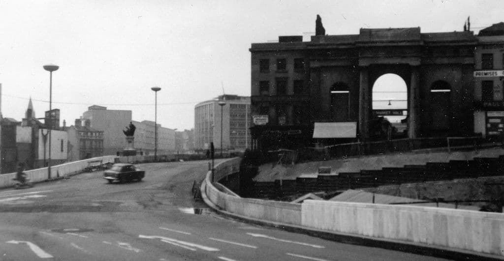
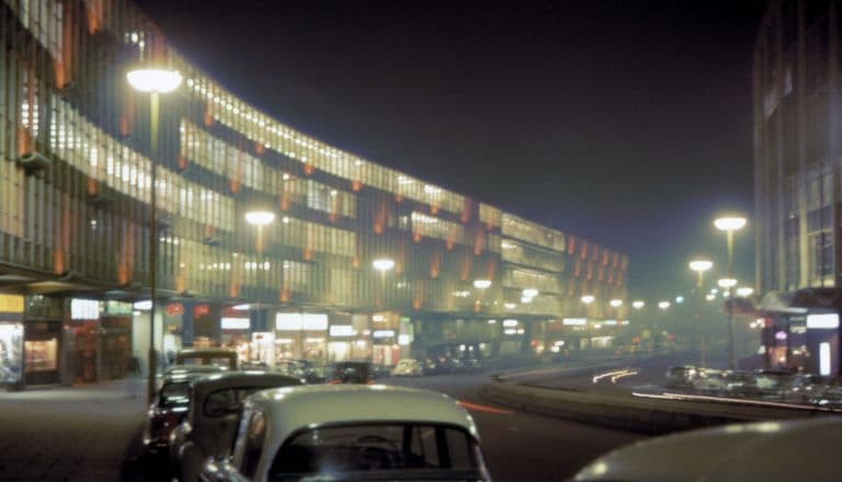
A long, sloping traffic island between the Bull Ring Centre and New Street station, with pedestrian subways underneath and Manzoni Gardens on the site of the old Market Hall.
History
The 1946 plan showed the bombed Market Hall demolished, but the line was soon changed. When building started, the road was laid out on either side of the repaired hall, leaving what Peter Larkham calls an elongated and awkwardly sloping island. In May 1961 John Ball photographed the new carriageway running past the Market Hall entrance; old Phillips Street and Bell Street became the two sides of the road. The Victoria County History records that the ring road had reached Carrs Lane by 1961.
Frank Price, who chaired the Public Works Committee from 1954, later said he saw the defects of the scheme “in particular, at the Market Hall roundabout”. But once the Market Hall had gone, Larkham records, changing the road line was felt to mean “an interminable discussion with the Ministry”, so the roundabout stayed and shaped the design of the Bull Ring Centre. The gardens on the old hall site were named after Herbert Manzoni. In 1972 they briefly held a 23-foot fibreglass King Kong.
Why it mattered
It was the clearest place where the ring road and the city’s oldest market met head on. The road dictated the shape of the 1960s Bull Ring.
Why it disappeared
Redevelopment
The Bull Ring Centre and the circus were swept away for the new Bullring, begun in 2000 and opened in 2003. Its design restored a direct walking route from High Street down to Digbeth.
The same spot, then and now
1888–1913
Today
Old map: Ordnance Survey six-inch, reproduced with the permission of the National Library of Scotland (CC BY 4.0). Today: © OpenStreetMap contributors.
More pictures
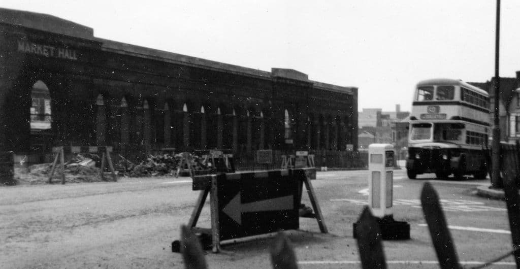
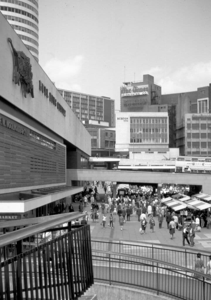
The north side of the Market Hall on the former Phillips Street, May 1961May 1961. John Ball (jlb2011.co.uk) via Wikimedia Commons · CC BY-SA 4.0 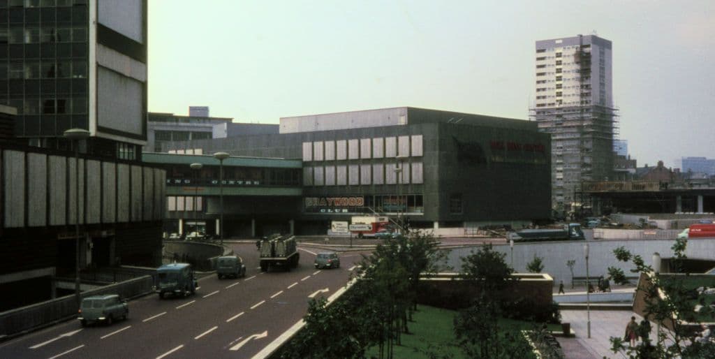
Manzoni Gardens and Smallbrook Ringway, 1966John Ball, 1966. Wikimedia Commons · CC BY-SA 4.0
What’s there now
What replaced it
The Bullring shopping centre. A bus and taxi link, St Martin’s Queensway, runs beneath it between New Street and Moor Street.
What survives
The Rotunda, which stood beside the circus, and St Martin’s church.
Today
The Bullring and Selfridges; St Martin’s Queensway is used by buses, taxis and cyclists.
Sources and further reading
The official name and exact extent of “St Martin’s Circus” are not documented in the sources read. No firm opening date has been found; a Birmingham Post report of 4 September 1961 (cited on Wikipedia, not read) describes finishing work.
- Replanning post-war Birmingham: process, product and longevity — Peter J. Larkham, architectura 46, 2016
- A History of the County of Warwick, vol. 7: The City of Birmingham — The Growth of the City, pp. 4–25 — W. B. Stephens (ed.), Victoria County History, 1964
- The Inner Ring Road, Underpasses & Murals of Birmingham — Keith M. Jordan, Sutton Coldfield Local History Research Group, 2006. pp. 13, 40–44
- The city as artwork: the dismemberment of modern Birmingham — Phil Jones, University of Birmingham, 2005
- Images of Birmingham (photographs 1959–1981) — John Ball, jlb2011.co.uk
Comments
Comments will load here.