
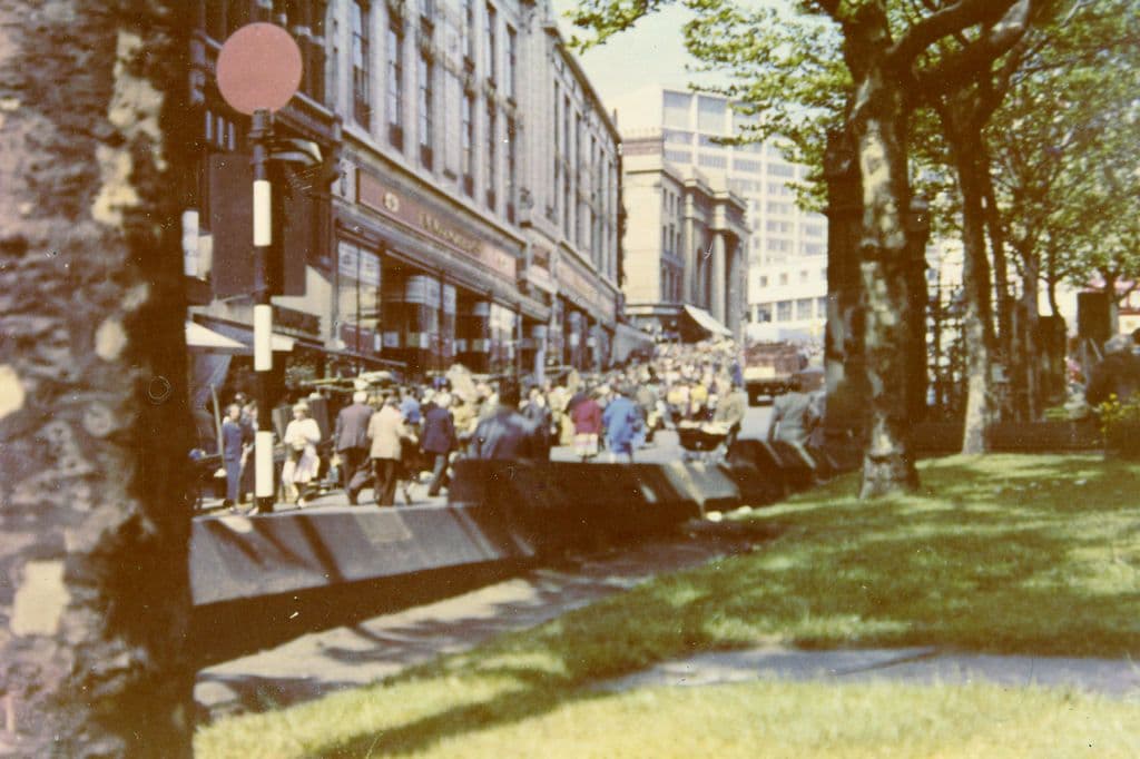
What was here?
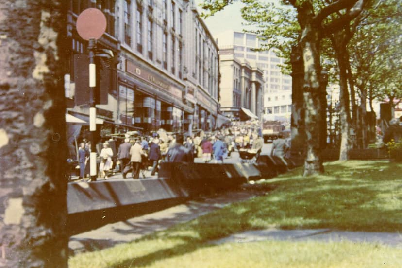
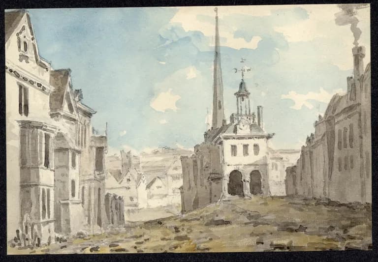
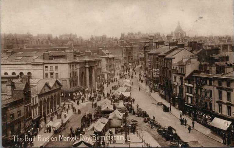
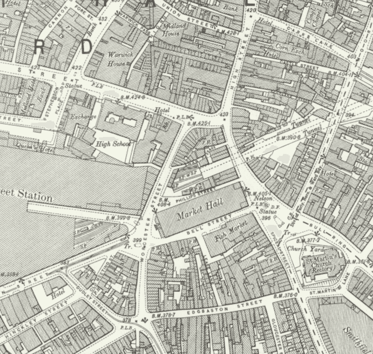
Before the 1960s the Bull Ring was an open, sloping market place running down from High Street to St Martin’s Church, with Spiceal Street climbing past the churchyard, the Market Hall on its island between Phillips Street and Bell Street, and Westmacott’s statue of Nelson in the middle of it all.
History
Birmingham began as a market. The Victoria County History records that Peter the steward received a grant, “made probably in 1166”, of a market to be held each Thursday. The place where it was held was the green below the parish church. By the time William Westley drew his map in 1731, the corn market stood in the Bull Ring, with the shambles above it and the beast market in High Street.
A market that kept growing
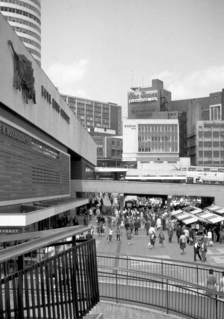
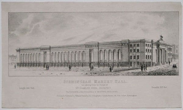
The town grew around this slope, and the slope kept its job. In 1806 the Street Commissioners cleared the Bull Ring and moved the general market there from High Street. In 1835 Charles Edge’s Market Hall opened on its island between Phillips Street and Bell Street. A wholesale fish market opened in Bell Street in 1869. The Victoria County History notes that the authorities spent years pulling the markets into this one small area, until the stalls spilled into the streets around it.
At the heart of it stood Lord Nelson. Richard Westmacott’s bronze, paid for by public subscription and unveiled on 5 October 1809, was, according to the Victorian Web’s account, Birmingham’s first public statue. Beside it, Spiceal Street ran up past St Martin’s churchyard to the Market Hall steps, lined with shops; by the 1950s Woolworths stood there.
The war, and the plan
The bombs of 1940 gutted the Market Hall but did not stop the market. The open-air Bull Ring market was still trading in 1950, selling poultry, eggs, rabbits, flowers and shrubs, the Victoria County History records.
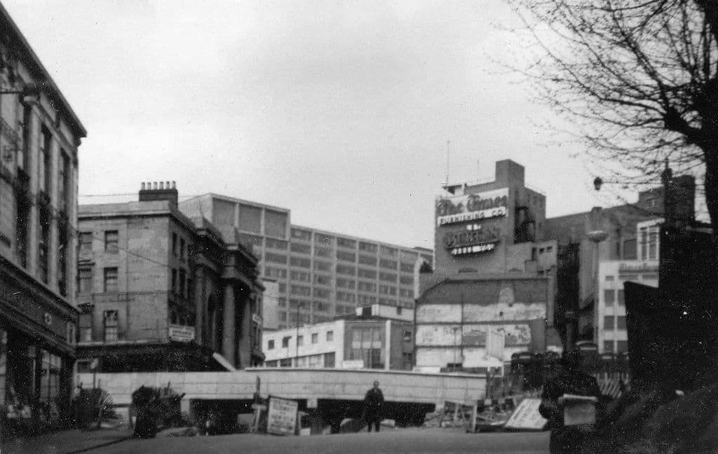
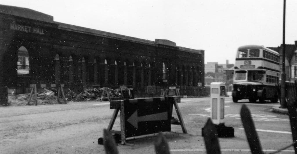
What finally changed the Bull Ring was not the Luftwaffe but the Inner Ring Road. The route had been fixed in the Birmingham Corporation Act of 1946, which gave the council powers to build the road and buy the land in its way. In 1959, Peter Larkham’s research in the Public Works Committee minutes shows, the committee held a conference on the Bull Ring and agreed to demolish the Market Hall. The committee chairman, Frank Price, later said he had got the council to agree “in the face of quite strong opposition from those who believed that it had some architectural interest”.
The road arrives
The same spot, then and now
1888–1913
Today
Old map: Ordnance Survey six-inch, reproduced with the permission of the National Library of Scotland (CC BY 4.0). Today: © OpenStreetMap contributors.
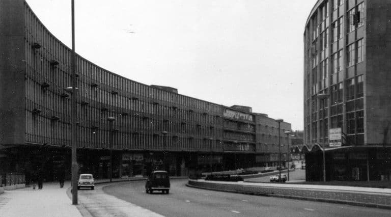
John Ball’s photographs catch the moment the old place broke apart. In May 1959 he stood at the bottom of Spiceal Street and looked up at Woolworths and the Market Hall entrance. Two years later he took the same view again: the shops and the hall were still there, but now the new Inner Ringway ran between them. Phillips Street, on the north side of the hall, had been widened to become one carriageway of the road; Bell Street, on the south side, became the other.
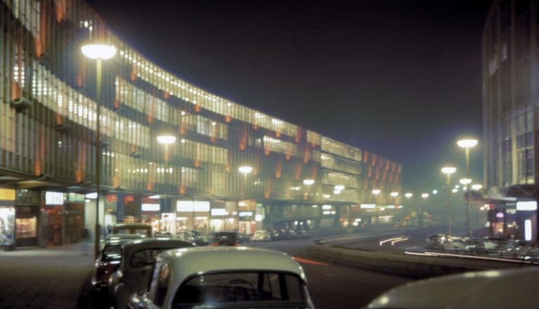
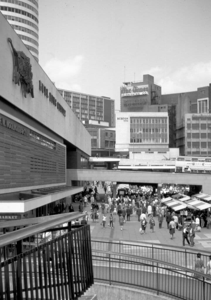
The land around the road went to John Laing’s development company, which built the Bull Ring Centre from 1961. It was opened by the Duke of Edinburgh on 29 May 1964. Historic England calls it the first indoor city-centre shopping centre in the UK. Larkham describes how “the ring road cut through the site”, with shoppers crossing it by corridors and escalators or passing under it in shop-lined subways. The island where the Market Hall had stood became part market, part garden: Manzoni Gardens, named after the City Engineer.
Nelson survived, but lost his setting. The Victorian Web records that his original pedestal, with its cannon and lamp standards, “was lost when the monument was moved during the city centre redevelopment of the early 1960s”.
A second rebuilding
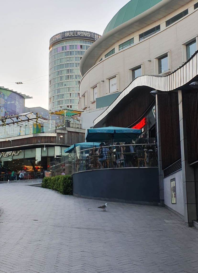
The new centre was hailed as a revolution. It did not last. By the 1980s, Historic England notes, people had turned against its grey concrete, and in 2000 demolition began. The present Bullring opened in 2003, and its design reinstated a walking route down the hill past St Martin’s, along a rebuilt Spiceal Street.
The church is the one thing that came through it all. Keith Jordan, who walked these subways for decades, put it in a sentence: in the 1960s “the old Bull Ring vanished, except for St. Martin’s church”.
What happened here?
Then An open market place on the slope below St Martin’s, held since the twelfth century, with the 1835 Market Hall, the Bell Street fish market, Spiceal Street’s shops and Westmacott’s Nelson.
What happened In January 1959 the Public Works Committee agreed to demolish the bombed Market Hall. The Inner Ring Road was driven through, with Phillips Street and Bell Street widened into its two carriageways, and from 1961 Laing built the Bull Ring Centre across the remaining land.
Why The Inner Ring Road scheme, authorised by the Birmingham Corporation Act 1946 and pushed through by the City Engineer’s department and the Public Works Committee, needed the land, and the council wanted a modern shopping centre beside it.
What replaced it The Bull Ring Centre (opened 29 May 1964), the ring road with its subways, St Martin’s Circus and Manzoni Gardens. That centre was itself demolished from 2000.
Now The Bullring shopping centre (opened 2003). A rebuilt Spiceal Street runs down past St Martin’s Church, and Nelson stands on a plain stone drum near his original site.
Why it mattered
The Bull Ring was where Birmingham started: a market town’s market place, in continuous use for some eight hundred years. Its loss shows the Inner Ring Road at its most ruthless. The road did not skirt the historic centre here; it ran straight through the middle of it, and the market that had survived the Blitz did not survive the plan.
Why it disappeared
Road building · Redevelopment · Wartime destruction
The Inner Ring Road scheme. The road was authorised by the Birmingham Corporation Act 1946; in 1959 the Public Works Committee agreed to demolish the bombed Market Hall (Larkham, citing PWC minutes of 6 January 1959). Phillips Street and Bell Street were widened into the road’s carriageways (John Ball’s dated photographs, 1961–63), and Birmingham Corporation let the surrounding land to the Laing Investment Company, which built the Bull Ring Centre from 1961 (Larkham; Historic England).
What’s there now
What replaced it
First, the Inner Ring Road (with St Martin’s Circus and its subways) and the Bull Ring Centre, built by Laing and opened on 29 May 1964, with Manzoni Gardens on the Market Hall island. Then, after demolition from 2000, the present Bullring shopping centre (opened 2003), with a rebuilt Spiceal Street and the Selfridges store.
What survives
St Martin’s Church (Grade II*) and Westmacott’s Nelson statue (Grade II*, NHLE 1343362), moved in the early 1960s and now on a plain Portland stone drum without its original pedestal. The street name Spiceal Street survives on a rebuilt route through the Bullring.
Today
The Bullring shopping centre covers the old market place. Spiceal Street runs down past St Martin’s Church, and the Nelson statue stands near the church.
Then and now
Then · May 1959
Now · 9 July 2022
Today
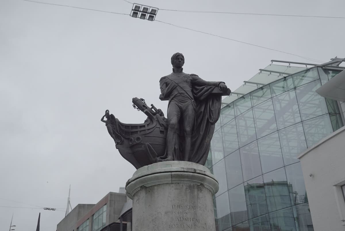
Statue of Horatio Nelson, Spiceal Street, 9 July 2016Jwslubbock, 9 July 2016. Wikimedia Commons · CC BY-SA 4.0
Key dates
- January 1959 — Public Works Committee agrees to demolish the Market HallA Public Works Committee conference on the Bull Ring agrees to demolish the bombed Market Hall, opening the way for the ring road and the Bull Ring Centre.
- May 1961 — The ringway splits Spiceal StreetJohn Ball’s photographs show the new Inner Ringway running between Spiceal Street and the Market Hall, with Phillips Street widened into one of its carriageways.
Sources and further reading
The market grant is dated only “probably” to 1166 (Victoria County History). Bill Dargue gives a different wording of the grantee’s name; the text follows the VCH.
Nelson’s unveiling: the Victorian Web gives 5 October 1809; Wikipedia gives 25 October. The text uses the Victorian Web date and attributes it.
The statements that Phillips Street and Bell Street became the ring road’s carriageways come from John Ball’s captions to his own 1961 and 1963 photographs on Wikimedia Commons, not from an engineering source. They match Larkham’s description of the redesigned road passing “close on either side of the repaired Market Hall”.
Larkham notes that Elain Harwood credits the developer Jo Godfrey, not Frank Price, with persuading the council to demolish the Market Hall, but gives no source; the text follows Price’s own account as reported by Larkham.
The exact start date of Bull Ring Centre construction is uncertain: Larkham says work began in 1961; other accounts give late 1961 or early 1962.
- A History of the County of Warwick, vol. 7: The City of Birmingham — Economic and Social History: Markets and Fairs, pp. 251–252 — W. B. Stephens (ed.), Victoria County History, 1964. pp. 251–252
- A History of the County of Warwick, vol. 7: The City of Birmingham — The Growth of the City, pp. 4–25 — W. B. Stephens (ed.), Victoria County History, 1964. pp. 4–25
- Replanning post-war Birmingham: process, product and longevity — Peter J. Larkham, architectura 46, 2016. pp. 7–10, 19–20
- The Rise of the Shopping Centre: 5 Shopping Centres Built by John Laing — Historic England
- Nelson Monument, Bull Ring, Birmingham — Jacqueline Banerjee, The Victorian Web
- The Inner Ring Road, Underpasses & Murals of Birmingham — Keith M. Jordan, Sutton Coldfield Local History Research Group, 2006. p. 49
- Photographs by John Ball (Birmingham, 1959–1969) — John Ball, Wikimedia Commons (from jlb2011.co.uk)
Comments
Comments will load here.