
What was here?
A roughly round island about 60–70 metres across, ringed by a moat, south-east of St Martin’s church. The lords of Birmingham lived here from the 12th century until 1536. Later it held a Georgian house, workshops and old timber buildings. It was cleared in 1815–16 for Smithfield Market.
History
The lords and their market
In 1166 Peter, the lord of Birmingham, was granted the right to hold a market “at his castle of Birmingham”. That market made the town. The lords lived on an island south-east of St Martin’s church, inside a moat about 110 metres from north to south and 90 metres across. The ditch was up to about 10 metres wide on the north side and nearly 40 metres wide on the south. William Hutton, writing in the 1780s, said it was fed by a small stream turned from its course.
Historic England dates the moat by its pottery and stonework to the late 12th century, probably soon after the market grant. Older historians took the “castle” of 1166 to be this moat. Historic England is more cautious and suggests it might have been the Parsonage Moat instead.
Stone in a timber town
What stood on the island? Excavations in 1973–75, and again in 2021, found a wall of finely cut and tooled red sandstone, up to eight courses and 2.5 metres high, with an older, rougher wall inside it. Both are dated by their style to the 12th or 13th century. Timber stakes had been driven into the moat’s inner edge on the south-east side. Historic England points out that, apart from St Martin’s church, this is the only medieval stone building known in Birmingham. Every other known medieval building in the town was timber-framed.
The lords leave
The de Birminghams did not always hold on easily. In 1424 Sir William de Birmingham and his household were thrown out by force by Sir Edmund Ferrers. In 1536 Edward Birmingham made the manor over to Henry VIII, and no lord lived at the Moat again. A settlement of about 1560 still mentions “the manor-house with a mill standing in the outer court”.
Hutton saw what was left. He describes a building on the north-east side with Lord Ferrers’ arms in the ceiling timbers, “the oldest in Birmingham”. He also saw the room where the court leet was held, “in what we should now think a large and shabby room”.
A Georgian house on a medieval island
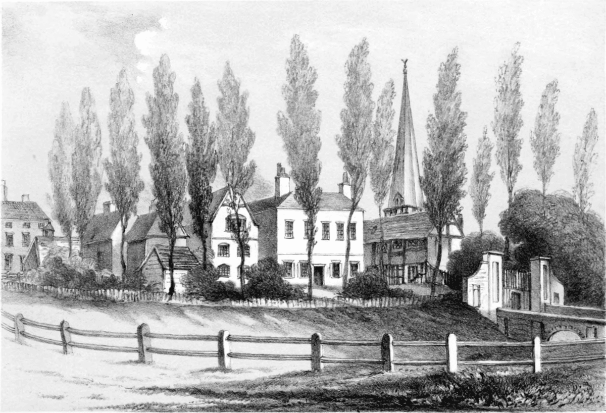
In the 1730s or around 1740 the Francis family built a new house on the island, “in the modern style”. From 1780 Thomas Francis leased the site and made coffin nails there. Hutton found the moat still full of water, used “now, to turn a thread-mill”.
He also saw the room where the court leet was held, “in what we should now think a large and shabby room”.
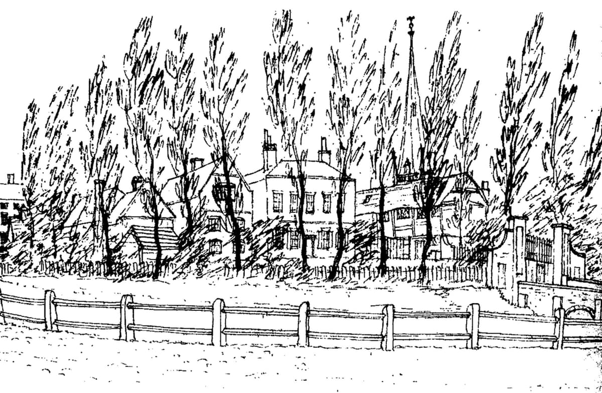
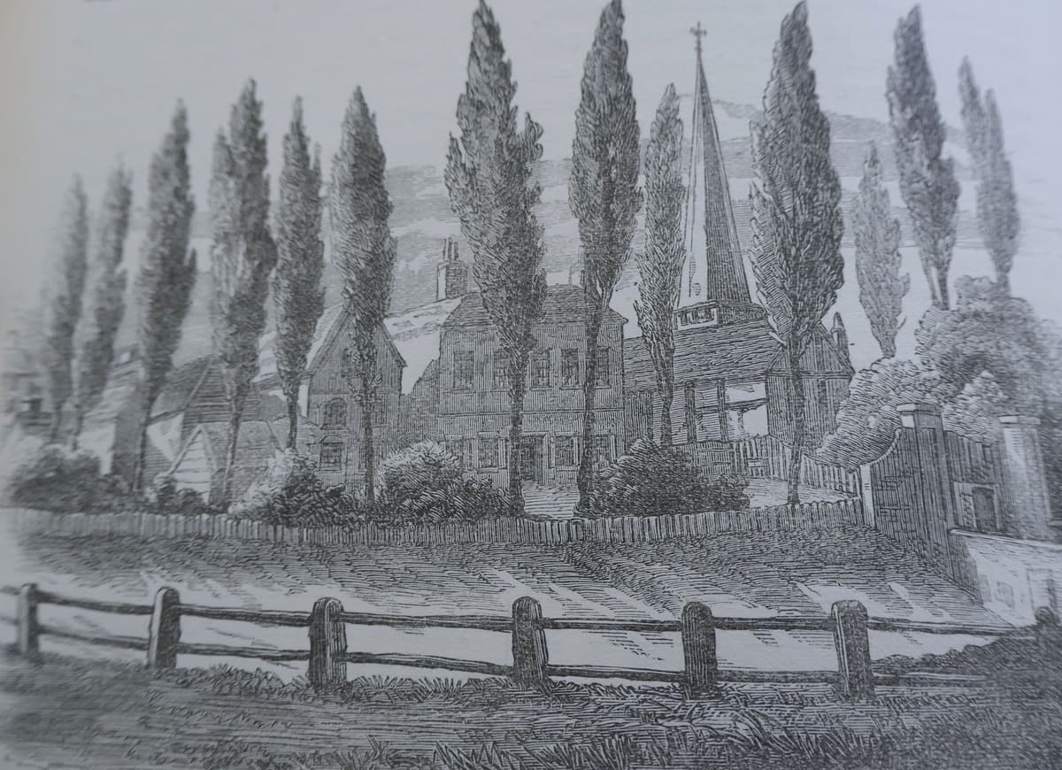
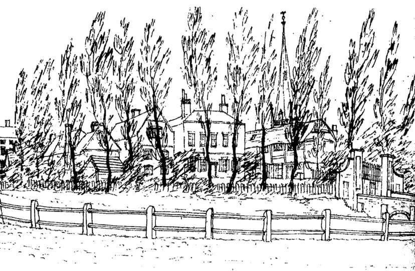
On 29 April 1814 William Hamper drew the place from the south-east. His sketch shows tall poplars, the Georgian house, an old gabled building that looks timber-framed, an arched bridge, and St Martin’s spire beyond. By then, R. K. Dent says, the moat was “the almost dry ditch”.
Smithfield
The same spot, then and now
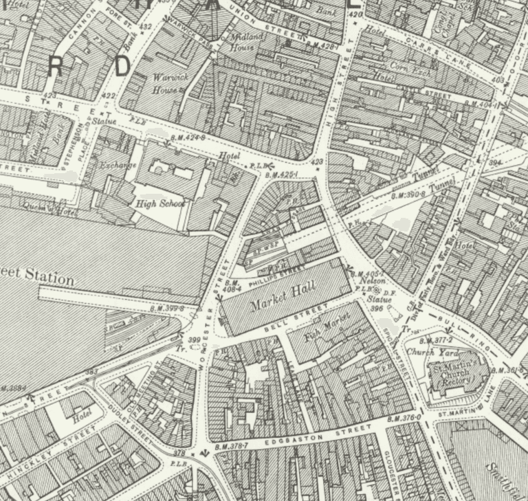
1888–1913
Today
Old map: Ordnance Survey six-inch, reproduced with the permission of the National Library of Scotland (CC BY 4.0). Today: © OpenStreetMap contributors.
Birmingham needed market space. The Street Act of 1812 let the Street Commissioners buy “the Moat and Moat House, belonging to Sir Thomas Gooch, Baronet, and Thomas Francis, Esquire”. By March 1815 they had bought it. In 1815–16 the buildings were cleared, the old drawbridge was removed and the moat was filled in. Smithfield Market opened on 29 May 1817 for cattle, horses, sheep and pigs.
The market stayed for two centuries. A wholesale vegetable market opened on part of Smithfield in 1883 and covered the whole site by 1900. The Birmingham Wholesale Markets followed in 1974. They closed in May 2018, moved to Witton, and the buildings were demolished in 2018–19.
Under the square
The demolition gave archaeologists another look. On 25 October 2023 the buried walls, the moat fills and the timber stakes were scheduled as a monument. The Smithfield redevelopment plans a public square over them. The island where Birmingham’s market began is set to become a public space, with the lords’ stone walls still lying beneath it.
Why it mattered
This was the seat of the lords of Birmingham, whose 1166 market grant started the town’s growth. Historic England scheduled it as a relatively early moated site, one of the starting points of the town centre, and the only medieval stone building known in Birmingham apart from St Martin’s. For two centuries afterwards the site was the heart of Birmingham’s market trade.
Why it disappeared
Redevelopment
The lords had left in 1536, and by the 1800s the island held a private house and workshops. The Street Commissioners, who were improving the town’s markets, used powers in the 1812 Street Act to buy it. They cleared the buildings and filled the moat in 1815–16 to make Smithfield Market, which opened in 1817.
More pictures
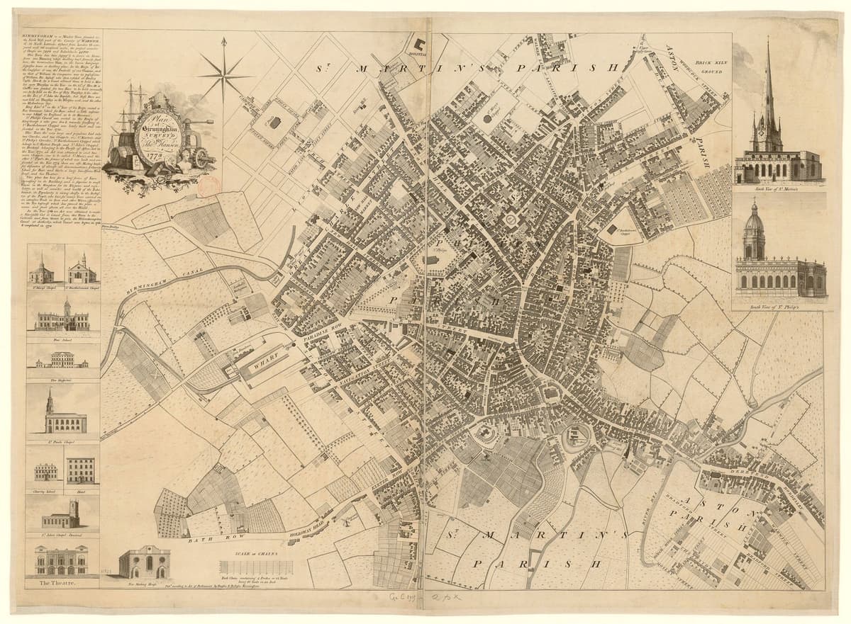
Plan of Birmingham surveyed by Thomas Hanson, 1778Thomas Hanson, 1778. Bibliothèque nationale de France via Wikimedia Commons · Public domain 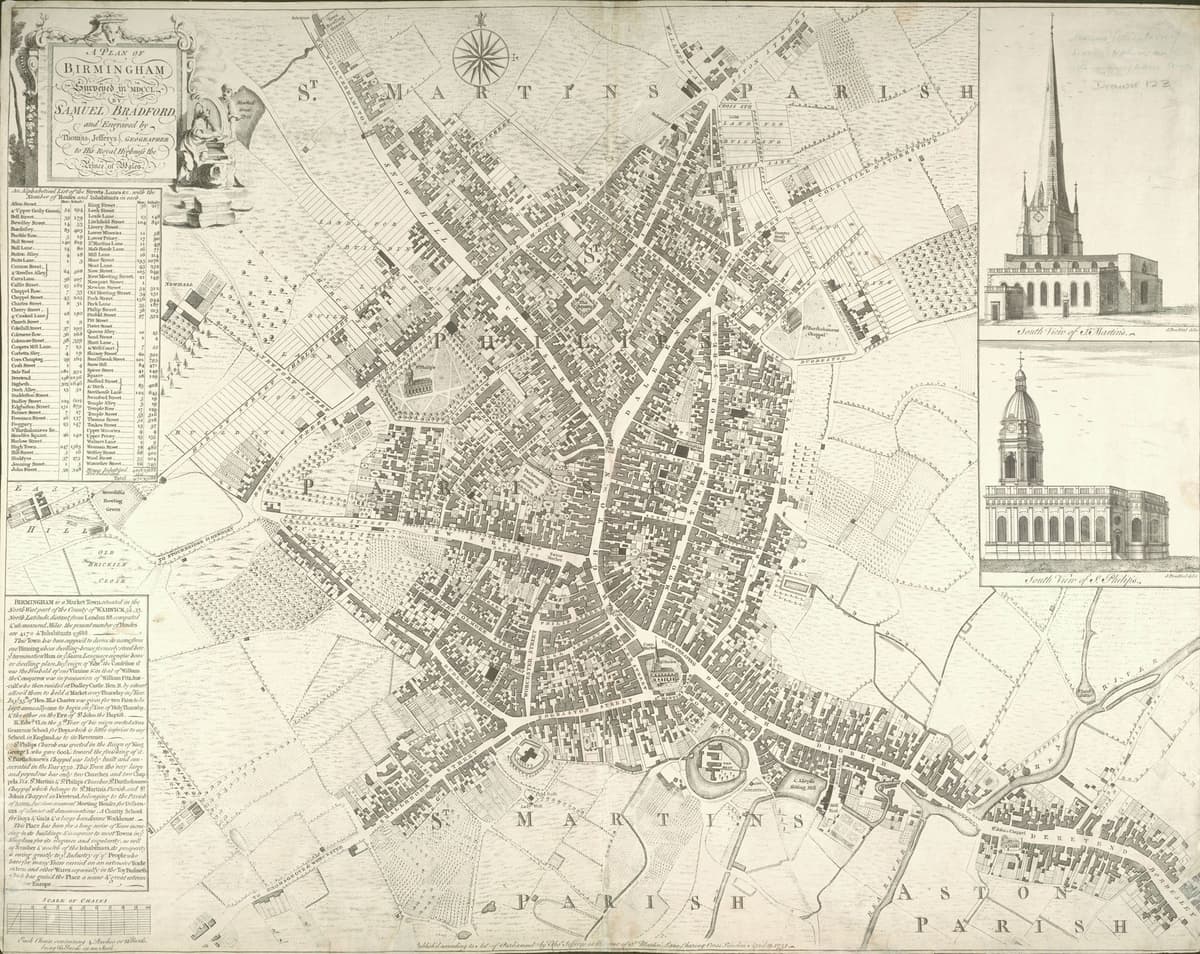
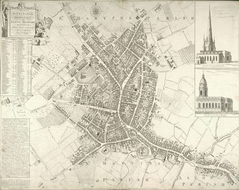
Samuel Bradford’s plan of Birmingham, 1751Samuel Bradford (surveyor); Thomas Jefferys (engraver), 1751. Wikimedia Commons · Public domain 
Birmingham Wholesale Markets at 4am, 4 April 2009star-one, 4 April 2009. Flickr via Wikimedia Commons · CC BY-SA 2.0
The manor house and moat, on today’s streets
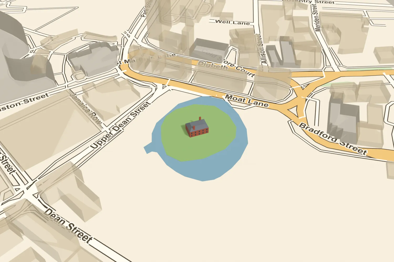
What’s there now
What replaced it
Smithfield Market (1817); the wholesale vegetable market (from 1883); the Birmingham Wholesale Markets (1974–2018, demolished 2018–19). The site is now part of the cleared Smithfield regeneration area beside Moat Lane, where a public square is planned over the buried moat.
What survives
Nothing above ground. Buried remains survive and are a scheduled monument (list entry 1485852): 12th–13th-century red sandstone walling re-exposed in 2021, a possible stone floor foundation, timber stakes and waterlogged moat fills. The street name Moat Lane survives. The moat is shown on the town plans of 1731, 1751 and 1778, and William Hamper drew it in 1814.
Today
Go to Moat Lane, B5, south-east of St Martin’s and the Bull Ring markets. The moated island lay just south-west of the lane, under the cleared Smithfield site, which was fenced off for redevelopment in 2025. Nothing of the moat can be seen.
Then and now
Then · 29 April 1814
Now · 14 March 2025

Today
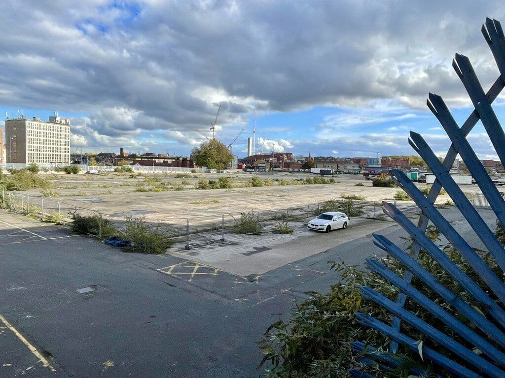
Smithfield market site, 22 October 2025Mike Parker, 22 October 2025. Geograph Britain and Ireland via Wikimedia Commons · CC BY-SA 2.0
Sources and further reading
Historic England suggests the “castle” of the 1166 market grant may have been the Parsonage Moat, not this site; Hutton, Dent and the Victoria County History equate the two. The Francis house is dated to the 1730s (Historic England) or about 1740 (VCH). Clearance is given as 1815–16 (Historic England) or 1816 (VCH). Historic England gives the moat as nearly 40 m wide on the south; fitting the 1751 and 1778 plans gives 25–29 m. Cotswold Archaeology plots the site about 10 m south-west of Historic England’s position. The moat held water in the 1780s (Hutton) but was “almost dry” by 1815 (Dent). Dent links the Commissioners’ £12,500 purchase of the manorial market rights to this period; the VCH says they bought them outright in 1824. The layout of the buildings is known only from 18th-century plans and Hamper’s 1814 drawing.
- The de Birmingham moated site, the seat of the medieval Lords of Birmingham — National Heritage List for England entry 1485852 — Historic England, 2023. dating, dimensions, stone walling, stakes, reasons for scheduling, scheduled 25 October 2023
- A History of the County of Warwick, vol. 7: The City of Birmingham — Manors, pp. 58–72 — W. B. Stephens (ed.), Victoria County History, 1964. 1166 grant, 1424, 1536, c.1560 settlement, c.1740 house
- A History of the County of Warwick, vol. 7: The City of Birmingham — Economic and Social History: Markets and Fairs, pp. 251–252 — W. B. Stephens (ed.), Victoria County History, 1964. Smithfield 1817; wholesale market 1883; tolls bought 1824
- An History of Birmingham (2nd edition) — William Hutton, Pearson and Rollason, Birmingham (Project Gutenberg text), 1783. ‘Manor House (The Moat)’; ‘Court Leet’
- Old and New Birmingham: a history of the town and its people — Robert K. Dent, Houghton and Hammond, Birmingham, 1880. pp. 154, 367–8: 1812 Act, 1815 purchase, clearance, opening notice
- A Century of Birmingham Life — John Alfred Langford, 1870. vol. 1, plate facing p. 160 (after Hamper, 1814)
- Birmingham Moat: its history, topography and destruction — Lorna Watts, 1980. via the Historic England list entry
- Plan of Birmingham, survey’d by Thomas Hanson — Thomas Hanson, 1778. Ref. Bibliothèque nationale de France copy
- A Plan of Birmingham surveyed in 1750 by Samuel Bradford, engraved by Thomas Jefferys — Samuel Bradford, Thomas Jefferys, London, 1751
- The East Prospect / Plan of Birmingham — William Westley, 1731
- Plan of the Borough of Birmingham (Pigott Smith), 1855 — J. Pigott Smith, National Library of Scotland (online), 1855
- Ordnance Survey 1:500 town plan of Birmingham, 1887–88, georeferenced — National Library of Scotland, 1888
- History — Birmingham Wholesale Market
- 5 photos of the Birmingham Wholesale Markets being completely demolished — I Am Birmingham, 2018
- Archaeology works begin at Smithfield Birmingham — Smithfield Birmingham, 2025
- Birmingham Manor House — Wikipedia. lead only

Comments
Comments will load here.