
What was here?
The town’s great open market for cattle, horses, sheep, pigs, hay and straw, laid out in 1817 on the site of the medieval manor house and its moat, between Jamaica Row, Moat Lane, Moat Row and St Martin’s Lane. From 1883 a covered wholesale fruit and vegetable market, with a glass roof on iron columns inside brick walls, spread across it until it filled the whole site by 1900.
History
The lords’ moat becomes a market
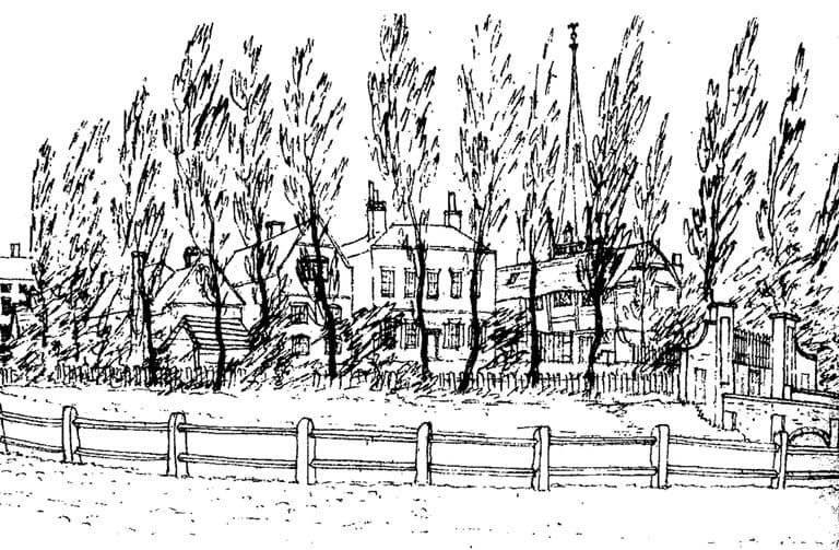
For centuries the moated house of the de Birmingham family had stood just below St Martin’s church. By the early nineteenth century it was a relic, and the town’s Street Commissioners wanted the ground. The Street Act of 1812 let them buy “the Moat and Moat House”. Showell gives the price of the house, moat and ground as £5,672.
On 27 March 1815 the Commissioners offered a premium of £10 for a plan for adapting the premises “for the Accommodation of the intended Smithfield”. The house was cleared in May 1816, its outbuildings the next month, and the moat was filled in.
Pens, pigs and hay
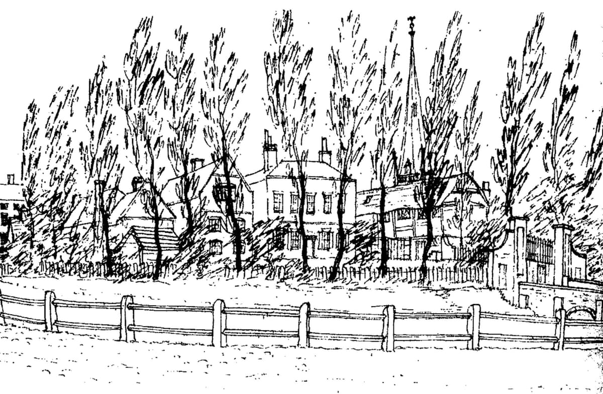
Smithfield opened on Thursday 29 May 1817, the day of the Whitsun fair, for “neat Cattle, Horses, Sheep, and Pigs”. Hay and straw followed on the Tuesday after. Until then the animals had been sold in the streets: pigs and sheep in New Street, cattle in Dale End and Deritend, hay in Ann Street. Gathering them into one yard was the Commissioners’ second great step in reordering the town’s markets, after the clearing of the Bull Ring in 1806.
Pigott Smith’s plan of 1855 shows the result: open ground filled with rows of pens, a small octagonal building in the middle and buildings along the northern edge. The town argued for years about moving the cattle out to Duddeston. In March 1865 the Council voted 31 to 30 against it, and a public meeting in December 1869 again preferred Smithfield.
Under glass
In the end it was fruit and vegetables that took over. In 1881–83 a covered wholesale market was built over the north-western part of the site, with a glass roof on iron columns and brick outer walls. A photograph of about 1887 shows its gabled brick fronts on Jamaica Row, each with a tall arched entrance. The pigs shared the roof, behind a wooden partition, in a pig market the Corporation’s historian called “inconvenient, cold, and windy”.
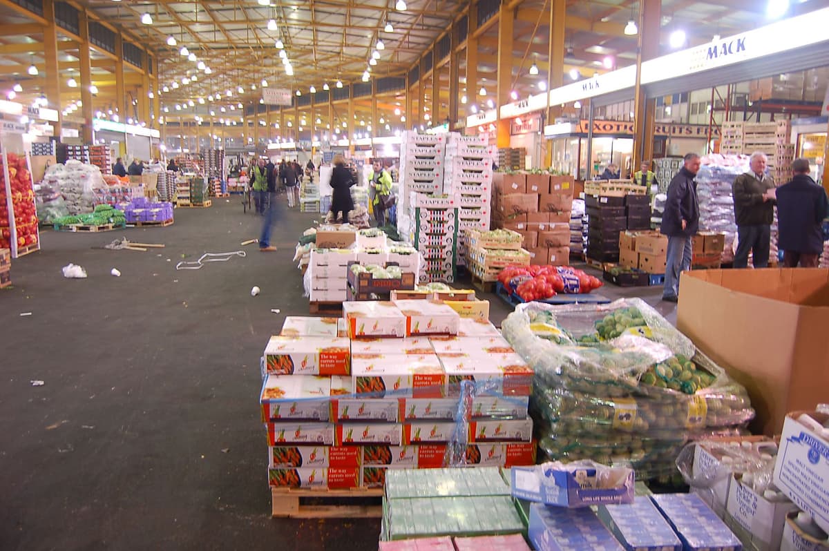
Live cattle sales were falling, blamed on imported dead meat and on the rules restricting the movement of stock to stop disease. In 1897 the pig market moved to Montague Street, and the cattle followed in 1898. The vegetable market took their space. In 1899 the Corporation bought W. & T. Avery’s premises in Moat Lane for £5,600 to extend it again, and by 1900 the whole site had been taken over. Takings had risen from £2,453 in 1883 to £8,040 in 1897–98, and still “many applications for stands were refused”.
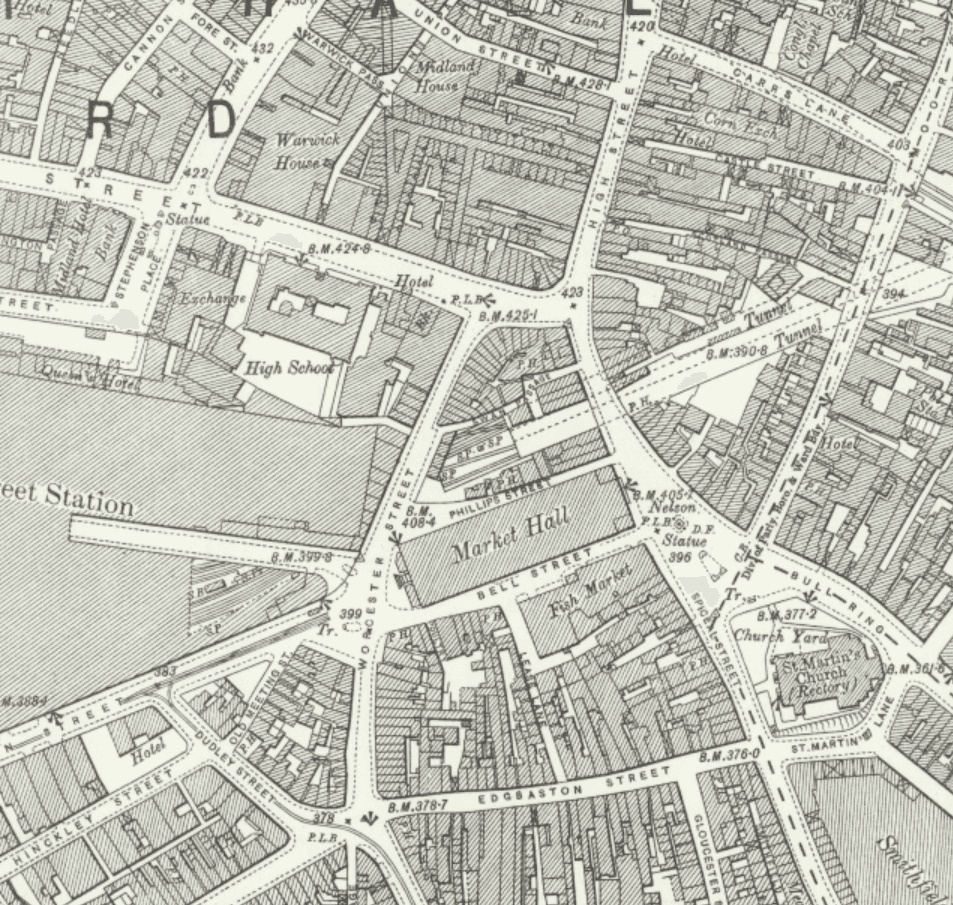
The same spot, then and now
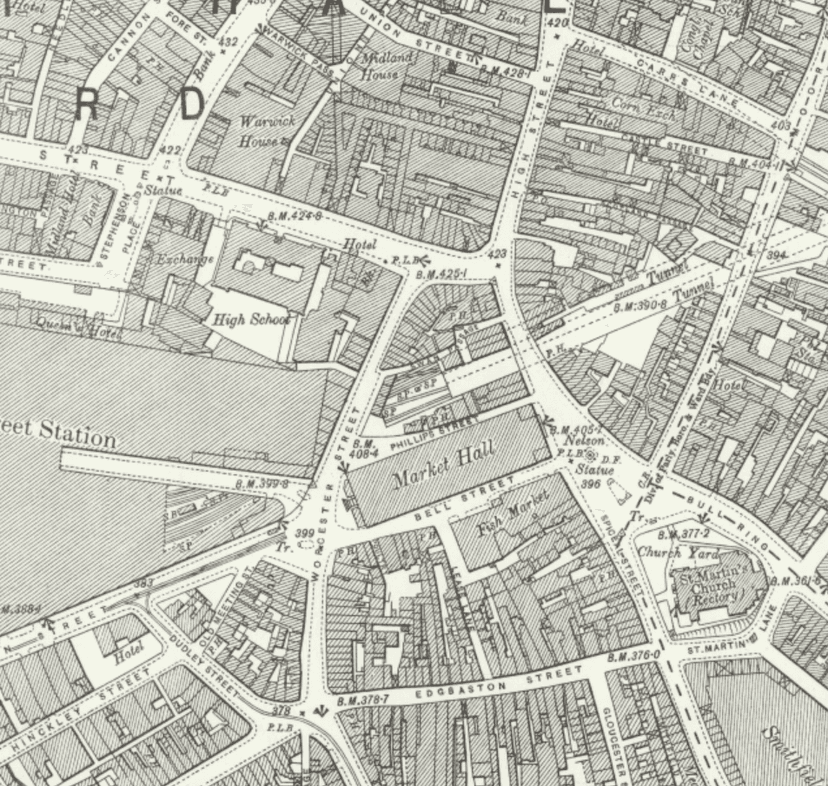
1888–1913
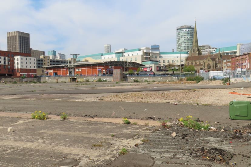
Today
Old map: Ordnance Survey six-inch, reproduced with the permission of the National Library of Scotland (CC BY 4.0). Today: © OpenStreetMap contributors.
The open ground by Moat Row had another life as well. Until 1957 the Rag Fair, the town’s second-hand market, was held in its lower part.
Cleared twice
In the 1970s Birmingham built new Wholesale Markets on the site. Their first phase, for fish, meat and poultry, opened in February 1974, and the Victorian market was demolished in about 1975. The new markets lasted just over forty years. They moved out to Witton in May 2018 and were cleared in 2018–19.
Today the ground is the cleared Smithfield regeneration site, with a public square planned over the buried moat. The market built to replace the lords of Birmingham’s house has gone, and the moat it buried is now a protected monument.
Why it mattered
Smithfield took Birmingham’s livestock, hay and straw markets off the streets and gathered them in one yard, on the very site of the lords’ manor house. From 1883 it was the town’s wholesale fruit and vegetable market, and it grew so fast that by 1900 it had taken the whole site. It was the forerunner of the Wholesale Markets that stood here until 2018.
Why it disappeared
Redevelopment
By the 1960s the Victorian market was congested and in poor condition, and the fish market in Bell Street had been demolished in 1958. The Corporation built a new Wholesale Markets complex on the site, and the old covered market was demolished in about 1975. Those markets in turn closed in 2018, when the trade moved to Witton.
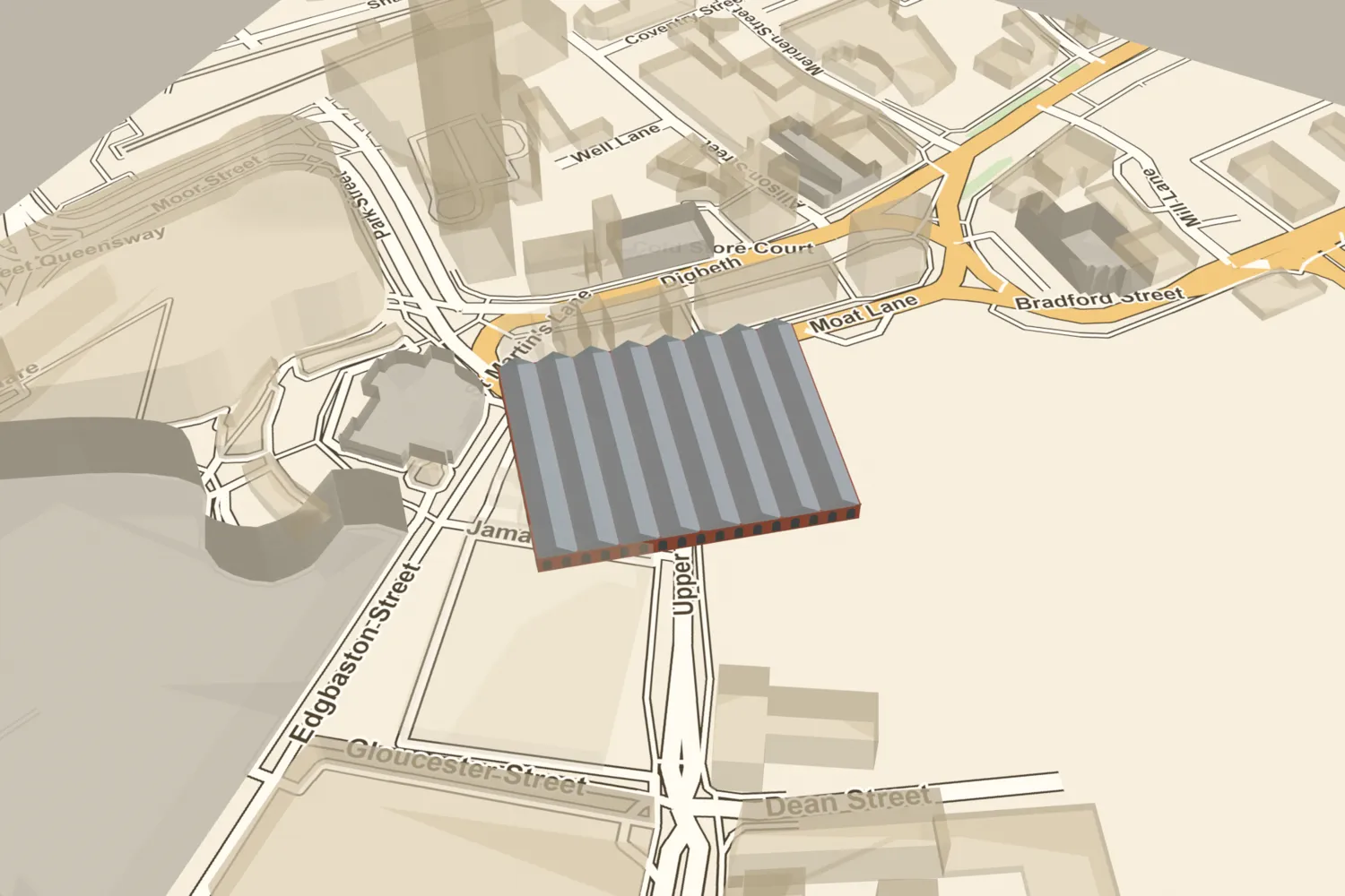
Smithfield Market, on today’s streets
What’s there now
What replaced it
Birmingham Wholesale Markets (first phase opened February 1974), which closed in May 2018 and were demolished in 2018–19. The site is now the cleared Smithfield regeneration area, with a public square planned over the buried moat.
What survives
Nothing of the market. The buried remains of the moated manor house beneath it are a scheduled monument (list entry 1485852). The name survives in Moat Lane, and a short stub of Jamaica Row remains by the Rag Market. Gates at the National Tramway Museum, Crich, may come from the old wholesale market hall, but this is unconfirmed.
Today
Stand on Moat Lane or Upper Dean Street and look into the fenced Smithfield site. The 1883 hall stood in its north-western part, along the line of Jamaica Row and just south-east of St Martin’s churchyard. The moat lay mainly under the southern and central part of the old market block.
Then and now
Then · c.1900
Now · 8 April 2025
Today
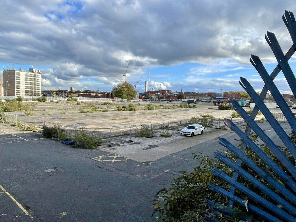
Smithfield market site, 22 October 2025Mike Parker, 22 October 2025. Geograph Britain and Ireland via Wikimedia Commons · CC BY-SA 2.0
Sources and further reading
The designer of the 1881–83 covered market is not established. Frank Barlow Osborn is possible, but this rests on Wikipedia’s reading of Building News (7 September 1883), which has not been seen; Osborn is also named for the 1903 extension. Historic England dates the covered market to 1881–83, the Victoria County History has it opening in 1883, and a lead source says 1884. Extensions are dated 1892 and 1903 by secondary sources, against the enlargements of 1897–1900 recorded by Vince; how these fit together is unclear. The demolition date of about 1975 rests on Prior & Partners (secondary) and Historic England’s “1970s”; a watching brief of 1973–75 suggests work began by 1973. The winner of the 1817 plan competition and the purpose of the small octagonal building on the 1855 plan are not known. Ironwork gates at the National Tramway Museum, Crich, are said by a photo caption to come from the old Birmingham wholesale market hall in 1975; this is unverified.
- A History of the County of Warwick, vol. 7: The City of Birmingham — Economic and Social History: Markets and Fairs, pp. 251–252 — W. B. Stephens (ed.), Victoria County History, 1964. Smithfield opened 1817; vegetable market 1883; pig and cattle markets moved 1897–98; whole site by 1900; Rag Fair
- The de Birmingham moated site, the seat of the medieval Lords of Birmingham — National Heritage List for England entry 1485852 — Historic England, 2023. covered market of 1881–83: glass roof on iron columns, brick outer walls; demolished 1970s
- History of the Corporation of Birmingham, vol. III (1885–1899) — C. A. Vince, Corporation of Birmingham, 1902. ch. VI, Markets and Fairs: receipts, pig market 1891, Avery’s premises 1899
- Old and New Birmingham: a history of the town and its people — Robert K. Dent, Houghton and Hammond, Birmingham, 1880. premium notice of 1815; opening notice of 1817
- Showell’s Dictionary of Birmingham — Thomas T. Harman and Walter Showell, Cornish Brothers, Birmingham, 1885. ‘Markets’, ‘Manor House’, ‘Vegetable Market’
- Modern Birmingham and its Institutions, vols 1–2 — John Alfred Langford, 1873–77. vol. 2: council votes of March 1865
- Markets: Wholesale Markets History — Birmingham City Council, 2007
- History — Birmingham Wholesale Market
- The Markets of Birmingham — Library of Birmingham (The Iron Room blog), 2016. photograph c.1887, WK/B11/367
- Smithfield Birmingham (project page) — Prior & Partners. demolition 1975; site cleared 2019
- Frank Barlow Osborn — Wikipedia
- Smithfield, Birmingham — Wikipedia
- Ordnance Survey 1:500 town plan of Birmingham, 1887–88, georeferenced — National Library of Scotland, 1888. 1883 hall traced
- Plan of the Borough of Birmingham (Pigott Smith), 1855 — J. Pigott Smith, National Library of Scotland (online), 1855
- Ordnance Survey 25-inch map, Warwickshire (Birmingham sheet), georeferenced — National Library of Scotland
- OpenStreetMap data (Overpass and Nominatim), central Birmingham — OpenStreetMap contributors, 2026
Archive references: Library of Birmingham WK/B11/367
Comments
Comments will load here.