
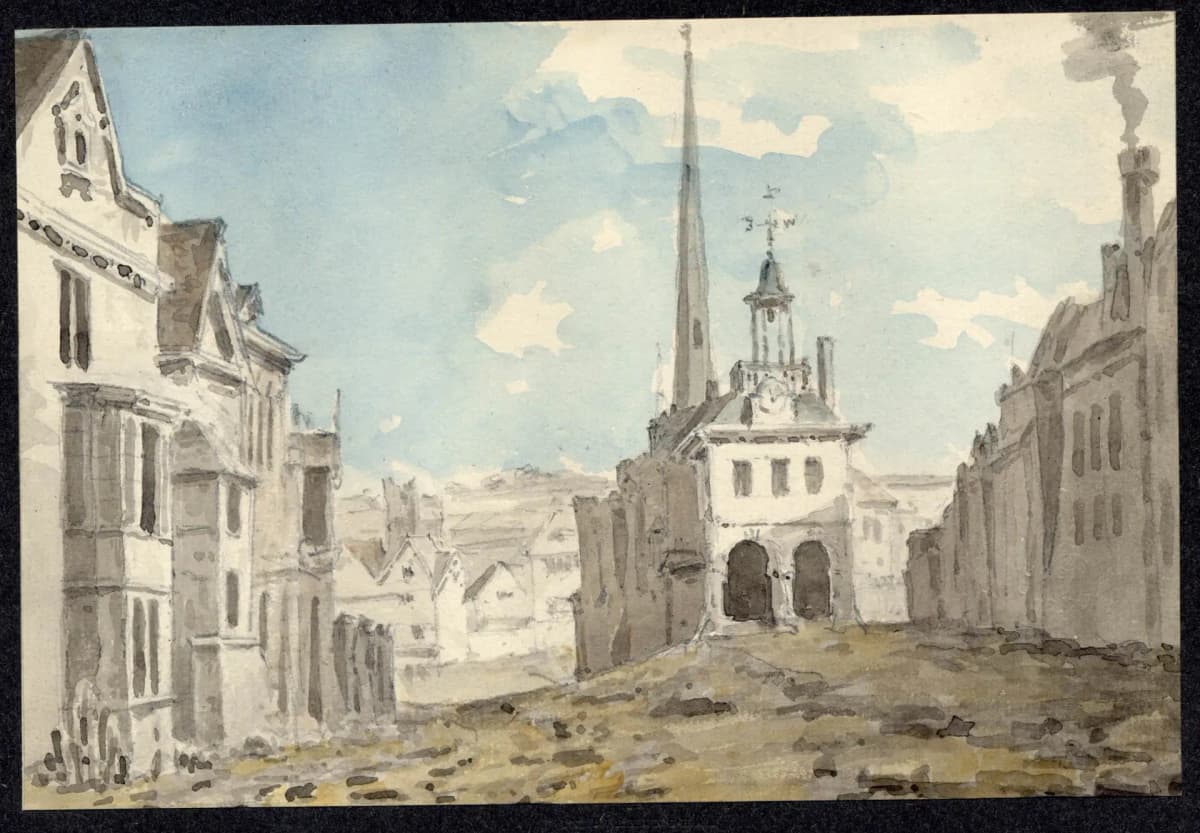
What was here?
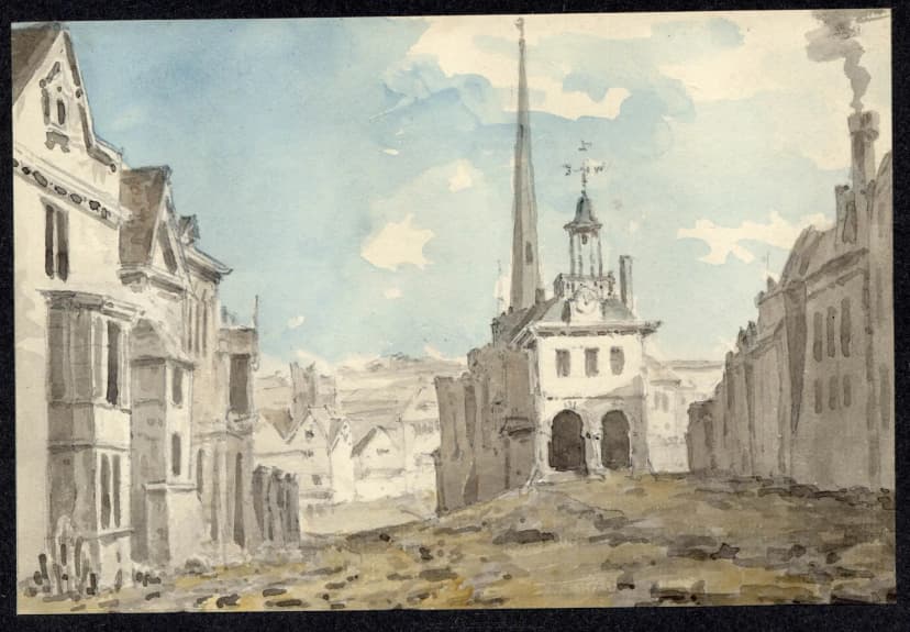
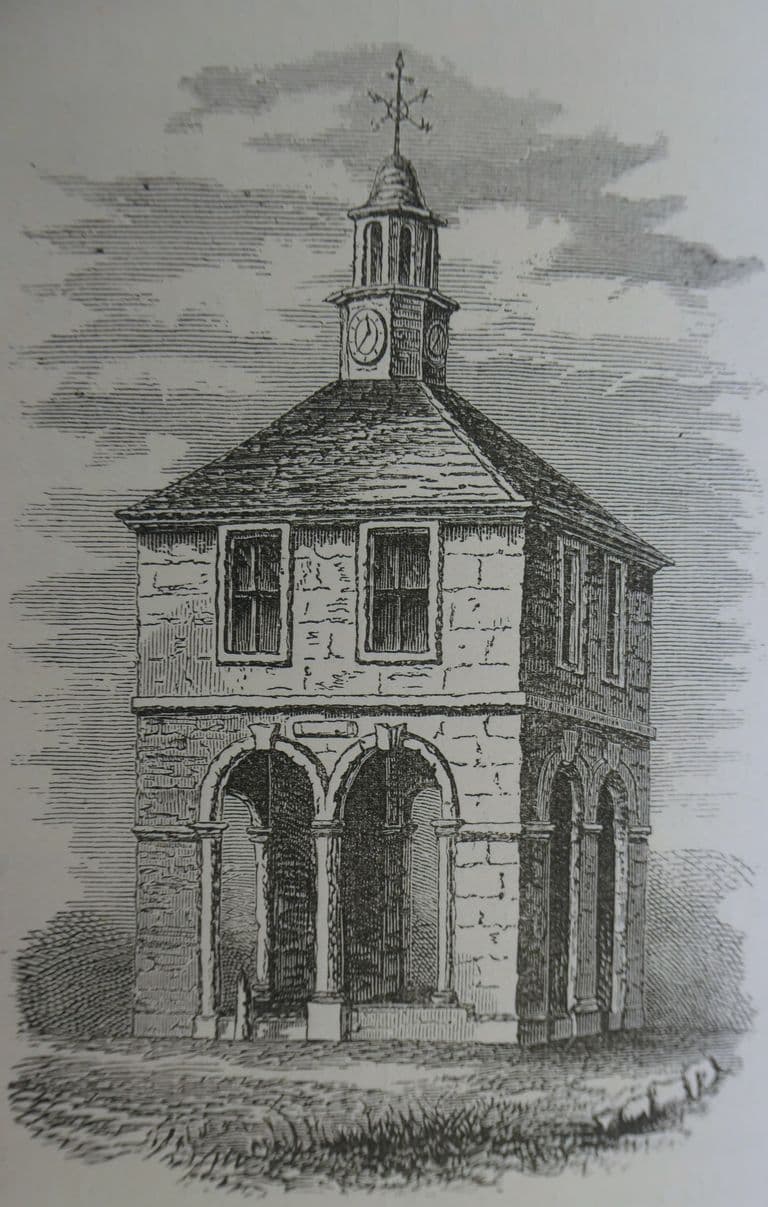
A small, square, two-storey market house standing free in the street at the head of the Bull Ring, nearly opposite the mouth of Philip Street. Below was an open arcade where butter, eggs, fruit and fowls were sold; above was a room used for town meetings and courts. It had a hipped roof with a balustrade, a cupola and, from 1727, a clock.
History
A room over the Butter Cross
By 1700 an open, arcaded market shelter already stood at the top of the Bull Ring. People called it the Butter Cross. In 1702 the townspeople subscribed money “for the repairing of the Market Cross and making a roome over it”. On 22 March 1703 the Town Book recorded “a Roome nearly built over that which is the Butter Cross”. The key went to the constables, and the room was kept for public meetings. The first recorded meeting “at the Chamber over the Cross” took place on 19 September 1704.
William Hutton, the town’s historian, put the cost of “the present cross” at £80 9s. 1d. The result was a small square house: open arches below, a room above lit by sash windows, and a hipped roof crowned with a balustrade and a cupola.
The town’s front room
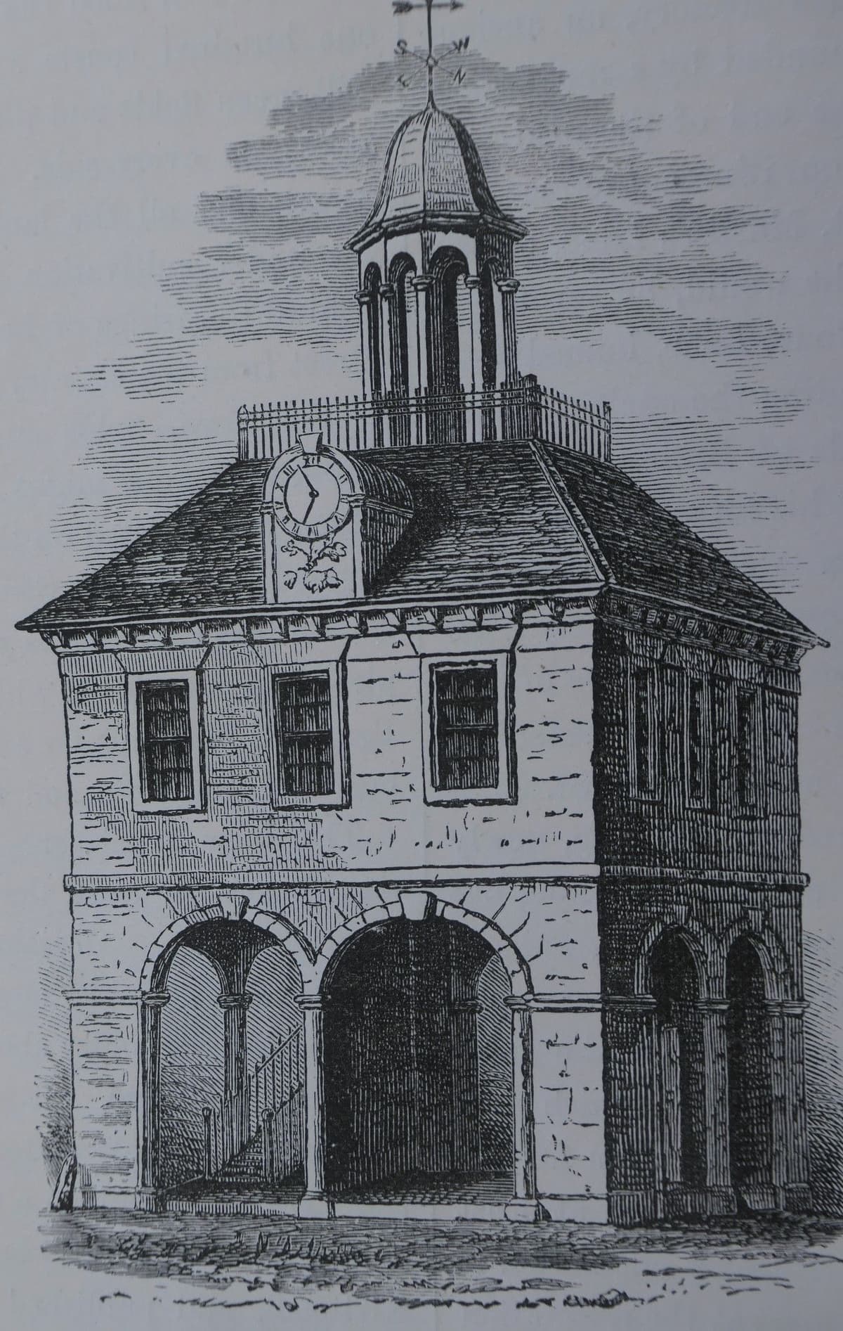
For most of the eighteenth century this little room was the town’s public hall. It was “designed for the court leet, and other public business”, Hutton wrote; that business had once been done at the lord’s moat house and then at the Leather Hall. From 1752 the commissioners of the new Court of Requests, the small-debts court, sat “in the chamber over the Old Cross every Friday morning”.
Below, the market carried on. “The under part was found a useful shelter for the market-people,” said Hutton, and in his day “fruit, fowls and butter are sold at the Old Cross”. Showell later recalled country women bringing butter and eggs to it, and farmers meeting round it with their samples of corn. In years of scarcity, he wrote, they “needed the protection of special constables”.
In 1727 “the neighbours to the Markett Cross” bought a new clock at their own expense, and in 1729 Jonathan Taylor was paid £4 13s. for “Painting and Gilding the Dyall Board at the Old Cross”. Once a second cross had been built at the Welsh End, this one was always the Old Cross.
A penniless young man on its steps
On 14 July 1741 a young man arrived in Birmingham without money and “sat to rest on the north side of the Old Cross, near Philip Street”. He was William Hutton himself. He stayed, prospered and wrote the town’s history. He thought “the ancient centre of Birmingham seems to have been the Old Cross, from the number of streets pointing towards it”. Distances in the town were once measured from it, and George Fentham’s charity of 1712 required its trustees to live within 100 yards of it.
Ruinous and sold
By 1784 the Cross was falling down. On 21 July a town’s meeting considered “the ruinous state of that venerable structure”. On 7 August its materials were auctioned for £60, and the clock and bell for £10. It was demolished that month, as the town began clearing the crowded market place round St Martin’s.
The same spot, then and now
1888–1913
Today
Old map: Ordnance Survey six-inch, reproduced with the permission of the National Library of Scotland (CC BY 4.0). Today: © OpenStreetMap contributors.
The spot was not forgotten. In 1805 “the spot near where the old Cross once stood” was suggested for a memorial to Nelson, whose statue went up in 1809 a little further down the Bull Ring. Today the site is at the western edge of St Martin’s Walk in the Bullring. Shoppers walk over the place where Birmingham once kept its clock, its courts and its town meetings, all in one room above a butter market.
Why it mattered
For most of the eighteenth century the room over the Old Cross was Birmingham’s public hall. Town meetings, the court leet and, from 1752, the Court of Requests met there, while the market traded underneath. Hutton thought it marked the ancient centre of the town, and Birmingham measured its distances from it.
Why it disappeared
Condition of the building · Road building
A town’s meeting found it ruinous in July 1784. Its materials, clock and bell were sold at auction on 7 August, and it was pulled down that month, as part of the clearing of the crowded market place round St Martin’s.
More pictures
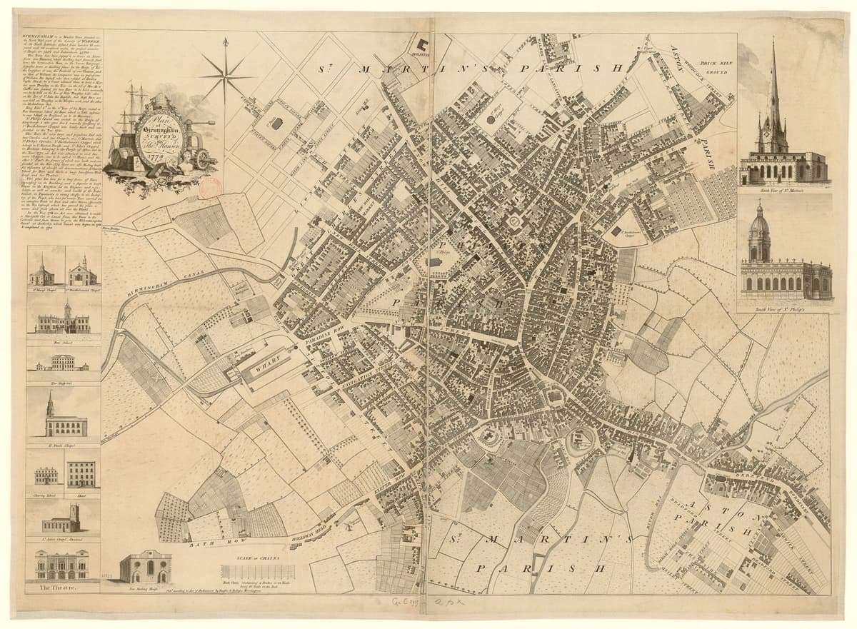
Plan of Birmingham surveyed by Thomas Hanson, 1778Thomas Hanson, 1778. Bibliothèque nationale de France via Wikimedia Commons · Public domain
The High Cross, on today’s streets
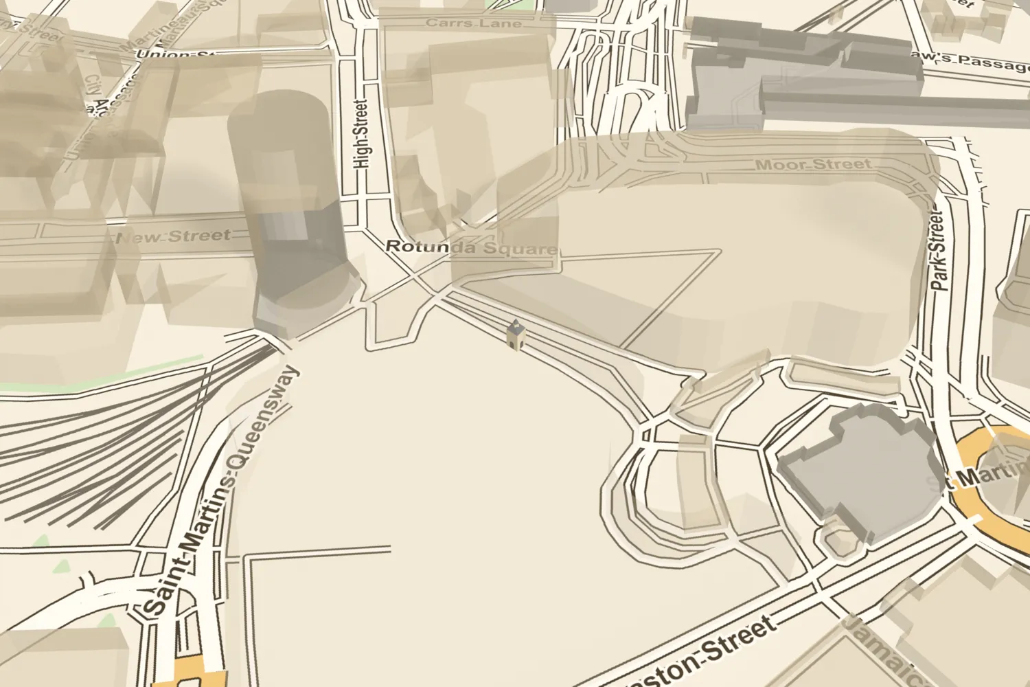
What’s there now
What replaced it
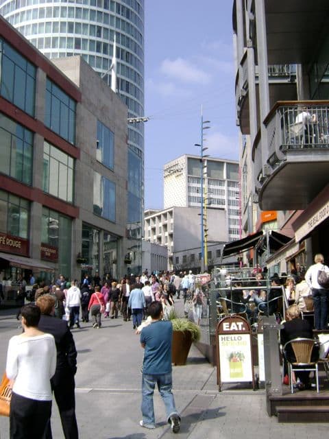
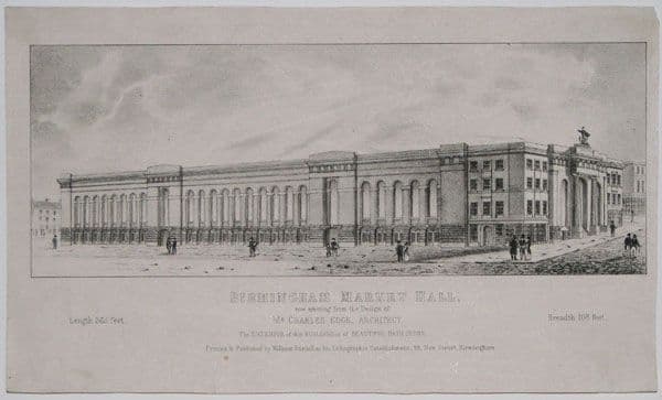
Open street at the head of the Bull Ring, later opposite the Market Hall of 1835. The site is now the western edge of St Martin’s Walk in the Bullring shopping centre (2003).
What survives
Nothing. A City of Birmingham blue plaque on Edgbaston Street reads “Near here stood the Old Market Cross. Public meetings were held here in the 18th century”. It is about 150 metres from the site worked out from the old maps.
Today
Walk up St Martin’s Walk in the Bullring towards New Street. The Cross stood at the western edge of the walk, by the frontage of the Bullring’s West Mall, roughly in front of where the steps of the Market Hall later rose.
Then and now
Then · before 1784
Now · 20 April 2009
Sources and further reading
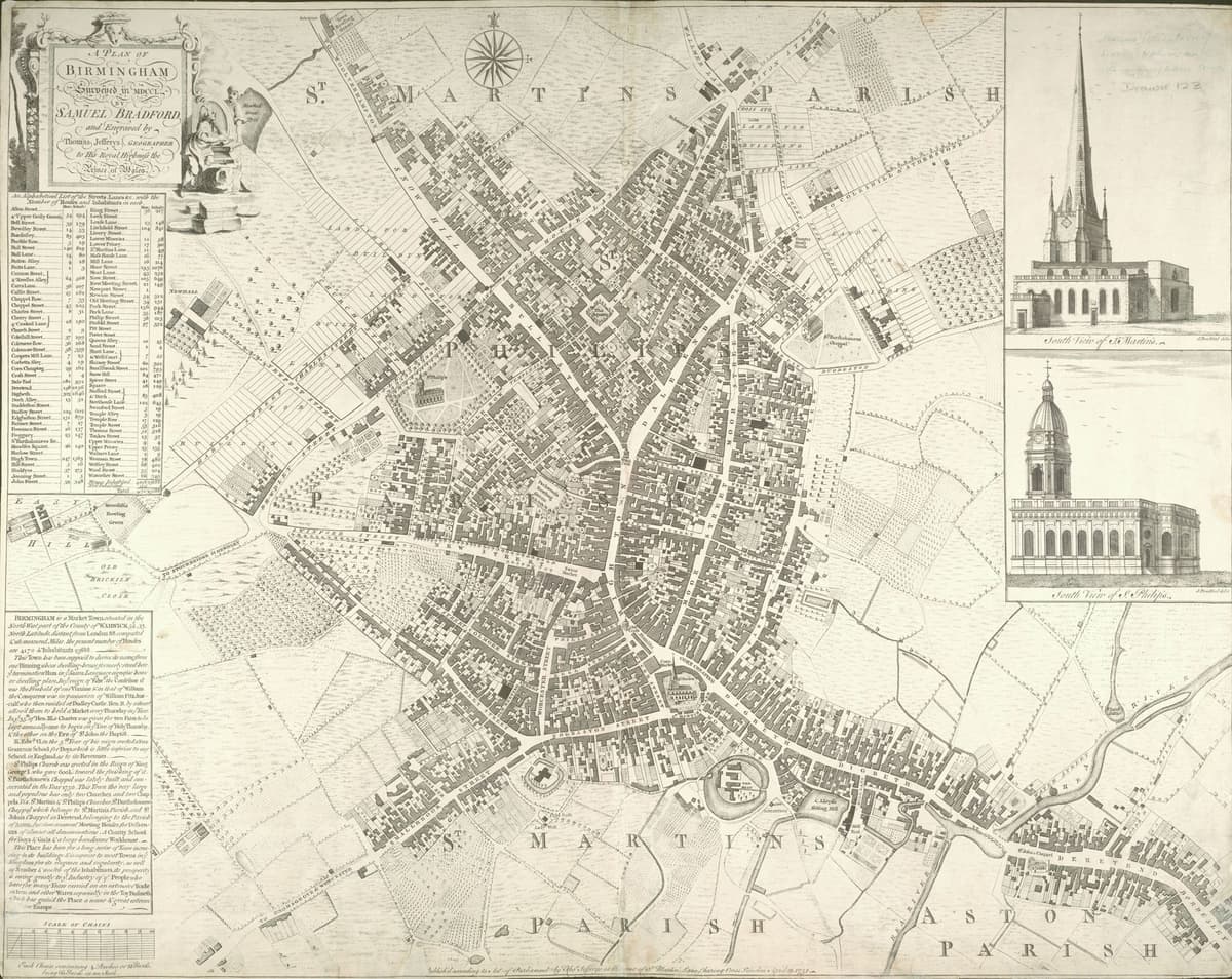
Hutton says the Cross was “erected” in 1702, but the Victoria County History and the Town Book extracts printed by Dent show a room added in 1702–3 over an existing arcaded shelter, so the ground storey may be older. Hutton gives the cost as £80 9s. 1d.; the subscription printed by Dent reads as about £47 15s. 3d., but the scanned text is unclear. The position is worked out from Bradford’s plan of 1751 and Hanson’s of 1778 and is good to about 15 metres. The blue plaque on Edgbaston Street (“Near here”) is about 150 metres from that position. Its size, about 5.3 metres square, comes only from Hanson’s symbol; no dimensions, materials or height are recorded, and Dent’s engraving redraws Hutton’s plate rather than being an independent record.
- A History of the County of Warwick, vol. 7: The City of Birmingham — Secular Architecture, pp. 43–57 — W. B. Stephens (ed.), Victoria County History, 1964. room added to an existing arcaded shelter; hipped roof, cupola and balustrade
- A History of the County of Warwick, vol. 7: The City of Birmingham — Local Government and Public Services, pp. 318–353 — W. B. Stephens (ed.), Victoria County History, 1964. Court of Requests; removal in 1784
- An History of Birmingham (2nd edition) — William Hutton, Pearson and Rollason, Birmingham (Project Gutenberg text), 1783. cost, uses, Court of Requests, ancient centre, Fentham’s charity
- Old and New Birmingham: a history of the town and its people — Robert K. Dent, Houghton and Hammond, Birmingham, 1880. Town Book entries 1702–29; Hutton’s arrival; 1784 meeting, sale and demolition
- An Historical and Descriptive Sketch of Birmingham — Beilby, Knott and Beilby (publishers), 1830. position nearly opposite Philip Street; taken down 1784
- Showell’s Dictionary of Birmingham — Thomas T. Harman and Walter Showell, Cornish Brothers, Birmingham, 1885. ‘Corn Market’, ‘Centre of Birmingham’
- A Century of Birmingham Life — John Alfred Langford, 1870. vol. 2: Nelson memorial proposal, 1805
- Old Market Cross blue plaque (Open Plaques 2147) — Open Plaques
- Tour of Lost Birmingham No. 11: Market Cross and Welsh Cross — Mapping Birmingham (blog), 2012
- A Plan of Birmingham surveyed in 1750 by Samuel Bradford, engraved by Thomas Jefferys — Samuel Bradford, Thomas Jefferys, London, 1751. ‘Old Cross’ fitted to modern landmarks
- Plan of Birmingham, survey’d by Thomas Hanson — Thomas Hanson, 1778. Ref. Bibliothèque nationale de France copy. ‘Old Cross’ fitted to modern landmarks
- Plan of the Borough of Birmingham (Pigott Smith), 1855 — J. Pigott Smith, National Library of Scotland (online), 1855
- Ordnance Survey 1:500 town plan of Birmingham, 1887–88, georeferenced — National Library of Scotland, 1888
- OpenStreetMap data (Overpass and Nominatim), central Birmingham — OpenStreetMap contributors, 2026
Archive references: British Museum 1909,0406.30
Comments
Comments will load here.