
What was here?
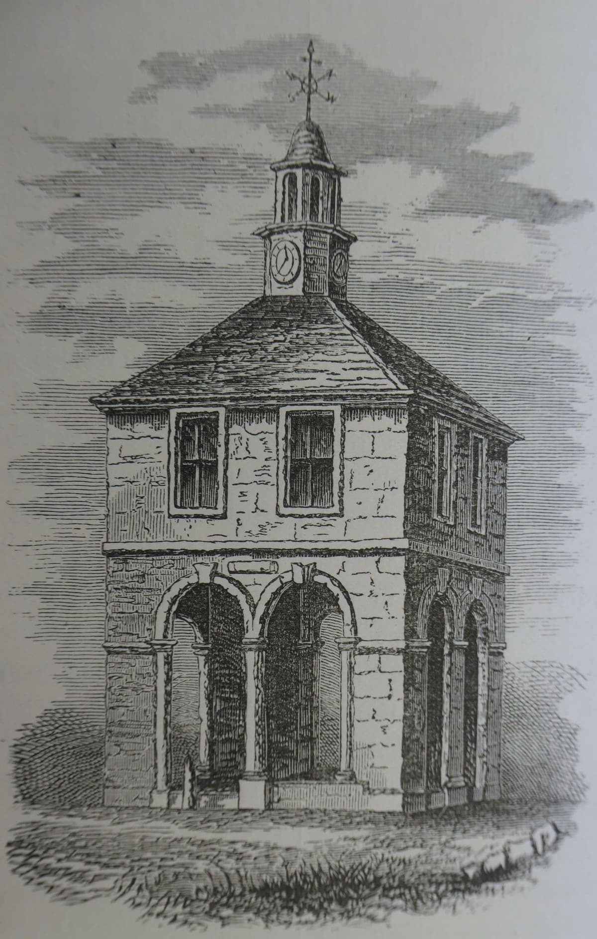
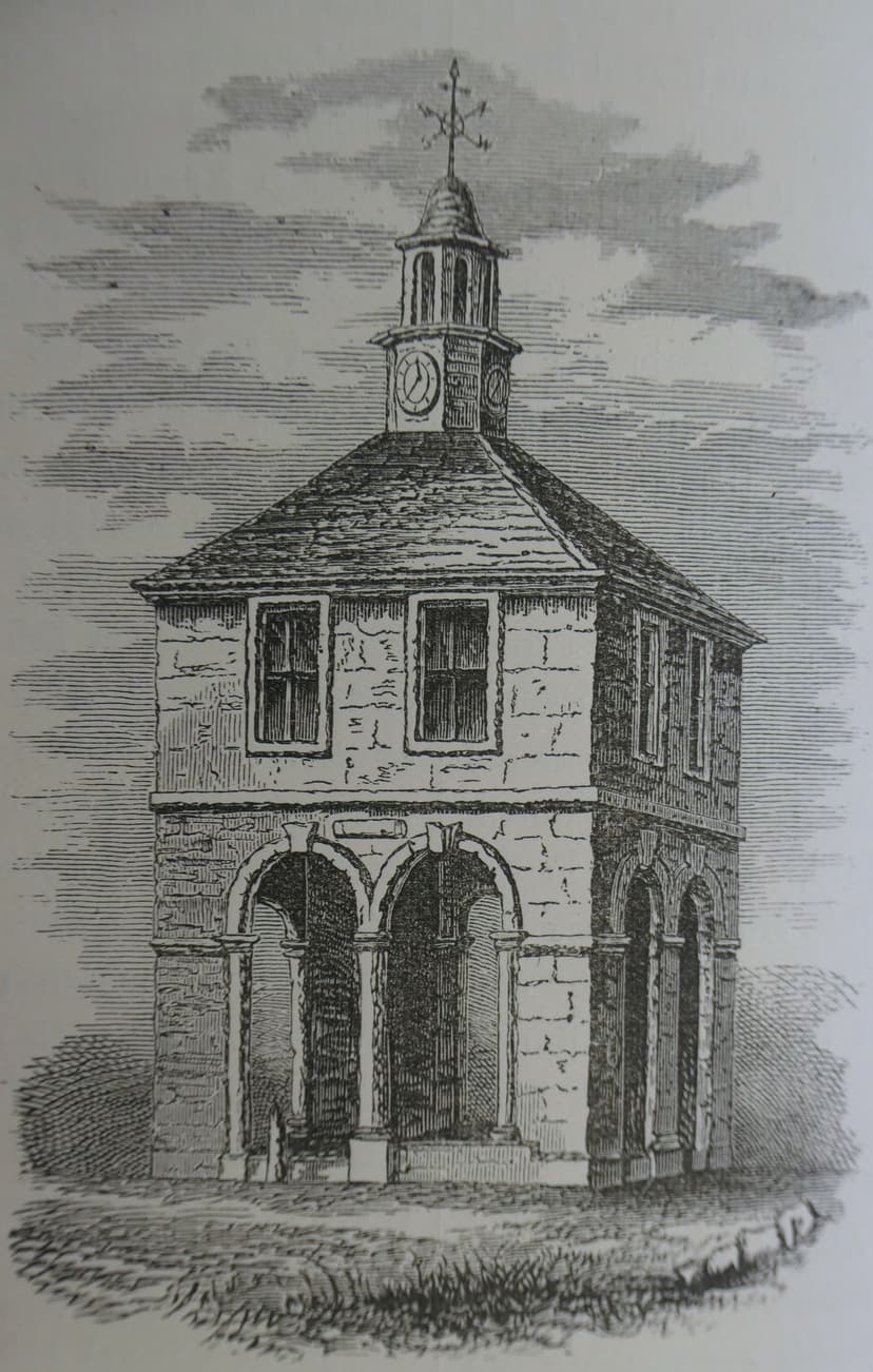
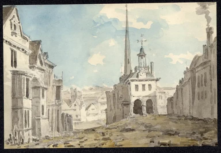
A small, square, two-storey market house standing in the street where High Street divides into Bull Street and Dale End. It had an open arcaded ground floor raised on steps, a room above, and a hipped roof with a clock turret, a cupola and a weather vane. The pillory and stocks stood in front of it.
History
At the Welsh End
Where High Street divides into Bull Street and Dale End, the old town once ended on the road towards Wales. Hutton wrote in 1783 that “200 years ago this spot bore the name of the Welch End”. Describing Prince Rupert’s attack on the town in 1643 for his own readers, Hutton placed the start of the fighting “in Bull-street, about twelve houses above the cross”.
The Town Book dates the cross that gave the spot its later name. On 16 February 1706 the constables were told to pay £18 12s. “towards the finishing of the Welch Cross and Chamber over the same”. Like the Old Cross at the head of the Bull Ring, it was a small square house, with an open arcade below, raised on steps, and a room above. A clock turret with a cupola and a weather vane sat on its hipped roof.
A market nobody wanted
It was built to take pressure off the Bull Ring as the town grew. The Welsh Cross was “designed, as population encreased, for a Saturday market,” wrote Hutton, “yet, although it is used in some degree for that purpose, the people never heartily adopted the measure.” The 1830 Sketch of Birmingham remembered that it “afforded considerable market accommodation, being surrounded by steps, and the lower part open”. In 1768 the cheese market was moved there.
Guard-house and pillory
The room upstairs found a harder use. In 1723 a town meeting wanted a proper guard-house built elsewhere, “because neither of the crosses were eligible”, but nothing was done. By 1783, Hutton reported, “the upper room of this cross is appropriated for a military guard-house”. It was also used to hold prisoners. The stocks and whipping-post were moved here from the manor court, and the 1830 Sketch describes the cross as the building “in front of which was fixed the pillory and stocks”. Showell later repeated a story, introduced with “it has been said”, that prisoners stepped straight out of the window onto a platform to be pilloried or whipped. It has never been proved.
The cross stood right in the road. On 15 April 1787 the Chester mail coach overturned “while rounding the Welsh Cross”.
Cleared for traffic
By 1800 the town’s Street Commissioners were widening the old streets. Their Street Act of 1801 authorised “the removal of the Welsh Cross”. On 4 October 1802 the Gazette advertised “the Clock with three Dials, now belonging to the Welsh Cross … also the Weather Vane, Iron Works, and Ball thereto belonging”. In March 1803 the cross was taken down to widen the street.
For a while its name stayed in use. In 1806 market stalls were banned between “Mr. Knight’s house (late the Welsh Cross)” and the end of Philip Street.
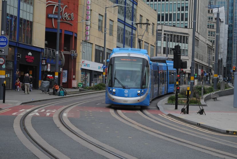
Today the spot is the paved junction at the foot of Bull Street, by Crooked Lane, where the Metro tram curves into Albert Street. There is no plaque. The trams now turn at the corner where Birmingham once tried, and failed, to start a second market place.
Why it mattered
The Welsh Cross was the town’s attempt to spread its market beyond the Bull Ring as Birmingham grew. It held the cheese market from 1768, and its room served as the military guard-house, with the pillory and stocks outside. Its name kept alive the ‘Welsh End’, the old edge of the town on the road towards Wales.
Why it disappeared
Road building
It stood in the middle of a busy junction. The Street Act of 1801 authorised its removal; its clock, vane and ironwork were advertised for sale in October 1802, and it was taken down in March 1803 to widen the street.
The same spot, then and now
1888–1913
Today
Old map: Ordnance Survey six-inch, reproduced with the permission of the National Library of Scotland (CC BY 4.0). Today: © OpenStreetMap contributors.
More pictures
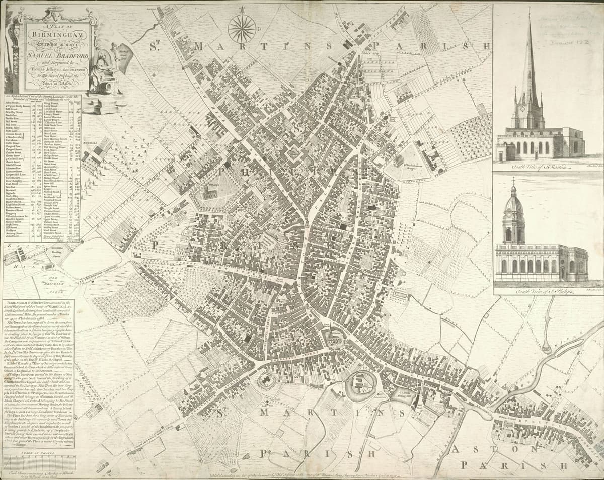
Samuel Bradford’s plan of Birmingham, 1751Samuel Bradford; engraved by Thomas Jefferys, 1751. Wikimedia Commons · Public domain
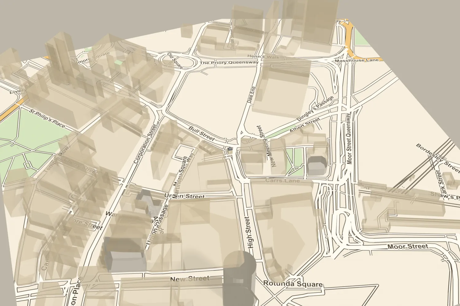
The Welsh Cross, on today’s streets
What’s there now
What replaced it
Open street at the meeting of High Street, Bull Street and Dale End, remodelled in the 1880s with Martineau Street and Albert Street. It is now the paved pedestrian and Metro tram junction at the foot of Bull Street.
What survives
Nothing, and there is no plaque.
Today
Stand at the foot of Bull Street, between Crooked Lane and the curve of the tram line into Albert Street, near Martineau Place. The Welsh Cross stood in the middle of the street here.
Then and now
Then · Published 1880
Now · 9 April 2026
Sources and further reading
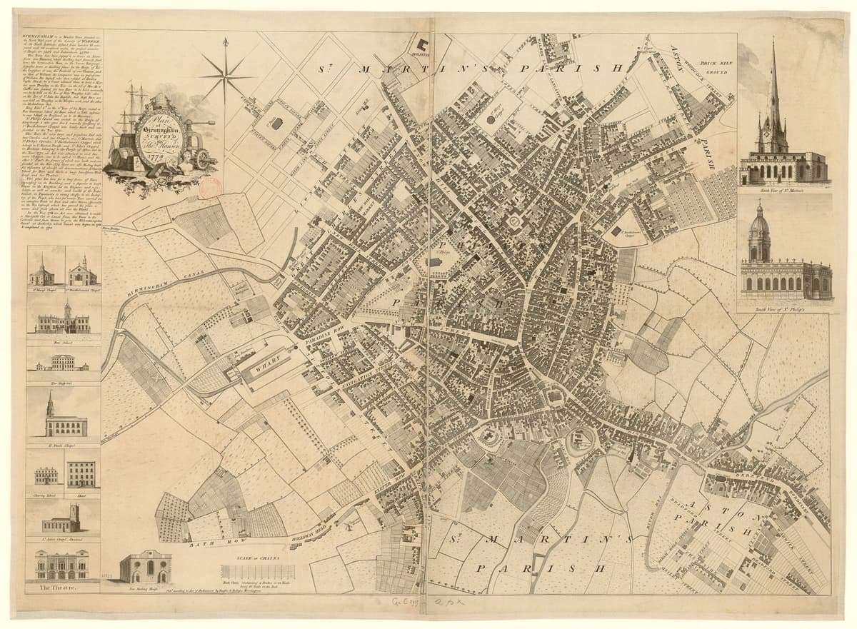
The Town Book shows the cross and chamber being finished in February 1706. The Victoria County History reads this as an upper storey added that year, so the open shelter may be a little older. Dent dates the clock advertisement 4 October 1802 and Showell 12 October. The position is good to about 15 metres: it rests on Bradford’s plan of 1751 and the 1855 street plan, while fits to Hanson’s plan of 1778 fall 11–17 metres further north. Its size, about 5.8 by 5.7 metres, comes from Hanson’s symbol, which is probably schematic. The main front, materials and height are not documented, and Dent’s engraving redraws Hutton’s plate. Showell’s story of prisoners stepping through the window onto a pillory platform is only “it has been said”.
- A History of the County of Warwick, vol. 7: The City of Birmingham — Secular Architecture, pp. 43–57 — W. B. Stephens (ed.), Victoria County History, 1964. upper storey added 1706
- A History of the County of Warwick, vol. 7: The City of Birmingham — Local Government and Public Services, pp. 318–353 — W. B. Stephens (ed.), Victoria County History, 1964. 1801 Street Act authorises removal
- A History of the County of Warwick, vol. 7: The City of Birmingham — Economic and Social History: Markets and Fairs, pp. 251–252 — W. B. Stephens (ed.), Victoria County History, 1964. cheese market moved here 1768
- An History of Birmingham (2nd edition) — William Hutton, Pearson and Rollason, Birmingham (Project Gutenberg text), 1783. Welch End; Saturday market; guard-house; 1723 meeting; 1643 attack
- Old and New Birmingham: a history of the town and its people — Robert K. Dent, Houghton and Hammond, Birmingham, 1880. Town Book order of 16 February 1706; stocks and whipping-post; 1802 advertisement; taken down March 1803
- An Historical and Descriptive Sketch of Birmingham — Beilby, Knott and Beilby (publishers), 1830. steps and open lower part; pillory and stocks; removed 1803
- Showell’s Dictionary of Birmingham — Thomas T. Harman and Walter Showell, Cornish Brothers, Birmingham, 1885. prisoners; 1787 coach accident; 1803
- A Century of Birmingham Life — John Alfred Langford, 1870. vol. 2: 1800 notice of the Street Bill; 1806 stall ban
- Tour of Lost Birmingham No. 11: Market Cross and Welsh Cross — Mapping Birmingham (blog), 2012
- A Plan of Birmingham surveyed in 1750 by Samuel Bradford, engraved by Thomas Jefferys — Samuel Bradford, Thomas Jefferys, London, 1751. ‘Welch Cross’ fitted to modern landmarks
- Plan of Birmingham, survey’d by Thomas Hanson — Thomas Hanson, 1778. Ref. Bibliothèque nationale de France copy. ‘Welch Cross’ fitted to modern landmarks
- Plan of the Borough of Birmingham (Pigott Smith), 1855 — J. Pigott Smith, National Library of Scotland (online), 1855
- Ordnance Survey 1:500 town plan of Birmingham, 1887–88, georeferenced — National Library of Scotland, 1888
- OpenStreetMap data (Overpass and Nominatim), central Birmingham — OpenStreetMap contributors, 2026
Comments
Comments will load here.