
21 pairs
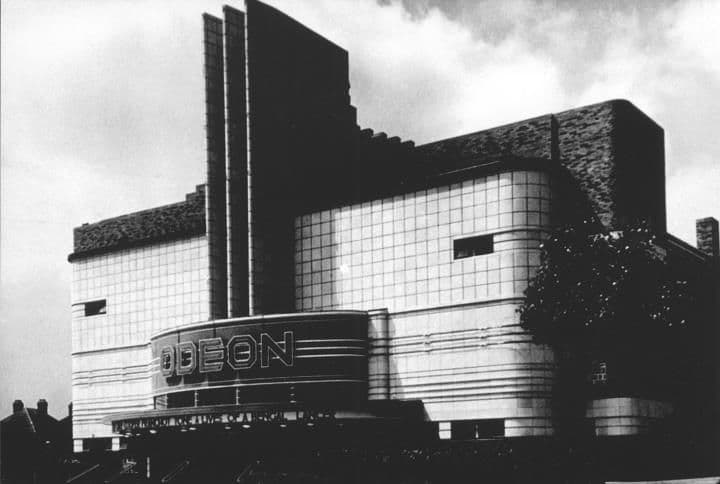
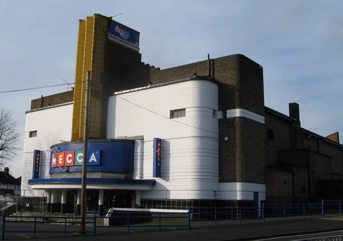
The Odeon, 1935 and 2014
The Odeon, from Harry Weedon’s practice, opened on 22 July 1935. It closed as a cinema in 1962 and became a bingo hall — and its fins still rise over the Circle.
1935: Library of Birmingham, Local Studies and History Department, Handsworth Historical Society (3/1338) · 2014: Brianboru100, 2014 · CC BY-SA 3.0
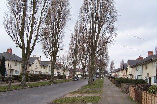
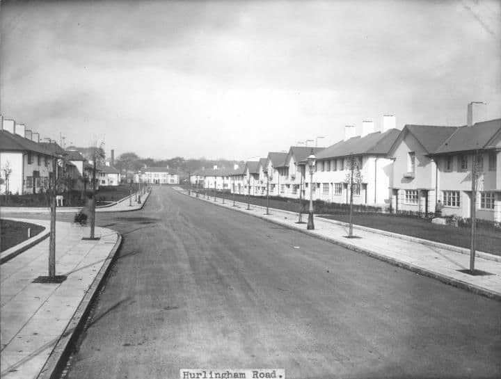
Hurlingham Road, 1932 and 2005
Brand new in January 1932, with bare verges and young street lamps. By 2005 the same view had become a tree-lined avenue.
The 1932 pictureThe 2005 picture
1932: Library of Birmingham, Local Studies and History Department, LSH Warks Photo Survey WK-K10-0022 (3/1253) · 2005: Photo: Adrian Bailey, CC BY-SA 2.0, via Geograph / Wikimedia Commons
St Mark’s Church, 1984 and 2020
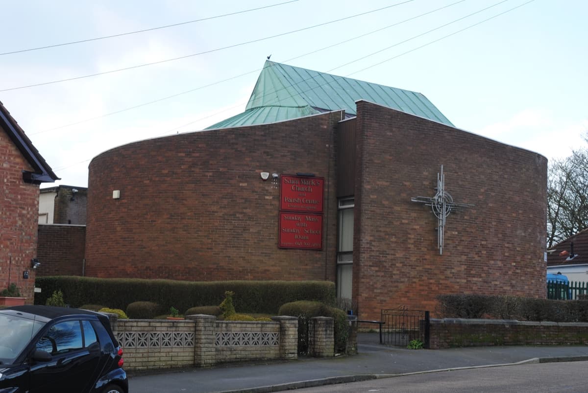
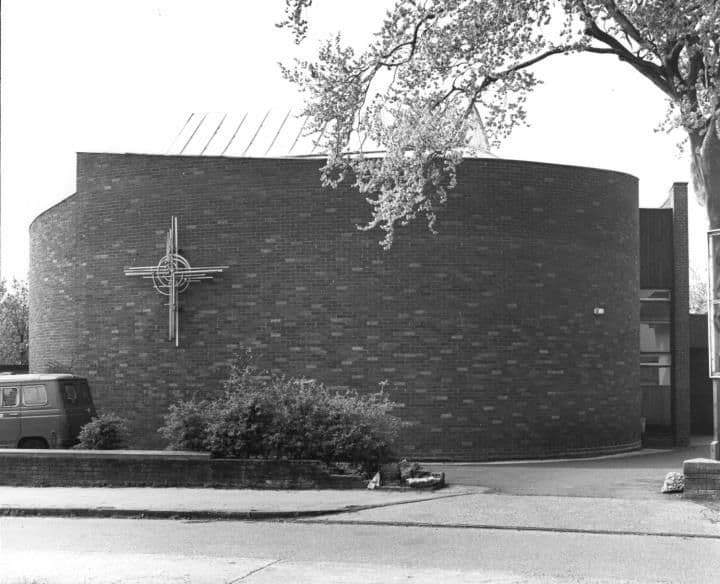
The round church on Bandywood Crescent, photographed from almost the same spot thirty-six years apart.
St Mark’s ChurchThe 1984 picture
1984: Library of Birmingham, Local Studies and History Department, LSH Warks Photo Survey WK-K10-0035 (3/1264) · 2020: Andy Mabbett, 2020 · CC BY-SA 4.0
The Circle, 1923 and today
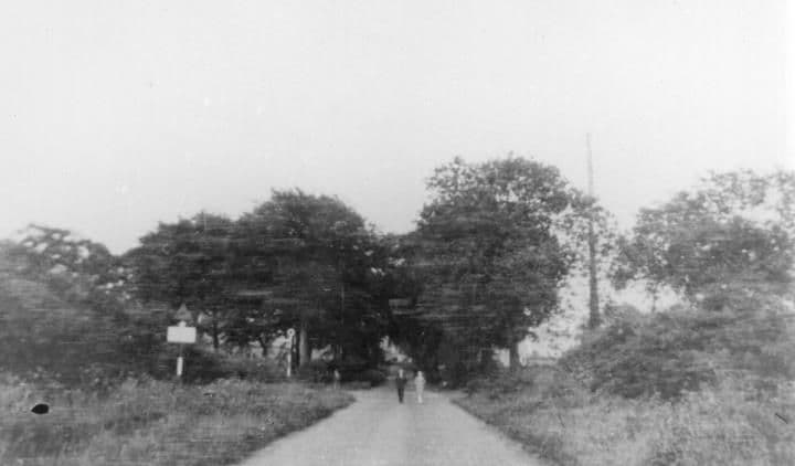
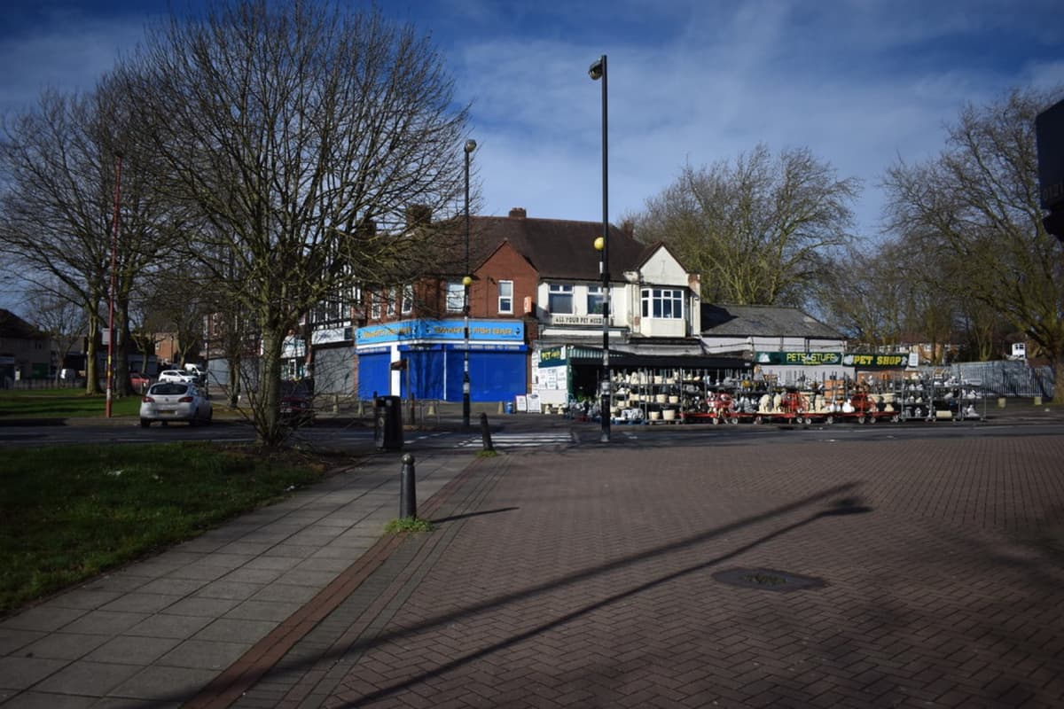
In 1923 it was a country lane looking east towards Sutton Coldfield. Within a few years it became the busy heart of the estate.
Kingstanding CircleThe 1923 picture
1923: Library of Birmingham, Local Studies and History Department, LSH WPS WK-K10-0068 (3/1294) · Today: Martin Richard Phelan · CC BY-SA 2.0
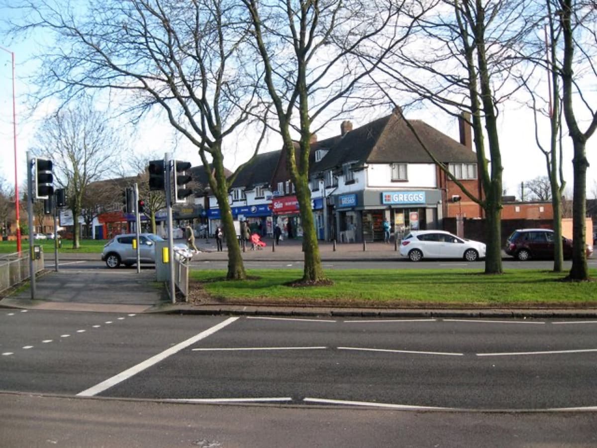
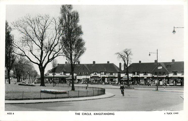
The Circle shops, c. 1950 and 2018
A cyclist rounds the railed garden in the middle of the Circle on a Tuck postcard of about 1950, with the gabled shop parade behind. The trees have grown and the railings have gone, but the parade still faces the roundabout.
Shops of the CircleThe 1950 picture
1950: Raphael Tuck & Sons postcard, c. 1950 (TuckDB Postcards). Public domain · 2018: Martin Richard Phelan, 2018 · CC BY-SA 2.0
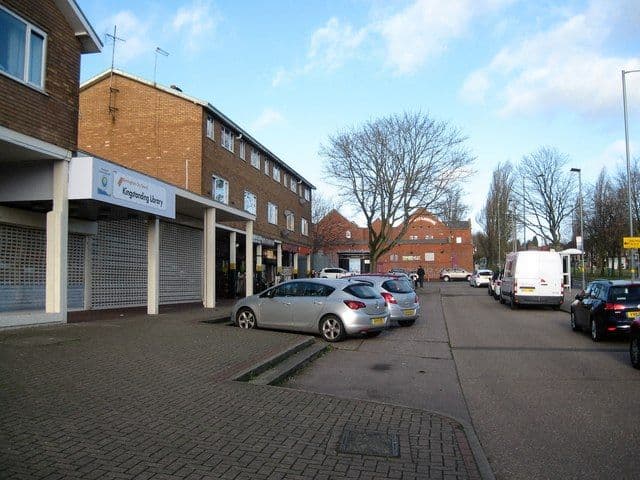
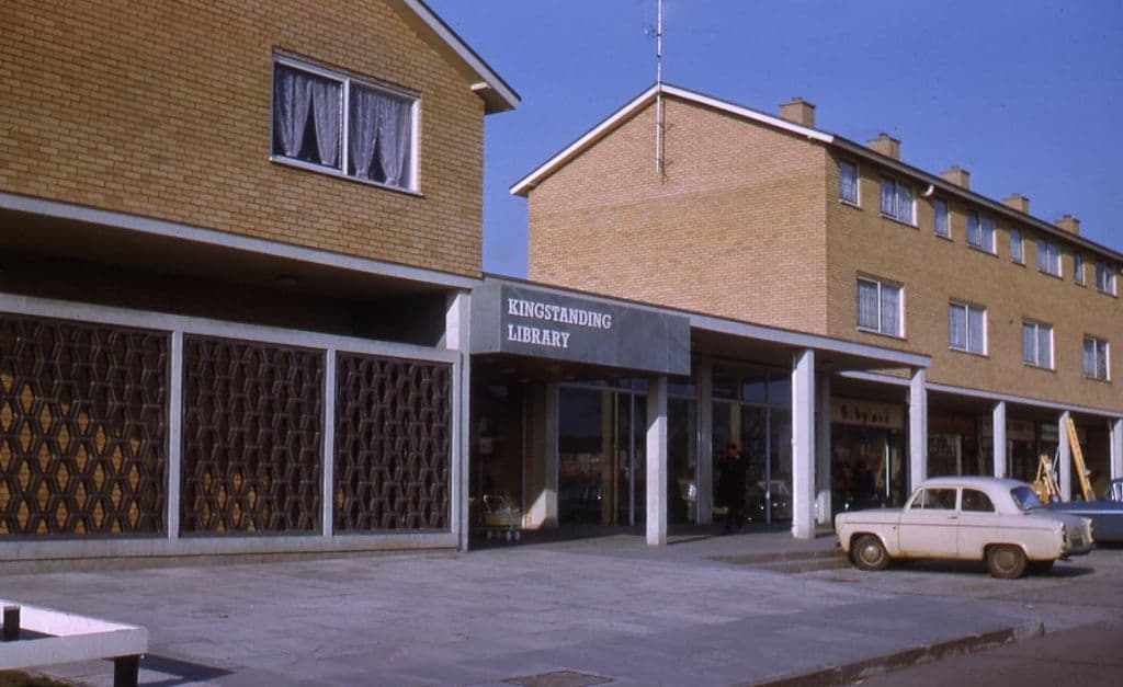
Kingstanding Library, 1960s and 2018
Kingstanding got a library of its own in June 1964, after thirty years of borrowing books from a room in the Methodist church. Ron Jameson photographed its new glazed entrance and the flats above the shops; in 2018 the same block stood behind shutters.
Kingstanding LibraryThe 1960s pictureThe 2018 picture
1960s: Photo: Ron Jameson. Reproduced with permission via Chris Hillcox, Voices of Kingstanding. · 2018: Photo: Martin Richard Phelan, 2018 · CC BY-SA 2.0
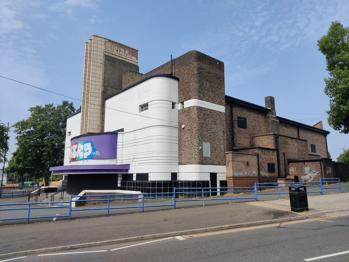
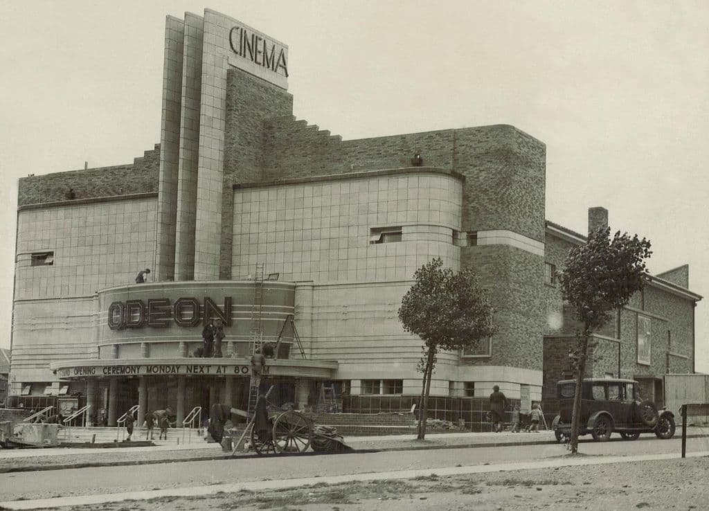
The Odeon, July 1935 and 2026
Days before it opened in July 1935, workmen were still busy outside the Odeon while the canopy promised a “Grand Opening Ceremony Monday Next at 8”. Ninety-one years later the tower and curved white corner still stand on the Circle.
1935: Photographer unknown, via Wikimedia Commons. Public domain · 2026: Andy Mabbett, July 2026 · CC BY-SA 4.0
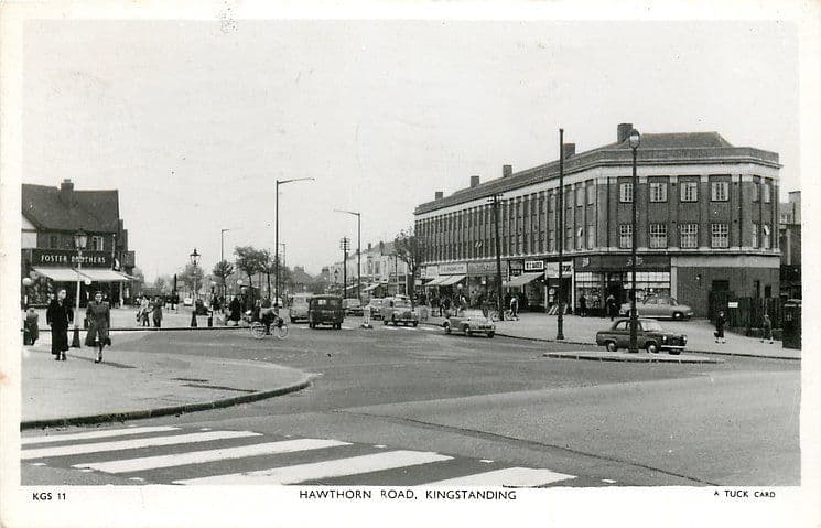
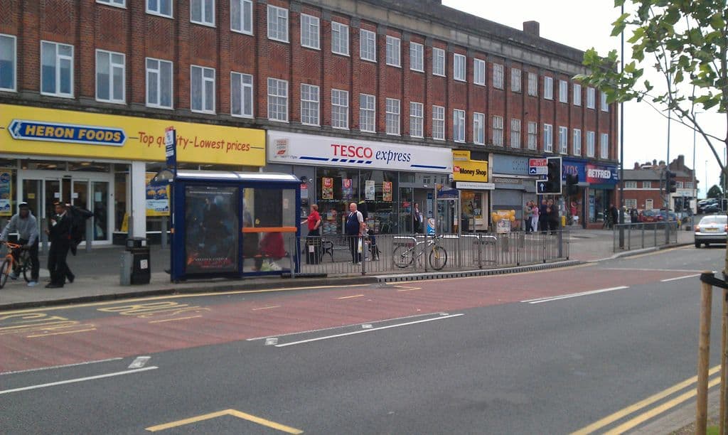
Hawthorn Road, c. 1950 and 2012
Shoppers and cyclists outside the big three-storey shopping block on Hawthorn Road, on a Tuck postcard of about 1950. The block still stands, its long rows of windows above a new generation of shopfronts.
Hawthorn Road shopsThe 1950 pictureThe 2012 picture
1950: Raphael Tuck & Sons postcard, c. 1950 (TuckDB Postcards). Public domain · 2012: Photo: Andy Mabbett, 2012 · CC BY-SA 4.0
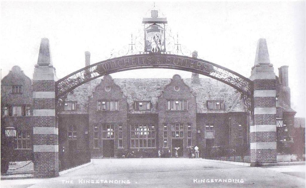
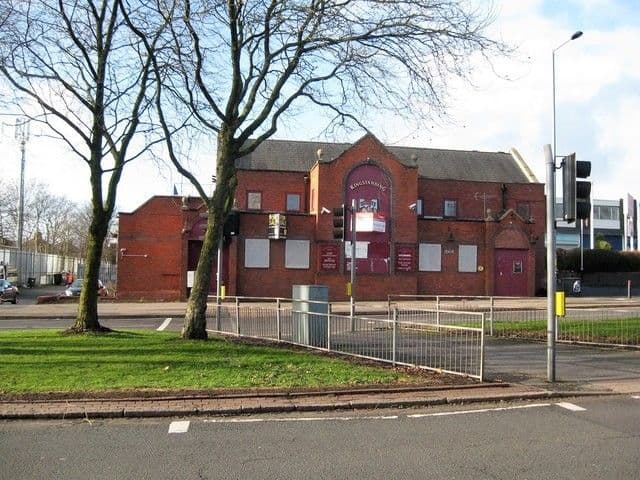
The Kingstanding pub, 1936 and 2018
In 1936 “The Kingstanding” stood behind a great wrought-iron arch lettered Mitchells & Butlers, under a sign of a rider on a white horse. The pub was rebuilt more than once on the same corner; the last one was closed and for sale in 2018 and burnt out a year later.
The Kingstanding pubThe 1936 pictureThe 2018 picture
1936: Postcard, 1936; publisher and photographer unknown · 2018: © Martin Richard Phelan, CC BY-SA 2.0 (Geograph)
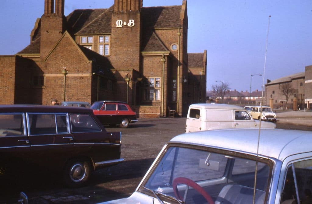
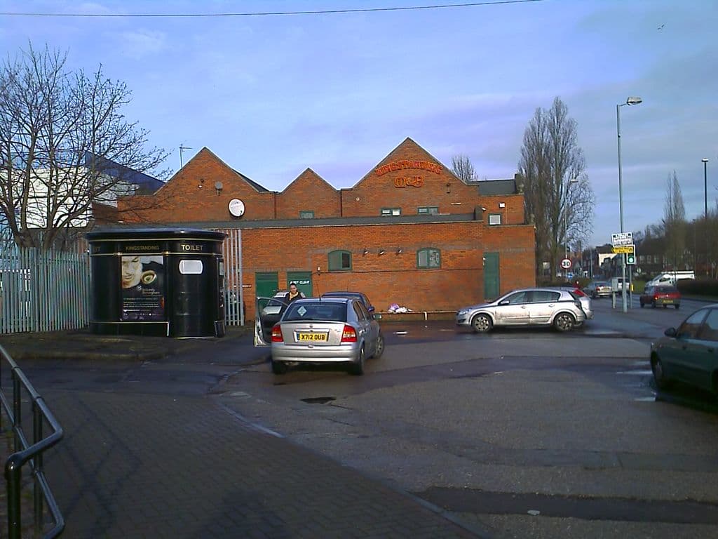
The Kingstanding pub car park, 1965 and 2011
Ron Jameson’s 1965 view from the pub car park shows the original Kingstanding, a building remembered for its “large chimneys and a big frontage”. By 2011 a smaller red-brick replacement stood on the site.
The Kingstanding pubThe 1965 pictureThe 2011 picture
1965: Photo: Ron Jameson. Reproduced with permission via Chris Hillcox, Voices of Kingstanding. · 2011: Image reproduced with permission of Chris Hillcox, Voices of Kingstanding.
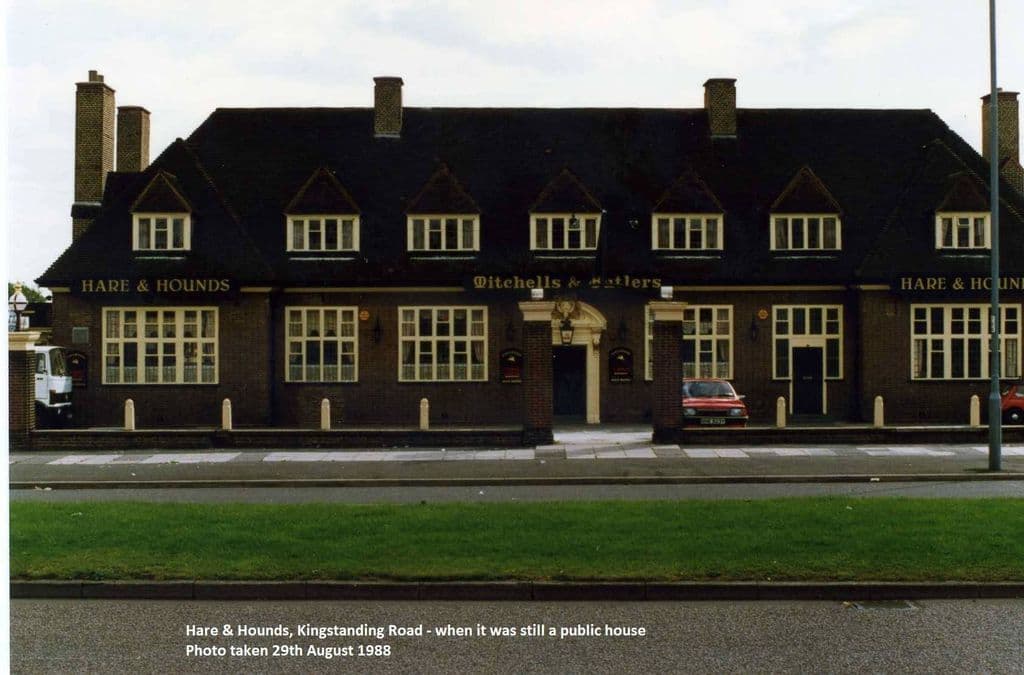
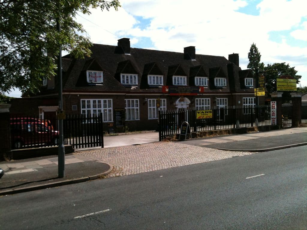
The Hare & Hounds, 1988 and 2011
The Hare & Hounds on Kingstanding Road on 29 August 1988, “when it was still a public house”: seven dormers, tall chimneys and Mitchells & Butlers over the door. By 2011 it was a hand car wash; it was gutted by fire in 2016.
The Hare and HoundsThe 1988 pictureThe 2011 picture
1988: Submitted by a resident of Oscott. Photo courtesy of Lee Lewis (as credited on Voices of Kingstanding). · 2011: Image reproduced with permission of Chris Hillcox, Voices of Kingstanding.
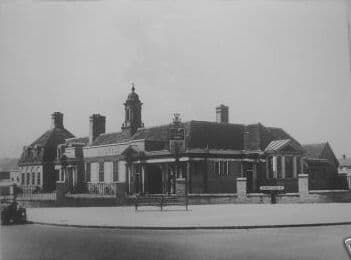
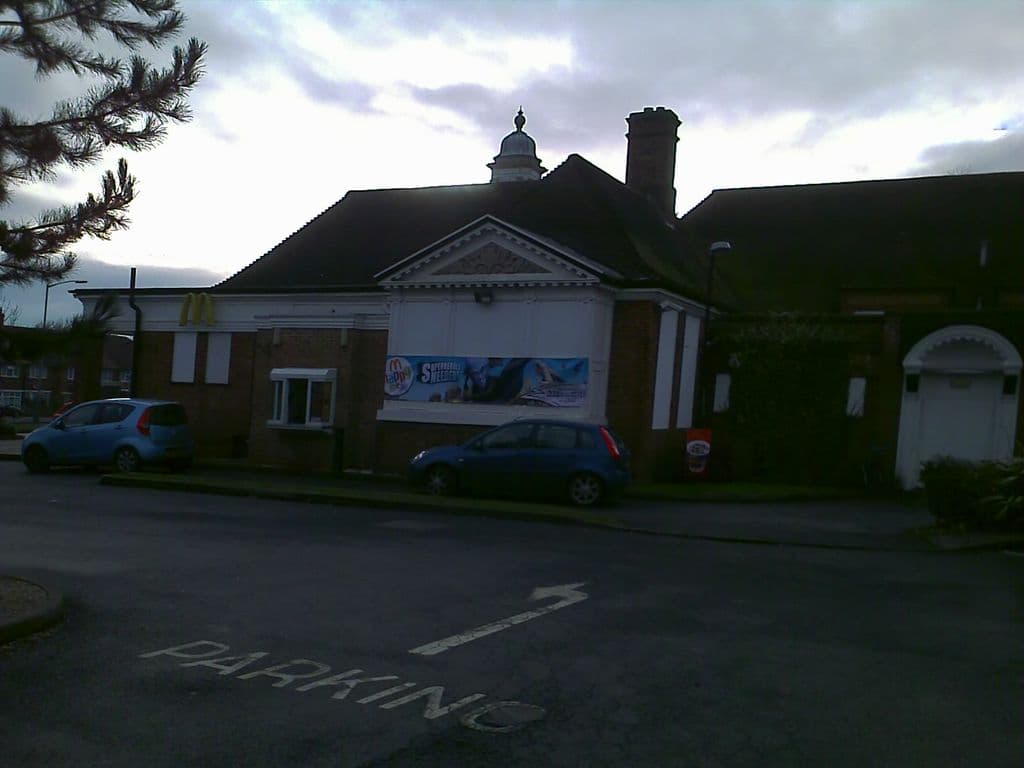
The College Arms, 1930s and 2010
In the early 1930s the College Arms’ assembly room doubled as a church for the new Christ the King parish. The building with its little domed cupola survives on College Road — as a McDonald’s.
The College ArmsThe 1930s pictureThe 2010 picture
1930s: Photo: Birmingham History Forum (“out of copyright”, as credited on Voices of Kingstanding). Reproduced via Chris Hillcox, Voices of Kingstanding. · 2010: Image reproduced with permission of Chris Hillcox, Voices of Kingstanding.
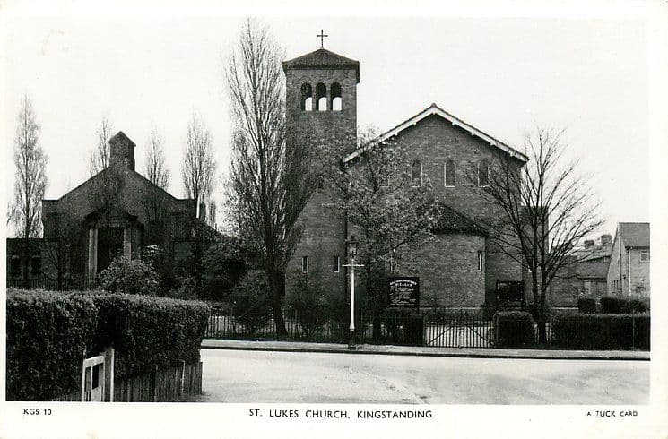
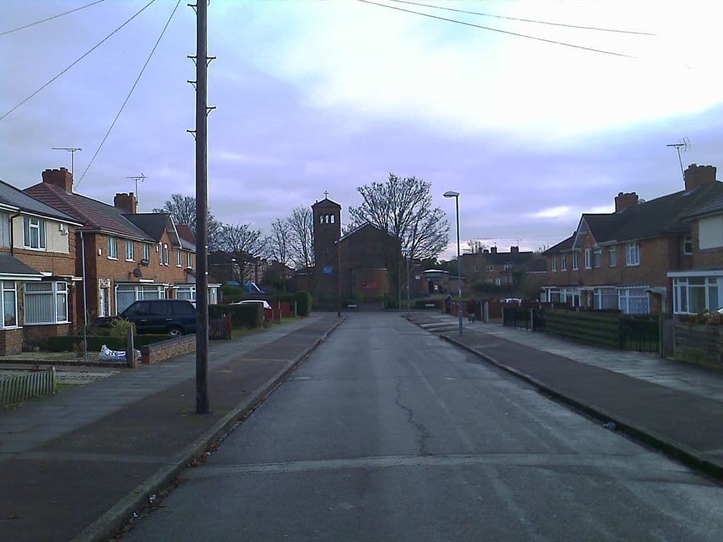
St Luke’s Church, c. 1950 and 2010
St Luke’s and its bell tower behind neat hedges and railings on a Tuck postcard of about 1950. In 2010 the tower still closes the view down Caversham Road.
St Luke’s ChurchThe 1950 pictureThe 2010 picture
1950: Raphael Tuck & Sons postcard, c. 1950 (TuckDB Postcards). Public domain · 2010: Image reproduced with permission of Chris Hillcox, Voices of Kingstanding.
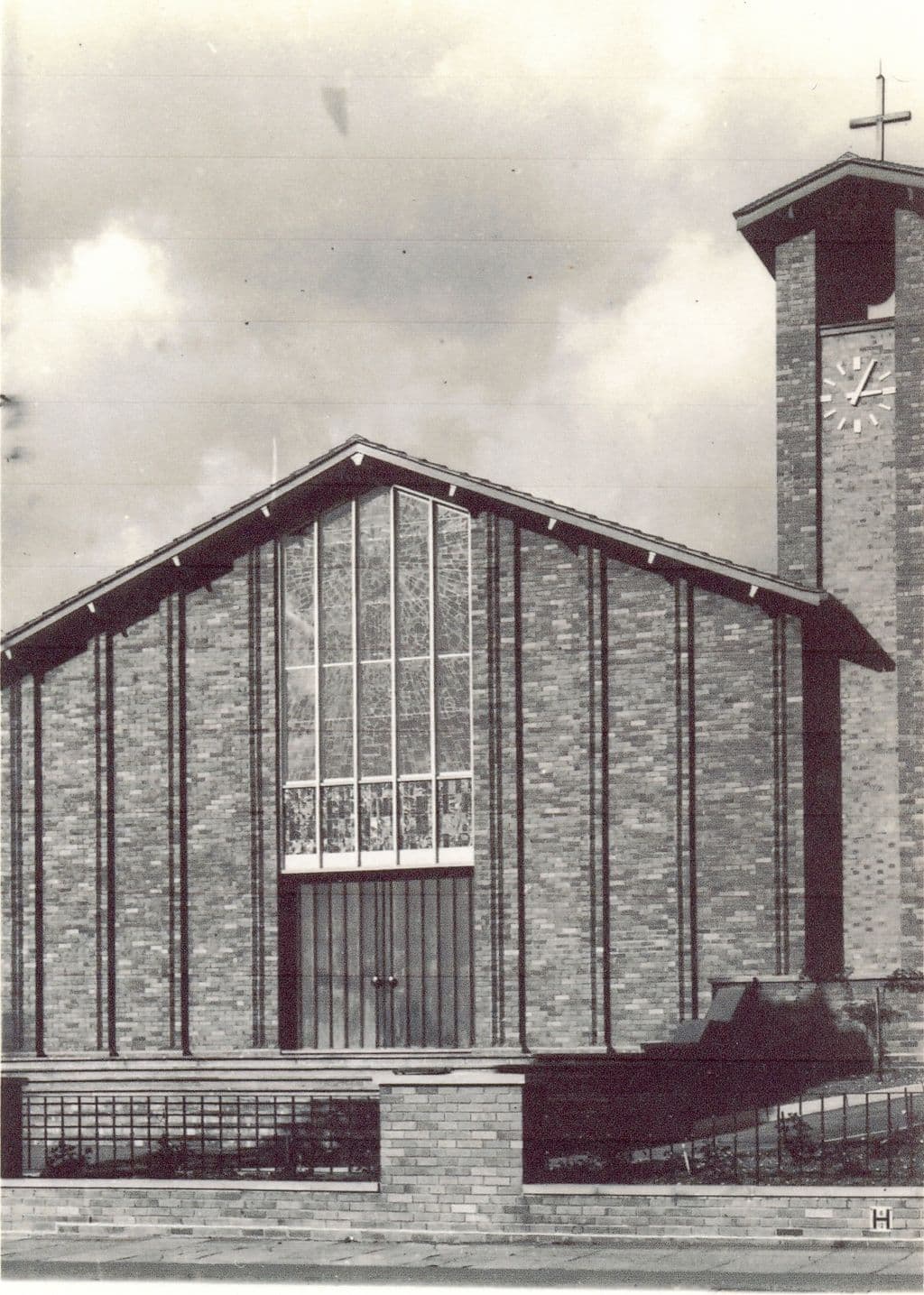
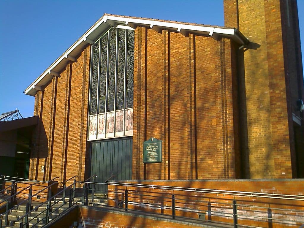
Christ the King, 1962 and 2010
The new Christ the King church was finished in time for Midnight Mass on Christmas Eve 1962, replacing the parish’s wooden church. Its tall stained-glass west front caught the winter sun in 2010.
Christ the King ChurchThe 1962 pictureThe 2010 picture
1962: Image reproduced with permission of Chris Hillcox, Voices of Kingstanding. · 2010: Image reproduced with permission of Chris Hillcox, Voices of Kingstanding.
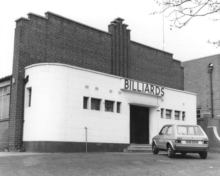
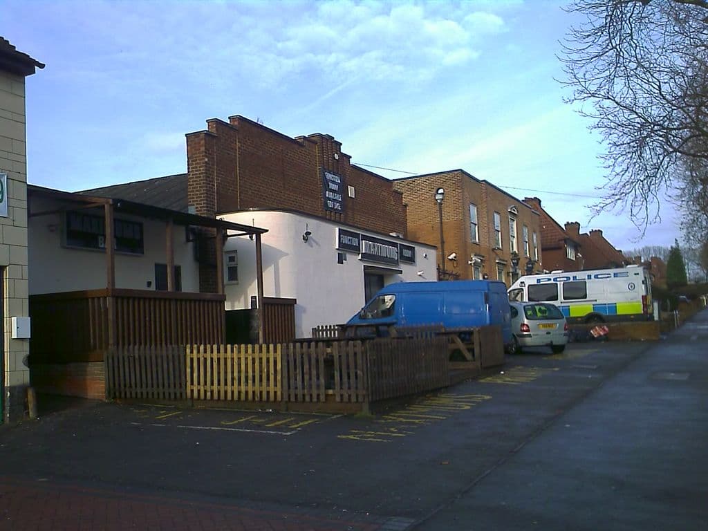
The billiard hall, 1984 and 2011
The Kingstanding Road billiard hall in 1984, its curved white front lettered Billiards. By about 2011 the same building beside the police station was advertising its function room.
The Royal Billiard HallThe 1984 pictureThe 2010 picture
1984: Library of Birmingham, Local Studies and History Department, WK K10 0010 (3/1242) · 2010: Image reproduced with permission of Chris Hillcox, Voices of Kingstanding.
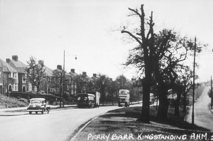
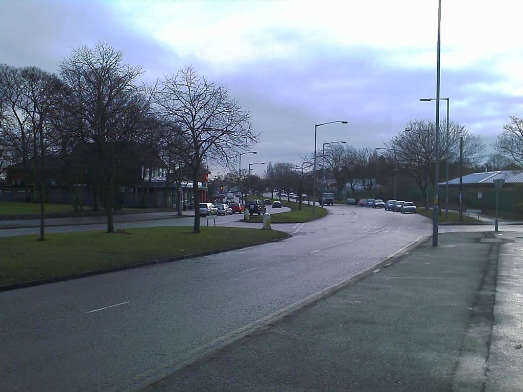
Kingstanding Road, 1950s and 2010
A car, a lorry and a double-decker bus on Kingstanding Road below the Hawthorn Road junction in the 1950s. The dual carriageway still curves away between wide grass verges and trees.
The 1950 pictureThe 2010 picture
1950: Library of Birmingham, Local Studies and History Department, lSH/ Warks Photo Survey WK-K10-0084 (3/1307) · 2010: Image reproduced with permission of Chris Hillcox, Voices of Kingstanding.
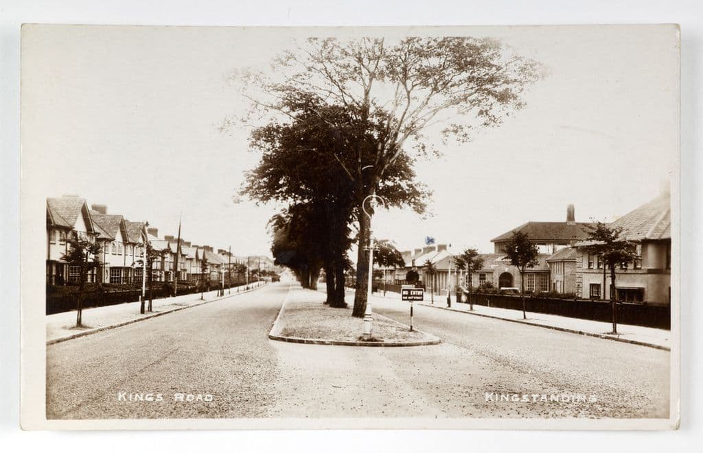
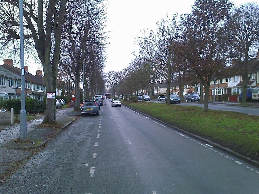
Kings Road, 1930s and 2010
Kings Road on a 1930s postcard: new houses on both sides and young trees on the central island. By 2010 those trees lined a long dual carriageway with a wide grass reservation.
The 1930s pictureThe 2010 picture
1930s: Photo by Birmingham Museums Trust, licensed under CC0 · 2010: Image reproduced with permission of Chris Hillcox, Voices of Kingstanding.
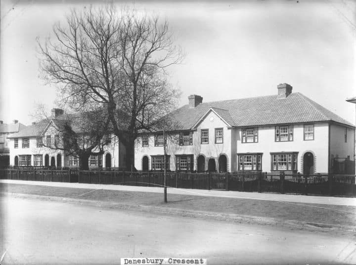
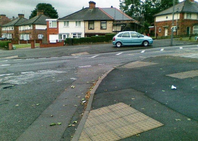
Danesbury Crescent, 1932 and 2011
New rendered houses on Danesbury Crescent, off Hurlingham Road, built by Birmingham’s Public Works Department and photographed in 1932 behind their timber fences. The crescent’s houses still face the road junction.
The 1932 pictureThe 2011 picture
1932: Library of Birmingham, Local Studies and History Department, LSH WK K10 0027 (3/1258) · 2011: Photo: Alex McGregor, CC BY-SA 2.0, via Geograph / Wikimedia Commons
Harringay Road, 1929 and 2014
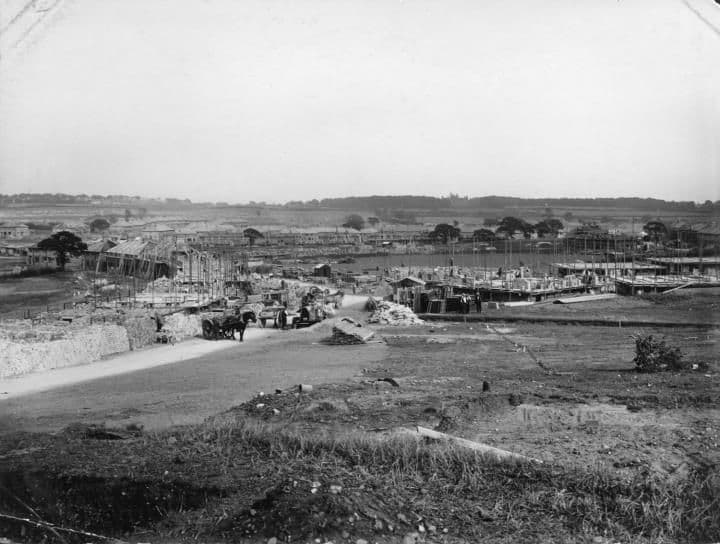
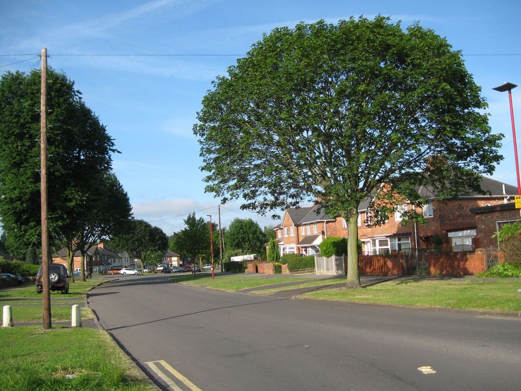
On 19 October 1929 Harringay Road was a building site of rough ground, horse-drawn carts and half-built houses. In 2014 it curves between grass verges under a big tree in full leaf.
The 1929 pictureThe 2014 picture
1929: Library of Birmingham, Local Studies and History Department, LSH WK K10 0060 (3/1286) · 2014: Photo: Martin Richard Phelan, CC BY-SA 2.0, via Geograph / Wikimedia Commons
The King’s Standing mound, 1966 and 2005
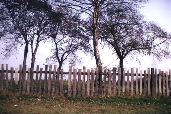
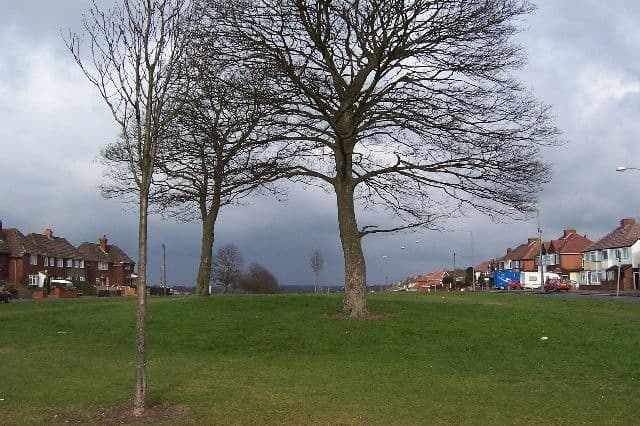
In 1966 the tumulus on Kingstanding Road was an inconspicuous clump of trees behind a paling fence. By 2005 it was a low grassy hummock on an open green — the scheduled mound that gave Kingstanding its name.
The King’s Standing moundThe 1966 pictureThe 2005 picture
1966: Library of Birmingham, Local Studies and History Department, LSH/ Warks Photo Survey WK-K10-0116 (3/1335) · 2005: © Adrian Bailey, CC BY-SA 2.0 (Geograph)
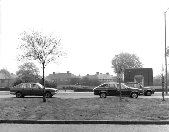
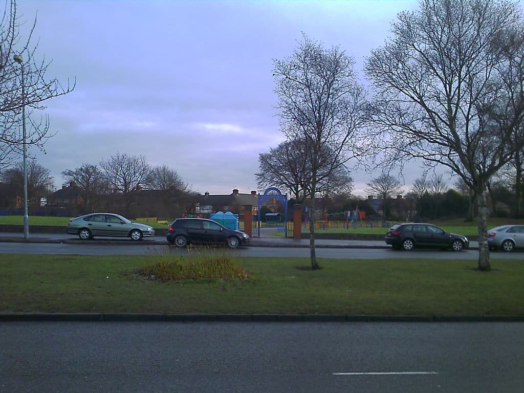
The old pumping station site, 1984 and 2010
The old waterworks building on Kingstanding Road, opposite the library, photographed in 1984. The pumping station has gone; its site is now Wheeldon Recreation Ground.
King’s Vale Well and Pumping StationThe 1984 pictureThe 2010 picture
1984: Library of Birmingham, Local Studies and History Department, LSH Warks Photo Survey WK-K10-0046 (3/1272) · 2010: Image reproduced with permission of Chris Hillcox, Voices of Kingstanding.
Help us finish the set
These archive photographs don’t have a partner yet. If you pass one of these spots, stand where the old photographer stood, take the view today and send it to us — we’ll pair them up here, credited to you.
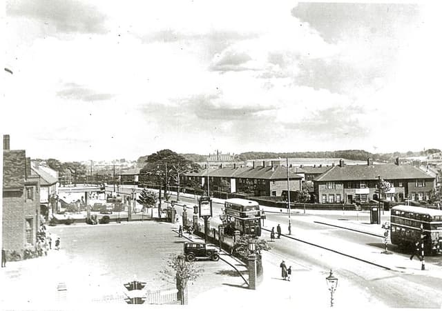 The Crossways pub and College Road, 19381938 · The Crossways, College Road
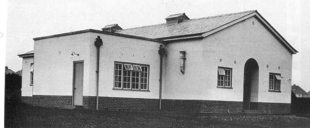 The Kingstanding Settlement buildingDate unknown · Kingstanding Settlement, Kingstanding
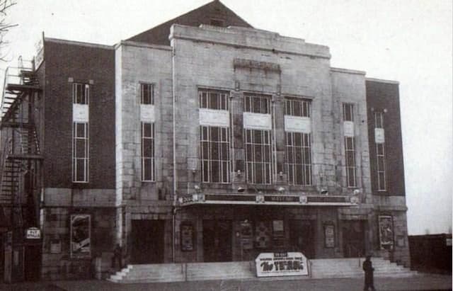 The Mayfair cinema, College RoadDate unknown · Mayfair cinema, 482 College Road, Perry Common
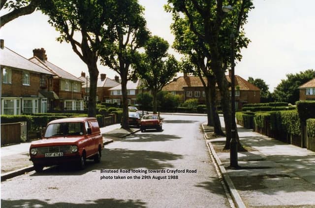 Binstead Road looking towards Crayford Road, 198829 August 1988 · Binstead Road, Kingstanding
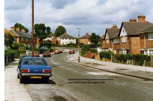 Dulwich Road looking towards Warren Farm Road, 198829 August 1988 · Dulwich Road, Kingstanding
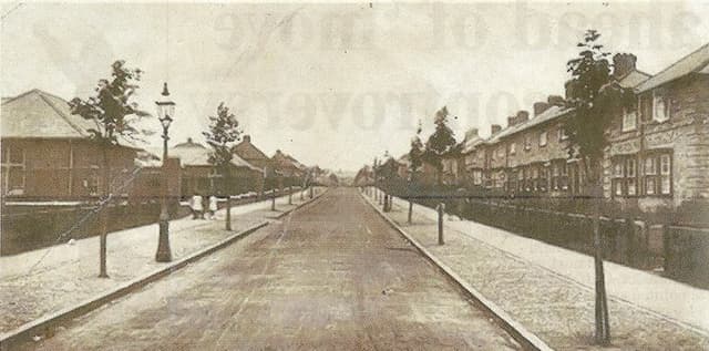 Hornsey Road, 19481948 · Hornsey Road, Kingstanding
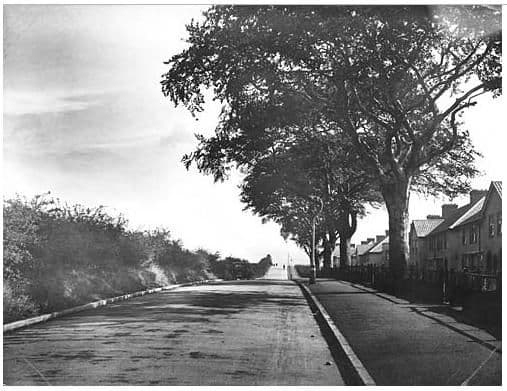 Rough Road, 19321932 · Rough Road, Kingstanding
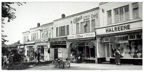 Hawthorn Road shops, 19571957 · Hawthorn Road shops, Kingstanding
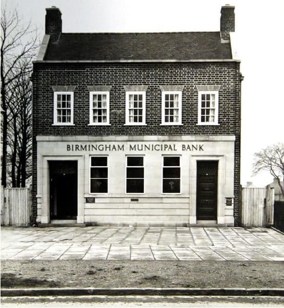 Birmingham Municipal Bank, Kingstanding Road, 19371937 · Birmingham Municipal Bank, Kingstanding Road, Kingstanding
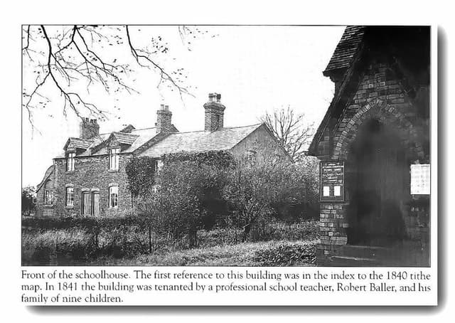 The old schoolhouse by the church, OscottPhotograph undated; building recorded 1840 · Shady Lane, Old Oscott
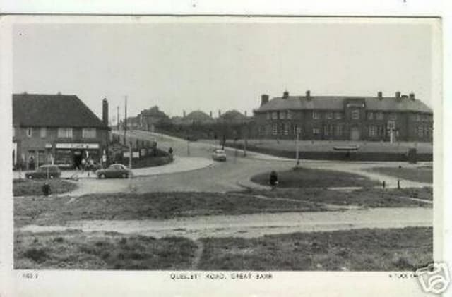 Queslett Road, Great Barr (postcard)c. late 1950s–1960s · Queslett Road, Great Barr
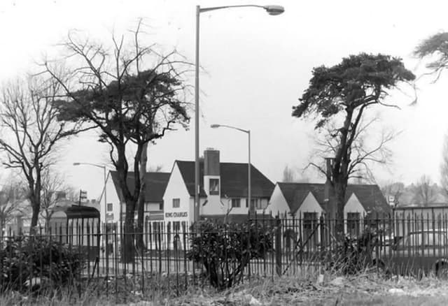 The King Charles pub, seen through the railingsUndated (probably 1960s–70s) · Kings Road
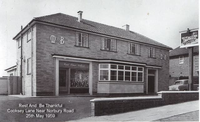 The Rest and Be Thankful, Cooksey Lane, 195925 May 1959 · Cooksey Lane near Norbury Road
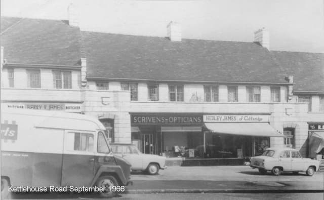 Shops on Kettlehouse Road, September 1966September 1966 · Kettlehouse Road
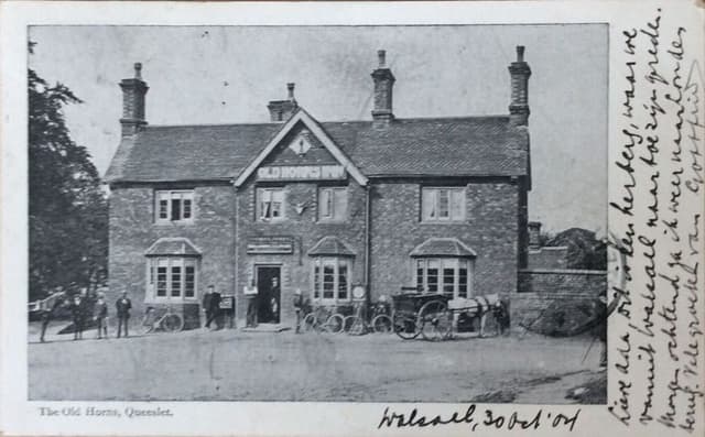 The Old Horns, Queslett, 1904 (postcard)Posted 30 October 1904 · The Old Horns, Queslett
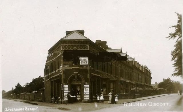 The post office at New Oscott, 1903 (postcard)1903 · Kings Road and Chester Road corner, New Oscott
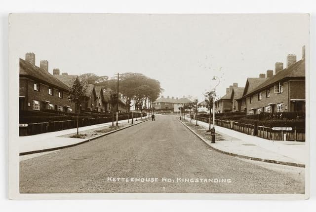 Kettlehouse Road, Kingstanding (postcard)c. 1930s · Kettlehouse Road, Kingstanding
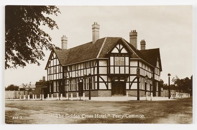 The Golden Cross Hotel, Perry Common (postcard)c. 1930s · The Golden Cross, Perry Common
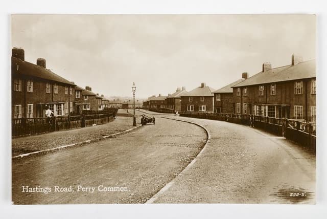 Hastings Road, Perry Common (postcard)c. 1930s · Hastings Road, Perry Common
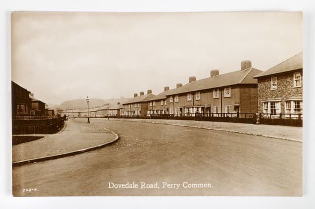 Dovedale Road, Perry Common (postcard)c. 1930s · Dovedale Road, Perry Common
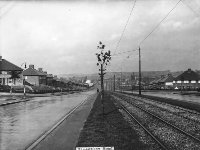 Streetly Road1930 · Streetly Road, Kingstanding
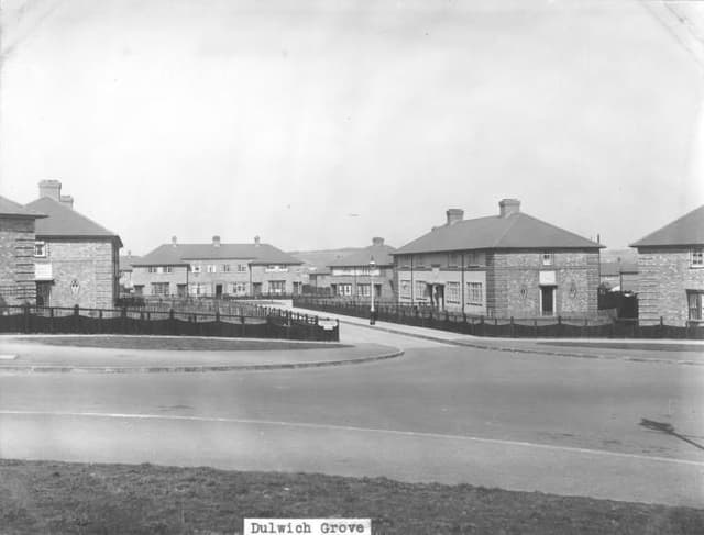 Dulwich Grove1931 · Dulwich Grove, Kingstanding
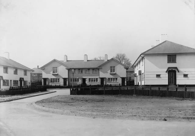 Leyton Grove1931 · Leyton Grove, Kingstanding
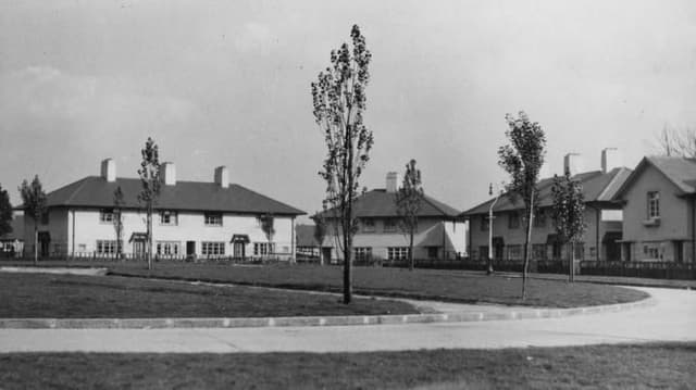 Greenwood Place1932 · Greenwood Place, Kingstanding
Comments
Comments will load here.