
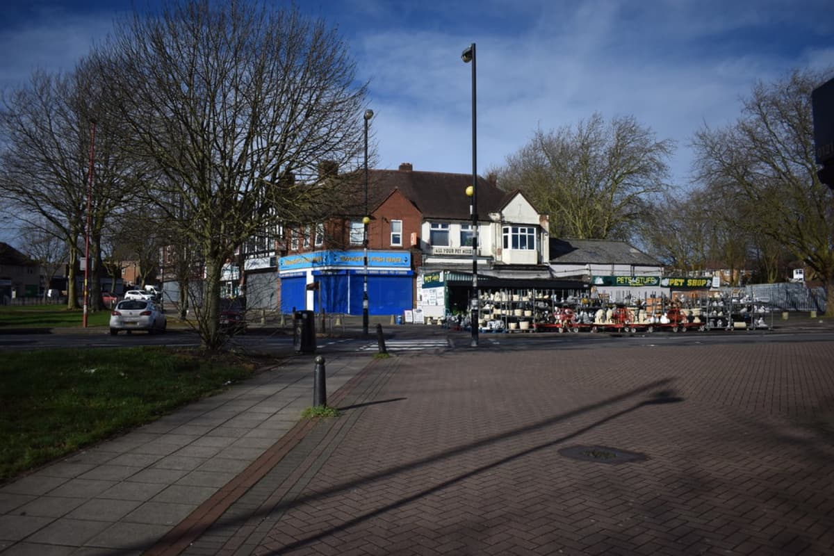
Kingstanding Circle is the great roundabout where Kings Road meets Kingstanding Road — the heart of Kingstanding since the estate went up in the 1930s, ringed by its shops and parades, with the Odeon’s three-fin tower rising beside it.
Before the estate
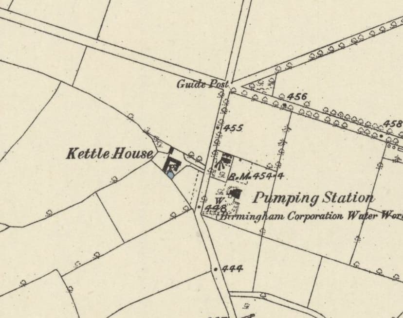
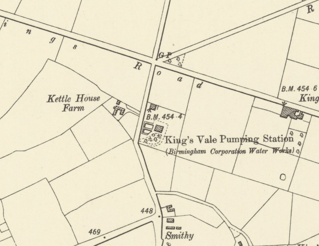
It was not always a busy junction. A photograph from 1923 looks east from the Circle towards Sutton Coldfield across open country. Kingstanding Road was still Holly Lane then, and in April 1928, near the Circle, Kettlehouse Farm and the Bandy Woods could still be seen. Kettlehouse Farm, on Kingstanding Road near the Circle, had been built on what was once Sutton Common at an unknown date after 1794.
The heart of the estate
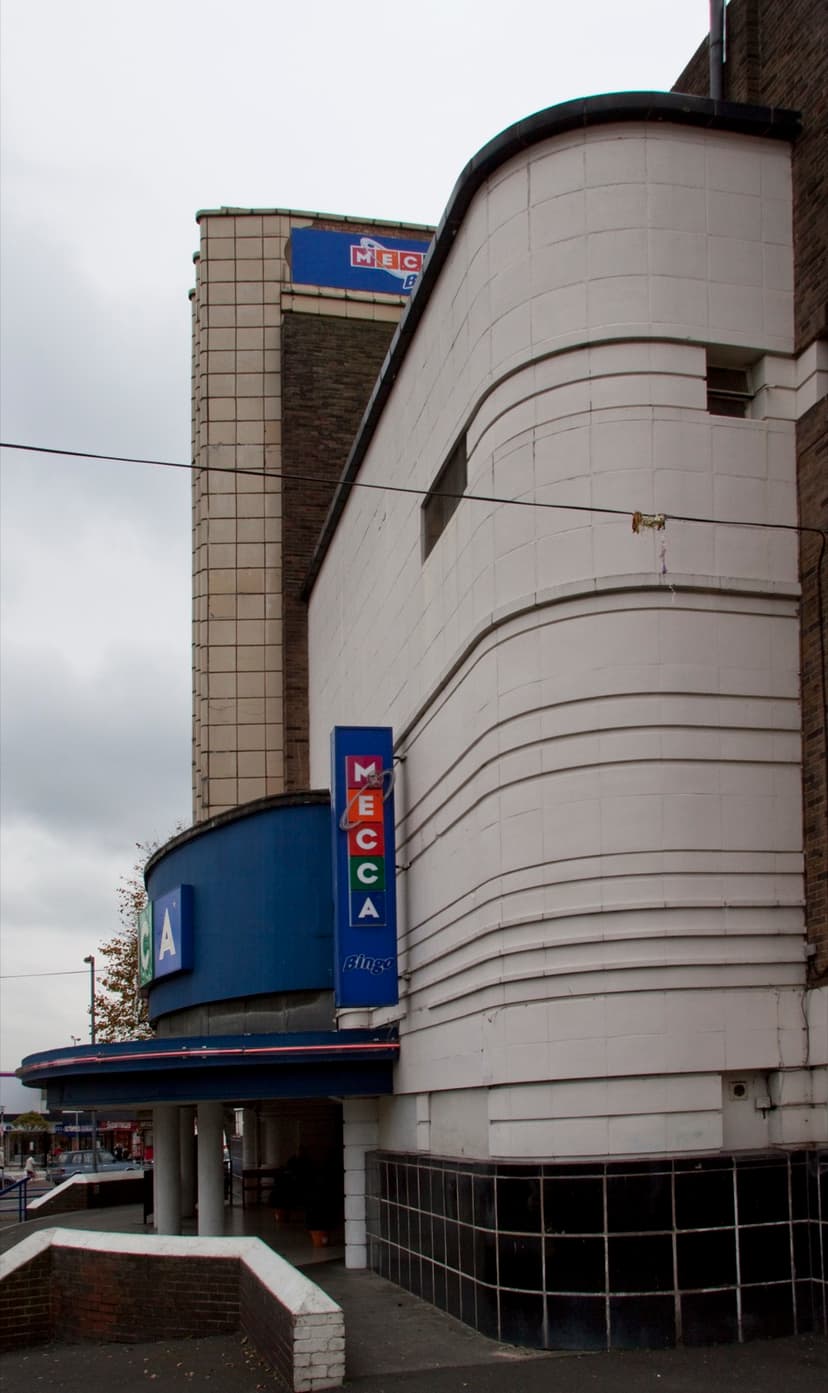
As the council estate grew, the Circle became its meeting point — shops, buses and the parade. In July 1935 the Odeon opened beside it, designed by Harry Weedon as the estate’s focal point. By 1939, researchers studying the estate found it “well served with shops, public-houses, schools, and cinemas”.
In the 1950s Rough Road Post Office stood on the Circle, with a branch of Boots next door. Photographs from 1984 show a billiard hall on Kingstanding Road near the Circle, and the old waterworks pumping station opposite Kingstanding Library.
Today
The Circle is still where Kingstanding shops, catches the bus and meets. Its shops, the former Odeon and the streets around it are part of what makes Kingstanding recognisable — and part of what Kingstanding Together wants to look after.
Then and now
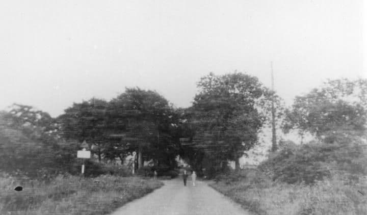
The Circle, 1923 and today
In 1923 it was a country lane looking east towards Sutton Coldfield. Within a few years it became the busy heart of the estate.
Kingstanding CircleThe 1923 picture
1923: Library of Birmingham, Local Studies and History Department, LSH WPS WK-K10-0068 (3/1294) · Today: Martin Richard Phelan · CC BY-SA 2.0
From the Heritage Archive
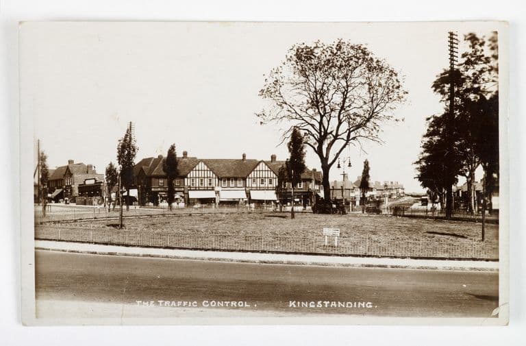 “The Traffic Control”: the Circle, Kingstanding (postcard)c. 1930s
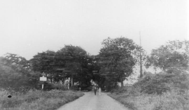 The Circle1923
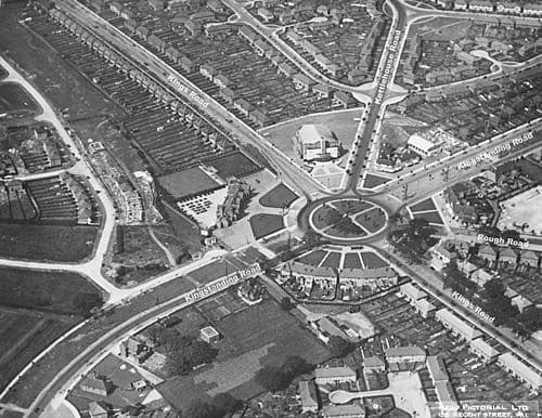 The Circle from the air, 1930s1930s
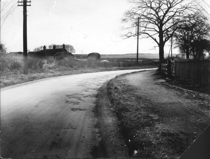 Kingstanding RoadApril 1928
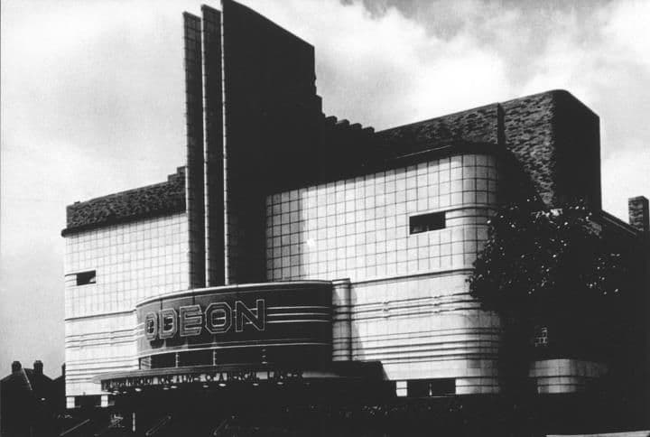 Kingstanding Odeon1935
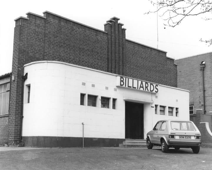 Billiard Hall1984
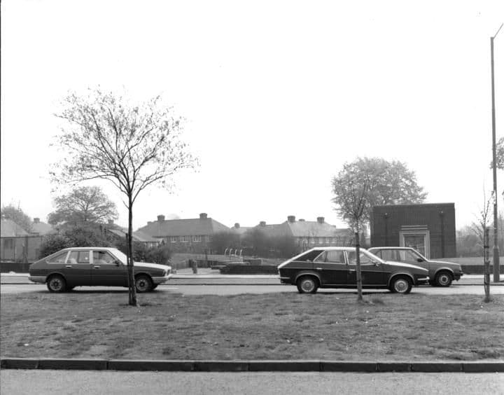 Old waterworks building1984
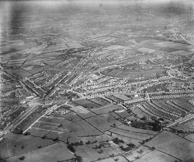 The Circle and the Odeon from the north-west, 19388 September 1938
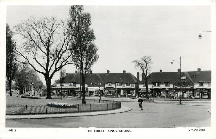 The Circle, c. 1950 (postcard)c. 1950
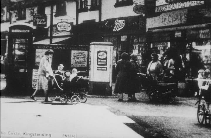 The Circlec. 1950–1959
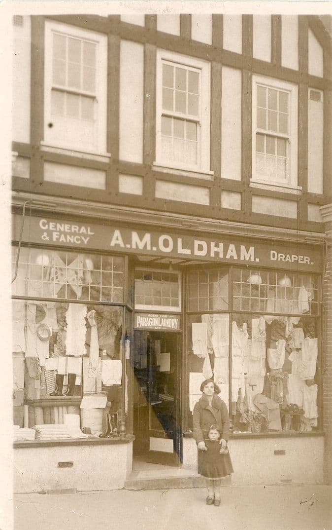 A. M. Oldham, draper, at the Circle, 1930s1930s
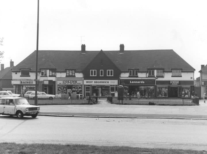 The Circle1984
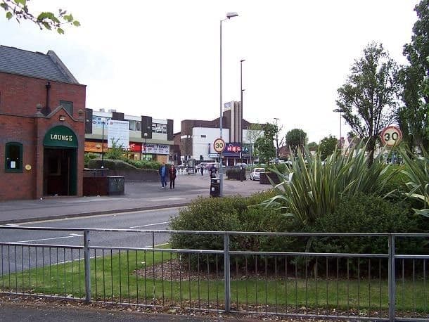 The Circle in 2005: pub, precinct and bingo hall3 June 2005
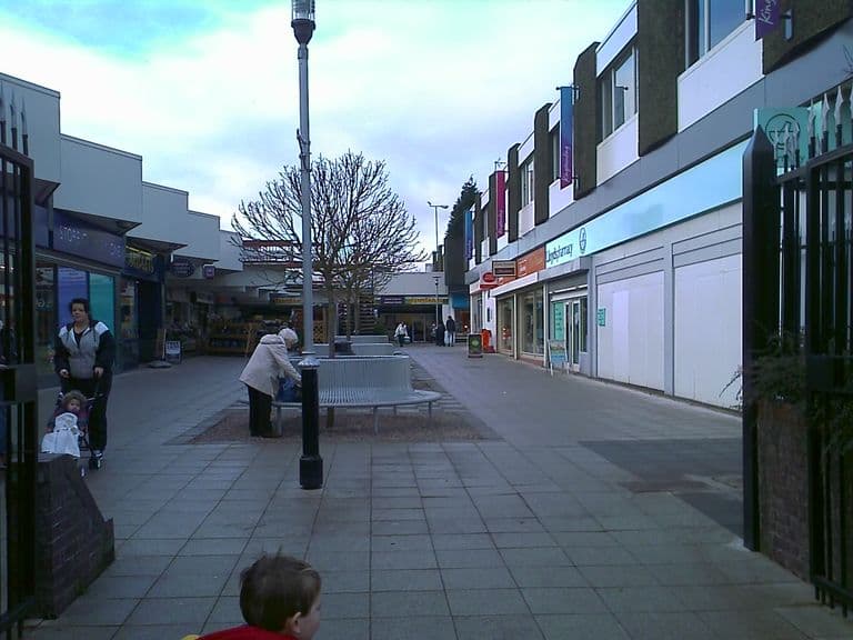 Kingstanding shopping centre, 2010c. 2010
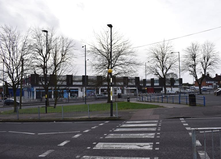 The Kingstanding Precinct just before demolition, 20202 February 2020
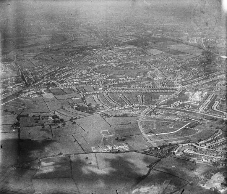 The estate from the north-west, 19388 September 1938
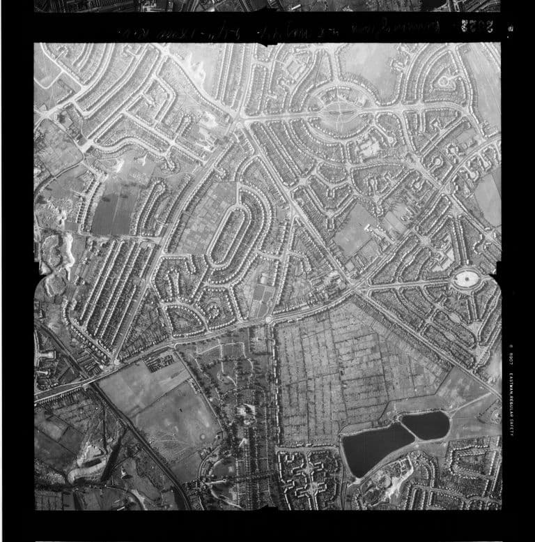 Kingstanding and Perry Common photographed by an American reconnaissance aircraft, May 194427 or 28 May 1944
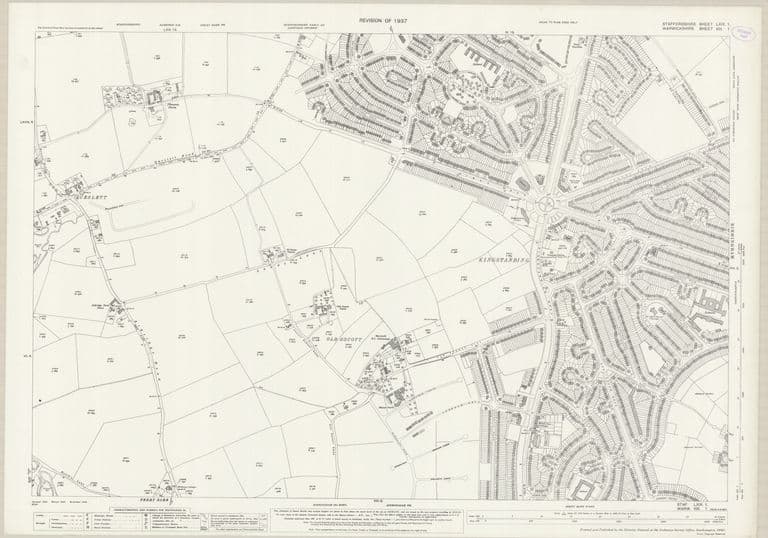 The new estate: OS 25-inch map, revised 1937Revised 1937, published 1941
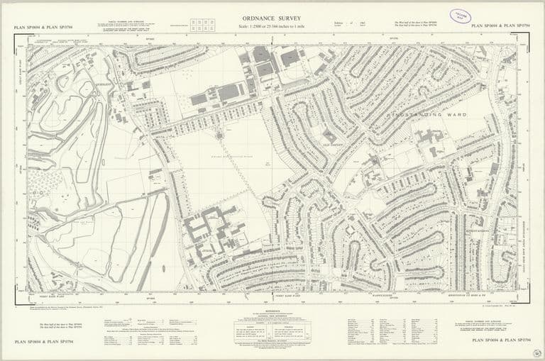 Queslett to Old Oscott and the Circle: OS 1:2500, 1962Revised 1961, published 1962
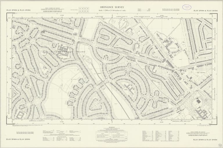 Kingstanding east to New Oscott, house by house: OS 1:2500, 1963Revised 1961–1962, published 1963
Sources. Library of Birmingham, Local Studies and History Department (Warwickshire Photographic Survey), catalogue captions (the Circle, 1923 and 1950s; Kingstanding Road, April 1928; Kettlehouse Farm; the billiard hall and old waterworks, 1984); Soutar, Wilkins and Sargant Florence, Nutrition and Size of Family: Report on a New Housing Estate, 1939 (published 1942).
Comments
Comments will load here.