
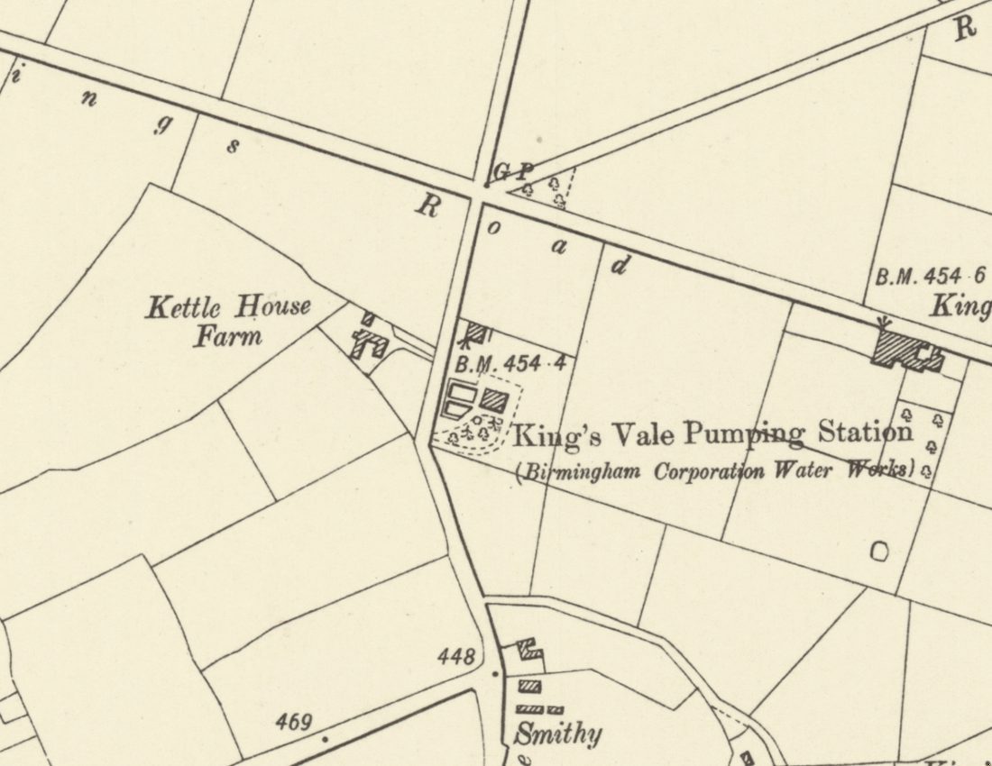
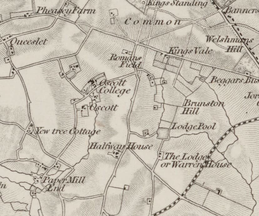
In November 1865 Birmingham readers opening their papers found a long legal notice from the Birmingham Waterworks Company. The Company was going to Parliament for powers to build “a well or shaft, and pumping engine or engines” on two pieces of land in Perry Barr, “known as the Corner Piece and the Roman Field”.
Those two fields sat beside the old road through what is now Kingstanding, a short walk south of today’s Circle. The Company was about to make a very expensive bet there, and lose it.
Six million gallons a day
Looking back in 1891, a speaker in the debate over Birmingham’s water recalled that in 1866 “a well was sunk at King’s Vale on a site marked out by the engineers”, a site “eminent geologists” had picked as the best in the old red sandstone beds. “It was estimated that the well would yield 6,000,000 gallons per day.”
The Company’s own half-yearly reports show the work going ahead. By September 1867 it had “obtained possession … of the land at King’s Vale”. By September 1868 contracts had been let for “the erection of an engine, boilers, engine-houses, and other necessary buildings at King’s Vale”. Drawings of a pumping engine for the Company’s “Perry Barr station”, dated 1869–70, survive among the Boulton & Watt papers and are probably for this engine.
“But a small supply”
Then came the disappointment. In September 1871 the directors had to report that “The sinking at King’s Vale continues to yield but a small supply.”
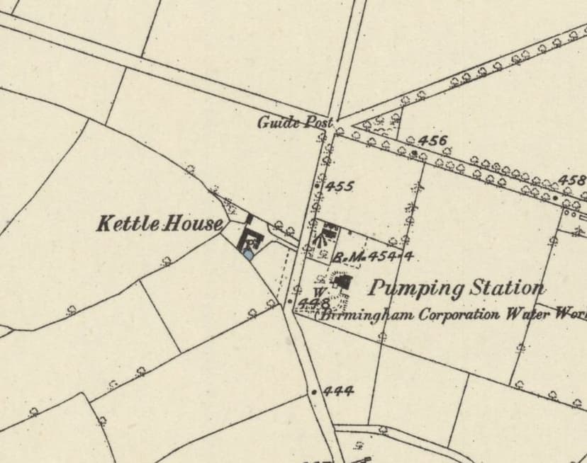
The Corporation took over the Company in 1876, and the well went on working. In 1880 King’s Vale was one of Birmingham’s five wells, with Witton, Perry, Selly Oak and Aston, and in 1888 £1,400 was allowed for iron pipes, instead of earthenware, between the King’s Vale well and Short Heath. The Ordnance Survey marked the “Pumping Station (Birmingham Corporation Water Works)” in 1882–83, and by 1901 it was “King’s Vale Pumping Station”, with its engine house and two tanks.
Its real yield became a byword. C. A. Vince, writing the history of the Corporation in 1902, used it to show that wells were a gamble: “The King’s Vale well had been expected, on geological evidence, to yield 6,000,000 gallons daily; its actual yield is only 300,000.” That is one gallon in every twenty.
Bad water
Worse was to come. In 1892, when Birmingham was asking Parliament for the right to bring water from the Elan valley in mid-Wales, Dr Frankland and other witnesses told the inquiry that the King’s Vale water was contaminated. The next year nitrates in the well were reported to be rising.
Welsh water won. On the map revised in 1913 the station is marked “(Disused)”.
What the site became
A photograph in the city’s collections shows the engine house at its grandest: an Italianate building with a square tower, a tall round chimney and pump beams jutting from the walls. When it was taken is not recorded. In the 1920s the pumping station was still standing in the background of photographs taken at Kettlehouse Farm across the road.
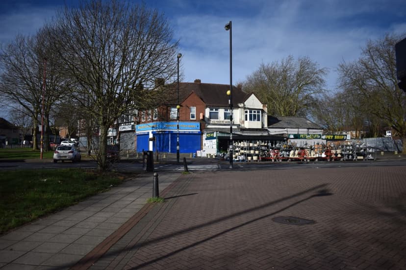
By 1984, when a photographer recorded the “old waterworks building” opposite Kingstanding Library, only a small flat-roofed brick building seems to have been left. Today the site is Wheeldon Recreation Ground, on the east side of Kingstanding Road facing the library.
Walk up Rough Road to the Perry Barr Reservoir and you will find a bronze plaque with the other half of the story. The water in it, it says, “has flowed 86 miles, without being pumped, through tunnels & pipes from the mountains of mid-Wales.” After the long struggle at King’s Vale, “without being pumped” were words worth casting in bronze.
Then and now
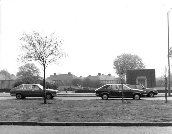
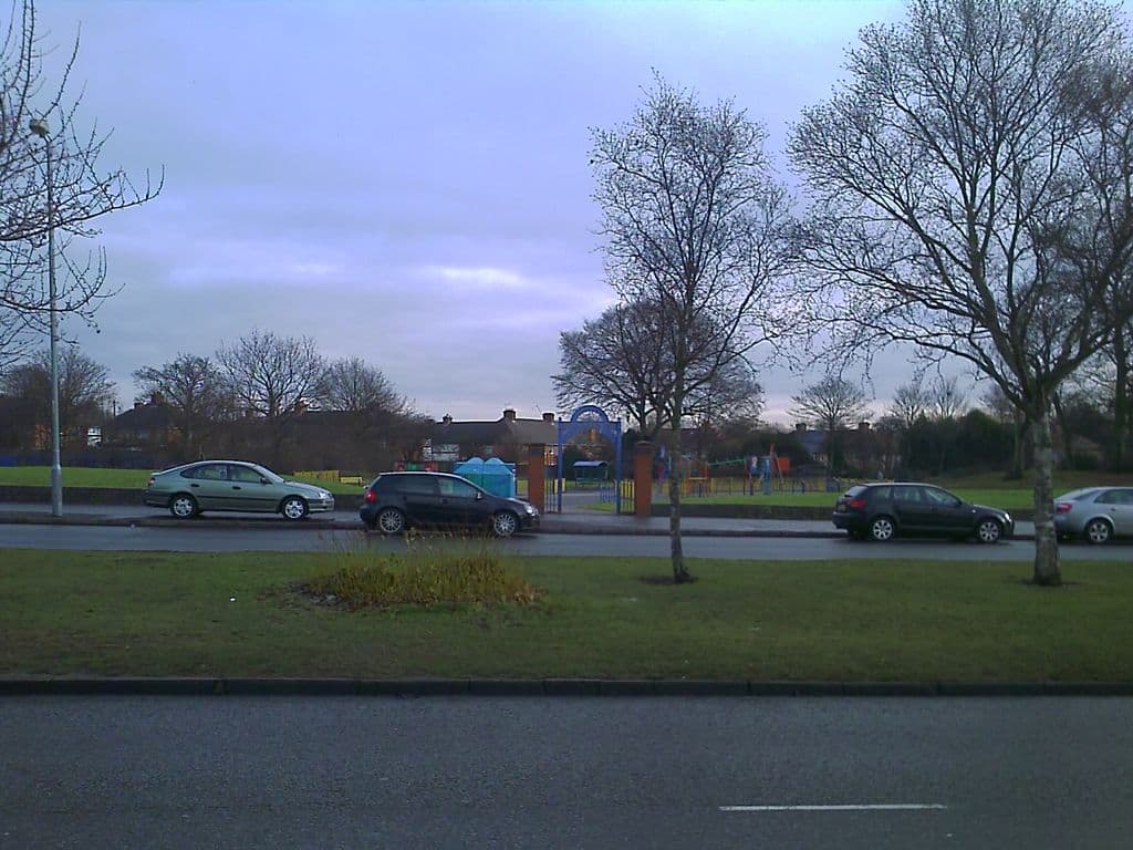
The old pumping station site, 1984 and 2010
The old waterworks building on Kingstanding Road, opposite the library, photographed in 1984. The pumping station has gone; its site is now Wheeldon Recreation Ground.
King’s Vale Well and Pumping StationThe 1984 pictureThe 2010 picture
1984: Library of Birmingham, Local Studies and History Department, LSH Warks Photo Survey WK-K10-0046 (3/1272) · 2010: Image reproduced with permission of Chris Hillcox, Voices of Kingstanding.
Pictures
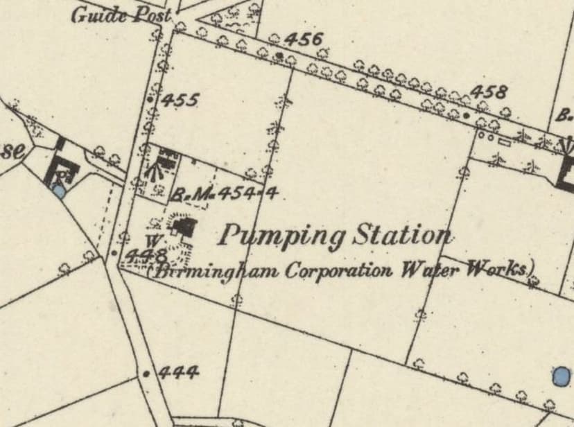
The first survey of 1882–83 already shows the “Pumping Station (Birmingham Corporation Water Works)”, with its well marked W.Ordnance Survey six-inch map, surveyed 1882–83, published 1884 · Out of copyright 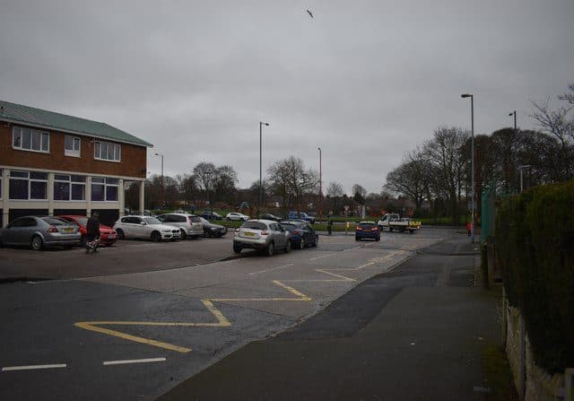
“Over to the Wheeldon”: the recreation ground on Kingstanding Road now covers the pumping station site.Martin Richard Phelan · CC BY-SA 2.0
From the Heritage Archive
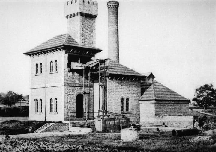 Kingsvale Pumping Stationc. 1900–1959
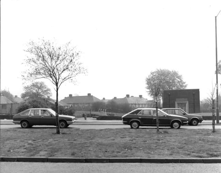 Old waterworks building1984
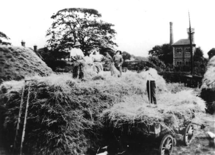 Kettlehouse Farmc. 1920–1925
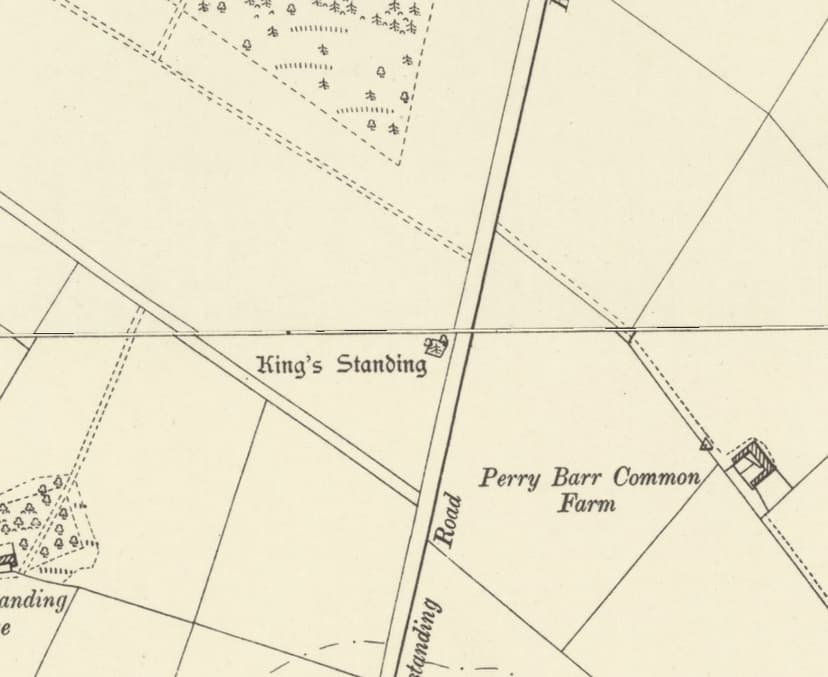
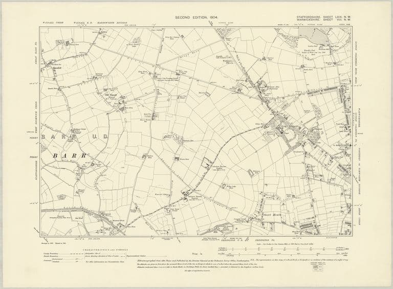 Farms and lanes: OS six-inch map, 1904Revised 1901, published 1904
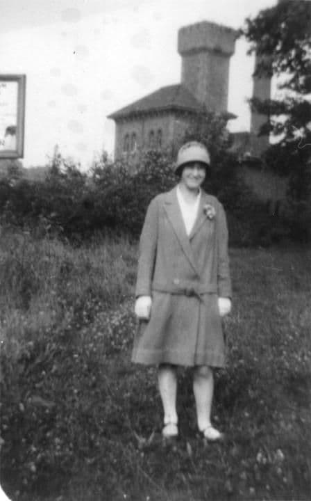 Kettlehouse Farmc. 1920–1929
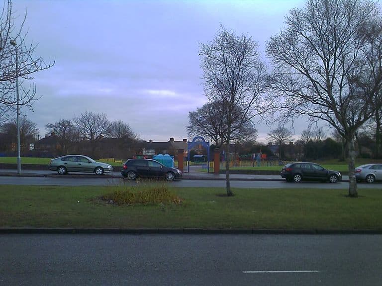 Wheeldon recreation ground, 2010c. 2010
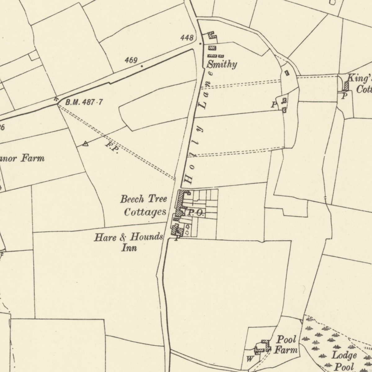
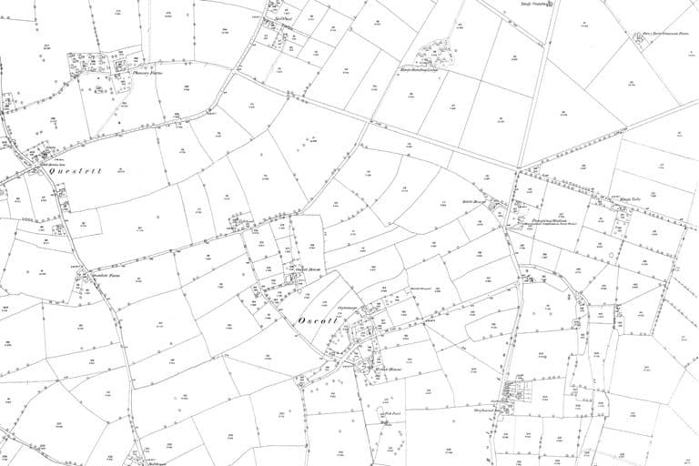 The fields of Kingstanding: OS 25-inch map, 1880sSurveyed 1882–83; published 1884–1891 (first edition)
- Birmingham Waterworks Company: notice of Bill — Birmingham Daily Post; Birmingham Daily Gazette; Wolverhampton Chronicle, 15, 22 and 29 November 1865. Ref. BL/0000033/18651115/027. “known as the Corner Piece and the Roman Field”. Snippet only.
- Company half-yearly reports — Birmingham Journal; Birmingham Daily Post, 14 September 1867; 17 and 19 September 1868. Ref. BL/0000224/18670914/015; BL/0000033/18680917/027. Snippets only.
- Company report — Birmingham Mail; Birmingham Daily Post; Birmingham Morning News, 12–13 September 1871. “continues to yield but a small supply”.
- Water supply reports — Aris’s Birmingham Gazette; Birmingham Daily Post, 2 February and 7 August 1880; 3 February 1888. Five wells; iron pipes to Short Heath.
- Elan water bill inquiry — Birmingham Daily Post, 15 April and 7 May 1892; 29 May 1893. Contamination evidence (Dr Frankland); nitrates.
- Speech on the water question (1866 well) — Worcestershire Chronicle, 30 May 1891. Ref. BL/0000350/18910530/040. A later retrospective; speaker not clear from the snippet.
- History of the Corporation of Birmingham, vol. III — C. A. Vince, 1902. Ref. p.304. “expected … 6,000,000 gallons daily; its actual yield is only 300,000”.
- Boulton & Watt drawings: pumping engine, Perry Barr station — Library of Birmingham, 1869–70. Ref. MS 3147/6/10; MS 3147/7/6. Attribution to King’s Vale probable, not proven.
- Photograph captions: Kingsvale Pumping Station; Old waterworks building, 1984 — Birmingham Images (Library of Birmingham), c. 1900–1959; 1984. Ref. WK-K10-0098; WK-K10-0046. Images viewed as previews only; not reproduced.
- Plaque, Perry Barr Reservoir — photograph by Andy Mabbett, Wikimedia Commons, 11 September 2009. Plaque reads “THROUGH TUNNELS”.
- OS six-inch maps, 1st and 2nd editions; OS 25-inch LXIX.1 revised 1913 — Ordnance Survey, 1882–83; 1901; 1913. Ref. NLS 101597597; NLS 115476157
- Over to the Wheeldon – Kingstanding, North Birmingham — Martin Richard Phelan (Geograph), 2019–20. Ref. Geograph 6512765. CC BY-SA 2.0
- Heritage research note 12 (Oscott, Queslett, water and Roman Field) — kingstanding.org, 2026. Site position ±30 m.
Comments
Comments will load here.