
In 1858 a Birmingham directory listed Caleb Foden twice under Perry Barr: once among the farmers and once among the beer-house keepers, both times at Holly Lane. Seventeen years later the entry read simply “Hare and Hounds, J. Foden, Holly ln”.
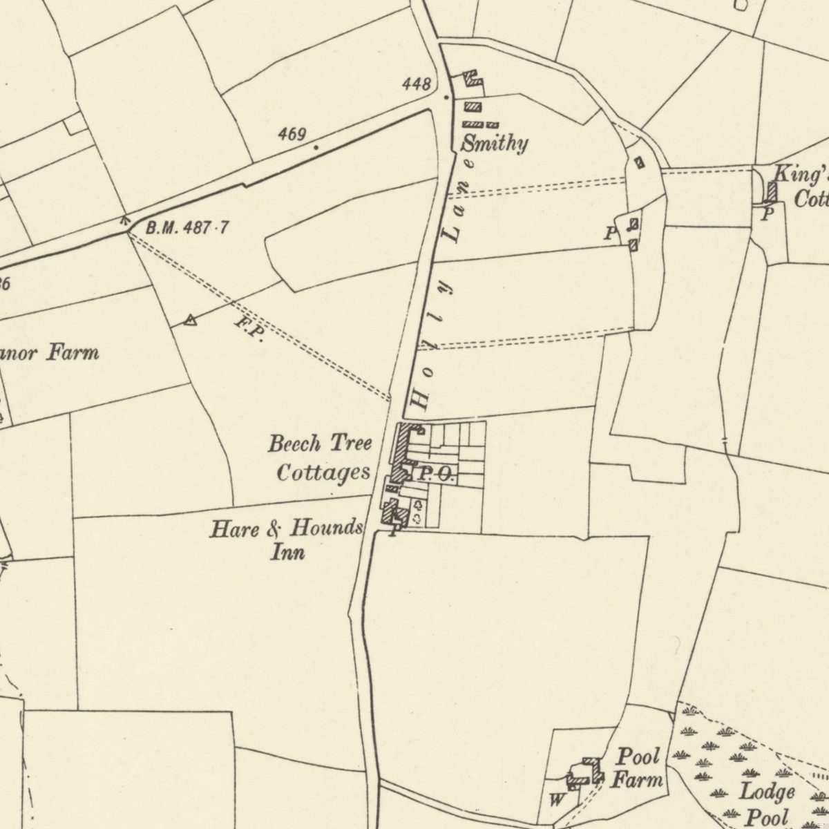
For most of the nineteenth century this was the nearest thing Kingstanding had to a village: a country lane with an inn, a smithy, a row of cottages and, by 1901, a post office. It ran along the southern part of today’s Kingstanding Road. A photograph of 1928 is even captioned “Kingstanding Village”.
An old line with a country name
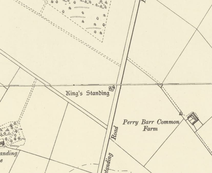
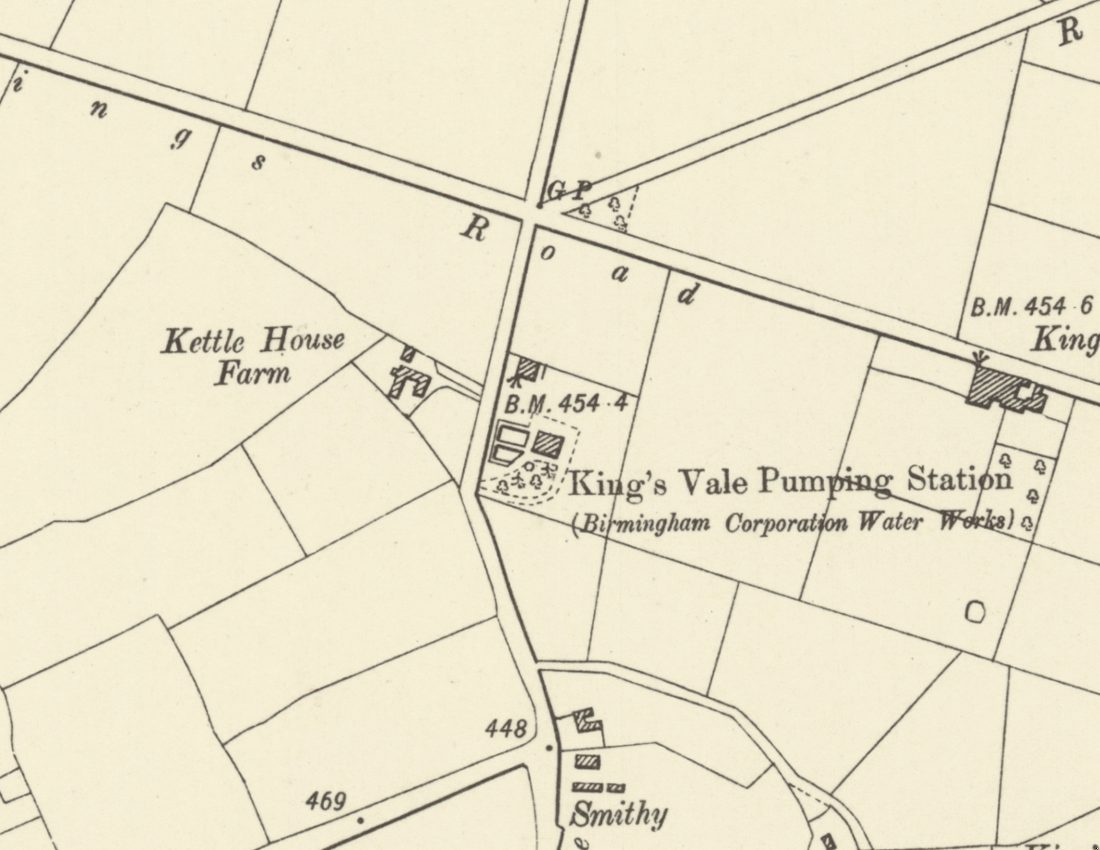
Holly Lane followed a far older road. In 1900 the antiquary B. C. A. Windle wrote that the Roman Ryknild Street “was identical with Holly Lane”. On the Ordnance Survey maps the name is lettered on the stretch running south from the Kings Road junction towards Halfway Farm, and by 1901 the surveyors were already calling the road north of the junction “Kingstanding Road”. Local usage was looser. Photographers in the late 1920s and 1930s still wrote “Holly Lane” for the road beside Kettlehouse Farm, near where the Circle is now.
Smithy, cottages and a post office
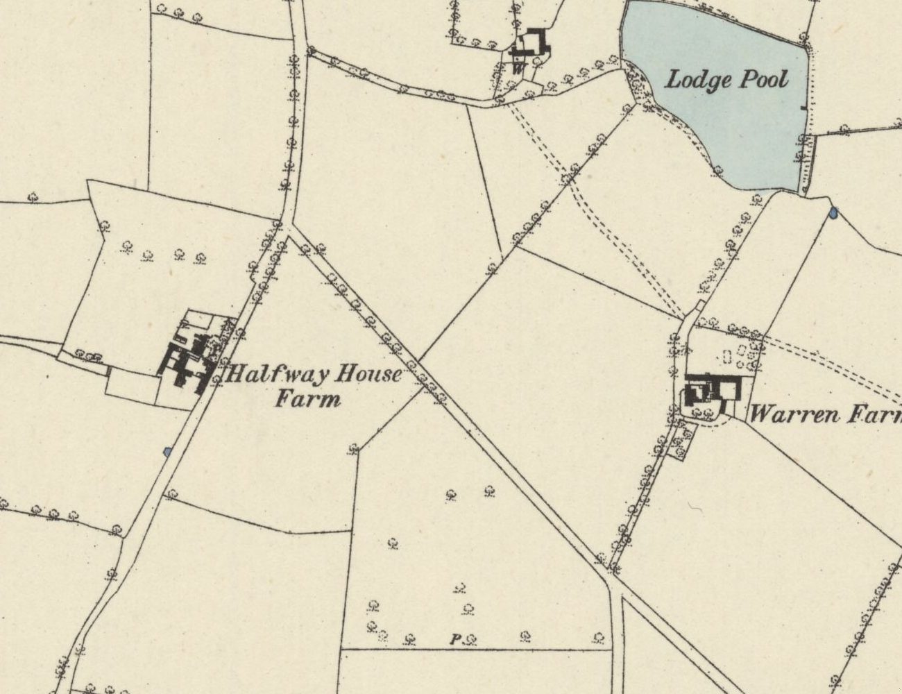
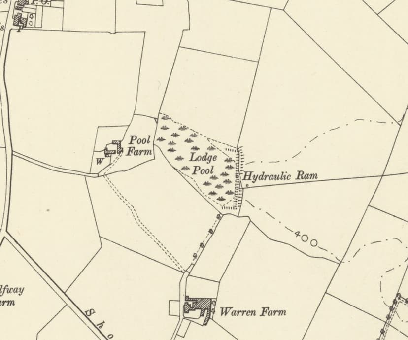
The first detailed survey, made in 1882–83, shows a tight group of buildings on the east side of the lane, with long garden strips behind them, and a smithy beside the inn. By 1901 the row had a name, Beech Tree Cottages, and a post office, and the smithy label had moved north towards the Kings Road junction. Across the fields to the north-east, on a track off the lane, stood King’s Vale Cottages with their pump. The 1913 map marks water rising from the ground beside them, the spring at the head of the brook that ran south to Lodge Pool and Warren Farm.
A photograph of the 1920s shows Mr Compton, the waggoner from Halfway Farm, cutting a neighbour’s hair. One archive catalogue places the scene at Halfway Farm; another says it was at Beech Tree Cottages.
The Greyhound that was the Hare and Hounds
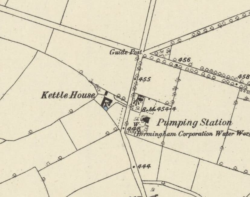
The inn is a small puzzle. The 1875 directory calls it the Hare and Hounds, and in November 1889 the coroner held an inquest “at the Hare and Hounds, Holly Lane, Perry Barr”. Yet the Ordnance Survey, surveying in 1882–83, lettered the same building “Greyhound Inn”. By 1901 the map agreed with everyone else: “Hare & Hounds Inn”. There was a real Greyhound Inn at New Oscott, on both surveys, so the Holly Lane label looks like the odd one out.
By local accounts the old inn was replaced by a new Hare and Hounds around 1931. That building was photographed in 1988 and damaged by fire in 2016.
The estate comes up the lane
When the council began building, Holly Lane became the way in. In November 1929 the Evening Despatch reported that a new route was planned “to the Warren Farm Estate via Holly Lane Perry Barr”. The fields on either side filled with houses, the farms went, and the name Holly Lane slipped out of use.
The village may not have vanished completely. The Ordnance Survey plan of 1961 shows a terrace numbered 429–457 Kingstanding Road with a post office, and when the 1901 map is laid over today’s streets, the Beech Tree Cottages plot falls on the block by Redbridge Close. Nos. 429–435 may be the old cottages themselves. Next time you pass, look at the rooflines and the brickwork. If you know those houses, kingstanding.org would love to hear from you.
Holly Lane has lost its name, its smithy and its first inn. It has kept its line: a country lane laid, if the antiquaries were right, along a Roman road, and still the spine of Kingstanding.
Pictures
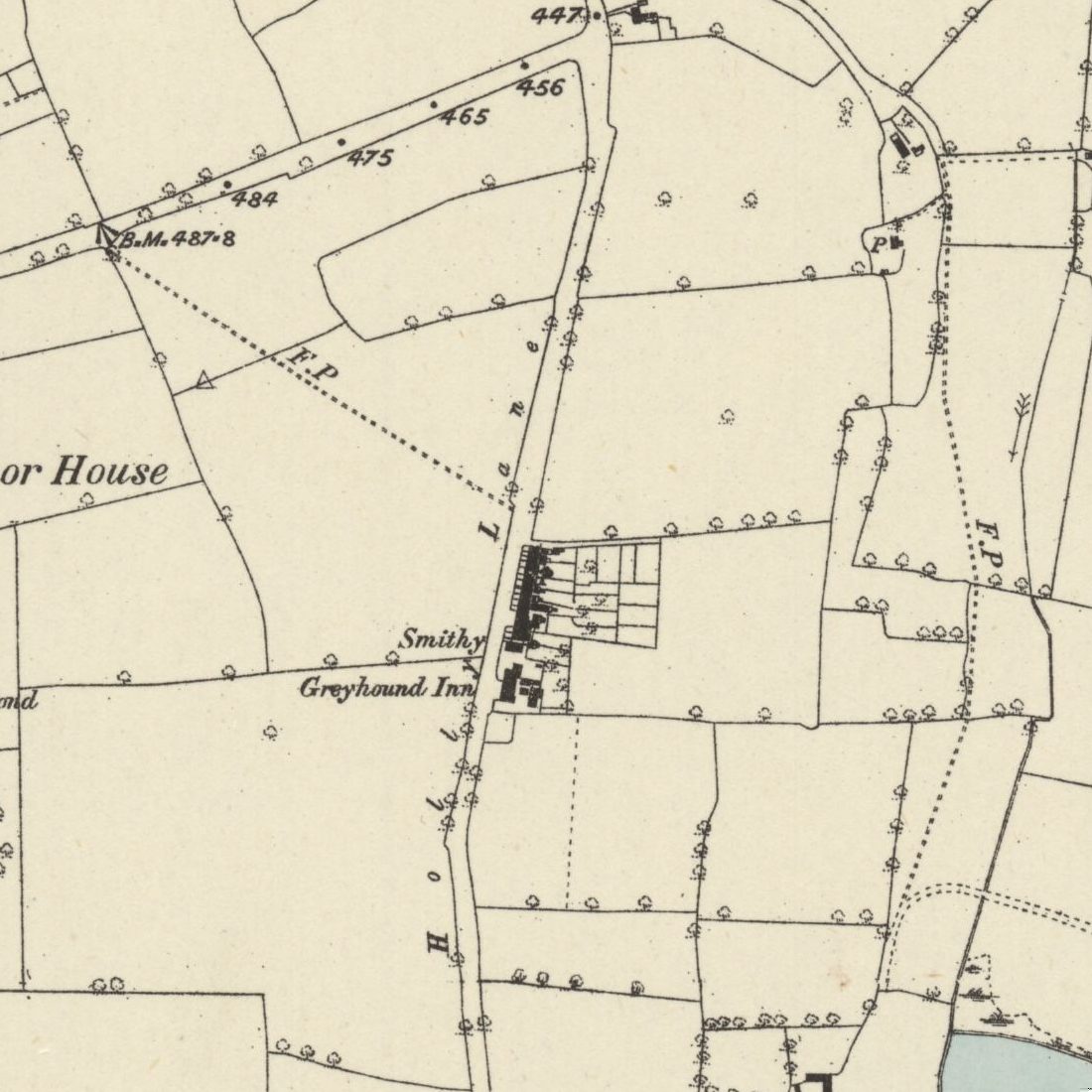
The same stretch surveyed in 1882–83, when the map called the inn the “Greyhound Inn”.Ordnance Survey six-inch map, surveyed 1882–83 (published 1884) · Out of copyright 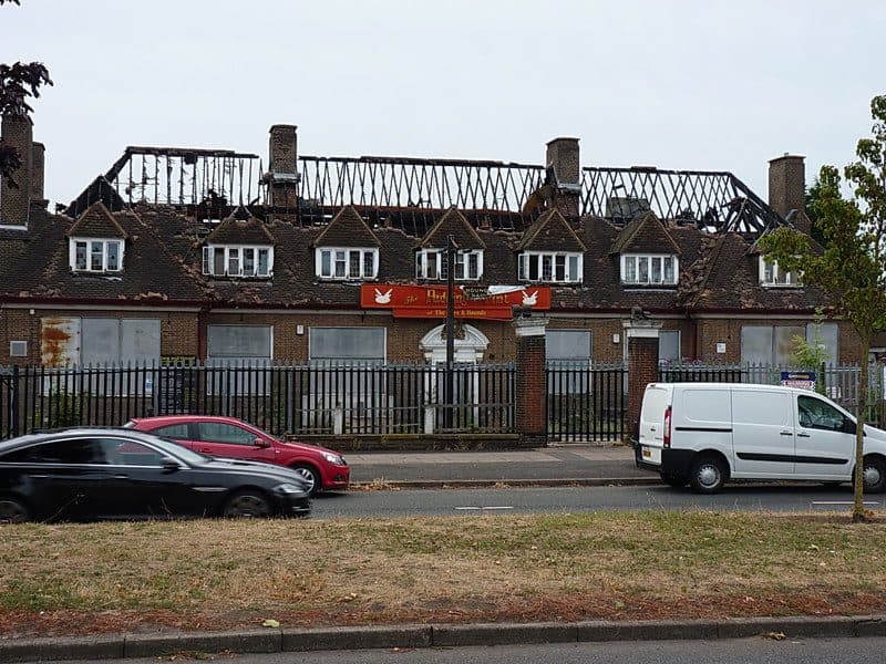
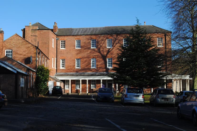
What remained of the later Hare and Hounds on Kingstanding Road after the fire of 2016.Richard Law, geograph.org.uk (5915864) · CC BY-SA 2.0
From the Heritage Archive
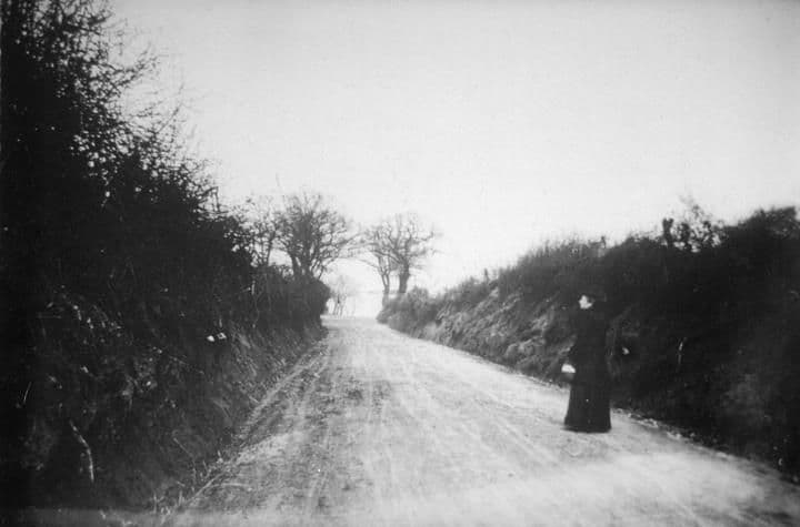 Kingstanding Road1900
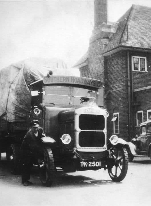 Hare & Hounds1920
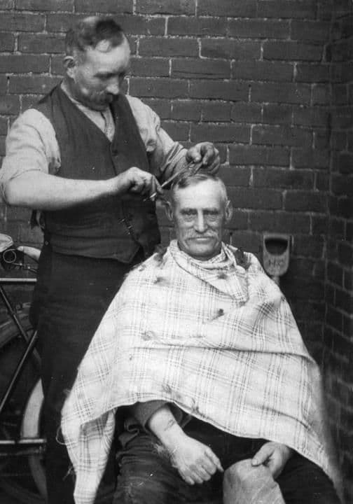 Halfway Farm1920
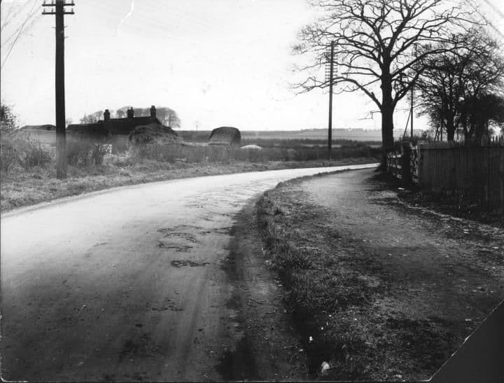 Kingstanding RoadApril 1928
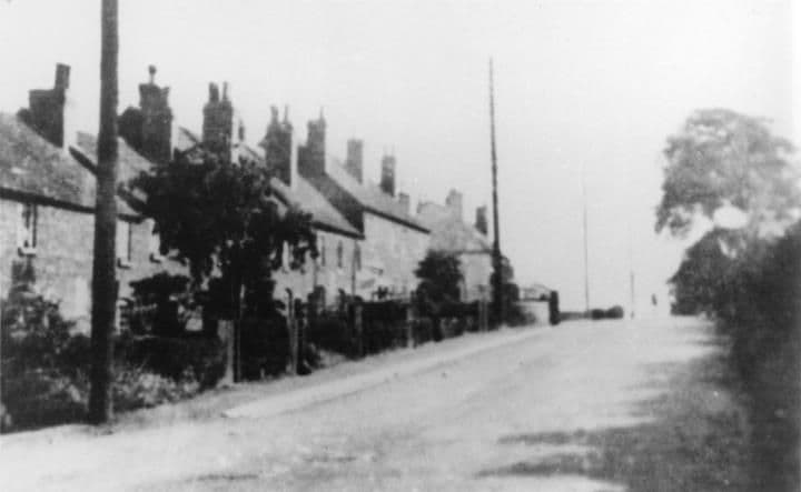 Kingstanding Village1928
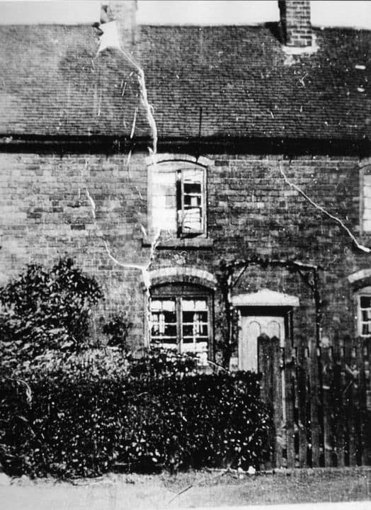 Beech Tree Cottages1929
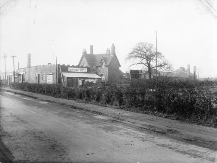 College Road near Holly Lane1927
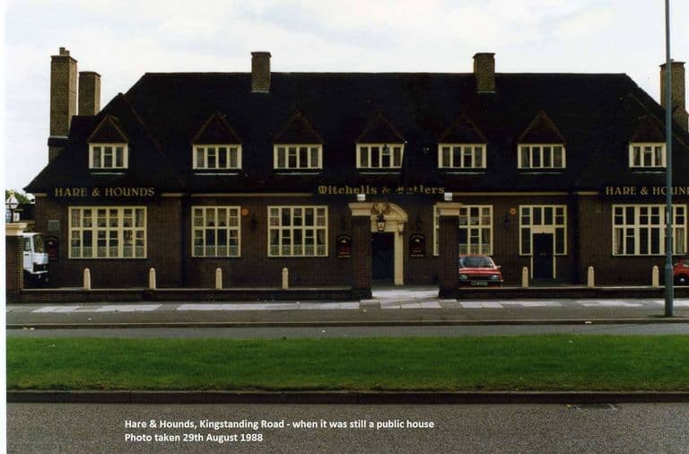 The Hare & Hounds, Kingstanding Road, 198829 August 1988
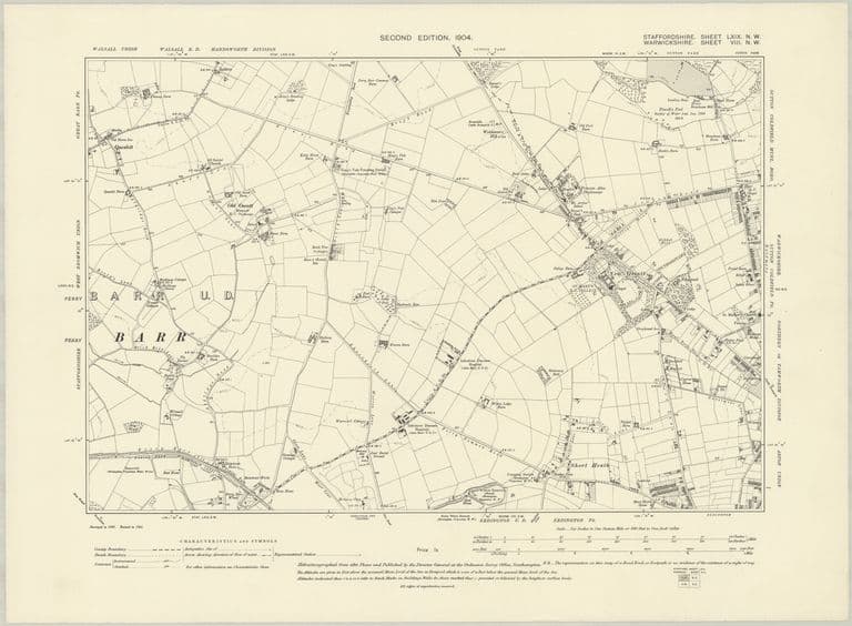 Farms and lanes: OS six-inch map, 1904Revised 1901, published 1904
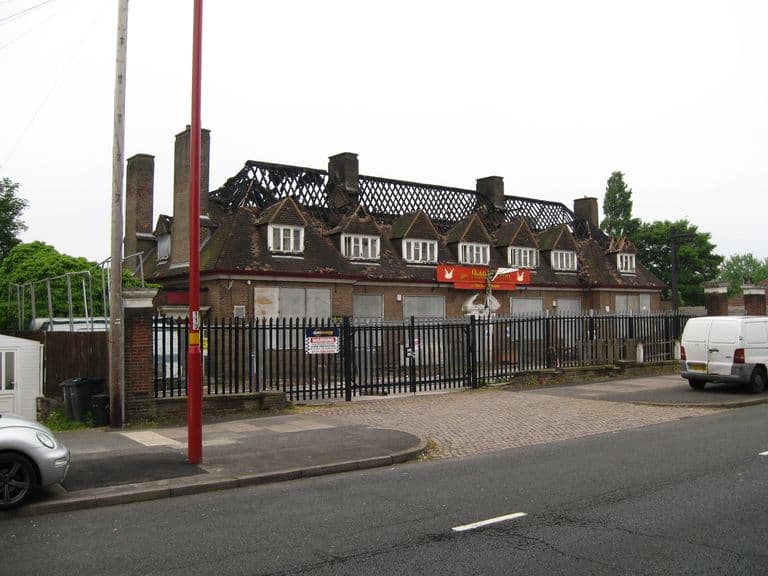 The Hare and Hounds after the fire, 201630 May 2016
- General & Commercial Directory of Birmingham, p. 674 (Perry Barr) — W. H. Dix & Co., 1858. Ref. Leicester CONTENTdm ptr 367168
- White & Co.’s Commercial & Trades Directory of Birmingham, vol. II, p. 762 — White & Co., 1875. Ref. Leicester CONTENTdm ptr 123458
- On Some Early Roads of Warwickshire and Worcestershire (Trans. Birmingham Archaeological Society vol. 25) — B. C. A. Windle, 1900. Ref. p. 45. Ryknild Street “was identical with Holly Lane”
- Ordnance Survey six-inch, 1st edition, Staffordshire LXIX.NW — Ordnance Survey, surveyed 1882–83, published 1884. Ref. NLS 101597597
- Ordnance Survey six-inch, 2nd edition, Staffordshire LXIX.NW — Ordnance Survey, revised 1901, published 1904. Ref. NLS “6inchsecond” layer
- Ordnance Survey six-inch, Staffordshire LXIX.NW — Ordnance Survey, revised 1913, published 1921. Ref. NLS 101597591
- Ordnance Survey 25-inch, Staffordshire LXIX.1 — Ordnance Survey, revised 1913, published 1914. Ref. NLS 115476157
- Kingstanding Road (then called Holly Lane) near The Circle, April 1928; Kettlehouse Farm, Holly Lane, 1930s — Library of Birmingham (Birmingham Images 1291, 1788), 1928; 1930s. Ref. WK-K10-0065; WK-P3-0374. Captions only
- Kingstanding Village; Beech Tree Cottages — Library of Birmingham (Birmingham Images 1305, 1308), 1928; 1929. Ref. WK-K10-0082; WK K10 0085. Captions only
- Mr Compton, waggoner at Halfway Farm, cutting his neighbour’s hair — Library of Birmingham, 1920s. Ref. WPS/WK/K10/86 (Birmingham Images 1309). CalmView: at Beech Tree Cottages; Birmingham Images: at Halfway Farm
- Birmingham Daily Post (inquest at the Hare and Hounds, Holly Lane) — 25 Nov 1889. BNA snippet
- Evening Despatch (new route to the Warren Farm Estate via Holly Lane) — 20 Nov 1929. BNA snippet
- OS 1:1250 SP0794SE — Ordnance Survey, surveyed Jul 1961. Ref. NLS 210970415. Terrace Nos. 429–457 with P.O.; Hare & Hounds
- Hare and Hounds, Kingstanding — Birmingham History Forum (“Astoness”), 2 Jul 2011. Local account of the rebuild c.1931 (lead only)
- Kingstanding Village — Birmingham History Forum, Jun 2025. Lead for the 429–435 survival (unverified)
- Heritage Archive: The Hare & Hounds, 1988; The Hare and Hounds after the fire, 2016 — kingstanding.org Heritage Archive, 1988; 30 May 2016
- Historic name gazetteer from old maps, 1775–1921 — kingstanding.org research notes, 29 Sep 2026. Ref. docs/heritage/notes/10-gazetteer.md. Positions and labels from each map edition
- Farms and lost homes of pre-estate Kingstanding (research notes) — kingstanding.org research notes, 29 Sep 2026. Ref. docs/heritage/notes/11-farms-lodge.md. Map overlays, newspaper snippets, catalogue entries
- Oscott, Queslett, water and Roman Field (research notes) — kingstanding.org research notes, 29 Sep 2026. Ref. docs/heritage/notes/12-oscott-queslett-water-roman.md. Greyhound / Hare & Hounds map evidence (C8)
Comments
Comments will load here.