
On 30 April 1872 a newspaper reported that lightning had struck a stable “on the premises of Mr. Short, of the Warren Farm, Perry Barr”. There were two horses inside. One was killed.
It is the earliest use of the name Warren Farm found so far. Five years earlier the Short family had given their address as “Warren House”, and before that the building had other names again. Those names tell the story of this corner of Kingstanding, from rabbit warren to council estate. Stand near the corner of Charlton Road and Dulwich Road today and you are close to where the farmyard was.
A lodge on the rabbit heath
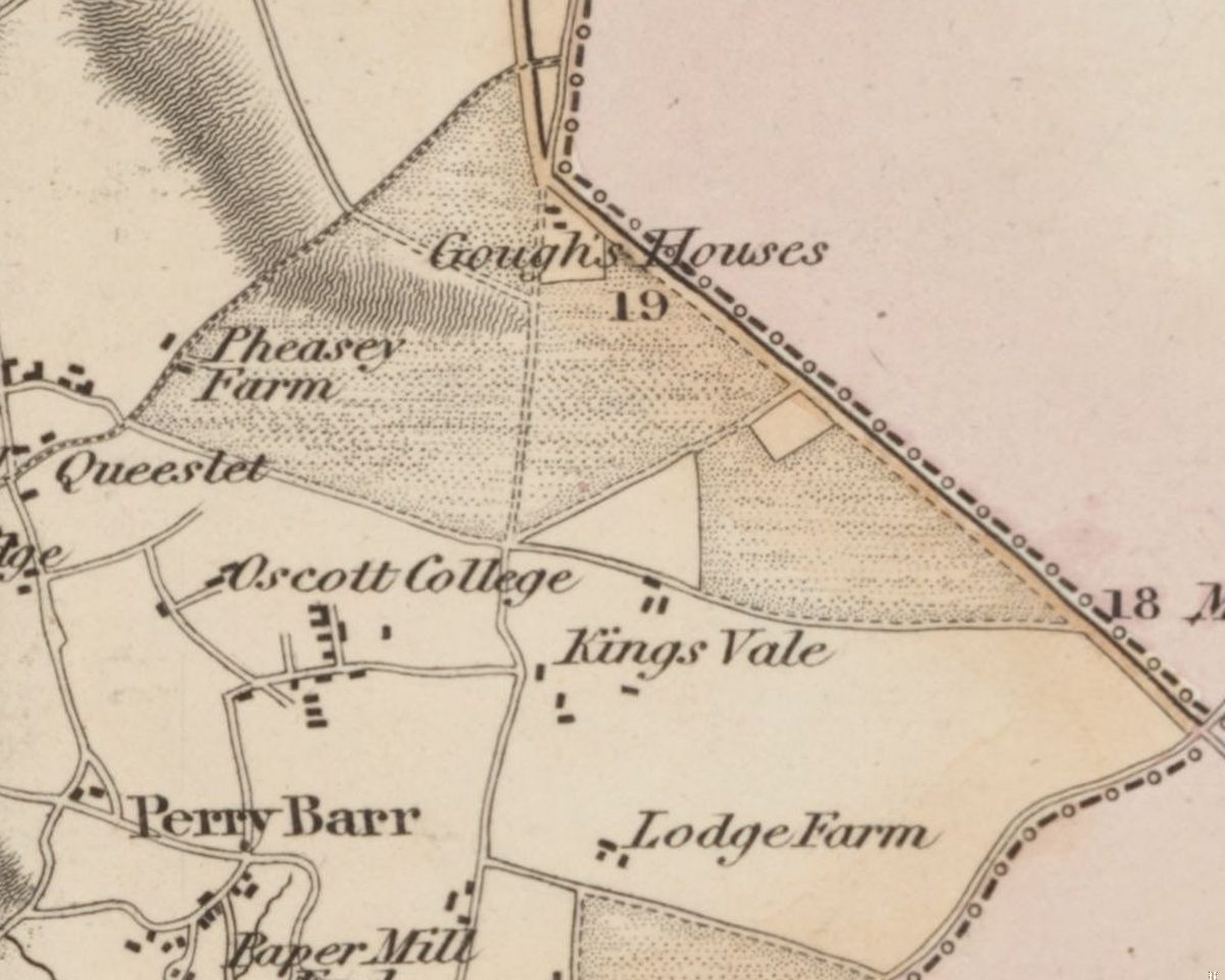
In 1775 William Yates’s map of Staffordshire showed open heath across this ground, with a building in a small square enclosure lettered simply “Lodge”. The archaeologist Mike Hodder identified it with this house, although Yates’s map is too loose for the match to be proved from the maps alone. An Ordnance Survey drawing of 1817 calls it “The Lodge”. The one-inch map, revised in 1831–32, hedges its bets: “The Lodge or Warren House”.
The second name gives the game away. This was warren country. The Act of 1811 that enclosed the heath named “Perry Warren” and “Kingstanding Warren” alongside Perry Barr Common itself, and Hodder links this house with the management of rabbit warrens.
When the house was photographed for a sale catalogue in 1921 it was brick-built with stone dressings and Dutch gables, a style Hodder dated to the late seventeenth century.
Shorts, Fulfords and Wells
By 1850 John and Joseph Fulford were farming at “Warren House”. John Short was there by 1867, and Thomas Short in 1875. In 1877 the farm was offered to let, with a “comfortable” farmhouse and labourers’ cottages on “Sound Turnip and Barley Land, very suitable for Sheep Farming”.
Augustine Lewis Wells was farming here by 1887. In November 1888 Mrs Elizabeth Wells, of Warren Farm, was killed in an accident while her groom drove her towards Birmingham in a trap. Wells became a magistrate and served more than twenty years on the West Bromwich Board of Guardians. When he died in 1934, aged 87, he was remembered as “one of the largest potato-growers in the district”, and his obituary said he had “owned the Warren Farm”. He had not always owned it. In 1921 Lord Calthorpe’s Perry Hall estate put “Warren and Pool Farm”, 308 acres, up for auction, so Wells probably bought it at or after that sale.
The pool and the ram
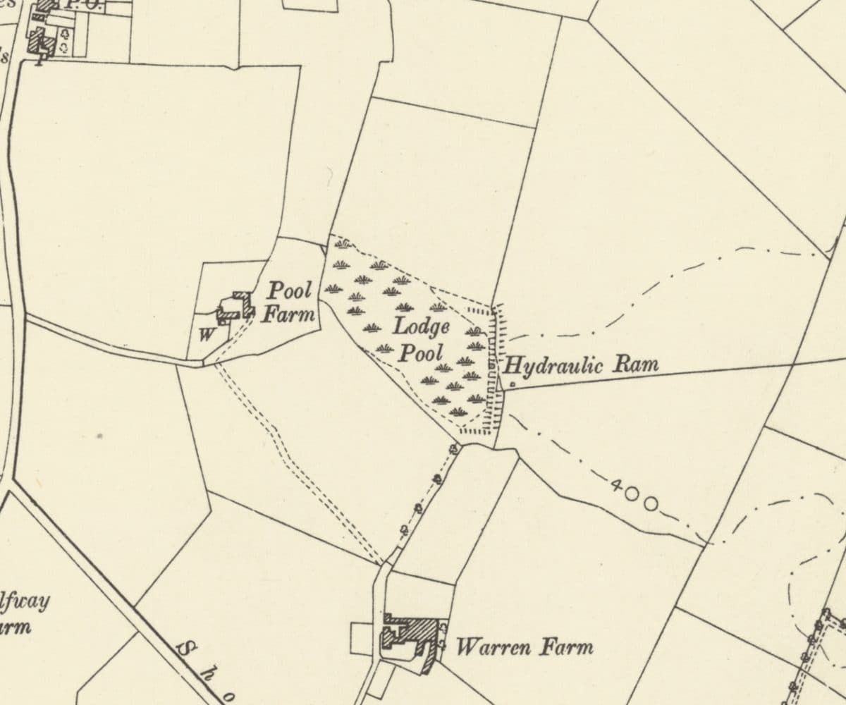
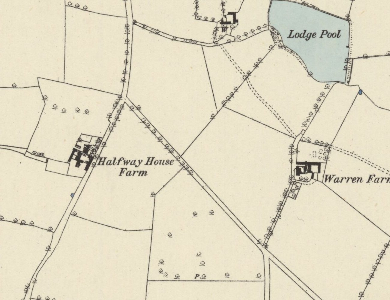
North of the farm lay Lodge Pool. The map of 1831–32 names it and draws a small square pool, apparently banked, with a stream running east. It probably took its name from The Lodge next door. The Ordnance Survey drew it as open water in 1882–83. By 1901 it had become marsh, and at its eastern end, below the dam, the map marks a “Hydraulic Ram”, a pump driven by the force of the flowing water itself. What it supplied, no record yet says.
The water came from the north. The 1913 map marks a spring rising beside King’s Vale Cottages, near Holly Lane, with a ditch running south to the pool and a line carrying on east from the ram.
Pool Farm and the Rodwell Grove cottages
West of the pool, down a lane off Holly Lane, stood Pool Farm, with its own well. Its buildings are on the 1882–83 survey, but the name first appears on the map of 1901. The lane is still there: it is Rodwell Grove.
The two short rows of cottages in Rodwell Grove are sometimes called Pool Farm Cottages and said to date from 1840. The maps say otherwise. They are missing from the surveys of 1882–83, 1901 and 1913, so they were built after 1913, either in the last years of the farm or as the estate arrived.
Streets over the fields
The government file on the council’s compulsory purchase order is titled “Kingstanding Estate, Warren Farm Pool”. On 16 September 1929 a photographer recorded the site being prepared for building, and by September 1930 houses on the Warren Farm portion were occupied.
Lay the old maps over the new and the farm falls between Chingford Road and Dulwich Road, near Charlton Road. Pool Farm stood between today’s Tansley Road and Cranbourne Road. Lodge Pool lies under the western curve of the Danesbury Crescent and Warren Farm Road loop, and the ram stood near where Warren Farm Road meets Aylesbury Crescent.
The rabbits, the pool and the Dutch gables have gone. The name has not. It is on Warren Farm Road and on the Warren Farm Lodge care home: a warrener’s lodge on the heath, still giving directions long after the last rabbit was caught.
Pictures
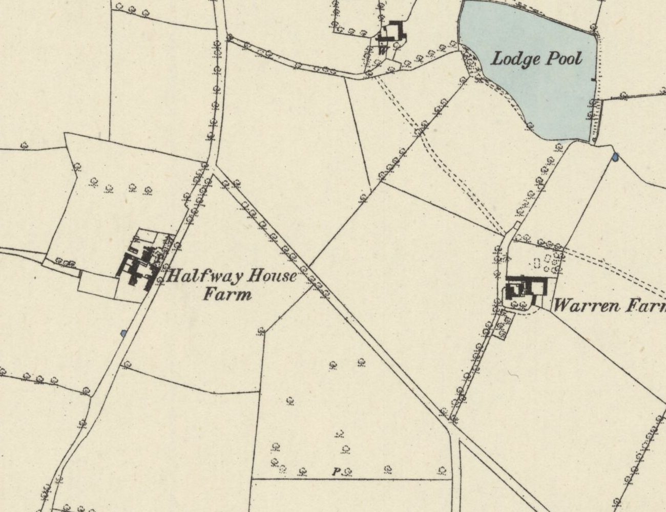
Lodge Pool as open water in 1882–83, with Warren Farm below it and the unnamed Pool Farm buildings to its west.Ordnance Survey six-inch map, surveyed 1882–83 (published 1884) · Out of copyright 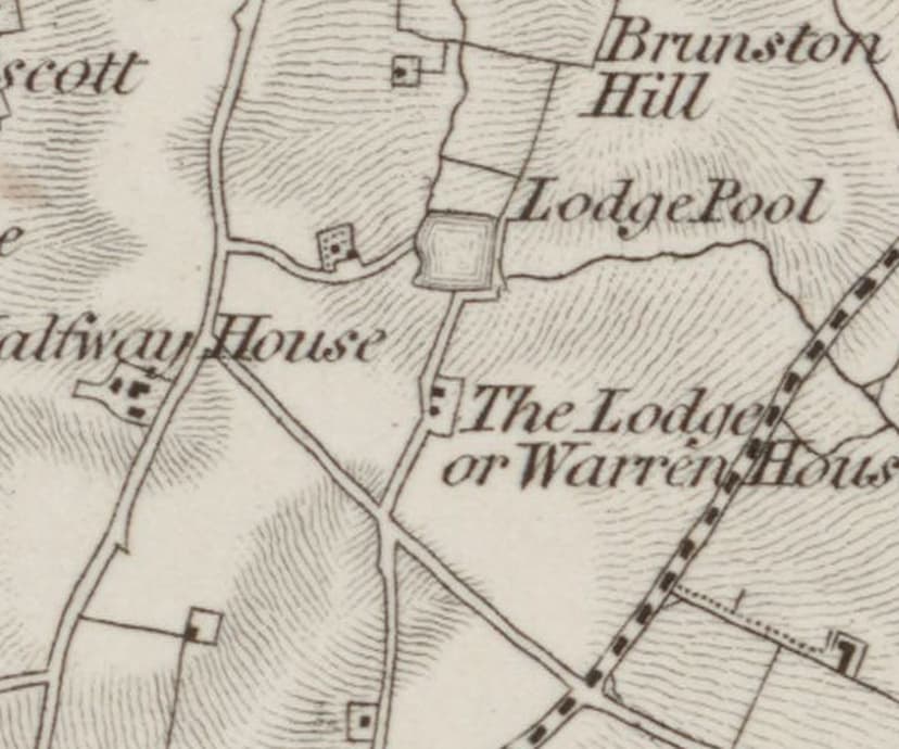
The one-inch map of 1831–32: a small square Lodge Pool and, just south, “The Lodge or Warren House”, the later Warren Farm. Enlarged.Ordnance Survey one-inch map, revised 1831–32 (1863 printing) · Out of copyright
From the Heritage Archive
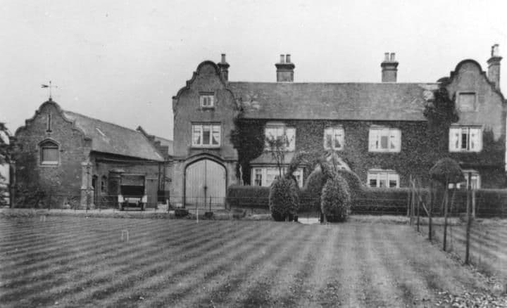 Warren Farm1921
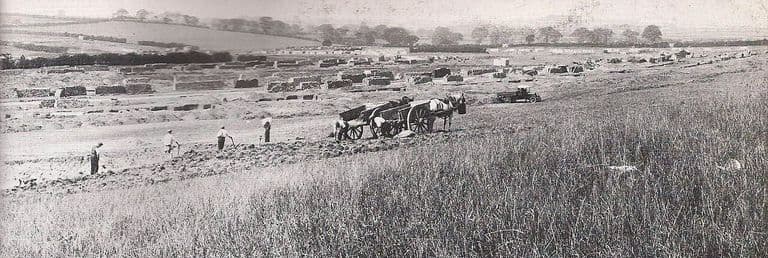 Warren Farm Estate under construction, 1929September 1929
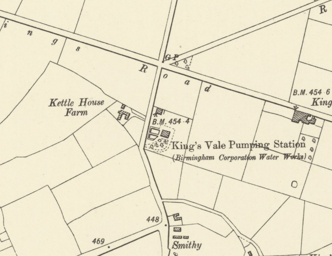
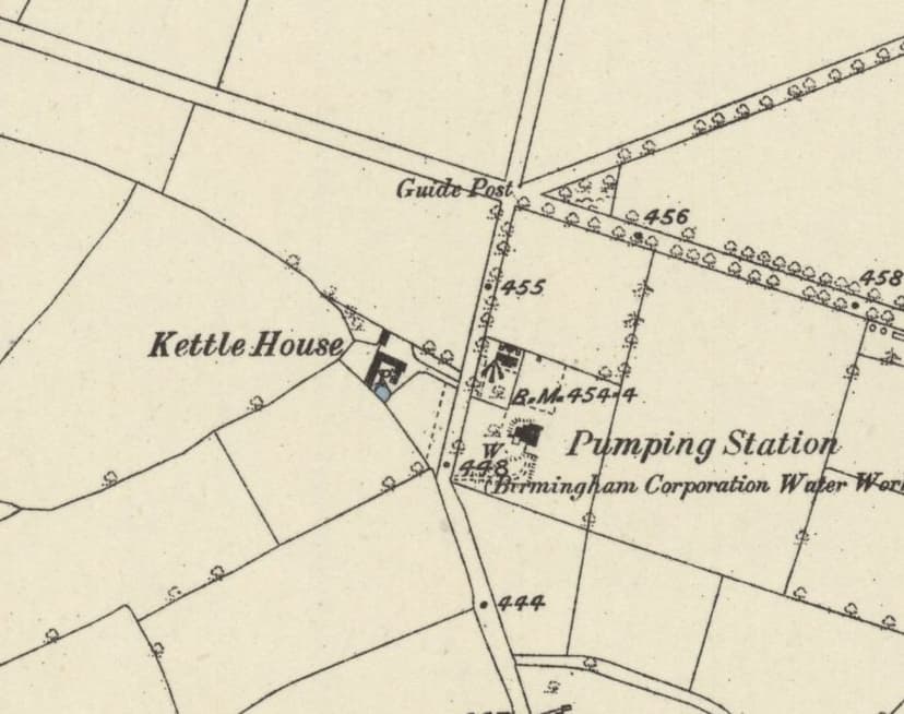
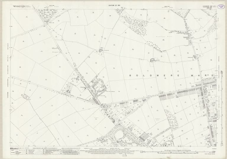 Kettlehouse and Warren Farm before the estate: OS 25-inch, 1914Revised 1913, published 1914
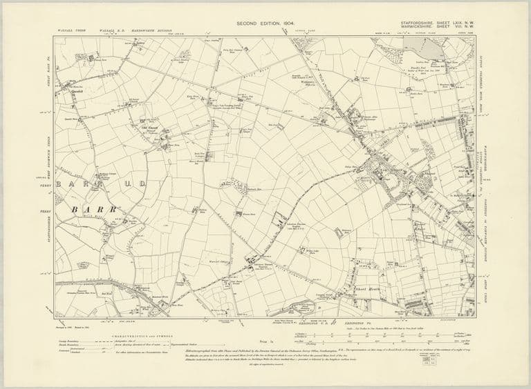 Farms and lanes: OS six-inch map, 1904Revised 1901, published 1904
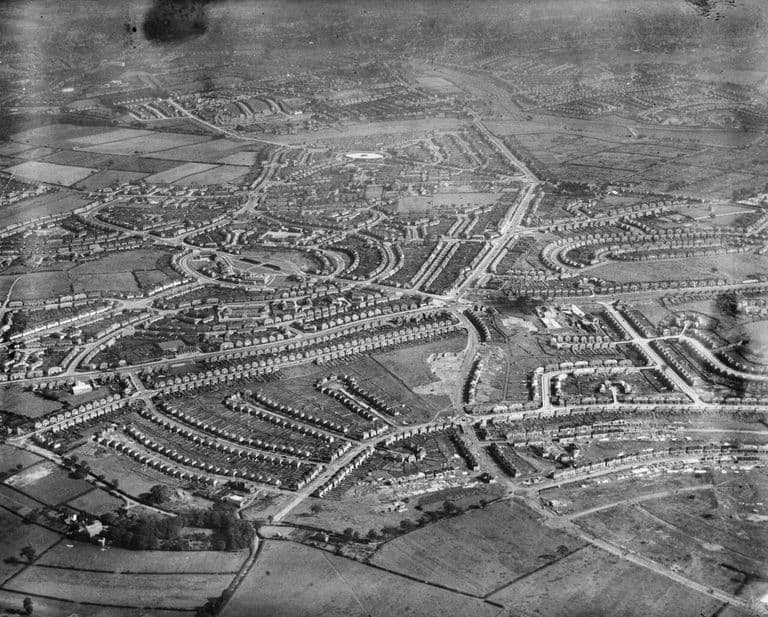 Kingstanding Road and Warren Farm Road from the air, 19388 September 1938
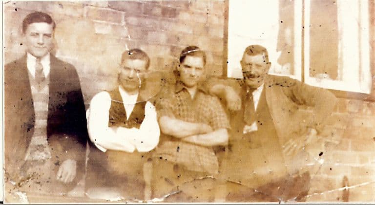 William Henry Wilson and his plasterers, Warren Farm estateDate unknown
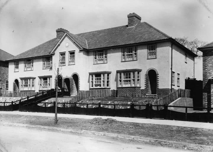 Danesbury Crescent1931
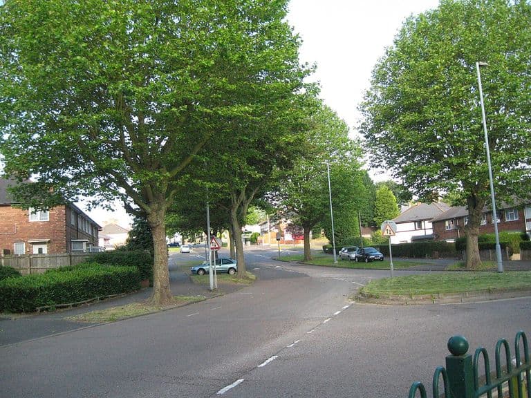 Westwards along Warren Farm Road, 201424 June 2014
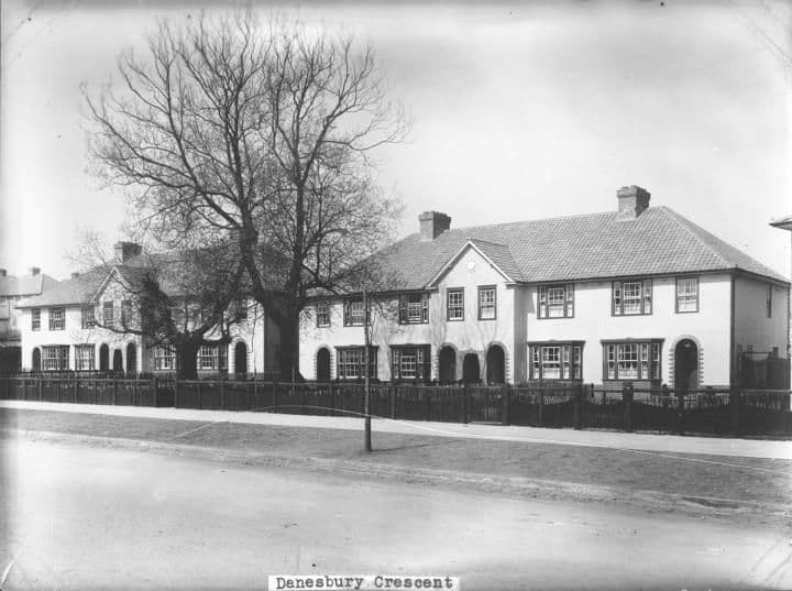 Danesbury Crescent1932
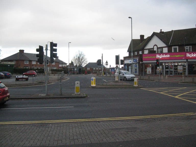 Over to Warren Farm Road, 20191 January 2019
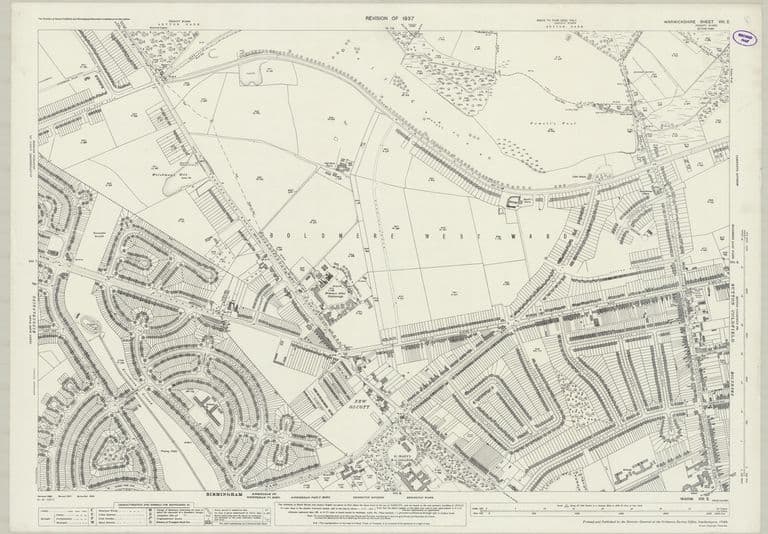 The eastern estate complete: OS 25-inch, 1937 revisionRevised 1937, published 1940
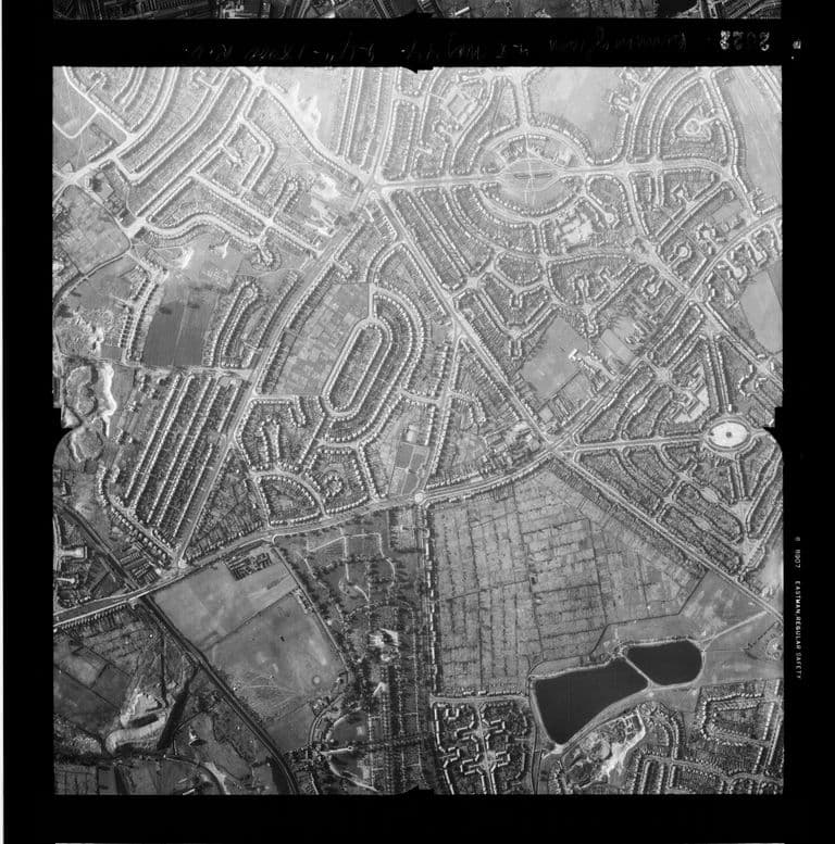 Kingstanding and Perry Common photographed by an American reconnaissance aircraft, May 194427 or 28 May 1944
- Western Times (lightning at Mr Short’s, Warren Farm) — 30 Apr 1872. BNA snippet, notes/11 Log 5
- Aris’s Birmingham Gazette (John Short, of Warren House) — 10 Aug 1867. BNA snippet, notes/11 Log 5; also Wellington Journal 16 Dec 1871
- Map of the County of Stafford — William Yates, 1775 (surveyed 1769–75). Ref. Staffordshire Past Track tile service. Read for research only; the scan is not reproduced here
- The development of some aspects of settlement and land use in Sutton Chase (PhD thesis) — M. A. Hodder, University of Birmingham, 1988. Ref. pp. 117–18, 131, 252–3, 263–4. Yates “Lodge”, OS 1817 “The Lodge”, OS one-inch “The Lodge or Warren House”; 1921 catalogue photo; Dutch gables dated late 17th century
- Ordnance Survey one-inch Old Series, sheet LXII SE (Lichfield) — Ordnance Survey, surveyed 1814–17, revised 1831–32; this printing 1863. Ref. NLS 257403148. Read for the gazetteer (notes/10) and Log 12 (notes/11)
- Ordnance Survey six-inch, 1st edition, Staffordshire LXIX.NW — Ordnance Survey, surveyed 1882–83, published 1884. Ref. NLS 101597597
- Ordnance Survey six-inch, 2nd edition, Staffordshire LXIX.NW — Ordnance Survey, revised 1901, published 1904. Ref. NLS “6inchsecond” layer
- Ordnance Survey six-inch, Staffordshire LXIX.NW — Ordnance Survey, revised 1913, published 1921. Ref. NLS 101597591
- Act for inclosing land in the Manor of Perry Barr: Perry Barr Common, Perry Warren, Kingstanding Warren — Library of Birmingham, Gough of Perry Hall papers, 1811. Ref. MS 3145/1/7/16/1 (old ref. MS 3145/58/1)
- Post Office Directory of Birmingham, Staffordshire & Worcestershire, p. 300 (Perry Barr) — Kelly & Co., 1850. Ref. Leicester CONTENTdm ptr 369588
- White & Co.’s Commercial & Trades Directory of Birmingham, vol. II, p. 762 — White & Co., 1875. Ref. Leicester CONTENTdm ptr 123458
- Birmingham Daily Gazette / Midland Counties Herald (Warren Farm to let) — Feb 1877. BNA snippet, notes/11 Log 4
- Oxford Review (“A lady killed at Perry Barr”) — 29 Nov 1888. BNA snippet, notes/11 Log 4
- Press notices of Augustine Lewis Wells, Warren Farm — Handsworth & Smethwick Free Press; Wearside Catholic News; Birmingham Mail; Birmingham Daily Gazette; Lichfield Mercury, 1887–1934. Incl. BDG 15 Sep 1934 obituary (“owned the Warren Farm”) and Lichfield Mercury 21 Dec 1934 (“one of the largest potato-growers”); notes/11 Log 10
- Perry Hall Estate sale (Fox & Sons): advertisements and auction report — Country Life; Birmingham Daily Gazette, Aug–Oct 1921. Catalogue itself at Sutton Coldfield Library (per LoB WK/K10/70)
- Warren Farm photographed for the Perry Hall auction catalogue — Library of Birmingham, 1921. Ref. WPS/WK/K10/70 (Birmingham Images 1296). Catalogue entry only
- Kingstanding Estate, Warren Farm Pool. Compulsory Purchase Order — The National Archives, 1929–39. Ref. HLG 49/960. Catalogue only
- Warren Farm Estate, Perry Barr, site being prepared for construction — Library of Birmingham (Birmingham Images 1790), 16 Sep 1929. Ref. WK-P3-0376. Caption only
- Evening Despatch (Warren Farm portion occupied) — 23 Sep 1930. BNA snippet, notes/11 Log 10
- OS 1:1250 SP0893NW (Rodwell Grove) — Ordnance Survey, surveyed Feb 1962. Ref. NLS 210970982. Rodwell Grove rows; with S182 forum thread for the “1840” claim (rejected)
- Historic name gazetteer from old maps, 1775–1921 — kingstanding.org research notes, 29 Sep 2026. Ref. docs/heritage/notes/10-gazetteer.md. Positions and labels from each map edition
- Farms and lost homes of pre-estate Kingstanding (research notes) — kingstanding.org research notes, 29 Sep 2026. Ref. docs/heritage/notes/11-farms-lodge.md. Map overlays, newspaper snippets, catalogue entries
Comments
Comments will load here.