
On 17 February 1840 Mary Loynes died at Halfway Farm, Perry Barr, in her seventy-fifth year. The notice in the Wolverhampton Chronicle ended: “Her memory will be long cherished by a large circle of friends.”
It is the earliest newspaper mention of the farm found so far. The farm itself was older, and it stood where the Army Reserve Centre on Kingstanding Road is today.
Halfway to where?
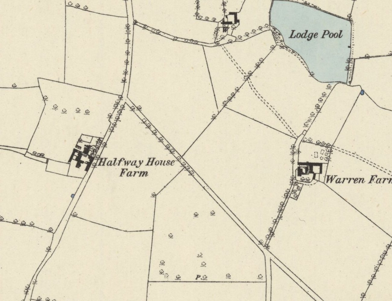
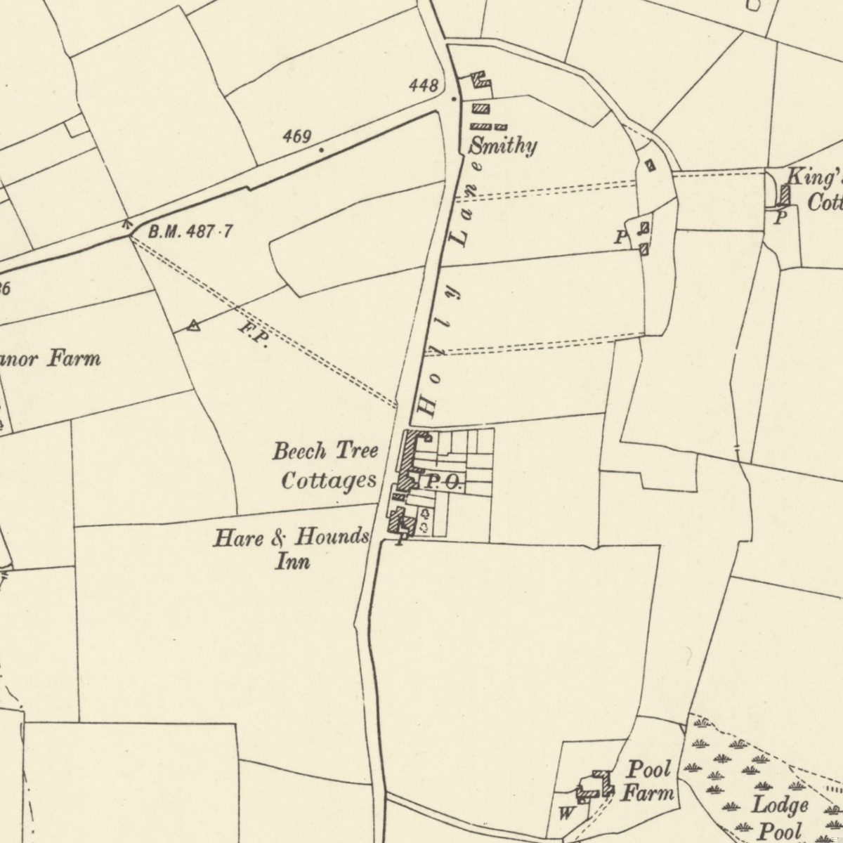
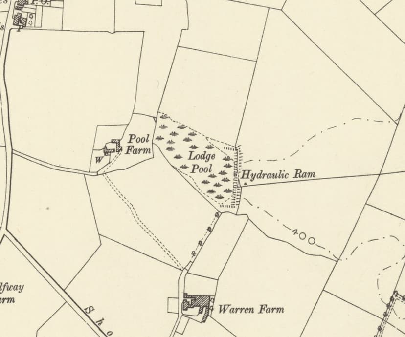
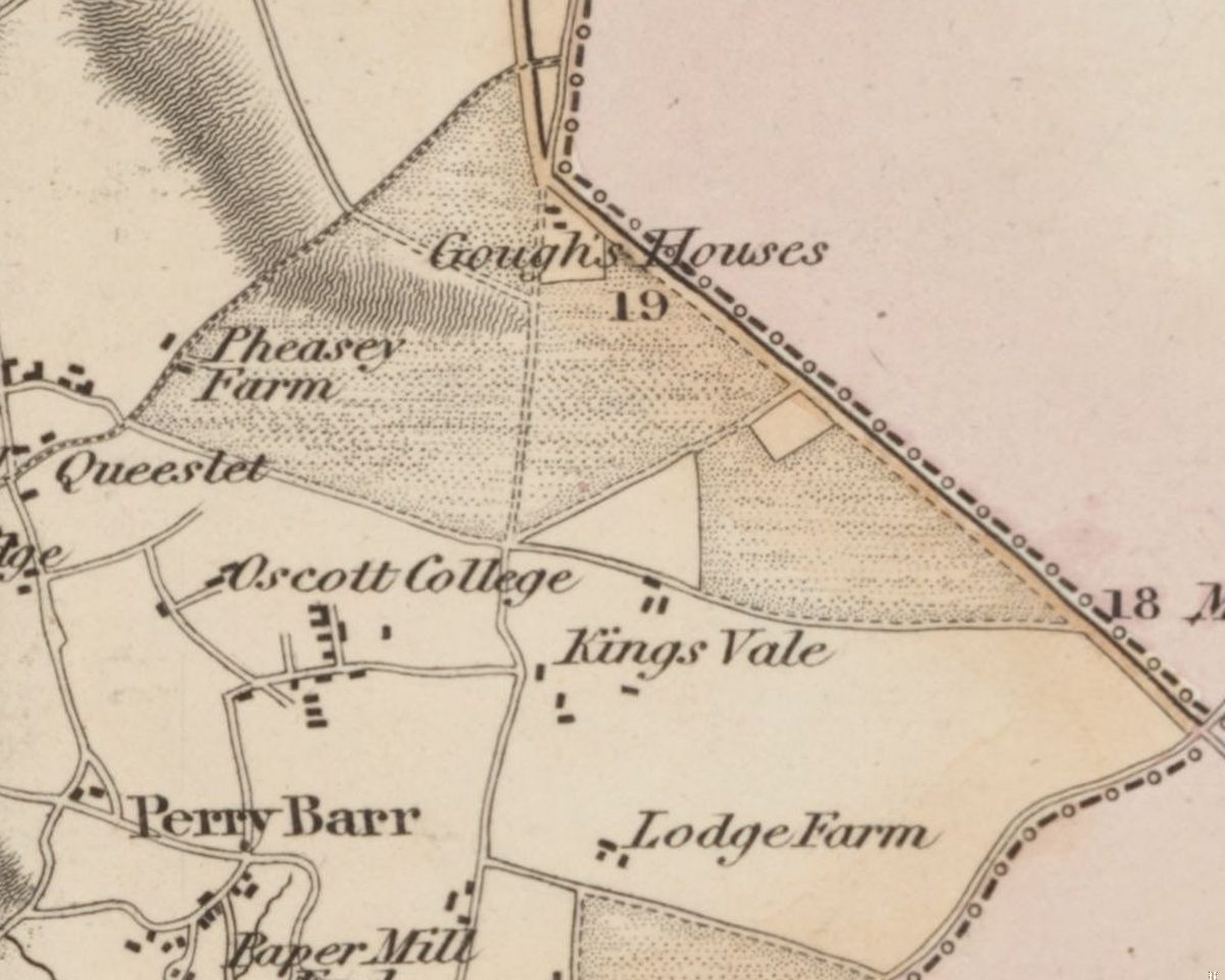
The Ordnance Survey had already named the place. On its one-inch map, revised in 1831–32, a group of buildings on the west side of the road south of Oscott is lettered “Halfway House”. The press called it Half Way Farm from 1840. The surveyors of 1882–83 wrote “Halfway House Farm”; those of 1901 wrote plain “Halfway Farm”. Both forms are historic.
What it was halfway between, no document says. An advertisement of 1849 put it “about one mile from the Gough’s Arms, at Perry Barr”. A newspaper feature in 1997 thought the answer obvious: the farm was “about half way up Holly Lane”. The name is older than any record that explains it.
The tax collector’s farm
Thomas Loynes was a man Perry Barr trusted with money. A Thomas Loynes, probably the same man, signed receipts for levies in Perry Barr in 1822 and accounts of assessed taxes as the township’s collector in 1826 and 1827. After Mary’s death he married again, in September 1841, to Ann, widow of Edward Brand. In 1843 he made a formal declaration about the ownership of land at Upper Tower Hill, which the Birch family was then selling.
In February 1849 his stock, implements and part of his furniture went under the hammer: Thomas Loynes was “retiring from the Farming Business”. He later lived in Brougham Street, Birmingham, and died suddenly at Droitwich Baths in June 1853, aged 72, “late of the Halfway Farm”.
Sheep, milk and potatoes
John Cooper came next. His wife Harriet died at the farm in 1860. John Gilbert was farming there by 1866, and after his death his executors sold the stock in 1875, including pure-bred Shropshire sheep. James Poole, farmer and maltster, followed. In 1883 he was fined £15 and costs for selling diseased milk in a foot-and-mouth case, and he was still at Halfway Farm in 1889.
In 1921 the farm was offered in the sale of Lord Calthorpe’s Perry Hall estate, and that October it was advertised at 188 acres, “a very valuable farm, containing a large area of excellent potato land”. In March 1923 there was a farm sale there. A photograph from the 1920s shows the waggoner, Mr Compton, cutting a neighbour’s hair.
From farmyard to drill hall
The council estate grew up around it. In 1932 and 1933 local teams played on the “Halfway Farm Community Ground”, and Frederick James Roper was still giving Halfway Farm as his address in 1935.
Then the Army arrived. In January 1937 the city council agreed to sell the War Office a site at Halfway Farm for an anti-aircraft station, and a notice-board went up in front of the farm. In February 1938 the papers announced that new drill halls for the 379th Company would be built “in Kingstanding-road, on the site of the Halfway Farm”. The Lord Mayor opened them on 26 March 1938.
Lay the old map over a modern one and the farm buildings fall on today’s Army Reserve Centre, Kingstanding Road. Halfway Close, about 900 metres to the south-west, borrowed the name but not the place.
The farmhouse has gone, and so have the sheep, the milk churns and the potato fields. But the reservists who gather on Kingstanding Road today are standing, near enough, in Thomas Loynes’s farmyard.
Pictures
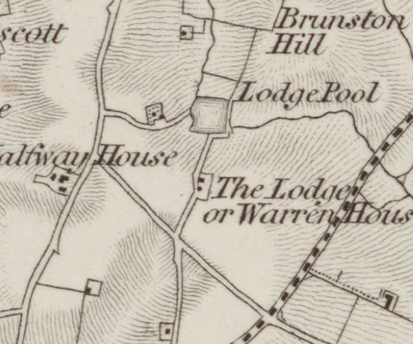
“Halfway House” on the one-inch map of 1831–32, the earliest form of the name found. Enlarged.Ordnance Survey one-inch map, revised 1831–32 (1863 printing) · Out of copyright 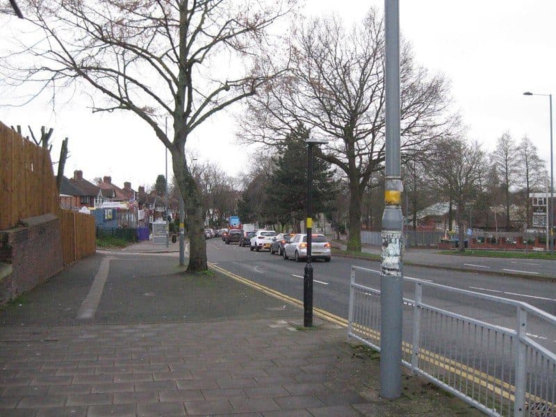
Kingstanding Road looking south in January 2019, past the Army Reserve Centre on the Halfway Farm site.Martin Richard Phelan, geograph.org.uk (6015325) · CC BY-SA 2.0
From the Heritage Archive
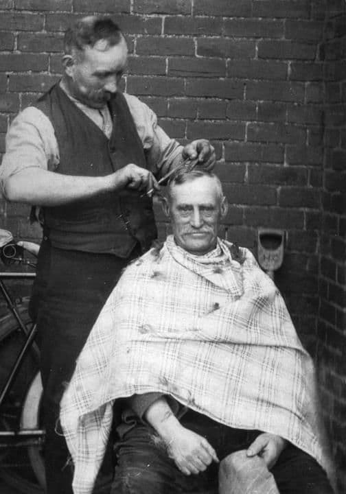 Halfway Farm1920
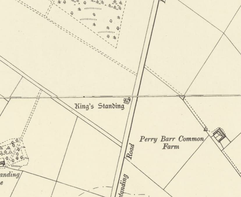
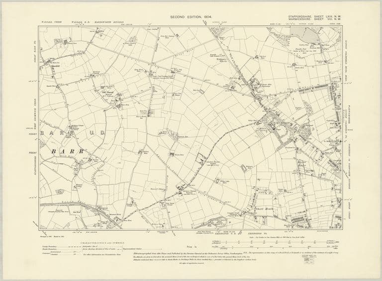 Farms and lanes: OS six-inch map, 1904Revised 1901, published 1904
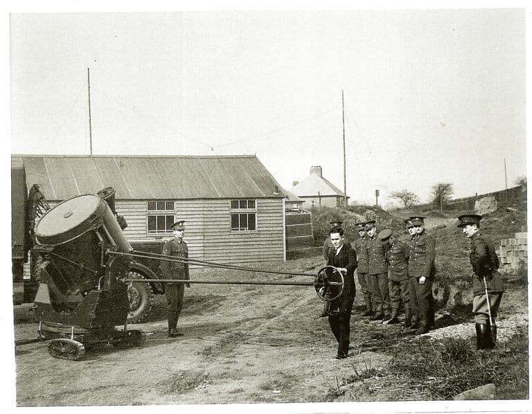 Searchlight training at the Kingstanding drill hall, 19381938
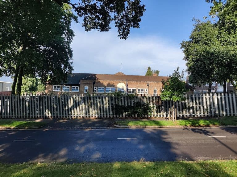 Army Reserve Centre, Kingstanding Road, 2023 (1)18 September 2023
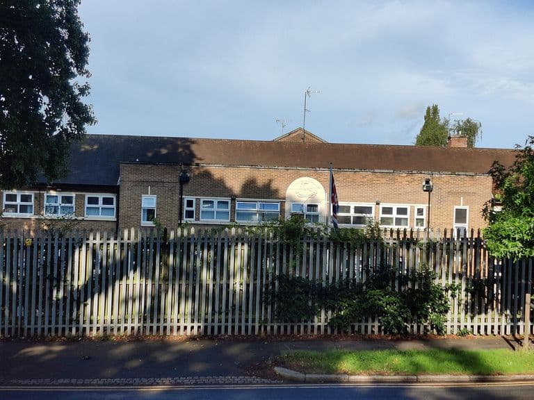 Army Reserve Centre, Kingstanding Road, 2023 (2)18 September 2023
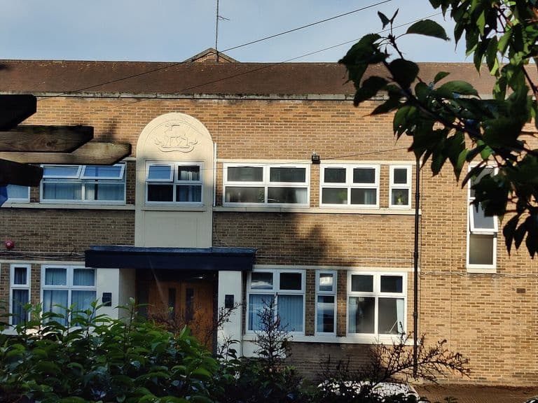 Army Reserve Centre, Kingstanding Road, 2023 (3)18 September 2023
- Birmingham Gazette obituaries index: Mary Loynes (1840); Thomas Loynes (1853) — Library of Birmingham, 1840; 1853. Ref. Newspapers/Birmingham Gazette/O/1840/L and /1853/L
- Wolverhampton Chronicle (death of Mary Loynes) — 26 Feb 1840. Also Birmingham Journal 22 Feb and Shropshire Mercury 29 Feb 1840
- Ordnance Survey one-inch Old Series, sheet LXII SE (Lichfield) — Ordnance Survey, surveyed 1814–17, revised 1831–32; this printing 1863. Ref. NLS 257403148. Read for the gazetteer (notes/10) and Log 12 (notes/11)
- Ordnance Survey six-inch, 1st edition, Staffordshire LXIX.NW — Ordnance Survey, surveyed 1882–83, published 1884. Ref. NLS 101597597
- Ordnance Survey six-inch, 2nd edition, Staffordshire LXIX.NW — Ordnance Survey, revised 1901, published 1904. Ref. NLS “6inchsecond” layer
- Receipts and assessed-tax accounts from Thomas Loynes, collector, Perry Barr — Library of Birmingham, Gough of Perry Hall papers, 1822–27. Ref. MS 3145/5/5/6/2/47 (Gough 313/31); /6/60 (Gough 317/25); /7/7 and /7/30 (Gough 318/7, 318/22)
- Wolverhampton Chronicle (marriage of Thomas Loynes) — 29 Sep 1841
- Copy declaration of Thomas Loynes of Halfway Farm, Perry Barr, re. ownership of the land — Library of Birmingham, 1843. Ref. MS 3145/1/7/23/7 (old ref. MS 3145/74/4b). In the Upper Tower Hill Farm papers
- Birmingham Journal; Aris’s Birmingham Gazette (Halfway Farm sale, Mr Thomas Loynes retiring) — Feb 1849
- Post Office Directory of Birmingham, Staffordshire & Worcestershire, p. 300 (Perry Barr) — Kelly & Co., 1850. Ref. Leicester CONTENTdm ptr 369588
- General & Commercial Directory of Birmingham, p. 674 (Perry Barr) — W. H. Dix & Co., 1858. Ref. Leicester CONTENTdm ptr 367168
- Post Office Directory of Birmingham, p. 140 — Kelly & Co., 1867. Ref. Leicester CONTENTdm ptr 254804
- White & Co.’s Commercial & Trades Directory of Birmingham, vol. II, p. 762 — White & Co., 1875. Ref. Leicester CONTENTdm ptr 123458
- Press notices: Cooper (1860), Gilbert (1866, 1875), Poole (1883–89) — Birmingham Journal; Aris’s; Midland Counties Herald; Birmingham Daily Gazette; Birmingham Mail, 1860–1889. BNA snippets, notes/11 Logs 4 and 10
- Perry Hall Estate sale (Fox & Sons): advertisements and auction report — Country Life; Birmingham Daily Gazette, Aug–Oct 1921. Catalogue itself at Sutton Coldfield Library (per LoB WK/K10/70)
- Walsall Observer (farm sale at Halfway Farm, 23 March 1923) — 10 Mar 1923
- Mr Compton, the waggoner, cutting a neighbour’s hair — Library of Birmingham, 1920s. Ref. WK/K10/86 (Birmingham Images 1309). Caption only; CalmView places the scene at Beech Tree Cottages
- Evening Despatch (Halfway Farm Community Ground); Coventry Herald (F. J. Roper) — 1932–33; 5 Jul 1935
- Birmingham Daily Gazette (War Office site at Halfway Farm); Birmingham Weekly Mercury (notice-board) — 6 Jan 1937; 4 Apr 1937
- Birmingham Daily Gazette (“on the site of the Halfway Farm”) — 26 Feb 1938. Drill halls opened 26 Mar 1938
- Birmingham Mail / Sandwell Evening Mail feature (“about half way up Holly Lane”) — 7 Jun 1997. Later explanation only
- Historic name gazetteer from old maps, 1775–1921 — kingstanding.org research notes, 29 Sep 2026. Ref. docs/heritage/notes/10-gazetteer.md. Positions and labels from each map edition
- Farms and lost homes of pre-estate Kingstanding (research notes) — kingstanding.org research notes, 29 Sep 2026. Ref. docs/heritage/notes/11-farms-lodge.md. Map overlays, newspaper snippets, catalogue entries
Comments
Comments will load here.