
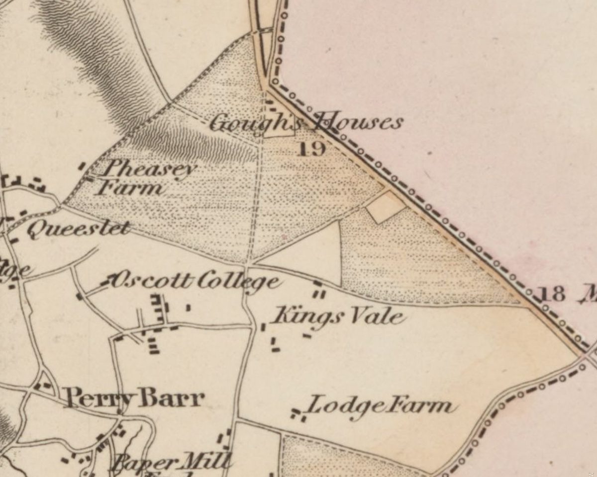
In 1811 Bayley Caddick of Perry Barr set down in writing his claim to “rights of common of pasture in the common and waste of Perry Barr”. It was the year the common’s days ran out. That spring Parliament passed an Act to enclose it.
The common in question is the ground most of Kingstanding now stands on. Before the estate, before the farms, this was open heath, and a good part of it was given over to rabbits.
Heath and rabbits
William Yates’s map of Staffordshire, surveyed in 1769–75, shows the heath without a name. It runs from Barr Beacon south to the lanes around Oscott, and east across the old road Yates simply lettered “Street” (the line of today’s Kingstanding Road) as far as the Chester Road. Enclosed fields appear only around Oscott, Queslett, Great Barr and Perry. On all that open ground Yates marks just two buildings: “Warren House” and “Lodge”.
Both names point to rabbits. In the 1500s the antiquary Leland had noted that the dry, sandy soils around Sutton Coldfield were “good for conies”. The archaeologist Mike Hodder, who studied this landscape in detail, found that rabbits were being deliberately managed in this area by the seventeenth century and that warrening carried on until the common was enclosed.
Three names in an Act
The Act of 1811 (51 George III, chapter 42) was “An Act for inclosing Lands in the Manor of Perry Barr”. The Gough family’s copy, now in the Library of Birmingham, names exactly what was to go: “Perry Barr Common, Perry Warren, Kingstanding Warren.” There, well before any housing estate, is the name Kingstanding, attached to a rabbit warren.
The work took three years. In 1812 Court and Jacob made a survey of the manor, building on an older one by Samuel Botham, “taken for the inclosing of waste and common within the manor”. The award and its map followed in 1814 and are kept at the Staffordshire Record Office. The heath was carved into allotments. Francis Hacket received allotments that went with his Kettle House lands, and part of Roman Field was allotted to Bishop Milner.
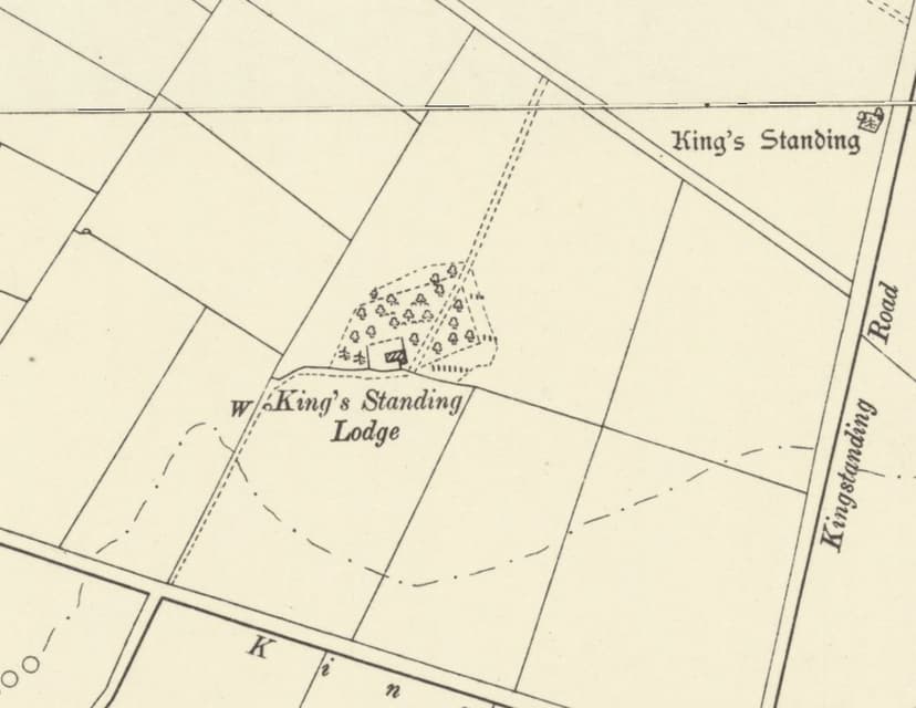
The rabbits did not vanish overnight. In March 1820 King’s Standing Lodge was advertised to let “with about 300 Acres of sound Land for a Rabbit Warren”.
Fields drawn with a ruler
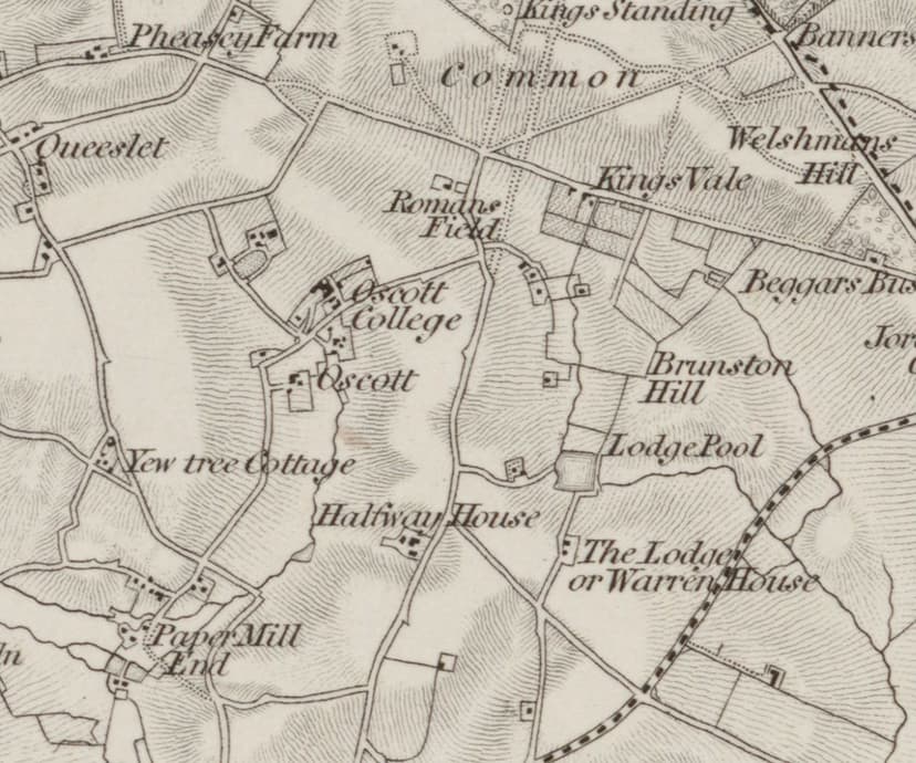
The maps took a while to catch up. Greenwood’s county map of 1820 still shades open blocks of heath: a triangle between the Chester Road, the Queslett–Kings Road line and the lane from Pheasey, and a strip east of Holly Lane. On the first Ordnance Survey map, revised in 1831–32, the word “Common” is still lettered across the ground below King’s Standing.
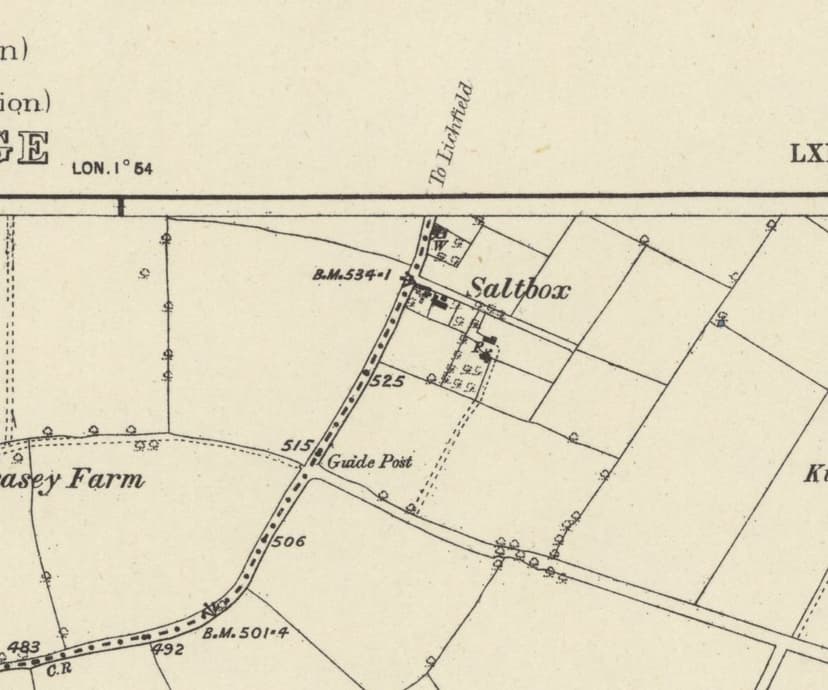
For decades the deeds carry the memory. Plots were sold as “land enclosed from Perry Barr Common” in 1822; a cottage near Queslett was “formerly part of Perry Barr Common” in 1840; Saltbox’s land was “enclosed from Perry Barr Common” in 1856.
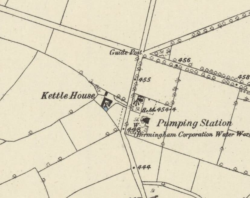
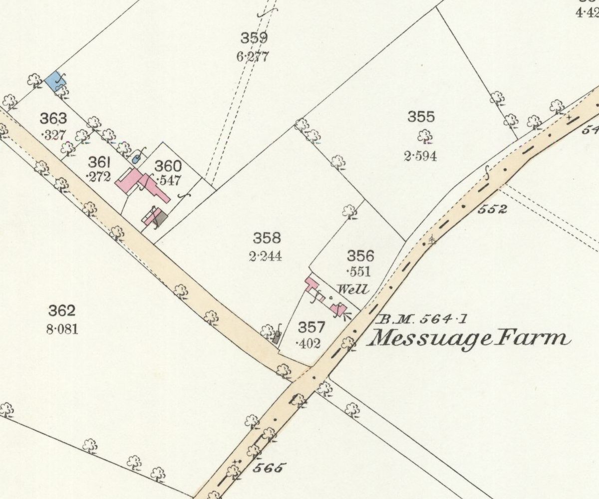
By the survey of 1882–83 the change is complete. North of the Queslett Road and Kings Road line, between Pheasey and the Chester Road, the maps show big straight-sided fields and straight roads. Scattered among them, far from any village, are small farms and cottages: Saltbox, Messuage Farm, King’s Standing Lodge, Perry Barr Common Farm, Kettle House and King’s Vale. South of that line, around Old Oscott and Queslett, the older fields are smaller and more irregular.
Not Perry Common
One name needs care. Perry Barr Common was in Staffordshire. Perry Common, where the council began building in the 1920s on Witton Lodge Farm, is a different place with a different history.
Look at a street map of Kingstanding today. Kings Road, Rough Road and the Queslett Road run straight, as the enclosure-era maps show them running between straight hedges across what Yates drew as open heath. The council built its estate inside a pattern that the end of the common had already drawn, and a name that once belonged to one of its rabbit warrens now belongs to the whole district.
Pictures
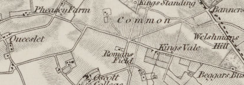
Twenty years after the Act, the first Ordnance Survey map still letters “Common” across the ground below King’s Standing.Ordnance Survey one-inch Old Series, revised 1831–32 (1863 printing) · Out of copyright 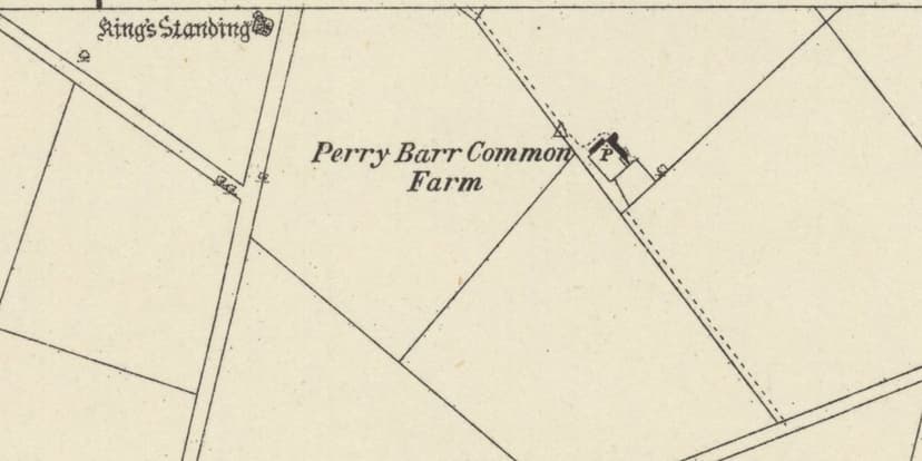
By 1882–83 the heath is ruled into big straight fields, with Perry Barr Common Farm standing on its own among them.Ordnance Survey six-inch map, surveyed 1882–83, published 1884 · Out of copyright
From the Heritage Archive
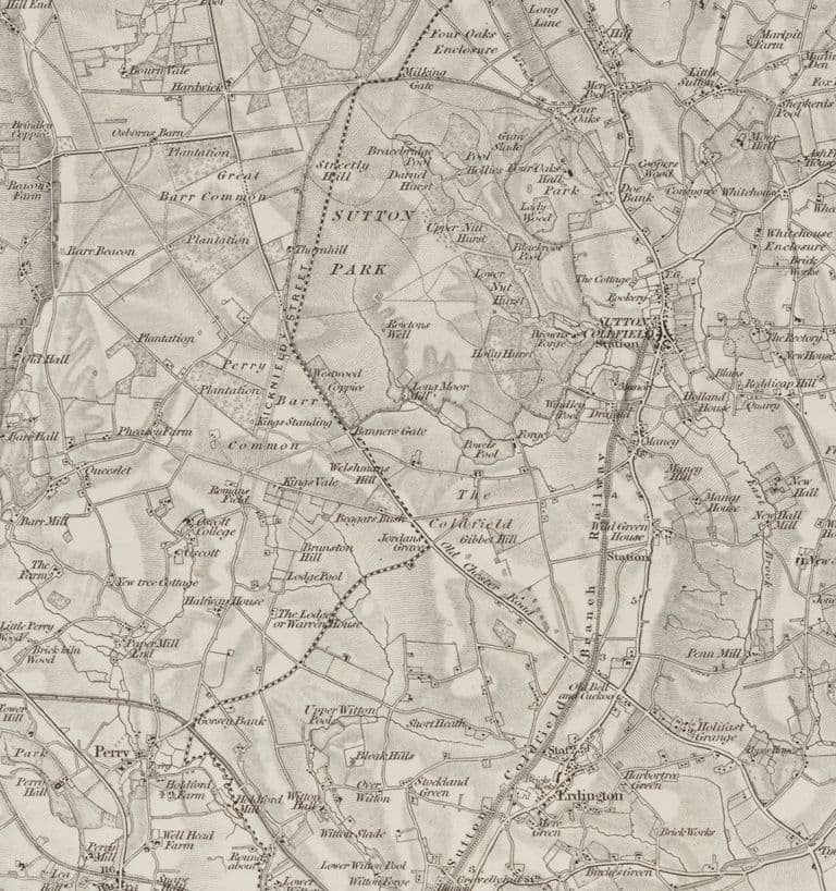 King's Standing on the first Ordnance Survey map, 1834Surveyed 1814–17, revised 1831–32, published 1834 (this copy printed 1863)
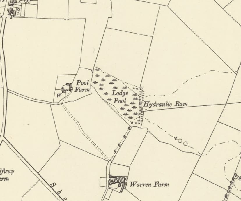
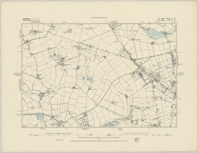 The first detailed survey: OS six-inch map, 1884Surveyed 1882–83, published 1884
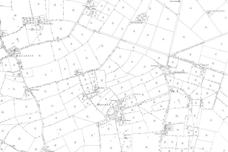 The fields of Kingstanding: OS 25-inch map, 1880sSurveyed 1882–83; published 1884–1891 (first edition)
- Act for inclosing land in the Manor of Perry Barr viz: Perry Barr Common, Perry Warren, Kingstanding Warren — Library of Birmingham, Gough of Perry Hall papers, 1811. Ref. MS 3145/58/1 (now MS 3145/1/7/16/1; Gough 58/1)
- Perry Barr Inclosure Act 1811 (51 Geo. 3 c. 42) — Wikipedia, List of acts of the Parliament of the United Kingdom from 1811. Secondary listing; royal assent 14 May 1811.
- Copy of claim of Bayley Caddick of Perry Barr to rights of common of pasture — Library of Birmingham, 1811. Ref. MS 3145/58/2
- Survey of the Manor of Perry Barr, Handsworth, by Court and Jacob — Library of Birmingham, 1812. Ref. MS 961. Based on an earlier undated survey by Samuel Botham.
- Perry Barr inclosure award and map — Staffordshire Record Office, 1814. Ref. Q/RDc/77. Not yet examined.
- Extract from the Inclosure Award of Perry Barr, 1814, recording allotments to Francis Hackett — Library of Birmingham, 1843. Ref. MS 3145/36/10
- Letters on the Roman Field at Maryvale allotted to Bishop Milner — Birmingham Archdiocesan Archives, 1873. Ref. B5225, B5226
- Deeds of land enclosed from Perry Barr Common — Library of Birmingham, 1822–1858. Ref. MS 3145/58/4, 58/5; MS 3145/70/3a; MS 3145/73/3
- Abstract of title 1704–1832 of Wyrley Birch — Library of Birmingham, 1852. Ref. MS 3145/153 (now MS 3145/1/15/33). Includes “Perry Warren, Kingstanding Warren”.
- Advertisement: King’s Standing Lodge to let — Aris’s Birmingham Gazette, 13 March 1820. Ref. BL/0000196/18200313/031. Snippet only.
- The development of some aspects of settlement and land use in Sutton Chase (PhD) — M. A. Hodder, University of Birmingham, 1988. Ref. pp.117, 131. Yates’s heath; Leland “good for conies”; warrening until enclosure c.1800.
- Map of the County of Stafford (Yates) — William Yates, surveyed 1769–75, published 1775. Read for facts only; not reproduced.
- Map of the County of Stafford (Greenwood) — C. Greenwood, 1820. Ref. NLS 262720197
- OS one-inch Old Series, sheet LXII SE; OS six-inch 1st edition — Ordnance Survey, 1831–32; 1882–83. Ref. NLS 257403148; NLS 101597597
- Heritage research note 10 (gazetteer), §8 — kingstanding.org, 2026. Extent of the straight-field zone is a map observation, not a surveyed boundary.
Comments
Comments will load here.