
What was here?
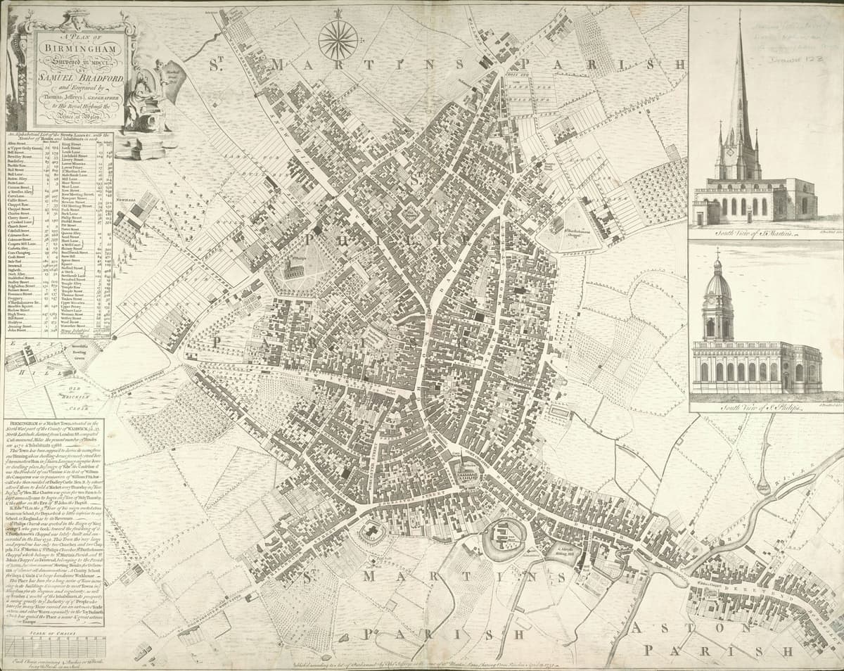
The bridge carrying the main road over the River Rea where Digbeth becomes High Street Deritend. In the Middle Ages there were two stone bridges, one over each arm of the river, with a ford alongside. The bridge was rebuilt in 1750 and again from 1789 under a toll Act, then widened until it disappeared into the road.
History
The crossing that tied the town together
Medieval Birmingham grew on the slope above the River Rea. Its roads to Coventry, Warwick and Stratford all crossed the river at the bottom of Digbeth, and on the far side lay Deritend, a hamlet of Aston parish. The Victoria County History says that “from an early date the crossing of the Rea at Deritend was an important link in the communications of the Birmingham area”.
It was never an easy crossing. Just above Deritend the Rea split into two streams that met again below the bridge, and downstream the dam of Heath Mill held the water up. In 1381 Deritend was allowed its own chapel partly because the river “was often impassable”. In the late 1530s the traveller John Leland “went through the ford beside the bridge”. In 1547 the Guild of the Holy Cross was said to keep up “two great stone bridges”, one over each arm.
Chains and quarrels
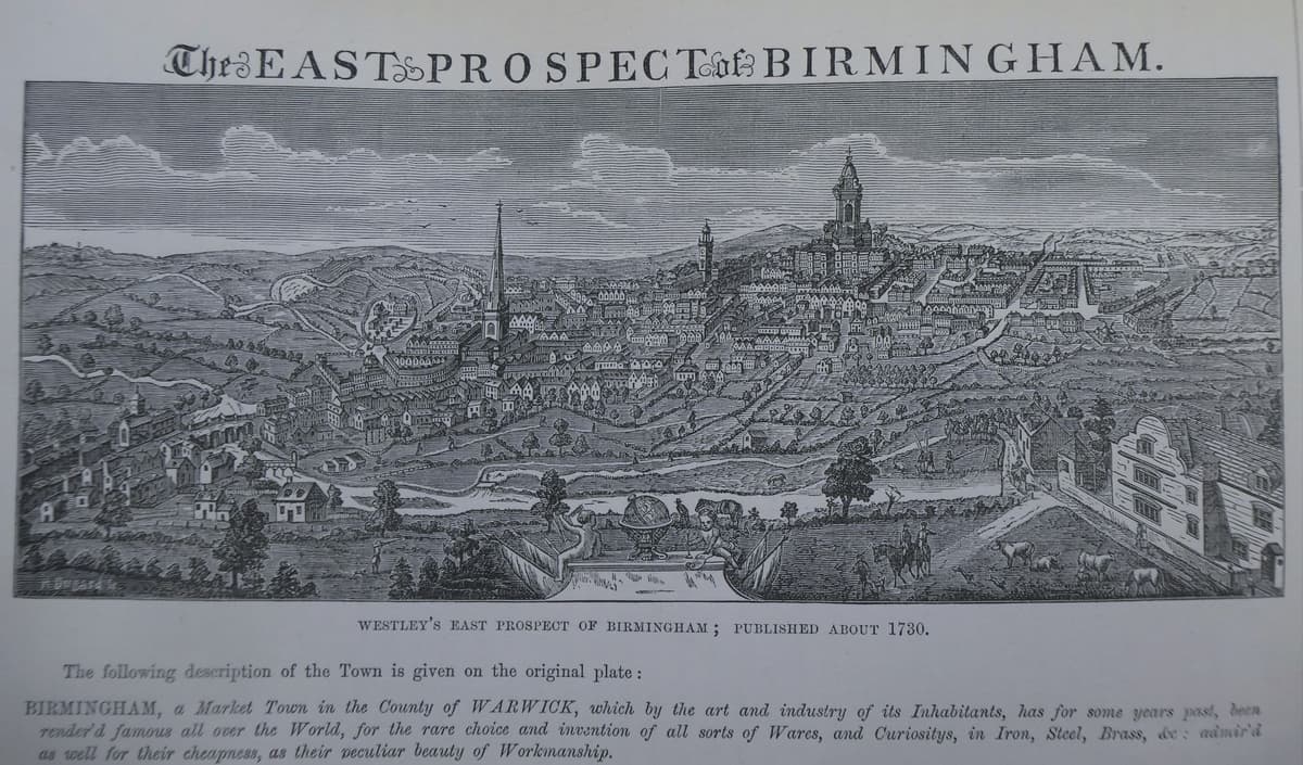
Who should pay for the bridge? In 1625 it was in bad condition, and the people of Deritend tried to have it declared a county bridge. The argument dragged on through the 1640s. By 1652 the bridge seems to have fallen down, and the county took on its repair.
In 1654, and again in 1687, the magistrates ordered the bridge kept chained. Carts had to use the ford unless the ford could not be crossed. People on foot, R. K. Dent wrote, took refuge in recesses in the old bridge to keep out of the way of the traffic.
The same spot, then and now
1888–1913
Today
Old map: Ordnance Survey six-inch, reproduced with the permission of the National Library of Scotland (CC BY 4.0). Today: © OpenStreetMap contributors.
In 1750 the overseers of the highway, Henry Bradford and John Collins, pulled the bridge down and built a new one of five arches. William Hutton complained of its “homely style, the deep ascent, and the circumscribed width”.
A toll bridge
Lower Digbeth still flooded. At a public meeting on 17 January 1787 the town resolved to seek an Act of Parliament. The Deritend Bridge Act of 1788 set up a trust to rebuild the bridge, widen the approaches and “widen, deepen, and vary the bed and course of the river”. The proposed tolls were 2d for a four-wheeled carriage, 1d for a two-wheeled one and ½d for a horse. Hutton called the new bridge of 1789 “more useful but less handsome”.
The money never matched the plan. By the trustees’ own account, printed in Aris’s Gazette in 1828, the tolls raised about £500 a year, half what had been hoped, and the work was “not more than half completed” when the first four years ran out. Further Acts followed in 1813 and 1822, and the bridge was rebuilt wider, with more open approaches. At midnight on 27 August 1828 the tolls ended and the turnpike gates came down.
Out of sight
In 1890–93 the Rea was deepened and put into a brick channel, and its bridges were rebuilt. Widening followed widening. By the 1950s, the VCH noted, the river “cannot be seen from the main road, in which a slight rise and fall is all that indicates the crossing”.
Traffic still crosses the Rea at the spot Leland forded nearly five hundred years ago. Hardly anyone on it notices that there is a river underneath.
Why it mattered
For centuries this was the main road crossing into Birmingham from Coventry, Warwick and Stratford, and the link between the town and its suburb of Deritend over the river. Arguments over its repair ran for decades, its flooding shaped where Deritend built its chapel, and the toll Act of 1788 was an early attempt by the town to tame the Rea.
Why it disappeared
Road building
The Rea was put into a brick channel in 1890–93 and the road was widened again and again in the late nineteenth and twentieth centuries. The bridge vanished into the road: by the 1950s the river could no longer be seen from it.
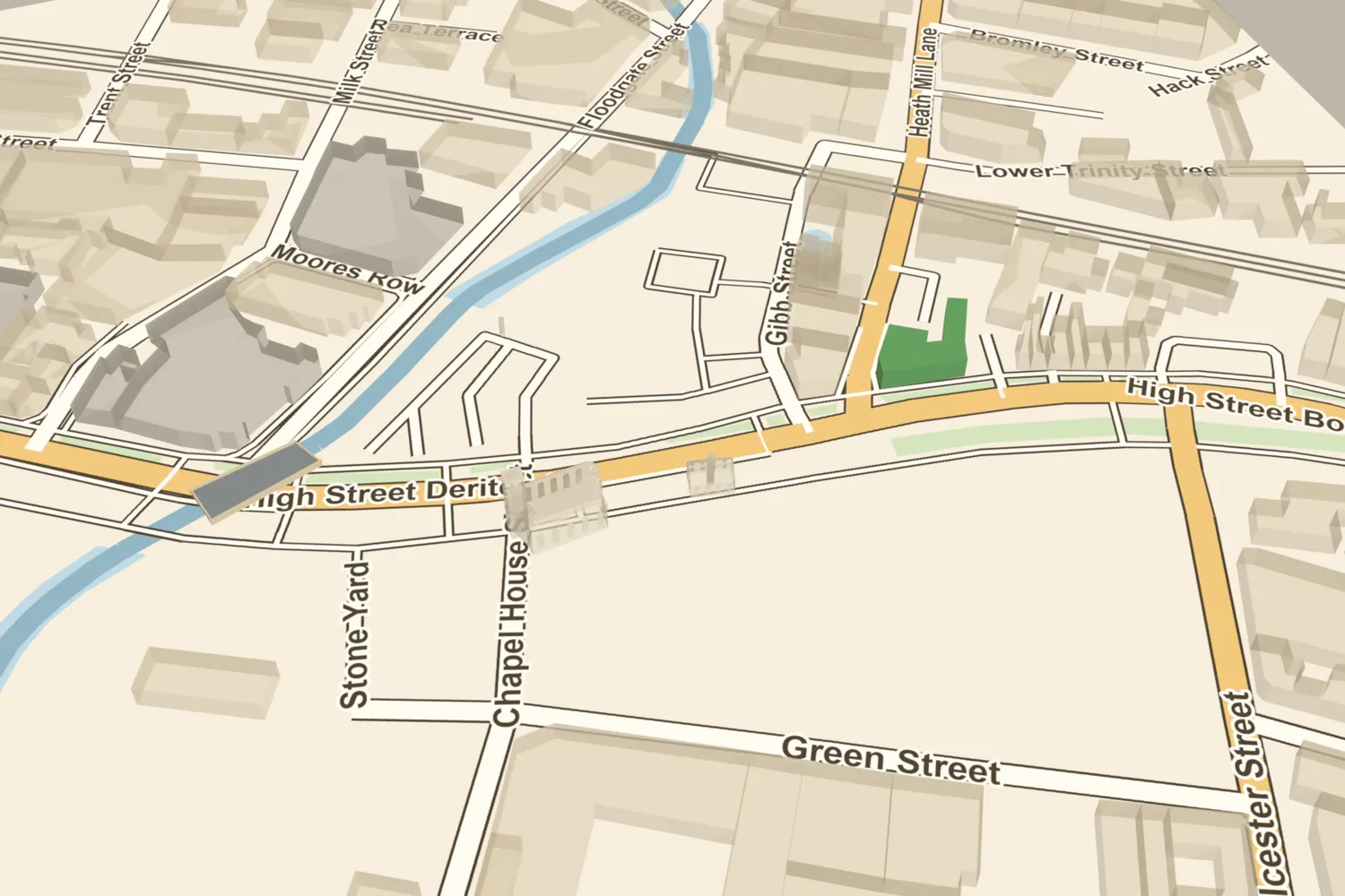
Deritend Bridge, on today’s streets
What’s there now
What replaced it
A culvert carrying the Rea under the junction of Digbeth, High Street Deritend and Floodgate Street.
What survives
The crossing itself, and the river in its brick channel on either side of the road. Whether any masonry of the older bridges survives inside the culvert is not known.
Today
Stand at the junction where Digbeth becomes High Street Deritend and Floodgate Street comes in from the south. The Rea passes under the road here. It can be seen in its brick channel from Floodgate Street, beside the Custard Factory.
Then and now
Then · 1751
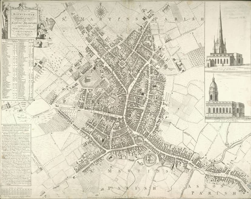
Now · 22 March 2022
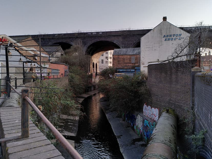
Today
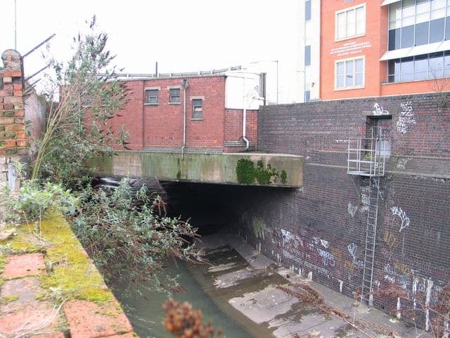
River Rea, Digbeth High Street, 7 February 2008John M, 7 February 2008. Geograph Britain and Ireland via Wikimedia Commons · CC BY-SA 2.0
Sources and further reading
Leland’s ride through the ford is dated 1536 by the VCH; it is often given as 1538.
The VCH says the bridge was replaced in 1789, but the trustees’ account of 1828 says it was “not more than half completed” until the Act of 1813. Both may be true: a new bridge in use by 1789, with the approaches unfinished. The first amending Act (54 Geo. III c.13) belongs to the 1813–14 session and is sometimes dated 1814.
The view of 1732 that the VCH describes, with four arches and a footbridge downstream, has not been seen directly. Exactly when the last visible parapets went is not established. Whether older masonry survives inside the culvert is unknown.
- A History of the County of Warwick, vol. 7: The City of Birmingham — Communications, pp. 25–42 — W. B. Stephens (ed.), Victoria County History, 1964. ‘Bridges’, fnn. 148–174
- Economic and Social History: Mills, in A History of the County of Warwick, vol. 7, pp. 253–269 — W. B. Stephens (ed.), Victoria County History, 1964. Heath Mill; the 1673 complaint about the ford
- An History of Birmingham (2nd edition) — William Hutton, Pearson and Rollason, Birmingham (Project Gutenberg text), 1783. ‘Deritend Bridge’
- Old and New Birmingham: a history of the town and its people — Robert K. Dent, Houghton and Hammond, Birmingham, 1880. pp. 421–2, Aris’s Gazette, 25 August 1828; the recesses of the old bridge
- Showell’s Dictionary of Birmingham — Thomas T. Harman and Walter Showell, Cornish Brothers, Birmingham, 1885. ‘A B House’
- Warwick Bar Conservation Area Character Appraisal and Supplementary Planning Policies — Birmingham City Council, 2008. §4: Rea works 1890–93
- A Plan of Birmingham surveyed in 1750 by Samuel Bradford, engraved by Thomas Jefferys — Samuel Bradford, Thomas Jefferys, London, 1751
- Plan of Birmingham, survey’d by Thomas Hanson — Thomas Hanson, 1778. Ref. Bibliothèque nationale de France copy
- Plan of the Borough of Birmingham (Pigott Smith), 1855 — J. Pigott Smith, National Library of Scotland (online), 1855
- Ordnance Survey 1:500 town plan of Birmingham, 1887–88, georeferenced — National Library of Scotland, 1888. ‘Deritend Bridge’
- OpenStreetMap data (Overpass and Nominatim), central Birmingham — OpenStreetMap contributors, 2026

Comments
Comments will load here.