
What is it?
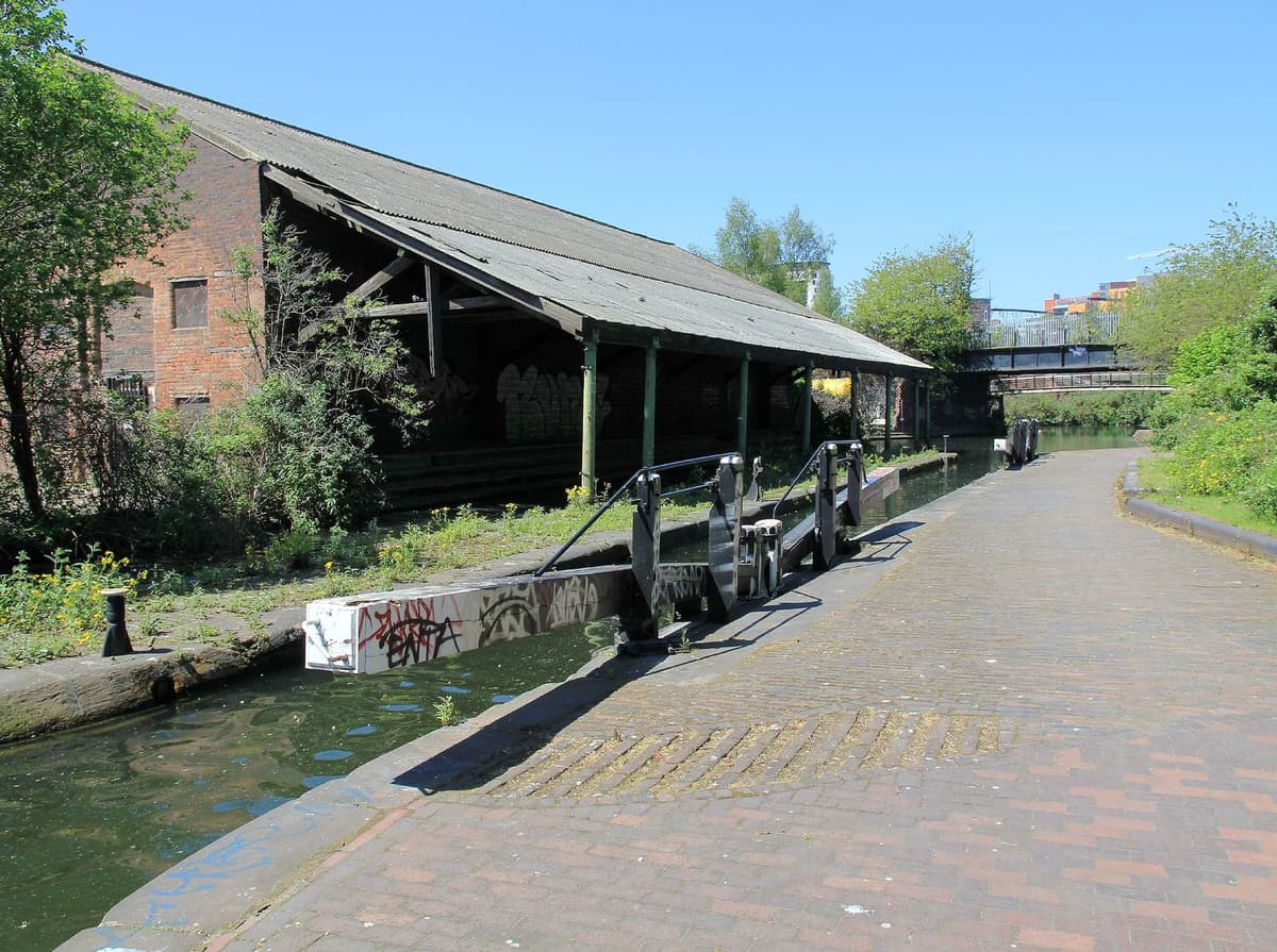
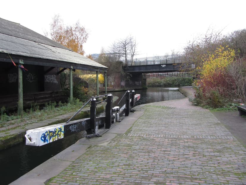
The junction off Fazeley Street where the Warwick and Birmingham Canal, now part of the Grand Union, met the Digbeth Branch of the Birmingham and Fazeley Canal. A stop lock controlled the water between the two companies’ canals, and beside it stands a single-storey warehouse whose roof is carried out over the water on cast-iron columns.
History
Where two canals met
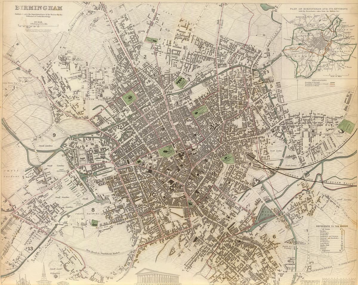
By 1790 the Birmingham and Fazeley Canal had a branch running down into Digbeth, through six locks at Ashted and a tunnel, to a wharf on Bordesley Street. In 1793 Parliament authorised a second company, the Warwick and Birmingham, to cut a canal from Warwick. Its line ran through the Little Park behind Heath Mill, crossed the River Rea on an aqueduct and, in 1799, joined the Digbeth Branch beside Fazeley Street.
The meeting point was a frontier between two companies. The Birmingham Canal Navigations charged the Warwick company’s traffic 3d a ton for goods coming in and 6d a ton for goods going out, “to be paid at the stop lock or bar”. That bar gave the junction its name.
The road to London
The new canal mattered because it pointed south. With the Grand Junction Canal, opened in 1805, the Victoria County History says, it gave Birmingham “a more direct route for waterborne traffic” to London.
The carriers moved in. Pickfords worked from Warwick Wharf until they gave up canal carrying in 1847–48. The Grand Junction Canal Company then rented the wharf, and in 1850 built the offices and warehouses at 106–110 Fazeley Street. When the Grand Junction stopped carrying in 1876–79, the trade passed to Fellows, Morton & Co., later Fellows, Morton & Clayton, which became one of the best-known canal carriers. They built The Bond on Fazeley Street in 1884 as their head office and main depot, and New Warwick Wharf in 1935. The firm went into liquidation in 1947.
The warehouse over the water
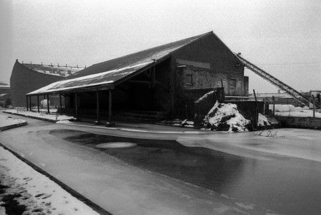
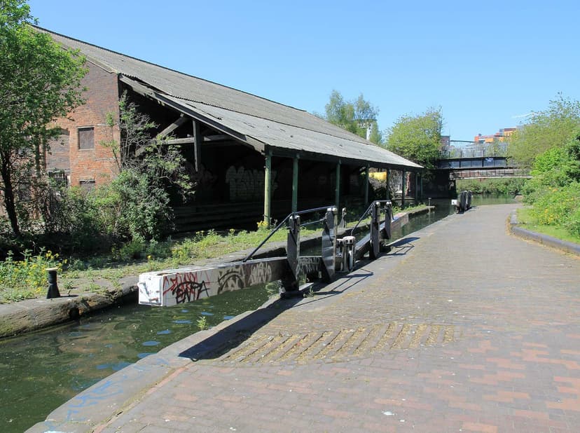
Beside the stop lock stands the building everyone photographs. Historic England dates it to about 1840; the city’s conservation appraisal says 1850. It is a single-storey red-brick warehouse with segmental-arched openings, most of them now blocked. Its roof runs out over the stop lock and the wharf on cast-iron columns, seven bays long and narrower at each end, with the braced timber trusses left open to view. Locally it is the Banana Warehouse.
The same spot, then and now
1888–1913
Today
Old map: Ordnance Survey six-inch, reproduced with the permission of the National Library of Scotland (CC BY 4.0). Today: © OpenStreetMap contributors.
The warehouse, with its stop lock and dock, was listed Grade II on 8 July 1982. On the opposite towpath the Ordnance Survey of 1887–88 marks a toll office and a sluice beside the “Bar Lock”.
Saved as a place
In 1987 the city made the junction the heart of the Warwick Bar Conservation Area, extended in 2000. Between 1999 and 2004 a Townscape Heritage Initiative paid for repairs to the stop lock. The appraisal calls the view of the warehouses from Warwick Bar “the most important in the conservation area”.
Around it Digbeth is changing fast, with new building on the old wharves and HS2’s Curzon Street station rising close by. But the stop lock where boats once queued to pay their pence is still there, its balance beams over the water where two rival companies’ canals meet.
Why it mattered
Warwick Bar is where Birmingham’s canal network met the Warwick and Birmingham Canal, the start of a more direct water route to London after 1805. Its stop lock, toll arrangements and carriers’ warehouses show how rival canal companies did business where their waters met.
Today
What replaced it
Not replaced.
What survives
The canal junction and stop lock, and the Grade II canalside warehouse with stop lock and dock (list entry 1075624). Nearby, 106–110 Fazeley Street (Grade II) and Fellows, Morton & Clayton’s buildings of 1884 and 1935 survive.
Today
The stop lock and warehouse are reached from the canal towpath off Fazeley Street, in the Warwick Bar Conservation Area. The Gun Barrel Proof House is on the other side of the Digbeth Branch, and the HS2 Curzon Street works are close by to the north-west.
Then and now
Then · 25 May 2012
Now · 19 November 2011
Today
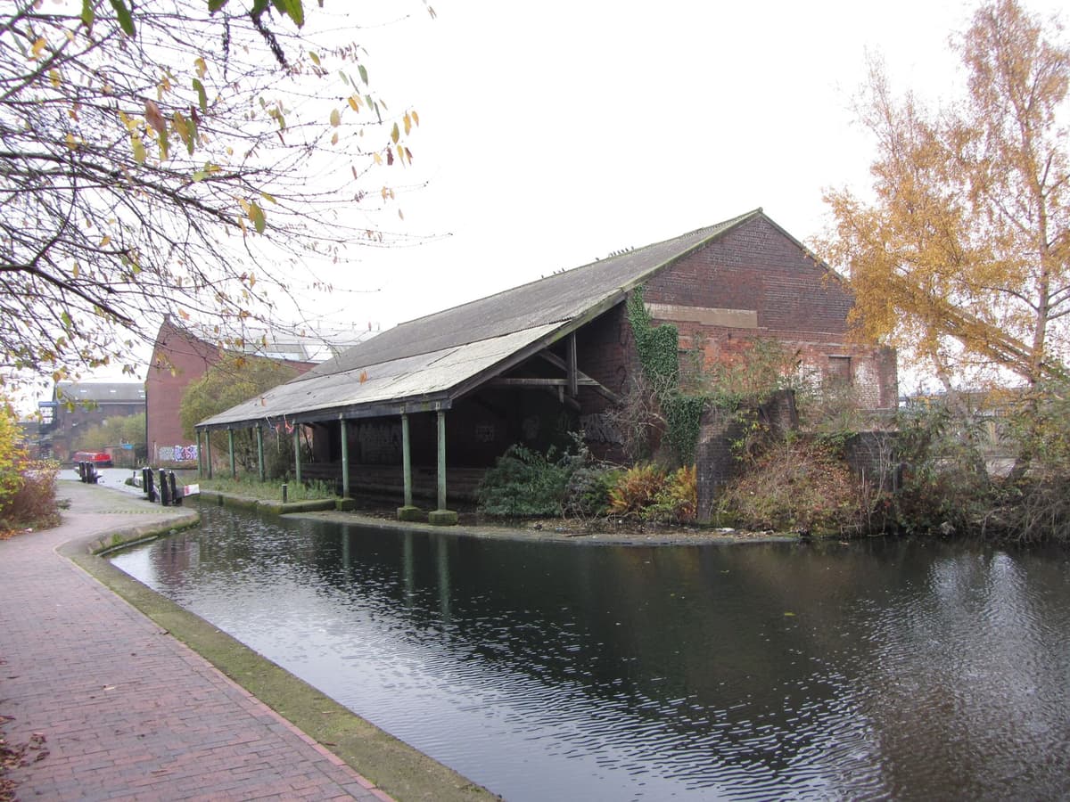
Former banana warehouse at Warwick Bar stop lock, 19 November 2011Gareth James, 19 November 2011. Geograph Britain and Ireland via Wikimedia Commons · CC BY-SA 2.0
Sources and further reading
Warehouse date: about 1840 (list entry) or 1850 (city appraisal). That the listed warehouse is the building called the Banana Warehouse rests on the appraisal’s description and photograph captions; it is very probable but not stated in the list entry. The name is said to come from later use by banana importers; this is unverified.
Two different buildings are called 122 Fazeley Street: a listed house of about 1840–50 (list entry 1075625) and Fellows, Morton & Clayton’s New Warwick Wharf of 1935. The local-list status of the Fellows, Morton & Clayton buildings has not been checked against the current Birmingham local list.
The canal’s opening is dated 1799 by the VCH and the appraisal, and 1800 by Showell. Whether the bar was ever a physical gap across which goods were moved, as some accounts say, is unverified, and the difference in water level at the stop lock has not been sourced.
- Canal side warehouse with stop lock and dock, Warwick Bar, Warwick and Birmingham Canal — National Heritage List for England entry 1075624 — Historic England. list description
- 106, 108 and 110 Fazeley Street — National Heritage List for England entry 1210764 — Historic England. 106–110 Fazeley Street
- Warwick Bar Conservation Area Character Appraisal and Supplementary Planning Policies — Birmingham City Council, 2008. canal history, tolls, carriers, conservation area
- A History of the County of Warwick, vol. 7: The City of Birmingham — Communications, pp. 25–42 — W. B. Stephens (ed.), Victoria County History, 1964. canals
- Showell’s Dictionary of Birmingham — Thomas T. Harman and Walter Showell, Cornish Brothers, Birmingham, 1885. ‘Canals’
- Birmingham (Society for the Diffusion of Useful Knowledge map) — J. Henshall (engraver), 1839. the uncropped 1839 map
- Plan of the Borough of Birmingham (Pigott Smith), 1855 — J. Pigott Smith, National Library of Scotland (online), 1855
- Ordnance Survey 1:500 town plan of Birmingham, 1887–88, georeferenced — National Library of Scotland, 1888. ‘Bar Lock’, ‘Toll Office’
- OpenStreetMap data (Overpass and Nominatim), central Birmingham — OpenStreetMap contributors, 2026
- Warwick Bar — Wikipedia contributors, Wikipedia
Comments
Comments will load here.