
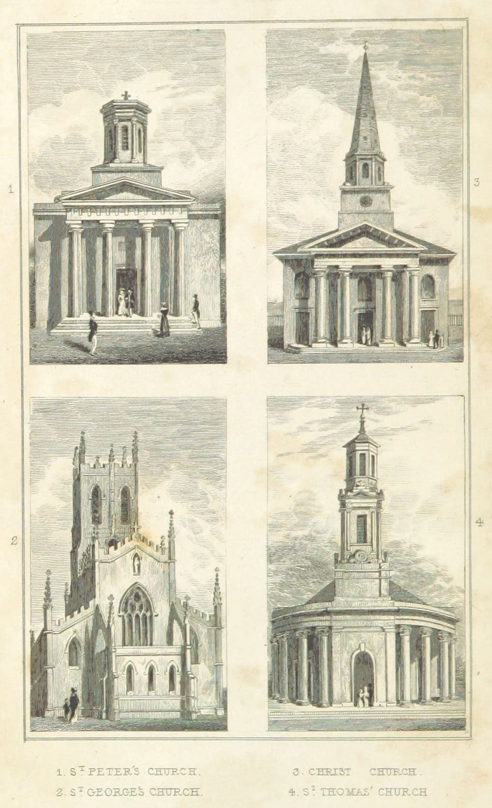
What was here?
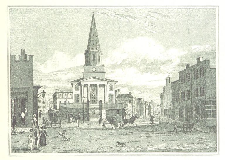
A large stone church in the Grecian style, built by the Church Building Commissioners for the growing south-west edge of the town. Its west front, facing Granville Street, had a tall tower rising from open arches between two curved Ionic porticos. The body of the church, 130 feet long, held more than 2,000 people. Only the west front stands now, at the end of the Peace Garden.
History
A church for the poor
On Monday 2 October 1826 the bishop laid the first stone of a new church on “a pleasant eminence on the south-western extremity of the town”. It was the third new church built in Birmingham by “his Majesty’s Commissioners, out of the Parliamentary Grant”, which paid the whole bill. The architects were Rickman and Hutchinson, “Architects, of this town”.
It was built for numbers. St Thomas’s had 2,125 sittings, “of which 625 sittings are in pews, and the remaining 1,500 are free, and appropriated to the use of the poor”. Aris’s Gazette noted that “the free seats are all provided with kneeling and book boards”. The bishop consecrated the church on Thursday 22 October 1829. It had cost £14,222, site included.
Grecian, with a novel entrance
The style was Greek, “of the Ionic order”. The Victoria County History calls it one of the two Greek Revival churches in Birmingham by Rickman and Hutchinson; the other was St Peter’s, Dale End. Inside it was 130 feet long and 60 feet wide, under a ceiling 38 feet high, “coved and panneled, and enriched with flowers”.
The same spot, then and now
1888–1913
Today
Old map: Ordnance Survey six-inch, reproduced with the permission of the National Library of Scotland (CC BY 4.0). Today: © OpenStreetMap contributors.
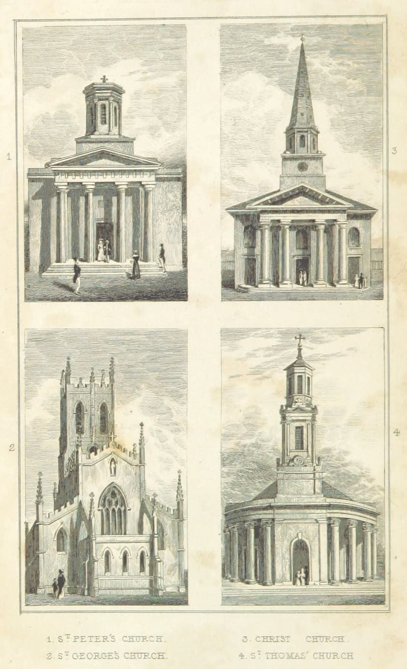
The west end was the showpiece. A tower, which the 1830 Sketch of Birmingham gives as 130 feet high, rose from massive piers with open arches, between “two noble Ionic circular porticoes”. Its middle stage had a pediment on Ionic columns on each face, and its top stage was an octagon carrying a ball and cross. The Gazette praised the entrances as “designed on a novel plan”: doors under the tower and the porticos gave “complete shelter to each of the entrance doors”.
A parish of its own
In 1834 St Thomas’s was given its own parish, carved out of St Martin’s. Showell later called it “the largest church in Birmingham”. It saw trouble as well as worship. In the Chartist riots of 1839, he wrote, “the people tore up the railings round the churchyard to use as pikes”. The church was refitted in 1893, and in 1939 its parish was merged with Immanuel’s.
The night of the raid
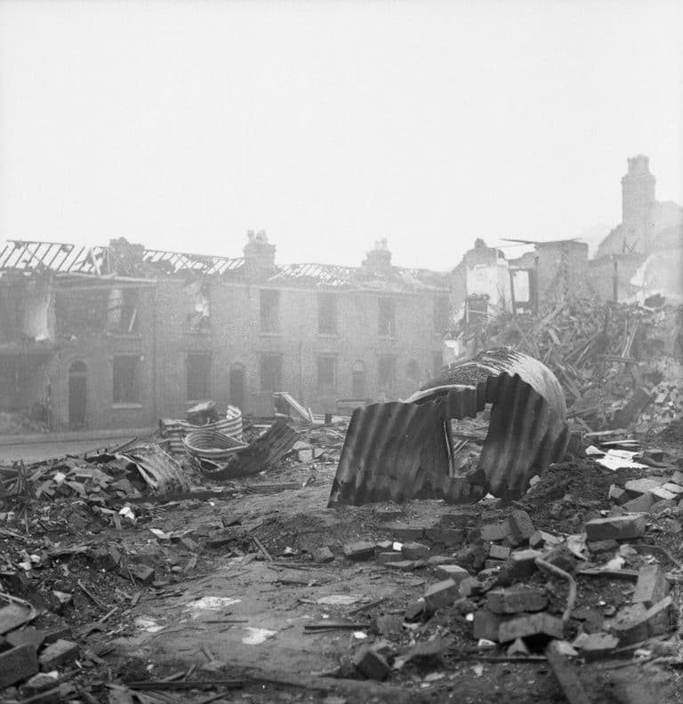
In December 1940 came a raid that “lasted from nightfall to dawn”. The inscription in today’s garden records that “the hands of the clock showed that the church received a direct strike at 7.25 pm”. The body of the church was destroyed. The tower and the two west porticos survived.
St Thomas’s was never rebuilt. In 1946 its benefice was united with Immanuel’s. In 1955 the churchyard was laid out as a garden to mark the Coronation, and a small shelter with two columns was built behind the ruin to support it. The remains were listed Grade II in 1982.
A garden for peace
On 2 December 1992 Bishop Mark Santer and Jack Jones opened the churchyard as St Thomas’ Peace Garden, with railings by the artist Anuradha Patel, made with pupils of Lea Mason School. The west front still stands at the end of it, its clock stage and plain octagon rising over Bath Row. It is one of the few visible marks of the Blitz left in the city centre: a church built for the poor of a growing town, kept now as Birmingham’s garden of peace.
Why it mattered
St Thomas’s was a Commissioners’ church paid for entirely from the parliamentary grant, and most of its seats were free, for the poor of the fast-growing south-west of the town. It was one of Rickman and Hutchinson’s two Greek Revival churches in Birmingham, with an unusual sheltered west entrance. Its bombed west front is one of the few visible marks of the Blitz in the city centre, and since 1992 it has stood in the city’s Peace Garden.
Why it disappeared
Wartime destruction
It was largely destroyed by bombing in December 1940; only the tower and west porticos survived. Its parish had already been merged with Immanuel’s in 1939, and the church was never rebuilt. The benefice was united with Immanuel’s in 1946, and the site became a garden.
St Thomas’s, Bath Row, on today’s streets
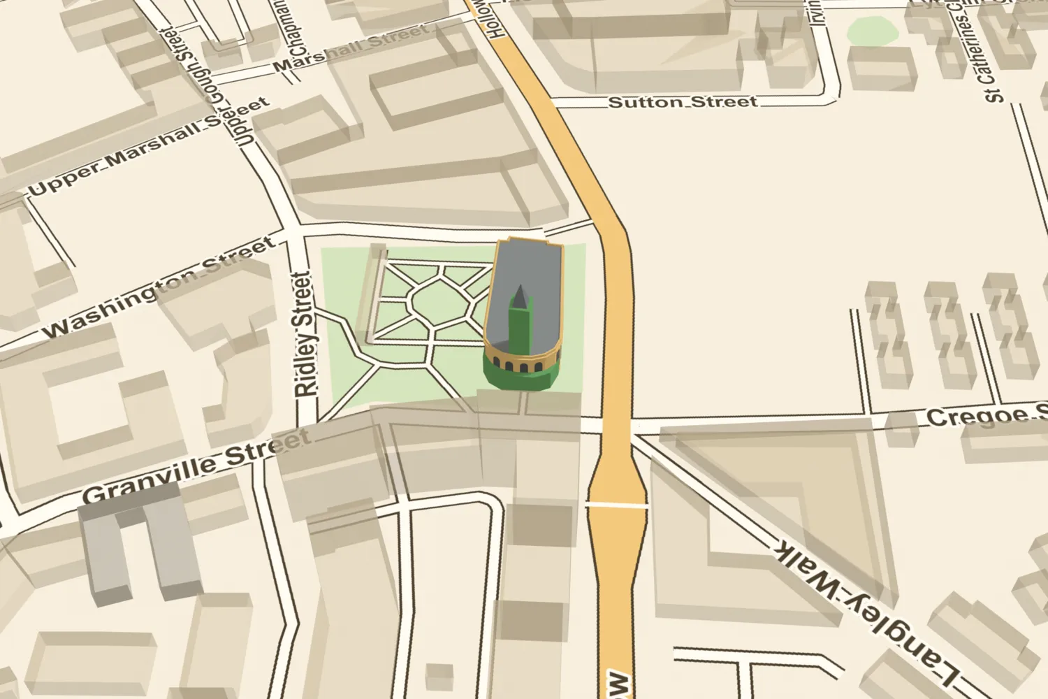
What’s there now
What replaced it
Never rebuilt. The churchyard was laid out as a Coronation garden in 1955 and reopened as St Thomas’ Peace Garden on 2 December 1992. The site of the nave is open lawn and paths east of the ruin.
What survives
The west front: the tower, standing to full height with its pedimented Ionic stage and plain octagonal top, and the two curved Ionic porticos either side, with their open-arched entrances. It is listed Grade II as the Remains of the Church of St Thomas (list entry 1343348). A two-column shelter of 1955 supports it from behind. The ball and cross have gone; a metal cross now crowns the tower.
Today
Enter St Thomas’ Peace Garden from Bath Row, Granville Street, Ridley Street or Washington Street. The surviving west front stands at the Granville Street end, and the lawn east of it covers the site of the nave.
Then and now
Then · 1830
Now · 11 August 2024
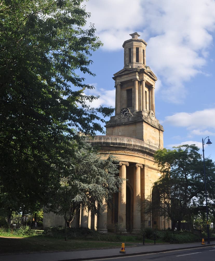
Today
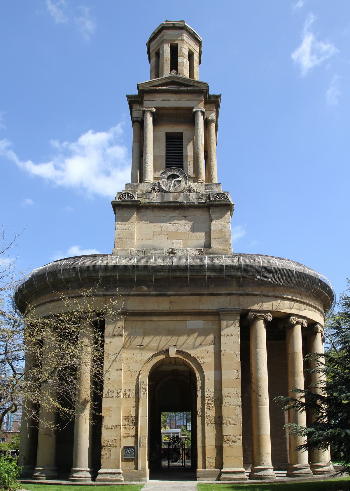
Ruins of St Thomas’s Church, 21 May 2015Tony Hisgett, 21 May 2015. Flickr via Wikimedia Commons · CC BY 2.0 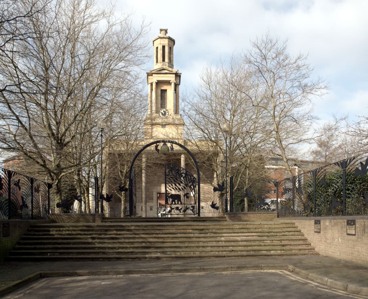
St Thomas’s Church seen from the Peace Garden, 2 March 2013habiloid, 2 March 2013. Geograph Britain and Ireland via Wikimedia Commons · CC BY-SA 2.0 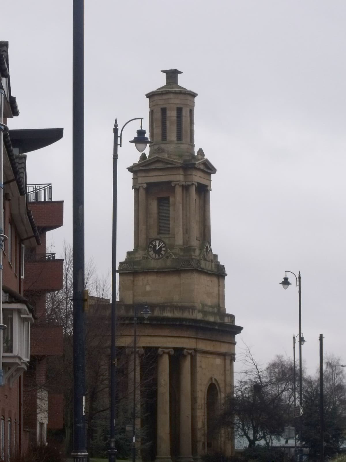
Remains of the Church of St Thomas, from Granville Street, 12 January 2011Elliott Brown, 12 January 2011. Flickr via Wikimedia Commons · CC BY 2.0
Sources and further reading
The Victoria County History says only “enemy action in 1940” and the Imperial War Museums record “December 1940”. The date 11 December 1940 comes from Wikipedia and secondary captions; it fits the all-night raid of 11–12 December but has not been confirmed from an authoritative source. Wikipedia and the IWM record give other dates for the first stone and consecration; the contemporary Gazette (via Langford) and the 1830 Sketch give 2 October 1826 and 22 October 1829, which are used here. Seating is 2,125 in 1829, 2,600 in Showell (1885) and “Seats for 2000” on the Ordnance Survey plan of 1887–88. The tower height of 130 feet comes from the 1830 Sketch only. The listing dates the Coronation garden to 1955, a photo caption to 1953; the IWM gives 2 December 1992 for the Peace Garden, a caption 1995. When the top stage was simplified is not recorded, and what happened to the churchyard burials when the garden was made has not been established. Rickman’s partner is usually identified as Henry Hutchinson; the sources say only “Rickman and Hutchinson”.
- A History of the County of Warwick, vol. 7: The City of Birmingham — Religious History: Churches built since 1800, pp. 379–396 — W. B. Stephens (ed.), Victoria County History, 1964. no. 123, St Thomas: Rickman and Hutchinson; parish 1834; refitted 1893; destroyed 1940; united 1946
- Remains of the Church of St Thomas, Bath Row — National Heritage List for England entry 1343348 — Historic England. west front only; quadrant porticos; 1955 shelter
- An Historical and Descriptive Sketch of Birmingham — Beilby, Knott and Beilby (publishers), 1830. pp. 121ff: Commissioners’ church, seating, dimensions, tower height, porticos
- A Century of Birmingham Life — John Alfred Langford, 1870. vol. 2: Aris’s Gazette, 2 October 1826 and 26 October 1829
- Showell’s Dictionary of Birmingham — Thomas T. Harman and Walter Showell, Cornish Brothers, Birmingham, 1885. largest church; Chartist riots 1839
- Birmingham Peace Garden — War Memorials Register 38693 — Imperial War Museums. December 1940 raid inscription; Peace Garden opened 2 December 1992
- St Thomas’ Church, Birmingham — Wikipedia
- Ordnance Survey 1:500 town plan of Birmingham, 1887–88, georeferenced — National Library of Scotland, 1888. church traced; ‘Seats for 2000’
- Ordnance Survey 25-inch map, Warwickshire (Birmingham sheet), georeferenced — National Library of Scotland
- OpenStreetMap data (Overpass and Nominatim), central Birmingham — OpenStreetMap contributors, 2026. way 73812486 (ruin); way 25093332 (garden)
Comments
Comments will load here.