
What was here?
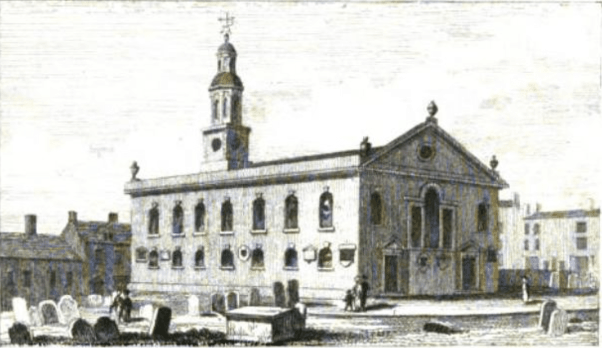
A plain, rectangular Georgian church of brick with stone dressings, with urns on its parapet and a small clock turret topped by a cupola, standing in a large churchyard on the eastern edge of the old town. It served the streets east of Dale End from 1749 until 1937.
History
A chapel in the fields
In 1731 the land east of Dale End and Park Street was still ploughed fields. Within twenty years houses were going up so fast that William Hutton wrote of them appearing “as if touched by the wand of magic”. The new streets needed a church. St Bartholomew’s was built in 1749 as a chapel of ease to St Martin’s, the old parish church, on land given by John Jennens. Mrs Jennens gave £1,000, and the rest came by subscription. R. K. Dent counted it as the town’s fourth Anglican church.
Plain brick and a small steeple
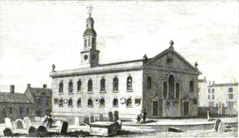
It was a plain rectangle of brick with stone dressings, in the Classical style, with gabled ends and an urn at each corner of the parapet. At the west end were three doors with pediments. Over the larger, central one rose a small clock tower with a cupola and a weather vane. Hutton called it an “infant steeple … very small but beautiful”. The Victoria County History says the architects were probably William and David Hiorne.
Hutton noticed something odd. The chancel “veres towards the North”: rather than face due east, the church was lined up with the streets around it. The Ordnance Survey plan shows it turned about 45 degrees. Hutton defended the choice.
Inside it seated about 800 people. An organ was added in 1806, and a silver communion service had been given in 1774.
A parish of warehouses
St Bartholomew’s became a parish church in 1847. The parish was small, about 100 acres, and it changed around the church. Canal wharves, railway lines and goods yards arrived, and warehouses replaced houses. Because it stood next to the Park Street burial ground, Showell says, it was nicknamed “the paupers’ church”.
The same spot, then and now
1888–1913
Today
Old map: Ordnance Survey six-inch, reproduced with the permission of the National Library of Scotland (CC BY 4.0). Today: © OpenStreetMap contributors.
In 1880 its churchyard and the Park Street burial ground were leased to the Corporation and laid out as Park Street Gardens, opened on 25 June 1880. The church itself was restored in 1893.
The name of the lane had an older story. Showell reports a tradition that the Catholic “Mass House” of 1687, wrecked by a crowd in 1688, stood on or near the site. That remains a tradition rather than a proven fact.
Closing
By the 1930s few people lived in the parish. St Bartholomew’s closed in 1937, and in 1939 its parish was joined to Bishop Ryder’s. By 1943 it had been demolished, apart from a fragment of the east end and its east window. By 1961 even that had gone, and the site was a car park.
The Victoria County History tells us the registers went to St Gabriel’s in Deritend and the communion silver to the diocese. The church itself left no trace on the ground. Today its site is an open lawn at Masshouse Plaza, with new flats around it. After nearly two centuries of warehouses, goods yards and car parks, the streets where St Bartholomew’s was built for new households are filling with homes again.
Why it mattered
St Bartholomew’s was built for the first big wave of Georgian expansion east of the old town, when fields turned into streets within a generation. Its later history traces how canals, railways and warehouses emptied the area of people, and how its churchyard became one of Birmingham’s first public gardens in 1880.
Why it disappeared
Redevelopment · Other or unknown
Homes in the parish gave way to canals, railways and warehouses, and the congregation dwindled. The church closed in 1937 and its parish was united with Bishop Ryder’s in 1939. It was demolished by 1943, and the site became a car park.
St Bartholomew’s, Masshouse Lane, on today’s streets
What’s there now
What replaced it
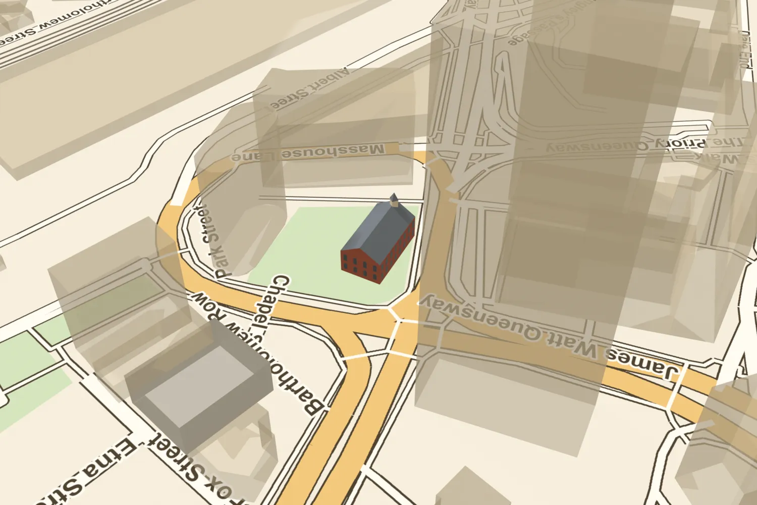
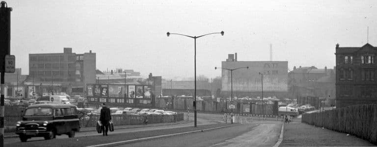
A car park by 1961. The area was later rebuilt as part of the Masshouse development. The church site is now an open grassed plot at Masshouse Plaza, beside the Hive and Masshouse flats, inside the loop of Moor Street Queensway, Park Street and Masshouse Lane.
What survives
Nothing on site. The silver communion service given in 1774 was in the care of the diocese in 1956, and the registers were kept at St Gabriel’s, Deritend, when the VCH was written in 1964.
Today
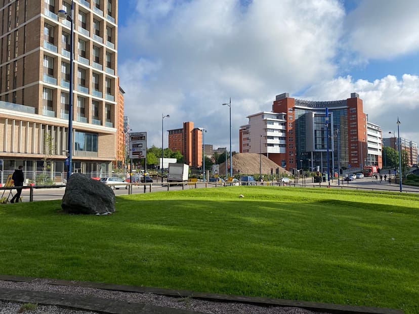
Go to Masshouse Plaza in Eastside, inside the loop formed by Moor Street Queensway, Park Street and Masshouse Lane. The church stood on what is now the open lawn west of the Hive flats.
Then and now
Then · 1830
Now · 26 May 2021
Sources and further reading
The cause of loss is not settled. Wikipedia says the church was damaged in an air raid in 1942 and demolished in 1943, but gives no source; the VCH says only that it was demolished, apart from a fragment of the east end, by 1943. Capacity is given as about 800 (Hutton, Pye, VCH), 1,200 (OS plan, 1888) and 1,800 (Showell, 1885); an uncited enlargement in 1840–41 may explain the rise. The donor is John Jennens in the VCH, Hutton and Pye but William Jennens in Showell. The VCH says the church was turned “a little north of due east”; the map shows a turn of about 45 degrees. The only known engraving probably shows the east end, so the west front with its three doors is not illustrated. The Mass House tradition is unproven.
- A History of the County of Warwick, vol. 7: The City of Birmingham — Religious History: Churches built before 1800, pp. 361–379 — W. B. Stephens (ed.), Victoria County History, 1964. St Bartholomew
- An History of Birmingham (2nd edition) — William Hutton, Pearson and Rollason, Birmingham (Project Gutenberg text), 1783
- A Description of Modern Birmingham — Charles Pye, 1818–19
- Showell’s Dictionary of Birmingham — Thomas T. Harman and Walter Showell, Cornish Brothers, Birmingham, 1885. ‘Park Street Gardens’, ‘Masshouse Lane’, ‘Places of Worship’
- Old and New Birmingham: a history of the town and its people — Robert K. Dent, Houghton and Hammond, Birmingham, 1880. pp. 101–2
- Ordnance Survey 1:500 town plan of Birmingham, 1887–88, georeferenced — National Library of Scotland, 1888. footprint traced; ‘Seats for 1200’
- Plan of the Borough of Birmingham (Pigott Smith), 1855 — J. Pigott Smith, National Library of Scotland (online), 1855
- OpenStreetMap data (Overpass and Nominatim), central Birmingham — OpenStreetMap contributors, 2026. way 846451820
- St Bartholomew’s Church, Birmingham — Wikipedia. lead only
Comments
Comments will load here.