
On 13 October 1938 a photographer for the Warwickshire Photographic Survey stood in Shady Lane and took a picture of an old school house. To the right of it, in the frame, was the door of All Saints Church. Soon afterwards the school house was pulled down.
A school by 1840
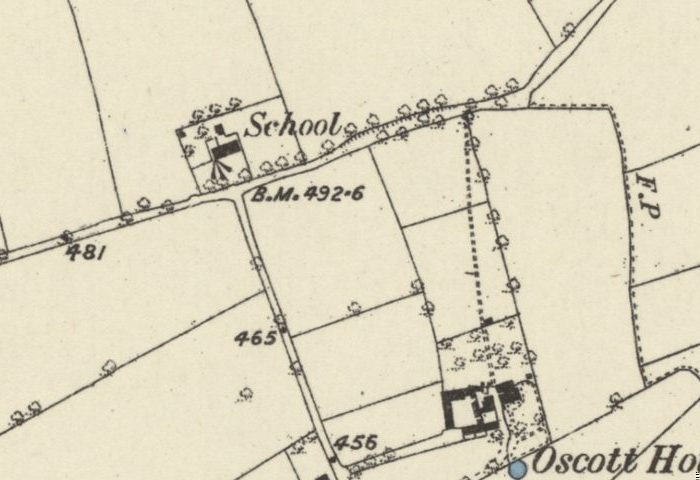
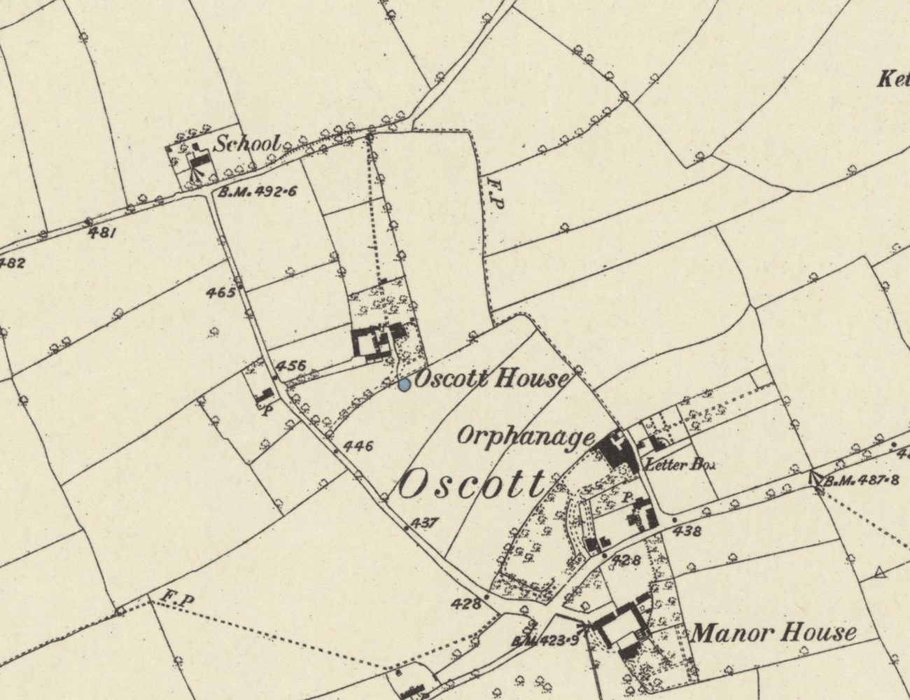
The building was old even then. The library’s captions say it was first mentioned in the index to the tithe map of 1840, and not recorded before that. When the Ordnance Survey mapped Old Oscott in the early 1880s, it lettered “School” on the north side of Shady Lane, where School Lane came up to meet it. School Lane is Oscott School Lane today.
Trade directories give glimpses of teaching here. In 1834 Sarah Scott kept a day school at Oscott, which may have been an early form of this one. In 1858 a “Protestant School” in Perry Barr had R. Baller as schoolmaster and Elizabeth as schoolmistress, though the directory does not say where it was. By 1867 the directory noted two free schools “entirely supported by the Calthorpe family”, and in 1875 it named the teachers at the “Oscott Free Schools”: W. P. and Mrs Shorten.
The Calthorpes’ school
The Victoria County History’s list of Birmingham schools gives it a name: Oscott Church School, Perry Barr. In 1873 it was one of three free schools supported by the Calthorpes of Perry Hall. It received annual state grants from 1879, and in 1884–85 it was also known as “The Hon. A. C. G. Calthorpe’s Oscott School”. It had room for 108 children, and it closed in 1900.
The captions on the 1938 photographs say the same thing — the building “had ceased to be a school in 1900”. That match is why we are fairly sure the Shady Lane school house and the Oscott Church School were one and the same. Another school, for girls, stood in School Lane at Old Oscott and was recorded as closing in 1897.
A mission church next door
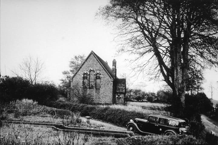
In 1893 the vicar and churchwarden of Perry Barr acquired a site at Oscott. The conveyance, dated 24 May 1893, was for premises “for use as a mission room to St. John’s, Perry Barr”, and it names the Hon. A. C. Gough Calthorpe of Perry Hall and the Rev. George H. Sharpe, vicar of St John’s. All Saints was built soon afterwards. On the map of 1901, “All Saints’ Church” is lettered where “School” had been, and the 1938 photograph shows the two buildings side by side.
The little church carried on long after the school. A register of services in “the licensed chapel of All Saints, Oscott”, kept from 1965 to 1983, records a service of thanksgiving for its restoration.
Not the village school
Kingsvale School is sometimes called Kingstanding’s original village school, and some accounts mix it up with the school on Shady Lane. They were different schools. Kingsvale opened in 1914, fourteen years after the Oscott Church School closed. It began as Perry Barr Council School, opened by Staffordshire County Council with room for 100 children, and was renamed King’s Vale Council School in 1915. Huts were added in 1930–31, and it closed as a separate school in 1931. Kingsvale followed the Shady Lane school in time; it was not a continuation of it.
Still on the map
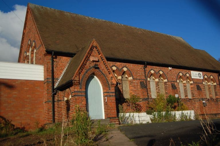
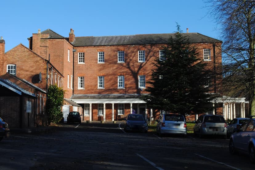
The school house has gone. But the church that grew up beside it was still standing on Shady Lane when it was photographed in 2013, and the lane beside it still carries the old name, as Oscott School Lane.
Pictures
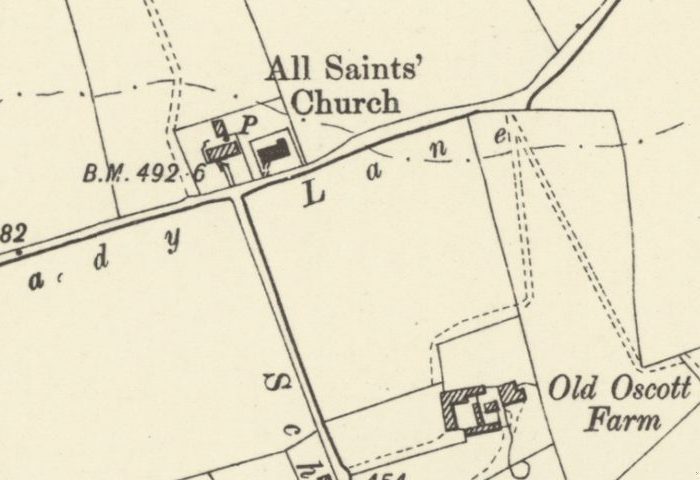
By 1901 “All Saints’ Church” is lettered on the school siteOrdnance Survey six-inch map, revised 1901 · Out of copyright 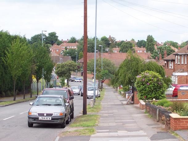
Shady Lane, Old Oscott, todayAdrian Bailey · CC BY-SA 2.0
From the Heritage Archive
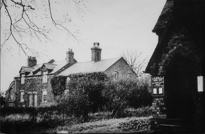
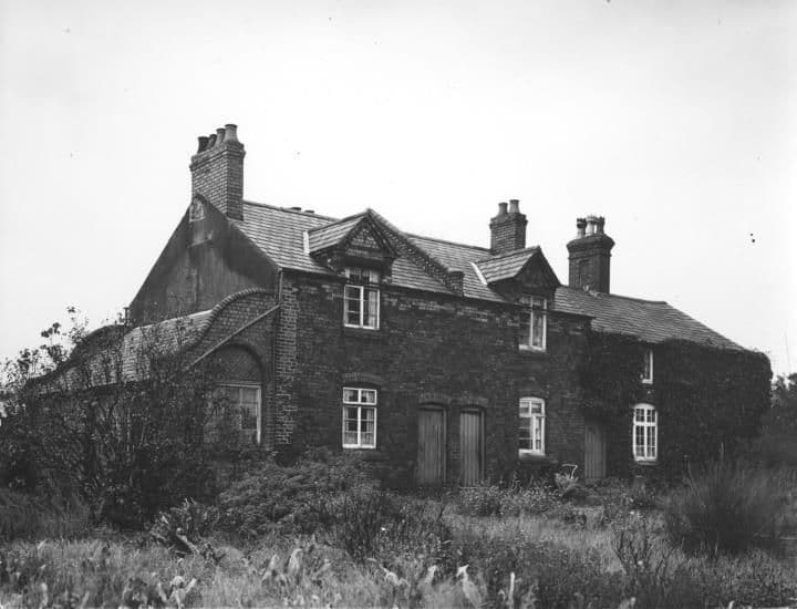
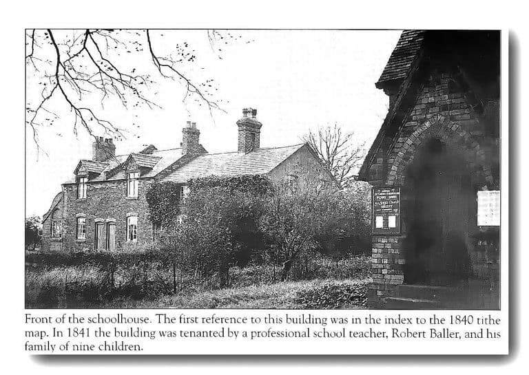
- Old school house, Shady Lane (photographs and captions) — Library of Birmingham, Warwickshire Photographic Survey (Birmingham Images), 1938; 13 Oct 1938. Ref. WK-K10-0110, WK-K10-0111, WK-K10-0123; WK-O2 (Birmingham Images 1330, 1331, 1342, 1368). Captions: first mentioned in the index to the 1840 tithe map; closed as a school 1900; the door of All Saints to the right; demolished soon after. Images not reproduced.
- All Saints Church, Shady Lane (photograph and caption) — Library of Birmingham (Birmingham Images 1332), 1938. Ref. WK K10 0112. Church built soon after the site was acquired in 1893.
- Victoria County History of Warwickshire, vol. 7: Schools — Victoria County History / British History Online, 1964. Ref. pp. 501–48. Oscott Church School (accommodation 108, closed 1900); girls’ school in School Lane closed 1897; King’s Vale Council School (1914).
- Copy conveyance of freehold premises at Oscott for use as a mission room to St John’s, Perry Barr — Library of Birmingham, 24 May 1893. Ref. EP104/12/2/1. Catalogue entry only.
- Land at Oscott and Perry Barr for a new chapel and mission room — Library of Birmingham, 1833–1899. Ref. MS 3145/360/4 a–e. Catalogue entry only.
- Register of services, licensed chapel of All Saints, Oscott — Library of Birmingham, 1965–1983. Ref. EP104/2/8/1. Catalogue entry only; records a thanksgiving for the chapel’s restoration.
- Board of Education files: Kings Vale Council School — The National Archives, 1911–1937. Ref. ED 21/15860; ED 21/41793; ED 21/62848. Catalogue entries only.
- Trade directories: White 1834 (p. 354); Dix 1858 (p. 674); Post Office 1867 (p. 140); White 1875 (pp. 761–2) — University of Leicester Special Collections, Historical Directories, 1834–1875. Sarah Scott, day school (1834); Protestant School, R. Baller (1858); two Calthorpe free schools (1867); Oscott Free Schools, W. P. and Mrs Shorten (1875).
- Ordnance Survey six-inch map, first and second editions — Ordnance Survey, 1880s; revised 1901. Ref. Staffs LXIX.NW. “School” (1880s) and “All Saints’ Church” (1901) on the same site.
Comments
Comments will load here.