
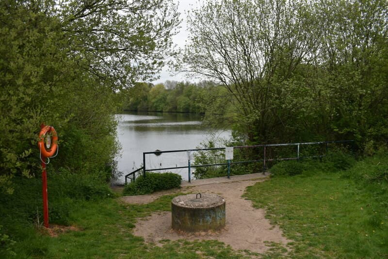
Just west of Kingstanding, behind the supermarket at the Old Horns roundabout, is a green oasis: woodland, wildflowers, a lake and a network of signposted paths, open to walkers and cyclists. It has not always looked like this — and the ground under it has more stories than almost anywhere nearby.
Wood-pigeon valley
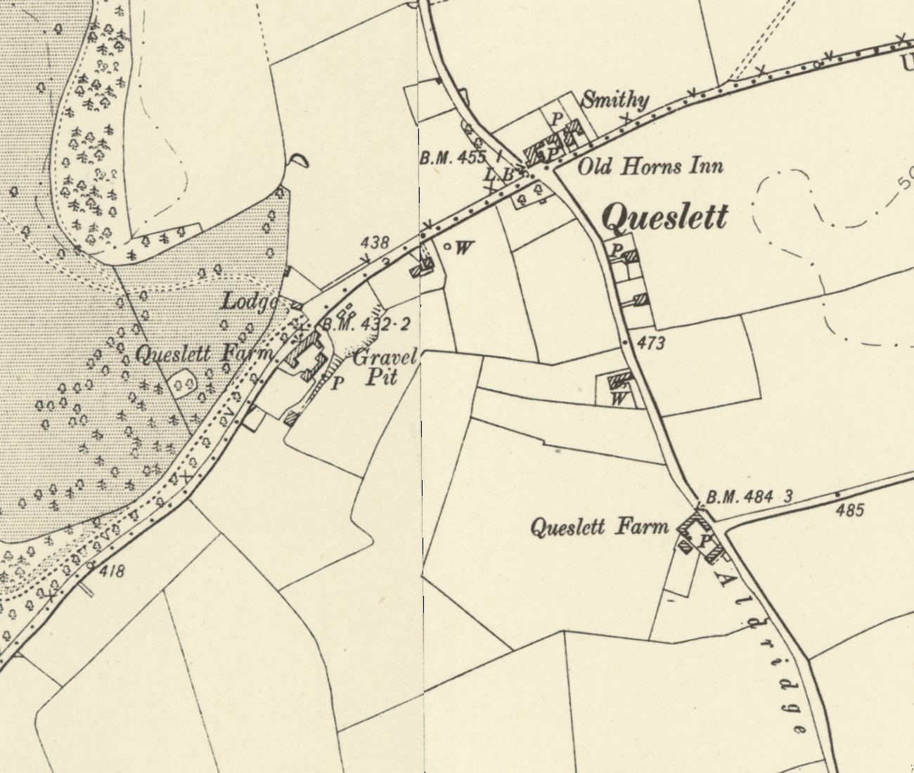
Queslett’s name has been spelled many ways — “Quieslade” in a book of 1810, “Queeslet” on the maps until the 1880s — and W. H. Duignan traced it back to the 16th century. It is usually explained as “wood-pigeon valley”, from “queest”, a wood pigeon, and “slade”, a small valley. For centuries this was farmland. Archaeologists working near Booths Lane found the remains of an older building and pottery going back to the 13th century — there was an isolated farm here in the Middle Ages.
The forger of Booth’s Farm
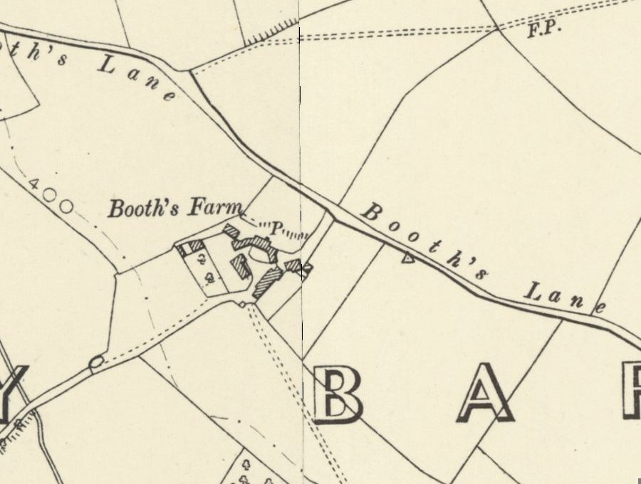
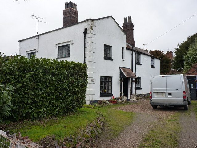
At the reserve’s southern end, near the Ashworth Road entrance, stood Booth’s Farm. William Booth and his brother John took it on a 21-year lease from John Gough of Perry Hall in 1799, and there William forged Bank of England notes until ten special constables and seven dragoons raided the farm on 16 March 1812. He was hanged on 15 August 1812 — at the third attempt. The farmhouse stood until 1974, and its footings still lie near Booths Lane. The whole story is on our Booth’s Farm page.
Wildlife out of waste
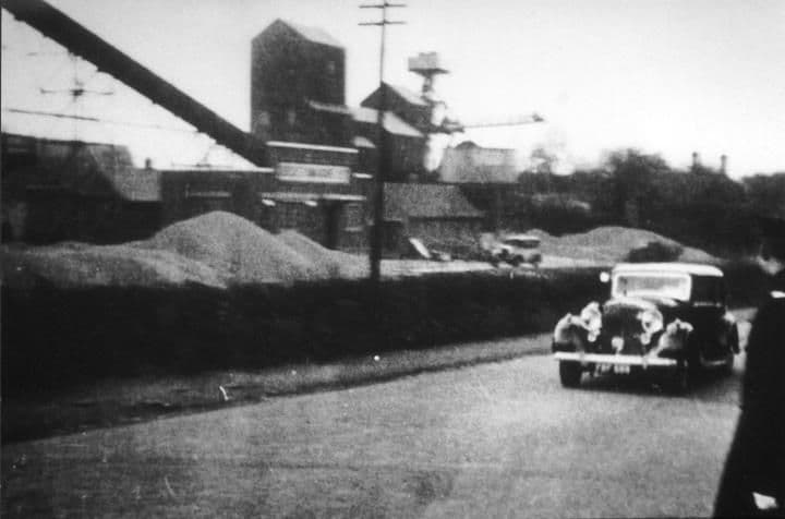
After the farm came the quarry. The ground here is sand and gravel — the Geological Survey recorded 25 feet of it at Queslett Farm in 1925 — and a gravel pit was already open at Queslett Farm by 1901. Booth’s Farm itself was the subject of a leading case in English law: in Waring v Foden (1932) the Court of Appeal held that sand and gravel were not “minerals”. The Booth Crushed Gravel Company worked here in the 1930s; later came the Queslett Sand and Gravel Company, part of APCM by 1961, and Midland Gravel. The deep pits were then filled with household refuse. By 1976 the site covered 147 acres, and a Commons debate that year heard that “There is a nature reserve on the site now”. When the tipping stopped, the ground was capped with topsoil, landscaped and replanted with native trees and wildflowers, and a pool was made. Over half the site is still fenced off: that is where the landfill is deepest, and methane is still drawn off there.
Left in peace, the wildlife came back. The council’s own board at the entrance names skylark, grey partridge and common lizard, and the whole site is now a Site of Importance for Nature Conservation.
Frylan Rock
In the reserve is a rock known locally as Frylan Rock. We have not found it in any book, map or record — its story so far lives in local memory. If you know how it got its name, how long it has been there, or have photographs of it, please share them with the button on this page so we can add them here.
Looked after by its Friends
The Friends of Queslett Nature Reserve were formed in 2006 to look after the reserve, its wildlife and the people who use it. Founded by the late Councillor Keith Linnecor, the volunteers do the pruning, planting and light maintenance with the council’s parks department. A memorial tree in the south-west corner remembers one of them, Bert Cook (1926–2012).
Farm, forger’s den, quarry and tip: few places in Birmingham have changed so many times. Now it has gone back to nature — and, thanks to its volunteers, it is staying that way.
Pictures
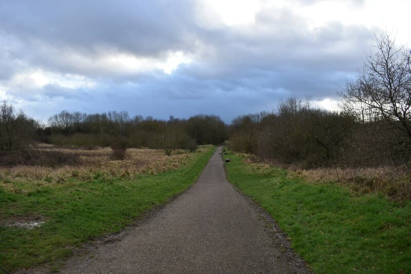
The path down towards Ashworth Road and Booths LaneMartin Richard Phelan, 2020 · CC BY-SA 2.0 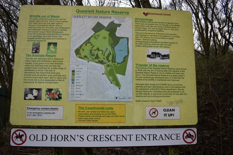
The information board at the Old Horn’s Crescent entrance — “Wildlife out of Waste”Martin Richard Phelan, 2020 · CC BY-SA 2.0 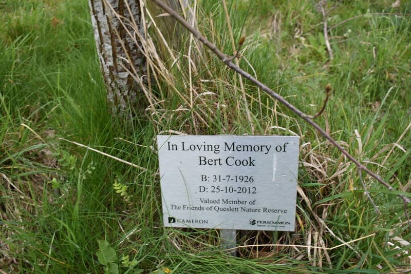
The memorial tree to Bert Cook, a valued member of the FriendsMartin Richard Phelan, 2022 · CC BY-SA 2.0
From the Heritage Archive
Sources. The information board at the Old Horn’s Crescent entrance (Birmingham City Council and the Friends of Queslett Nature Reserve), as photographed by Martin Richard Phelan for Geograph, 2020; “The life, trial, and execution, of Wm. Booth” and “The Trial of William Booth, of Perry Barr” (both 1812; Harvard Law School Library, transcribed on Wikisource); Library of Birmingham, Calthorpe estate papers MS 3145/45a (lease, 1799); Wikipedia, “Queslett”; Birmingham Open Spaces Forum, “The Friends of Queslett Nature Reserve”; Birmingham Be Heard, “Queslett Nature Reserve potential improvements” (2023); OpenStreetMap. Frylan Rock: local knowledge — no written source found yet.
- Queslett Nature Reserve information board (Old Horn’s Crescent entrance) — Birmingham City Council and the Friends of Queslett Nature Reserve; photographed by Martin Richard Phelan for Geograph, 2020. Wildlife, landfill history, SINC status and the Friends (formed 2006). SINC and 2006 not independently confirmed.
- Booths Farm farmhouse information board (FOI response) — Birmingham City Council / WhatDoTheyKnow, 30 Jul–8 Oct 2020. Ref. BCC ref. 16683822. The farmhouse and 13th-century pottery. Contains a false “non-capital crime” claim.
- The life, trial, and execution, of Wm. Booth; The Trial of William Booth, of Perry Barr — Turner; J. Drewry, 1812. Ref. Harvard Law School Library. Primary accounts of the raid, trial and execution.
- Counterpart lease for 21 years, John Gough to John Booth and William Booth — Library of Birmingham, 1799. Ref. MS 3145/45a. Catalogue entry only.
- Waring v Foden; Waring v Booth Crushed Gravel Co. [1932] 1 Ch 276 (CA) — Law Reports, 1932. Booth’s Farm gravel: sand and gravel held not to be “minerals”.
- Quarry and gravel trade references (Directory of Quarries 1935; Highways and Bridges 1939; Sources of Road Aggregate 1951; APCM reports 1961–62; Kelly’s Directory of Manufacturers 1965) — 1935–1965. Booth Crushed Gravel Co.; Queslett Sand & Gravel Co. (APCM by 1961); Midland Gravel. Snippets.
- HC Deb 4 August 1976, Waste Disposal (West Midlands) — Hansard, 1976. Ref. vol 916 cc1910–24. 147 acres; tipping; “There is a nature reserve on the site now”.
- Birmingham planning register: Blue Circle, Great Barr Shopping Centre — Library of Birmingham, 12 Apr 1983. Ref. BCC/1/GG/D/1/7/2/2/1983/2010. Catalogue entry only; the shopping-centre (Asda) site.
- Birmingham Historic Landscape Characterisation, area BCA25 (Old Oscott–Queslett) — Birmingham City Council, c. 2013. Reclaimed about 2000 (probable).
- Queslett Road, showing the Sand and Gravel Works (photograph and caption) — Library of Birmingham (Birmingham Images 1320), 1930s. Ref. WK-K10-0100. Caption only.
- The Geology of the Country around Birmingham (memoir) — Geological Survey, 1925. Gravels at Queslett Farm and Booth’s Farm.
- Queslett Nature Reserve – Potential Improvements — Birmingham City Council (Be Heard), Feb–Mar 2023. Cllr Keith Linnecor as founder of the Friends.
- The Friends of Queslett Nature Reserve — Birmingham Open Spaces Forum. The Friends’ work.
- Queslett — Wikipedia, accessed 2026. Lead only; used for the name’s meaning on the current page.
- Frylan Rock — Local knowledge. No written source found yet.
Comments
Comments will load here.