
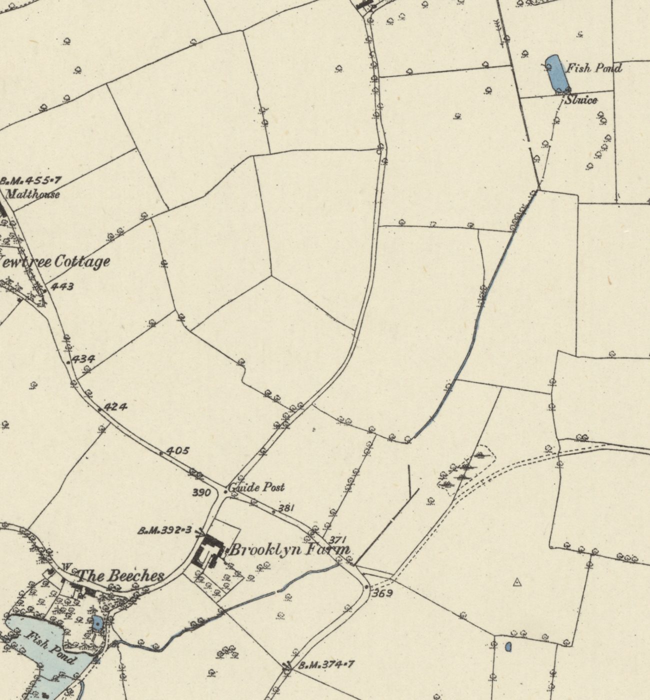
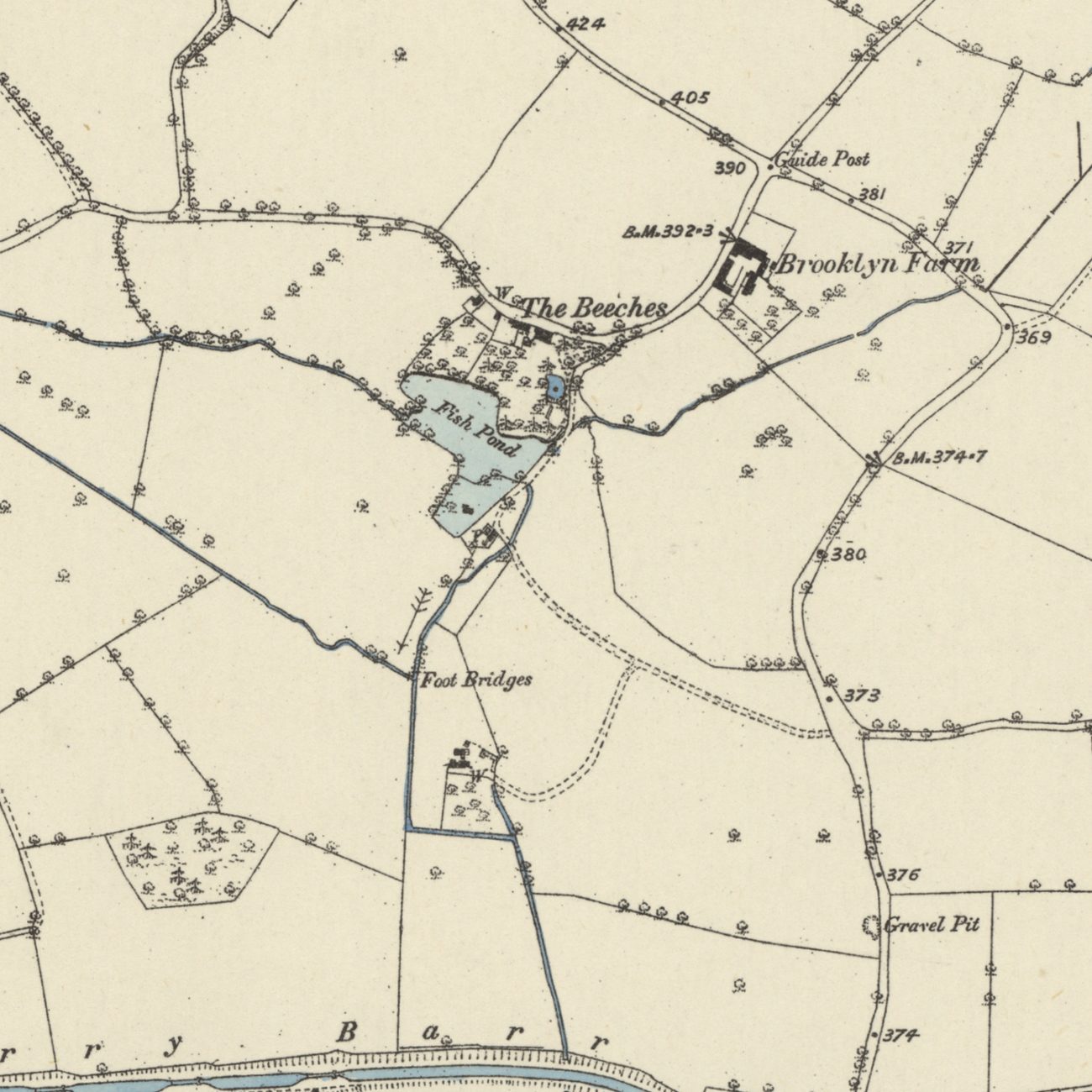
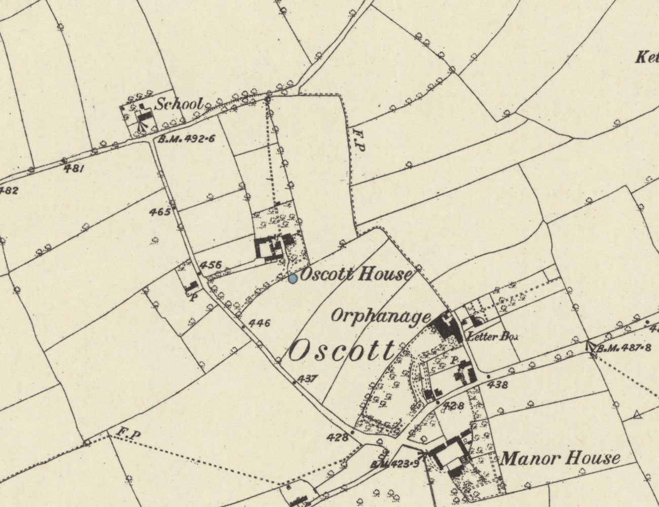
When the Ordnance Survey mapped Old Oscott in 1882–83, its surveyors drew a narrow pond in the field below the Manor House, the home of the Davenhill family. They lettered it “Fish Pond”, and at its southern tip they marked a “Sluice”. From that sluice a small stream set off towards Perry Barr and the River Tame.
A brook without a name
We call it Oscott Brook, after the Birmingham historian William Dargue, who wrote that the hamlet of Oscott “stood in the valley of Oscott Brook”. No old map gives the stream a name — not Yates in 1775, and not the Ordnance Survey in 1831–32, 1882–83, 1901 or 1913 — and no old document found so far does either. Yates does show it, though: a stream rising south of “Ascott” and running past a chain of small ponds to the Tame near Perry Bridge.
Down the line of Birdbrook Road
The 1880s map lets us follow it. From the sluice the stream ran south-south-west, across the line of today’s Dyas Road and down behind the houses on the west side of Birdbrook Road. For about 700 metres the road follows the brook. Near the south end of Birdbrook Road the water turned south-west, passed below Brooklyn Farm on Aldridge Road, and ran west along the valley, by today’s Smalldale Road, into the Fish Pond at The Beeches.
It is tempting to read something into the name Birdbrook. It tells us nothing about the stream: it belongs to a set of estate street names borrowed from English villages, like Swinbrook, Corbridge and Tresham.
Into the mill pool
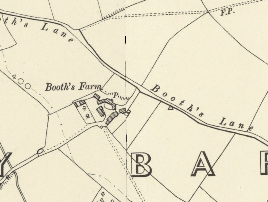
At The Beeches our brook met the Hol Brook, which came down from the lake in Great Barr Park, past Holly Wood and Booth’s Farm. The pool they filled was very probably a mill pool, serving the mills of Paper Mill End. Below the dam the water ran south past Wiremill Cottage, under the Tame Valley Canal at the Perry Barr Locks, through the reservoir that is now the lake in Perry Park, and on to the Tame near Perry Bridge.
The streams on the other side of Kingstanding went a different way. The water from King’s Vale and Lodge Pool drained east and south towards Witton. Oscott Brook carried Old Oscott’s water west, to Perry.
Going underground
The pond at its head did not last. By 1901 it was just an unnamed pond, and the map of 1913 shows only a dry oval outline. When the Kingstanding estate was built in the 1930s, the upper course seems to have gone as well: on the large-scale Ordnance Survey maps of the 1950s and 1960s there is no open stream along Birdbrook Road. Local memory has the brook going underground after the Second World War; for this stretch, the maps point to the 1930s.
Lower down, through Perry Beeches, it may have stayed open for longer. One resident has described it running in the open through Perry Beeches in the 1940s to 1960s, under the canal into the Perry Park reservoir, and on under Church Road to the Tame by the Zig-Zag Bridge, with parts of it running in a pipe under the M6.
Where the water went
There is no water to see at the island where Dyas Road meets Birdbrook Road today. But the road still runs where the brook ran, and the stream that began below a manor house fish pond once helped to fill the pool behind the mills of Paper Mill End.
Pictures
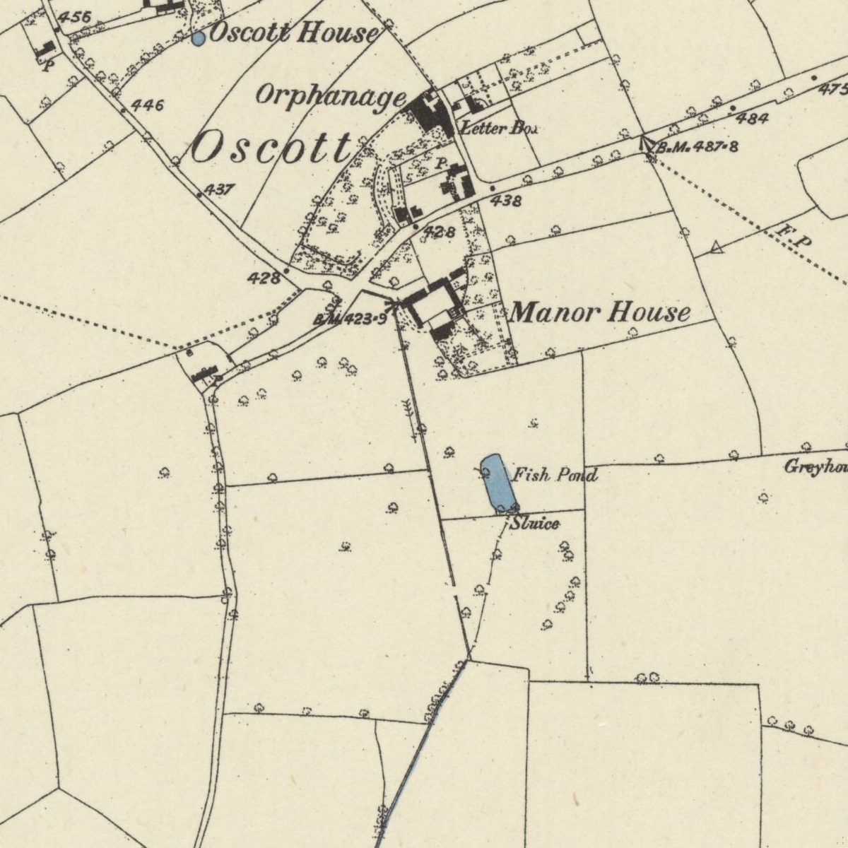
The head of the brook: the Fish Pond and Sluice below the Manor House, 1882–83Ordnance Survey six-inch map, first edition, surveyed 1882–83 · Out of copyright 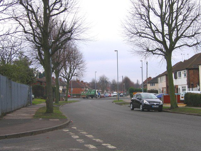
Birdbrook Road, looking towards Dyas Road: the brook ran behind the houses on this lineRoy Hughes · CC BY-SA 2.0 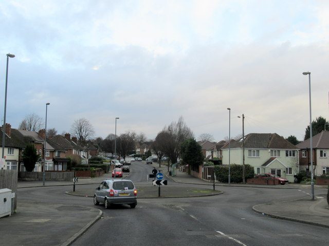
The island where Dyas Road meets Birdbrook RoadRoy Hughes · CC BY-SA 2.0
- Ordnance Survey six-inch map, Staffordshire LXIX.NW, first edition — Ordnance Survey, surveyed 1882–83, published 1884. Ref. Staffs LXIX.NW. Fish Pond and Sluice below the Manor House; the stream traced to The Beeches.
- Ordnance Survey six-inch map, second edition, and 1913 revision — Ordnance Survey, revised 1901 and 1913. Ref. Staffs LXIX.NW. Unnamed pond (1901); dry oval outline (1913).
- Ordnance Survey 1:1250 maps — Ordnance Survey, c. 1950s–60s. No open stream along Birdbrook Road.
- Map of the County of Stafford — William Yates, 1775. A stream rising south of “Ascott” runs past small ponds to the Tame near Perry Bridge. Consulted only; not reproduced.
- Ordnance Survey one-inch Old Series, sheet LXII SE — Ordnance Survey, revised 1831–32. Watercourse unnamed.
- Historic name gazetteer and watercourse tracing (notes 10 and 12) — Kingstanding Together research notes, 29 Sep 2026. Course reconstructed by overlaying the 1880s water on later maps; positions ±30–50 m.
- History of Birmingham Places & Placenames: Oscott — William Dargue, 2008–2022. Secondary. Source of the name “Oscott Brook”.
- General & Commercial Directory of Birmingham, p. 674; White’s Directory 1875, p. 762 — W. H. Dix; White & Co., 1858; 1875. Davenhill family at the Manor House, Oscott.
- Forgotten brooks (thread 52492), post by “oldMohawk” — Birmingham History Forum, 11 Nov 2020. Memory of the brook open through Perry Beeches in the 1940s–60s. Local tradition.
- Victoria County History of Warwickshire, vol. 7: The City of Birmingham — “Economic and Social History: Mills” (Mills on the Hol Brook) — Victoria County History / British History Online, 1964. Ref. pp. 253–69; fns 91–109 (citing B.M. Add. Ch. 41830; B.R.L. 276767, 181855, 181865; Perry Barr Tithe Award 1843, B.R.L. 299997, and Map 1840; Meath Baker MS 169; Perry Barr Inclosure Award). The main account of the Garrett blade mill (1597, 1614), the 1648 paper mill, the Gough mill and the four mills of 1843. Lists the 1597 and 1648 mills separately.
Comments
Comments will load here.